Day 135 – 365 Project…Blackbeard Slept Here

Welcome to day 135 of  365 photos…Edward Teach, aka Blackbeard the pirate, was said to have frequented the Hammock House, also called Blackbeard’s House. In those days, it was an inn. It is located in Beaufort, NC on Hammock Lane, just off of Front ST. From Wikipedia: “The house is believed to be constructed in… Continue Reading

The post Day 135 – 365 Project…Blackbeard Slept Here appeared first on Moosetique Musing.

May 23 through 25, 2014

5-23 and 24, Friday and Saturday, Gulf of Mexico crossing:

We got going about 11:00 from Clearwater, FL.  All the wind and wave reports were for calm seas with 1 foot waves but right away the seas were 3 to 4 feet with 10 to 15 knot winds with occasional 5′ footer and only 3 seconds between waves.  This kept up until about 03:00 on Saturday morning; it was a long day and night.  We are kind of getting used to high seas as we have had them so much lately.  Anyway, we made it safe and sound.

Early on, about 13:00, we kept hearing transmission on Channel 16 from the Coast Guard and Tow Boat US.  First we heard that a boat had capsized and sunk and there was one person in the water with only a hand held radio and he didn’t know his GPS location.  Then we heard the person had been attacked by a Bull Shark and he was bleeding; and then we heard he had lost his right leg from the knee down.  There were several boats involved in the search and a helicopter but they couldn’t find him.  About an hour or so later they called the search off after finding out it was a hoax!  Unbelievable someone would do such a thing.  It was a busy day and the start to the holiday weekend.  We heard several more calls for the Coast Guard and all we think were legitimate.  One 51 year old woman was missing after kayaking and they were still looking for her late into the night; we don’t know if she was found or not.  Another person was in the water after their jet ski sunk but the person was saved, and the last one we heard was on Saturday morning and their boat was taking on water and that was all we heard.  These were just the ones we heard; I am sure there were more.  Crazy things happen on the water especially on a holiday weekend and the Coast Guard and Tow Boat US are kept very busy. 

We got across the Gulf as far as Dog Island, just outside of Carrabelle, FL, by 06:30.  We were traveling about 10 mph most of the time but had to slow down some so we had day light by the time we got to Carrabelle.  From there we picked up the GIWW and kept going as far as Port St. Joe Marina on the Gulf, just 5 miles off the GIWW at about Mile 330.0.  We arrived at the Marina by 13:00 after putting 26 hours on the engines and traveling 245 miles.  We were both very tired and got about 3 hours of sleep before going out to eat at Dockside Restaurant here at the marina. We asked our waiter if we were in Central Time Zone yet and he said the Marina is still in Eastern Time Zone but where he lives is right on the border between both zones. He can actually hold his cell phone in one hand and get one zone and hold it in the other and get the second time zone. He said when he first started working at the restaurant he was an hour early because he evidently had his phone in the wrong hand!  After dinner it was an early to bed for a good nights sleep. We will stay at Port St. Joe until Monday AM before traveling on.

N29.81439
W85.31007

CO’s comments:  After we docked at Port St. Joe I talked to a couple of sport fishermen and they said that the wind and wave forecasts have been way off for the last month.  He also said he never knew what to expect.  I think weather men today rely too much on technology and not enough on the old fashion art of weather forecasting.  As a professional pilot, they got it right more times in the 70’s and 80’s than they did in the 90’s plus when all the new technology came out. 

5-23-2014: Sun Set on the Gulf of Mexico

5-24-2014: Sun Rise on the Gulf of Mexico.

5-24-2014: Good morning. Nice to see day light after a very long, dark, night.

Alaska 2014 – Port McNeill to Pruth Bay

May 24, 2014

0430 arrived all too quickly as we turned on the coffee pot and made preparations to get underway in the dawn twilight.  We were not the first boat to get underway, a 62 foot power catamaran “Wild Wind IV” beat us by about 10 minutes.  We cast off the lines at 0456 in light rain, calm winds and a relatively cool 52 degrees.  By 0500 the tender was in tow astern.  Cutting across Neill Ledge through the 24 foot deep gap we headed past Graeme Point on Malcom Island and into Queen Charlotte Strait, setting a direct course for Pine Island.  The seas are less than 1 foot with the beginnings of a low westerly swell.  It looks like a parade of cruise ships, tugs and pleasure craft all headed out into Queen Charlotte Sound and Pine Island via Gordon Channel.  The cruise ship Zaandam is at the front of the group, but will have to slow and drop off the pilot at Pine Island, where we will turn north past Egg Island and into Fitzhugh Sound.

We changed our minds on the routing when we were alongside the Walker Group and diverted up Bolivar Passage to the north end of Storm Islands to avoid some of the flood current and shave a few miles off the crossing.  The swell increased to a moderate westerly swell as we approached the tip of the Storm Islands and set a direct course for Cape Calvert at the entrance to Fitzhugh Sound.  By 1300 we were out of the swells and into Fitzhugh.

Earlier that morning we had talked to Doug and Karen Dance on the Selene 53 “Peregrine”, who were some 4 miles ahead of us and agreed to meet in Pruth Bay.  We had not anchored there before, so it was to be a new experience.  At 1600 the anchor was set in 55 feet of water.  We had covered 84 nautical miles for a grand total of 382 nautical miles so far.

Pruth Bay has free wifi provided by the Hakai Beach Institute, with the caution not to download large photo files or videos, so we will save most of the pictures for a few days.  No phone service however.

Mosquito Sculpture carved into cedar tree at Hakai Beach Institute
We all headed to shore and took the walk through the Hakai Beach Institute, visiting the mosquito sculpture carved into a large cedar tree and out to West Beach.  West Beach is exposed to the ocean and is a large and scenic sand beach with some interesting rock formations to photograph.

Returning to Spirit, and waiting out a torrential downpour, we decided to have a potluck dinner on Spirit, pulling pizzas from the freezer which were then doctored with additional toppings and supplemented by a big salad with home-made vinaigrette dressing.

May 25, 2014

The wind remained calm all night in the quiet anchorage in Pruth Bay.  The weather is beginning to deteriorate for the next few days, so we are heading to Codville Lagoon Marine Park, just 25 miles away.

Cologne 1

Guten Morgen,
“Germany is a country for which Jews have a very visceral reaction.”
http://www.obermayer.us/german/german_conscience.htm
During our travels I’ve made attempts in several countries to seek out the “Jewish presence.”   I visited synagogues in Singapore, England  and India and while in New Delhi attended a Friday night service with Jewish cruiser friends Linda and Michael on B’Sheret.  I’ve […]

Sunday, May 24, 2014 – from Fort Bragg, CA to Port Orford, OR

Friday, May 23, 2014 – heading north from Trinidad Harbor
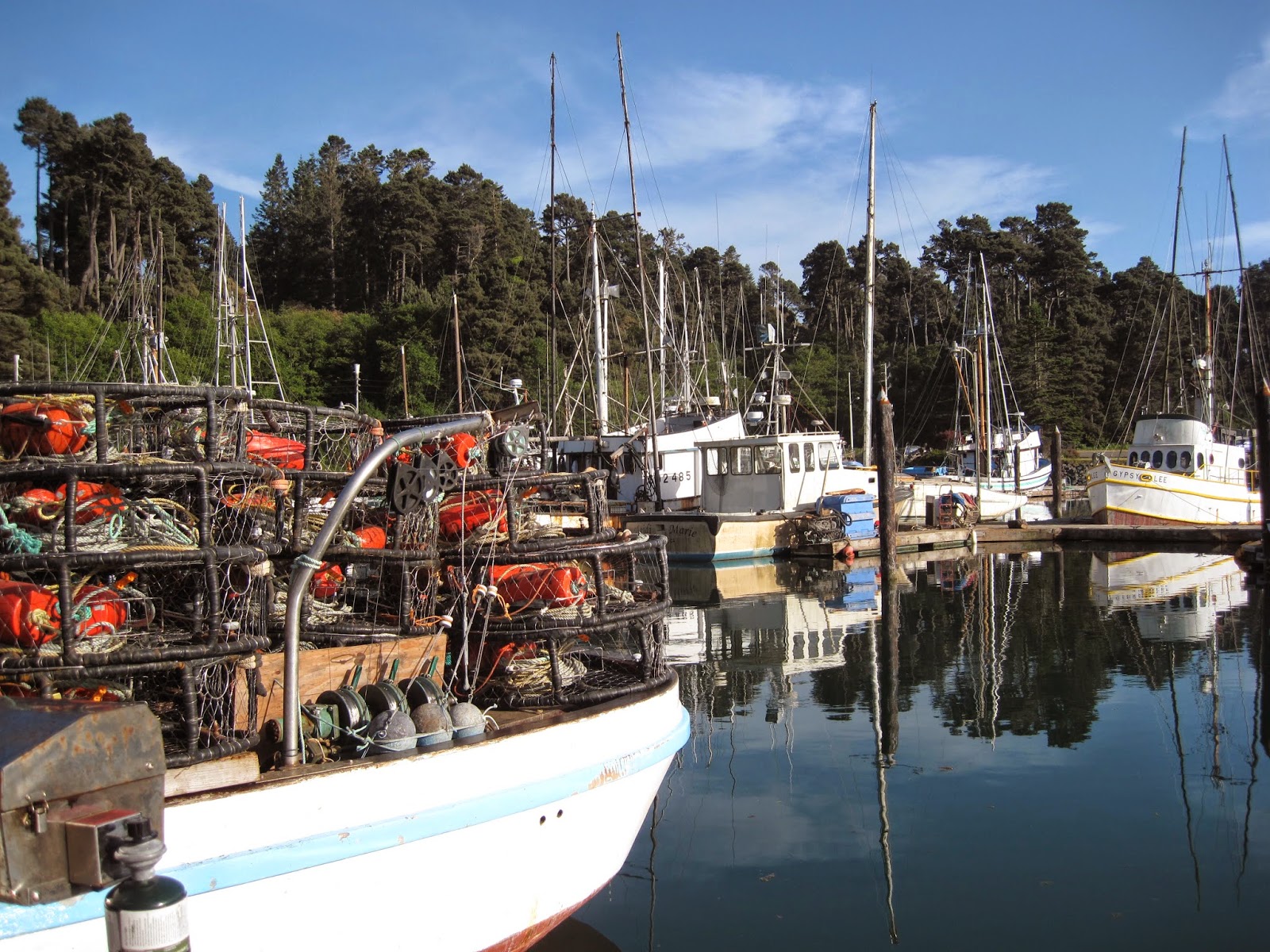
Fort Bragg Marina
Departure from Fort Bragg on Thursday was predawn.  The tide had already begun to ebb and full ebb is the worst time to cross bars.  The crabber tied next to us pulled out and we followed within 10 minutes around 5 am. 
I was not looking forwarded to the day, and, in retrospect, it is one I could happily have skipped altogether.  We knew from the weather that it would be better today then any other day for a week so we felt we had to go regardless. The lump started as soon as we left the river.  After Wednesday, I was apprehensive.  I have to say that it was not as bad as Wednesday, but it was still an uncomfortable ride for most of the day.  Initially we were barreling along at over 7 knots, and with the current against the wind the swells were large and close. 
At some point between Punta Gorda and Cape Mendocino the current changed, so we traded 2 knots of speed for a more comfortable, if longer, ride.  It was cold so we had all the windows closed and I was taking comfort from the wind gauge that never varied from 6.  Of course, Earl had to point out to me that it was not working and he thought it was probably blowing 30 to 35.  I was happier thinking it was 6.
I am now accustomed to having everything on the floor.  I had been diligently putting things back on the berth above the bench in the pilot house.  I am no longer bothering.  It is easier to step over stuff than dodge it.
Our choice was between going into Eureka and getting a slip or going on 20 miles to Trinidad and anchoring.  Bypassing Eureka was a time saver and also allowed for an early departure today.  The downside of that decision was it was 12:30 by the time we inched our way into the Trinidad harbor between crab pots.  As it turned out, we did not go in far enough and ended up with a very rocky night, made even worse by the periodic banging of an unlatched closet door.  I was too tired to care, but it was not a great night.  Earl called it quits at 6 and pulled the anchor. 
We are headed for Brookings, just above the California Border, and more than halfway up the US coast.  It is a beautiful ride.  The wind gauge which has been reset says 8, the seas are flat and we are going 6.6.  An added bonus, so far we have seen no crab pots once past Trinidad.  Who cares if it is foggy!  Even better, Brookings is about 60 miles from Trinidad.  We should be able to tie up by late afternoon and have a nice dinner on a stable table. 
Saturday, May 24, 2014 – Anchored at Port Orford, Oregon
Well I spoke too soon.  Not 5 minutes after writing that we had seen no crab pots, we started to see them.  However, the weather remained reasonable and the fog lifted. 
Brookings turned out to be out of the question.  They required that our insurance company fax them a copy of our insurance policy specifically adding Brookings port as a covered party.  At 4:45 pm that was not going to happen.  We had found a couple of possible anchorages not too far from Brookings and, since the weather was okay, decided to head north. 
We opted for Mack Arch.  Here the anchorage is tucked behind a combination of reef and standing rocks and it looked good.  In we went and found that the seas were definitely reduced, but the swell did continue.  Dinner demanded coordination as the boat rolled and when we got to bed, the gentle rocking was sometimes rather more than less.  It was, however, far better than the night we had spent in Trinidad! 
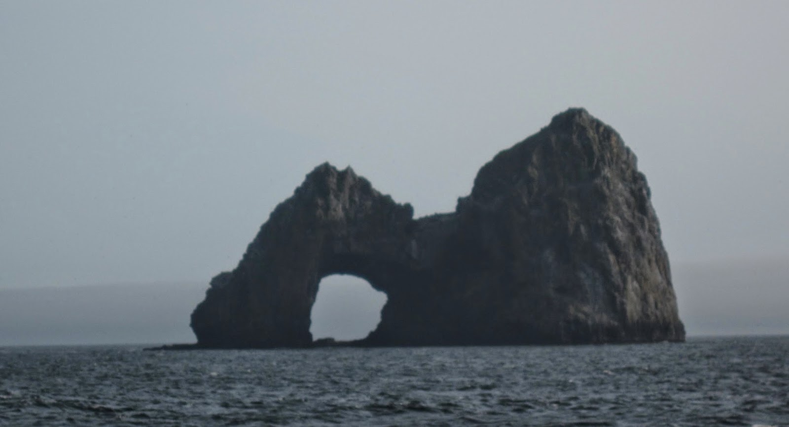
Mach Arch
By morning we were in a sea of fog.  At about 6 we headed north.  It was not the best, but far from the worst, of conditions.  The only other boats we saw were some good sized crabbers.  They must have thought we were nuts (and who is to say that we aren’t?)  The winds were 20 to 25 and gusting to 35.
Happiness is a great anchorage, with no swell, at noon!  We got into Port Orford and tucked in behind a cliff to the north and watch as our wind gauge dropped from 35+ to 15.  There was time for Earl to wash down the boat while I picked up the debris from the last few days before of lovely lunch of Bloody Marys and potstickers.  The afternoon included naps, reading, knitting, trimming Daisy’s eyebrows and just enjoying a boat that was not moving. 
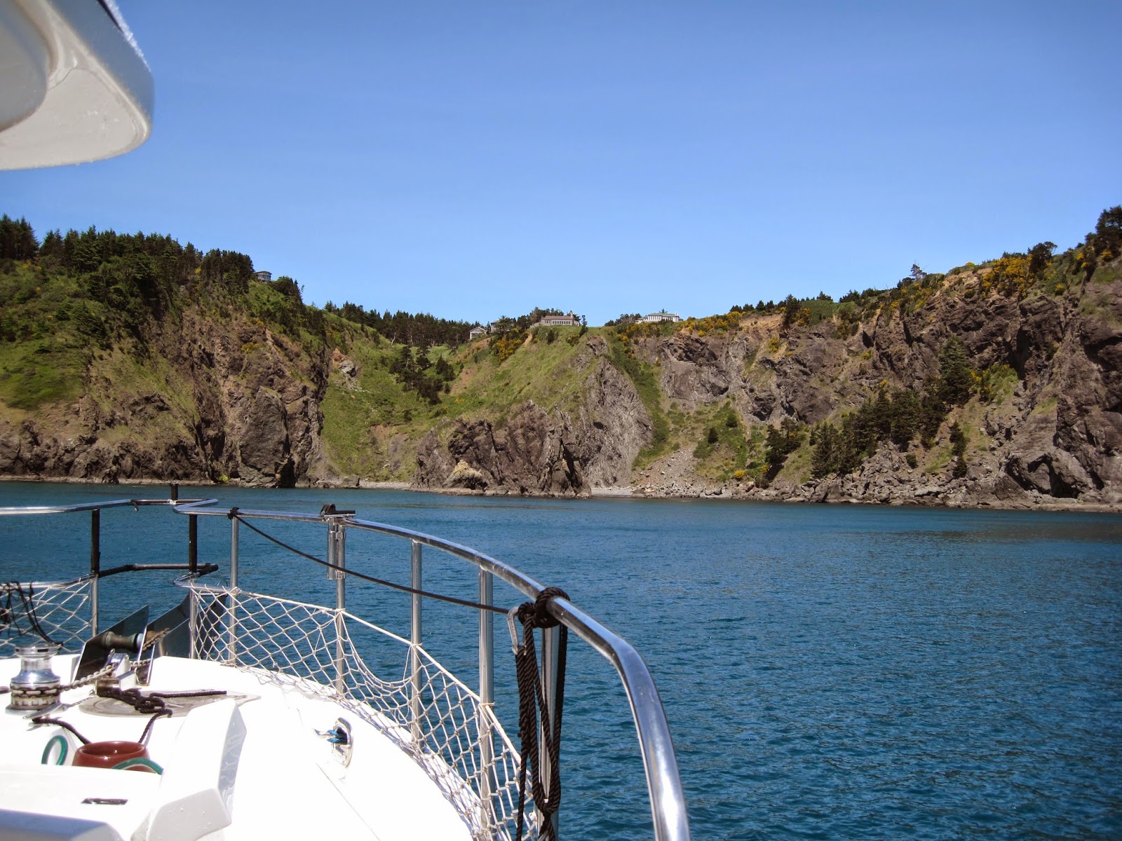
Happy anchorage at Port Orford

Port Orford is not your usual harbor.  There is no marina.  Instead the boats are lifted out of the water by cranes and stored on land. 
Port Orford non- marina

After the last few days since leaving Bodega Bay our expectations of sea conditions have certainly changes.  White water seems normal.  However, I am an optimist.  The weather for the next few days looks like it will be better.  Here’s hoping!

Sunday, May 24, 2014 – from Fort Bragg, CA to Port Orford, OR

Friday, May 23, 2014 – heading north from Trinidad Harbor
Fort Bragg Marina
Departure from Fort Bragg on Thursday was predawn.  The tide had already begun to ebb and full ebb is the worst time to cross bars.  The crabber tied next to us pulled out and we followed within 10 minutes around 5 am. 
I was not looking forwarded to the day, and, in retrospect, it is one I could happily have skipped altogether.  We knew from the weather that it would be better today then any other day for a week so we felt we had to go regardless. The lump started as soon as we left the river.  After Wednesday, I was apprehensive.  I have to say that it was not as bad as Wednesday, but it was still an uncomfortable ride for most of the day.  Initially we were barreling along at over 7 knots, and with the current against the wind the swells were large and close. 
At some point between Punta Gorda and Cape Mendocino the current changed, so we traded 2 knots of speed for a more comfortable, if longer, ride.  It was cold so we had all the windows closed and I was taking comfort from the wind gauge that never varied from 6.  Of course, Earl had to point out to me that it was not working and he thought it was probably blowing 30 to 35.  I was happier thinking it was 6.
I am now accustomed to having everything on the floor.  I had been diligently putting things back on the berth above the bench in the pilot house.  I am no longer bothering.  It is easier to step over stuff than dodge it.
Our choice was between going into Eureka and getting a slip or going on 20 miles to Trinidad and anchoring.  Bypassing Eureka was a time saver and also allowed for an early departure today.  The downside of that decision was it was 12:30 by the time we inched our way into the Trinidad harbor between crab pots.  As it turned out, we did not go in far enough and ended up with a very rocky night, made even worse by the periodic banging of an unlatched closet door.  I was too tired to care, but it was not a great night.  Earl called it quits at 6 and pulled the anchor. 
We are headed for Brookings, just above the California Border, and more than halfway up the US coast.  It is a beautiful ride.  The wind gauge which has been reset says 8, the seas are flat and we are going 6.6.  An added bonus, so far we have seen no crab pots once past Trinidad.  Who cares if it is foggy!  Even better, Brookings is about 60 miles from Trinidad.  We should be able to tie up by late afternoon and have a nice dinner on a stable table. 
Saturday, May 24, 2014 – Anchored at Port Orford, Oregon
Well I spoke too soon.  Not 5 minutes after writing that we had seen no crab pots, we started to see them.  However, the weather remained reasonable and the fog lifted. 
Brookings turned out to be out of the question.  They required that our insurance company fax them a copy of our insurance policy specifically adding Brookings port as a covered party.  At 4:45 pm that was not going to happen.  We had found a couple of possible anchorages not too far from Brookings and, since the weather was okay, decided to head north. 
We opted for Mack Arch.  Here the anchorage is tucked behind a combination of reef and standing rocks and it looked good.  In we went and found that the seas were definitely reduced, but the swell did continue.  Dinner demanded coordination as the boat rolled and when we got to bed, the gentle rocking was sometimes rather more than less.  It was, however, far better than the night we had spent in Trinidad! 
Mach Arch
By morning we were in a sea of fog.  At about 6 we headed north.  It was not the best, but far from the worst, of conditions.  The only other boats we saw were some good sized crabbers.  They must have thought we were nuts (and who is to say that we aren’t?)  The winds were 20 to 25 and gusting to 35.
Happiness is a great anchorage, with no swell, at noon!  We got into Port Orford and tucked in behind a cliff to the north and watch as our wind gauge dropped from 35+ to 15.  There was time for Earl to wash down the boat while I picked up the debris from the last few days before of lovely lunch of Bloody Marys and potstickers.  The afternoon included naps, reading, knitting, trimming Daisy’s eyebrows and just enjoying a boat that was not moving. 
Happy anchorage at Port Orford

Port Orford is not your usual harbor.  There is no marina.  Instead the boats are lifted out of the water by cranes and stored on land. 
Port Orford non- marina

After the last few days since leaving Bodega Bay our expectations of sea conditions have certainly changes.  White water seems normal.  However, I am an optimist.  The weather for the next few days looks like it will be better.  Here’s hoping!

Day 134 – 365 Project…Miss Gwendolyn

Welcome to day 134 of  365 photos…I thought Miss Gwendolyn looked downright “purty” sitting at the dock with all those colors against the blue sky. I know -you are thinking not ANOTHER shrimp boat but I just can’t help myself. Camera: Nikon D7100 – Lens: Nikon 80-400mm Focal Length: 125mm – Aperture: f/5.6 – Shutter… Continue Reading

The post Day 134 – 365 Project…Miss Gwendolyn appeared first on Moosetique Musing.

Life in the Fast Lane: Race Called???

Thursday morning we assessed our situation with regard to the remaining 1,119 nautical miles to Chicago.  We considered the following:We had an expectation that the ECU Governor would be installed late Thursday afternoon (3:00 PM best case)We woul…

A bit of a diversion

Goofing off yesterday only meant that today it was back into the shed for more sanding. I did put some good mileage on the Flexicats today. I sanded down the entire starboard side, approx. 140 sq. ft. It took me awhile, 2-1/2 hrs with frequent breaks b…

Alaska 2014 – Dent Island to Port McNeill

May 21, 2014

We awakened to light rain as we prepared to go fishing with Herb, our guide for the morning.  After trying several locations, depths and lures, we called it quits about noon, having only hooked up with one juvenile king salmon and two rockfish.  As we returned, the rain increased to heavy showers, and we thought we might have a repeat of our 2007 Dent Island experience with lightning storms striking all around us, but fortunately that did not transpire.

Patrick fishing in Lewis Channel

Incredible scenery with the moon half full over Toba Inlet
Returning to Dent Island Lodge, we took care of maintenance items on both Spirit and the tender before heading to dinner in the lodge.  We were the only guests, and the first dinner guests of the 2014 season, so we had a unique menu from available supplies before the shipment of fresh goods, which included appetizers (goat cheese and caramelized onions on potato pancakes), spot prawn risotto, tenderloin with gnocchi and sautéed mushrooms, and a dessert of éclairs stuffed with ice cream with a blueberry sauce.  Joe, the new executive chef, who had been the sous chef the last three years, did a great job, with perfectly cooked and seasoned food, even though he had not yet gotten the annual shipment of supplies and fresh food from Campbell River.  It is clear that he loves cooking and interacting with the guests to make sure the food experience is great.  We are really looking forward to stopping on our return to see how the “Rapids Grill” experience is, where 12 or more people come, possibly as strangers, but definitely leave as friends.

May 22, 2014

Rain and fog in morning when we got up, we could not see across to Stuart Island.  The fog lifted slightly as we cast off the lines at 1115, just before high slack water.  By 1132 we had cleared Dent Rapids and proceeding down Cordero Channel we entered Green point Rapids at 1308 with no problems.  Proceeding down Chancellor Channel to Wellbore Channel we were flushed though Whirlpool Rapids at 1420 into Sunderland Channel and from there into Johnstone Strait.  The strait was smooth, with little wind until we passed Port Neville, where the wind increased to 20 knots, but from behind us, so the ride continued smooth.

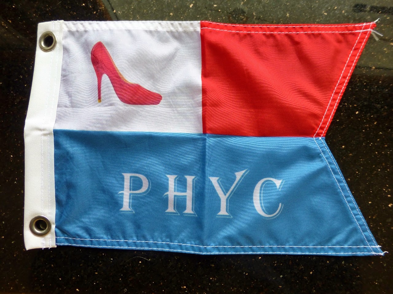
At 1740 we docked at Port Harvey Marine Resort, operated by Gail and George Freeman.  This is one of our favorite spots to stop, with the warm welcome and the beautiful setting, and the well-stocked store.  This early in the season the “Red Shoe Café” was not yet open, but Gail and George still deliver pizzas to the boat and cinnamon rolls in the morning.  We ordered a large pizza which was delivered right on time at 1900.

We have now covered 265 nautical miles.

May 23, 2014

The fog was thick when we got up to make coffee before our cinnamon rolls arrived, but by 0800 the fog had lifted to provide one mile of visibility.  The cinnamon rolls were huge and still warm from the oven when George brought them to the boat, where we shared coffee before departing at 0845.  We are now charter members of the “Port Harvey Yacht Club”, just an informal group of people who like Port Harvey and the Freeman’s.

Our Port Harvey Yacht Club Burgee
Johnstone Strait was mostly calm with light winds, but a few gusts to 20 knots.  We kept Spirit close to the north shore to minimize the effects of the flood tide, which was running at 3 knots in the center of the strait, but only about 1 knot close to the shore.  The main obstacles this morning were the amount of logs and other debris to avoid.

Ahead of us, on AIS we could see another Selene Trawler, “Peregrine”, so we called them and agreed to meet the next day in either Pruth Bay or Green Island Anchorage after crossing Queen Charlotte Sound and then up into Fitzhugh Sound.

Docking at North Island Marina (formerly the Port McNeill Fuel Dock and Marina) at 1340 we headed to the store for last minute perishables since the next store will probably be Ketchikan in about one week.  We needed some spare parts (fuses, wiper blades, another 12 pound downrigger cannonball, etc) and managed to find everything we needed by early afternoon.  We have now covered 298 nautical miles since leaving Anacortes,  

The weather around Cape Caution across Queen Charlotte Sound sounds favorable, so we will depart tomorrow between 0500 and 0530 and will not have cell phone or internet except possibly in two days at Shearwater.  We will be a little short on weather info since the critical buoy at West Sea Otter has been out of service for 9 days, and that is the wave height info that most pleasure craft rely on to make the decision to cross the longest open water crossing of the trip.