December 25, 2010
Merry Christmas Dear Family and Friends!
We are safely in Ft. Myers Beach. We have celebrated Jesus’ Birthday with good friends, but we miss our family very much.
We hope that you have been able to celebrate this special d…
Archive | Grateful RSS feed for this section
Merry Christmas 2010
Merry Christmas 2010
December 25, 2010Merry Christmas Dear Family and Friends! We are safely in Ft. Myers Beach. We have celebrated Jesus’ Birthday with good friends, but we miss our family very much. We hope that you have been able to celebrate this special day …
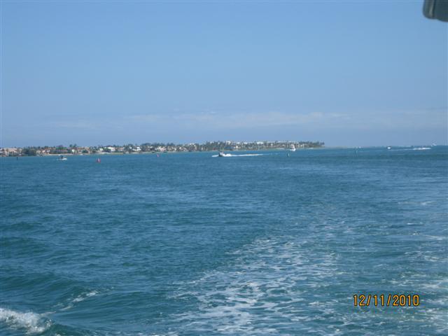
Titusville to Vero Beach to Okeechobee Waterway
December 9-13, 2010
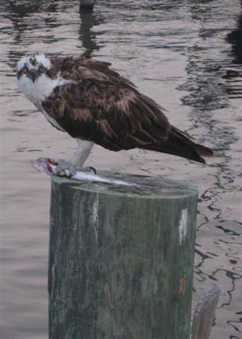
We left early from Titusville because we had 75 miles to go to Vero Beach. Titusville Municipal Marina has many resident ospreys. One had chosen the “soft” post on Grateful’s port side to eat its breakfast. As we were making to leave, it puffed its feathers and spread its wings to make itself BIG, but I still won the battle and it finally flew away with its catch.
We looked forward to Vero Beach because we had heard so many positive comments and we had heard that there was a dog beach close by. Our intention was to spend the weekend there. We stopped and got fuel – another 300 gallons – and they put us into a nice slip. Unfortunately it was raining off and on and things were a little soggy. However, it made a lovely sunset picture.

Friday dawned on a foggy morning and it didn’t clear until 9:00. But when it cleared, the day was brilliant and warm. We did find the dog park, and after a few Frisbee throws, Porter went to the drainage ditch for a drink – pretty much guaranteed a bath for him. Later in the day, Mark and I used the free city shuttle and went shopping. We needed dog chow, milk and sweet vermouth. My O&M friends would be proud of me because I figured out the bus schedule and we were standing on the correct side of the road to catch our ride home. But, alas, we decided to leave Vero Beach early as a cold front was going to be moving through on Sunday bringing high winds and freezing temperatures. We were able to rearrange our marina reservations so we were all set.
Saturday dawned with heavy fog again. We were ready to go but needed to wait until we could see the sailboats anchored in the harbor. Well, we could see them and we had our trusty GPS and radar, so by 8:30 we departed.


 |
| Finally the sun broke through to shine on a gigantic USA flag |
The day cleared to a bright, cool day. We traveled the Indian River this whole day. The river is sometimes a mile wide, but with only a very narrow channel with 8-10 ft depths. The channel is lined with spoil islands – some have trees, beaches and room for camping.

As we approached St Lucie Inlet, the water became that beautiful aqua. There were many more dolphin sightings and some came to swim with us. There were a lot of boats out enjoying the day. At the St. Lucie Inlet we had to turn inland to find the Okeechobee waterway. The first test was getting through a set of three bridges – one high, an open RR bridge, and a low bascule bridge. Finally we were through and into the canal.
 |
| St . Lucie Inlet |
 |
| Wall dripping with purple flowers |
 |
| Tight quarters through RR bridge and bascule bridge |
 |
| Finally through the bridges |
We made it through the St. Lucie lock – a 13 ft lift. We are old hands at locks, but this one seemed hard. In the Midwest, water is run into the lock through a pump system – water seems to boil up from the depths. So far these locks seem to work by simply opening the lock door at the other end. We had a heck of a surge as 13 feet of water poured into the lock – we both were holding on for dear life!!
 |
| Entering the Okeechobee Waterway |
 |
| Just narrow canal |
 |
| St. Lucie Lock gates opening |
We cruised until we came to the RiverForestYachtCenter. This is not a marina, but has electrical power and water. This is one of the places we are considering to store Grateful rather than cruising to South Carolina.
 |
| Grateful at sunset |
We had reservations at Indiantown for both Sunday and Monday evenings. We knew the cold front was beginning to move through the area. Sunday morning arrived peacefully and calm.
 |
| Dawn in the harboe |
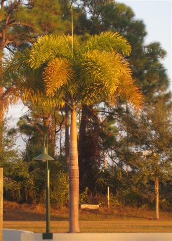 |
| Love these “bottle-brush” palms |
However, Sunday morning I called Indiantown Marina to find out when we could arrive. Because the cold front was due to arrive, the boats that were going to leave the marina had not left. We offered to stay where we were – and the same happened for Monday.
The wind that has arrived with the cold front is crazy – gusts to 35 mph. We have been out rearranging fenders continuously as the wind bumps us against the wall. Travel across Lake Okeechobee is not advised – weather channels call it “rough”. Lake Okeechobee is the second largest lake within the boundaries of the US, but it is only about 13 feet deep. Winds can make crossing the lake quite hazardous. When I called the Indiantown Marina today, they did not think anyone was leaving throughout the week. I guess we will wait. According to weather forecasts, we might be able to cross Lake Okeechobee by Wednesday – we will make the attempt. We will start from RiverForest rather than 13 miles closer at Indiantown.
Until then……….
Titusville to Vero Beach to Okeechobee Waterway
December 9-13, 2010We left early from Titusville because we had 75 miles to go to Vero Beach. Titusville Municipal Marina has many resident ospreys. One had chosen the “soft” post on Grateful’s port side to eat its breakfast. As we were making …
December 3-8, 2010
Camachee Cove Yacht Harbor, St. AugustineHalifax Harbor, Daytona BeachTitusville Municipal Marina, TitusvilleIt’s been awhile since I added to the blog. We have traveled every other day and rested on the off days. We are still on target to get to…
December 3-8, 2010
CamacheeCoveYachtHarbor, St. Augustine
HalifaxHarbor, Daytona Beach
Titusville Municipal Marina, Titusville
It’s been awhile since I added to the blog. We have traveled every other day and rested on the off days. We are still on target to get to Ft.MyersBeach by either December 16th or 17th. Even though we are traveling on the ICW, the weather could be a factor by next week. It seems so odd to have to pay so much attention to what may happen with the weather.
On December 3rd we left FernandinaBeach for St, Augustine. We needed assistance leaving the dock again because of the tidal current, but mostly because of a strong wind blowing us into the dock. As it turned out, Mark placed one of orange ball fenders toward Grateful’s bow and pivoted the stern out using the fender against the dock. Our trip was uneventful – thank goodness – and we saw some interesting sights on the way to St. Augustine.
 |
| We passed two of these “houseboats” on the way to St. Augustine. |
 |
| Lady Catherine, a beautiful Trumpy yacht, passed us. |
 |
| Sunset at Camachee Cove Yacht Harbor |
 |
| Boats in dry dock facility being repaired |
 |
| A perfect end to a long day. |
CamacheeCoveYachtHarbor is very nice and protected. Last spring we spent a week at the St. Augustine Municipal Marina. While we had a wonderful week there with easy access to beautiful historic St. Augustine, the hustle and bustle (construction on the Bridge of Lions, tour boats coming and going, transient boats crashing and getting caught up in the current) was quite a difference from the calm, peaceful feel of Camachee Cove. On Saturday many boaters were decorating their boats for Christmas – the big regatta is next weekend.
 |
| Grateful at Comachee Cove Yacht Harbor |
 |
| Entrance to Camachee Cove |
We moved on to Daytona Beach on Sunday, and returned to HalifaxHarbor. We had a very pleasant stay with them last spring and this time was no different. Our trip was another easy one – and we shared the waterway with many more boats than we had seen before. As this day progressed apparently the wind shifted from the west to out of the north. We were getting a healthy push from the wind as well as the current, but it ushered in very cold weather for this part of the country. For the last three mornings we have been getting up to mid-30s for temps. I have pulled out all the winter gear that I needed last fall when we were traveling down the Mississippi. Even Captain Mark has reluctantly given up his shorts for a pair of sweatpants.
 |
| St. Augustine at dawn |
 |
| Castillo in St. Augustine |
 |
| Passage through the Bridge of Lions |
 |
| Halifax Harbor at sunset |
On Tuesday, we continued down to Titusville and stopped at the Municipal Marina again. We had forgotten what an adventure it was to get into a slip here. Because the docks are fixed not floating and because the fingers are only about 25 ft long, we have to go stern in so that we can get off our boat. (Our doors are located about 10 ft from the back of the boat). Things seemed to be going just great with the stern fitting between the soft posts when suddenly the dockhand yells “FORWARD” because one of those posts had moved right behind us!!! Well, Captain Mark still has fast reactions and we did not hit the post. I got the stern line to the dockhand, but then I had to run to the bow to lasso those soft posts with bow lines. Good Grief – I am going to need more practice on that skill. Anyway with expert help from the dockhand, we were finally tied down. Our power cord and water barely reach from the front of the boat back to the main dock behind us, but we are connected. And this is another great place to stay. Porter loves it because he can get off and on the boat under his own power. With floating docks we need a ladder so we have to lift Porter off the boat. He is much happier this way.
 |
| First dolphins to swim with Grateful – a family of three. |
 |
| Never get tired of watching |
 |
| Can you find the heron? |
 |
| Spilled red wine – Porter was helping clean up the mess. |
 |
| Heron at Titusville Municipal Marina. |
Last spring we watched the Atlas rocket launch while we were here and we thought we might see another commercial rocket launch of the Falcon 9, but it has been delayed – maybe tomorrow morning? We will look as we travel down to Vero Beach.
Golden Isles to Fernandina Beach
Ah Yes!! After having a chilly but beautiful evening at Golden Isles….. Sunset at Golden IslesWe were going to have an easy cruise today. Well, not so much.We did plan to leave at dawn again which was about 1.5 hours after flood tide. The winds …
Golden Isles to Fernandina Beach
Ah Yes!! After having a chilly but beautiful evening at Golden Isles…..
 |
| Sunset at Golden Isles |
We were going to have an easy cruise today. Well, not so much.
We did plan to leave at dawn again which was about 1.5 hours after flood tide. The winds had settled some to 15-20 knots out of the north, but we were able to get through the St. Simons and St. Andrews Sounds (where Georgia’s big rivers run into the Atlantic Ocean) without incident. We knew that this timing would get us through the much-warned-about Jekyll Creek portion of the ICW approximately 2-3 hours after flood. Even so we were surprised at some areas and had to search a little right or left to find more comfortable depths. Other than Jekyll Creek there were no more “warnings” online of shoaling or shallows along our route for the day. Even local knowledge knew of no other concerns.
But then we came to a portion of the ICW called the Cumberland Dividings at about one hour before ebb tide. And there was plenty of water in the very narrow channel, so we proceeded slowly and carefully. However, there were also trap markers IN the channel and while Mark was dodging one of these traps suddenly there was no water under Grateful and we ran aground. During that time, I was down below fixing drawer runners in the V-berth. To those of you who know what would have been my reaction to this situation last year, would have been amazed (as was my husband) that I continued to work on the drawers. Yes, I did….. and I prayed a little – a lot! But I knew that the tide would be rising in an hour, and we would most likely be on our way. And I also knew there wasn’t anything I could do or say that would help Mark at that moment. Well, the good news was that the ebb tide was strong enough to push Grateful off the mud flat and we were on our way within moments.
I came up after finishing my chores, and found out that Mark wondered if I was injured or had passed out down below when we went aground. FUNNY. Anyway, the rest of the Cumberland Dividings was nerve-wracking, and we came upon markers that were not in our charts. In order to follow them, our GPS and charts showed us cruising over an island! Mark found the following online post yesterday that was an account of that very same area just the day before (December 1st)…….
Subject: Severe shoaling Cumberland Dividings
Dear,
Thank you for speaking with me. I have attached a pdf with photos and chart segment. I came through this area yesterday, an hour before low tide. When I came on the scene, a 48+ ft Sea Ray was sitting to the East of the Red 60 completely out of the water and partially spun around at the base of the marker. They WERE in the channel according to the markers and the chart but there was no water. Tow BoatUS was on the scene and guided me around thankfully. From Green 59A to Green 63 stay well East (at least 25 yards) of the Reds and almost to shore on the green side. The small little island that is shown on the charts east of Red 60 is NOT there. In fact that is where you need to be. My chartplotter showed me driving right over it as I followed the Tow BoatUS around safely. There was 10ft of water close to shore at low tide. Coast Guard MUST put drop aides here, this is a serious risk to boaters.
I was extremely disturbed when I discovered this significant discrepancy which has the potential to end with tragic consequences. I have since discovered that there are multiple groundings in this spot each week, there are no Securite calls warning of the hazard (until I called Jacksonville yesterday), no mention in the LNM and this problem has existed for at least a year. I feel drop aides are essential, require minimal effort and should have been placed long ago. I thank you for whatever you can do to correct this problem.
The small island shown on the chart at:
30 50.951 N
081 28.687 W
This island does not exist and is in fact where the proper channel should be.
Current safe water is found by staying close to G 59A and following a arced course over the little island to G 63 . Remaining at least 25 yards East of Red markers. Red daybeacons should be removed and drop aides placed until either dredging can occur or the deabeacon can be properly moved.
Thank you,
John Webster, USCG Master #2851625 USCGAUX 1155849
Mr. Webster,
Appreciate the heads up on the shoaling issue at this turn. Believe it or not, this was the first that we heard of the issue. The same day that we were informed of the shoaling I dispatched my crew and established 2 temporary red buoys to help mark the inside turn a little more adequately. We also discovered that the #63 had been knocked down, we set that temporary buoy further outside the green side of the channel to hopefully draw boaters to that side.
The Coast Guard cutter Hammer is scheduled to be in that area in early December to restructure the turn. They were forwarded the pictures so they can plan accordingly.
Thank you for your assistance.
Respectfully,
BMC Rob Lehmann
Officer in Charge
Aids to Navigation Team Jacksonville Beach
It would have helped if we had read this notice before we traveled, but we are ever so grateful that swift action was taken by the USCG and the temporary markers were in place when we went through.
The rest of the trip was great. We passed more shrimp boats and this one was pulling in a net – notice all the birds waiting for a possible meal.
 |
| Birds waiting for a meal |
This tour boat passed us with this unusual paint job.
 |
| Nice paint job |
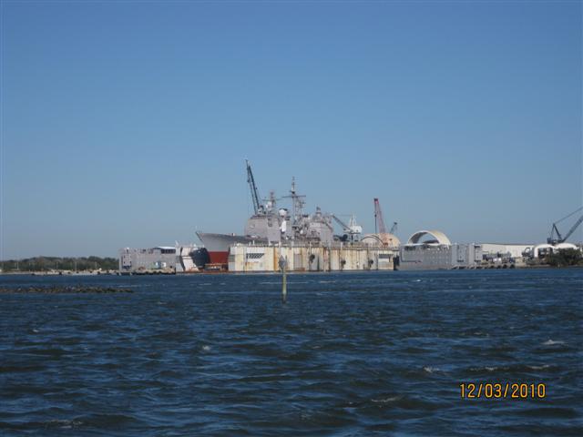
We again went by King’s Bay – a facility where up to 6 submarines can be moored – and this time we saw one being worked on. It is impressive.
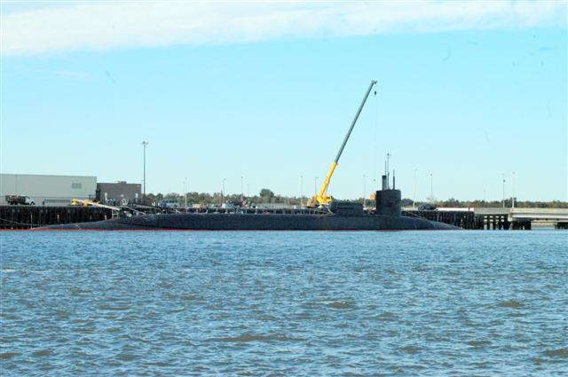 |
| Submarine at King’s Bay |
 |
| Notice the men on the top of the sub |
 |
| Guardians of King’s Bay |
Then as we crossed St. Mary’s Sound and nearing FernandinaBeach we watched this container ship come into port (just north of the marina we stayed in). In a matter of three hours this ship had docked, been unloaded and moved on.
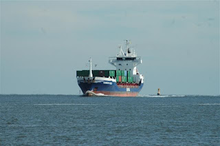
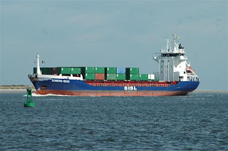


 |
| Escort Tug |
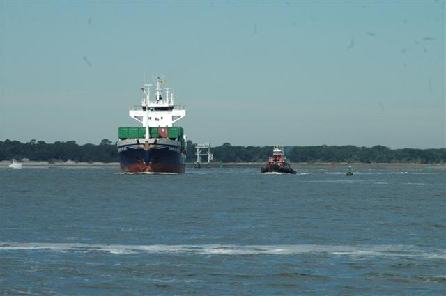 |
| Escort approaching |
Again, we liked FernandinaBeach – a pretty little town. We went out to eat at the Irish pub, and I purchased some fine chocolates to get us through these chilly nights.
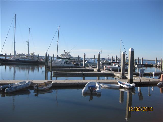 |
| Fernandina Harbor Marina |
 |
| Are we in Florida |
 |
| Town Hall |
 |
| Christmas tree in marina |
 |
| Main Street in Fernandina Beach |
South Carolina and Georgia
December 1, 2010We are cruising a 64 mile day on the Georgia ICW. And today has been more exciting than most so far on our trip.Let me start out by saying by way of explanation that for the last two days we have been concerned about travel because of t…
South Carolina and Georgia
December 1, 2010
We are cruising a 64 mile day on the Georgia ICW. And today has been more exciting than most so far on our trip.
Let me start out by saying by way of explanation that for the last two days we have been concerned about travel because of the predicted severe storms and the extreme high winds. Yesterday we squeezed our short 26 mile trip in between two rain/storm fronts. A warm front off the coast is running into a cool front traveling east from Mississippi (it’s probably the other way around meteorologically). Not only were we concerned about weather, but we were trying to time our trip to take advantage of the tidal swing – 8.5 ft.
 |
| Low tide |
 |
| High tide |


We wanted the water to be low enough for Grateful to get under SkidawayBridge, but rising enough to get Grateful through “Hell Gate”. Hell Gate is infamous (obviously to deserve the name) for shoaling and shallow water. We passed at mid rising tide and had no problem. Landing was a little quicker than usual because of wind, current and tide, but I was ready with all our fenders out – Kilkenny Marina’s docks are a little rough. (We picked up fuel there because we could save about 30 cents per gallon – we needed 317 gallons at $3.09 – do the math – YIKES!)
Last night we waited for the second wave of storms in front of the cold front to hit. There was no TV or computer to check the weather status. Other boats also sought shelter at Kilkenny – s/v Talisman from Sister Bay, WI, s/v Extra! Extra! from Annapolis, MD, and m/v Miscellaneous. We got some rain, lost electrical power for part of the night, but the inverter took over and we at least had a fan. It was 70 degrees and humid when we went to bed (after playing a game of Scrabble) and we woke up to 47, clear and WINDY!!
So yesterday was the easier of the two days. Today the extreme winds – 20-25 knots with gusts up to 35 knots – have compounded the effects of tides and current. In the narrow channels and rivers, it is better than in the Sounds. Georgia’s ICW is mostly rivers joining sounds with some manmade cuts when needed. Also, for several years, Georgia has not budgeted much money to maintain the ICW. Therefore areas that are prone to shoaling in most cases have not received attention for awhile. Our 64 mile trip to St. Simon’s Island has taken us through St. Catherine’s, Sapelo, Doboy, Altamaha Sounds so far and we will need to go partially into St. Simon’s Sound to get to Morning Star Marina of Golden Isles. St. Catherine’s Sound was first and was quite refreshing!! Grateful got a saltwater bath and we were rockin’ and rollin’. Most things in and on the boat are secure for waves, but not for the winds and pounding sea spray. I was laying towels down to soak up water both down below and in the upper salon and then noticed that the canvas cover for our tender was hanging over the back windows! I got to drive for a bit while Mark went to the upper station to secure the cover. He commented that it wasn’t at all as bad as trying to fix the chocks on the way to the Bahamas. Then he had to go out to tighten the ropes on the kayak as wind was lifting and shifting it on the deck. There he said he could believe that the gusts were 35 knots as he had to hold on to stay on.
 |
| Hard to capture how wild the wind was |
Today we also traveled with the cruise ship, American Star. We caught up to her as we were coming out of Sapelo Sound and moving into the FrontRiver, CreightonNarrows and Old Teakettle Creek. The tide also had just shifted from ebb and was rising. The American Star has a draft between 7-8 feet so she traveled slowly and extremely precisely through those critical areas. As the river widened into Doboy Sound we were able to pass and move on at a little faster pace.
 |
| No passing in narrow and shallow channels |
 |
| Narrowly able to pass |
I can tell already that this is going to be another long blog, so while I have you I want to tell you about our past week. It was terrific!!
We traveled from Isle of Palms, SC to Beaufort, SC, on Wednesday, November 24. Because it was an 80 mile trip we were up at daybreak and moving by 7:00. Mark and I don’t usually experience this time of day – what a novelty.
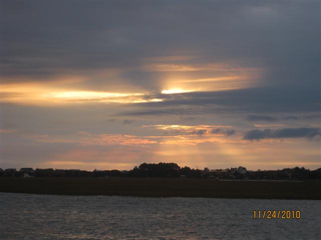 |
| Sunrise |
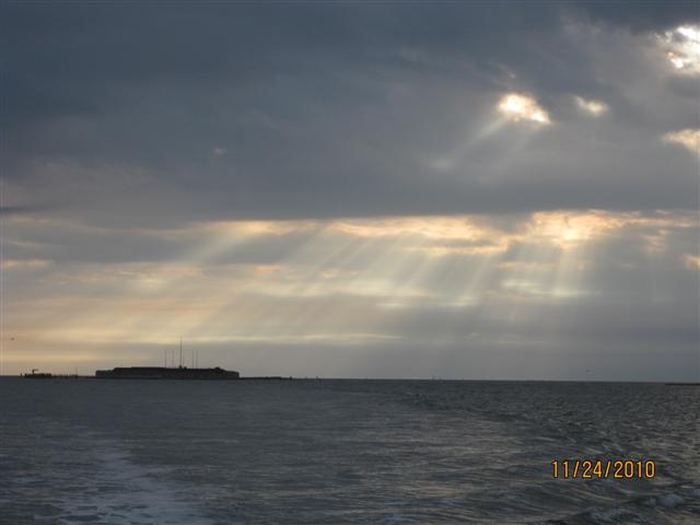 |
| Dawn over Fort Sumter |
 |
| Surprise! A towboat |
 |
| Finally past |
 |
| Nature’s Christmas colors |
We made good time and landed at Downtown Marina of Beaufort around 3:30. Hank & Ann, m/v Queen Ann’s Revenge, were already there and we made plans to go out for dinner. We ate at Plums and had a fabulous meal – I had the server take a picture before we destroyed the evidence.
 |
| Dinner with Ann and Hank |
Hank & Ann went on to Port Royal Marina for a Thanksgiving feast while we stayed in Beaufort for a few more days. Thanksgiving Day is all about eating and Mark and I were all over that. We had the traditional meal that I made on the boat and then we sat around and were lazy. Friday was rainy so we used the courtesy car and got groceries and I did laundry. Saturday was a day of working on the steering and repairing a leak on one of the engine exhaust hoses. (We discovered the leak on our way to Beaufort when it took the bilge pump one hour to expel the bilge water when normal is about 2-5 minutes.)
 |
| At work in the engine compartment |
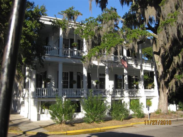
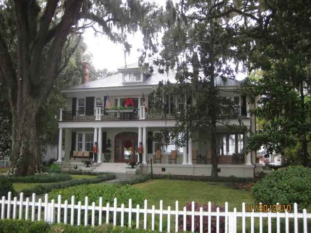
After the chores we took a carriage tour of the area. The homes were spared in the Civil War because the Union Army moved in and occupied them.
 |
| Beaufort Christmas tree |
 |
| Waterfront Park |
 |
| The Rhett house |
 |
| Street in Beaufort |
 |
| Oldest church still holding regular services |
 |
| The tombstones of the church were used for surgical tables during the Civil War |
 |
| Arsenal built in late 1700s never fired upon |
 |
| The “Hanging tree” |
 |
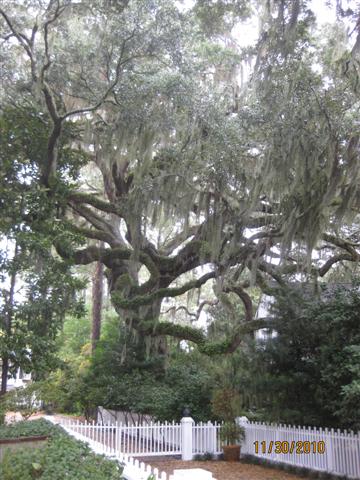
| Angel tree – live oaks where the branches extend out and touch the earth |
 |
| 1000 year old live oak |
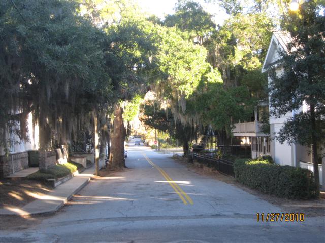
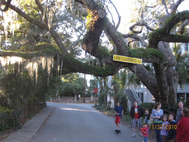
We moved on to Isle of Hope, Georgia, on Sunday. The trip was OK – Mark’s fixes to the engine exhaust hose worked, but the fix to the auto pilot and steering did NOT. The Isle of Hope community is just outside of Savannah. Mark and I took a morning walk along
Bluff Street
Bluff Street
. I continue to be enchanted by the live oaks covered in Spanish moss. Both Beaufort and Isle of Hope have many trees that are near 1000 years old – awesome.
 |
| Bluff Street |

The homes on
Bluff Street
Bluff Street
are both grand and charming – this area was a summer “playground” for Savannah’s elite in the early 1800s. Most of the homes are antebellum “cottages” that I would call mansions. Christmas looks beautiful here.


 |
| Nutcrackers guard the door |