May 11, 2021 With the extra distance run yesterday, we were able to delay our departure from Codville Lagoon until 0700. The sun was shining and the reflections of the rock walls in the water made it look like totem poles laid on their side….
Archive | Spirit RSS feed for this section
Alalska 2021 Day 4
Spirit Log Day 4
May 10, 2021
We planned a 0600 departure from Allison Harbour to cross Cape Caution before the afternoon westerlies piped up. Arising at 0530, we were greeted by dense fog, but light winds. Departing at slow speed with the automatic fog signal blowing every 2 minutes, we inched out the entrance. The fog began to lift and we discovered clear skies over the Strait of Georgia. The swell was running at 1.6 meters, or about 5 feet, with a 2 foot wind chop from the west. We cleared Cape Caution at 0745 and passed behind Egg Island at 0835. Not the best sea conditions, but far from the worst.
Making good time, especially as the seas calmed entering Fitz Hugh sound, we passed by our initial anchorage location, Green Island. Proceeding up Fitz Hugh we entered Codville Lagoon and anchored under sunny skies at 1500, having covered another 73 NM today.
With the early arrival, we relaxed and enjoyed a movie night, watching “First Man” and snacking on popcorn.
Alaska 2021 Day 2-3
May 8, 2021
Spirit Log Day 2
As expected, the winds abated after sundown and shifted back to northwest. About 0330 the winds died completely, but the residual low swell caused the fishing boat to start banging against the fenders, waking us up. Seeing nothing amiss it was back to bed until about 0700.
Our day today takes us through Seymour Narrows to Thurston Bay. We need to hit high slack current at Seymour Narrows, so the 48 NM run to the narrows allowed us to delay our departure until 0900, under overcast skies and almost no wind in Tribune Bay. Rendezvous is following us about ½ mile astern.
Overnight our anchor light failed, so we will have to replace when we get to Ketchikan. Turns out that even LED lights have finite lifespans. The light is located at the top of the mast in a difficult location and we will have to wait until Ketchikan to replace it, since Patrick discovered that there was no spare on board.
The Strait of Georgia was calm with light winds as we headed further northwest to Campbell River, just this side of Seymour Narrows. The last of the flood tide flowing south through Discovery Passage slowed us down to less than 4 knots at times. Even so, we arrived at 1600, 37 minutes ahead of high slack, our target. The current was very manageable so we proceeded through the narrows and entered Johnstone Strait headed for our evening destination, Thurston Bay. There was virtually no marine traffic the entire day.
We anchored Spirit at 1840 in light rain and calm seas, after a voyage of 69 NM. After a dinner of roasted pork tenderloin scalloped potatoes and salad, we all retired early for the 0600 departure for our next stop, Allison Harbour. We have covered nearly 185 NM since leaving Anacortes on May 6.
Spirit Log Day 3
Dawn arrived all too early for a tired crew, but the calm water and gentle sound of rain on the decks provided a soothing environment for sleep. Setting the alarm for 0530, we were underway at 0545, some 15 minutes behind Rendezvous. Riding the ebb tide up a calm Johnstone Strait in rain, dodging barges also riding the ebb tide, we turned into Blackney Pass and into Blackfish Sound. Alas, no Orca’s to be seen, just an adverse current of 4 knots for several miles until we entered Queen Charlotte Strait. By this time, the afternoon westerlies began to build and the ebb current created some short steep seas as we crossed over to the British Columbia Mainland side of the straits. Passing Numas Islands the wind increased to 20-25 knots, the sun came out and we put a lot of spray over Spirit. Threading our way behind points and islands to minimize the waves we finally decided to explore a different approach into Allison Harbour. We could see several small passenger boats anchored behind some islands at the entrance and were pleasantly surprised by a nice potential anchorage for future trips. The anchor was set in Allison Harbor ¼ mile behind Rendezvous at 1755, having logged 102.93 NM today, for a trip total of 289 NM, essentially halfway to Ketchikan.
Alaska 2021 Day 0 and Day 1
Spirit Log – Day 0 to 1
May 6, 2021
The first stage of our 2021 Alaska Journey was a positioning cruise to Roche Harbor in order to be close to the Canadian Border Services Agency (CBSA) marine reporting terminal at Van Isle Marina, Sidney. Arriving at Roche Harbor we met up with the Selene 55 Rendezvous who are also headed to Alaska. The cruise provided a good opportunity to test out the towing bridle for the Johnson’s 18 foot aluminum fishing boat. We departed Anacortes Marina for the fuel dock at 0745 and after taking on 460 gallons of fuel departed Cap Sante at 0830. Underway we tested out the towing bridle and the procedures for deploying and retrieving the fishing boat.
The towing bride worked fine but was more effective when we shortened the overall length by about 20 feet to 130 feet.
Arriving at Roche Harbor Marina at 1145, after a short 27.5 NM journey, our assigned slip was Slip 1 on the main guest dock, close for Miriam to get up to McMillin’s Restaurant where we were scheduled for a sendoff dinner with the crew from Rendezvous. Dinner and adult beverages were excellent, but the summer prices were a shock compared to just weeks ago during the Selene Owner’s Rendezvous. Likewise, the moorage prices between winter and summer went from $88 to $203 for the same boat.
|
Following dinner we watched the traditional summertime Colors Ceremony as the sun slipped below the horizon in a blaze of light.
|
Later that evening Patrick finished scanning passports into the ArriveCan app, required for entry in Canada, along with our proposed quarantine plan for the mandatory 14 day period. The app accepted the entries and we received a 0800 appointment at Van Isle Marina for the next morning.
May 7
Our departure from Roche Harbor was uneventful, but early, at 0545. Heading the ten miles to Van Isle Marina we called in as we crossed the border and CBSA confirmed our time of 0800. Arriving at the CBSA float we found a small sailboat with nobody aboard blocking most of the float. There were also no CBSA officers. We managed to place Spirit mostly on the dock, with about 20 feet of the stern hanging out into the fairway. Fortunately there was little traffic, and the only way on and off was by climbing over the side rail. The CBSA officers arrived about 0825, since they start work at 0800, but at the Victoria Airport. The inspectors were courteous and professional and after a series of questions about alcohol, fruits and vegetables, cash, cannabis products and firearms, they performed a brief on-board inspection while we waited in the cockpit, leaving the boat neat. By 0845, just twenty minutes later, we were on our way north, with the officers even helping with our lines. Overall, this was a pleasant surprise after reading other crossing reports.
Since the process took less time than we expected, in consultation with the crew of Rendezvous, who were cleared shortly after us, we decided to try for slack water at Dodd Narrows, which shortened the distance to our first stop by a few miles. We actually rode the last of the favorable current through the narrows, hitting speeds of 13 knots over the ground.
Entering the Straits of Georgia and threading our way between the bulk carriers waiting to load/unload east of Protection Island we found very favorable wind and sea conditions at we skirted the western boundary of the acoustic range WG (Whiskey Golf) which was not active this day. Passing Ballenas Islands the normal brisk winds spilling over Vancouver Island near Qualicum Beach, reaching 33 knots and the associated beam seas for the last ten mile run into Tribune Bay on Hornby Island coated Spirit with salt. As we approached the anchorage, the wind and seas abated and we anchored in 30 feet of water at 1844, having covered a total of 88 NM since leaving Roche Harbor. Rendezvous anchored shortly after us.
The somewhat exhausted crew enjoyed Chicken Piccata prepared by Teri Johnson before retiring for the evening.
Introduction to our 2021 Voyage
Log of “Spirit”
May 2021
After no blog entries in several years, we are once again documenting our voyages. Since our last posting in 2018, documenting our cruise from Iceland to Montreal on Seabourn Quest, following the route of the Vikings to Greenland and Newfoundland, we made another voyage around New Zealand on Seabourn Encore and then to SE Alaska in 2019.
In March of 2020, we headed to Buenos Aires to board Seabourn Quest for a 36 day expedition up the Amazon and ending up in Miami. The Covid pandemic intervened and we barely escaped Buenos Aires before the airspace was closed.
Returning the Bellevue, we quarantined ourselves, and finally in June headed to Anacortes to spend time of Spirit, again isolating ourselves. Summer 2020 was spent between Bellevue, Anacortes and a number of short cruises in the crowded San Juan Islands, since the Canada/USA border was closed to recreational traffic. In late August Miriam suffered a major stroke and the next 8 months were spent in recovery and rehabilitation with the goal of transiting Canada to SE Alaska, an allowable activity.
The end of April marked the temporary end of rehab until we return to Bellevue in August.
Spirit will attempt to clear Canada customs the morning of May 7.
Route of the Vikings – Post 7
August 24, 2018
At Sea
Today we are headed to the final proven stop on the route of the Vikings. We are at sea all day as we pass down the Labrador coast, still seeing the occasional iceberg. The wind is 25-35 knots on our stern, but at least the temperatures are around 50 degrees.
August 25, 2018
L’Anse aux Meadows, Newfoundland, Canada
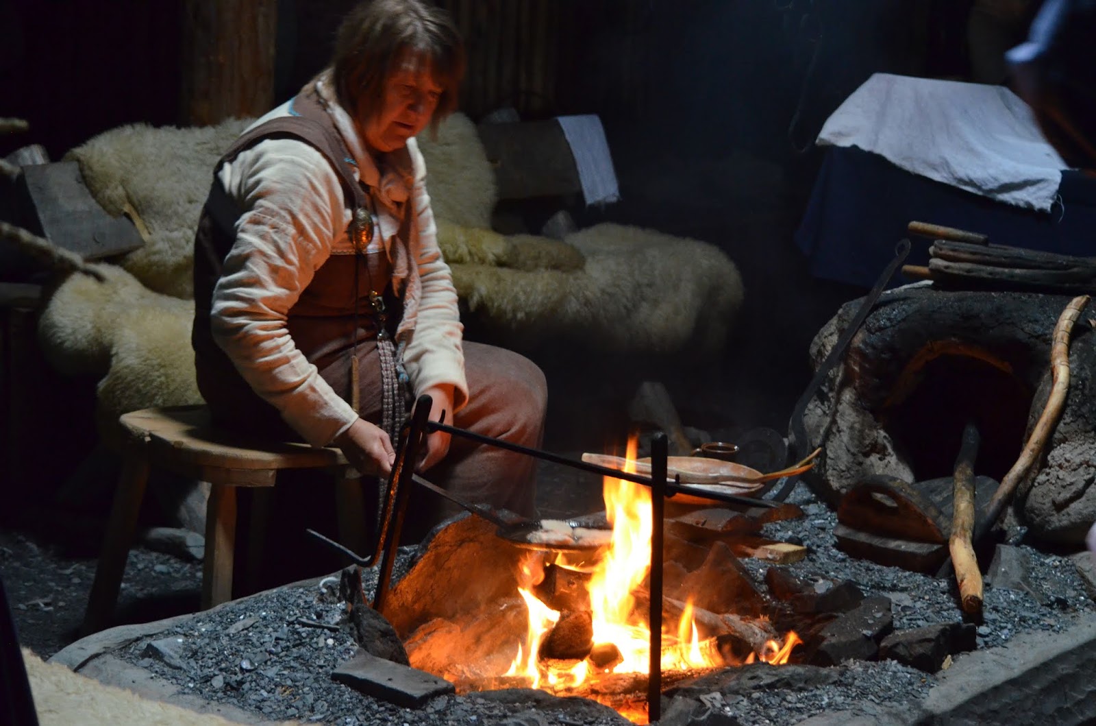
The Seabourn Quest pulled into a bay a few miles from the tender landing point and anchored shortly after 0700. By 0830 we were ashore and headed first to Norstead, a re-creation of a failed Viking settlement from the time of Leif Erickson, predating Columbus in North America by 500 years. The actual site was discovered in the 1960’s and the archeological evidence confirms the written sagas from the Viking era.
Norstead was built for the 2000 Millenial Celebration to avoid too much damage to the actual site from the tens of thousands who attended.
The actual site is now a Unesco World Heritage site and a Canadian National Park. At the site, the foundations of the sod houses are still visible, but have been recovered with sod to preserve them for future generations. Adjacent to the foundations is another recreation of what the site would have looked like 1000 years ago, complete with actors in period attire doing daily activities similar to what historians believe may have taken place.
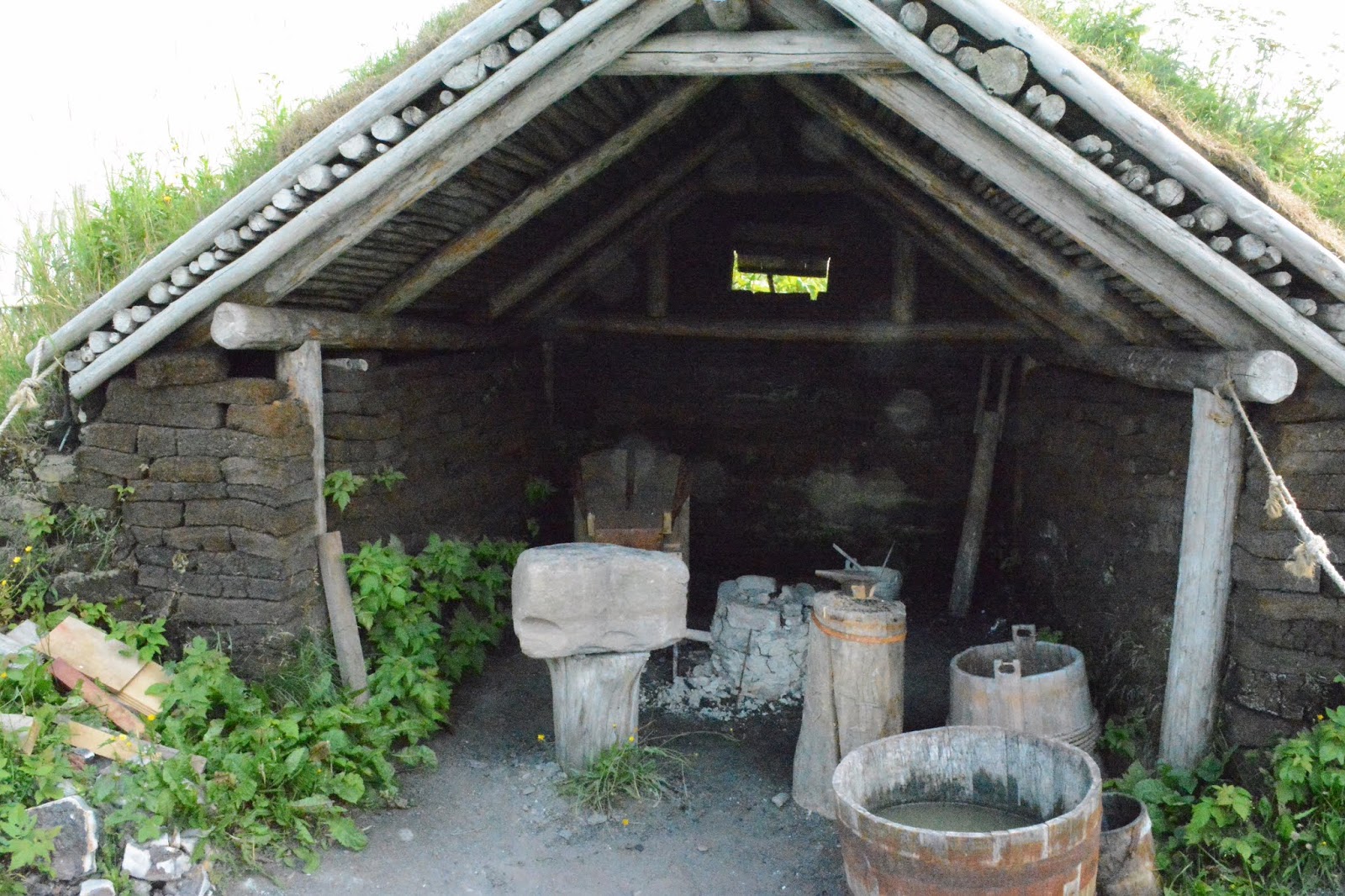 |
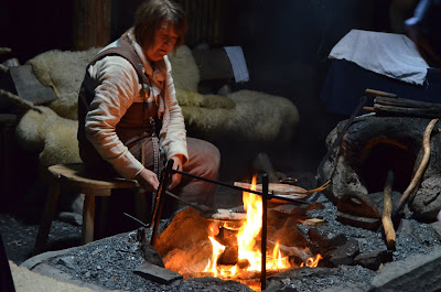
| Forge at L’Anse aux Meadows |
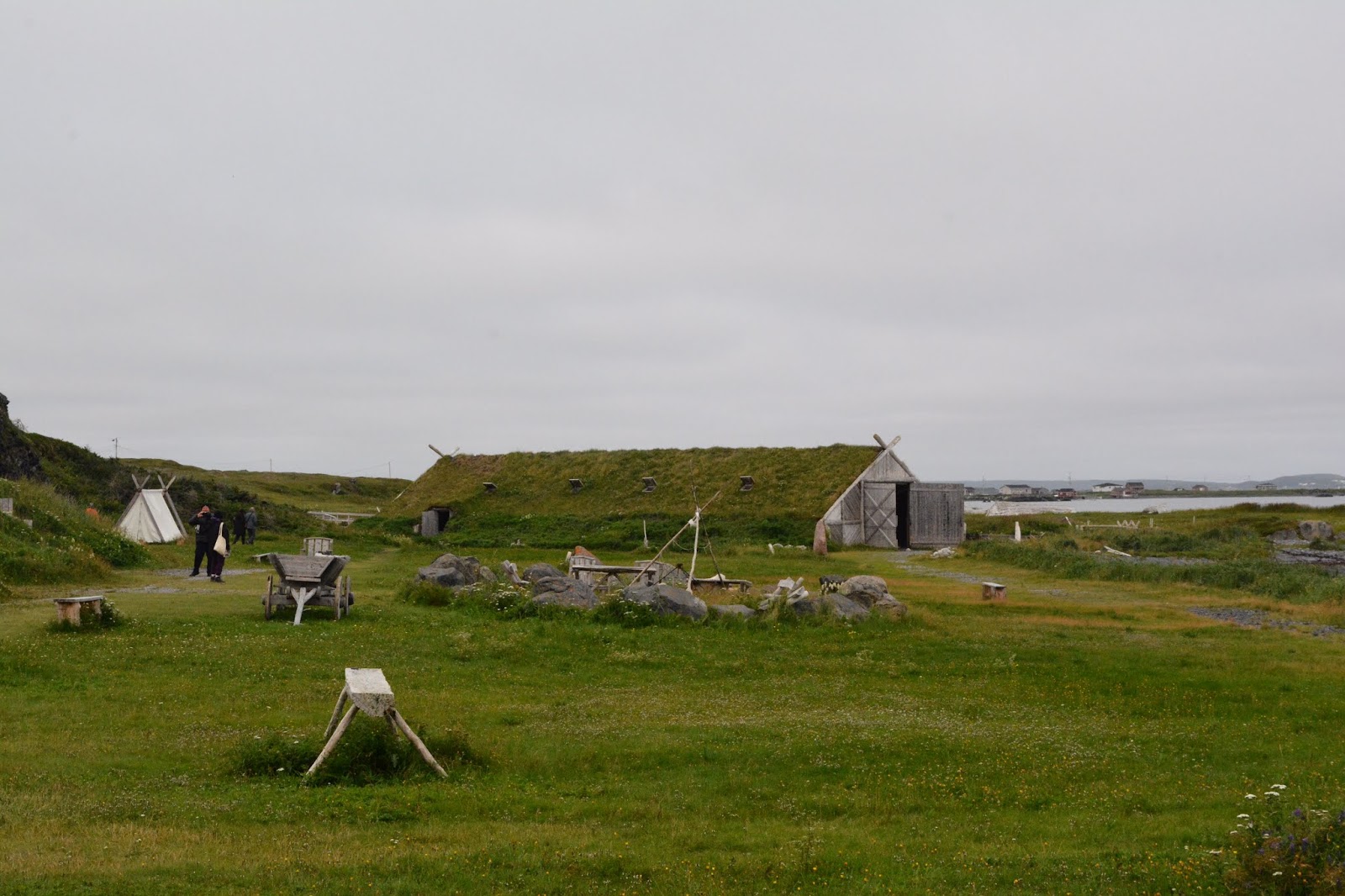 |
| Recreated settlement at Norstead |
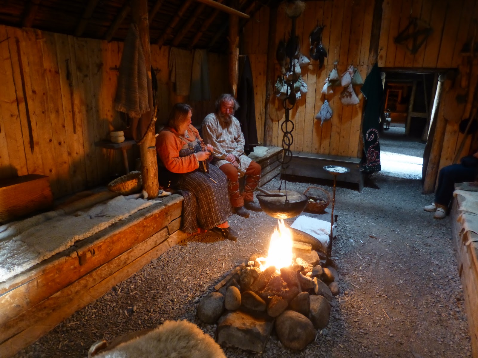 |
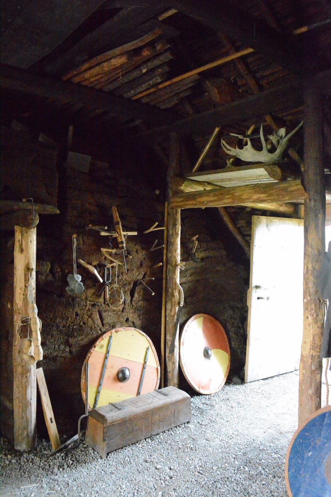
| Inside the sod houses |
 |
| Using Norse tools |
 |
| Loom |
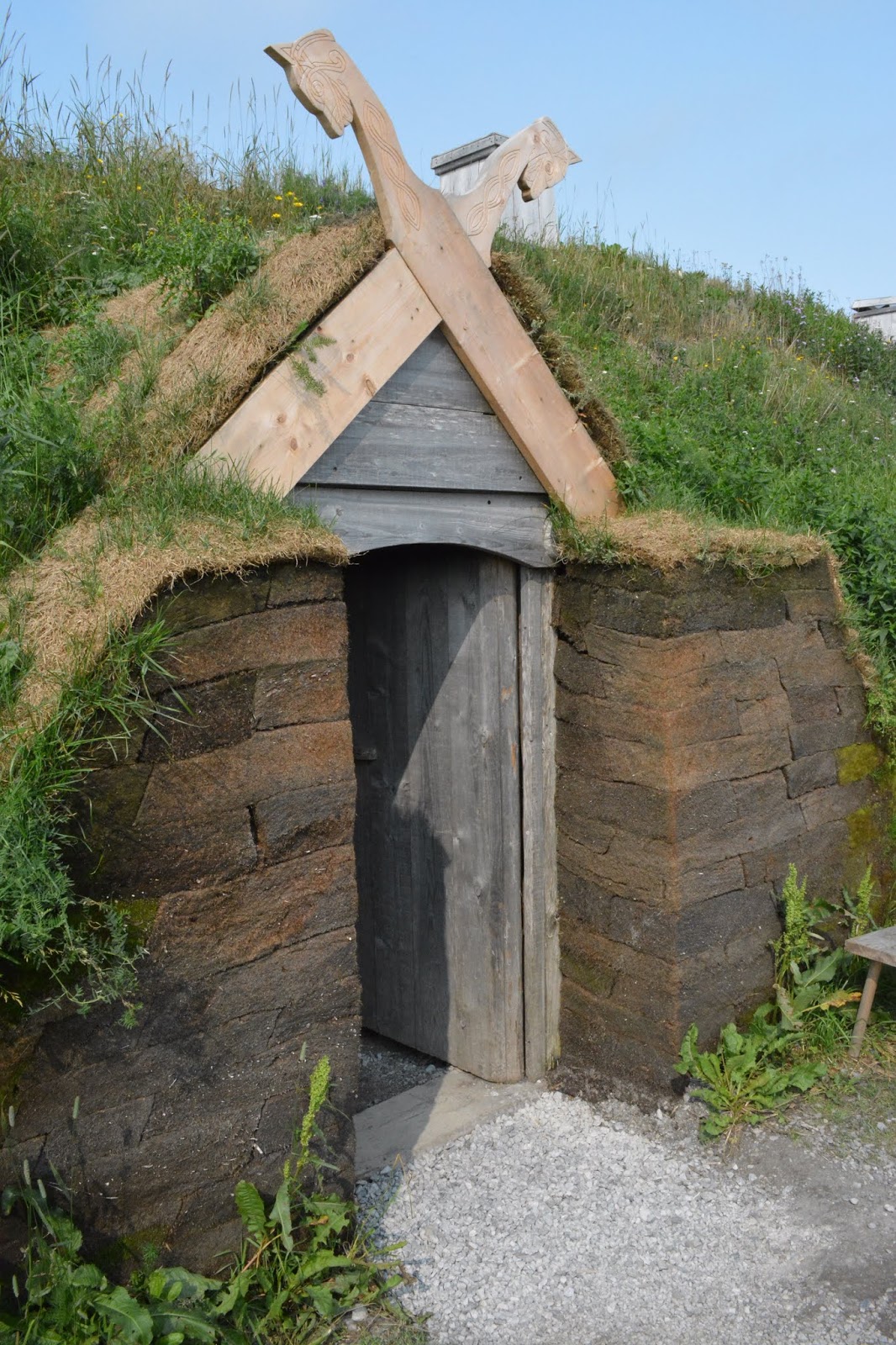 |
| Entrance into Sod Houses |
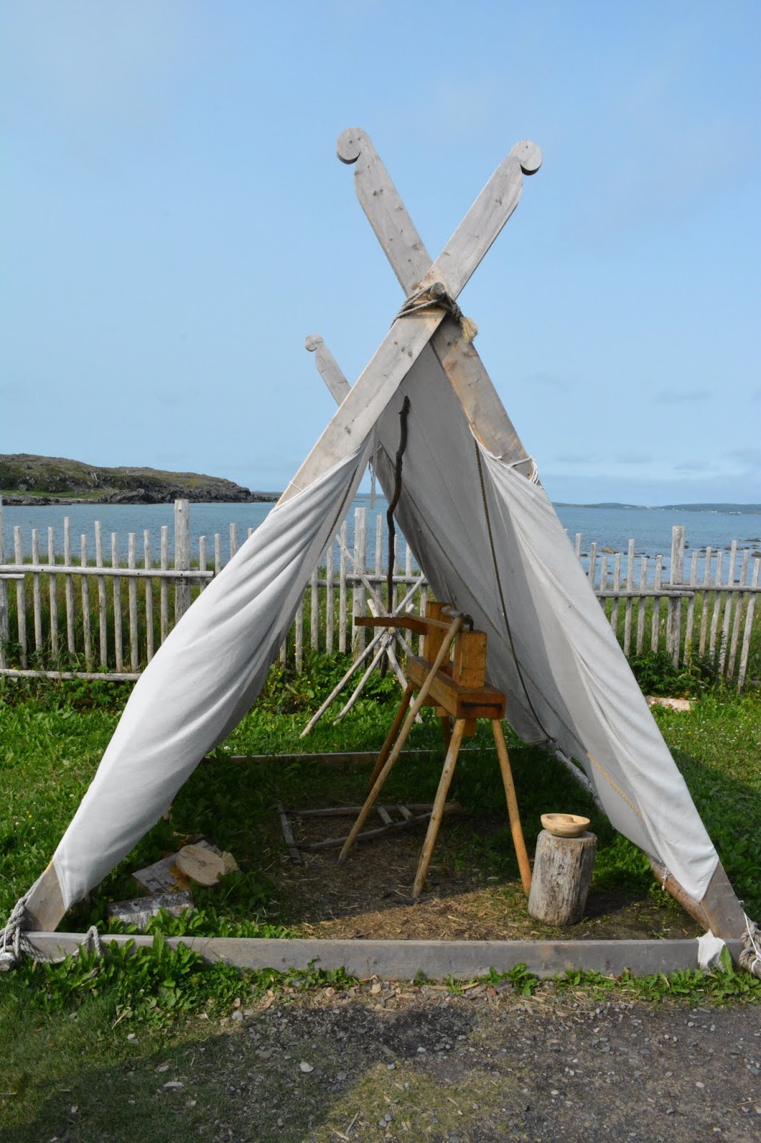 |
| Primitive Lathe |
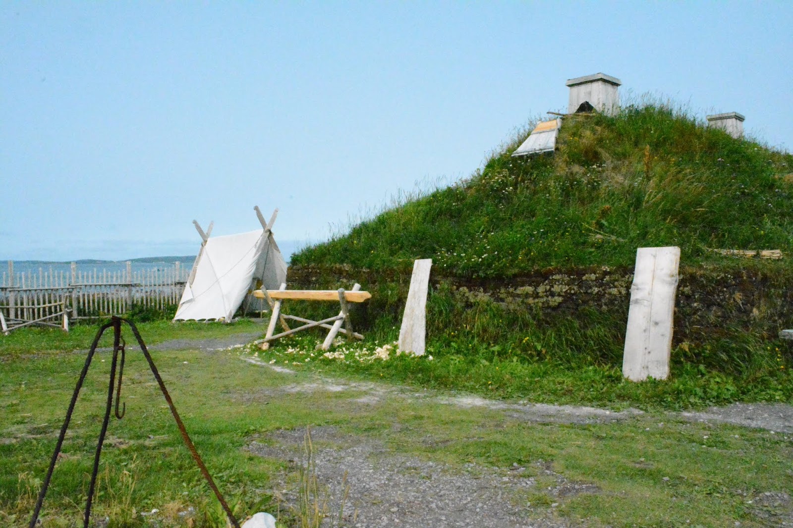 |
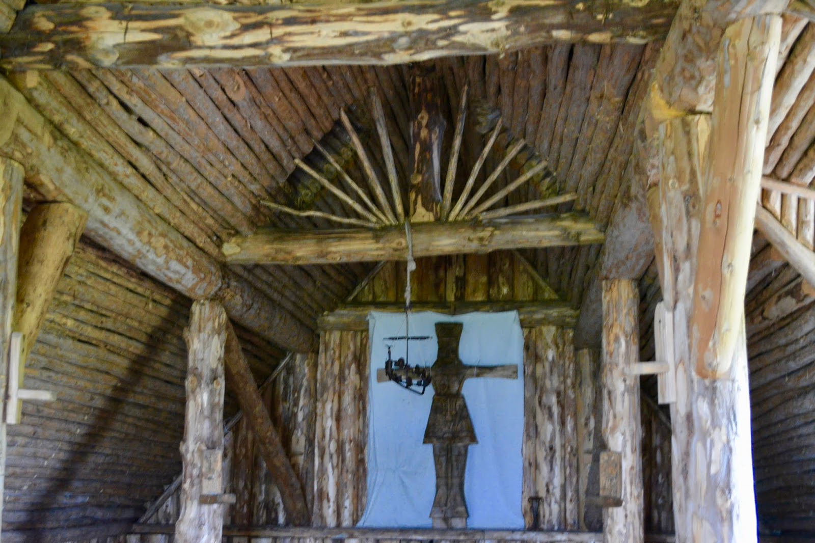
| Sod House |
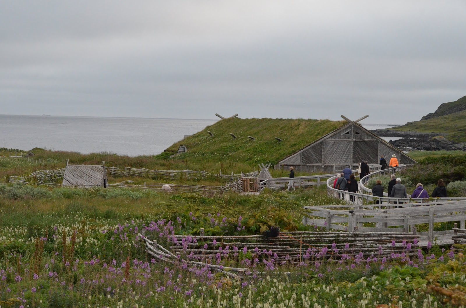 |
| Large Sod House, Contains Viking Longboat |
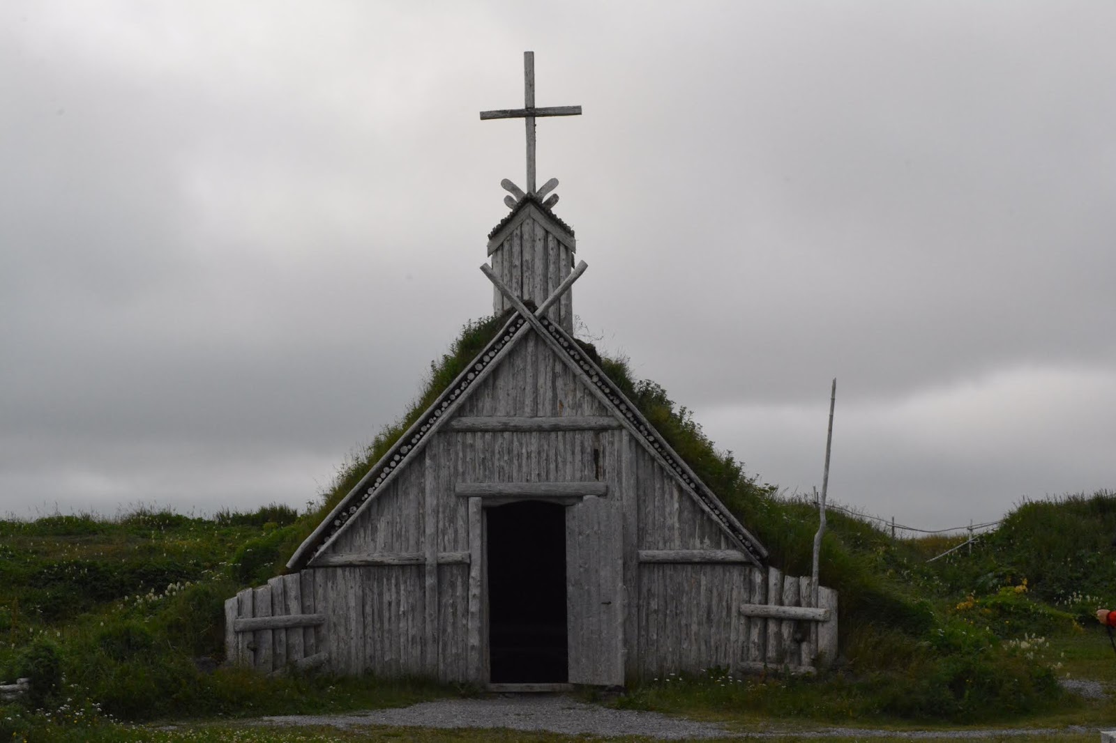 |
| Sod House Church |
 |
| Cooking Flatbread |
 |
| Looking over Archeological Site |
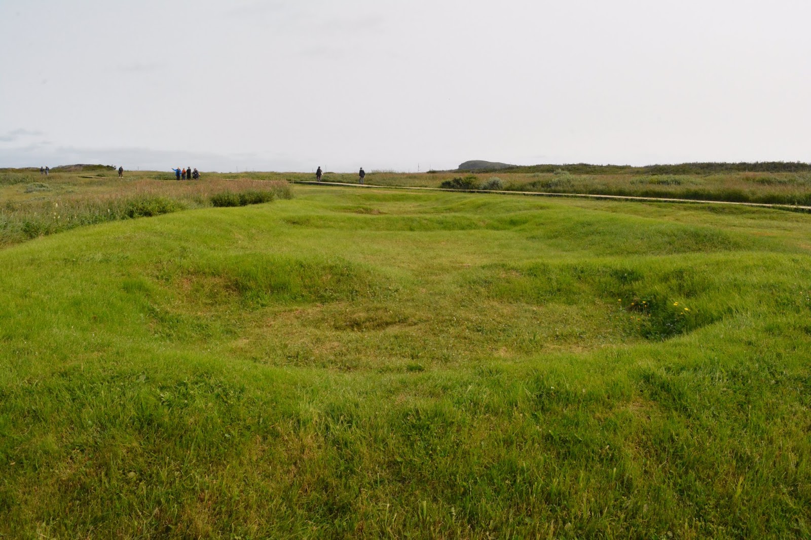 |
| Original Foundations recovered to protect the site |
 |
| Inside Chapel |
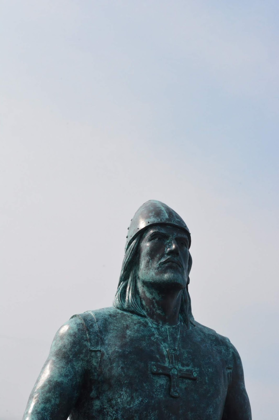 |
| Leif Erikson Memorial from Seattle |
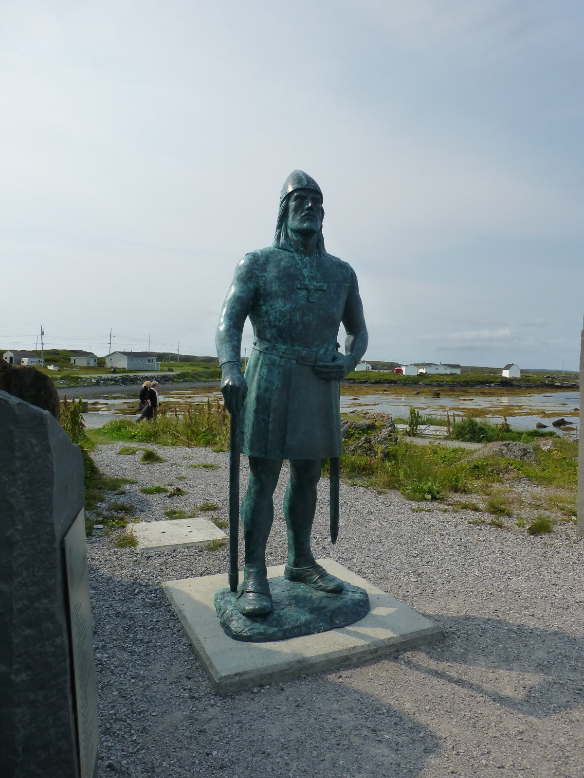 |
| The statue is near the tender landing |
 |
| Building are filled with items that would have been from 1000 years ago |

 |
| What a cooking fire and oven may have looked like 1000 years ago |
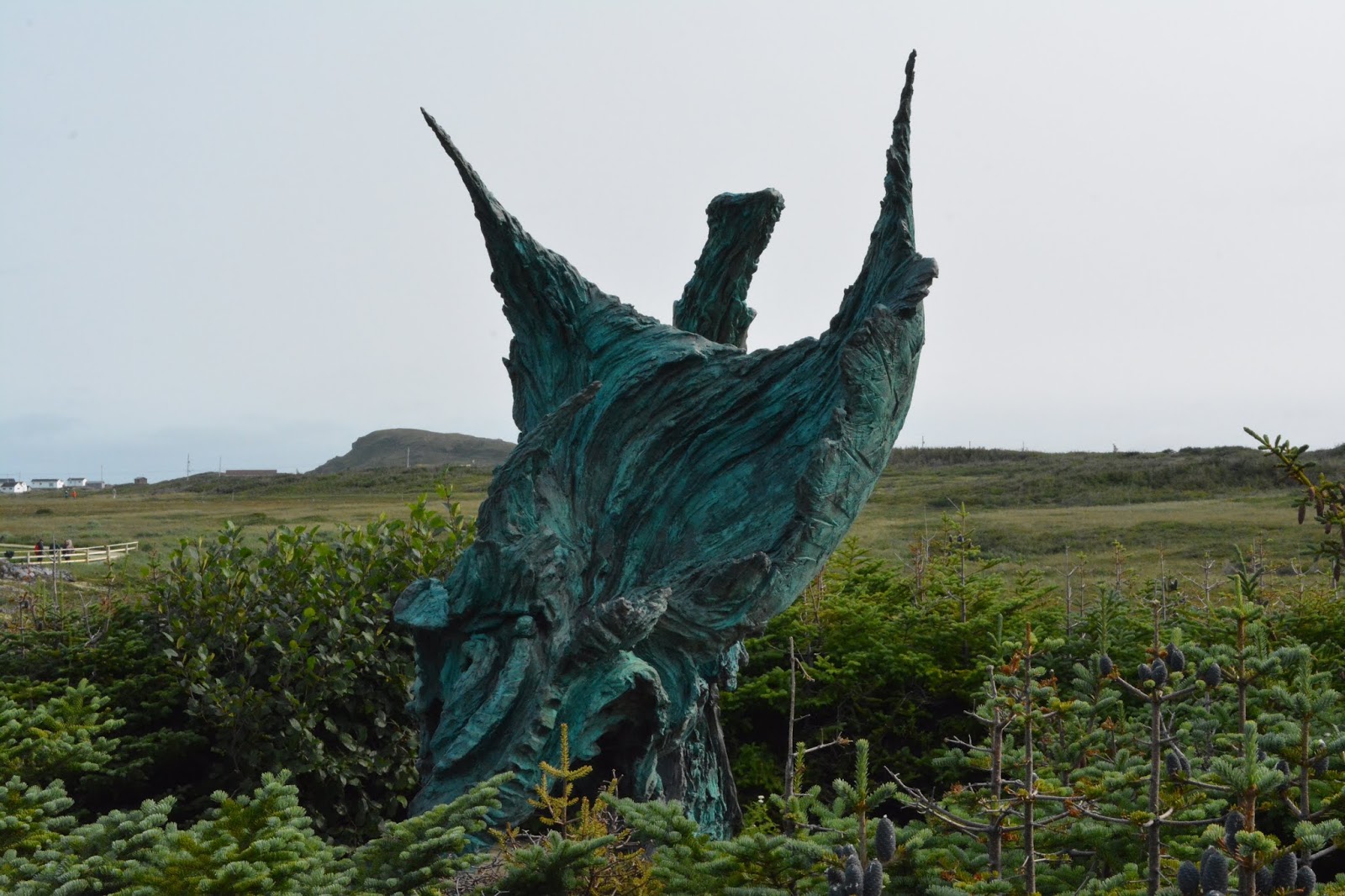 |
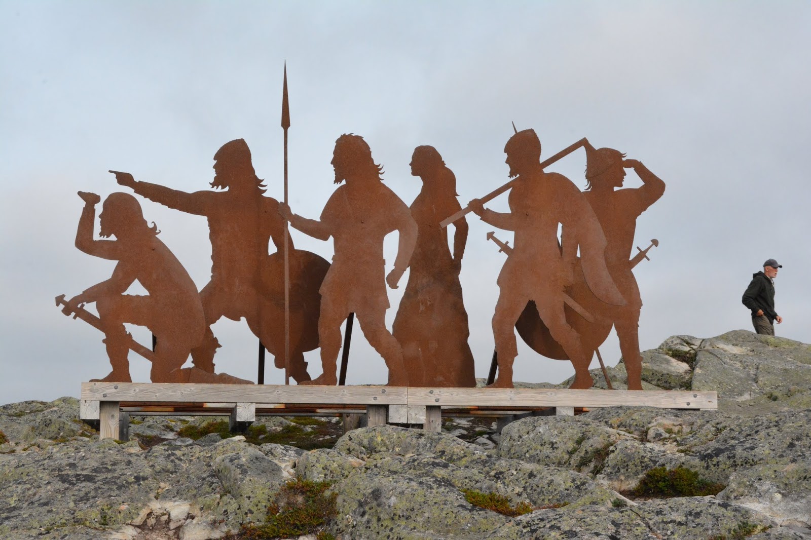
| Sculpture at L’Anse aux Meadows |
At the small boat landing there is a donated copy of the Leif Erickson stature from Seattle, donated by various Seattle civic groups in 2013.
The site at L’Anse aux Meadows marks the end of the verifiable trail of the Viking presence in North America and is believed to have been used only as a gateway for other explorations, for which no firm evidence has been found elsewhere. The expansion of easier trade routes in Europe is thought to be the reason the site was abandoned after only 50-70 years.
The archeological sites we saw in Greenland were abandoned in the 1400’s, probably due to the increasingly cold climate from the climate changes then occurring.
So ends the Route of the Vikings, but still more stops before we arrive in Montreal.
August 26, 2018
Red Bay, Labrador
After leaving L’Anse aux Meadows, the Seabourn Quest travelled only 45 nautical miles across Belle Isle Straits back into Labrador and anchored off the small town of Red Bay, only 230 residents. This town was once a thriving Basque fishing and whaling village, but that is long gone. There is no cell phone service and few other services.
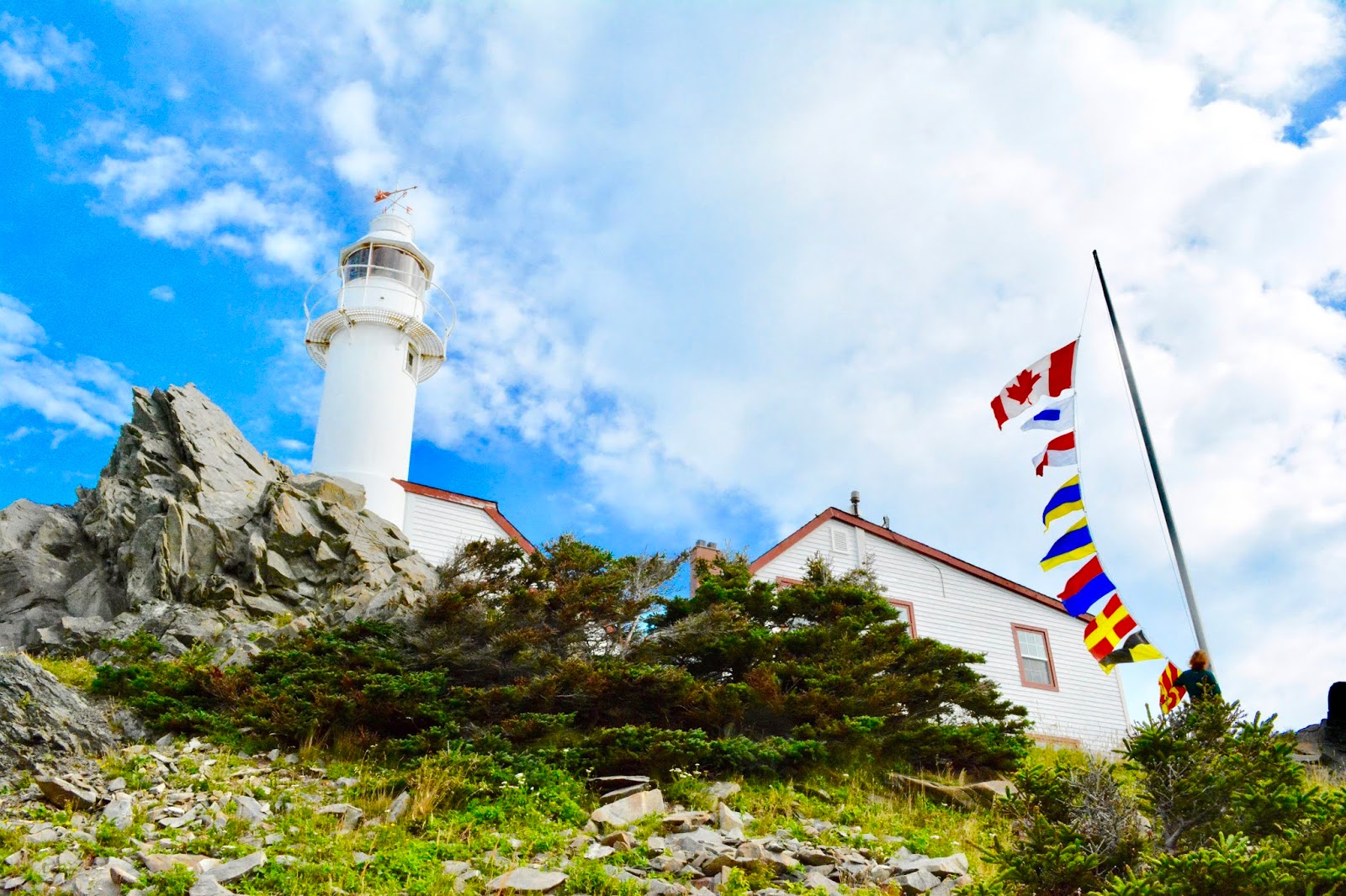
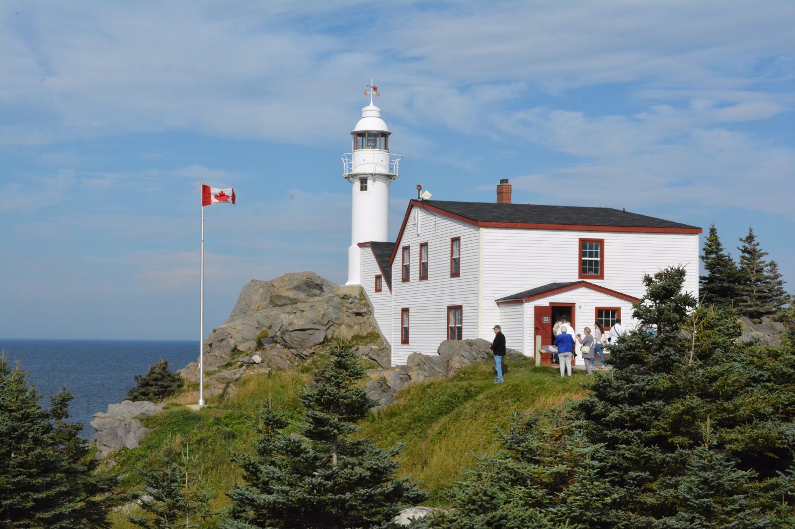
At 0800 we departed on the tender and boarded a school bus for the lengthy trip west down the coast, passing several more small communities, over a combination of paved and gravel roads, both filled with potholes. The school bus seats are very close together and the bus had poor suspension. Nonetheless, after 75 minutes of bouncing, we arrived at one of the tallest lighthouses in Canada, the Point Amour light, which has been in continuous operation for 160 years. The light is 132 feet above ground and 180 feet above sea level, easily illuminating the 9 mile wide Belle Isle Strait.
 |
| Original Light |
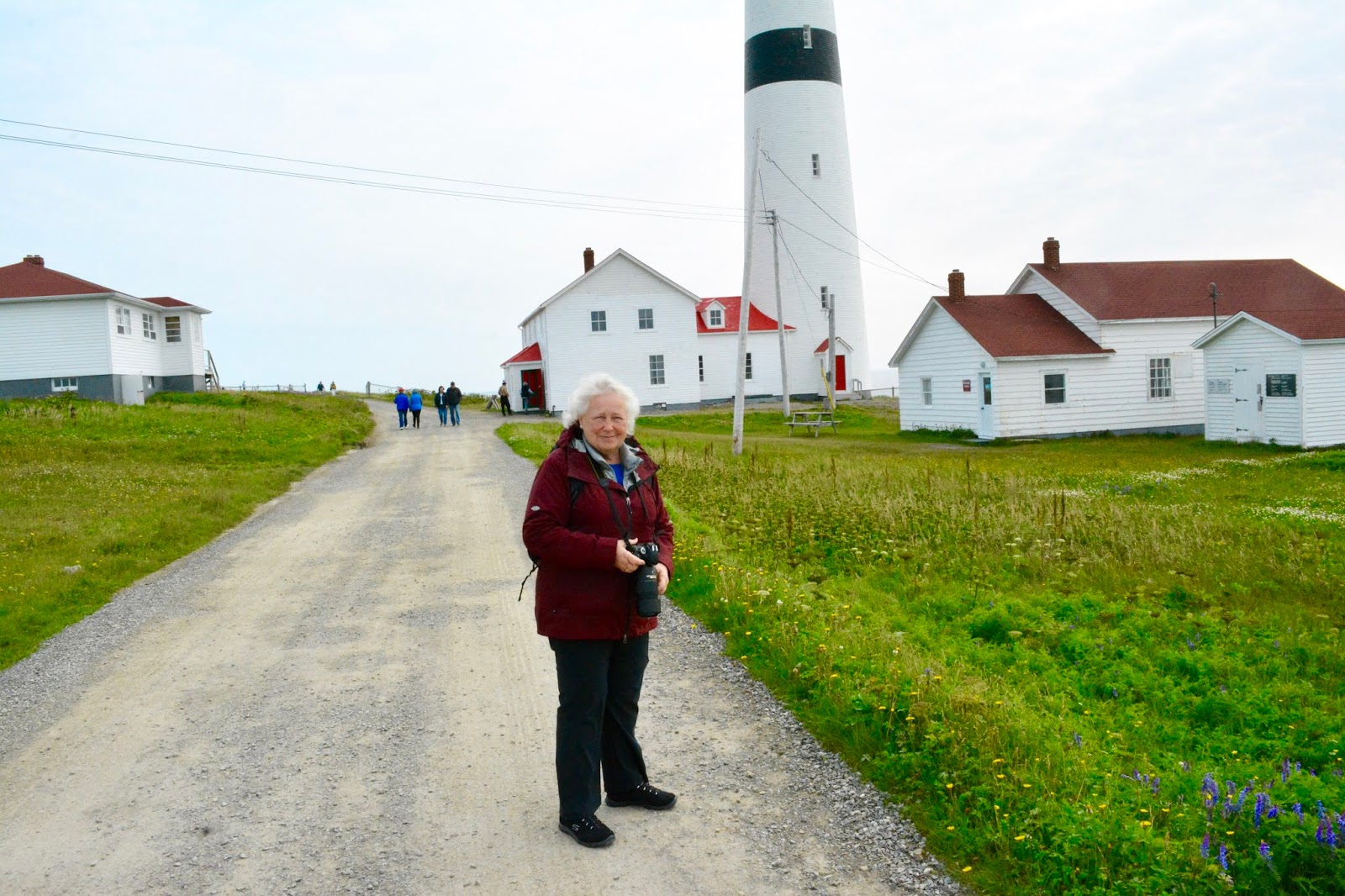 |
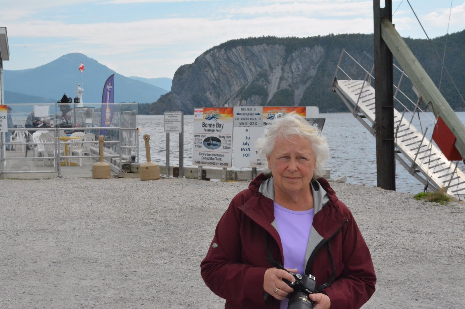
| Miriam at Point Amour |
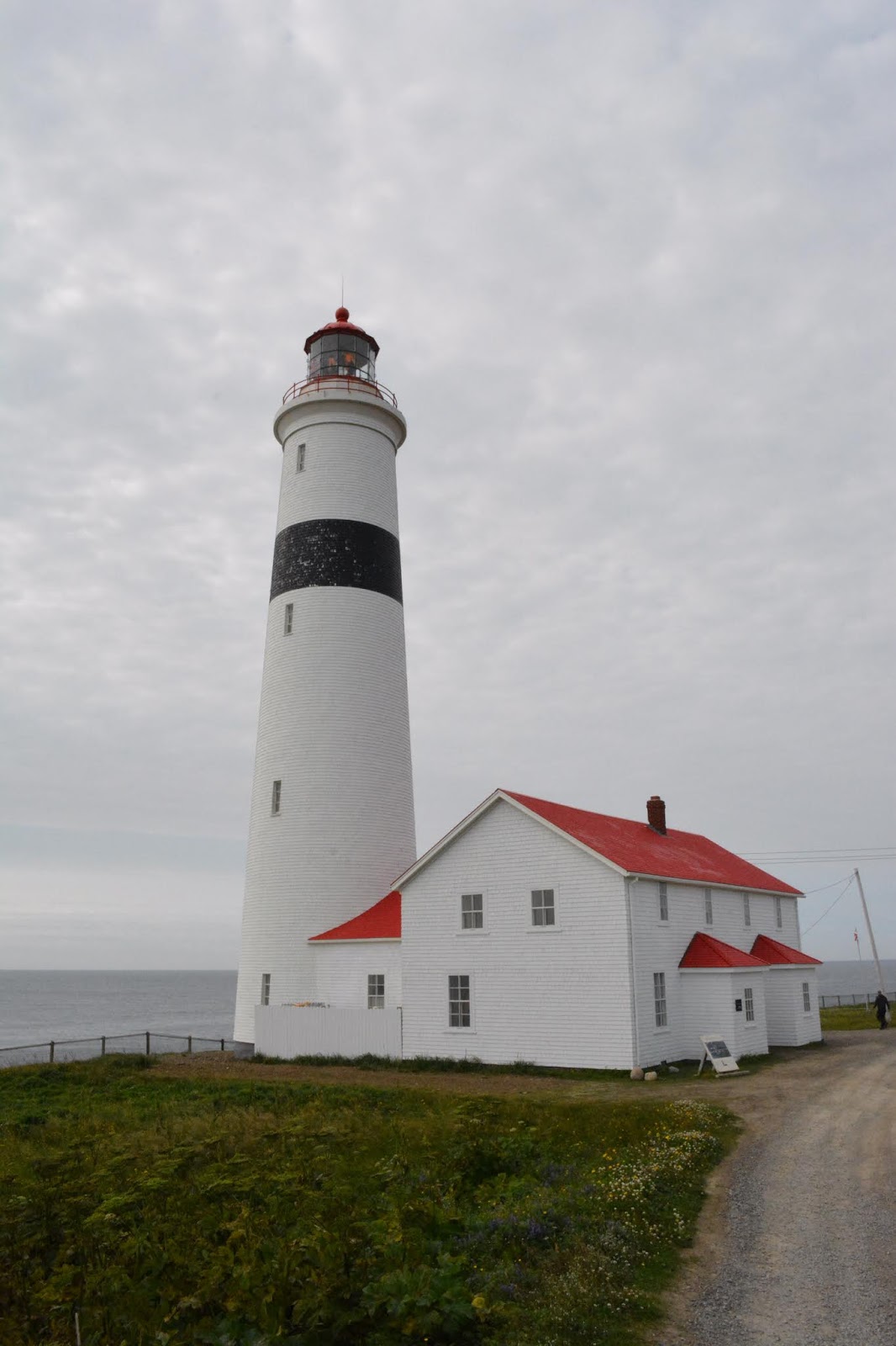 |
| Point Amour Lighthouse |
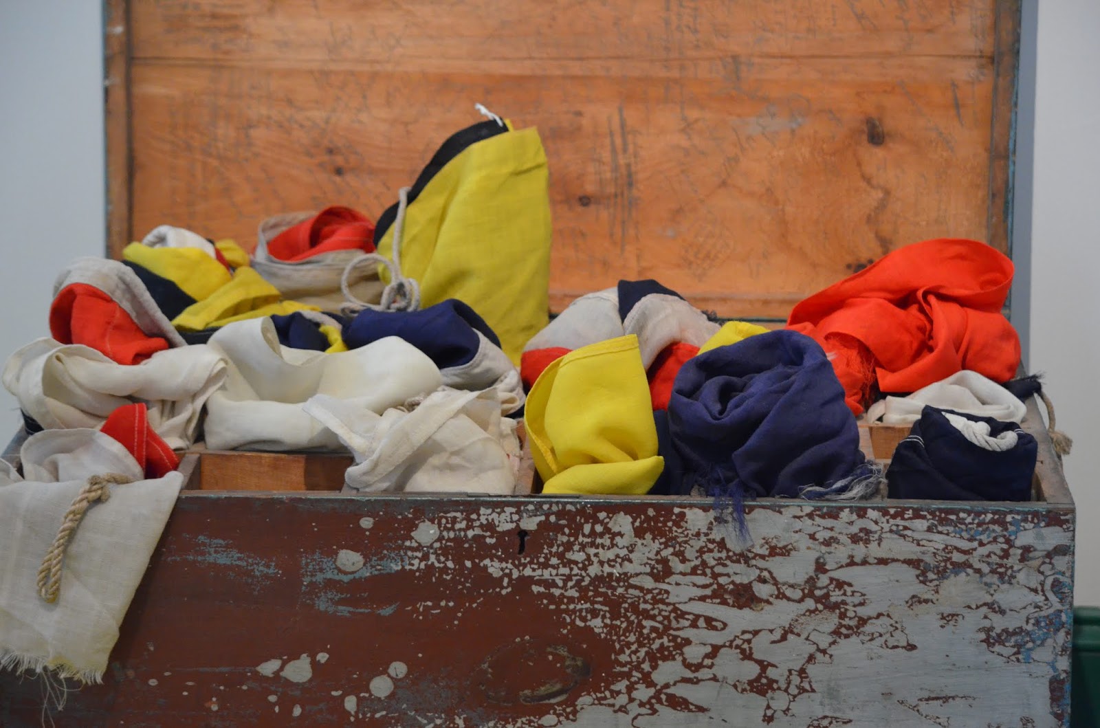 |
| Wind Signal Flags |
The lighthouse is one of four “Imperial” lighthouses, so-called because England provided the funds for construction, that provide navigational aids to Belle Isle Strait. Belle Isle Strait is a shortcut between England and the Saint Lawrence, nearly 200 nautical miles shorter that the deeper water route via Cabot Straits on the south side of Nova Scotia.
We were able to climb the lighthouse and walk through many rooms of exhibits and enjoy some local desserts made from the Partridge Berry.
Returning to the ship we stopped several times for photo opportunities and at 1600 the Seabourn Quest weighed anchor and set sail for Corner Brook, Newfoundland, diagonally west across Belle Isle Strait and 190 nautical miles further towards our final destination in Montreal.
August 27, 2018
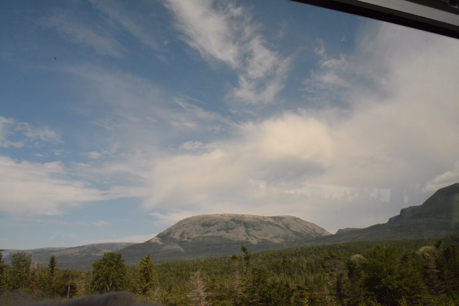
Seabourn Quest arrived at the pilot station about 0600 and was tied to the dock by 0730. Our tour today was a bus tour to Gros Morne National Park. The park is a combination of geological anomalies, wildlife, beaches, small villages, historic lighthouses, and most importantly, the barren tablelands.
 |
| Gros Morne |
 |
| In front of tablelands |
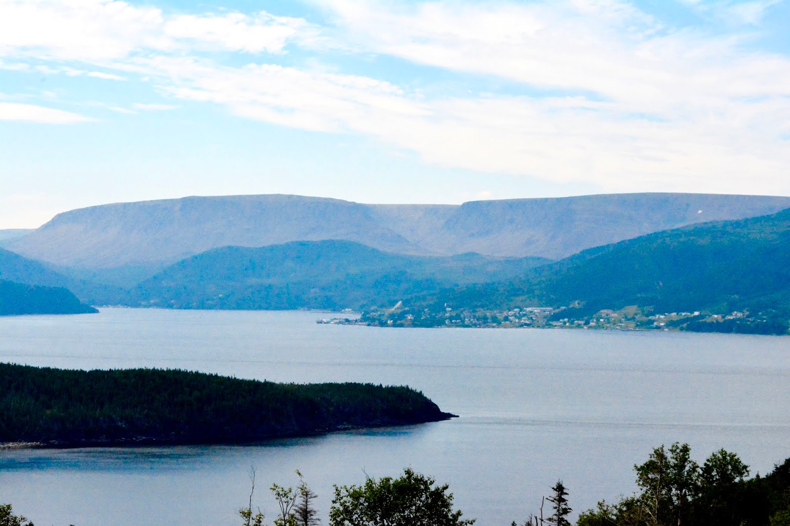 |
| Barren Tablelands in Gros Morne |
 |
| Lobster Head Bay Lighthouse |
 |
| One of four “Imperial” Lighthouses on Belle Isle Strait |
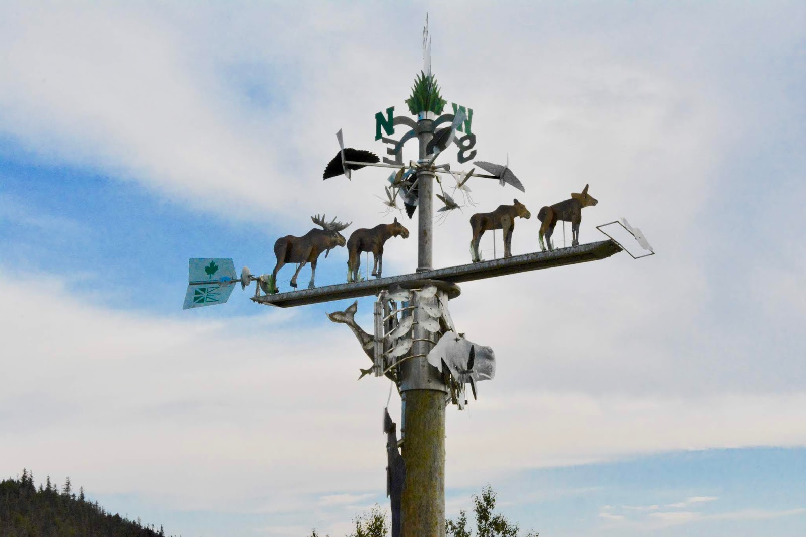 |
| Moose Windvane in Gros Morn park |
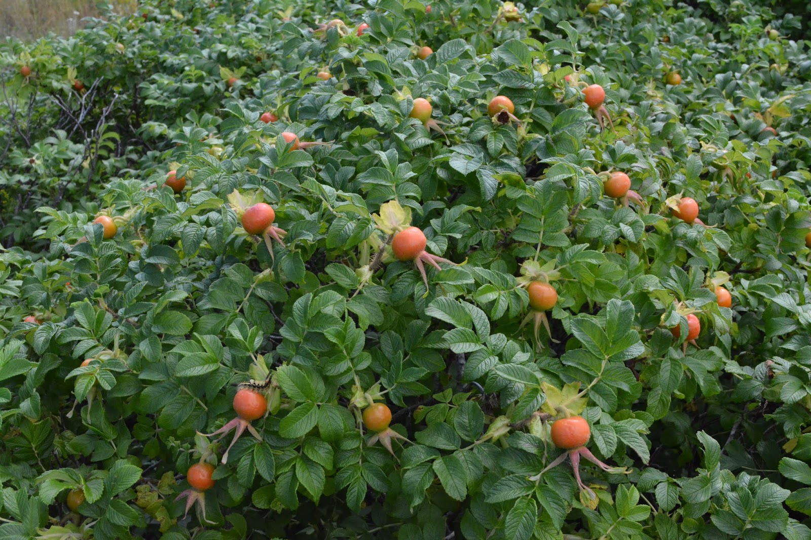 |
| Lots of rosehips in Gros Morn |
The tour took most of the day, and we were the last tour group back on board before our scheduled 1600 departure. The departure was marred by a massive power blackout as we moved away from the dock, with the ship drifting powerless, the lights out, emergency hall lighting on and massive clouds of white smoke coming from the stacks.
The ship was close enough to the dock that they were able to throw heaving lines ashore and slowly winch the ship back to the dock. The problem was resolved, apparently, and the ship finally departed Corner Brook at 1930.
August 28, 2018
Seabourn Quest continued into the Gulf of Saint Lawrence and entered the river about 1900. Quebec City is some 200 miles inland, but the river is still very wide. We spent several hours trial packing our luggage for the trip home on the 30th. We also had the final lectures on “The Route of the Vikings”, this time looking at the Eastward expansion into the Caspian and Black Seas.
August 29, 2018
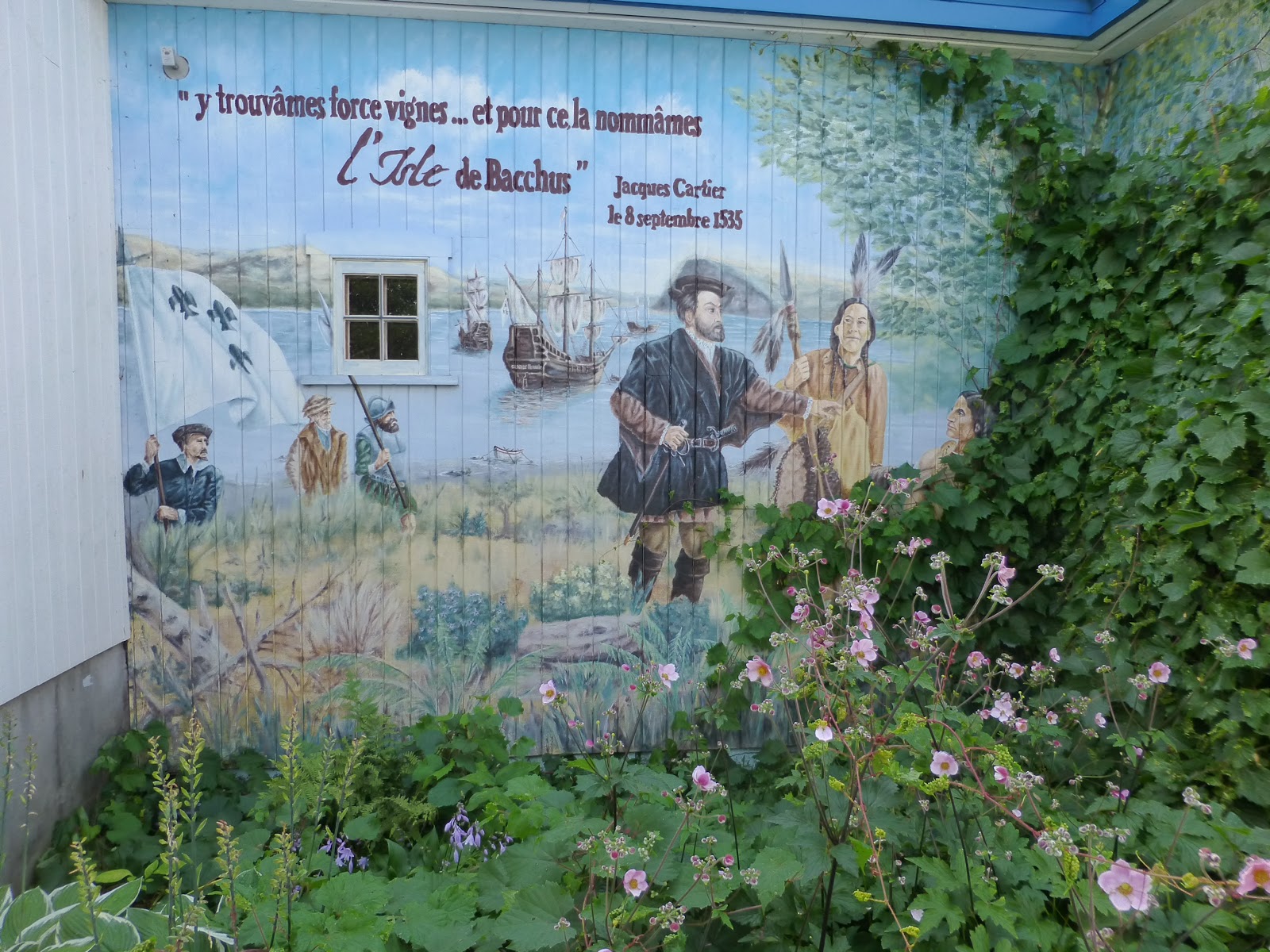
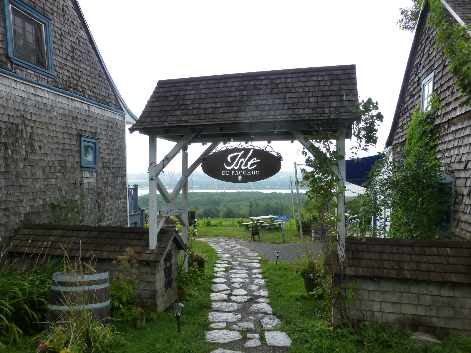
Arriving at the cruise ship terminal just below the Chateau Frontenac at the foot of the old part of Quebec City at 0730, we joined 17 fellow passengers whose travel agents were part of the Virtuoso Network. After a driving tour of the old city we headed to Ilse d’Orleans, an island just downstream from the city. Originally named Ilse d’Bacchus by Jacques Cartier in 1536, it was renamed by XXX after himself about 1540.
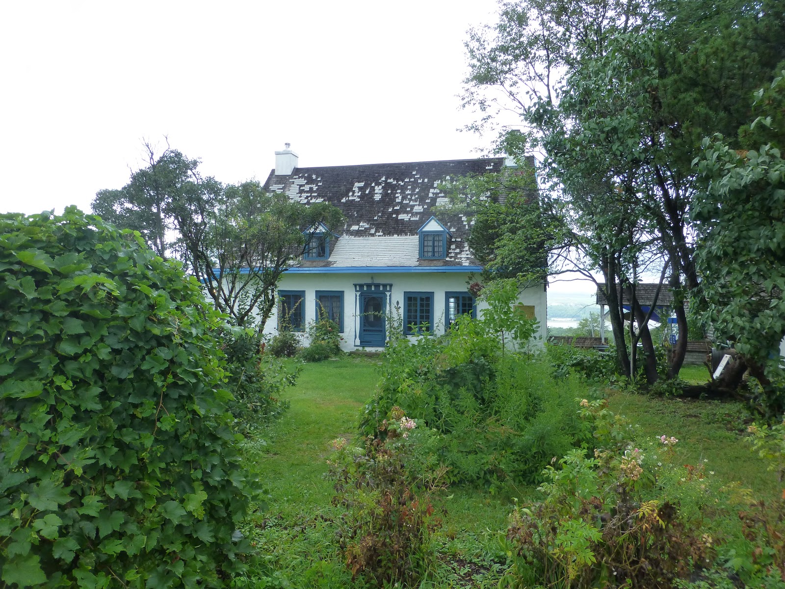
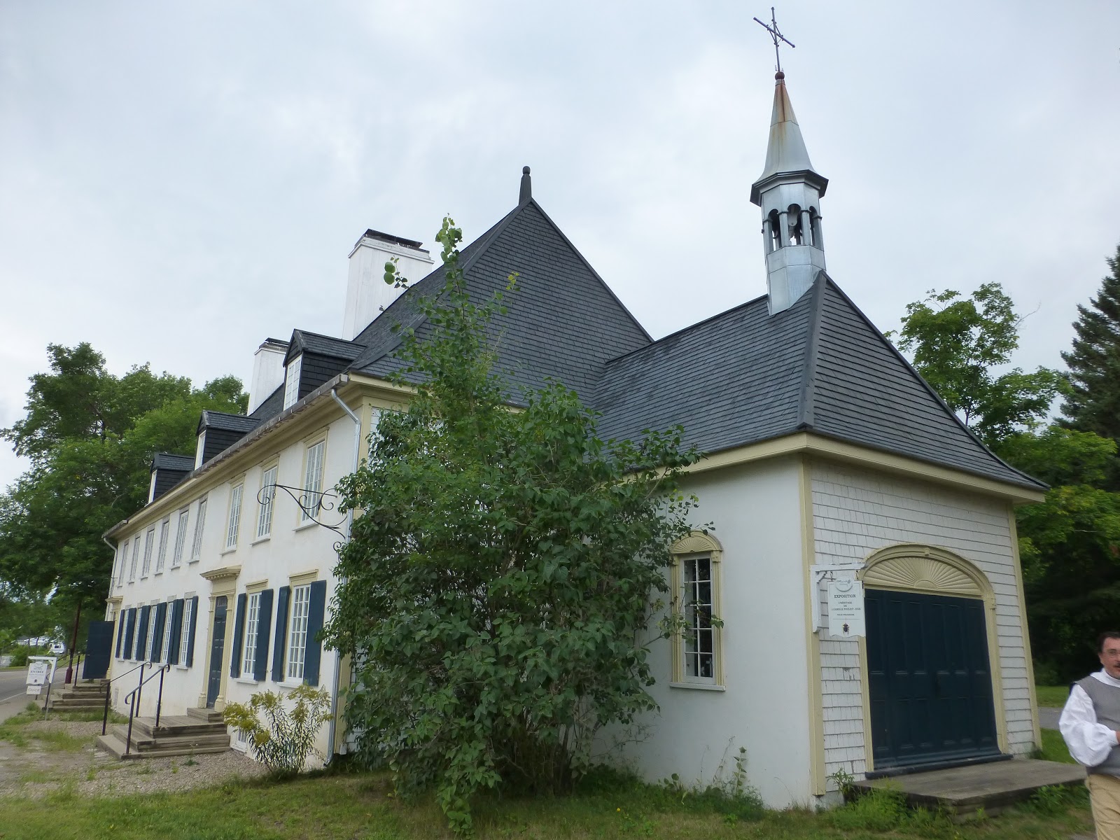
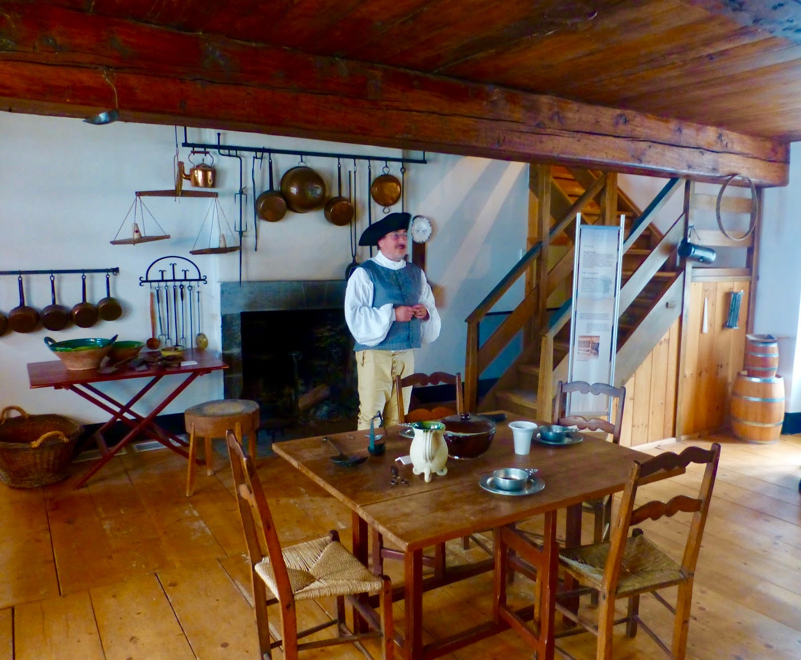
Visiting a Cassis farm and winery we tasted several concoctions of Cassis or Black Current wines and liqueurs. Following a sightseeing tour of the eastern end of the island, we stopped at a restored dwelling dating from the 1500’s that belonged to a surgeon and landowner. The host was in period costume and the house was well done. Lunch was at a small restaurant “Moulin Laurent”, a converted mill, hence the “Moulin” or windmill in the name. During lunch the skies opened up and we boarded our bus in the rain for our final stop of the day, the “Isle de Bacchus” winery where we tasted three varietals and toured the operation.
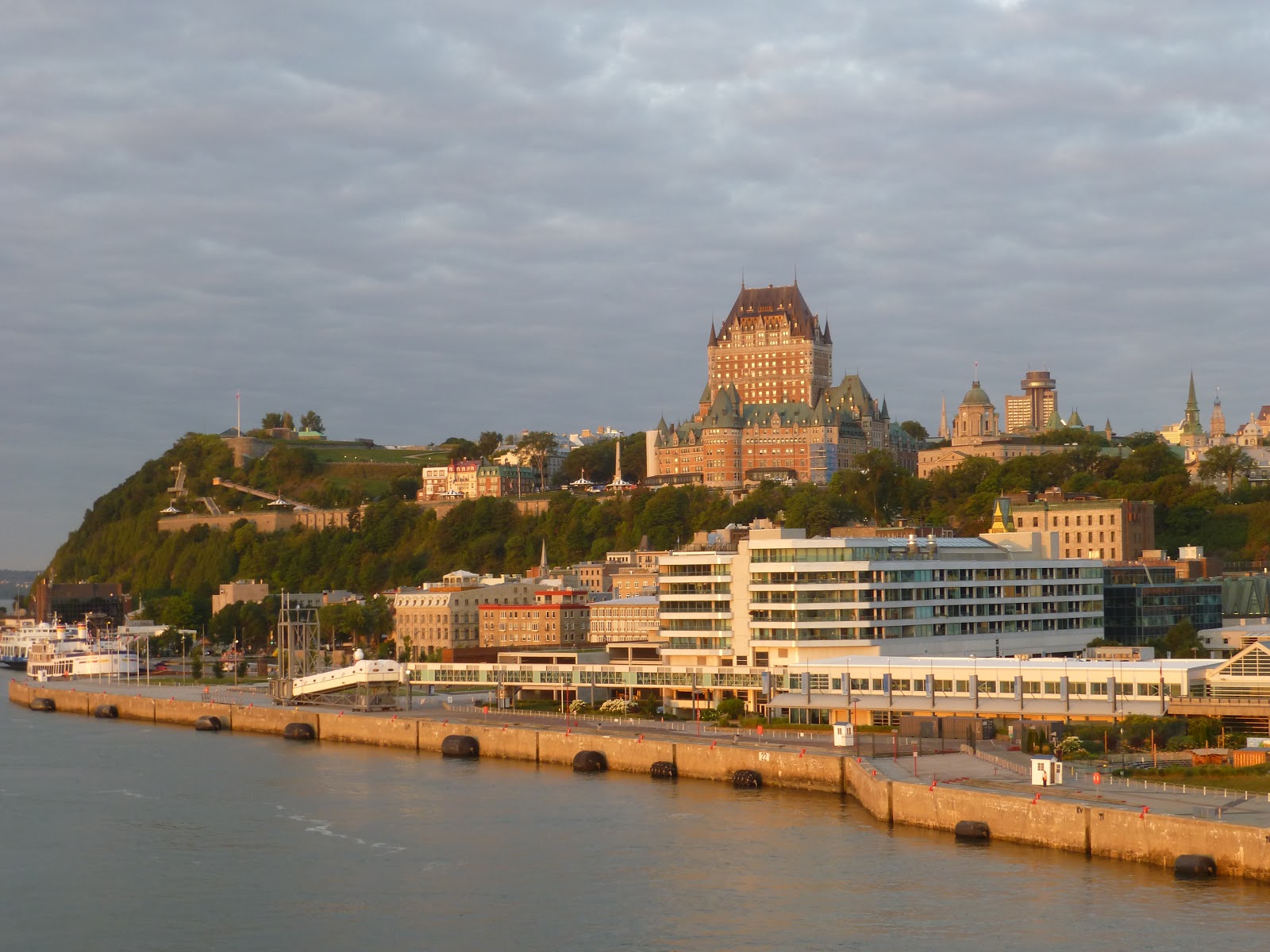 |
| Approaching our dock in Quebec |
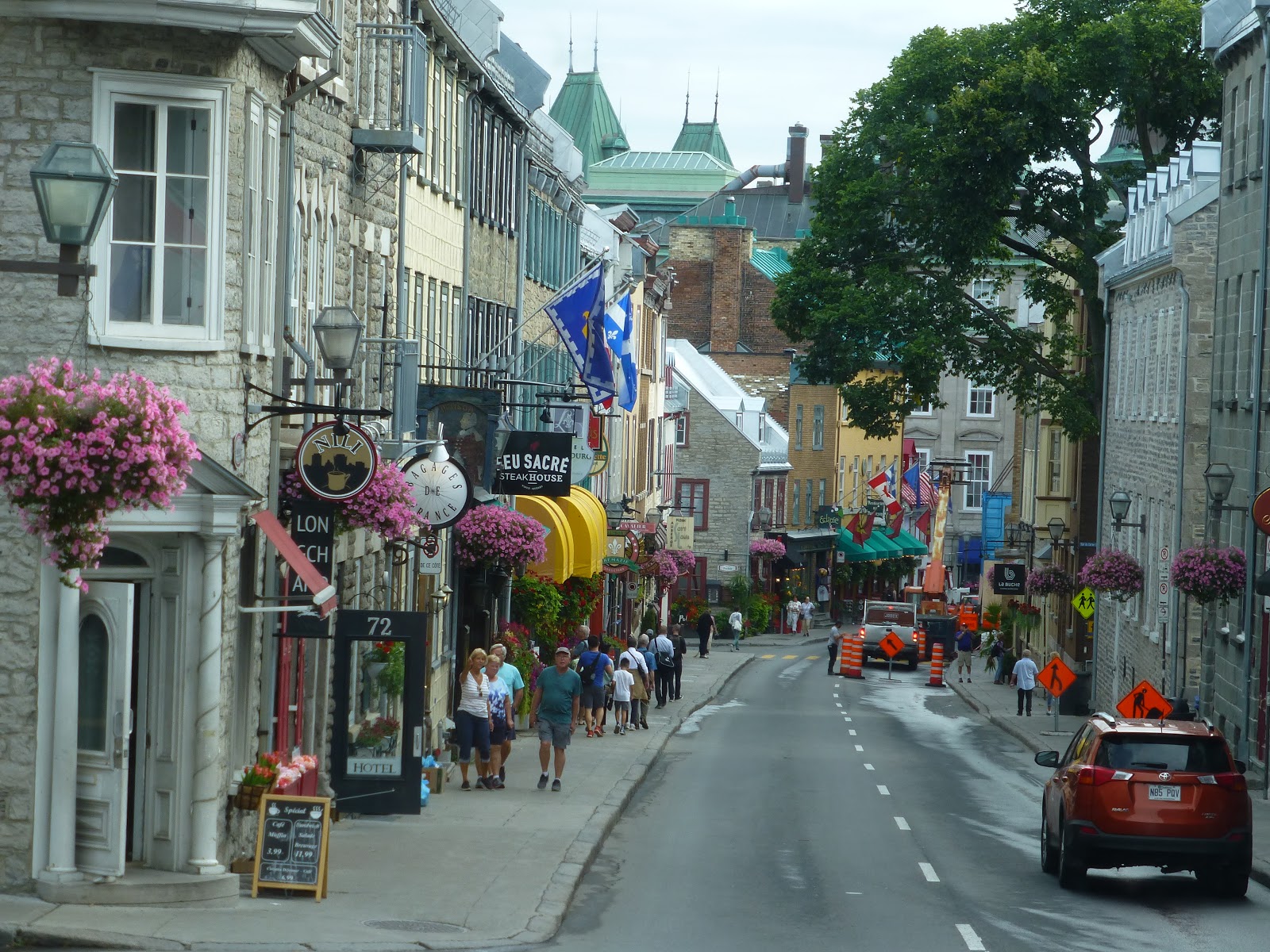 |
| Old City Streets |
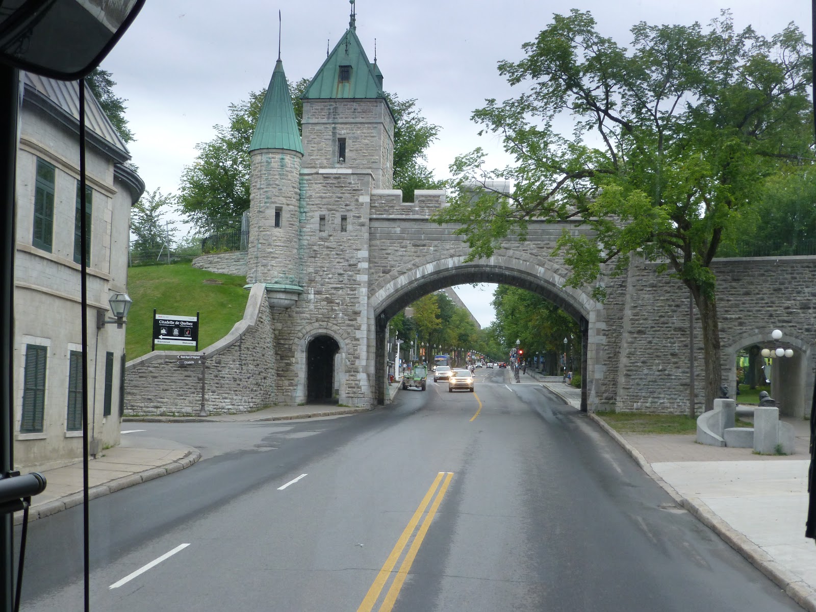 |
| One of Quebec city gates |
 |
| Cassis Farm |
 |
| Winery |
 |
| L’Isle de Bacchus Winery |
 |
| Winery |
 |
| Historic Mansion from 1500’s |
 |
| Inside Mansion |
 |
| Moulin Laurent Restaurant |
Heading back to the ship in the rain, we finalized our packing and met with friends in the Observation Bar for last drinks before departure and disembarkation the next morning. The final “sailaway” party for the ship was moved to the Grand Salon because of the rain. After being underway for several hours, the captain made an announcement that there was a main engine cooling issue that required immediate attention and that we would be anchoring in the river until it was rectified. We were worried since we had an early flight and any delay would mean missing the flight on a holiday weekend with no backup flights. After some time, the problem was rectified, no firm explanation given, and the Seabourn Quest raised the anchor and proceeded at full speed towards Montreal, with a one hour delay expected.
August 30, 2018
To our surprise, time was made up and we docked only 30 minutes late and we actually made our transportation 5 minutes early, only to run into traffic jams on the way to the airport. Arriving at 0835, we checked in and found Patrick had been randomly selected for additional screening (searches) which took extra time. However, we still arrived at the gate in time for our flight to Chicago and the connection to Seattle. We had a 7 hour layover at O’Hare, but our passes to the “United Club” provided a place to wait with some food, drink and fewer crowds than in the main terminal.
The United flight to Seattle was uneventful and our trip ended with our arrival home just before midnight.
Route of the Vikings – Post 6
August 20, 2018
As expected, the winds and seas increased overnight as we approached our next wildlife stop, Akpatok Island, which has more than one million Brunnich’s Guillemots nesting and breeding in crevices in the 800 foot high limestone cliffs. The island is also home to walruses and polar bears.
With the seas at 2-3 meters and sustained winds to 35 knots, the captain cancelled the planned zodiac expeditions due to safety considerations in launching, boarding and retrieving the zodiacs. The 38 degree temperatures combined with the winds made for chilly viewing as the captain substituted scenic cruising several miles off the beach for 2 hours. There were purportedly 2 polar bears on the beach, but our enlarged photographs showed only light colored limestone rocks which had fallen from the cliffs. We headed for our next stop, Happy Valley-Goose Bay, two days away. As we cruised back out of Hudson Strait the ship motions and shuddering increased for a while as the winds continued to build.
We were treated to two more impromptu lectures, one on Inuit art and one on killer whales and the impact on the arctic as the whales range further north in search of prey. Finally, near evening we turned the corner back into Davis Strait and paralleled the Labrador Coast.
August 21, 2018
About 0200 we briefly watched the Northern Lights under clear skies. Unfortunately, they were faint and not much color, impossible to photograph from a moving ship.
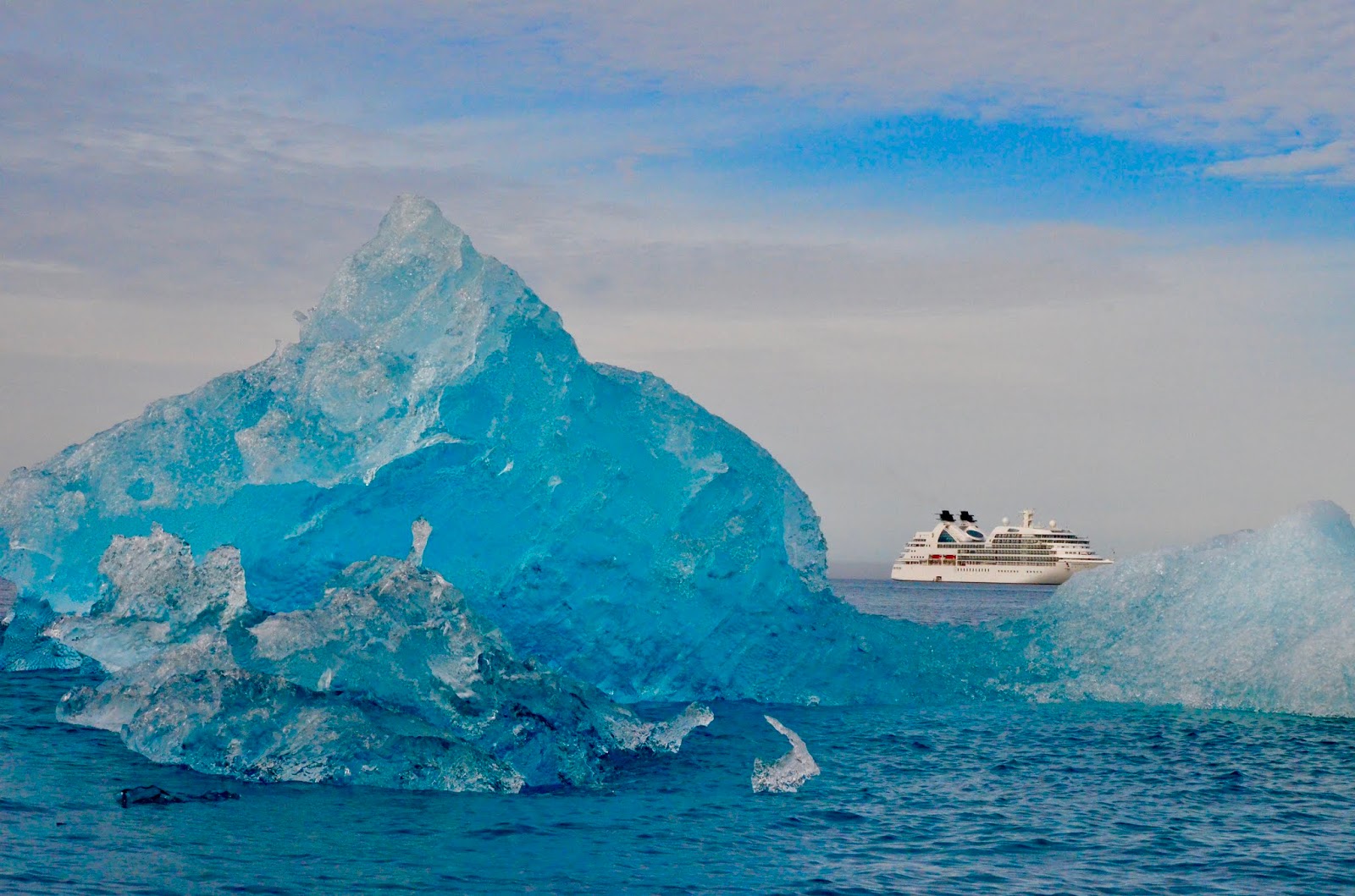
Dawn brought sunny skies and cool weather, with the coastline in the distance on the right and a steady parade of icebergs as we continued our journey.
There are three lectures today, one on ocean trash, one on Arctic Seabirds and finally, a presentation by Trevor Potts and his amazing recreation of Shackleton’s voyage in 1993 in a similar open boat with no liferafts or other support equipment. The boat is now on permanent display in Cambridge, England.
August 22, 2018
The clear but cool weather we enjoyed yesterday has been replaced by wind, low clouds and rain as we continue to make our way to Happy Valley-Goose Bay. We are out of Davis Strait and in the Labrador Sea. Later in the day the rain was replaced by fog, so once again we hear the foghorn going off every two minutes.
The fog lifted as we approached the entrance into Lake Melville, a large tidal estuary where Happy Valley-Goose Bay is located. The ship picked up a pilot and proceeded into the relatively narrow entrance. As we transited the entrance we were treated to the sight of three Orca splashing alongside the ship.
By dinnertime, the rain returned and continued throughout the night.
August 23, 2018
Happy Valley-Goose Bay
Seabourn Quest continued the 100 nautical mile journey up Lake Melville overnight and docked at the Port of Goose Bay shortly before 0800. Rain was expected to continue most of the day, with mild temperatures. The dock is about 5 miles from the Happy Valley town center and several miles from the airbase at Goose Bay.
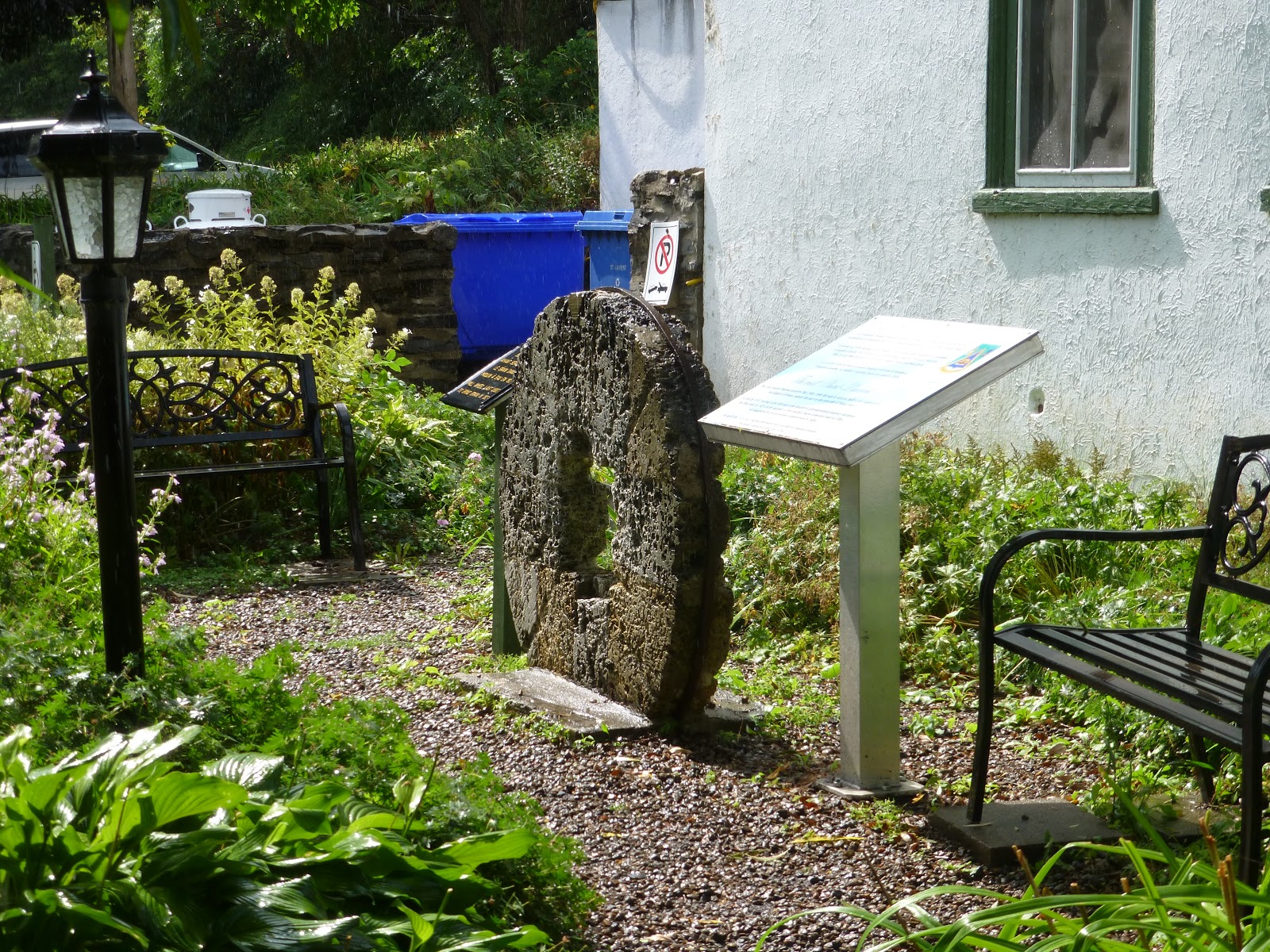
We had selected a shore excursion to the town of North West River, which is literally at the end of the road system in Labrador. Until a bridge was built in 1981 the only ways to get to North West River were by boat or a cable car spanning the river.
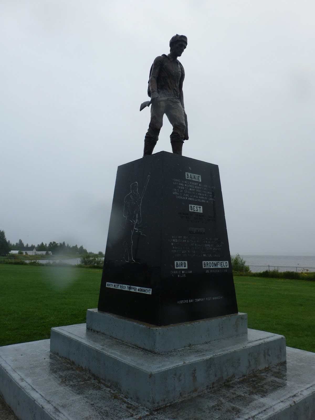
Trapper’s Monument
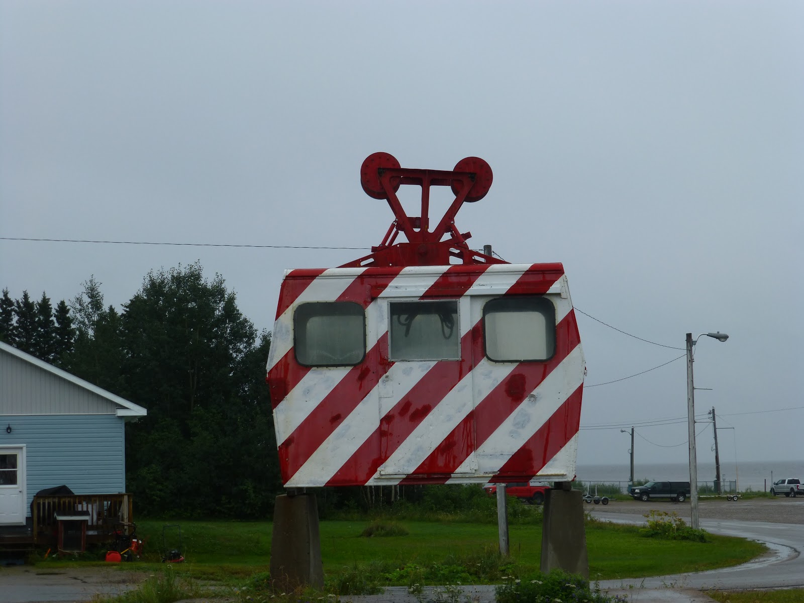
Cable Car from 1981
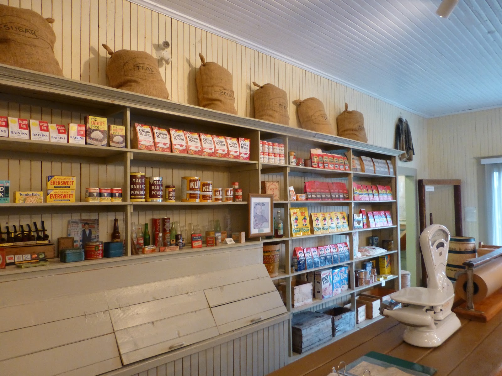
Hudson Bay Company Store Museum
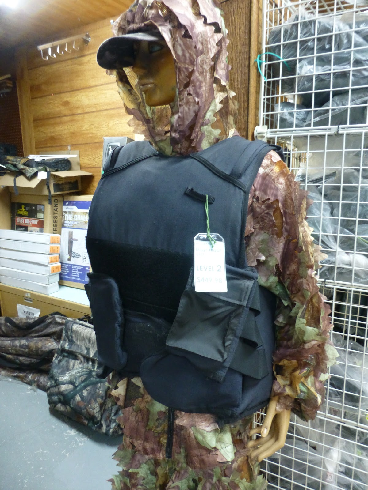
The Northern Lights Store even sells bulletproof vests
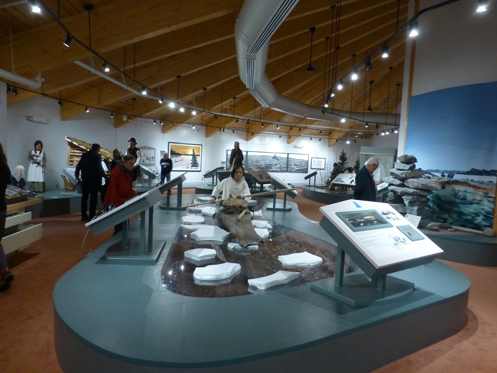
Part of the Labrador Interpretive Center
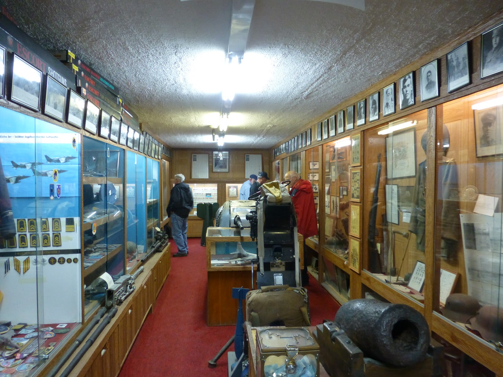
Northern Lights Military Museum

Historic Fire Extinguisher in North West River
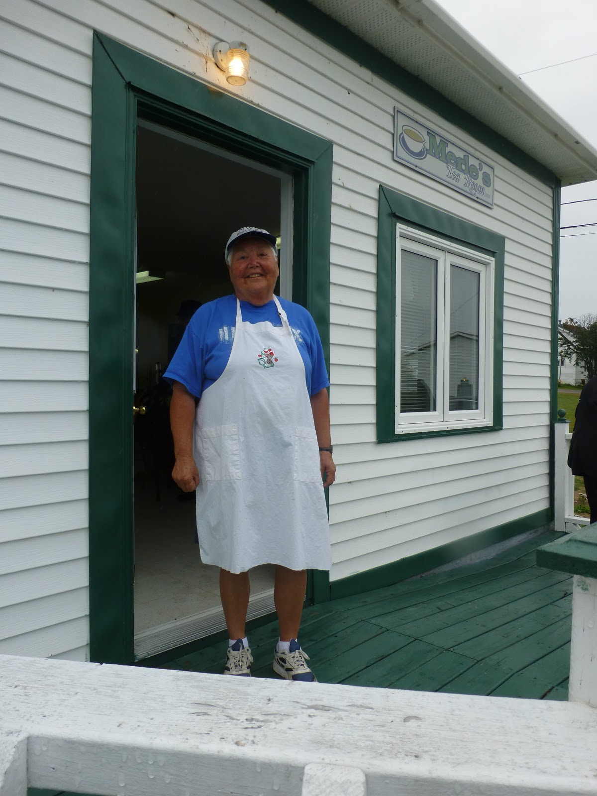
Our Inuit Host Joan McLean, for Lunch
Until the early 1940’s when the airbase was built, this was an Inuit barter economy town where people hunted and trapped and traded at the Hudson Bay Company store for items they could not gather for themselves. Our first stop was at the Hudson Bay Company Store, now a museum, showing how the store looked and operated in the early 1900’s.
After wandering through the displays we walked for several blocks, some on a re-creation of the old boardwalk, to a little café where the local Inuit ladies had prepared a lunch of soup, sandwiches and desserts, all home cooked. It was a delightful experience as we learned what life was like in the small town of 500 people from the people who actually live there. After lunch we travelled by bus to the Labrador Interpretive Center, going down a road called “Airstrip Road” since it started as an emergency airstrip.
The interpretive center was well done and had lots of information on the different peoples who have lived in Labrador, going back 10,000 years, plus a special focus on the transition in recent years from a barter economy to a wage economy and the restoration of Inuit lands and rights.
North West River is also the location of a Canadian Discovery Channel reality TV show appropriately called “Last Stop Garage” and one of our guides has a brother who is in the show.
Following the tour at the Labrador Interpretive Center we were given a short detour to Happy Valley and the Northern Lights Military Museum, a private collection in the basement of the “Northern Lights” store (formerly a Hudson Bay Company Store) that stocked a little bit of everything from clothing, camping, guns and souvenirs.
Returning to the Seabourn Quest, the sun finally came out and many local inhabitants lined up in their cars to wave us off, sounding their horns while our Captain replied with the ship’s horn.
Route of the Vikings – Post 5
August 18, 2018
Reflections on Greenland while at anchor in Iqaliut
Before taking this trip we had scoured the internet for books on Greenland and settled on “This Cold Heaven” by a Danish author, Greta Erlich.
The book was a well written mix of personal stories and the history of the waves of inhabitants in Greenland, but focused more on the areas north of Ilulissat, which is as far north as we went on this trip.
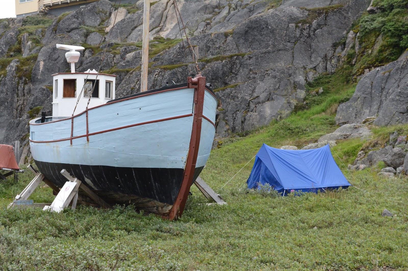
The two towns north of the Arctic Circle we visited were much like the descriptions in the book. However, Greenland is moving so quickly into the modern world that much of the Inuit traditional life seemed to us to be swallowed up by cars, modern buildings, stores, café’s, airports, and modern small boats. The movement of people from the small settlements into the larger towns and the construction of more and more apartment blocks has been swift. Several of the towns had massive fish processing plants to handle the fish caught from the productive waters fed by the Labrador Current.
Greenland has also been “discovered” by tourists like us, with more cruise ship visits and the allure of adventure travel to one of the last isolated places on earth. So, some of the towns cater to skiers, hikers, fishermen and other outdoor enthusiasts. Just in Ilulissat alone we saw four other cruise ships, some just scenic cruising, others like the Seabourn Quest anchoring off the town and going ashore or cruising the Icefjord in Zodiacs. There was a thriving business of locally operated whale watching and iceberg tours.
I think what surprised us the most was the amount of “green”, the variety of vegetation thriving in the brief summer season. We also did not realize how much of the western coastline is ice free all year, even north of the Arctic Circle.
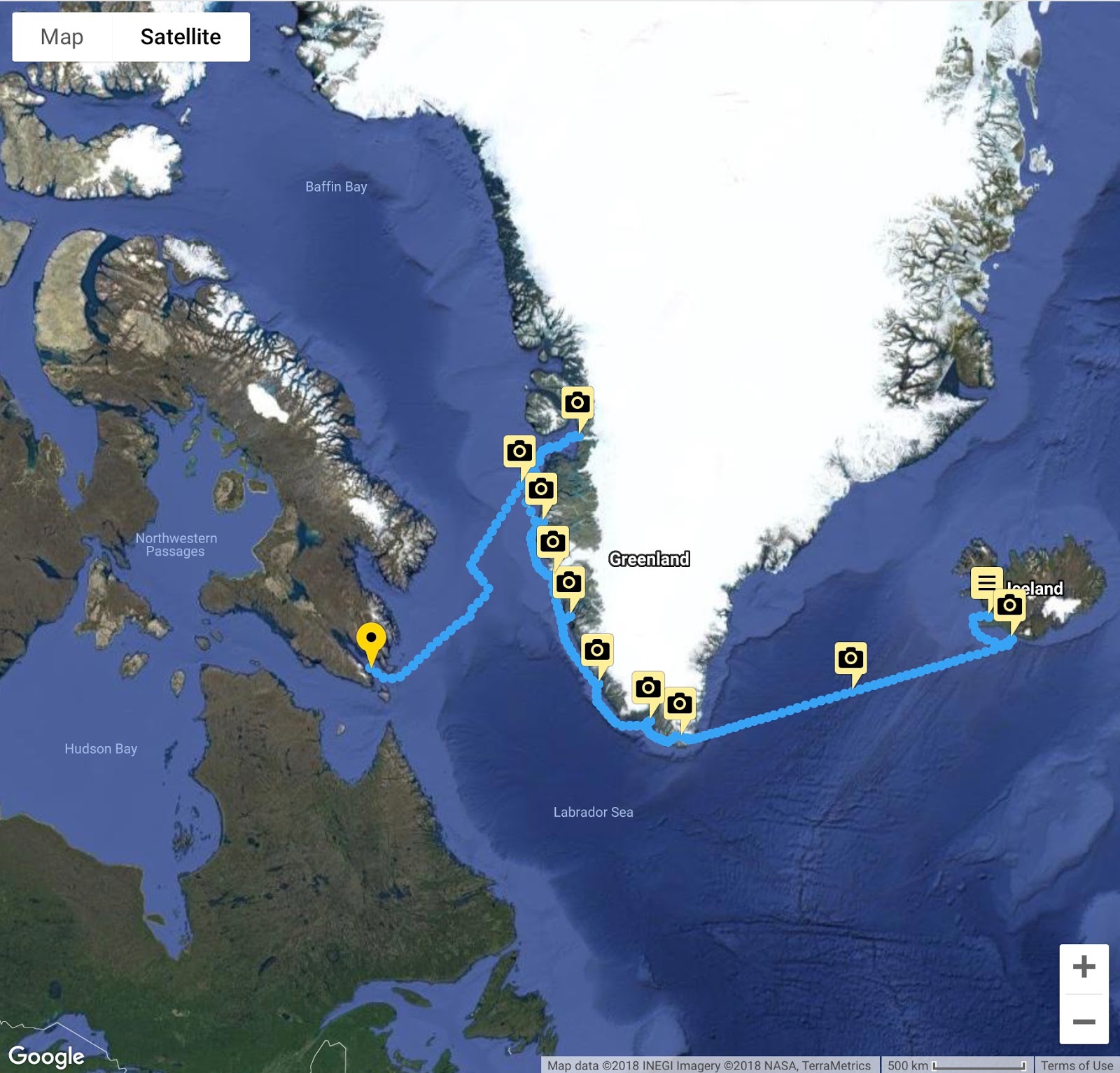
Our route so far
Last night we anchored off the town of Iqaluit, the capital city of Nunavut. Before the Northwest Territories were split in two, the town was called Frobisher Bay and sits on the bay itself. We are not allowed off the boat and into the town, it is Canada Customs clearance only. There are still patches of snow on the surrounding hills, which are much lower and rounded compared to Greenland’s west coast.
The morning was overcast, but by noon patches of sun broke through the clouds as we prepared to head for our next stops, zodiac tours by three islands, Monumental Island, Lady Franklin Island and Akpatok Island, where we may see polar bears and other wildlife. This will be possible only if the wind and seas permit launching the zodiacs.
Sunday, August 19, 2018
Lady Franklin and Monumental Islands
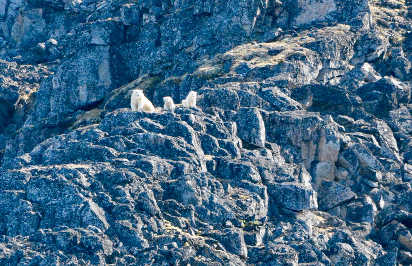
The ship is lying still several miles off the islands, which are in Davis Strait and in the open ocean. There are icebergs of various sizes visible all around the horizon. The winds are light as promised, with a low swell. At 0530 we headed to the embarkation point for the zodiac tour at 0600 to Lady Franklin Islands. The first departure group was small, only 21 people and 2 zodiacs. Heading to the islands, the fog began to settle in as the sun rose higher above the horizon through broken clouds. Our guides spotted a polar bear on one of the islets comprising the group and we were able to approach quietly and get some photos and observe through binoculars. The were also Ravens, Black Guillemots and Fulmars on the island or in the water.
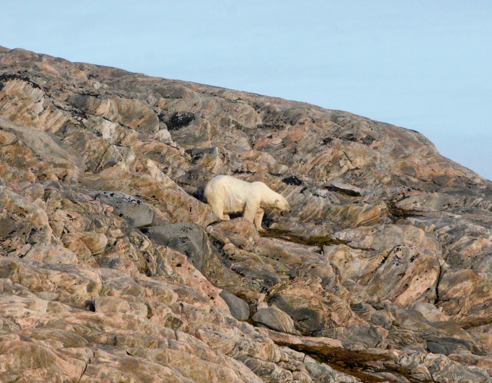
Our first Polar Bear Sighting

The bear seemed curious but not concerned
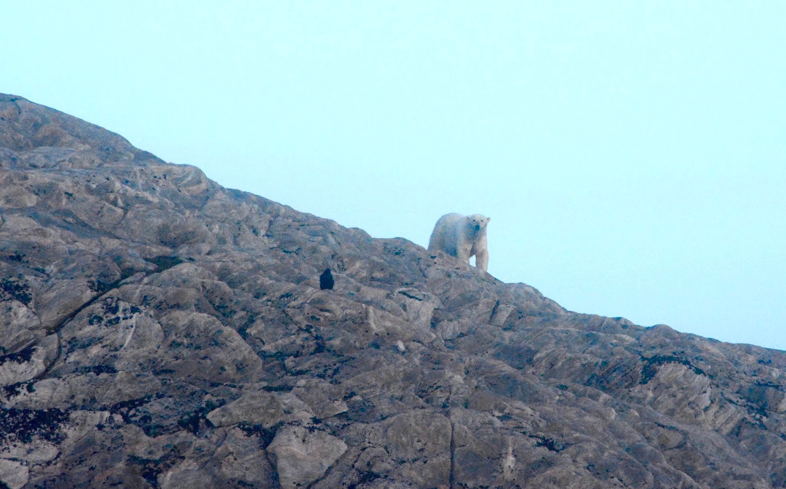
The fog began to roll back in

The final view before returning to the ship in the morning
After the morning tours the ship moved to Monumental Island, about 15 nautical miles away. There we saw Walruses and 4 more Polar Bears on our afternoon zodiac tour.


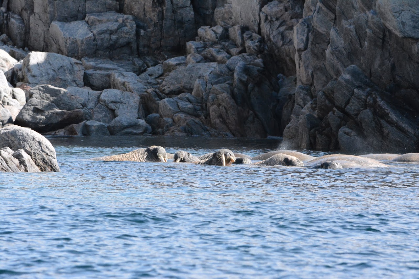
Pod of walruses
Mother and two cubs
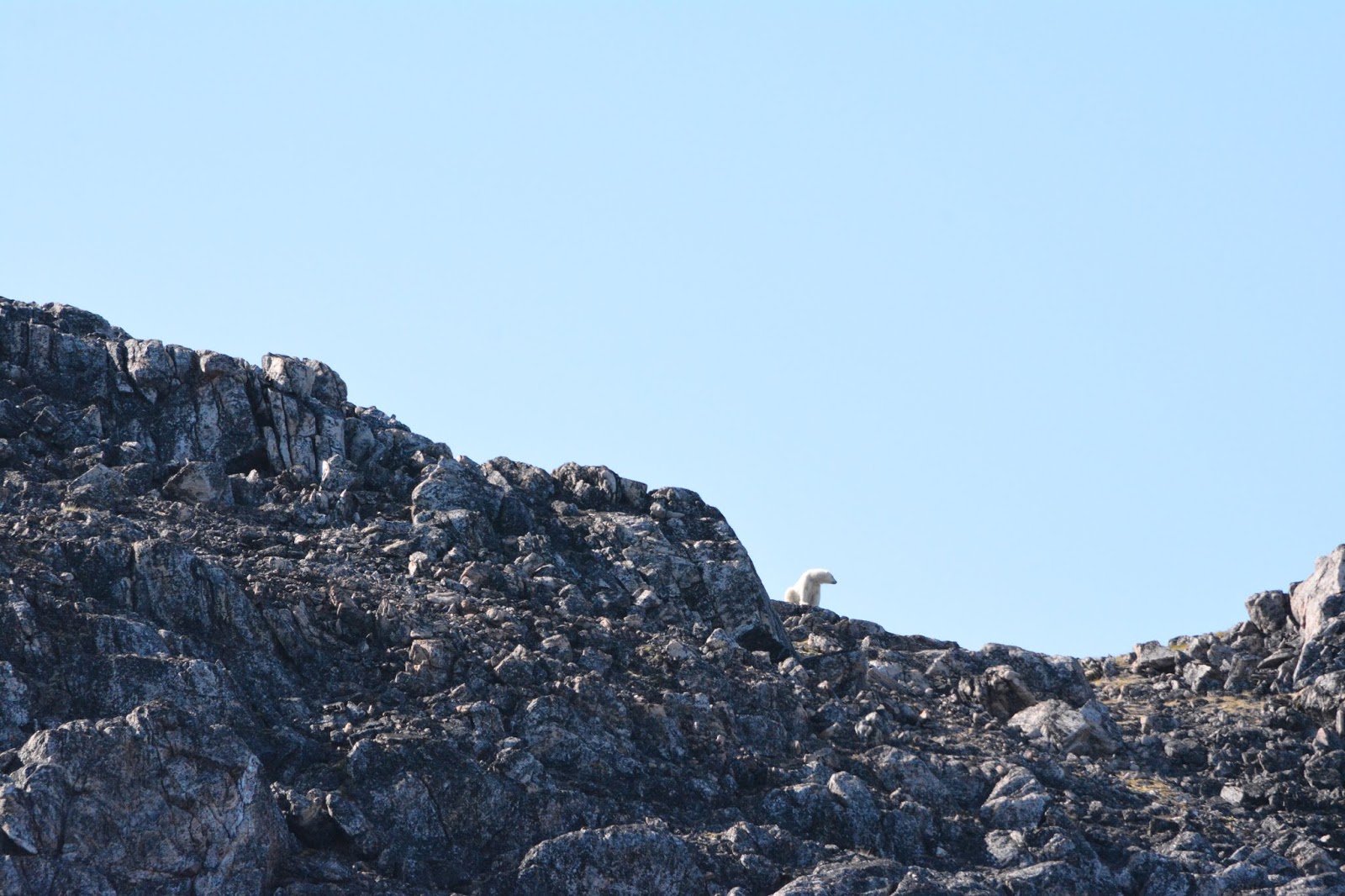
4th Polar Bear on ridge
Route of the Vikings Post 4
Route of the Vikings – Part 4
August 7, 2018
After holding station in the wind and waves for several hours, we listened to the local pilot describe his experiences during the eruption in 1973. He was 11 years old at the time and talked about the noise, earthquakes, sirens waking people and the ash. Fortunately, the fishing fleet was in and all 5000 residents were evacuated to the mainland, where many remained for more than two years. There are now about 4000 residents in the town, with regular ferry service to the mainland.
Turning around in the 40 knot winds, we headed back down the east side of the Westman Islands, past the final Island of Surtsey, the newest volcanic island in the chain.
Heading just slightly south of west, our ship then headed out into the Denmark Strait for the 850 nautical mile crossing to the south of Greenland and Prince Christian Sound where we will do scenic cruising. The ship continued moderate rolling in the seas and winds, which gradually calmed overnight.
August 8, 2018
Today is a quiet day at sea, with a mandatory briefing required for passengers on all ships belonging to AECO (Arctic Expedition Cruise Organization), similar to the briefings required before we landed in Antarctica several years ago. The briefings cover protection of the environment, wildlife, plants and indigenous cultures we will be exposed to while ashore. No passenger will be allowed ashore if they did not attend the briefing.
We then attended a lecture with photos on all the Greenland ports we will visit, with information on what we will see and do, very informative.
The Captain’s Reception was held this evening, it was a low key event, just the introduction of part of the senior crew and two short performances by members of the shipboard entertainment staff. Later in the evening, the fog horn started sounding as the visibility decreased. Dinner this evening was in “The Grill”, the Thomas Keller specialty dining venue emulating a 50’s-60’s Steakhouse with a modern flair. In our opinion the food we chose was good, but not great and the portions were too large for us.
The foghorn continued all night.
August 9, 2018
This morning we are approaching the southern tip of Greenland, in dense fog. Our destination for the day is Prince Christian Sound, which separates the mainland from the southern island and Cape Farewell via a narrow channel not unlike the fjords in SE Alaska, Norway and British Columbia. We will enter from the east and exit on the west coast some 100 kilometers later.
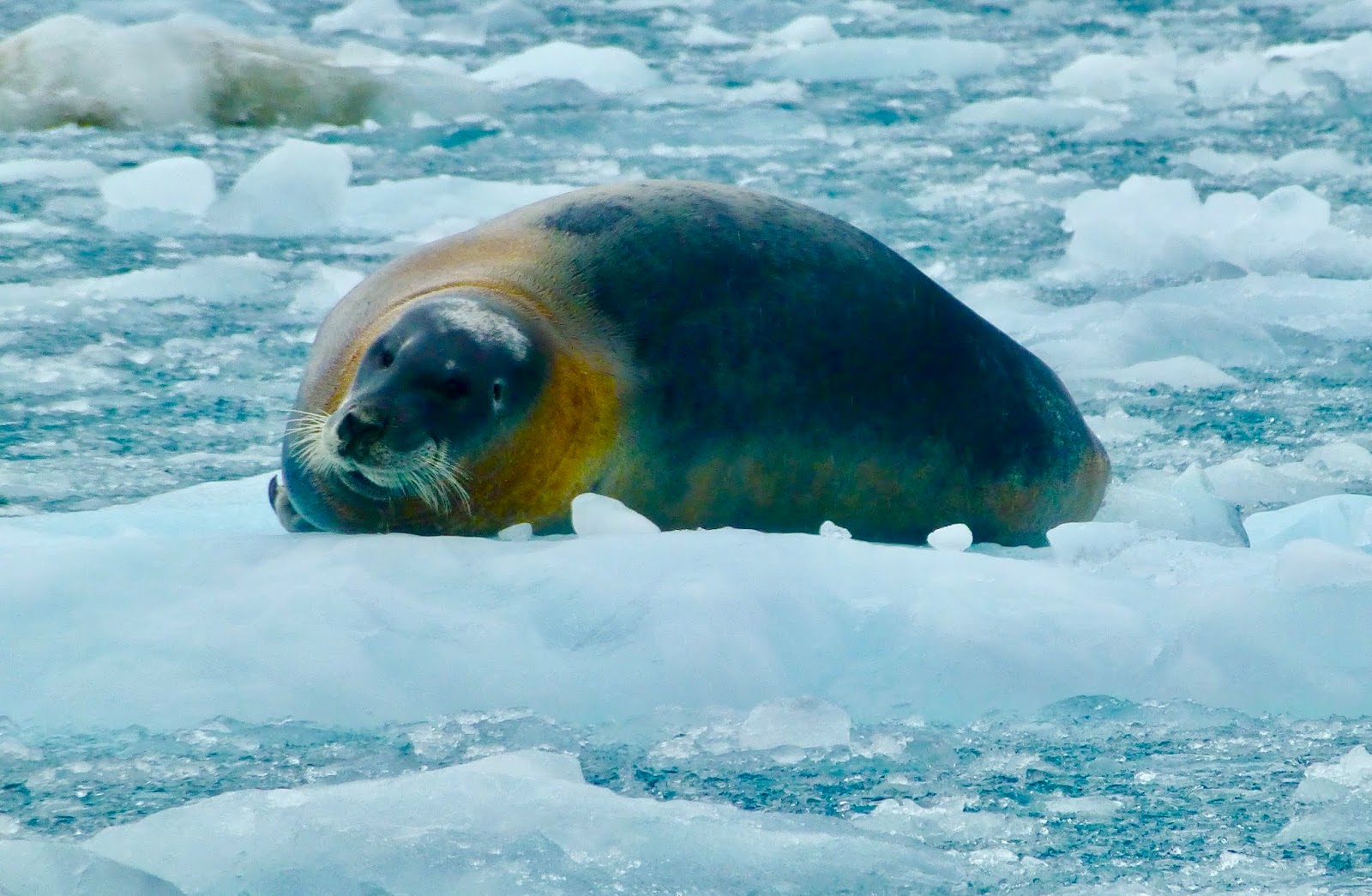
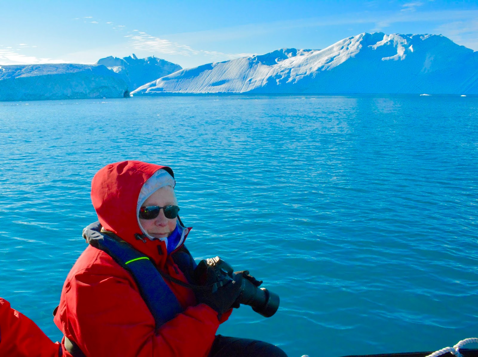
The fog lifted about 3 miles from the coast and we entered the narrow passage in rain. The ship stopped about 5 miles up the passage and offloaded 4 zodiacs for our tour. We were in the first wave, 40 people/10 per zodiac. In cold rain, heavy at times, we explored ahead of the ship and into the first tidewater glacier coming down from the Greenland Ice Cap. There were a number of bearded seals lounging on the ice floes and the glacier was actively calving. By this time, the ship caught up with us and waited outside the inlet while we pushed as far into the ice as possible, getting to within about ¼ mile from the end, the closest safe distance if a large calving were to occur.
Returning to the ship, after disembarking and having some hot chocolate, Patrick headed out on the second zodiac tour. The rain was much lighter and when close to the glacier face, a large segment splashed down creating a miniature tsunami. The waves were about three feet high when they reached the zodiacs.
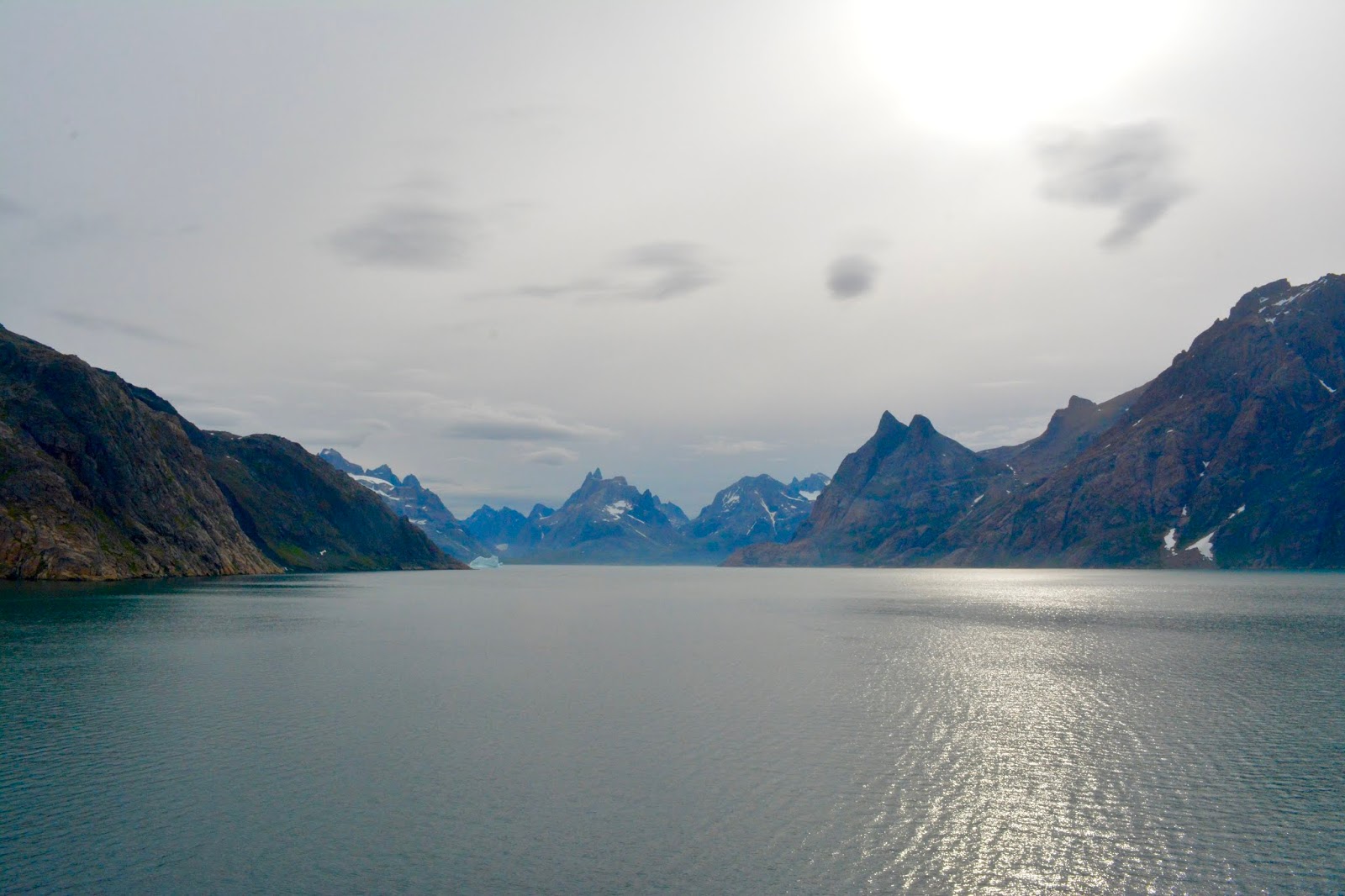
The view up Prince Christian Sound
Surprising amount of colorful vegetation
Bearded Seal
First Greenland Glacier
After returning to the ship the zodiacs were loaded back into the stern compartment and the Seabourn Quest continued its transit of Prince Christian Sound, zig zagging our way to the west coast of Greenland past more glaciers and spectacular jagged peaks and one small town of 130 people. We exited back into the open sea and more fog banks about 1800.
Only town on the sound
August 10, 2018
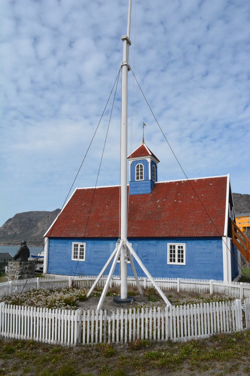
Qaqortoq, Greenland
Our stop for today was Qaqortoq, the largest city in South Greenland, with a population of more than 3200. The Seabourn Quest anchored in the fog about 0630, just off the small harbor, which was often not visible.
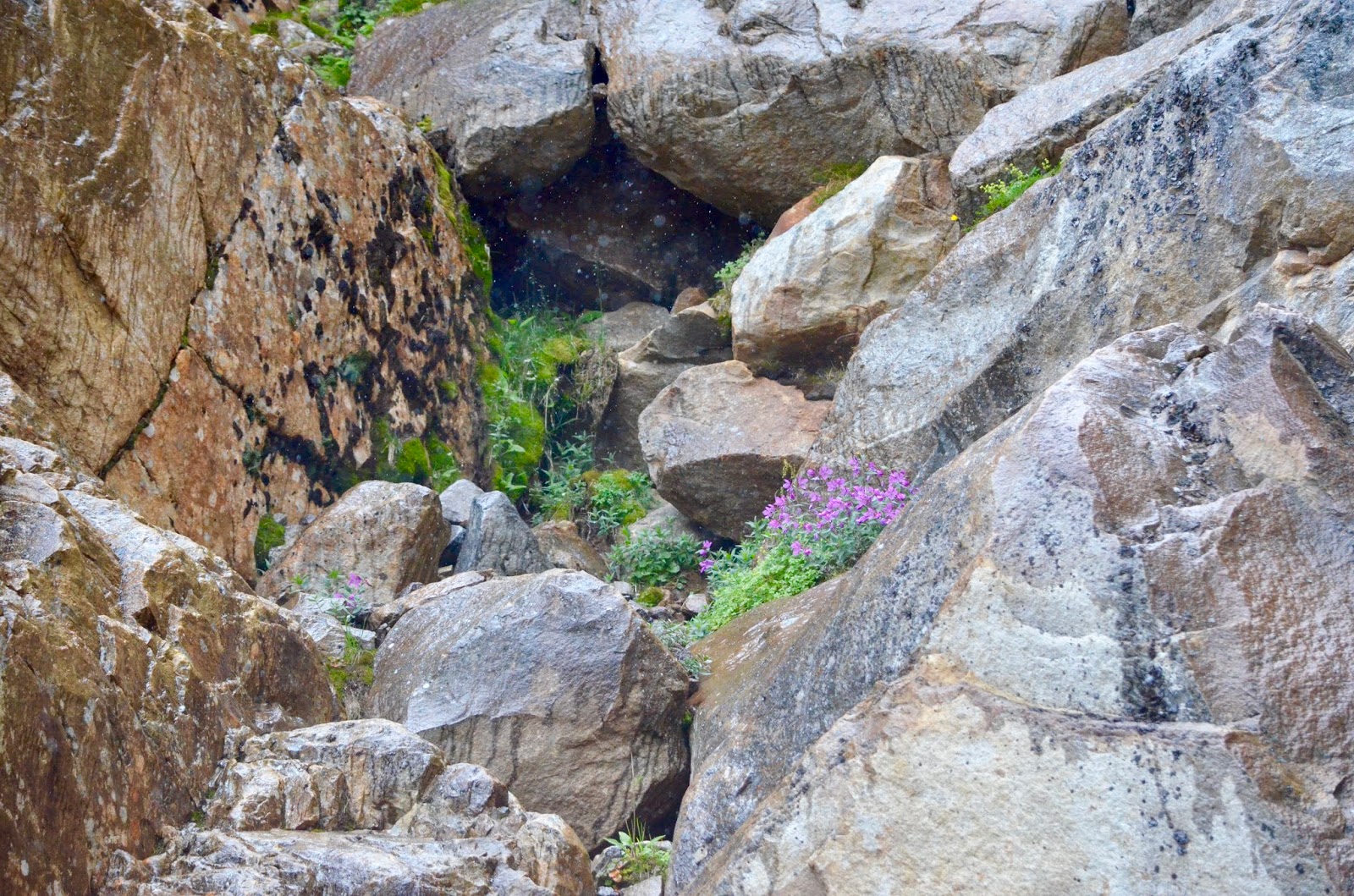
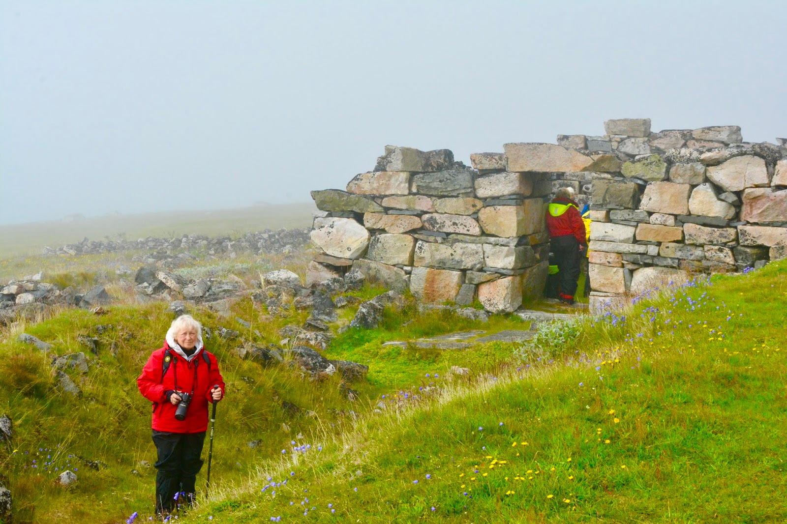
Shortly after, the cruise ship Nautica also anchored. At 0900 we departed on our Zodiac tour, in the fog, for a one hour ride to the Norse Greenland Unesco site at Hvalsey, consisting of a church and other buildings, partly excavated, dating to the 10th century. The site was abandoned sometime before 1500, the exact date is not known. The fog lifted for most of our one hour visit and then settled back in as we headed back to the ship, past several large bergs.
The banquet hall
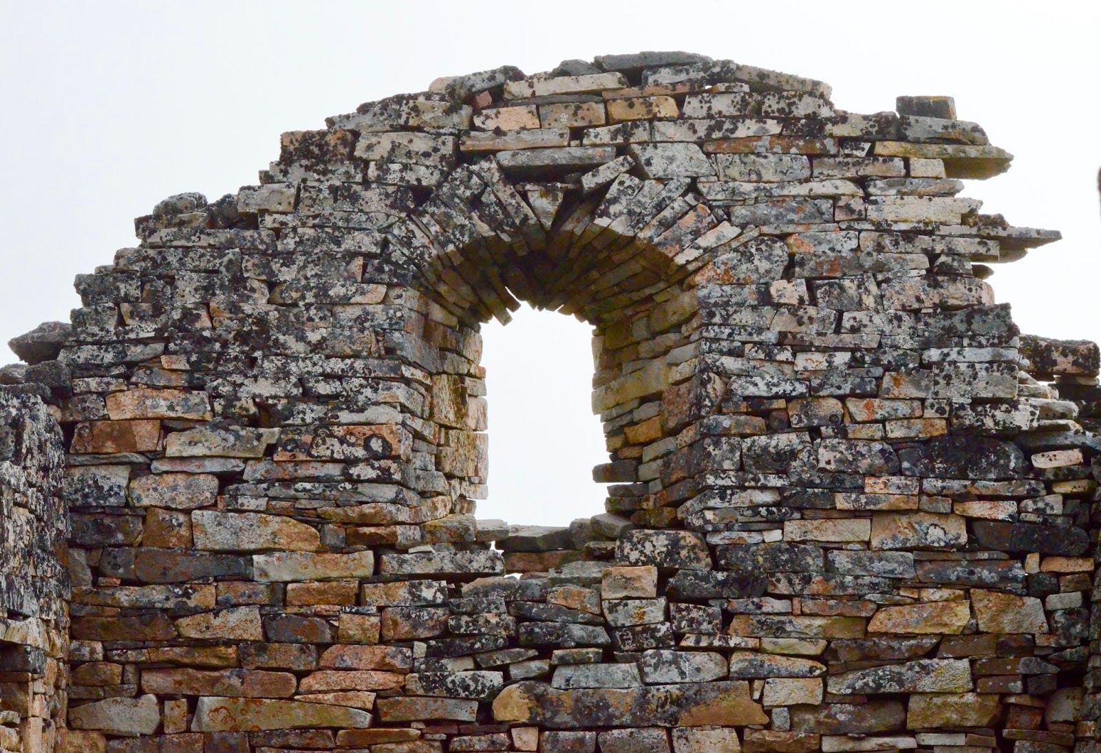
Inside the church remains
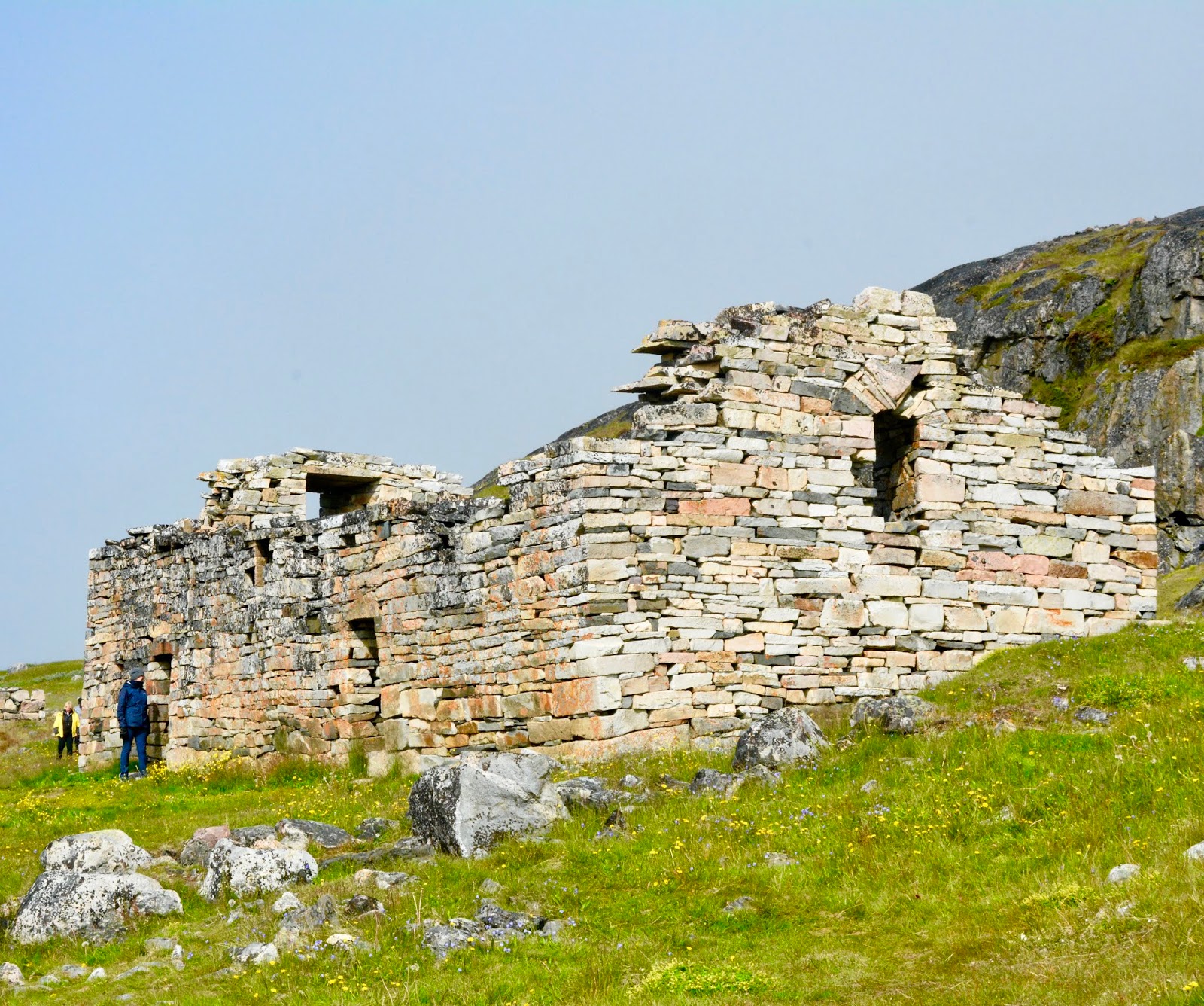
Church at Hvalsey
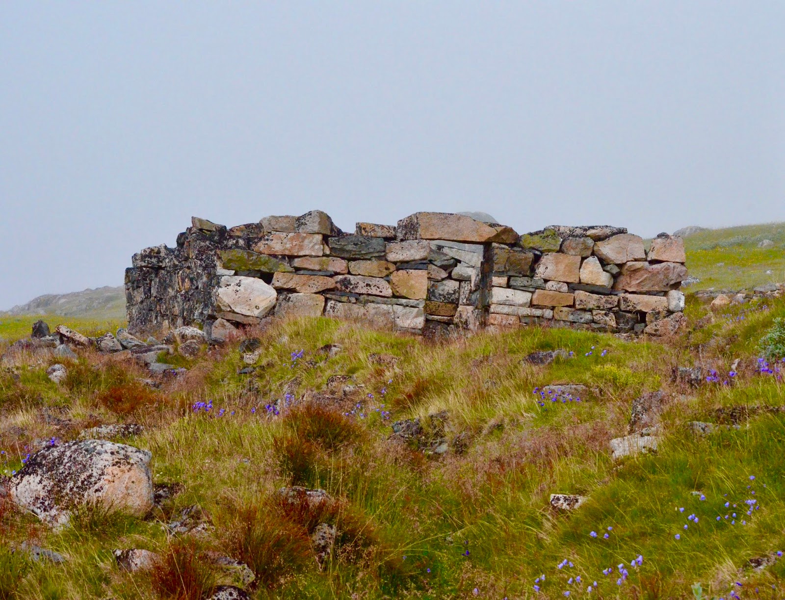
Another view of the banquet hall
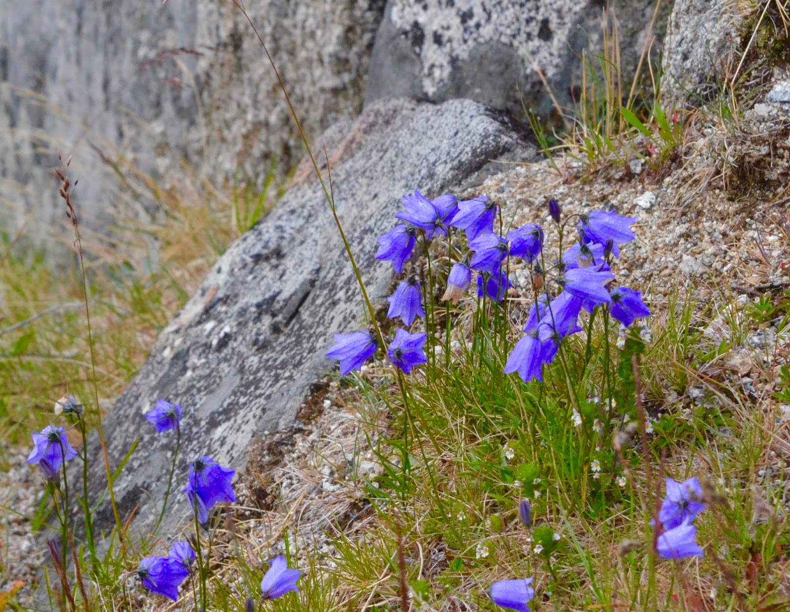
Surprising number of flowers on the old farmsite
Due to fog, Patrick’s kayaking tour was cancelled, so after a quick lunch during which the fog disappeared and the sun appeared, we both headed ashore and took in some local sights, including a fish market with freshly caught whale meat and shops selling very expensive souvenirs.
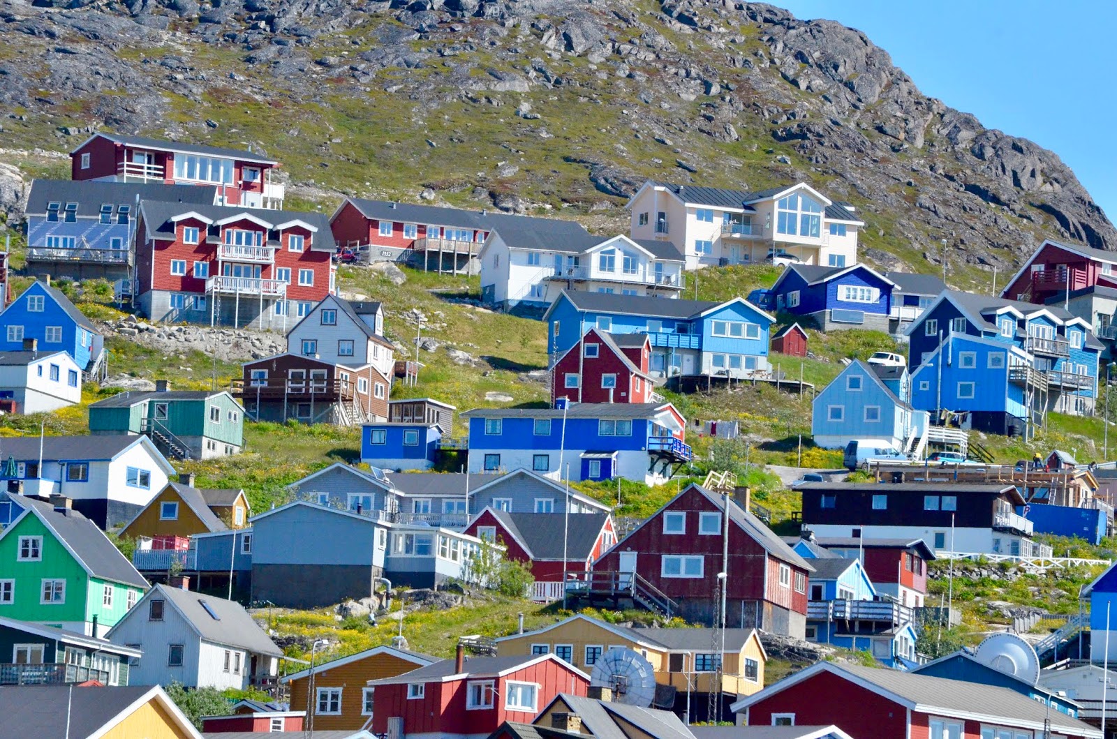
Colorful Houses in Qaqortoq
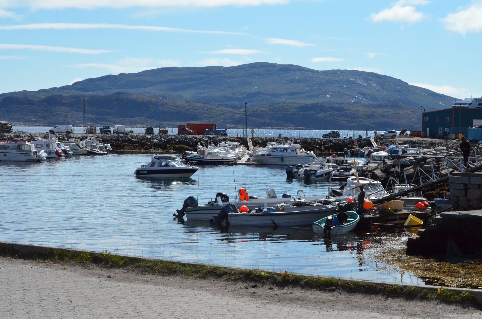
Boat Harbor in Qaqortoq
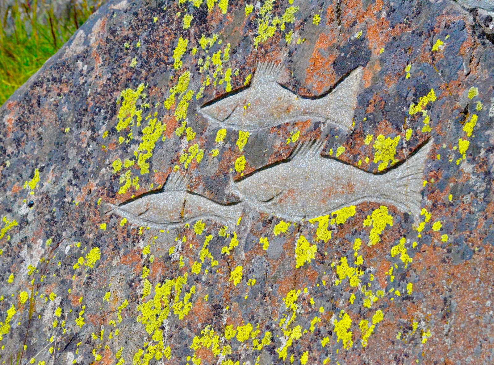
The town is known for rock sculptures
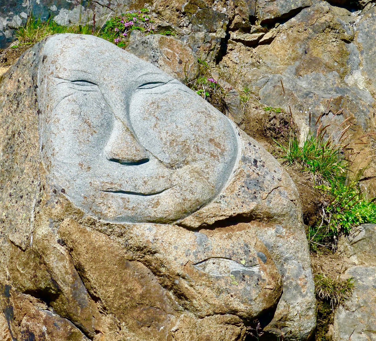
Rock Sculptures
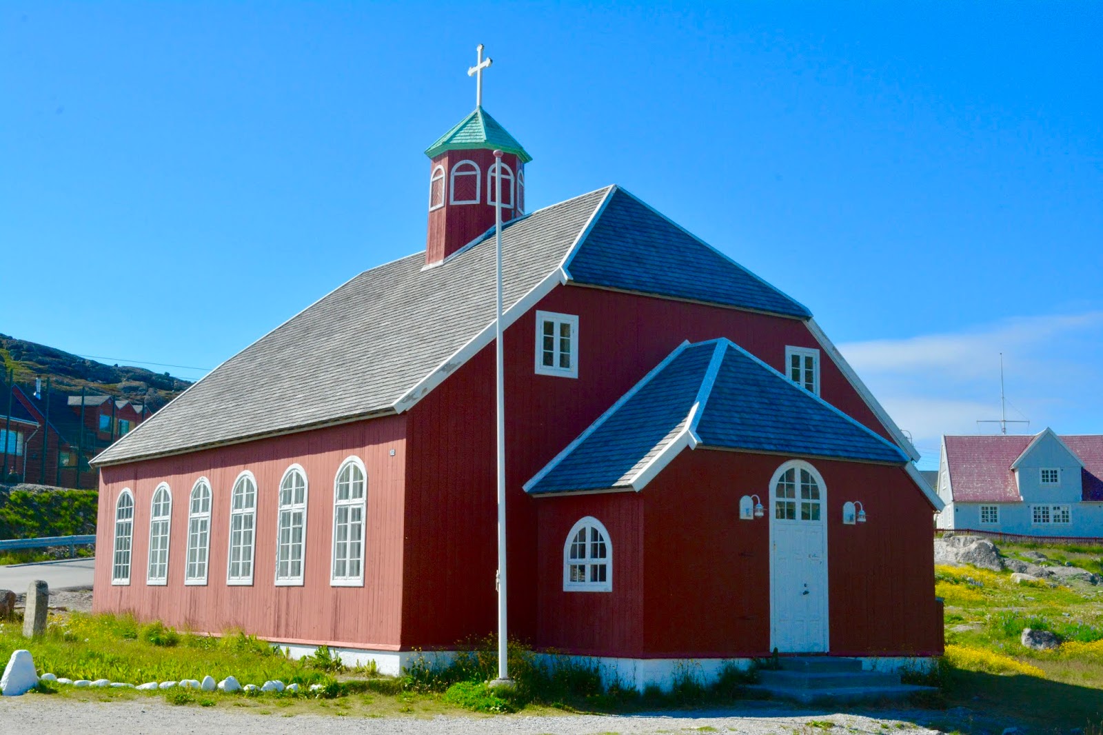
Lutheran Church in Qaqortoq

Town Square in Qaqortoq
August 11, 2018
Paamiut, Greenland
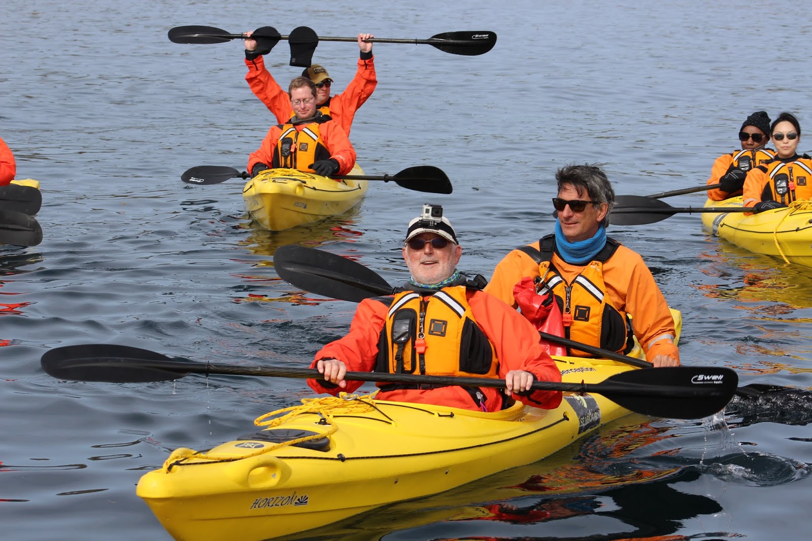
Most of the evening the ship sailed in clear seas, but in the morning the fog settled in close to the coast as we approached our anchorage off the small town of Paamiut. The fog lifted just before the decision to cancel the water tours, so we were able to go. Miriam did a Zodiac Tour and Patrick did sea kayaking. Both tours passed by shipwrecks, icebergs, whale carcasses and fishing equipment. After lunch we headed ashore and walked the town, went through the museum and hiked up to a viewpoint. Although small, this town had a lot of charm, with a restored turf house and old fishing vessels on display.
Iceberg in Paamiut

Shipwreck in harbor entrance
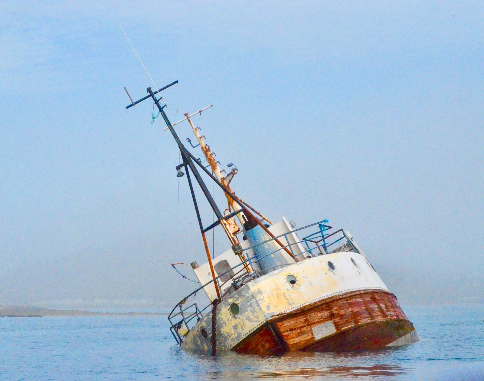
Another shipwreck
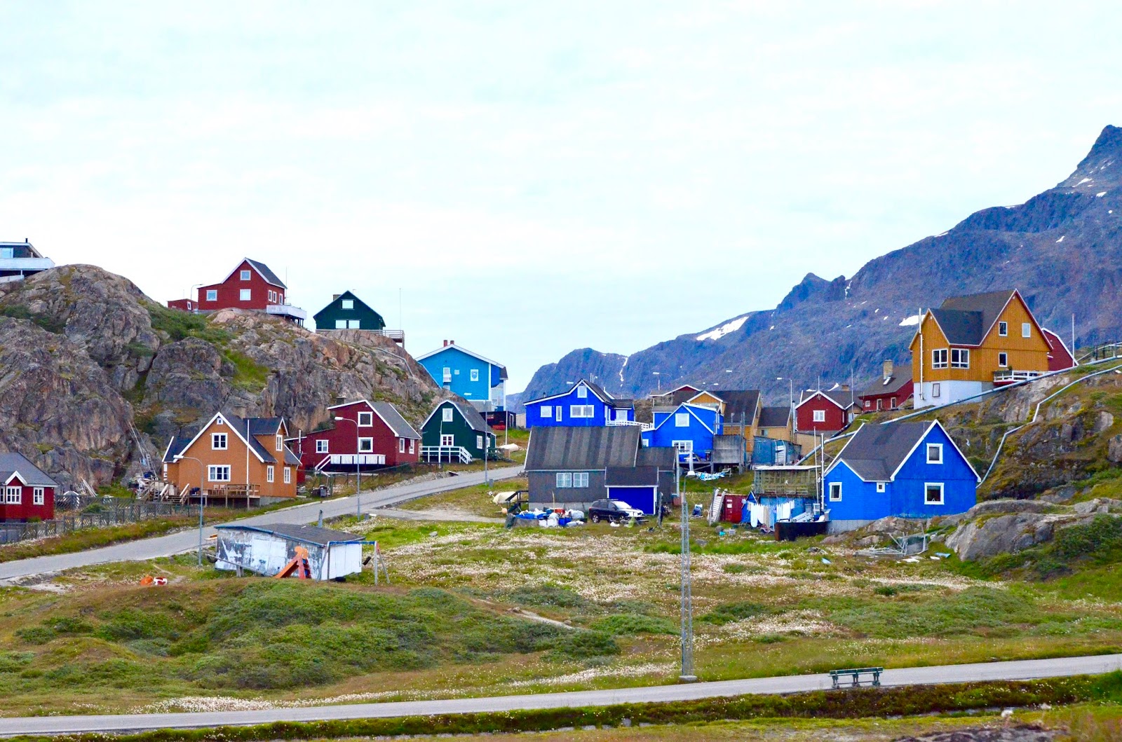
Colorful Houses in Paamiut

Lutheran church in Paamiut
Returning to the ship we were treated to views of a number of humpback whales as we exited the anchorage. The weather was nice enough to eat outside at the Patio Grill, although we did have blankets for added warmth. During dinner we passed a section of the Greenland Ice Cap looking like a massive fog bank lying on top of the land.
August 12, 2018
Nuuk, Greenland
Nuuk is the capital of Greenland and its 17,000 inhabitants comprise about 30% of the total Greenland population. One of the apartment blocks houses more than 1% of people! The town is situated on a rocky hill projecting out at the intersection of two fjords.
Seabourn Quest docked at the port, the first time we have been dockside since leaving Reykjavik. Patrick took a zodiac tour up Kobbefjord to a lake and research station. The relatively warm weather brought out millions of mosquitoes and took the edge off an otherwise great excursion. After Patrick returned to the ship Miriam and Patrick headed into town for a guided tour of the Greenland National Museum, led by Dr. Colleen Batey, who is an expert on vikings. The visit included the “Norse” Greenlanders and the Greenland mummies dating to 1475 which were found a few years ago.
Hiking in Kobbefjord
Spectacular Scenery
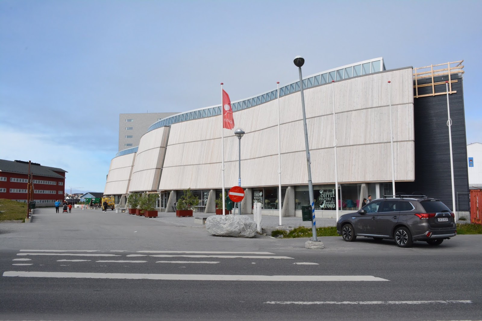
Nuuk Cultural Center
Main Pedestrian Mall

More Churches in Nuuk
Interesting Windows
August 13, 2018
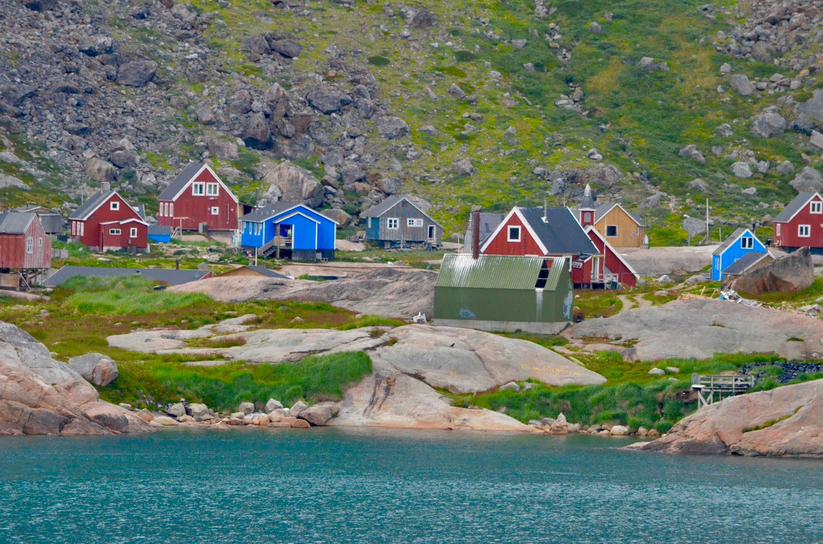
Maniitsoq, Greenland
Arriving in dense fog off the town of Maniitsoq, all operations were delayed until the fog lifted enough to see the shore. The ship was about 2.5 miles from town due to reefs too dangerous to anchor near. The morning kayak trip was cancelled, so when tender operations were started, 90 minutes late, we headed into town, visiting the fish market, museum, hotel, jewelry workshop, church and graveyard. It was also the first day of school for the local kids, so that was interesting. Both the children and parents were dressed in traditional costumes for the event. Patrick did another kayak tour in the afternoon. These are really small towns, reminiscent of towns like Wrangell in SE Alaska (minus the seal and porpoise meat and musk ox in the local meat market).
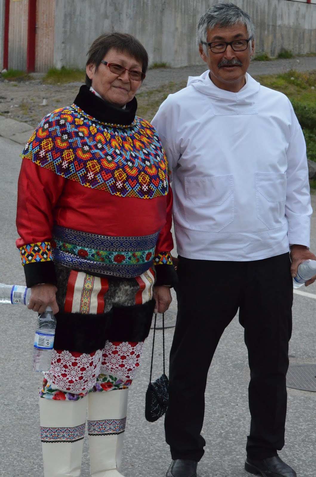
Formal Greenlandic Atire
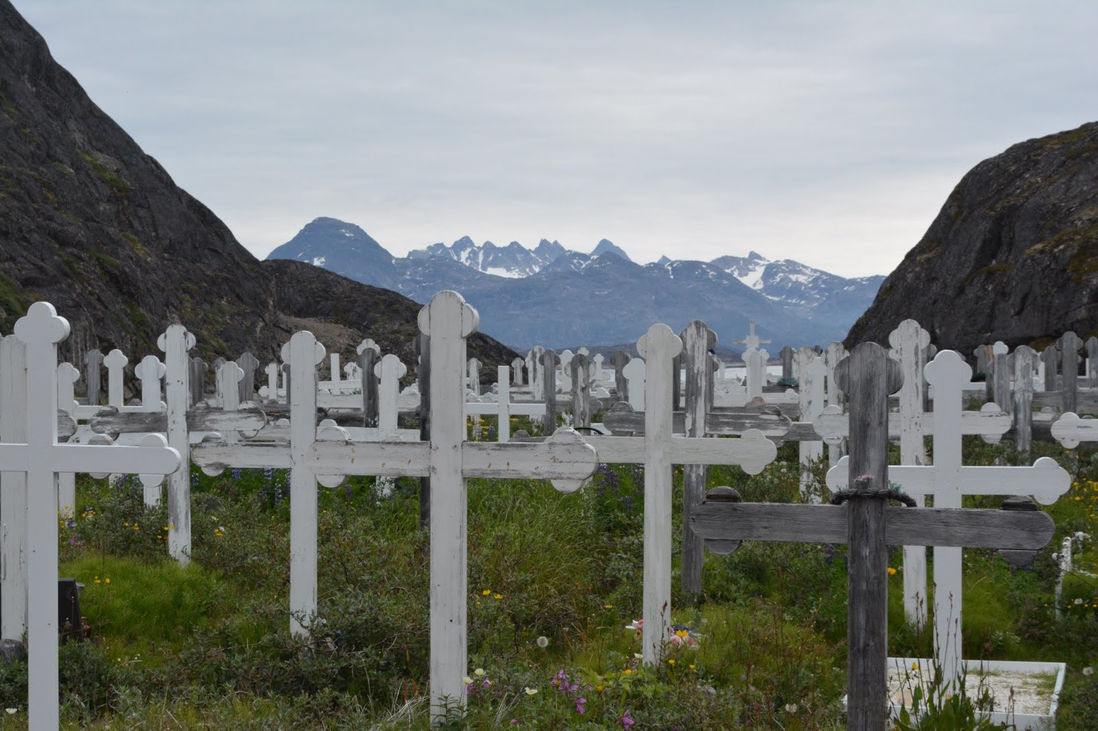
Typical Cemetery
Musk Oxe house decoration
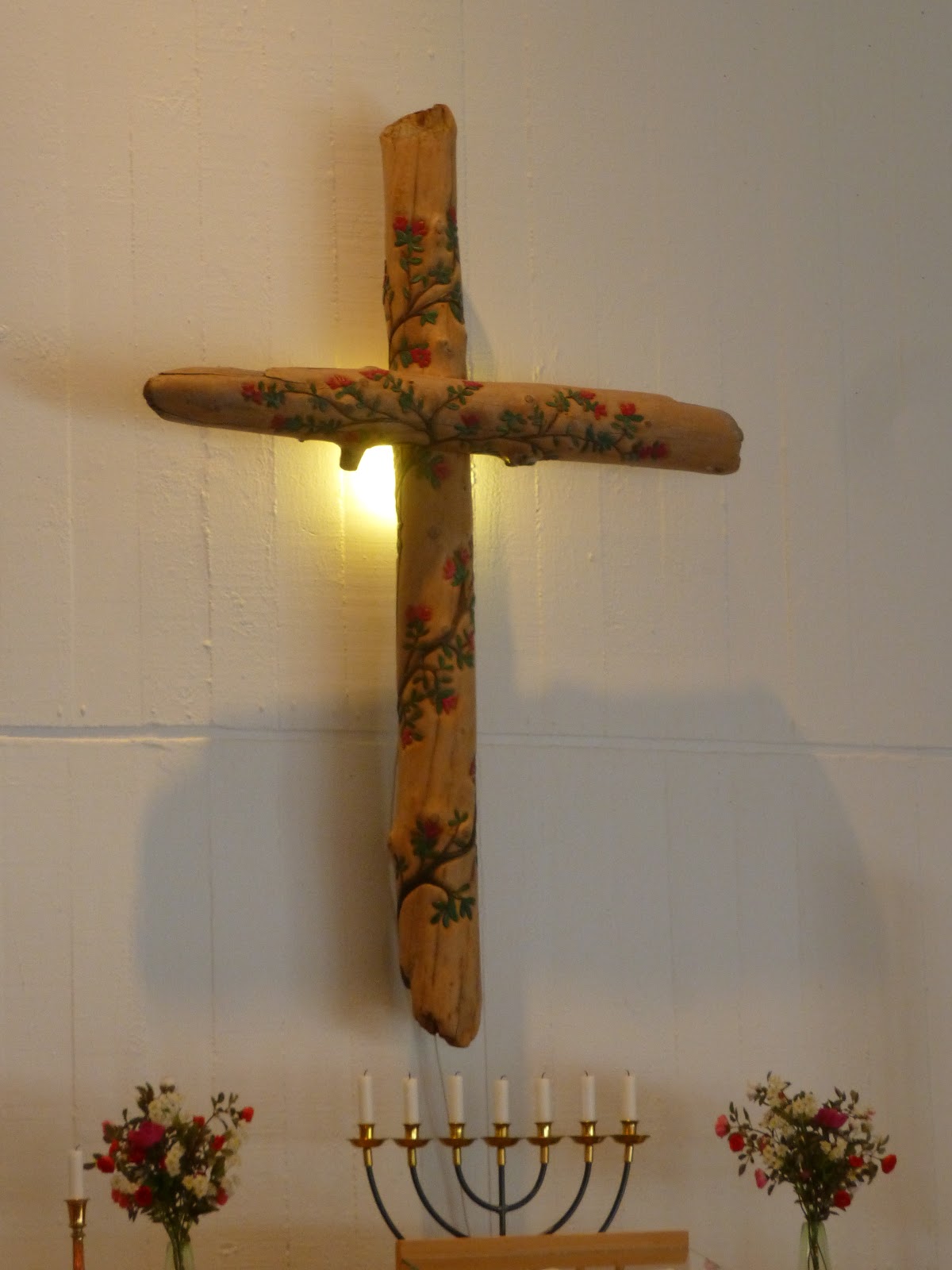
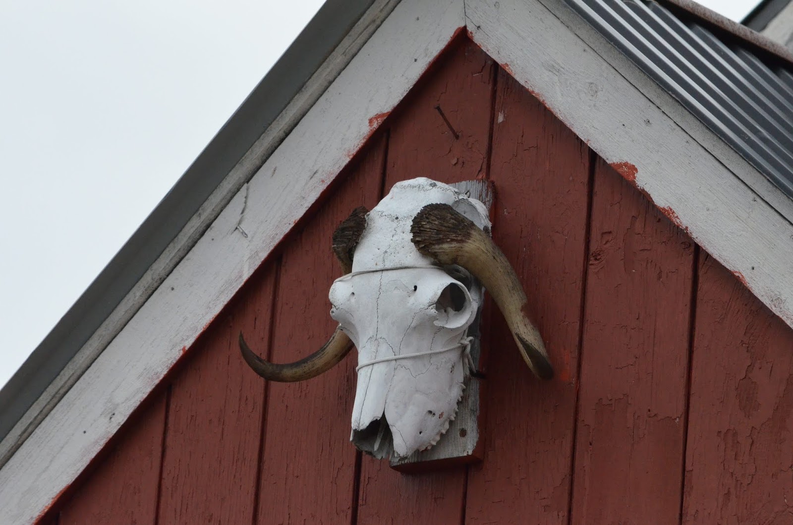
“New” church cross of whalebones
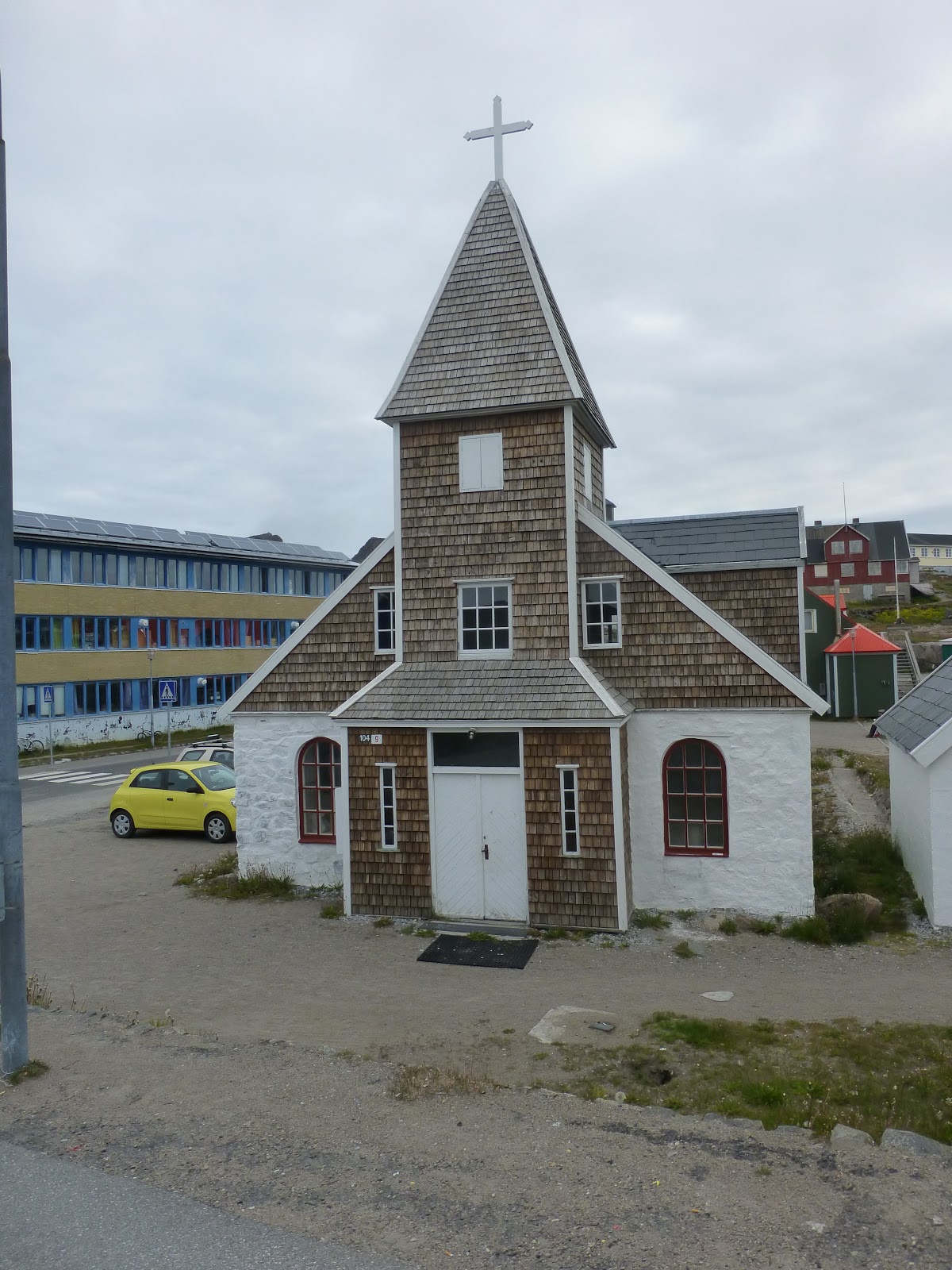
“Old” Church

Every town is hilly and rocky
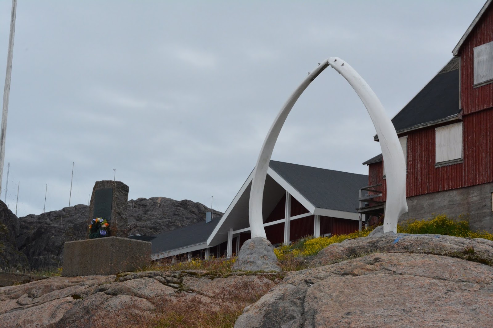
Every town has whalebone arches
Typical old fishing boats
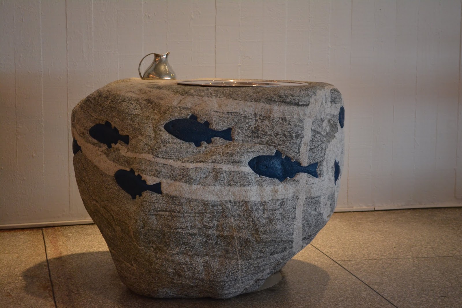
Baptismal font carved from rock
August 14, 2018
Sisimuit, Greenland
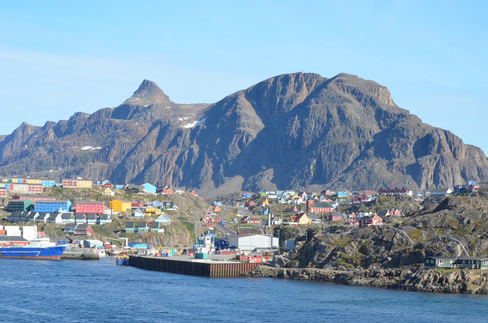
The second largest city in Greenland, with 5600 inhabitants, had a dock long enough for the Seabourn Quest to dock, rather than anchor and tender in to shore. The town is built on a rocky headland below a mountain, with steep roads, colorful houses and ancient archeological sites dating to 4500 BC and the Saqqac people believed to be among the first human inhabitants in Greenland.
We are now above the Arctic Circle and the Greenland Sled Dogs are now everywhere. They are either chained up in town or loose on many of the small islands around the town. Passing by the islands on the kayaks was amazing as the dogs followed us, howling all the time.
Approaching the dock in Sisimiut
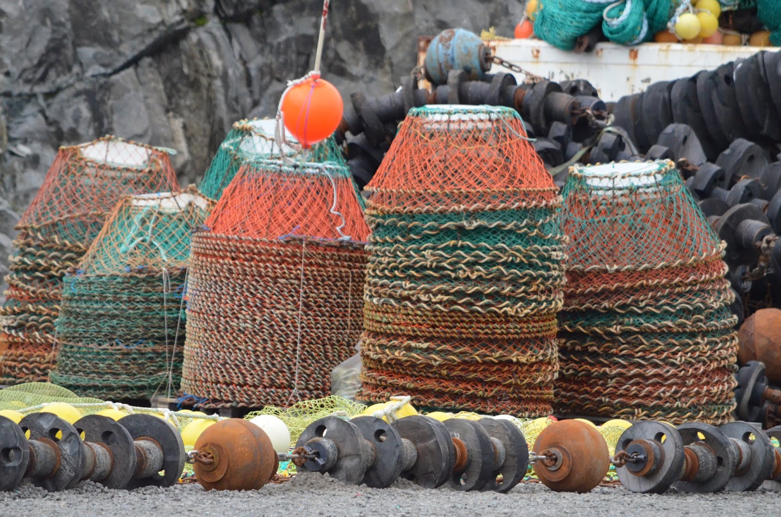
Crabbing is important – pots everywhere
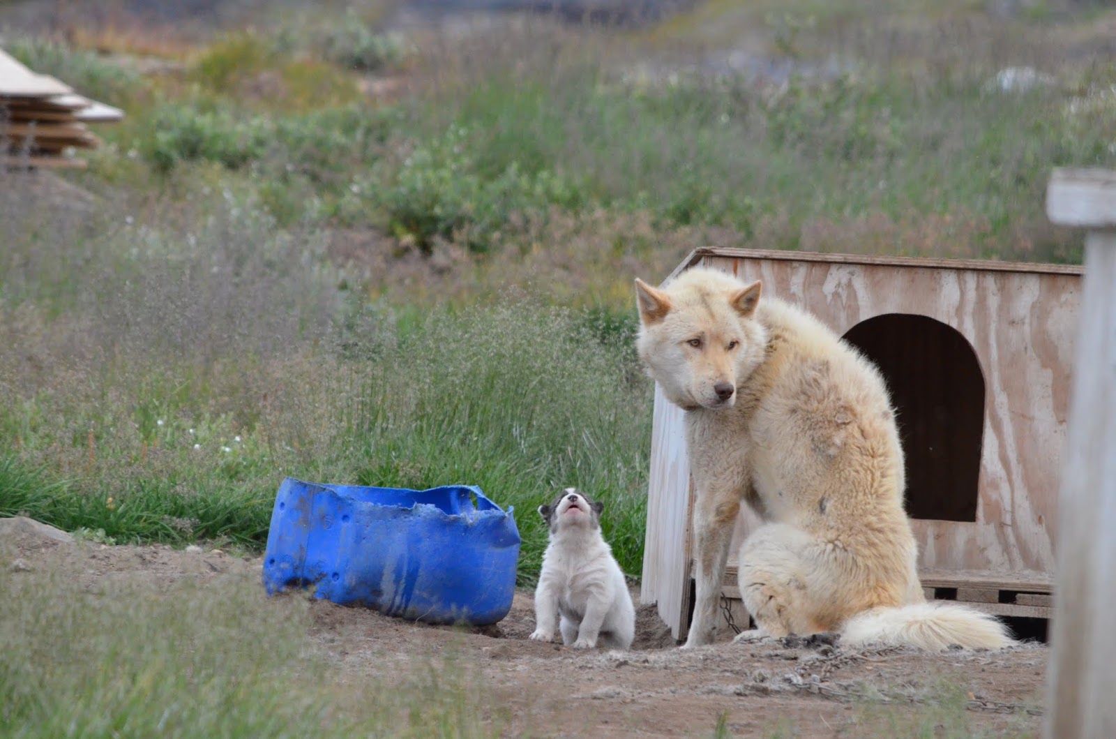
Greenland sled dogs are all above the Arctic Circle
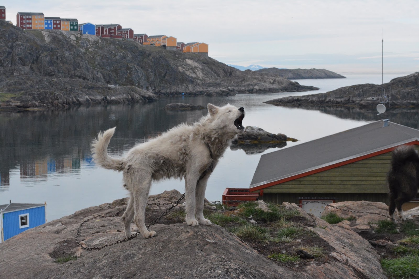
The howling is unique and pervasive
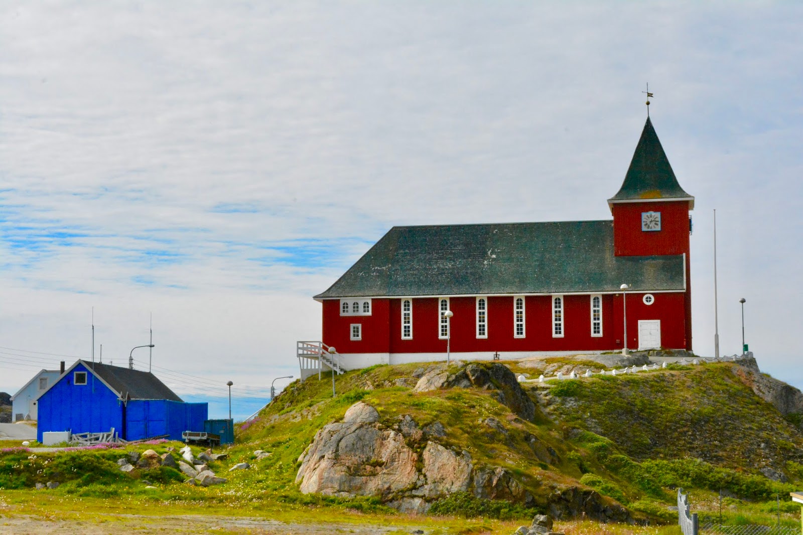
New church perched on hill

Blue church is now part of a museum

Now seeing sleds everywhere
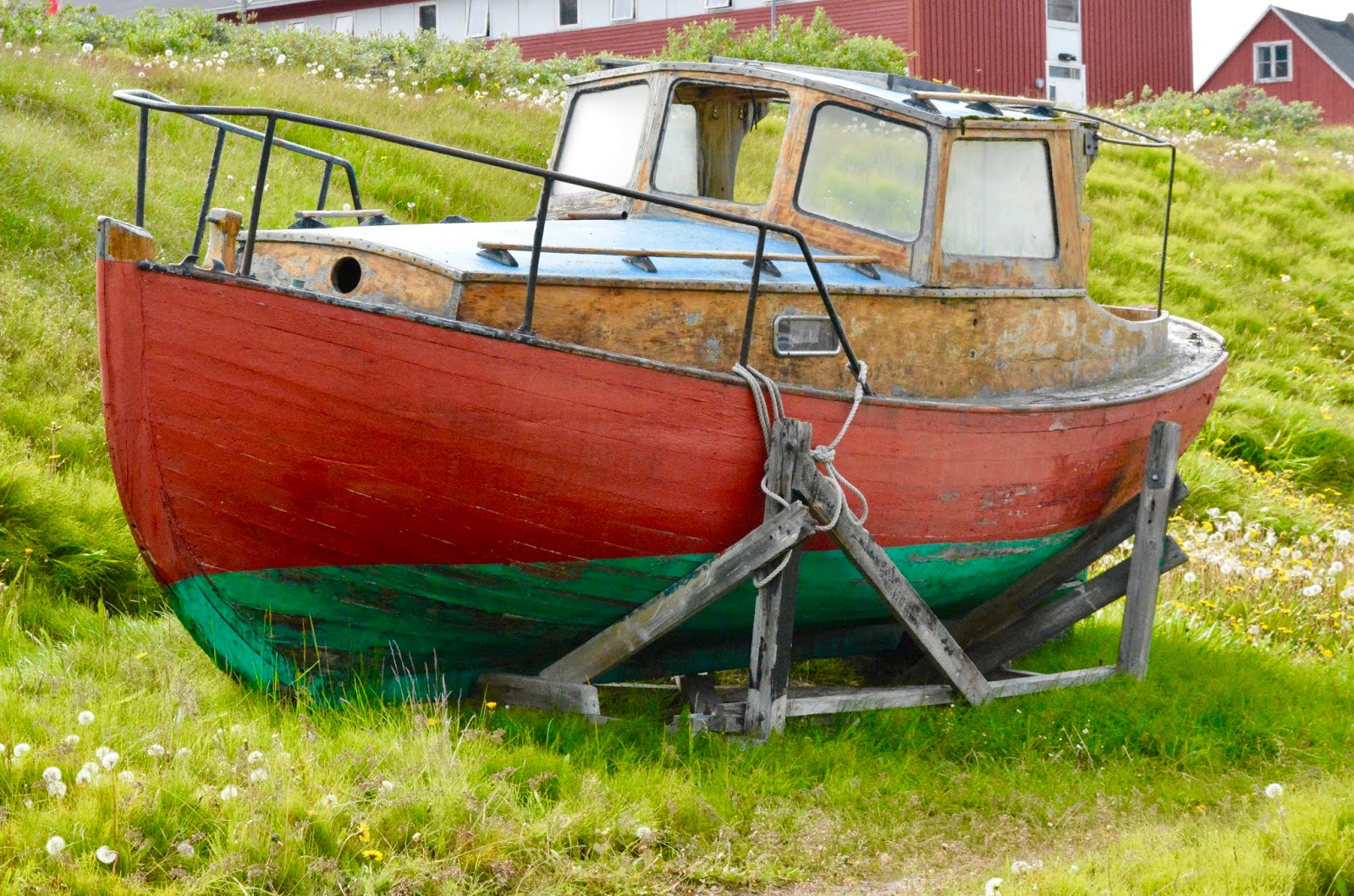
Colorful traditional fishing boats
Blue church
Final kayaking trip, above the arctic circle
We have still not seen much marine wildlife, perhaps more in Canada.
August 15, 2018
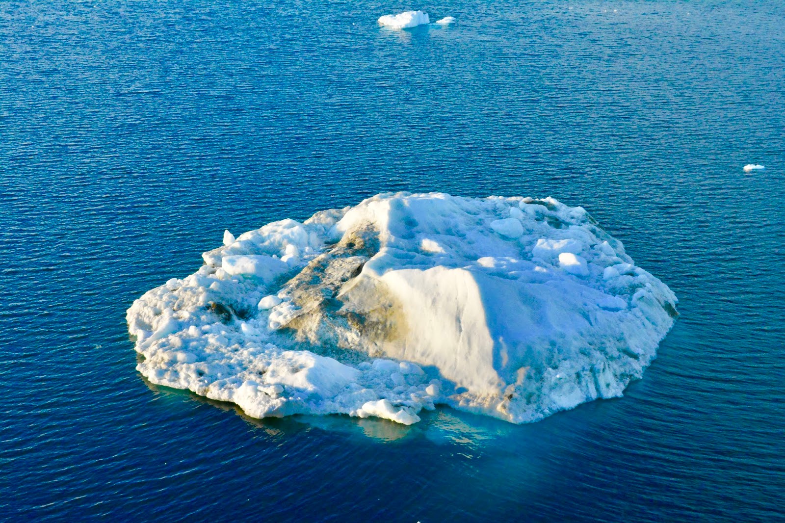
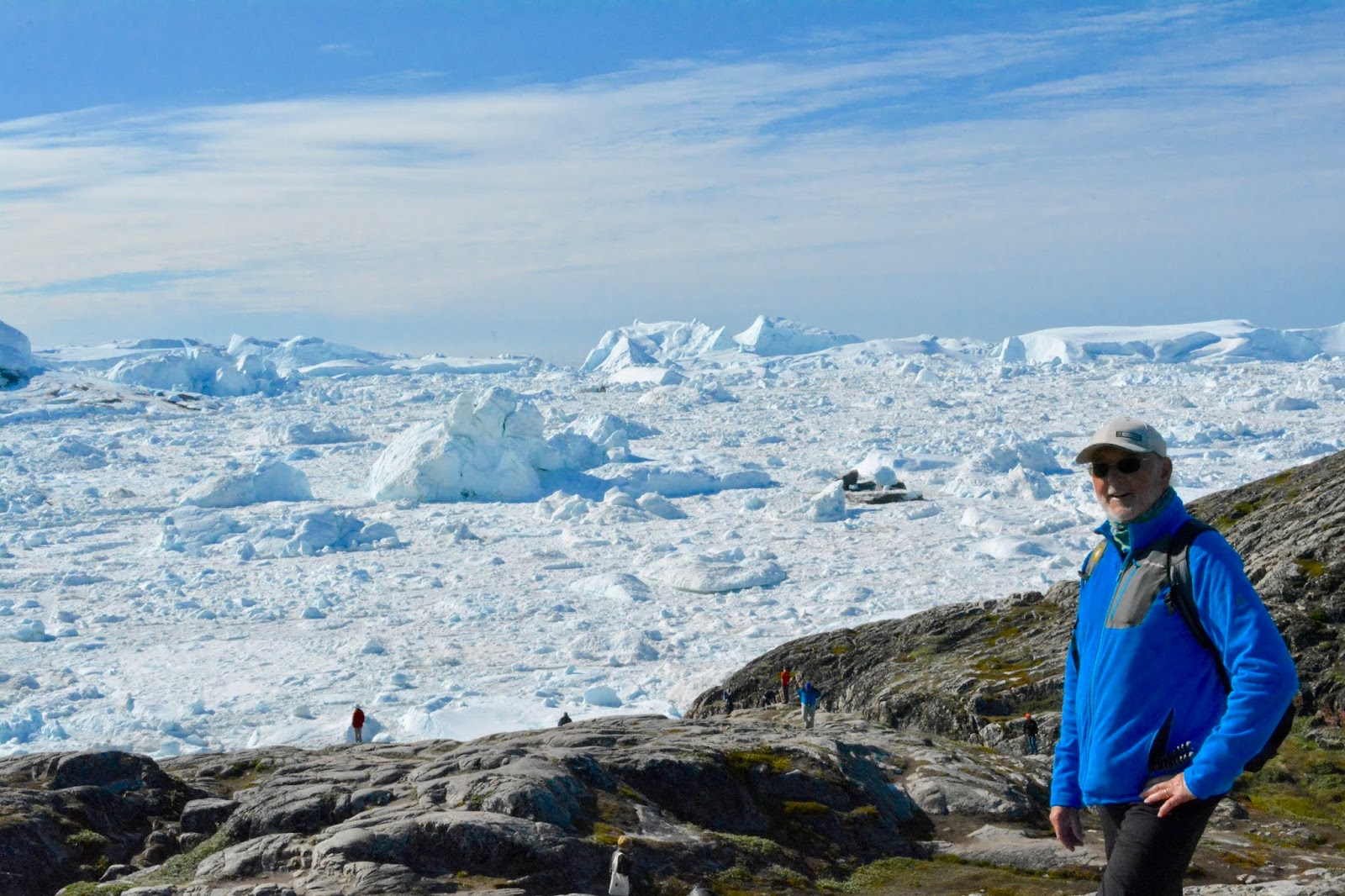
Ilulissat, Greenland
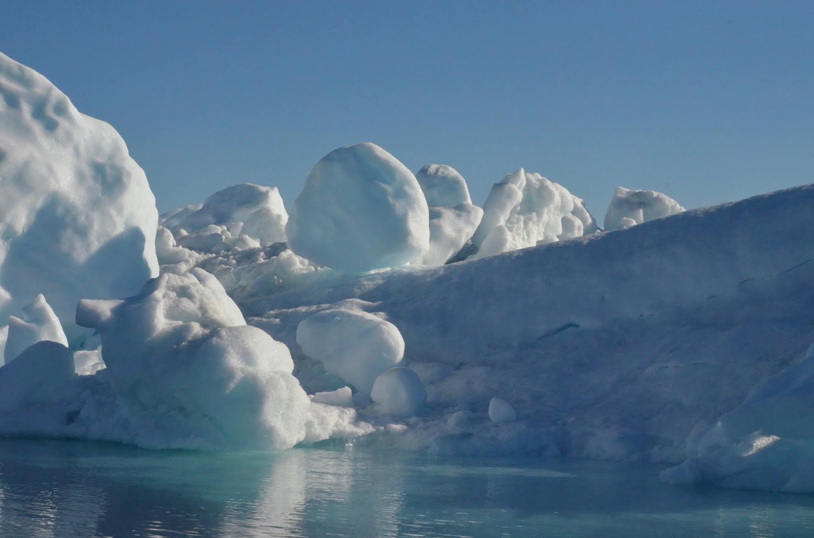
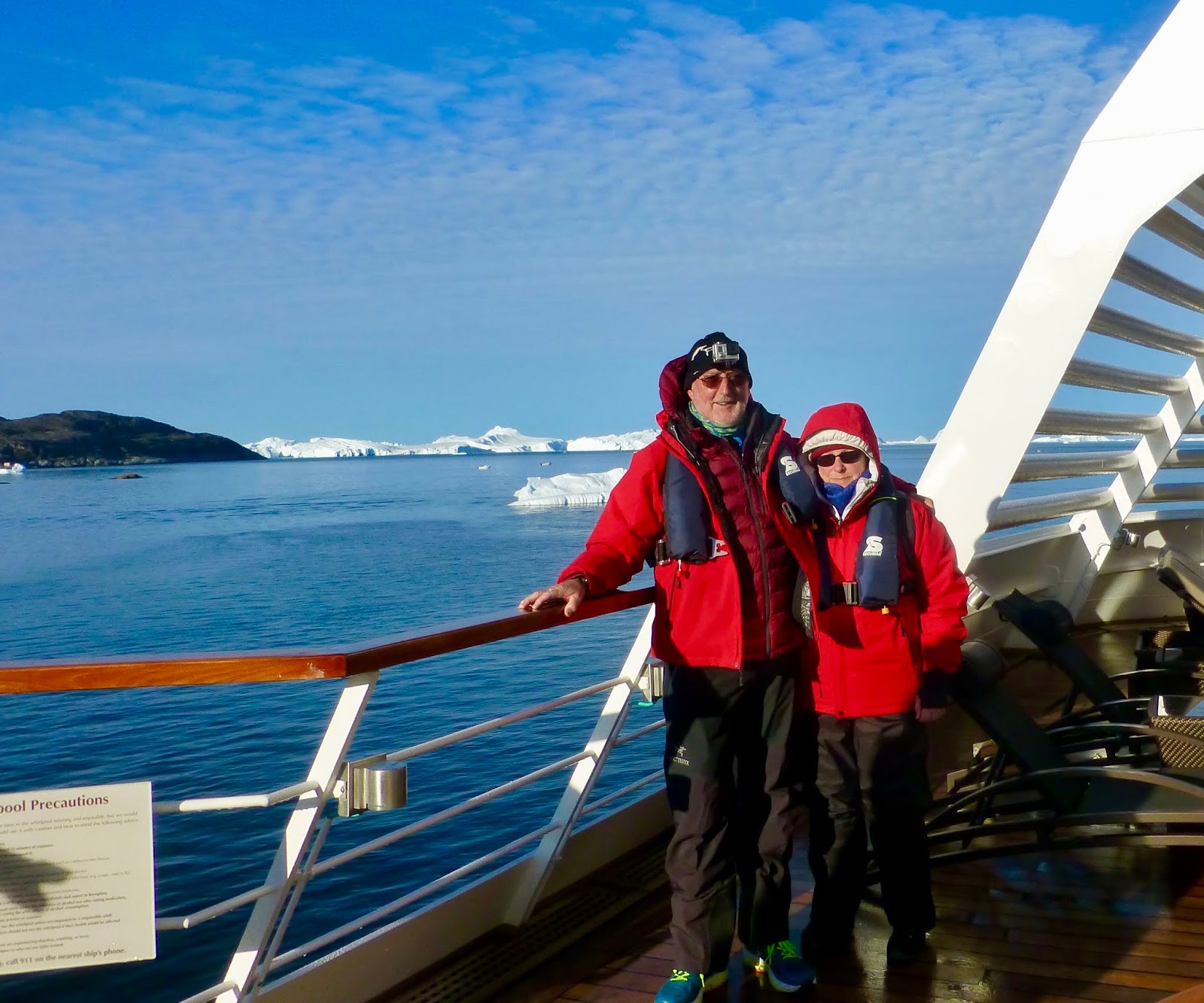
This town, now the third largest in Greenland, lies at the mouth of Ilulissat Icefjord, a UNESCO world heritage site. This single glacier drains between 7 and 10 percent of the entire Greenland Ice Cap and is believed to have spawned the iceberg that sank the Titanic more than 100 years ago. We approached the town and icebergs starting about 0300, with many guests watching from the observation lounge.
At 0800, after anchoring in the middle of several large bergs, we headed out on Zodiacs, weaving among the big bergs and stopping to watch Humpback Whales feed. After 2 hours, we headed back to the ship and changed out of zodiac gear and took the tender into the town. Ilulissat is growing rapidly, with much construction, but still has thousands of sled dogs chained around town, howling as one walked by. The town has an airport and many outdoor activities possible, from fishing, winter sports to visits to lodges at the terminal edge of the glacier some 40 kilometers away.
Approaching Ilulissat after sunrise
Approacing the icefjord
Prerparing for our zodiac tour
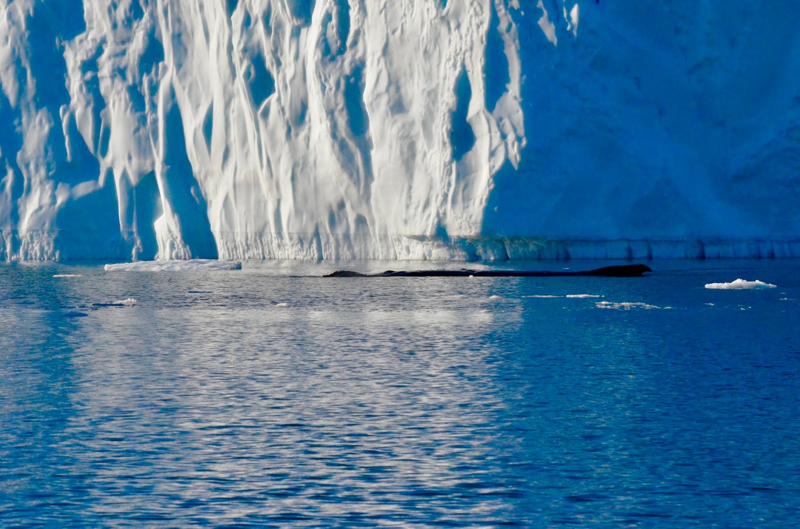
Resting Humpback whale looks like a log in the water
Crowded harbor at Ilulissat
Looking out over the icefjord
from Sermermiut
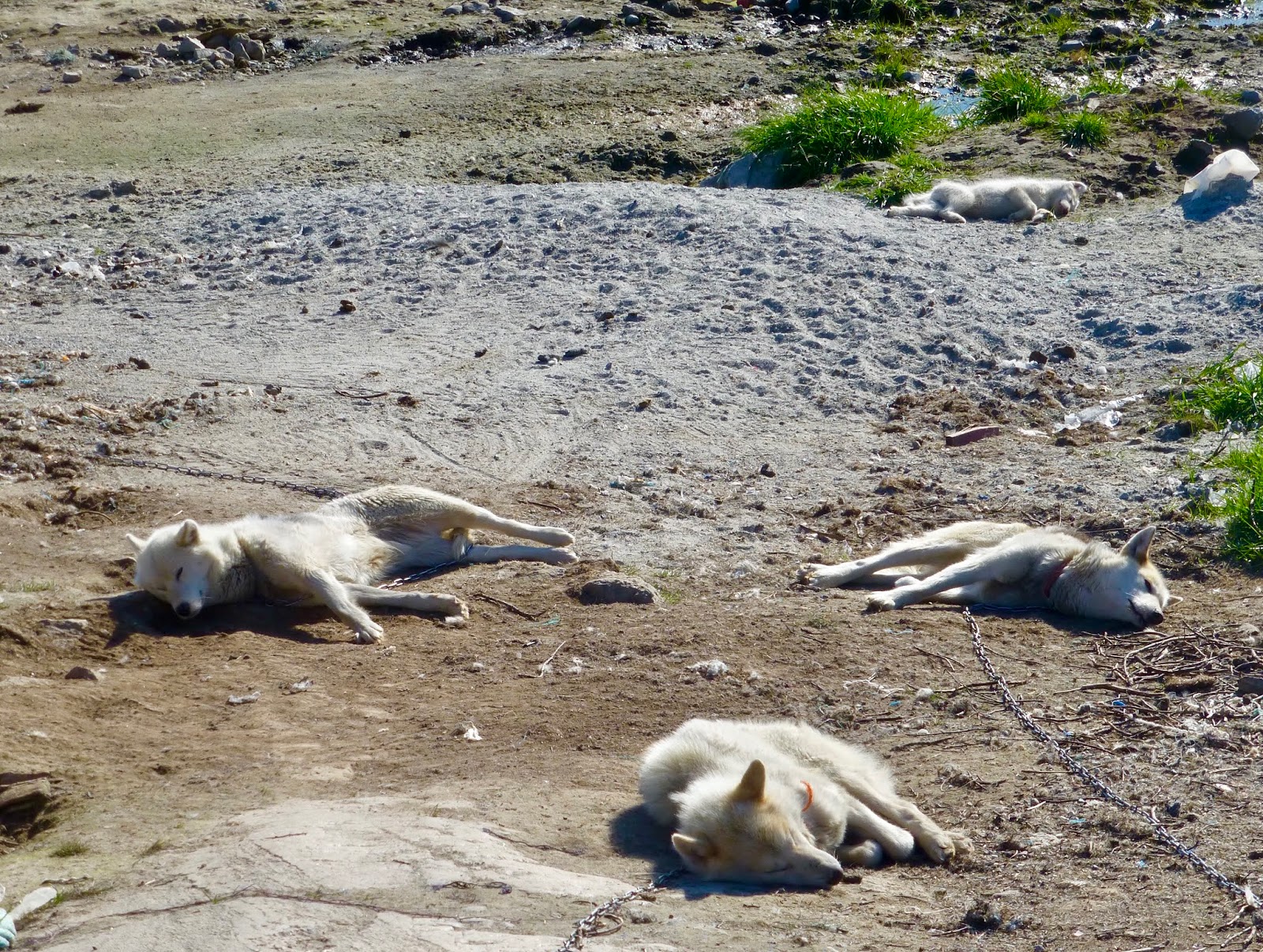
Sled dogs resting in the sun
Patrick walked the several miles each way trek to Sermermiut, both the site of settlements from 4500 BC, and of spectacular views of the Ilulissat Icefjord.
After a “Caviar on the Ice” sail-away party on the pool deck, the captain wove his way through the icebergs passing very close to some spectacularly shaped bergs and back into the relatively open sea for our crossing of Davis Strait and on to Canada for the rest of our voyage.

Saying goodbye to Greenland
Next Stop is Canada’s Nunavit Region
August 16, 2018
Transiting Davis Strait
This day at sea gives us time to sort through our photos, attend some lectures on our upcoming destinations, both the cultures of the Inuit and the wildlife we are looking for. There are still bergs visible, some large but most relatively small. The visibility was poor, with the ship’s foghorn sounding much of the day and into the evening. This was the second formal evening, with a set “Chef’s Menu” in the main dining room.
August 17, 2018
Transiting Davis Strait
The weather deteriorated overnight and we woke to 30 knot winds and rain from the south. We will arrive at the town of Iqualuit for customs clearance into Canada about 2200 this evening. No one is allowed off the ship. We are arriving early due to the need to hit slack water at the entrance channel, which has currents of 6-7 knots.
Route of the Vikings Part 3
Vikings Post 3
August 7, 2018 – standing off Heimaey, Iceland
The wind is whistling through the door to the veranda. With winds steady at 38-40 knots and seas 2-3 meters, the Captain has wisely decided to cancel the port visit. There is no safe way to launch the tenders, much less transfer guests ashore through the seas into the inner harbor. As the morning wore on, a mist from the water and wind began to obscure the detail and the horizon disappeared.
A few photos will have to suffice, along with a lecture later this morning by a resident who was here when the volcano erupted and buried the town. The town is now a UNESCO World Heritage Site, called the Pompeii of the North.
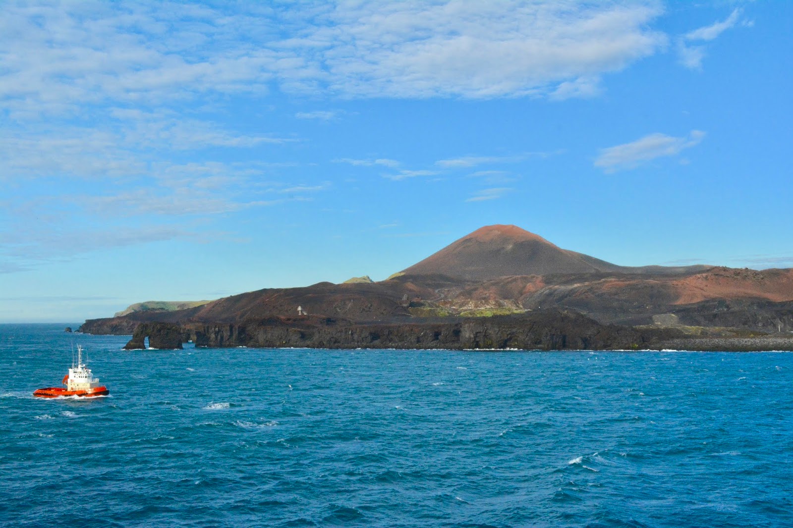
Main Volcano Dome
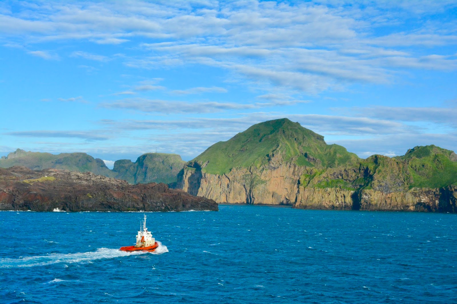
The edge of the channel where the town was
 |
| Add caption |
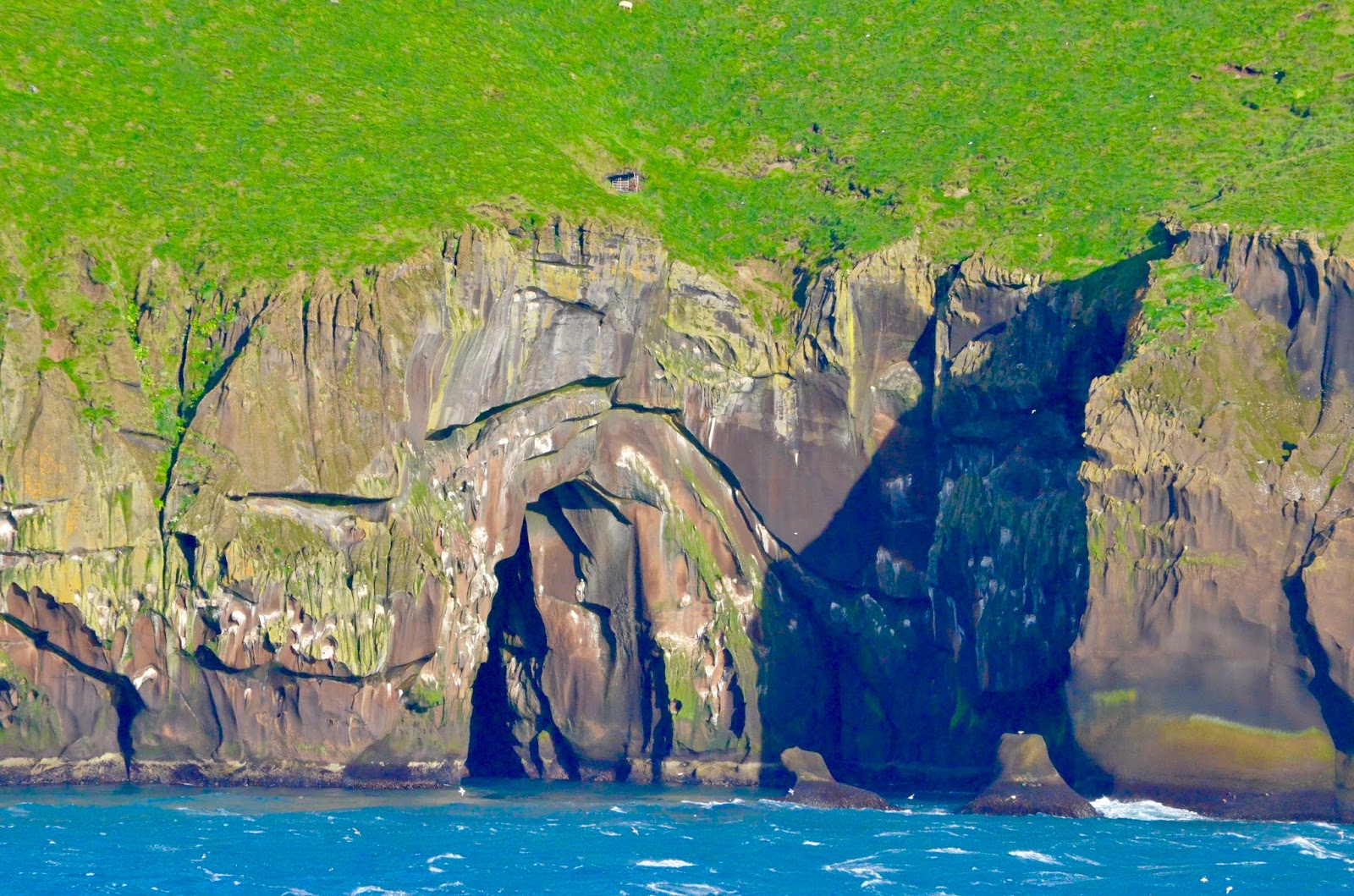
Layers of lava eroding into caves
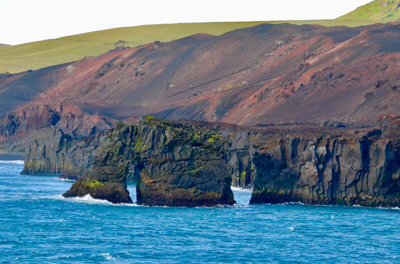
Spectacular Arches