At its best, travel should challenge our preconceptions and most cherished views, cause us to rethink our assumptions, shake us a bit, make us broader minded and more understanding. –Arthur Frommer
We did a lot of walking while we were in Chicago…over 15 miles in three days. We wandered the beautiful streets taking in the sights and doing a little shopping. We also walked along the riverwalk and the lake. Here’s a little of the history we learned.
Navy Pier is a 3,300-foot-long pier on the shoreline of Lake Michigan. It was opened to the public in 1916, originally known as Municipal Pier. The purpose of the pier was to be a shipping and recreation facility. It was renamed Navy Pier in 1927 as a tribute to the Navy personnel who were housed there during World War I. I don’t remember hearing anything about it when we visited family in Chicago as a kid. I’m not sure if anything was there, but in 1995 the pier reopened to the public offering all kinds of experiences. The pier celebrated its 100th anniversary in 2016 with new attractions like the Centennial Wheel and a new welcome center. We walked over to the pier, but it seems mostly to cater to young families. I’m sure it’s a busy place in the summer, but there wasn’t much going on the morning we were there, but it gave us great views of the city and the lake.
The water in Lake Michigan is an unbelievable color. As beautiful as any water we’ve seen, even in the Bahamas. Here are pictures of the Centennial Wheel, the Captain at the Helm and the Crack the Whip statues. All are at the Navy Pier.
The Navy Pier Auditorium…as seen from our tour boat.
Ohio Street Beach with views of the Hancock building.
We chose the Wendella Tour Company to get a better look at the Chicago River and the Chicago Harbor. They’ve been doing architecture tours since 1935. We had a wonderful trip, the sky and water were beautiful…although it was very cold. The Chicago River is a system of rivers and canals that runs through the city of Chicago. Although the river isn’t long it’s one of the reasons for Chicago’s geographic importance: the related Chicago Portage is a link between the Great Lakes and the Mississippi River Basin, and ultimately the Gulf of Mexico.
The Chicago River was another place that people didn’t visit in the 70’s & 80’s. All it was at that time was an artery for industrial shipping, a handy place to dump sewage, and an ever-present barrier to transportation and development, but heavy industry has given way to a glistening new downtown. Efforts to clean the river began more than a century ago with the reversal of flow away from the lake, but when the construction of the Riverwalk started in 2001 it has become one of the most beautiful and unique features of the city.
Waiting for the tour to start.
Our tour began at the base of the Wrigley Building at Michigan Ave.
The Chicago Harbor Lock was built in the mid 1930’s. It was built primarily as a means of limiting diversion of water from Lake Michigan, but also as a component of the project to reverse the flow of the Chicago River to improve the water quality of the lake.
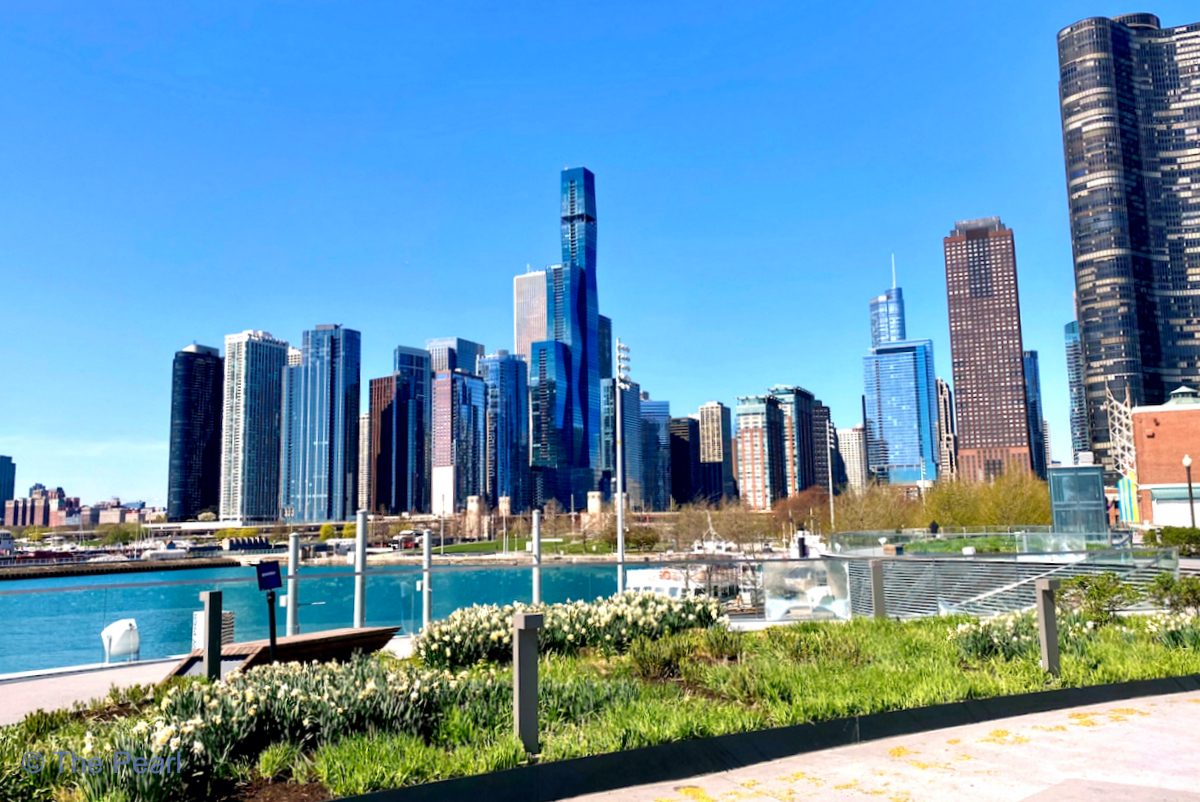
Views of the city from the harbor. Looking south of the Navy Pier towards the Sears Tower, now known as the Willis Tower.
Looking towards the Navy Pier with the Hancock Building in the background.
The Chicago skyline north of the Navy Pier.
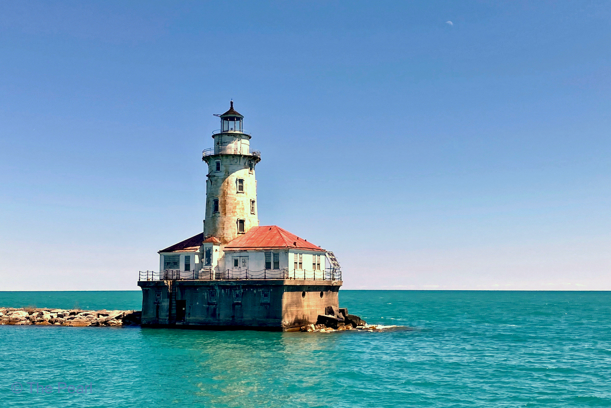
The Chicago Harbor Lighthouse
Looking west from the harbor at the Franklin Delano Roosevelt Bridge.
The Trump Tower to the right and the bridges on Wabash and State Street in the middle.
Looking west at the La Salle Street Bridge.
Looking back at the La Salle Street bridge with our hotel (The Pendry) in the middle of the picture.
Looking towards Lake Street with a L crossing the river.
Along the river between Dearborn Street and the lake is the Chicago Riverwalk. It’s a public path that offers a variety of dining, entertainment and recreation options. It’s a hub for summertime entertainment in the Loop, and is divided into six distinctive “rooms”. Each room has a different design and purpose, accommodating diverse activities, from dining and performances to kayaking and fishing.
Art on the Mart is the largest permanent digital art projection in the world, projecting contemporary artwork across the 2.5 acre river-façade of the Mart.
View of the Art at the Mart and the river.