Monday (May 4) was a busy day. All Class Detailing finished the waterline up wax job, we provisioned the boat and the crew. Dick Hoffman and David Jones, arrived in the early evening. Once everybody was situated aboard we adjorned to the Harbor C…
Archive | Guided Discovery RSS feed for this section
Adventures in Fort Pierce: Goodbye Sea Strainer Problem
Part two of our outing was a visit to West Marine. I usually don’t write about such mundane issues as visits to a marine hardware store but this visit turned out to be very special. In fact, I’m going to deem it the highlight of our visit t…
Hauling the 63 on the Manatee River
New boats have warranty issues, it simply comes with the territory. What does not necessarily come with the territory is how those warranty issues are resolved. Our experience with Outer Reef with regard to correction of problems continues …
Thanksgiving Celebrations 2014
We had the pleasure of two Thanksgiving celebrations, one in Sarasota at the Bird Key Yacht Club with Marjorie and Dick on Thanksgiving day and one in Captiva on Saturday with Cathy and Jerry.A bird and a key on a navy background adorn the BKYC burgeeB…
Welcome to Sarasota
Sarasota in not new to us and neither is Marina Jack, where we stayed for 21 days during our Great Loop adventure (12/22/14 to 1/10/11). What is new is that we will be spending the winter at Marina Jack (three and a half months 11/13/14 to 3/31/1…
Hingham to Sarasota: The Final Leg
Reader Note: We arrived at Marina Jack in Sarasota on Thursday, November 13. I started this article on the way to Sarasota. Today, as I finish it, it is Monday the 17th in the late afternoon. Diana often jokes by saying “how did you …
Hingham to Sarasota: Crossing Florida on the Okeechobee
Reader Note: You may have noticed that I have caught up. This is the direct benefit of being in lovely weather with calm waters and a competent crew. Thank you Dick and Phil.We departed Sunset Bay Marina (Stuart) at 6:33 AM on Tuesday and h…
Hingham to Sarasota: Life in the Slow Lane
Back in may I wrote a series of articles entitled Life in the Fast Lane reporting on the run from Fort Lauderdale to Albany New York in a new 2014 64 foot Pershing express cruiser. The Pershing, which is equipped with twin 1,326 HP diesels, cover…
Hingham to Sarasota: Crossing Cape Hatteras in a Raging Storm
THURSDAY, PM
Southwest winds at 15 to 20 knots and head seas of 1-2 feet continued as we approached the Chesapeake Bay shipping lanes on a southwesterly course to Cape Henry and the Virginia Beach / Norfolk area. It was just after noon. In terms of our cruising strategy this is the stretch where we would need to make our third major route decision. Whether to continue on the open ocean around Cape Hatteras, delay at Virginia Beach waiting for favorable weather or continue to Norfolk and take the ICW from Norfolk to Beaufort.
There were two other critical decision points earlier in the trip. One as a crossed out of Buzzards Bay where we needed to decide whether to tuck in to Long Island Sound and one at Cape May where we would elect to cruise up the Delaware River and then down the Chesapeake Bay. Both of these decisions effectively increased our time enroute by increasing the distance and limiting our night travel. If we had elected both we would have added over a hundred of miles (12 hours) and at least three days. We opted to run outside as the conditions, while not perfect, we easily within the 63’s capability.
Weather, as always, is the key ingredient in these route decisions. The decision to go to Norfolk and take the ICW increases the trip by one full day as we can only run during the day. It also has the potential to add another day if the decision is related to high winds. The Alligator River Swing Bridge will not open when winds exceed 30 knots. This proved to be a problem on the trip north last spring when we were delayed by high winds in the Belhaven Haven (Dowry Creek Marina).
We have been watching the weather intently since departing Hingham so it was no surprise when we reviewed the weather from Cape Henry to Ocrakoke Inlet. The forecast was not good. Below is the synopsis
SYNOPSIS FOR EASTERN NORTH CAROLINA COASTAL WATERS… A COLD FRONT WILL MOVE OFF THE COAST THIS EVENING. HIGH PRESSURE WILL MOVE THROUGH FROM THE WEST SATURDAY. ANOTHER COLD FRONT WILL MOVE THROUGH ON SUNDAY WHILE AT THE SAME TIME AN AREA OF LOW PRESSURE WILL MOVE NORTHEAST OFF THE COAST. HIGH PRESSURE WILL MOVE THROUGH EARLY NEXT WEEK. A COLD FRONT WILL MOVE THROUGH THE MIDDLE OF NEXT WEEK.
Below are the NOAA forecast maps.
 |
| Thursday night show the cold front crossing over Cape Hatteras with a low pressure center moving up the northeast coast |
 |
| !2 H]hour later the low deepens and a low pressure trough forms west of the coast Isobars close together indicate high northwest winds over Cape Hatteras |
 |
| 24 hours out shows the low weakeing over the northeast withj a low pressure trough west of Cape Hatteras. |
The following is the near shore marine forecasts for the Cape Hatteras:
327 PM EST THU NOV 6 2014: S OF OREGON INLET TO CAPE HATTERAS NC OUT 20 NM- S OF CAPE HATTERAS TO OCRACOKE INLET NC OUT 20 NM
SMALL CRAFT ADVISORY IN EFFECT THROUGH LATE FRIDAY NIGHT
TONIGHT SW WINDS 25 TO 30 KT…BECOMING NW AFTER MIDNIGHT. SEAS 6 TO 9 FT. DOMINANT PERIOD 6 SECONDS. A CHANCE OF SHOWERS THIS EVENING.
FRI NW WINDS 20 TO 25 KT. SEAS 5 TO 7 FT. DOMINANT PERIOD 6 SECONDS.
FRI NIGHT N WINDS 15 TO 20 KT. SEAS 4 TO 6 FT. DOMINANT PERIOD 6 SECONDS.
SAT N WINDS 5 TO 10 KT. SEAS 3 TO 5 FT. DOMINANT PERIOD 9 SECONDS
Notice the 25 to 30 knot winds and 6 to 9 foot waves forecasted for Thursday night. This would have dictated stopping and that probably was the prudent thing to do. However, the wind shift to NW after midnight influenced my decision. Since we would be running close shore the shift to NW would put the wind on our starboard aft quarter in effect putting on a lee shore. The only question I could not precisely answer is when the frontal passage would occur.
Explanatory Note: Waves are a product of wind and there are three factors that effect their formation; the speed of the wind, the time of the wind and fetch, the size of the area over which the wind it blowing. The higher the wind speed, the longer it blow and the amount of open water dictate wave height. On Lake Michigan a 20 knot wind blowing out of the north east produces 10 foot waves on the Chicago lake front.
As we proceeded south just past Currituck Light at 4:45 PM we had south southwest winds at 18 to 20 knots with a 1 to 2 foot head sea. Sunset occurred at 5:07 PM and at 5:59 PM we lost nautical twilight. At 8:18 PM just south east of Bodie Island Light I noted head seas of 2 feet with SW winds running 25 to 30. The 63 in not noticeably affected by head seas under 4 feet. Hence at 10:18 PM we were riding smoothly even as the the head sea build to 3 feet in the continued 25 to 30 knot southwest wind, At that point we had covered 532 nautical miles since leaving Hingham.
Shortly thereafter satellite weather showed the area between Currituck Light and southwest of Cape Hatteras under a severe thunderstorm warning. Cells were visibile both on sat weather and also on my radar screen moving northeast and were northwest of our position. Satellite weather showed the cold front 157 NM west of our position.
As a general rule thunderstorms and rain showers occur ahead of the front. Further, frontal information unlike Doppler radar is not immediate. Hence the front’s exact location was unclear.
At 10:51 PM a cell visible on our radar crossed our position with heavy rain and gusts to 39 knots (45 MPH) and the wind shifted northwest. Nine minutes later we crossed our next waypoint and changed course to 186 degrees putting the wind on our starboard aft quarter. At 11:00 PM I recorded 30 knot winds out of the north northwest and a peak gust of 49 knots (56 MPH). Between 10:51 and 11:00 seas quickly built to an estimated 6 to 8 feet. Fortunately we were experiencing a following sea.
 |
| Approaching Cape Hatteras with a thunderstorm on radar. Next to radar is our night vision. |
We were in big seas with gale force winds just 2 hours northwest of Cape Hatteras. Clearly a raging storm. However, we experienced its intensity by looking at the waves through the window, which is not easy at nigh, and reading numbers on the instruments. We could not hear the wind due to the integrity of 63’s construction. It was surreal. The photo below is of my notes for the hours before the frontal passage and for two hours afterwards. Notice that the legibility of my writing does not change. This speaks to the amazing stability of the 63. Thank you Outer Reef.
Our next challenge was Diamond Shoal. From Cape Hatteras, Diamond Shoal juts out 17 miles to the southeast. Noticeably there are no depth numbers on the chart suggesting that bottom tends to shift around. Bottom line. You have to go around Diamond Shoal. In our case, we wanted to round Diamond Shoal and then immediately head northwest into the wind to get close to shore and take advantage of the lower seas created by the lee shore (i.e., reduced fetch). The question here was how would the 63 perform in the different points of sail as we rounded the shoal.
At 2:13 AM we turned to starboard (266 degrees) which put us on a beam sea. Waves were 6 to 7 feet with winds out of the northwest at 25 to 30 knots. The stabilizers were giving us a stable ride. An hour later (3:04AM) were turned northwest into a 6 to 7 foot head sea. Again I recorded “stable ride despite high winds and seas.” The rounding of Diamond Shoal (Cape Hatteras) demonstrated the 63’s sea worthiness.
At 4:03 AM we were off Hatteras Inlet in a head sea of the starboard quarter. Winds were northwest at 40 knots but owing to being close to shore the waves were only 3 to 4 feet. Lots of spray from the wind but a very stable ride.
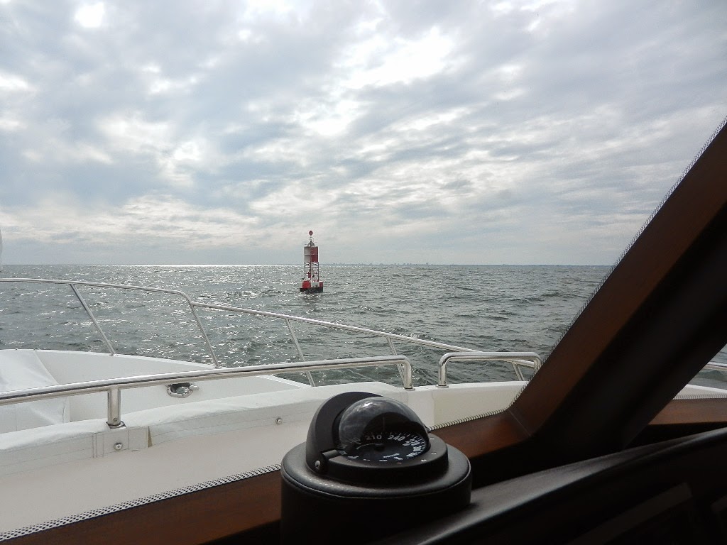
At 6:19 AM we were off the Ocrakoke Inlet Open Water Buoy on a course of 237 degrees. Winds were NNW at 29 knots. We were enjoying 1 to 2 foot seas as we cruised within one mile of shore. We were finally getting the full advantage of the close to shore strategy.
We continued on toward Morehead City rounding Cape Lookout at 11:57 AM. Winds were now 19 knots. At 2:20 PM we entered the Morehead City Inlet. We had covered 661 nautial miles since leaving Hingham three days ago.
 |
| Heading into the sunset as we start our second leg to Stuard |
We stopped at Morehead City Yacht Basin, refueled and by 4:00 PM we were headed outbound to continue on to Stuart. Stay tuned for my next article “Life in the Slow Lane – Morehead to Stuart.”
Below is the note that I wrote to Jeff Druek, President of Outer Reef.
Dear Jeff,
We transited Cape Hatteras Thursday night during a very strong cold frontal passage with wind gusts as high as 49 knots. Seas built very quickly to 7 to 9 feet with sustained winds of 30 to 35 knots. All this happened as we were circumventing Diamond Shoal, which puts us at least 17 miles offshore and required course changes encompassing 270 degrees. We went from a following sea to a quartering sea to beam sea to another quartering sea to a head sea at the height of the storm.
Notwithstanding the flaw in my judgment for being out there (I took a calculated risk), the 63 showed no flaws in terms of its sea keeping regardless of the point of sail. The experience is almost surreal. You cannot hear the roar of the wind due to the boat’s amazing quietness and since it was night, it was hard to see the wave heights. The boat just moved through the turbulence with sure footed stability.
Sir, you and your team build an amazing boat. I was confident that the 63 could handle heavy seas when I bought it but now I know from experience how stable she is. While I will continue to adhere to my conservative approach to heavy weather I will have the confidence that should the unexpected happen the boat can handle it.
Written by Les
Hingham to Sarasota in 6 Days: Hingham to Cape Henry,MD
READER NOTE: I’m publishing this article on Sunday, November 9 with our position just north of St. Augustine Florida. As of this moment we have covered 1,060 total mile and have been cruising non stop for 5.5 days. We are scheduled to arrive in Stuart at around 5:00 PM on Monday. Our goal of cruising non-stop for 6 days to Stuart is within sight given the favorable weather conditions. I had expected to publish articles as the journey progressed but as you can see I’m, as usual, behind. Cruising 24 hours a day is actually an active process especially when one is the person responsible for the safety of the endeavor.
NOW THE STORY:
The extremely strong northeaster that arrived on Friday afternoon (10/31) with high winds and torrential rains began to move northeast late Sunday with clearing skies and continued high 25 to 30 knot winds. The weather on Monday was as forecast, clear skies with blustery winds for most of the day. Tuesday called for calm winds and flat seas. Those who follow this blog will recall that the weather folks were showing a weather window starting on Tuesday morning and that proved to be the case (at least on Tuesday)
Diana and Kodi departed on Monday morning for their 4 day car trip to Sarasota. They were off by 9:20AM.
The crew arrived late Monday afternoon. Dick flew in from Sarasota and was picked up by his sister, Betsey, who drove him to the marina. Phil flew in from Philadelphia and took the ferry to the marina. They arrived at the same moment. I took this as a good omen.
We spent the afternoon on Guided Discovery chatting about our May Norfolk to Hingham adventure over Mount Veeder 2010 Cabernet Savingnon with cheese and crackers and then adjourned to a lovely dinner at Alma Nove, the 3 star restaurant at the Hingham Shipyard. This was followed by a briefing on the ships equipment, electronics and emergency procedures.
Explanatory Note: We have outfitted Guided Discovery with safety gear to deal with a wide range of emergencies. In addition to all required Coast Guard’s gear we carry a 6-man emergency life raft, an EPIRB, a defibrillator. oxygen, an advanced medical kit and extra high capacity fire extinguishers strategically located throughout the boat My thought process is it’s better to have it and not need than need it and not have it. That said, if the crew is not familiar with the equipment, where it’s located and how to use it then the reality is it is not worth having. Hence the pre-departure briefing.
TUESDAY:
 |
| Sunrise over Hull Mass as we deaprt |
Perfect weather with an on-time 5:58 AM departure. I love it! The cruise from Hingham to the Cape Cod Canal was picture perfect. We arrived at the canal at 11:32 PM noting an average speed from the dock of 8.3 knots to cover the first 45 nautical miles. Our passage through the canal was with the current and took about 50 minutes. Pure luck. We hit a top speed of 12.1 knots and boosted our average speed to 8.5 knots. We gave some of the gain back as we transited Buzzards Bay in southwest winds and an unfavorable change in the current. However, unlike the canal where currents run at 2 to 4 knots, the current in Buzzard Bay is measured in tenths of a knot.
 |
| Plymouth Light |
 |
| Houses and fall color on the Cape Cod Canal |
 |
| :Passking commercial traffic as we approach the Bourne Bridge at the west end of the canal |
The evening was a different story. As we crossed into Block Island Sound the winds continue to build from the southwest reaching 18 to 20 by 9:00 PM as we passed Block Island Light. Now we were in a head sea with 3 to 5 foot waves. This continued as we ran southwest along the Long Island coast. We passed Shinnecock Light at 12:30AM and Fire Island Light at 4:25 AM. The overnight passage saw seas build to 4 to 5 feet. By sunrise (6:33AM) we were 16 NM south east of JFK and entering the New York City shipping lanes. Our average speed for the first 24.5 hours since departure was 8.3 knots and we had covered 203 nautical miles, which is right in line with our predication of 100 NMs every 12 hours. Fuel consumption was 193 gallons. Note at 1400 RPM we cruise at 8.4 knots on a clean bottom. To compensate for the head seas and current we upped the RPM to 1480, which had a noticeable effect on the fuel burn.
 |
| We approach the NYC shipping lanes |
WEDNESDAY:
We were off Massapequa at Sunrise (6:33 AM) still in a 4 to 5 foot quartering head seas and entering the New York City Shipping Lanes. There were lots of targets of the radar and several ships in sight. We elected to take a short cut at 7:15 AM and turned southwest to bypass the traffic in the shipping lanes and intersect with our course along the Jersey Shore. Winds started to diminish at sunrise and by mid morning we were enjoying diminishing seas. This continued throughout the day. By the time we reached Cape May and crossed the Delaware Bay seas were 1 to 2 feet. Unfortunately, visibility reduced due to haze. Oh well. You can’t have it all.
 |
| Off Cape May New Jersey |
On Wednesday evening we refined our after dark watch policy and agreed that each of us would take a two hour watch between the hours of 6:00 PM and 6:00 AM. That gives each person 4 hours of uninterrupted sleep and a total of 8 hours each night. We followed our plan and everyone got a good night’s rest while still maintaining an active watch. Two hours on proves the perfect watch period as it’s over quickly thus reducing the chance that the watch person falls asleep.
Crossing the Delaware Bay means crossing another major shipping lane. As we crossed the lanes we encountered two ships one heading inbound and the other outbound. We had both on radar and the question was could we continue to make way at our current speed or did we need to take evasive action (e.g., reduce speed and/or turn) to avoid a potential collision. Using radar in combination with our new Raymarine (FLIR) night vision device and a visual collision avoidance technique where you compare the target’s movement to a stanchion rail we determined that we hold both course and speed.
By 11:49 we were off Ocean City Maryland after an easy crossing of the Delaware Bay.
NIGHT CRUISING:
Knowing that we were anticipating a 6 day nonstop cruise I gave a lot of thought to night vision. Night vision for us has both a systems and a human component. System wise we are well equipped with AIS, radar and, most recently, thermal imaging night vision. However, that equipment plus all of the other “stuff” on our panel put out a lot of light and that light effects the eye’s ability to see in the dark. Essentially, the more light on the control panel the less human night vision.
Sitting at the dock on Sunday night with the lights out and all of the electronics and equipment operating I considered a method of dimming or eliminating every light source. The first part of the solution involved determining the low light setting for each instrument that could be dimmed. The second involved blue painters tape and black thin cardboard sheets. The tape alone worked well for dimming certain lights without eliminating their utility. See photo below.
 |
| Note pretty but very effective |
 |
| Note the blue tape on the Glendenning Engine Control |
During my second watch on Wednesday evening I gave a lot of thought to what goes into night cruising and as a result found myself using the electronics capabilities to an even greater extent than ever before. Necessity is the mother of invention.
THURSDAY AM:
We continued through the night along the Maryland shoreline in relatively calm seas (2 to 3). I took the 10 to 12 and 4 to 6 watches. Around 5;00 AM I encountered an AIS target dead ahead. AIS identified it as US Navy 841 and I also saw it on radar. When we got within a mile and a half I was able to the see ship on the night vision devise. The photo below shows the target on all three systems and also shows how we use our system at night,
 |
| Port Screen: Chartplotter with AIS. Starboard Screen: Left: Radar, Right: Night Vision |
As the morning progressed the head seas we had been confronting as since entering Block Island Sound began to build slightly as the winds continued out of the south southwest at 15 to 20 MPH. The ride was still pleasant despite taking lots of spray.
At 9:00 AM I performed an engine room inspection and following that proceeded to transfer approximately 300 gallons from the auxiliary tanks in the lazarette. The process took about 50 minutes per tank. This was my first en-route fuel transfer. It went very well thanks to Outer Reef’s incredibly thorough orientation by Captain Randy.
Explanatory Note: I wear sound deadening ear muffs made a Remington that almost totally deaden the diesel engine noise. The process involves a visual inspection of all equipment along with temperature verification with a pyrometer.
At 11:00 AM we were off Cape Charles Maryland preparing to cross the Chesapeake Bay shipping channels. Winds were still out of the southwest around 15 knots with 1 to 2 foot seas on our nose.
Stay tuned for the next article which I’ve titled “Crossing Cape Hatteras in a Raging Storm.” It’s exciting.
Written by Les.