Day 82 – 365 Project…Spring Blossoms

Welcome to day 82 of  365 photos…Spring blossoms are appearing here in our part of North Carolina – finally!! These photos were taken while I sat in the back yard trying to get some bird photos. The birds were not cooperating this afternoon though so I decided that there are those that still have cold… Continue Reading

The post Day 82 – 365 Project…Spring Blossoms appeared first on Moosetique Musing.

Big Boys and Their Toys

Big boys, meaning Earl and I.  If you’ve followed our Drift Away blog, you know that boat is loaded with toys, from the Boston Whaler on the roof (which may be coming here as a fishing boat) to the $15,000 in electronics.  No, we haven’t sold…

The Exumas

We spent about 5 days in Georgetown.  We never found a lot of Kid boats but it had
not changed much since 2009.  They still
had an active VHF radio net each morning and plenty of organized activities.  Tom took advantage of the VHF net to
advertise to the 300 cruising boats anchored here and unload some used
items.  We sold our old back-up dingy, 2
HP outboard motor and all of our paper Caribbean charts to 3 different
cruisers.  Here is a pic of our old dingy
being towed away…it had no patches but it was almost 10 years old.

We also found the Chat ‘n Chill conch bar was still there and
we ordered up 3 salads for a beach snack. 
We watched them bring 3 conchs up from the beach, open and clean them
and then chop them up (raw) finely with fresh onions, peppers, tomatoes and
they drowned it all in lime and orange juice. 
I even had them add a little diced habanero hot pepper to mine for some
extra zip!  

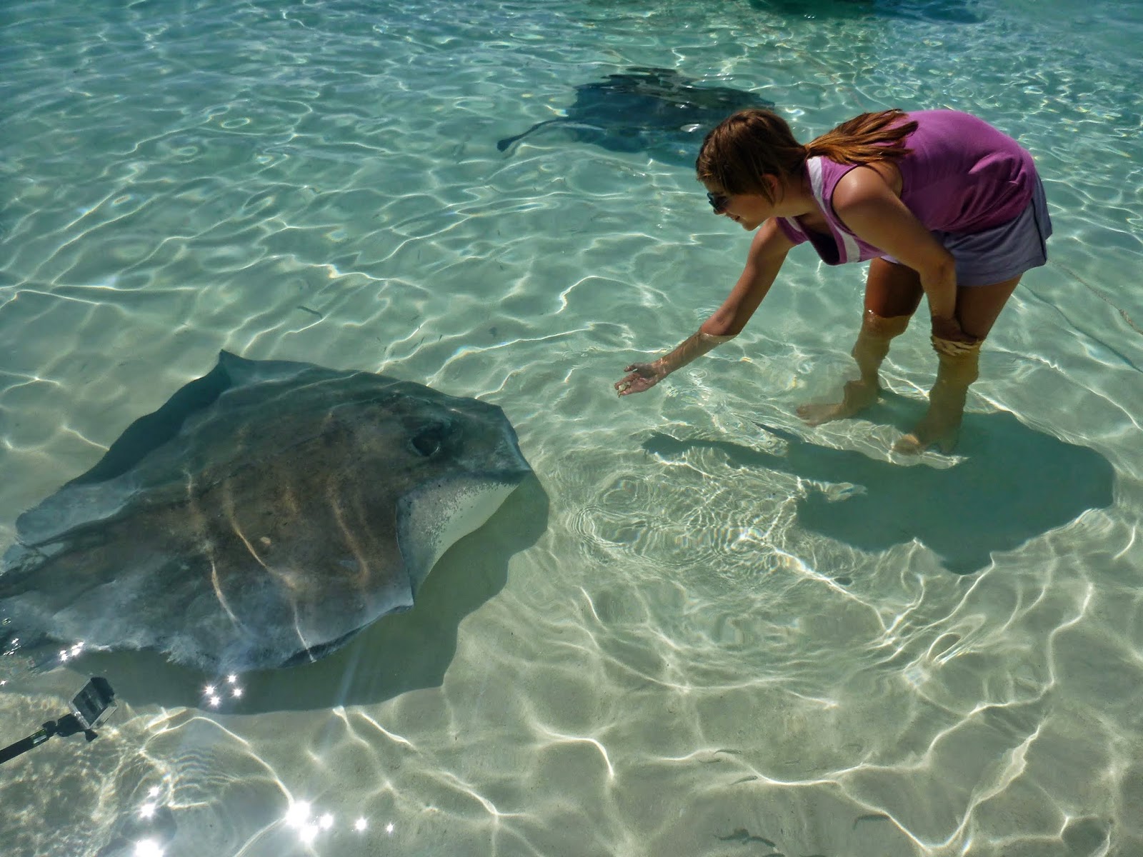
Man, was that good.  Emily enjoyed petting the tame sting rays
that were also enjoying the conch discards.

From Georgetown we moved northwest to Rudder Cut Cay where
we took shelter from the wind that would clock from southeast to west to north
within 24 to 36 hours before returning to the normal easterly direction.  This happened each time a cold front went
through which was happening about every 5 days. 
We had to plan our moves to enjoy the south wind while moving north but
find good shelter from the clocking winds after arrival.  Because of the limited anchorages giving
shelter from the west winds and the sheer number of cruising boats, it was a
challenge to find room. 

We saw 3 good
sized boats driven hard aground on reefs. 
This fellow tried to anchor near me but was convinced (by me) that there was not
enough room and anchored elsewhere.  The
next morning, he was hard on a reef and was pulled off by the blue salvage
vessel.

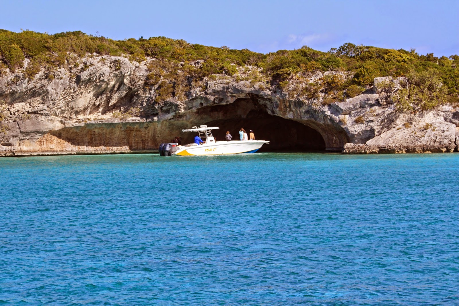
The water was clear at Rudder Cut Cay.  Kim and Emily Snorkeled each day collecting
shells.  We saw an underwater statue here
too before moving north to Big Majors & Staniel Cay. Check out the eyes on the milk conch in the photo below.

 
We enjoyed feeding the swimming pigs again and snorkeling
Thunderball Cave.  The nurse sharks are
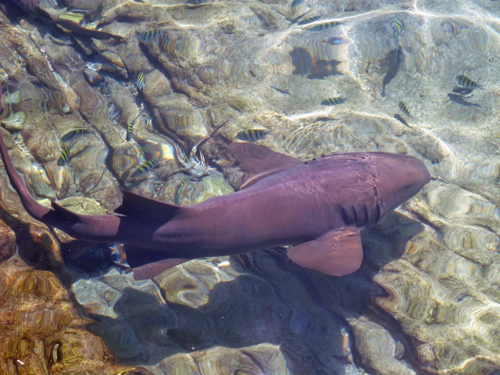
still hanging around the dingy dock at the yacht club waiting for handouts.

 
Warderick Wells was our next stop but was a disappointment
because we were looking forward to feeding the sugar birds (bannaquits).  During our 2009 stop, the rangers handed out
sugar and Emily had swarms of the birds on her tiny hands.  Environmental Nazis have now stopped handing
out sugar and they discourage feeding them. 
We ignored their idiocy, took out our own sugar and found at least one
bird that remembered the good old days with us. 


Tom and Emily hiked up towards Boo Boo Hill and Tom slipped on some
loose rocks and found a different type of Boo Boo.  Despite a bloody knee we enjoyed the views.

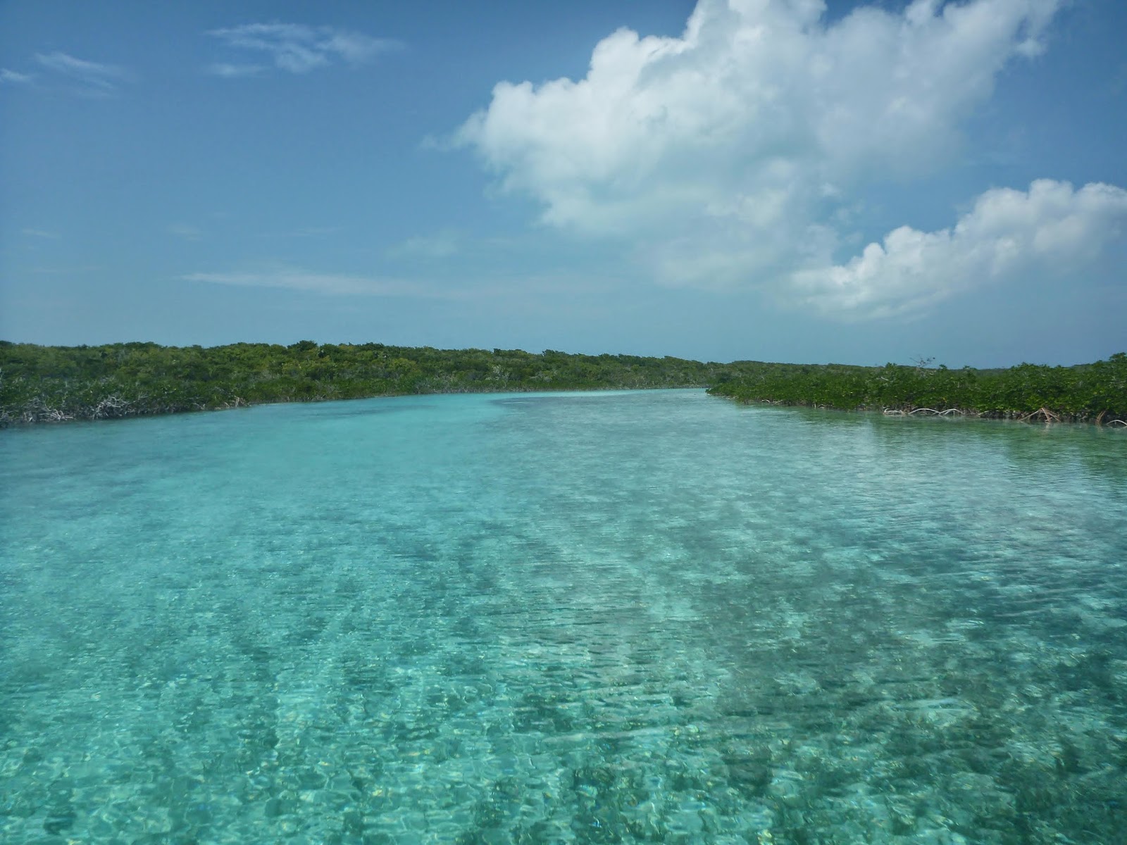
After Wardrick Wells, we stopped at Shroud Cay.  This island was new to us and we enjoyed
taking the dingy through the winding mangrove streams all the way to the
eastern side and a powder white beach.


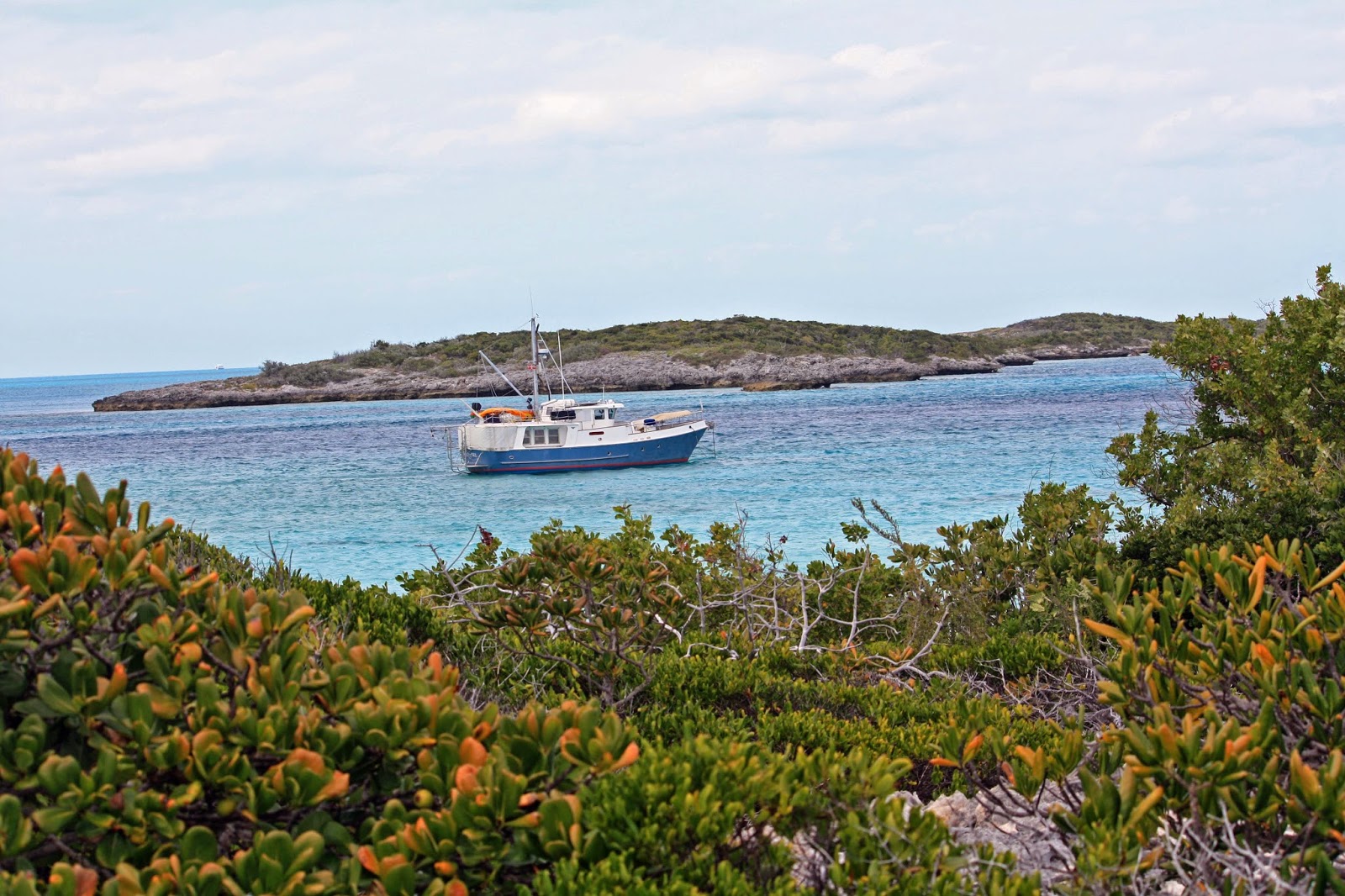
Our last stop in the Exumas was Allen’s Cay.  Although crowded in the main anchorage, we
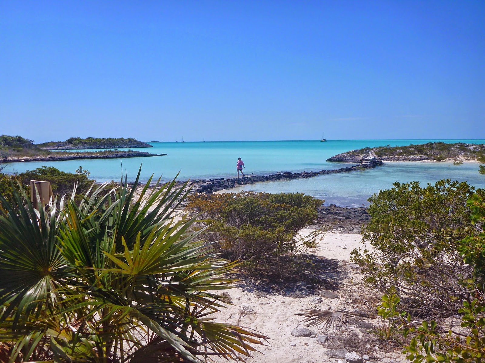
found just enough room to set our hook in southwest Allan’s Cay.  We were all alone with our private white
sandy beach. We were a bit anxious as the winds rose to 25 knots and started
clocking around.  At two points in this
process the stern of Emily Grace was only about 30 feet off the jagged coral
coast.  The anchor was dug in hard however
and held well.  This was not the first
time we were thankful for our oversized 120 lb Spade anchor!

 
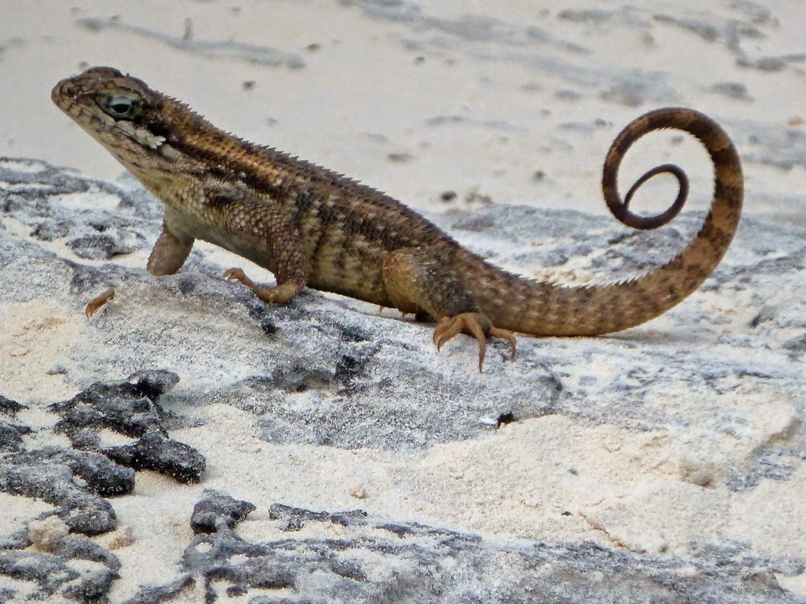
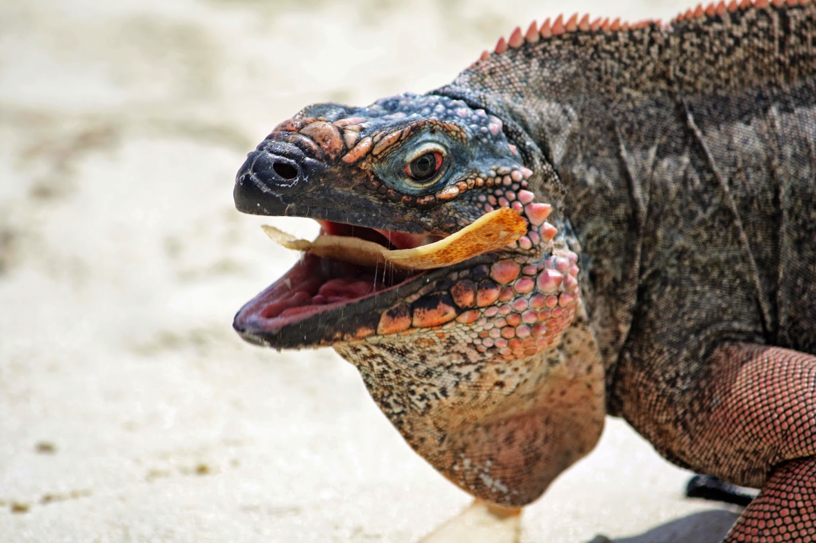
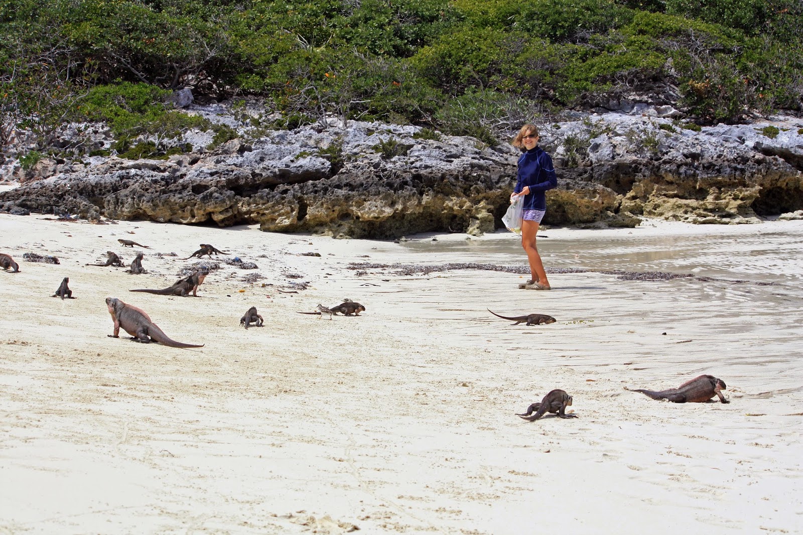
The big attraction here is the iguanas.  That same private beach in our cove would
swarm with hungry iguanas every time we would come to shore with our table
scraps.  Judging from their numbers, they
seem to be doing just fine.

From here we will make a short hop northeast to Spanish
Wells at the north of Eleuthera before heading up to the Abacos.  These are all new islands to us and we are
anxious to see what they have to offer. 
Come along.

Tom

The Exumas

We spent about 5 days in Georgetown.  We never found a lot of Kid boats but it had not changed much since 2009.  They still had an active VHF radio net each morning and plenty of organized activities.  Tom took advantage of the VHF net to advertise to the 300 cruising boats anchored here and unload some used items.  We sold our old back-up dingy, 2 HP outboard motor and all of our paper Caribbean charts to 3 different cruisers.  Here is a pic of our old dingy being towed away…it had no patches but it was almost 10 years old.

We also found the Chat ‘n Chill conch bar was still there and we ordered up 3 salads for a beach snack.  We watched them bring 3 conchs up from the beach, open and clean them and then chop them up (raw) finely with fresh onions, peppers, tomatoes and they drowned it all in lime and orange juice.  I even had them add a little diced habanero hot pepper to mine for some extra zip!  

Man, was that good.  Emily enjoyed petting the tame sting rays that were also enjoying the conch discards.

From Georgetown we moved northwest to Rudder Cut Cay where we took shelter from the wind that would clock from southeast to west to north within 24 to 36 hours before returning to the normal easterly direction.  This happened each time a cold front went through which was happening about every 5 days.  We had to plan our moves to enjoy the south wind while moving north but find good shelter from the clocking winds after arrival.  Because of the limited anchorages giving shelter from the west winds and the sheer number of cruising boats, it was a challenge to find room. 

We saw 3 good sized boats driven hard aground on reefs.  This fellow tried to anchor near me but was convinced (by me) that there was not enough room and anchored elsewhere.  The next morning, he was hard on a reef and was pulled off by the blue salvage vessel.

The water was clear at Rudder Cut Cay.  Kim and Emily Snorkeled each day collecting shells.  We saw an underwater statue here too before moving north to Big Majors & Staniel Cay. Check out the eyes on the milk conch in the photo below.

 
We enjoyed feeding the swimming pigs again and snorkeling Thunderball Cave.  The nurse sharks are still hanging around the dingy dock at the yacht club waiting for handouts.

 
Warderick Wells was our next stop but was a disappointment because we were looking forward to feeding the sugar birds (bannaquits).  During our 2009 stop, the rangers handed out sugar and Emily had swarms of the birds on her tiny hands.  Environmental Nazis have now stopped handing out sugar and they discourage feeding them.  We ignored their idiocy, took out our own sugar and found at least one bird that remembered the good old days with us. 


Tom and Emily hiked up towards Boo Boo Hill and Tom slipped on some loose rocks and found a different type of Boo Boo.  Despite a bloody knee we enjoyed the views.

After Wardrick Wells, we stopped at Shroud Cay.  This island was new to us and we enjoyed taking the dingy through the winding mangrove streams all the way to the eastern side and a powder white beach.


Our last stop in the Exumas was Allen’s Cay.  Although crowded in the main anchorage, we found just enough room to set our hook in southwest Allan’s Cay.  We were all alone with our private white sandy beach. We were a bit anxious as the winds rose to 25 knots and started clocking around.  At two points in this process the stern of Emily Grace was only about 30 feet off the jagged coral coast.  The anchor was dug in hard however and held well.  This was not the first time we were thankful for our oversized 120 lb Spade anchor!

 
The big attraction here is the iguanas.  That same private beach in our cove would swarm with hungry iguanas every time we would come to shore with our table scraps.  Judging from their numbers, they seem to be doing just fine.

From here we will make a short hop northeast to Spanish Wells at the north of Eleuthera before heading up to the Abacos.  These are all new islands to us and we are anxious to see what they have to offer.  Come along.

Tom

Catch-up Article – Trawlerfest Return and Sea Trial Enroute to Palm Beach

Reader Note: I like to blog in a linear sequence and for most of the last 3 1/2 years have managed to do so. The process of commissioning the 63 has definitely interfered with my objective.

This article covers the return from the Lake Park Trawlerfest on March 2 and the cruise to Palm Harbor Marina on the 15th.   The 13 days in between were spent at Marina Bay Marina working with Outer Reef to resolve items on the punch list.  The “fun” I had during those 13 days is documented in two articles: “Stress, Stress and More Stress” and “A Day in the Punch List Life.”

Speaking of the Punch List: We had 7 items outstanding and 5 more on the Pending List when I started writing this article (on March 24). At that time 70 items had been resolved.  This list had grown as we discover (and finally report) new issues.   Again, the good news is that most stuff fulls into the annoyance category and the better news is that Outer Reef has been great about making problems go away.  As of this writing there is no open items on the active Punch List with 9 on Pending List.

Trawlerfest Return:

The Trawlerfest ended on Saturday March 1.  We planned to depart on Sunday morning for our return to Fort Lauderdale and Marina Bay Marina to complete (or attempt to complete) the commissioning/outfitting process.

Late Saturday afternoon Mike introduced me to Craig Parkhurst from Wheelhouse Technologies, Outer Reef’s supplier of maintenance management software.  While not Greek, Craig came bearing gifts (well a gift) in the form of a brand new 64K 4G enabled iPad Air.  That iPad held the following;

  • A 115 page Outer Reef Owners Manual customized for the 63 Motoryacht
  • All of the owners manuals for the equipment installed on the 63
  • The Wheelhouse Technologies maintenance management application

Explanatory Note – Wheelhouse Technologies: This program enables a boat owner (or Captain) to totally manage the maintenance of the boat.  The program works on time and hours (engine, generator and tender) to alert the owner with regard to required and suggested maintenance.  The program allows you to record maintenance performed including parts used, labor time, cost etc.  It even allows you to upload scanned work orders and invoices associated with a maintenance or repair item.  Another key feature is parts numbers for every system on the boat and the ability to order parts on line and have them shipped to your location.  There’s more but this is not a sales pitch for Wheelhouse.  The software is fairly intuitive and I’ve already begun to use it.

Craig and I hit it off and I invited him to accompany me on the 55 mile run back to Marina Bay Marina.  He was a welcome addition to my temporary crew.  Craig’s accompanying me allowed Diana and Kodi to return to Marina Bay by car.

The trip back to Fort Lauderdale was relatively easy as the wave heights (3 to 4) were less than forecasted (4 to 5s).  Our route of travel took us down the ICW to Worth Inlet, out to the ocean and south down the coast to the Port Everglades Inlet and then north on the ICW to the New River.  The trip took 6 hours and 15 minutes.

As we headed south from Worth Inlet Billy Black, considered one of the best marine photographers in the world took photos of Guided Discovery underway.  We met Billy again when he did an evening photo shoot for Outer Reef.

Billy Black snapping away
Billy Black

The New River, the final leg of the journey, is always challenging but especially so on a lovely Sunday afternoon.  A boat coming out of a launch almost hit us around Las Olas Blvd (he ultimately backed up into a piling  – thunk!) and I learned some importance lessons about disengaging the synchronizer and stabilizers when navigating in tight waters.

Heading toward the New River we are passed by a 48 Sundancer

Craig graciously helped me wash down the boat after we tied up.  It took the two of us two hours (or do the math – four man hours) to clean up the boat after running in seas with spray.  This was the first time I had washed the boat.  It was a big job and together we did a first class job.  Glad I had help.

Off to Palm Beach and Passagmaker Sea Trial:

We were scheduled for our “installation” into the Palm Beach Boat Show on Sunday at 10:00 AM. Unfortunately, to cover the 55 miles from Marina Bay Marina to the show’s location just south of the Flagler Memorial Bridge and arrive at 10:00 AM we would have had to leave at 3:00 AM.  Not a good idea.

So I decided to “stage” the boat on Saturday at a marina close to the show.  We (actually Pam Rose) chose Palm Harbor Marina, which is located just 300 yards north of the show.  On this trip I accompanied by Pam, my part-time assistant Captain, and Milt Baker, a Passagemaker contributing editor and his lovely wife Judy.  We departed the Marina Bay Marina docks at 9:00 AM.

A little background.  I started reading Passagmaker Magazine way back in the late 90s when Diana and I were considering early retirement and the purchase of a trawler (actually the Nordhavn 50 that we almost bought).  Passagemaker is, in my opinion, the best boating magazine out there.  Its articles are interesting and educational and totally focused on the cruising lifestyle.

Passagemaker had decided to do a feature article on our 63 and Milt was aboard to perform a “standard” Passagemaker Sea Trial.  Judy came along for the ride and brought her charm and tasty sandwiches.

Why our boat?  Our 63 Motoryacht (or LRMY – Long Range Motor Yacht) is the first one built for a US owner.  While Outer Reef has built other 63s, they have all been of the Cockpit Motor Yacht version shown in the photo below.  What’s the difference?  While essentially the same boat, the LRMY has a longer salon, larger aft deck, longer boat deck and a massive lazarette.

Outer Reef 63 CPMY
Our 63 LRMY

There were clearly three highlights to this trip.  The first was the run down the New River, which was my best and fortunately last outing on that busy piece of water.  The second was the sea trial and the last was Palm Harbor Marina where we were one of the smaller boats.

After we headed north we performed the sea trial, which took two hours.  It consisted of running the boat on reciprocal courses (to adjust for wind, seas and current) from 1,000 RPM to WOT at 2,539 RPM.  We were in 3 foot seas during the test which made getting GPS SOG (Speed Over Ground) readings difficult. The turbulence bounced the reading all over the place.  Milt tracked SOG, fuel consumption and decibel readings at each RPM.

Milt’s speed and fuel consumption data essentially mirrored Tania’s sea trial results which I published last October (Sea Trial in Taiwan).  However, Milt then adjusted his numbers for a 10% fuel reserve.  At 1,500 RPMs Milt found our speed to be 8.9 knots with fuel consumption at 9 gallons per hour  (Note: Tania recorded 9 knots and 8 GPH at 1,500 RPM).  This yielded a range of 1,100 miles.  He also measured sound levels in the Pilothouse, Salon and Master Stateroom, which were 60, 63 and 63 respectively.  Between 60 and 70 in considered a moderate sound level equivalent to conversational speech.  These reading confirmed what we already knew.  Guided Discovery is a very quiet boat underway.

Milt Baker, Judy Baker and I pose for a photo at the end of the Palm Beach run

I found Milt and Judy fascinating.  Milt crossed the Atlantic Ocean in his Nordhavn 47 trawler and has logged over 35,000 miles.  He is the founder of Bluewater Chart.  Not surprising his boat is named “Bluewater.”

Milt & Judy Baker’s Nordhavn 47 crossed the Atlantic Ocean

Milt shared with me the final paragraph of his article which I will now share with you.

“A month ago I knew little about Outer Reef yachts, but I come away from my sea trial experience very impressed in a good sort of way.  What I like best, perhaps, is that Outer Reef Yachts places a high priority on keeping its customers happy—before, during and after the sale.  Les says the word  “no” is just not in their vocabulary.  Price will surely rule out an Outer Reef for many PassageMaker readers, but for a cruising couple with the means and the desire to travel to far-off ports in a safe and elegant motor yacht, a boat like Les Shapiro’s could be just the ticket.  An Outer Reef 630 LRMY would look right at home in most any yachting port in the world.”

Reader Note: It’s 1:00 AM on Wednesday April 2 and by blog is finally caught-up as is most of me personal stuff.  HURRAH!  We are also ready to start cruising north cruise with our good friend’s Darrell Peters and Sue Lister on Present Moment.  Stay tuned for “timely” updates on our cruising experience.

Written by Les.

    Day 81 – 365 Project…Red-headed Woodpecker

    Welcome to day 81 of  365 photos…saw this gorgeous  red-headed woodpecker just before we were heading back home for dinner today. I was hoping for a flight shot but he was content right there on that tree. What a pretty bird this woodpecker is.  Click on photo for a larger view.Camera: Nikon D7100 – Lens:… Continue Reading

    The post Day 81 – 365 Project…Red-headed Woodpecker appeared first on Moosetique Musing.

    Boys and Their Toys.

    No really.  This little boy visits our neighbor often and whenever he does he comes over to play with our dogs.  He was picking up the dogs’ toys  and tossing them in the dogs’ pool.  Ruby doesn’t want her toys in the pool and pulls…

    THE ARGONAUT April 2, 2014

    CAPTAIN’S LOG March 15 – 31   Santa Marta to Cartagena de Indias to Bogota’ This morning we are at sea about 200 miles east of Colon, Panama.  I am on watch.  It is 0900, and my watch began at 0700.  Everyone else is asleep.  The Trade Winds are blowing us and the sea, which is a rolling three to seven feet on our starboard quarter.  I love listening to classical music at this time of day; no one is around and I can turn up the volume as much as I want.  The wind is fresh, the sky is a little…

    THE ARGONAUT April 2, 2014

    CAPTAIN’S LOG

    March 15 – 31   Santa Marta to Cartagena de Indias to Bogota’

    This morning we are at sea about 200 miles east of Colon, Panama.  I am on watch.  It is 0900, and my watch began at 0700.  Everyone else is asleep.  The Trade Winds are blowing us and the sea, which is a rolling three to seven feet on our starboard quarter.  I love listening to classical music at this time of day; no one is around and I can turn up the volume as much as I want.  The wind is fresh, the sky is a little pink, and the sun is rising.  It is great to be alive!


    We left Santa Marta yesterday morning after ten days in Colombia.  This is a wonderful country and we are so glad we came here.  It is clean, it offers very interesting tourist experiences, great food, very friendly and accommodating people, and a rich history and culture.  People work here; no one is loafing. Colombians seem very happy and good natured with an easy sense of humor, yet there is a welcomed interpersonal formality that reflects respect.  It is very safe; we felt no sense of insecurity anywhere, and travel was easy to arrange once we were here.


    We arrived Friday March 14 at 0200.  The next day we completed formalities and looked over the town as I reported in my last blog.  Saturday we arranged for a trip to Cartagena and Bogota.   On Sunday we hired a private van to take us by road to Cartagena de Indias.  The fare was a suspicious $35 each for a four hour drive.  As it turned out the van wasn’t really private, unless you think eight people stuffed in a little Korean crap box was a private vehicle.  Our fellow passengers were foreign travelers like us, and luggage was stuffed everywhere.  Anyway, the drive along the coast gave us a chance to see Colombia.  The coast from Santa Marta to Panama and beyond to Ecuador is mostly mangrove wetland.  There are some beaches, but for the most part it is brackish inlets and swamps.  Small, seemingly poor fishing villages dot the coastline except for Barranquilla, a very large city located at mouth the Rio Magdalena, the country’s largest river.  Barranquilla is the third largest port after Cartagena and Santa Marta.    The road was in some places a four lane interstate highway, then, when it entered a town, would converge to two lanes before leaving the town and returning to four, maybe.  This part of Colombia is arid.  Although the Trade Winds blow constantly and are heavy with water much of the time, the rain isn’t released on the coast at this time of year, rather the clouds float over the coastal mountains, hit the Andes and drop their payload.  In Santa Marta it hasn’t rained for four months.


    The Andes (called the Sierra Nevada de Santa Marta at this location) in Colombia are divided into three parallel mountain ranges, the Cordillera Oriental (the nominal Andes), the Cordillera Central, and Cordillera Occidental.  The tallest range, the Oriental, begins a few miles east of Santa Marta, where a 16,000 mountain called Mount Bolivar rises from the sea.  The three ranges lie along a southwest path to Ecuador where they merge and turn south and continue down the continent ending at Tierra del Fuego in Chile.  As the Trade Winds strike the Andes at Santa Marta, some of the wind is directed south to the Amazon basin on the south side of the Cordillera Oriental providing rain and moisture to the Amazon Basin.  Bogota’ is located on their northern slopes at a level of almost 9, 000 ft.  On the southern side of these mountains lies the Amazon Valley, which occupies about half of the land mass of Colombia.  Some of the air moves inland between the northern slope of the Andes and the other mountain ranges, the area between which are long, wide, and verdant valleys.  The Rio Magdalena, Colombia’s largest river, flows through the valley between the Central and Oriental Mountains to Barranquilla where it ends in the Caribbean Sea.   From the air, these valleys look like California’s Central or Sacramento Valleys, although more green and lush.  Medellin, Colombia’s second largest city lies at the northeastern end of the Cordillera Central.   Cali, third largest, is south of Panama and on the interior side of the Cordillera Occidental.  We were told that Medellin is the most beautiful city and Cali is home to the most beautiful ladies, although we unfortunately cannot verify these opinions as we didn’t have time to visit them. 


    About half of Colombia lies south and west of Panama.  The Pacific coast of Colombia is known as the Darien.   The southern part of Panama and this region are dense jungles formed on floating plant matter, sort of like peat. Part of the Darien is a rich savannah that supports the cattle industry in Colombia.  The wet part of the Darien will not support roads or structures, but it does provide a home to some of the most remote and primitive Indians on the planet.  It is also home to the drug cartels and their cocoa fields.


    Cartagena de Indias is best described by pictures, which I have posted on www.tischtravels.com.  Cartagena was “discovered” by the Spanish in 1506 and became site of their gold mint and was the principal port for the export of gold to Spain.  It was so important that the Spanish built the largest fort in the Americas, Castillo San Felipe de Barajas, named after the king.  Cartagena was the center of Spanish power because it was the point from which gold was shipped to Spain and of course it had to be protected at all costs.  In the late 18 century the fort was attacked by a large British force under command of General Edward Vernon whose intent was to dislodge the Spanish and take the nexus of Spanish power in the Americas for England.  However the campaign failed, although they did manage to take Port Arroyo in Panama, and Veracruz in Mexico.


    Edward Vernon’s family members were beneficiaries of a land grant in Virginia from the King of England.  They were also friends of the Washington family.  In fact Lawrence Washington, George’s older brother fought in the Cartagena campaign as a British officer under Vernon.   Lawrence Washington bought some of the Vernon’s Virginia holdings and, after his death it was bequeathed first to his wife, and at her death shortly thereafter it fell to George, who named his plantation “Mount Vernon”.  Anyway, Edward Vernon lost the campaign to deny the Spanish the riches of Colombia and South America and it remained in Spanish hands until Colombia was granted independence in 1810 as a result of a revolutionary war led by Simon Bolivar (a Mason like GW). 


    There are five islands that form Cartagena and its harbor.  The historic center is on one of the islands and is an intact medieval city that once was home to Sir Francis Drake and others.  It is a UNESCO World Heritage site.  Like other Spanish territories it was the site of an active and vicious Inquisition, which extorted wealth from the rich and prosperous.  Today the former site of execution and torture is a public park named for Simon Bolivar.  Of the other four islands, two are home to beautiful high rise apartments and condos as well as designer shopping areas.   The other islands contain the sea port and the San Filipe fortress.  Cartagena is a beautiful, exciting, interesting city that offers some of the best restaurants we have encountered in our travels.


    Before the arrival of the Spanish, Colombia and the locality of Cartagena had long been a crossroads of trading activity between the various tribes of the Americas, including the Incas and Aztecs.  Native peoples inhabited this region for perhaps 20,000 years, and developed a very sophisticated culture and economy, including irrigated fields, trading over long distances and a robust belief system.  Among other beliefs, they worshiped the sun as the source of all power, and gold represented the sun.  Gold could easily be found in the sands of the Rio Magdalena near Barranquilla.  Native peoples created the lost wax method of jewelry making and fashioned beautiful objects of gold, including gold bells to adorn tree branches at the site of buried family members.  From what I could discern, their belief system was very similar to other ancient peoples, and included a belief in an afterlife and the need to send off the deceased man with his principal wife (they were allowed twenty), and as many of his belongings as would be necessary to get him started in the afterworld.  Corpses were usually adorned in gold if they were of a high rank.  The museum in Cartagena and Bogota’ have wonderful pieces of gold art that survived the Spanish plundering of the native civilization. 


    One of the more interesting ancient beliefs that seems to have persisted to this day and can be seen in everyday Colombian life is the idea that fertility in the female can be best predicted by a large bottom, or in modern parlance, a big booty.  Younger women here show as much as possible, wear the tightest clothing possible, and accentuate their derrière in a way that appeals to the primal instincts of man, those same instincts that the church has tried to stamp out for 2100 years.  Colombia also sports the fifth highest use of plastic surgery in the world.  Women here employ all the tools God gave them, and a few developed by modern technology, to enhance their natural endowments as much as possible. 


    After four delightful days in Cartagena we flew to Bogota’, the capital city.  Formerly known by the indigenous peoples as El Dorado, Bogota lies about 400 miles southeast of Cartagena on the northern slopes of the Andes, 9,000 above sea level.  The city is home to about 8,000,000 people and is the largest city in Colombia.  It is a lovely city with modern high rises, broad thoroughfares, large parks, and clean streets.  We stayed in the nicest part of town and devoted one day to touring its major sites. The major points of interest are the “T” zone near our hotel, which is the center of the city’s restaurant and night life.  The restaurants are world class, lovely with good service and wonderful food.  The Monserrate Sanctuary and former monastery atop one of Bogotá’s’ highest peaks is a spot not to be missed because of the panoramic view of this huge and sprawling city.  The historic Spanish center known as the Candelaria is colorful, very interesting and home to the Botero Museum.  Here you can see the delightful paintings and sculptures of Botero that are sure to bring a smile.   A few blocks further down the hill is the city center and large Public Square, characteristic of Spanish cities.  On the south side is the Catholic Cathedral and offices of the Archdiocese, across the square is the office of the Mayor, and on the other two sides are the National Capital and the Palace of Justice.  Behind the capital is the Presidential Palace. The Palace of Justice was rebuilt a few years ago after a fire that destroyed it.  The fire was set by the minions of Pablo Escobar who were attempting destroy evidence of his misdeeds.  


    We enjoyed our week poking around Colombia, but now it was time to get back to ARGO and get underway for Panama.  I wasn’t looking forward to the Caribbean again, which offers potentially high winds and seas, and our trip would take two days.  As it turned out, our trip was fine and we arrived in Colon on the Caribbean side of Panama right on schedule.  Our only problem was the failure of our water maker, which caused a certain level of anxiety and consternation.  We took the whole thing apart at sea, I was crawling around places on the boat I had hoped I would never have to crawl into, but things worked out and the water maker hobbled along.  We are going to transit the canal today (3/31) and tomorrow, and we will complete the story then. 


    Thanks for looking in on us.


    Randy and Rebecca

    Start your own blog now! Free!

    Finding A Winter Home.

    Before the day was done, upon our arrival at Fernandina Harbor Marina, the winds began to pick up and continued to increase for almost a week. This was the weather system that we were trying to stay ahead of and the reason we planned a marina stop inst…