Archive | Beach House RSS feed for this section

Part 2 – Anchoring in the Gulf Intracoastal Waterway – Cape Sable, FL to Mobile, AL

Taken from The Great Book Of Anchorages, Cape Sable, Fl to Mobile, Al, including the Okeechobee Waterway..

The Big Bend–Crystal River to Carrabelle (Mile 46 to Mile 164)
Many boats, especially those with deeper drafts, use Anclote Key as their jump off or arrival point from the Carrabelle area. Even we used to be under the impression that the Big Bend region was only for shoal-draft boats, but it really isn’t. The main thing you have to contend with is the distances in from deeper water to the river entrances, usually about 10 miles. Then add another 10 miles or so to the anchorages.

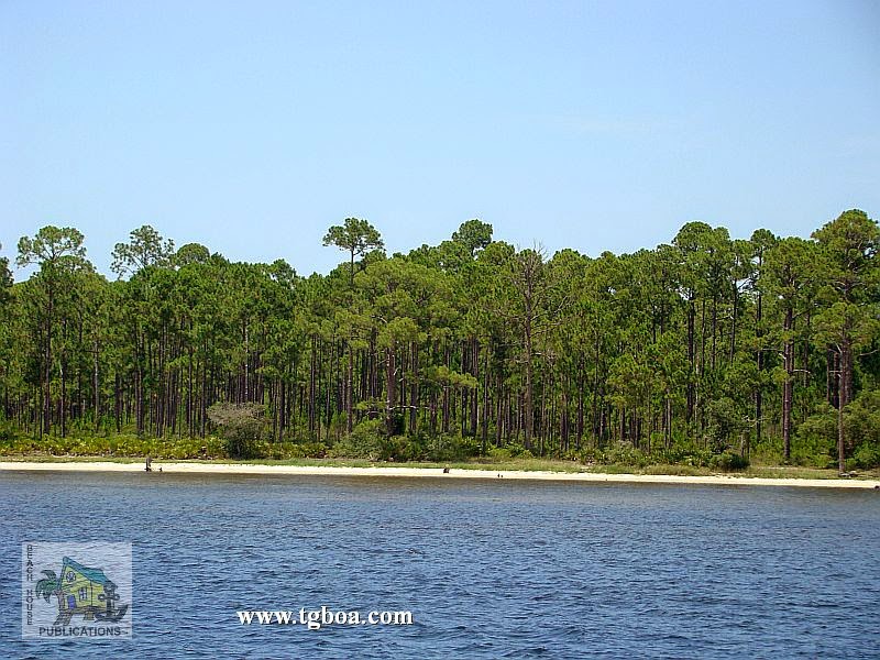
About 46 miles north of Anclote Key is the Crystal River, your first stop on the Big Bend route heading north. Yes, there is a 5-foot bar near the river entrance, but on a rising tide, even vessels drawing 6 feet can enter and travel upriver. The river itself is deep and once in Kings Bay, you can find a spot with enough water to drop the hook. A grocery store, laundry and marine supplies are all close by. Next, a short distance north, is the Florida Barge Canal. There are no depth issues here, with 7 feet at MLW being about the lowest you will see out in the Gulf and a consistent 10-14 feet in the canal itself. It’s a protected spot next to a park where you can walk, bike or hike and just a little over a mile to provisions to the north.

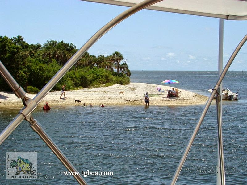
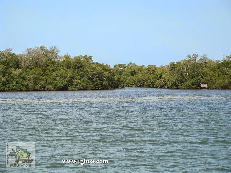
Making a short trip out, then northeast into the Withlacoochee River, you will not see anything less than 7 feet. The Withlacoochee is absolutely beautiful. Plan on stopping here to wait out a weather system or simply to rest and relax. It is truly “Old Florida” at its finest. After coming out of the Withlacoochee, head west about 10 miles toward Seahorse Reef, then north into the Main Ship Channel to visit quaint Cedar Key. Anchor either by Seahorse Key or near town, depending on the wind direction. You’ll need to come out the same way you entered, however, as the Northwest Channel has shoaled to the point where it is not recommended by locals to use.

With at least 7-foot depths over the northern portion of Seahorse Reef, you can easily cross over and continue on your way to the Steinhatchee River, a reasonably comfortable day’s journey. You will find 6-foot areas in the entrance channel so a rising tide is recommended for deeper draft vessels, but those areas are few and far between, so don’t let that stop you from visiting this quiet little fishing village. The river offers a number of anchoring options. all within a short dinghy ride to shore. Then walk to grocery or hardware stores.

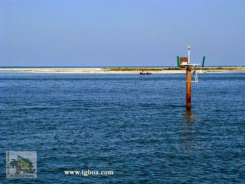
The next leg of the Big Bend takes one to the St. Marks River. With the exception of a brief period of 8-foot depths at a bend in the lower section of the river just north of the lighthouse, the rest of the river is quite deep. A number of anchoring options present themselves here as well. Restaurants, a small grocery and marine supplies are available.

A relatively short trip will carry you down Apalachee Bay, around South Shoal and then into Alligator Harbor to anchor at Peninsula Point. With 7-foot depths in the approach channel, this too is a viable option for most cruising vessels and a pretty stop for the night behind a lengthy sand bar. One more short hop west takes one to Carrabelle, the end of the Big Bend and the beginning of the East of Harvey Lock portion of the Gulf Intracoastal Waterway. The little town of Carrabelle is a great spot to provision, dine and just to visit in general. It’s a friendly place with anchorage in the protected harbor. But don’t forget to visit the beautiful anchorages behind Dog Island. These anchorages are open to the north, but are protected from the prevailing afternoon sea breezes. Do not miss this lovely island.

GIWW EHL FL–Carrabelle Beach to Perdido Key State Park, FL (Mile 378 to Mile 170)
If you don’t need to come into town or want an easy start in the morning, anchor off Carrabelle Beach, located down the river and around to the west. This is also your starting point for this stretch. Continuing southwest along St. Georges Island, one finds another group of beautiful anchorages, some more protected than others. Rattlesnake Cove is a cozy spot for shoal-draft vessels. Gap Pt. to the east has better depths. All of these anchorages, however, share one thing–they are open to north winds blowing across the sound from the mainland, but are great in prevailing winds.

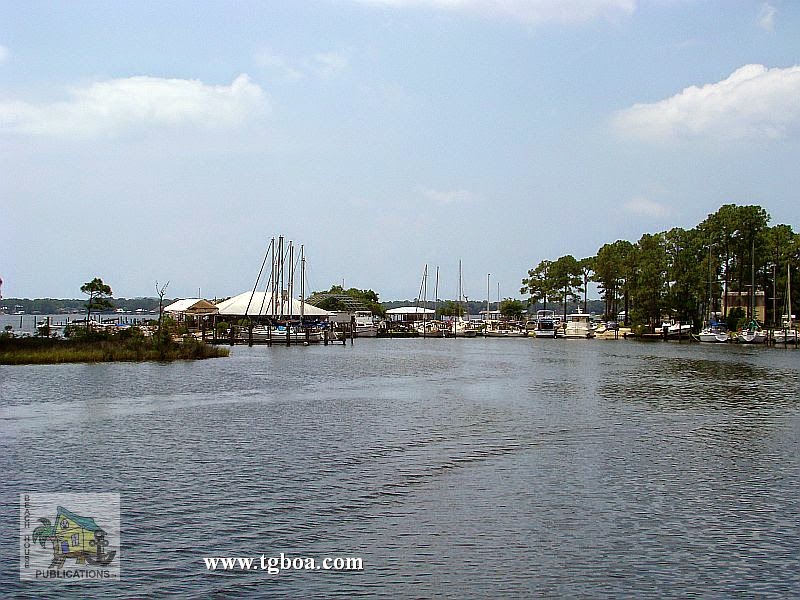
At the southwestern end of the sound, a turn to the north finds one in Apalachicola. This super little town continues to try to find ways to lure the cruiser to visit. They have free docks just to the north of the fixed high-rise bridge as well as a long wharf along the waterfront to which one can tie during the day. If you prefer to anchor, it’s a short ride across to the floating dinghy dock at the wharf in the mouth of Scipio Creek. The next section of the GIWW takes you away from the beach and into beautiful, protected forest and swamp. The Pinhook or Saul and Searcy creeks are well-protected options within the next 15 miles. Then one arrives at White City, a public park belonging to the county, which has a floating dock along the canal for deeper-draft boats or fixed docks for boats that draft less than 6 feet in the basin.

A little more than a mile northwest in the GIWW, the Gulf County Canal heads southwest to Pt. St. Joe and St. Joseph Bay. The significance of this 5-mile-long canal that accesses the Gulf is that if you cannot clear the 50-foot Dupont Bridge, some 33 miles northwest near Panama City, you must go offshore here and come in via the inlet into St. Andrew Bay to visit Panama City. You’ll not be very happy to cover all of those miles to find you need to turn around and go back out at St. Joe Bay! The good news is there are some great anchorages in St. Joseph Bay, which we’ve included, and it’s only a day run to Panama City along the coast. Anchor near Port St. Joe and walk to provisions or the nice downtown area shops and restaurants, and then visit the great beach anchorages on St. Joe Peninsula. The bad news is you’ll miss some cool anchorages in the GIWW.

Back on the GIWW from Gulf County Canal to the Dupont Bridge, there is a 20-mile stretch of waterway with only one viable anchorage, Wetapoo Creek, and then the waterway opens into East Bay with its many bayous to choose from. Some are good for overnights where others are good for sitting out bad weather. Although they each have some sort of shore access for your pet, you’ll have to wait to reach Panama City for any provisioning. Once through the Dupont Bridge at SM 295.5, the very protected Pearl Bayou opens to the southwest. Even sailboats with tall masts will be able to visit here by coming through the deep inlet into St. Andrew Bay. The bayous on the north side between here and SM 290 will provide boaters an opportunity to access provisions while the bayous on the south side, like Smack Bayou, will be primarily for holing up for weather or getting away from it all. Watson Bayou to the north is one of our favorites.

St. Andrew Bay gives folks another opportunity to get their beach fix with some great anchorages behind Shell Island and in Grand Lagoon, both part of St. Andrews State Park. The downside of these anchorages is that there is a lot of local boat traffic throwing wakes. They are also very busy during the summer and on weekends. Also, be aware that dogs are not allowed on state park beaches in Florida. The St. Andrew Bay/Panama City area is another spot where tall-masted vessels will be able to visit, but can only travel so far without turning around and going back out the inlet. We’ve already covered the restriction of the Dupont Bridge to the east. To the west, your next height restriction doesn’t come for a long time, but again, it will ruin your day(s) to find you have to turn around and travel many miles to get back out into the Gulf. Though over 60 miles away, you may be restricted by the 50-foot Brooks Bridge just west of SM 225 in Ft. Walton Beach and the 49-foot bridge at Destin, leading from Choctawhatchee Bay to the Gulf of Mexico. If your mast can’t clear these bridges, you’ll have to run from St. Andrew Bay to Pensacola offshore, a distance of about 90 miles that we’ve done in an overnight run.

If you can run the inside route from Panama City, you’ll have a couple of nice, peaceful options to anchor for the night before making the 20 mile or so trek through the land cut sometimes known as the “Grand Canyon” for it’s unusual sand and rock formations. In North Bay there’s Upper Goose Bayou for east winds, and in West Bay, Harrison Bayou for west winds and Burnt Mill Creek for north winds. At the west end of the canal, you’ll be in Choctawatchee Bay. Pick an anchorage there based on wind direction if you are ready to stop for the day–just outside of the canal for east winds or either end of the 65-foot bridge for north or south winds. If you feel like continuing on, your next option is going to be another 8 miles beyond the bridge on the south side of the bay in Hogtown Bayou; another beautiful, quiet spot with little traffic. Beyond here it’s another 10 miles to any reasonably protected anchorage short of just pulling off to the side of the bay in the mouth of a shallow bayou or cove. Because they offer little to no protection, we have not included them here, but there are options. After passing under the 64-foot bridge that runs from White Pt. to Moreno Pt., head north into Rocky or Boggy bayous for some great anchorages or south into Joes Bayou at SM 230 and back into the very protected basin in the southeast corner. You’ll have a lot more traffic in the latter than the former.

A few miles farther on brings you to Destin. If you can clear the 49-foot bridge, you can enter Destin Harbor or access the GIWW from the Gulf. It is incredibly busy in this area on weekends and during the summer, but if you’d like, take care with the constant shoaling and current turning in here, then anchor wherever depth and space allows outside the marked channel in the harbor. Boats also anchor before the bridge in Cinco Bayou to the northwest of Destin. Cinco and Garnier bayou’s inner recesses are only accessible by vessels that can clear the 19-foot bridges that cross their entrances, leaving them out for most cruising boats. At the west end of Choctawhatchee Bay is the 50-foot Brooks Bridge and the entrance to The Narrows. The Ft. Walton Beach Free Dock is just west of the bridge to the north. This is a great provisioning stop as a major grocery store is just blocks away to the northeast, but be careful crossing this busy road. There is no power on the dock, but pump-out and water are available on the dock, and trash cans, recycle bins and restrooms are located in the park. You will be bothered by wakes here so fender well.

The next 10 miles of Santa Rosa Island is in a restricted area occupied by the military so if you anchor along this stretch, land on the mainland side if needed. Navarre Causeway is another easy access point to shopping with a grocery store right across the street from the anchorage by the bridge. For the next 10-15 miles between the bridges, you can pull off toward Santa Rosa Island just about anywhere you’d like with plenty of depth, but for a specific anchorage, we recommend Big Sabine Pt. for the best protection. It is only open to the northeast, and even then, the shoals break up any chop. If you need more protection, Little Sabine Bay about 6 miles west offers 360° protection. After passing English Navy Cove to the north, another great anchorage for frontal passages, you will enter Pensacola Bay. Here, you can either continue west in the GIWW where it enters the land cut just north of Fort McRee, or head north to Pensacola, a city rich in military history. The free day dock downtown gives you access to the city’s restaurants and museums, then anchor for the evening across the bay in Old Navy Cove, or around and into Bayou Chico if more protection is needed.

Back in the GIWW, those of you who had to run offshore due to bridge heights will be able to re-enter here and pick up the waterway at Big Lagoon. If you want to anchor at Ft. McRee, make sure you only attempt entry from the west side as the east side near the inlet is shoal. There is plenty of water between the visible shoals on the west side to enter and anchor. Redfish Pt., a mile or so away, is a favorite amongst cruisers, but one of our favorite spots is farther down Perdido Key near Big Lagoon State Park. We anchor on either side depending on weather. It’s great to anchor, dinghy ashore, then walk across the dune to the Gulf beach. Again, the beaches are the highlight of Gulf cruising for us.

GIWW EHL AL–Orange Beach to Dog River, AL (Mile 167 to Mile 133.5)
The line between Florida and Alabama is a bit murky. Perdido Key is in Florida, but Ono Key is in Alabama. The 1st anchorage is on the way to Orange Beach, the spot between Ono and Perdido keys near the bridge–a good stop for the night. You’ll have Florida on one side and Alabama on the other. Our 2nd anchorage in Alabama is in Terry Cove, Orange Beach. It’s a 5-mile trek off of the GIWW to get there and it’s also a very busy place. Just north of the GIWW, Spring Branch and Palmetto Creek in Perdido Bay provide beautiful, sheltered anchorages for those who draw 5 feet or less. Continuing west is the gorgeous, protected Roberts Bayou, with good eats and drink at the restaurant or the Arnica Bay anchorage next to a marina and restaurant, but exposed to wakes. Ingrams Bayou, another lovely, protected spot, is just around the corner to the north.

Anchor off the north side of Orange Beach for easy access to convenience stores and other services, or head up into Wolf Bay for quiet, pretty anchorages. These will be your last opportunities to anchor until you reach Bon Secour Bay, some 10 miles west. Upon exiting the land cut, the Bon Secour River entrance will be immediately to your north. These will be the last protected anchorages you will have until the Dog River northwest in Mobile Bay. Bon Secour provides a couple of adequate anchorages. Edith Hammock on the peninsula is a good spot for south winds, or head north some 20 miles to the Dog River in Mobile. Once beyond the marinas and restaurants, head west to anchor around the bend. This ends the coverage of anchorages from Cable Sable to Mobile.

Part 1 – Anchoring in the Gulf Intracoastal Waterway – Cape Sable, FL to Mobile, AL

Taken from The Great Book Of Anchorages, Cape Sable, Fl to Mobile, Al, including the Okeechobee Waterway…

A very different kind of cruising awaits the boater traveling on the Gulf Coast. For starters, there is no one system for keeping track of th…

Part 1 – Anchoring in the Gulf Intracoastal Waterway – Cape Sable, FL to Mobile, AL

Taken from The Great Book Of Anchorages, Cape Sable, Fl to Mobile, Al, including the Okeechobee Waterway

A very different kind of cruising awaits the boater traveling on the Gulf Coast. For starters, there is no one system for keeping track of the mileage for the various legs of the journey. Each section, the Southwest Florida Coast, the Gulf Intracoastal Waterway (GIWW), the Big Bend and the GIWW East of Harvey Lock (EHL–the distance east of Harvey Lock in New Orleans), has their own method–the Statute Mile is given in two of the sections and the other two use distances between waypoints/markers, leaving you to calculate the miles (which we have done for you). The biggest difference for us on the Gulf Coast is the beaches. With a few exceptions, you are generally traveling right along the coast, either just inside barrier islands or hopping from one island or river entrance to the next. And what could be more wonderful than always being close to the beach?

We begin coverage of Gulf Coast anchorages in Cape Sable, FL mainly because the major guide books and chart kits do this as well and you will be using them together. Although some of you will be Loopers using the book, you’ll simply need to work your way from back to front.

Southwest Florida Coast – Cape Sable to Sanibel (Mile 114 to Mile 4) East and Middle Cape Sable will be your first possible stops on your way north from Moser Channel, if you came by way of Marathon in the Middle Keys. They are pretty much open roadsteads so will only be an option in settled weather or in winds from the east. Your next best bet for more protection is the Little Shark River, some 17 miles north. Some folks use the Little Shark as a hurricane hole, as one can travel many miles with good depths. Next north are the anchorages in Russell Pass at Indian Key– beautiful and protected–or the great beach anchorage on Panther Key’s west side.

Some of you will be able to take the inside route north to reach the Marco Island area, if you draw 4-5 feet and can pass under the 55-foot bridge. If so, you have a few more anchorages available to you. In Gullivan Bay, take Coon Key Pass into the well-marked channel that runs through Goodland, then west under the 55-foot bridge connecting Marco to the mainland. There are some good spots to drop the hook in and around Goodland, then a few more in Factory and Smokehouse bays in Marco. If your draft will not allow you to take the inside route, you’ll need to take the long trek out and around Cape Romano, then back into Capri Pass to access these last few.

Not many boats can safely travel the shallow waters between Marco and Naples on the inside (the Old ICW), so most of you will have to head back out into the Gulf for the short trip to Naples. For very shallow-draft vessels, however, there a couple of cool spots near and behind the barrier island of Keewadin. Naples offers some anchoring choices relatively near their well-appointed town–a couple close to the Gordon Pass entrance and the other near Doctors Pass. Next heading north will be the Ft. Myers Beach area. A mooring field blankets much of the harbor, but you can still find a spot to anchor among the permanents boats farther down the harbor. There is also a good overnight spot outside in San Carlos Bay. Or, try anchoring in the lee of Sanibel, south of the bridge, for those of you with deep drafts who want an easy in and out stop.

The Gulf Intracoastal Waterway (GIWW)–Merwin Key to Anclote Key (Mile 2 to Mile 151) The next area north is the Gulf Intracoastal Waterway which starts at Statute Mile 0 at the mouth of the Caloosahatchee in San Carlos Bay. This is also the end (or beginning if you’re headed east) of the Okeechobee Waterway. Those anchorages will be covered separately in their own section at the end of the book. Sailboats will need to come through the high-rise bridge at Punta Rassa to access the GIWW at Statute Mile (SM) 0, however powerboats can proceed to the west near Pt. Ybel, pass under the 26-foot bridge, then travel along Sanibel to enter the GIWW at around SM 3.

The first 25 miles of the GIWW has so many anchorages, you could spend days or weeks just gunkholing here. They start as soon as you enter the waterway with some fair weather anchorages at Merwin and Picnic Islands, St. James City or the large basin off Sanibel’s J.N. “Ding” Darling Wildlife Refuge. Next, try the protected anchorage in Roosevelt Channel on Captiva. As long as there aren’t strong southerly winds, the south end of Cayo Costa is a beautiful spot to walk on those white sand beaches looking for shells. Need more protection? Continue on and anchor in Pelican Bay near the park docks and ranger station. You can also anchor around Useppa Island to the east or west, then Charlotte Harbor is next on your itinerary. Although it is a long trek northeast from the GIWW (approximately 20 miles), many folks can’t pass Punta Gorda without stopping. The anchorage is very open to the east and west, but all feel it is worth the journey. There are a few more stops in the harbor as well.

Back out on the GIWW, a short trip across Charlotte Harbor brings you to Gasparilla Sound and Island. Enter via the well-marked channel to the west into the area marked “Yacht Basin” on the chart. You can either anchor beyond the marina to the south or take the narrow, deep channel north into a lovely, mangrove lined cove and anchor, tying your stern to the mangroves to avoid swinging into the basin or drop a stern anchor. There’s also a free day dock there to access town. This is a beautiful place with a lush golf course and high-end homes and resorts. If you have no need to go ashore or just need a quick stop, the 5-10 miles between SM 30-40 afford you a number of opportunities. Try Peekins Ranch Cove near the north end of Gasparilla Island, the area between the railroad and bascule bridges, the park area just north of the bridge, or any number of spots between Cape Haze and Don Pedro Island.

You will then enter Lemon Bay just before SM 40 where another group of great anchorages await. Thorton Key lies just next to Stump Pass for those of you desiring quick access to the beach or fishing. If you need a bit more protection, continue on to Englewood Beach to anchor in the channel that runs behind Manasota Key. If you’re in need of provisions, the mainland side anchorage near Englewood is your next choice. Walk to the nearby grocery store. There are no anchorages for the next 10-15 miles between SM 45 and 57. Your next opportunity to anchor will be in Venice. Over the years, Venice has gotten a reputation for being unfriendly to cruisers, but a local who has been visiting the free day dock there for the past 30 years told us that he has never been bothered or harassed by anyone and even stays overnight there on the dock. Your best bet might be to find a place to anchor for the night near the permanently moored boats after visiting the day dock, but remember, it is not a no-wake or even slow-speed zone and you are likely to get waked. The anchorage lies fairly close to the GIWW.

Between here and Sarasota, SM 58-73, the anchoring possibilities are once again fairly limited. You’ll have one in Blackburn Bay, where you can pull off to the west in 6 feet of water, or one in Little Sarasota Bay, also with about 6 feet at MLW. Deeper draft boats will have to wait until arriving in Sarasota proper. Your decision about where to anchor in Sarasota will be dictated by what you want to do while in the area. If you need to provision or want to visit the Ringling Brothers Museum, you’ll probably want to anchor on the mainland side for easier access to downtown. If you want to shop and dine, try the anchorage at Lido Key for the shops and restaurants on St. Armands. If you want to get away from it all, there are anchorages in and around Longboat Key that will fit the bill. The west end of Longboat Key and the area around the Cortez Bridge provide another group of anchorages with access to beaches, restaurants and shops. If you need good protection for coming weather, try the anchorage in Bimini Bay inside Anna Maria Key with great depths.

Now you have reached Tampa Bay. A short hop to the east brings you to the mouth of the Manatee River. There are a number of great anchorages here, including the one just around the corner at DeSoto Point or the free dock and neighboring anchorages in Bradenton. Terra Ceia Bay just to the north of the Manatee River is accessed by going back out into Tampa Bay, then entering through a winding, but well-marked channel to a quiet, uncrowded area for exploration. Those in need of an urban experience will want to continue north in Tampa Bay to the St. Petersburg area. You can anchor just outside of the north basin to the south or north with a short walk to everything you could want or need. If weather is moving in, head south into Big Bayou or around into Boca Ciega Bay’s multitude of anchorages and take the bus to St. Pete.

Boca Ciega has practically endless anchoring opportunities. Mud Key Channel takes you back to a very protected anchorage just across the road from the beach. The anchorage off Gulfport is not very protected, but gives you access to a great little town. Good restaurants and shops are right off the waterfront. A short distance down the waterway takes you to Paradise and Treasure Islands. This is a great stop if you need to provision, as the grocery store’s dinghy dock is just a short distance away. Another well-protected anchorage lies hidden behind Johns Pass in a basin to the south with room for a few boats. Redington Shores is a nice spot off the waterway to spend the night, provided you aren’t disturbed by water-skiers.

Then you pass through The Narrows at Indian Rocks Beach, where you can tie to the free day dock for a few hours, then move on in the evening to one of the anchorages in the Clearwater Harbor area. The anchorage next to Belleair Causeway has good easterly protection and shore access. Clearwater Beach also has a great free day dock in Mandalay Channel just across the street from the Gulf. You can tie here for the day to run errands and dine on the beach, then drop back across the channel and anchor for the night.

Traveling a little farther north brings you to the end of this section of the GIWW. Three Rooker Bar is not much more than a sandbar with bushes, but what a great spot to unwind. Just to its north is Anclote Key and Anclote River. Anclote Key is good for fair weather, whereas you may want to find a spot in the river anchorage if any foul weather is moving in. Tarpon Springs, upriver, doesn’t really have any anchorages to speak of, but you may want to stop here nonetheless, especially if you are a Greek food aficionado.


Part 2 will continue along the Bog Bend region, Florida Panhandle and portions of Alabama.

Checked Your Boat Zincs Lately? By Mike Dickens

For the first time, we present a guest blogger here at Trawler Beach House. Mike and Mary Dickens are our guest bloggers for today’s post. Mike and Mary are the owners of Paradise Yachts in Florida where they assist boaters in selling and buying of luxury trawlers, motor yachts and sailboats. They are also trawler owners and full-time liveaboards. You can visit their website at http://www.paradiseyachtsales.net

We all hear talk about the docks regarding boat zincs at haul out, but what do they really do?

Any time you have two different metals that are physically or electrically connected and immersed in seawater, they produce electrical current. Some current flows between the two metals and it can dissolve metals such as props, shafts, thru hulls and sea strainers in the engine room. The way we stop galvanic corrosion is to add a piece of metal called a sacrificial anode, and most often it is zinc. In fact, most of us refer to sacrificial anodes simply as boat zincs. On the Galvanic Scale, Zinc is number 4, 1 being the most sacrificial to seawater, Aluminum is 12, Steel is 30, Brass is 51, 316 Stainless is 76 and pure Gold is 91. This is why zinc is used, we want it to erode away and protect the other metal down there. Using zinc anodes on your boat is very important. When a zinc is gone, the metal component it was installed to protect begins to dissolve. Boat Zincs should be replaced when about half of the anode has been lost to corrosion. Ideally we want that to occur not more frequently than annually. I check these routinely and replace zincs that need it. At haul out, a full set is always installed. All zincs are not made the same. Insist on MIL spec zincs. Here is a supplier that I get mine from, BoatZincs.com. Good zincs, good price.

Boat Zincs – Props and Rudders


Propellers are normally protected by a zinc collar bolted together around the shaft. It is necessary to make sure the shaft is clean and polished before clamping the collar to it. Metal rudders and struts are protected with zinc disks bolted directly to the metal. Be sure bottom paint does not cover them. To provide good contact, the zinc should be tapped with a hammer all around and tightened several times during installation.

Boat Zincs – Hull Plates

Bonding is the connecting together of zinc plates bolted to the hull to other metals. All the underwater gear and the metal inside the engine room is connected to these plates. Be sure you check the bonding between thru-hulls and other metal gear by the use of a multi-meter set on the ohm settings.

Tip: If you spot “green” bronze fittings, the bonding has failed and corrosion is in progress. Check and restore the bonding.

Boat Zincs -Cooling Water

2014-09-02_140937
Heat exchangers and engine raw water systems are also at risk. Most heat exchangers are fitted with a zinc “pencil”. You will find it under a brass plug. The pencil is unscrewed from the plug for replacement. In addition, oil and transmission coolers will have zincs too. Check your manual for locations. Be aware that pieces of pencil zincs can clog coolant systems if not maintained.

Mike Dickens
Paradise Yachts
Broker of Record
1417 Sadler Road
Box 183
Fernandina Beach, FL 32034
904/556-9431

Fax: 866/846-2389

Another Boating Equipment Update

We like to take some time at the end of a cruise or during a pause in a cruise to report on the equipment we have installed in preparation for traveling the waterways. If you have followed our blog for any length of time, you know we post each instal…

Another Boating Equipment Update

We like to take some time at the end of a cruise or during a pause in a cruise to report on the equipment we have installed in preparation for traveling the waterways. If you have followed our blog for any length of time, you know we post each installa…

If Your Mate Has a Stroke Can You Help?

I know that’s a scary question and not a subject you usually find here on our blog. One of the big "What if" questions that often goes through our mind when cruising revolves around what we would do if a medical emergency arises. First and foremost, would we recognize the signs, and then, would we know what to do. As our fellow boaters, us included, approach our golden years, the potential

If Your Mate Has a Stroke Can You Help?

I know that’s a scary question and not a subject you usually find here on our blog. One of the big “What if” questions that often goes through our mind when cruising revolves around what we would do if a medical emergency arises. First and foremost, would we recognize the signs, and then, would we know what to do. As our fellow boaters, us included, approach our golden years, the potential issues change in our minds. Early on, our concern was getting injured, but in these later years, it turns more to potential serious health problems. The real possibility was brought to mind by a recent article written by Keith Murray and published online at http://the-triton.com . It is with their permission that we re-post the article here for your thoughts and consideration. We hope you find it as informative as we did…

I have written about this topic before, but it’s all I can think about today. When I conduct onboard CPR, AED and first aid classes, we always review the signs and symptoms of a stroke. It’s important to recognize those signs so you can help someone having a stroke.

My father just had a stroke last weekend. Fortunately, it looks like he is going to make a full recovery.

When reading this column today, please ask yourself if you would know what to do if someone you loved were having a stroke, heart attack or other medical emergency. Could you help them? Could you recognize the signs of a stroke? Do you know how to treat a stroke victim? What would you do if a crew mate began to slur his words, appeared confused or not walking well?

A stroke is a life-threatening medical emergency that can cause paralysis, coma and death. It is the brain’s version of a heart attack. A stroke occurs when a blood clot blocks a blood vessel, interrupting blood flow to an area of the brain (ischemic stroke) or an artery bursts and blood leaks into brain tissue (hemorrhagic stroke).

Think of a stroke as a plumbing problem at home or onboard. Either your pipes are blocked with rust (plaque) or the pipe is leaking.

When either of these occurs, brain cells begin to die and brain damage occurs. Where the damage to the brain occurs and how much of the brain is damaged will determine which symptoms the person will display.

Here are some typical symptoms that you may observe:

  
Sudden numbness or weakness of the face, arm or leg, especially on one side of the body

Sudden confusion, trouble speaking or understanding

Sudden trouble seeing in one or both eyes

Sudden trouble walking, dizziness, loss of balance or coordination

Sudden, severe headache with no known cause

It should be noted that women may experience symptoms that are different from men. Those may include sudden face and limb pain, sudden hiccups, sudden nausea, sudden general weakness, sudden chest pain, sudden shortness of breath, and sudden palpitations.

If you think someone may be having a stroke, act F.A.S.T. and do this simple test:

F — Face: Ask the person to smile. Does one side of the face droop?

A — Arms: Ask the person to raise both arms. Does one arm drift downward?

S — Speech: Ask the person to repeat a simple phrase. Is their speech slurred or strange?

T — Time: If you observe any of these signs, get medical attention immediately.

Though it is not part of the test, note the time when the symptoms first began. There is only about a three-hour window for a clot-busting medication to be given at the hospital. It is very important that the stroke victim get to a hospital as quickly as possible.

A TIA, or transient ischemic attack, is called a “warning stroke” or “mini-stroke”. This type of stroke produces stroke-like symptoms but generally has no lasting damage. Recognizing and treating TIAs may reduce the risk of a major stroke. Often TIA symptoms are the same as those of a stroke, only temporary. The short duration of these symptoms and lack of permanent brain injury is the main difference between TIA and stroke.

The best way to help someone having a stroke is to recognize that they are indeed having a medical emergency and getting them to a hospital as quickly as possible. Stay with the victim, place them in a position of comfort, and monitor their breathing and consciousness.

To learn more about stroke warning signs and other medical emergencies, take a CPR, AED and first aid class. Ideally, everyone should take a refresher class at least every two years. Often classes can be conducted at your location, on your boat, or at your business.

Shipboard classes are helpful because they allow the crew to develop plans, review first aid supplies, and talk about medical emergencies as they relate to their surroundings, crew, passengers and the various ports of call.

The American Heart Association has a good 60-second video that everyone reading this should watch. And send the link to a friend. It may help someone save a life. Visit http://strokeassociation.org, click on the FAST box on the right side, then scroll down to the FAST Body Language PSA box.

Keith Murray, a former firefighter EMT, owns The CPR School, a first-aid training company. He provides onboard training for yacht captains and crew and sells and services AEDs. Contact him at 877-6-AED-CPR, 877-623-3277 or www.TheCPRSchool.com. Comments on this column are welcome at editorial@the-triton.com.

Is Facebook Really for Boaters?

We think so. There are several very active boating groups on Facebook with a lot of knowledgeable people who can provide answers, insights and even some humor when answering many boat related questions. There’s something for everyone, from the novice t…

Is Facebook Really for Boaters?

We think so. There are several very active boating groups on Facebook with a lot of knowledgeable people who can provide answers, insights and even some humor when answering many boat related questions. There’s something for everyone, from the novice t…