Archive | M/V Alpenglow RSS feed for this section

The Long Way Around

Marcia and I often joke about a Labor Day weekend trip more than 20 years ago in which we traveled 550 miles from our Seattle home to Leavenworth (typically a 120 mile drive) via Canada.  As explanation, I’ll say our original goal was Hozomeen, a North Cascades peak just south of the border whose shortest access is via Canada.  Relentless rain washed that goal away and kept pushing us east searching for blue sky and ultimately to Leavenworth.

Something like that has happened in the 2-1/2 weeks since we left Wrangell on June 5.  We are now in Petersburg, about 45 miles from miles from Wrangell via Wrangell Narrows.  The route we took was a “little” less direct and totaled about 626 miles.  Along the way we took a detour to within 20 miles of Craig on Prince of Wales Island, headed out to Sitka on 2015-06-067xthe West coast of Baranof Island via Peril Strait, continued south along the coast of Baranof, rounded Cape Ommaney, recrossed our earlier path (thus completing a circumnavigation of Baranof Island), overshoot Petersburg by going to the north end of Dry Strait (we were able to pick up VHF calls to the Wrangell harbor master), then finally docked at Petersburg on June 21.  Thank heavens it’s the journey not just the destination that matters.
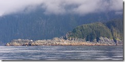
2015-06-088xThe highlights since leaving Sitka include two lovely new (to us) anchorages on the West coast of Baranof Island, Kristoi Basin and Puffin Bay, and a tremendous humpback whale experience outside of Tebenkof Bay.  We turned off the engine and watched a pod of 15 to 20 whales feeding (including bubble feeding) over a broad area.  To hear them breath from hundreds of yards away is always a moving experience.
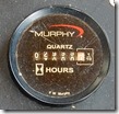
2015-06-177yOur boat passed a milestone as well, accumulating 3000 hours on the main engine on the leg into Petersburg.  That accumulation is in the 5-1/2 years since we off loaded the boat in Seattle in January 2010.

From here, we have about a 130 mile journey to Auke Bay, in Juneau.  We’ll take it leisurely over 10 or 11 days but the route will probably be more direct than this most recent path.

In Sitka

We’re currently in Sitka after having stopped in Wrangell, made a feint towards Craig then shifting our destination to Sitka.

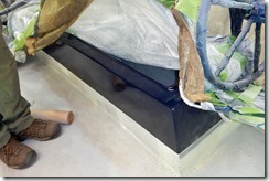
In Wrangell, we had a great visit with our friends, Dorothy & Dave Nagle, owners of the Seahorse Marine Diesel Duck DavidEllis. They’ve been in a boatyard in Wrangell since last fall recoating their boat.  I use the term “coat” because “paint” does not do justice to the multiple layers of protectants than go into keeping the corrosive effects of sea water, oxygen and sun from turning a boat (especially a steel boat) into a piece of scrap.  Journalist Jonathan Waldman released a book this year, Rust, describing the ongoing struggle of humankind to protect its constructs against corrosion.

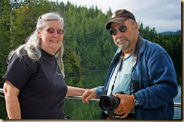
2015-06-001xDorothy and Dave hope to be back in the water and ready to cruise shortly after the July 4th holiday.  We got a sneak preview of the glossy finish they’ll have when everything is complete.  We’ll be jealous.

While in Wrangell, the blocking high that brought the sunny weather to SE Alaska in May decided to leave and we ended up staying an extra day while a bit of wind and rain passed through.

From Wrangell, we decide to head over to Craig on the west side of Prince of Wales (PoW) Island. Sea conditions were generally favorable so we made it a long day, heading across the top of PoW, down to Shakan Bay and hit Dry Pass in El Capitan Passage just about high tide.  We anchored the night in Devilfish Bay about 6 miles south of the El Capitan caves.

The next day we headed to Salt Lake Bay, about 30 miles away.  We had enjoyed our visit there in 2014 and wanted to visit again.  By the time we reached Salt Lake Bay, the rain began to fall.  We set our anchor in the rain and retrieved it in the rain next morning.  In the mean time, we concluded that fishing would probably be better near Sitka so we retraced our path from the previous day to Devilfish Bay.

2015-06-029xThe next morning we went back through Dry Pass in El Capitan Passage.  It gets narrow in certain spots and we had to wait for the small cruise ship Wilderness Discoverer to pass through one section before proceeding.

Once back in Sumner Passage, we headed towards Keku Strait and the south entrance to Rocky Pass.  We dropped the anchor and took an early dinner break waiting for high tide in the pass.  At 5:30 pm we restarted the engine, pulled the anchor and covered the remaining 14 miles to our anchorage for night in Stedman Cove.

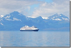
2015-06-060xFrom Stedman Cove we went to the always scenic Red Bluff Bay on Baranof Island for the night.  The day was quite stunning with calm winds and lots of sun.  Along the way we passed the Holland America cruise ship Amsterdam.  Chatham Channel being a bit wider than 2015-06-061xDry Pass, we didn’t have to wait our turn, although I did alter our route to keep the passing more than 3/4 mile.

The weather turned decidedly cooler and wetter than next two days as we first went to Douglass Bay in Hoonah Sound than on to Sitka the next.  High temperatures struggling to get above 50 degrees and frequent rain showers.

The current plan is to do some fishing in the Sitka area before returning to Sitka to start our way to Juneau.

Sunny Alaska

A big old blocking high has been sitting off the coast for a couple of weeks keeping the BC coast and SE Alaska generally warmer and drier than normal. It was nice to not have to worry about big storms but the prevailing NW 15-25 winds can build up wav…

Our Lot in Life

I used the term “our lot in life” in a radio conversation this morning at 5:15 am with a vessel following me out of Bottleneck Inlet where both of us had anchored for the night. In was in reference to the necessity for slow boats to start early in order to put in long miles in a day.

That phrase also describes all of the routing we’ve done since we made the second start to our 2015 cruise after having to return to our winter homeport to deal with our misbehaving electronic compass (it is working fine so far, by the way). The delayed start meant we missed our optimum timing at Seymour Narrows, an early morning slack before the ebb. We like to ride the building ebb down Johnstone Straits. That ebb will add a couple of knots to our normal sedate cruising speed of 6-7 knots.

The week delay meant the slack before the ebb was closer to mid-day. Unfortunately, the relatively stable high pressure ridge off the coast was generating afternoon NW winds of 15-25 knots. When those winds hits the ebb current in Johnstone, the waves build up and you have short steep waves combined with current eddies, an uncomfortable combination.

We chose the more protected channels through, Yuculta, Gilliard, Dent, Green and Whirlpool rapids, as the winds are generally less there. Unfortunately, all of those rapids require timing. We split them over two days, the first 3 on one day and the other 2 on the second day. The travels on the second day, lasting 14 hours, got split into 3 sections with brief interludes between the sections. That was so we could time Whirlpool and then later, Chatham Channel which got us into the Broughtons. It was just our lot in life to have to travel the slower route this year.

Since getting past those hurdles, our pace has quickened. The starts are still early but at least we’re racking up the miles and hope to be in Ketchikan (weather permitting) in a few days.

Migrating North

We started the northward migration from our Arizona winter home the last full week of March.  The cats, while not amused by the 1600 mile drive, are tolerating it better.  Rather than individual carriers, we use a soft sided pet pen sold at the www.drfostersmith.com web site.  That way they are together and have more room to stretch out.  Additionally, we have a litter box available outside the pen for their use.  At the smallest sign of agitation, Marcia will make it available to them which they both did at least once as we were driving along.

Upon arrival at our winter moorage in Eagle Harbor, we’ve been immersed in getting the boat ready for the summer cruise.  We had a few equipment issues that needed resolving and we preemptively do other things because we’ve used the boat enough that things are wearing out.

We managed to take care of everything on the list and start our cruise on Sunday, April 26.  The first stop was in Anacortes to fill fuel tanks for the season and have routine service performed on our furnace.  A side benefit was meeting up with friends Natala and Don Goodman.  They’ve both retired and now live in a newly remodeled home on Lake Samish.  Their retirement indulgence is a Cessna 182 on which they are going to put floats.  Should everything come together, they might fly up to B.C. and meet us somewhere.  We’d love to see that happen!

The morning we were leaving Anacortes for the next leg of the trip north, we got an alarm on our autopilot saying that it was not receiving the compass heading data from our GPS compass shortly after we turned on the navigation electronics.  We switched to our backup electronic compass and continued to monitor the status of the primary compass as we left Anacortes.  After doing a lot of tests, we decided to head back to our winter moorage to figure out the problem. 

We ended up taking the unit to the manufacturer, Comnav, in Vancouver.  After testing and discussion with them, we concluded that the problem was precipitated by moisture build up in the unit.  Also, the way it was wired into the navigation system was not optimal.  We’ve now dried the unit out, took actions to mitigate future moisture issues and made the recommended wiring changes.  The unit appears to be operating stably now.

At this point, we are targeting Wednesday, May 6 for the second start to our summer cruise.  The migration northward continues.

Old Trips Remembered

One of the challenges I’ve taken on in retirement is organizing the thousands of photographs I’ve taken since the early 1970’s when I bought my first SLR camera.  Pretty much everything since I bought my first dSLR in 2004 has been digital.  Before that time, most everything were slides (“don’t take my Kodachrome away”) which require the extra step of digitizing.  But just having a digital images isn’t enough, the hard work comes from adding metadata about the where, what and when of the image (I won’t even worry about the “why”)

I’ve made a pretty good dent in the numerous boxes and trays of slides but I keep getting distracted and slowed by looking at the slides and remembering the wonderful trips and beautiful places they capture (or at least try to capture).  I’ve now concluded that the main function my photos now serve is simply to help me remember.

So in keeping with that purpose, I’ve created another blog, http://oldtripsremembered.blogspot.com/, in which I’ve written a brief description and pulled a couple dozen images of some of the trips I’ve experienced.  Unlike most blogs which are a contemporaneous chronicle of events and thoughts, this new blog looks back and records my current memory of the trip (which is likely a bit ragged) and what I now feel about the trip (which is probably shaded to the “rose” end of the spectrum).

I as I write this, I am certainly not done, but I’ve made progress.  I just hope this isn’t my personal “Nine Billion Names of God” and that once complete, I can continue with new trips and beautiful places.

Where we were

The map below shows all of the locations at which we stopped overnight.  If you click on one of the place marks, more information (distance, engine hours, anchor chain) will pop up. 

View Cruise 2014 in a larger map

Back on the Dock

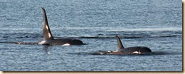
2014-09-011xAfter passing the last of the rapids, Yuculta, that separate the Broughtons from the Desolation Sound area, we were anxious to get across the Strait of Georgia.  We went first to Cortes Bay, then traveled down Malaspina Strait on the east side of Texada Island to Pender Harbour.  From there we headed across the Strait of Georgia but not before encountering a pod of a half dozen orca near Thormanby Island.  We entered the Canadian Gulf Islands via Porlier Pass, anchoring for the night on the north side of Gray Peninsula by Montague Harbour. 

Other than strong opposing currents in the Boundary Pass area, crossing the border was straightforward. Our first port of call was Deer Harbor Marina where our yacht club has dock space.  The only other club boat there was Sea’s the Moment owned by Chris and Sandy Benson who winter moor in Winslow directly ahead of us on the dock.  We spent our first evening back gabbing for several hours with them catching up on travels.

Some winds were forecast on the Strait of Juan de Fuca the next day so we spent a second night at the dock.  An early start on Tuesday, September 9, got us across the strait in time to catch the start of the flood current down Admiralty Inlet.  We wanted to add some fuel in our tanks to get us through the winter so we headed to Poulsbo for the night with the intent to go to the fuel dock first thing the next morning. We took advantage of the reciprocal dock at the lovely Poulsbo Yacht Club marina for our nights moorage.

After taking on 300 gallons of diesel at the Poulsbo fuel dock, we headed to our winter spot on the dock in Eagle Harbor.  We arrived at 1130 on September 10, 20 weeks after departing on April 23.

During the 140 nights we were away, we anchored out 86 nights, moored at public docks (i.e., no services) 7 nights, and paid for moorage 47 nights.  Using my navigation program’s trip log as the arbiter, we covered 4052 nautical miles during that time.  Our main engine operated 720.8 hours including 48.5 hours spent at idle fishing or taking photographs.  Subtracting those idling hours, we averaged 6.03 nm/hour which is our normal speed.  This average speed includes the time spent anchoring and docking at the begin and end of each day’s travels.  Fuel economy calculations will have to wait until next Spring when we fill up ahead of our trip north.

Three Weeks in the Broughtons

The fog lay thick the morning of August 12 as we departed Fury Cove and it remained thick for next nine hours.  Electronic charting, radar and AIS was how we navigated and avoided other vessel traffic in the less that 1/4 mile visibility.  We put the stabilizers in the water less than an hour after we left the anchorage.  With the visibility as poor as it was, we didn’t want to have to worry about sea conditions on top of our other concerns.  The anchorage for the night was Carriden Bay, about 68 miles from our starting point.

While in Alaska, we arranged for my brother Mike and his wife Jo to join us in Port McNeill for a weeks worth of cruising later in the month so we had some major inside & outside boat cleaning to do before their arrival.  In addition, we wanted to insure that some of the destinations we were going to take them still had the prawns we were promising them.

After visiting Sullivan Bay Marina, we headed to Port McNeill for fresh water, provisioning and the first round of cleaning.  While there we crossed paths with Doug and Cathlyn MacQuarrie from our yacht club.  In 2012, we sublet the slip at Shilshole Marina where they live on their Nordhavn 46.  They offered some suggested destinations in the Broughtons that we had not visited before.

The cruising in the Broughton archipelago is far more intimate than what you encounter in Alaska.  The channels between the many islands are numerous, intricate and well protected from the outside waters.  In addition, there are a half dozen or so small family operated marinas catering to pleasure craft.  They provide an opportunity to socialize with other boats at the organized evening happy hours or dinners. During the three weeks we were in the area, we stopped at Shawl Bay, Sullivan Bay, Echo Bay, Kwatsi Bay and Port Harvey.  We also stopped at the docks of the closed Greenway Sound Marina.  The docks are showing the wear of several years without maintenance and we chose to anchor in the cove behind Broughton Point on our subsequent visits to Greenway Sound.

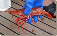
2014-08-054x2014-08-028xWe had regaled Mike & Jo with the bounty we had pulled from the waters on our cruise so we were determined to produce while they cruised with us.  The prawn gods were smiling on us and we were able to feature prawns several nights.

After Mike & Jo left us, we made one more pass through the Broughtons then headed south.  We elected to take eastmost route which necessitates timing five rapids, Whirlpool, Green, Dent, Gillard & Yuculta.  We hadn’t been this way since our 2007 trip in our first boat.  We split the rapids in two by stopping for the night at Cordero Lodge which is a few miles after passing Green Rapids.

In contrast to the rainy Alaskan weather we experienced June and July, the three weeks we spent in the Broughtons were almost uniformly sunny.  According to the marina operators, they had only a few days of rainy weather all summer.  We made a conscious effort to try new places, anchoring in five new locations, and found several new spots for prawn fishing.

Three Weeks in the Broughtons

The fog lay thick the morning of August 12 as we departed Fury Cove and it remained thick for next nine hours.  Electronic charting, radar and AIS were how we navigated and avoided other vessel traffic in the less that 1/4 mile visibility.  We put the stabilizers in the water less than an hour after we left the anchorage.  With the visibility as poor as it was, we didn’t want to have to worry about sea conditions on top of our other concerns.  The anchorage for the night was Carriden Bay, about 68 miles from our starting point.

While in Alaska, we arranged for my brother Mike and his wife Jo to join us in Port McNeill for a weeks worth of cruising later in the month so we had some major inside & outside boat cleaning to do before their arrival.  In addition, we wanted to insure that some of the destinations we were going to take them still had the prawns we were promising them.

After visiting Sullivan Bay Marina, we headed to Port McNeill for fresh water, provisioning and the first round of cleaning.  While there we crossed paths with Doug and Cathlyn MacQuarrie from our yacht club.  In 2012, we sublet the slip at Shilshole Marina where they live on their Nordhavn 46.  They offered some suggested destinations in the Broughtons that we had not visited before.

The cruising in the Broughton archipelago is far more intimate than what you encounter in Alaska.  The channels between the many islands are numerous, intricate and well protected from the outside waters.  In addition, there are a half dozen or so small family operated marinas catering to pleasure craft.  They provide an opportunity to socialize with other boats at the organized evening happy hours or dinners. During the three weeks we were in the area, we stopped at Shawl Bay, Sullivan Bay, Echo Bay, Kwatsi Bay and Port Harvey.  We also stopped at the docks of the closed Greenway Sound Marina.  The docks are showing the wear of several years without maintenance and we chose to anchor in the cove behind Broughton Point on our subsequent visits to Greenway Sound.

2014-08-054x2014-08-028xWe had regaled Mike & Jo with the bounty we had pulled from the waters on our cruise so we were determined to produce while they cruised with us.  The prawn gods were smiling on us and we were able to feature prawns several nights.

After Mike & Jo left us, we made one more pass through the Broughtons then headed south.  We elected to take eastmost route which necessitates timing five rapids, Whirlpool, Green, Dent, Gillard & Yuculta.  We hadn’t been this way since our 2007 trip in our first boat.  We split the rapids in two by stopping for the night at Cordero Lodge which is a few miles after passing Green Rapids.

In contrast to the rainy Alaskan weather we experienced June and July, the three weeks we spent in the Broughtons were almost uniformly sunny.  According to the marina operators, they had only a few days of rainy weather all summer.  We made a conscious effort to try new places, anchoring in five new locations, and found several new spots for prawn fishing.