Sunrise on Tuesday, February 7 The weather was back to cold and windy again. On Tuesday, Wednesday and Thursday, we mostly laid low in the marina. Eric finally completed a project that he’d started in San Diego: creating a system to … Continue reading →
Keith’s Perspective on La Paz (Costa Baja)/Le Point de vue de Keith sur La Paz (Marina Costa Baja)
I am having a good time at La Paz. We’ve eaten out a lot: breakfast, brunch, lunch, and dinner. Je passe un bon moment à La Paz. Nous mangeons beaucoup dehors : petit déjeuner, brunch, déjeuner et dîner. We went … Continue reading →
Feb. 12 – Jayuya, PR
“Travel doesn’t become adventure until you leave yourself behind.” –Anonymous
Today we left the beach and headed inland to Jayuya (hah-YOO-yah). The town is known as the “Town of The Three Peaks” and is located high in the central mountain region of the island, north of Ponce. It’s the site of the highest mountains in Puerto Rico, surrounded by the Cerro La Punta and Los Tres Picachos mountains. We plan to do a little hiking and explore the mountains and waterfalls in the area.
We spent the morning enjoying our last view of the Atlantic Ocean. We’ve truly loved being here, but we are ready for something a little different. The road through the mountains was an adventure in itself…beautiful but narrow and very windy. It’s a good thing Stan doesn’t mind this type of road. Google tried to send us on a few shortcuts, but the friendly locals set us straight.

Believe it or not this is one of the wider mountain roads we were on today.

This Caonillas Lake we passed it on our way to Jayuaya.

The house we’re staying in isn’t fancy, but very adequate. It’s a historic house built in the 1920’s and it sits across the street from the town plaza. We wandered around this afternoon and it’s a pretty little town on the Rio Grande del Jayuya. The people are super friendly. We were invited to join a local family to watch the Super Bowl, but we passed. We were just too tired.
Our home for the next three nights.

The house is basic but we have three bedrooms and two baths. Each bedroom has AC, but the evenings are in the low 60’s so they are only needed to keep out the sounds of the town and the roosters.

Our Lady of Monserrate Parish in the plaza across the street from our house. The bells ring each morning at 6:30…no need for an alarm clock here.

One of the pedestrian bridges that cross the river in town.

The Rio Grande del Jayuya that runs through town.

These stairs lead to the monument that pays homage to the Taíno culture of Puerto Rico. The Taínos were the indigenous inhabitants of Puerto Rico. It is located just off the plaza where our house is.

The sculpture at the top of the stairs is a bust of the Taíno leader Hayuya. The stairs lead to the tomb. The words made with mosaic tiles in the steps greet visitors and are the Taíno names of Puerto Rican towns.

The view from the top of the stairs.


We ended up going to Patria Mia for lunch and dinner since it was close to the house and so good. We were the only turistas in the whole place.

Way over there in the west is where we came from today.

Feb. 12 – Jayuya, PR
“Travel doesn’t become adventure until you leave yourself behind.” –Anonymous
Today we left the beach and headed inland to Jayuya (hah-YOO-yah). The town is known as the “Town of The Three Peaks” and is located high in the central mountain region of the island, north of Ponce. It’s the site of the highest mountains in Puerto Rico, surrounded by the Cerro La Punta and Los Tres Picachos mountains. We plan to do a little hiking and explore the mountains and waterfalls in the area.
Elephant Island and Scotia Sea
Thursday, February 9, 2023 – Elephant Island
Seabourn Quest steamed at 17-19 knots northeasterly from the tip of the Antarctic Peninsula 115 NM to Elephant Island. The skies cleared after several hours, but the wind was still brisk and the seas were still 2.5 meters. At 1630 Elephant Island showed up about 15 NM in the distance. As we approached the eastern tip of the island numerous Fin whales were spotted, along with flocks of seabirds including Cape Petrels and groups of penguins porpoising in and out of the swells. The area is rich in Krill.

Our Route through the Antarctic Peninsula to Elephant Island

Map of Elephant Island with Point Wild on north side

Cape Petrels off of Cape Valentine

Shackleton Memorial at Point Wild

Fin Whales off of Cape Valentine

Point Wild, Elephant Island
We passed about 4 NM abeam of Cape Valentine, avoiding reefs. This point was the first landfall for Shackleton’s group, but it was an unsafe area with no real shelter and rockfalls down the steep slopes. Shackleton moved to the middle of the north side and and found an area in which they could build shelters. Their shelters were the two other lifeboats, overturned and with canvas sidewalls. By this time it was April and winter was approaching. The third lifeboat, “James Caird” took off for South Georgia with a crew of six and after an amazing journey three of them turned up at the Stromness whaling station on May 20, 1916. The James Caird was recovered along with the other three crew a few days later. After four attempts, the survivors on Elephant Island were all recovered by Shackleton five months later.
The Seabourn Quest also rounded Cape Valentine and retraced Shackleton’s route, approaching Point Wild where Shackleton set up camp. We approached to within ½ mile and were able to see the memorial cairn set up at the site of the camp. Landing on the island is not permitted and the site is now also a penguin colony, which was not present 110 years ago.
During the voyage to Elephant Island, retracing Shackleton’s route, we were treated to a lecture by Robert Egelstaff, the lead kayak guide, who had been on Seabourn Venture with us this past summer. His talk, “In The Wake of Shackleton” was about how he and three others built a replica 29 years ago of the “James Caird”, the 22 foot lifeboat from the Endurance, and recreated that famous voyage from Elephant Island to South Georgia. They named the replica “Sir Ernest Shackleton”.
Robert and his teammates took the same amount of time, 14 days, and were able to take the same number of noon sextant sights (4) as Frank Worley, the Captain of Endurance, to determine their location. Due to weather they were unable to land in King Haakon Bay, where Shackleton and his 5 companions landed, instead finding shelter on the NE side of South Georgia. Their replica boat is on permanent display in the UK at the Scott Polar Museum in Cambridge.
As a matter of interest, last year the wreck of Endurance was found in the Weddell Sea, only 4 miles from Frank Worley’s estimated position relying only on celestial navigation and a chronometer that had not been adjusted for 18 months. The wreck lies more than 10,000 feet deep and is in surprisingly good shape.
Seabourn Quest departed from Point Wild on Elephant Island at 1845 and headed out across the Scotia Sea, following the general track of Shackleton more than 800 NM to South Georgia.
February 10-11, 2023 – Transiting the Scotia Sea
Midday on Feb 10 Seabourn Quest passed through a large field of tabular bergs, giving us some spectacular views, even though it was a little hazy/foggy. The morning was spent on bio-security inspections of all outerwear going ashore on South Georgia and a mandatory bio-security briefing in preparation for the inspections by health officers from South Georgia when we arrive at Grytviken on Feb 12. The government of South Georgia and the South Sandwich Islands are determined to preserve the area from an ecology standpoint. Since were here last they have eradicated rats, removed the non-native reindeer and actively look for non-native plants and remove them. They have also established a 200 NM Marine Protected Area around the islands, strictly controlling all activity, including illegal fishing.

Tabular Berg more than 1 mile wide
Internet connectivity remains very poor, with little communication from the crew on what the real problem is, since we are quite a bit further north and it should be better than on the Antarctic peninsula where coverage was surprisingly good.
We continued with lectures on Shackleton’s voyages, on the Global Ocean, and on several attempts to cross the white continent, Antarctica.
On Feb 11, we had lectures on “What happens to Whales when they die at sea”, descriptions of both the Amundsen and Scott races to the South Pole and their respective life histories, and on Elephant Seals, which we expect to see on South Georgia.
Elephant Island and Scotia Sea
Thursday, February 9, 2023 – Elephant Island
Seabourn Quest steamed at 17-19 knots northeasterly from the tip of the Antarctic Peninsula 115 NM to Elephant Island. The skies cleared after several hours, but the wind was still brisk and the seas were still 2.5 meters. At 1630 Elephant Island showed up about 15 NM in the distance. As we approached the eastern tip of the island numerous Fin whales were spotted, along with flocks of seabirds including Cape Petrels and groups of penguins porpoising in and out of the swells. The area is rich in Krill.
Our Route through the Antarctic Peninsula to Elephant Island
Map of Elephant Island with Point Wild on north side
Cape Petrels off of Cape Valentine
Shackleton Memorial at Point Wild
Fin Whales off of Cape Valentine
Point Wild, Elephant Island
We passed about 4 NM abeam of Cape Valentine, avoiding reefs. This point was the first landfall for Shackleton’s group, but it was an unsafe area with no real shelter and rockfalls down the steep slopes. Shackleton moved to the middle of the north side and and found an area in which they could build shelters. Their shelters were the two other lifeboats, overturned and with canvas sidewalls. By this time it was April and winter was approaching. The third lifeboat, “James Caird” took off for South Georgia with a crew of six and after an amazing journey three of them turned up at the Stromness whaling station on May 20, 1916. The James Caird was recovered along with the other three crew a few days later. After four attempts, the survivors on Elephant Island were all recovered by Shackleton five months later.
The Seabourn Quest also rounded Cape Valentine and retraced Shackleton’s route, approaching Point Wild where Shackleton set up camp. We approached to within ½ mile and were able to see the memorial cairn set up at the site of the camp. Landing on the island is not permitted and the site is now also a penguin colony, which was not present 110 years ago.
During the voyage to Elephant Island, retracing Shackleton’s route, we were treated to a lecture by Robert Egelstaff, the lead kayak guide, who had been on Seabourn Venture with us this past summer. His talk, “In The Wake of Shackleton” was about how he and three others built a replica 29 years ago of the “James Caird”, the 22 foot lifeboat from the Endurance, and recreated that famous voyage from Elephant Island to South Georgia. They named the replica “Sir Ernest Shackleton”.
Robert and his teammates took the same amount of time, 14 days, and were able to take the same number of noon sextant sights (4) as Frank Worley, the Captain of Endurance, to determine their location. Due to weather they were unable to land in King Haakon Bay, where Shackleton and his 5 companions landed, instead finding shelter on the NE side of South Georgia. Their replica boat is on permanent display in the UK at the Scott Polar Museum in Cambridge.
As a matter of interest, last year the wreck of Endurance was found in the Weddell Sea, only 4 miles from Frank Worley’s estimated position relying only on celestial navigation and a chronometer that had not been adjusted for 18 months. The wreck lies more than 10,000 feet deep and is in surprisingly good shape.
Seabourn Quest departed from Point Wild on Elephant Island at 1845 and headed out across the Scotia Sea, following the general track of Shackleton more than 800 NM to South Georgia.
February 10-11, 2023 – Transiting the Scotia Sea
Midday on Feb 10 Seabourn Quest passed through a large field of tabular bergs, giving us some spectacular views, even though it was a little hazy/foggy. The morning was spent on bio-security inspections of all outerwear going ashore on South Georgia and a mandatory bio-security briefing in preparation for the inspections by health officers from South Georgia when we arrive at Grytviken on Feb 12. The government of South Georgia and the South Sandwich Islands are determined to preserve the area from an ecology standpoint. Since were here last they have eradicated rats, removed the non-native reindeer and actively look for non-native plants and remove them. They have also established a 200 NM Marine Protected Area around the islands, strictly controlling all activity, including illegal fishing.
Tabular Berg more than 1 mile wide
Internet connectivity remains very poor, with little communication from the crew on what the real problem is, since we are quite a bit further north and it should be better than on the Antarctic peninsula where coverage was surprisingly good.
We continued with lectures on Shackleton’s voyages, on the Global Ocean, and on several attempts to cross the white continent, Antarctica.
On Feb 11, we had lectures on “What happens to Whales when they die at sea”, descriptions of both the Amundsen and Scott races to the South Pole and their respective life histories, and on Elephant Seals, which we expect to see on South Georgia.
Feb. 11 – Aguadilla, PR
“To find a seashell is to discover a world of imagination.” –Michelle Held

Today was our last day at the beach. The weather was wonderful and the surf was down, so we were able to truly enjoy the beach in front of our house. It’s been a fun week…mostly relaxing and taking in the view of the ocean and watching the power of the water. When the tide, wind and waves allowed I did a lot of beach combing for amazing sea glass. I found an unbelievable amount of great glass and some beautiful shells.
This is the path from the street and our garage down to the beach and our house.


The local fishermen returning to the beach. They roll the boat down to the surf and roll it up when they return.

Some of our treasures. We found so many more shells that I didn’t get a picture of…this was a great beach.


The town of Aguadilla is clean and beautiful and the water here is so pretty. We enjoyed walking along the shoreline and wandering through town. Here are a few photos from our week in paradise.

So many stars in the sky.

A pretty little park in town.

Looking towards Aguadilla.

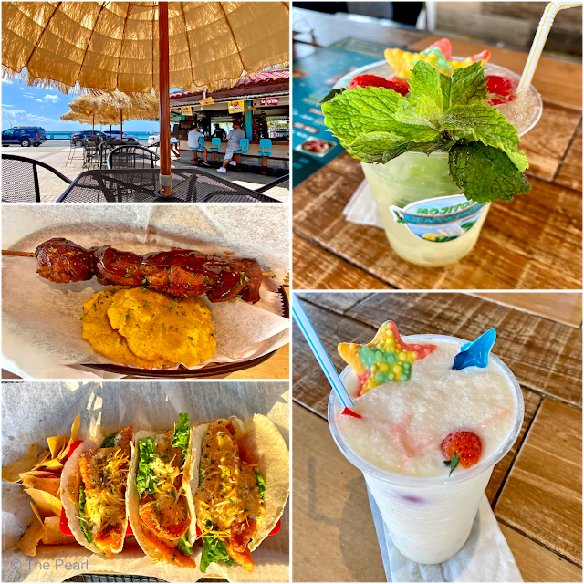
We enjoyed our last evening in Aguadilla at this little place overlooking the beach. We had a great very of the sunset.


Feb. 11 – Aguadilla, PR
“To find a seashell is to discover a world of imagination.” –Michelle Held
Today was our last day at the beach. The weather was wonderful and the surf was down, so we were able to truly enjoy the beach in front of our house. It’s been a fun week…mostly relaxing and taking in the view of the ocean and watching the power of the water. When the tide, wind and waves allowed I did a lot of beach combing for amazing sea glass. I found an unbelievable amount of great glass and some amazing shells.
Second Trip tp Marina Costa Baja Days 7 – 8
Sunday and Monday (February 5 and 6) were more chores days. The weather was sunny and warm, with it reaching 80 degrees Fahrenheit (27 celsius) both days. Eric: Christi and Keith finally got around to washing the boat. They were … Continue reading →
Girlache Strait
The Girlache Strait extends from the northern end of the Wilhelm Archipelago and separates the Palmer Archipelago from the Antarctic Peninsula. It was discovered in 1898 by Lt. Adrien de Gerlache, leader of the 1897-1899 Belgian Antarctic expedition. The crew included famed Norwegian polar explorer Roald Amundsen, who in 1911 was the first to reach…