
On Thursday, May 16, Jim purchased a new toy; I mean boat. It is a 16′ Boston Whaler with 90 horsepower motor and trailer. Su is not sure how that trailer will work behind Palmetto Moon…
Palmetto Moon 2014-05-31 11:30:00
On Thursday, May 16, Jim purchased a new toy; I mean boat. It is a 16′ Boston Whaler with 90 horsepower motor and trailer. Su is not sure how that trailer will work behind Palmetto Moon…
Palmetto Moon 2014-05-31 11:24:00
Jim spent the next few days cleaning it up and we did cruise, or was it fly, down the Waterway one afternoon. On Tuesday, May 22, we drove down to DNR on James Island to register the boat and motor. Believe it or not, there are only tw…
Palmetto Moon 2014-05-31 11:24:00
Jim spent the next few days cleaning it up and we did cruise, or was it fly, down the Waterway one afternoon. On Tuesday, May 22, we drove down to DNR on James Island to register the boat and motor. Believe it or not, there are only two pla…
Second verse
is the same as the first! Same as yesterday except only 3-1/2 hrs of sanding this morning. Couldn’t take it anymore. Arms falling off. :-(Need to go to the hardware store and buy some Draino. I hope it cuts coagulated epoxy dust so I can have a s…
Alaska 2014 – On To Ketchikan
May 26, 2014 – Continued
We soon lost sight of the Oosterdam, but for a brief period we regained cell phone service so were able to call home and also update this blog. The 4G hotspot worked until we reached Ivory Island lighthouse at the junction of Seaforth Channel and Milbanke Sound. The swell looked manageable so we took the outside route into Finlayson Channel rather than Reid Passage, Percival Narrows and then Jackson Narrows. Experimenting with the impact of stabilizers “on or off” we discovered that in following seas the motion was more comfortable with the stabilizers off.
For a while, while the sun was out, we were followed by a small pod of Dall’s Porpoises, playing in our bow wave, but they tired of it and disappeared after about 15 minutes.
Turning at Vancouver Rock we headed up Finlayson Channel past Cone Island and on to Bottleneck Inlet. The entrance to the inlet is narrow with a minimum depth of 10 feet at zero tide. The inlet had one other vessel (a Nordhavn 57) anchored when we arrived so we had our choice of spots. We went deep into the inlet, further than we had ever ventured, and anchored in 25 feet of water over a sticky mud bottom. Soon the crab pot was set, and three hours later we had two nice Dungeness crab. By 1700 there were six vessels anchored in the inlet. We shared cocktails and appetizers with Dennis Raedeke and his two guests from the power catamaran “Wild Wind IV” that we had met several days earlier at Port McNeill.
That evening, when we went to start the generator to top off the batteries for the evening, we discovered it had experienced some sort of failure, only putting out 60 volts. We shut down all non-essential loads until the next morning, and called Selene Yacht Service (SYS) on the satellite phone for advice.
May 27, 2014
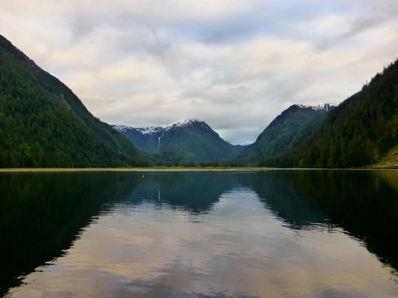
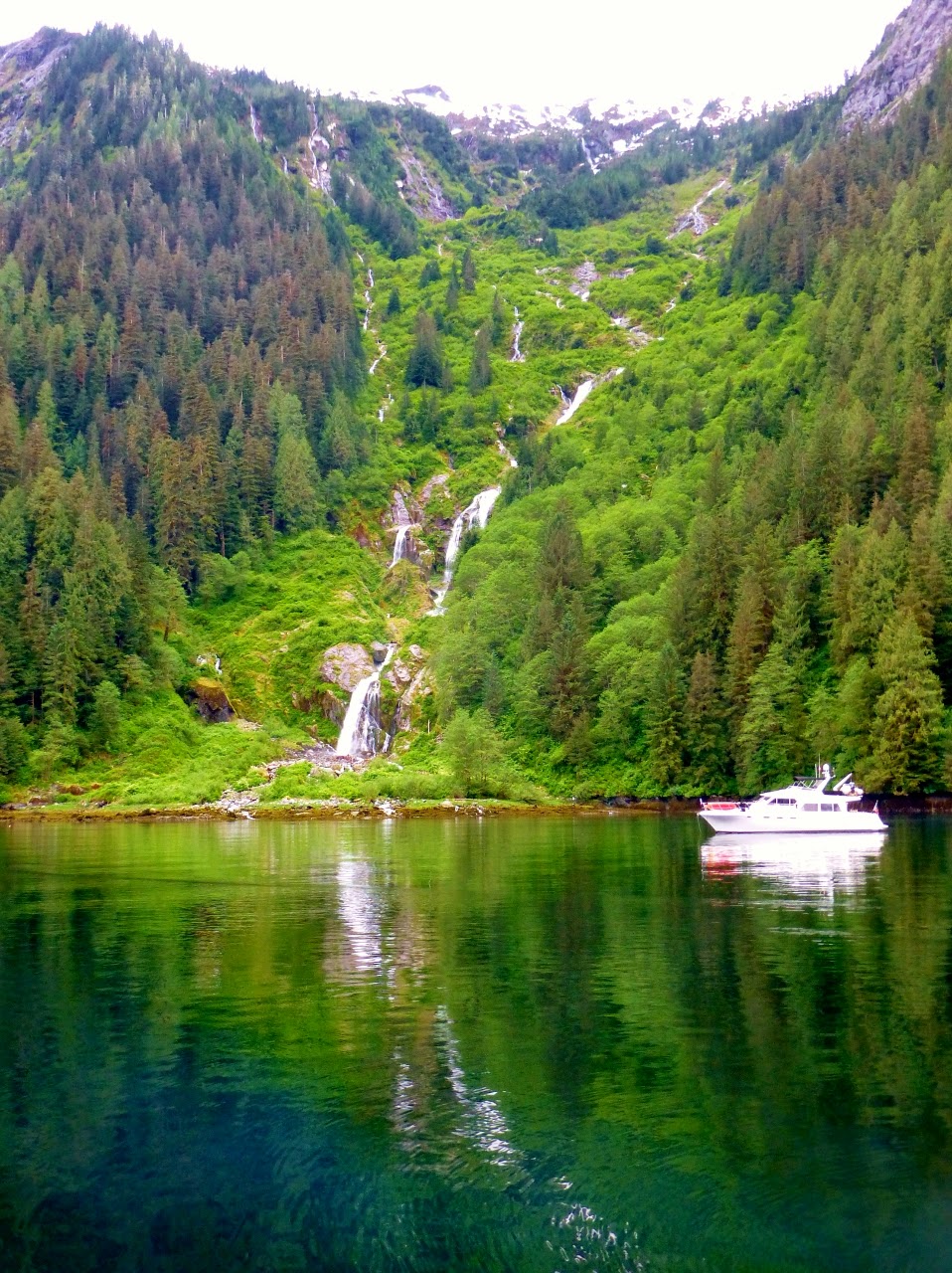
At 0810 we pulled the anchor from the sticky black mud in Bottleneck inlet and were glad there was no wind so we could bring the anchor chain up slowly and wash off the mud. We were the next to last boat to leave. The charts were correct on the 10 foot minimum depth in the entrance as we left on a +1.2 foot tide. Continuing up Finlayson Channel we rode the flood tide through Heikish Narrows and into Princess Royal Channel. Entering Khutze Inlet we anchored behind one other vessel and set out the crab pot. Right behind us was a third vessel that anchored close by. All three USA vessels moor in the Anacortes area and all of us are heading to Sitka to fish.
.jpg) |
| The head of Khutze Inlet from our anchor point at high tide |
.jpg) |
| Waterfall in Khutze – in 2012 it was snow fields to the water |
Anchoring in Khutze Inlet is tricky since the anchoring is on a narrow shelf shockingly close to the mud flats from the river delta. The water depth goes from 90 feet to zero in just about 100 feet of horizontal distance. Fortunately, there was enough water flowing out of the river to keep us oriented away from the shallow water. By evening we had captured two nice Dungeness crabs in our favorite crabbing location.
We managed to consult with SYS on the generator with the satellite phone and have parts on order for when we arrive in Ketchikan.
May 28, 2014
Dense ground fog covered the anchorage when we pulled the anchor at 0655. The tide was still not low, but the beach was shockingly close due to the steep shelf where vessels must anchor. The crab pot was empty, but we got 4 more crabs from the Nordic Tug “Sunday” from Shelter Bay. Dave and Margaret Allen had pulled in more than their needs of legal crabs and donated the excess above their license and needs to both us and the sailing vessel “Merry Fortune” from Victoria.
The fog lifted by the time we entered Princess Royal Channel, but we bucked an adverse tide clear to the entrance to Grenville Channel. Passing the former cannery site at Butedale we could see further deterioration of the abandoned buildings and the falls were flowing heavy. There is talk that Butedale has been purchased with plans to revitalize it as a stop for vessels in the gap between Klemtu and Hartley Bay. We searched the shoreline of Princess Royal Island for the white “spirit” bears, but with no success. The waterfalls were nonetheless spectacular.
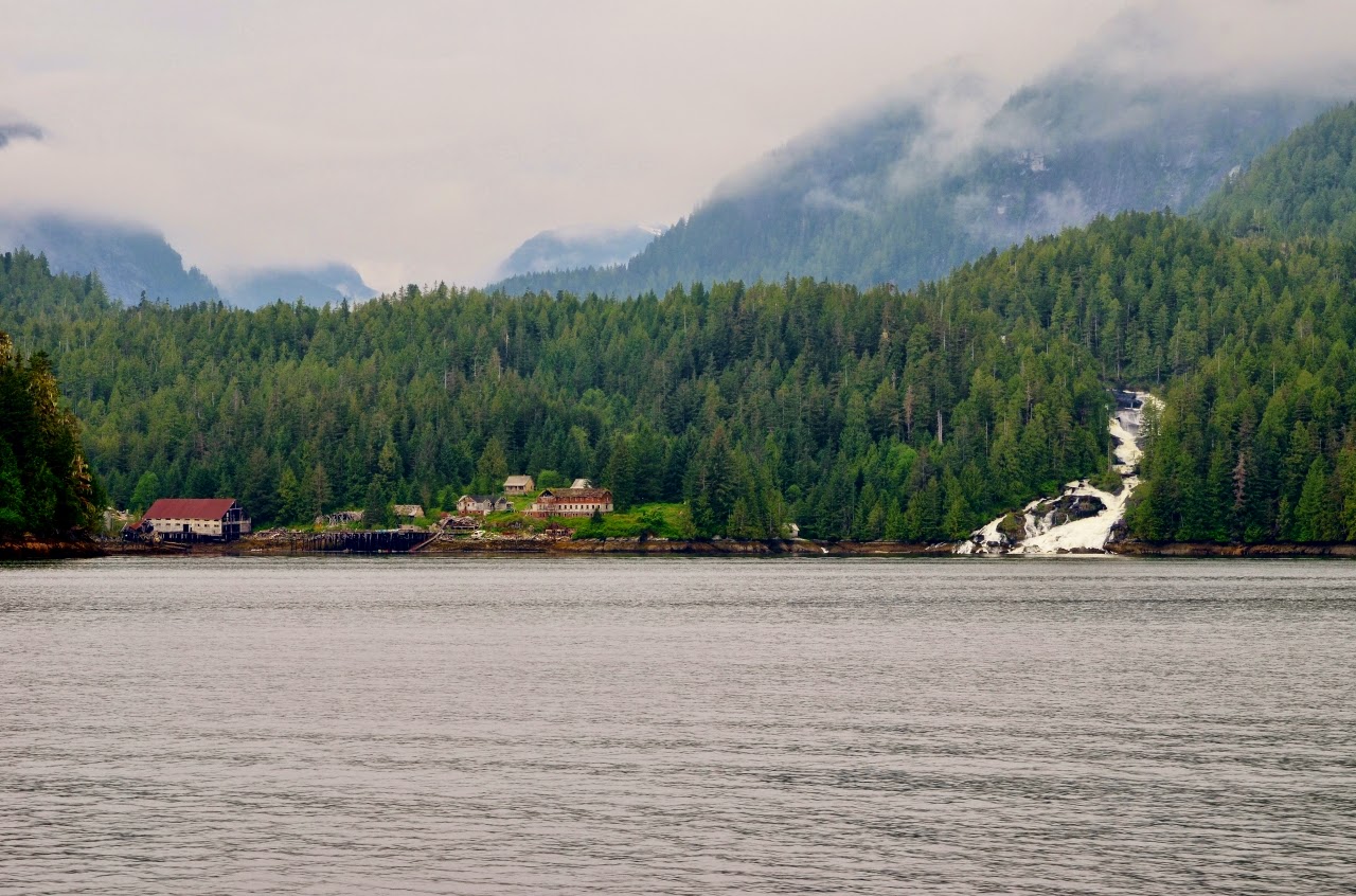 |
| Former cannery site at Butedale |
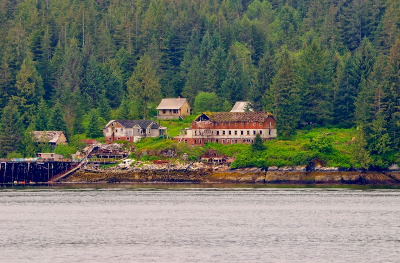 |
| More buildings are gone since 2012 |
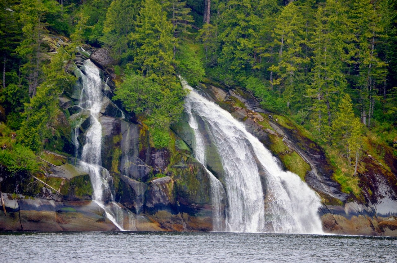 |
| Typical waterfall along Princess Royal Channel |
Our plan had been to ride the flood tide north to Lowe Inlet, but the wind increased to a steady 25 knots gusting to 32 knots and with the effects of the wind and three foot chop, the flood current on the surface was non-existent. The Nordic Tug “Sunday” was already anchored, but Nettle Basin in front of Verney Falls is large, so we anchored in front of the falls in the current, which kept us aligned and stable, with the stern towards the sun. We set our anchor in 100 feet of water at 1450. Our total mileage is now 555 nautical miles since Anacortes.
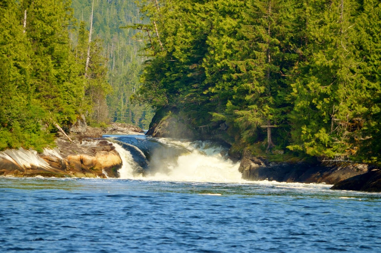 |
| Verney Falls in Lowe Inlet, Nettle Basin |
By 1730, “Wild Wind IV”, “Peregrine” and three other boats had anchored. We shared potluck appetizers in our cockpit with both “Sunday” and “Wild Wind IV”.
May 29, 2014
Today will be a long day, so we departed Lowe Inlet at 0530 and fought a 4.8 knot ebb current in Grenville Channel for about 10 miles before we came abeam of Klewnuggit Inlet where Grenville widens out. The sky was overcast, but the winds were light as we joined a parade of pleasure craft all headed for either Ketchikan or Prince Rupert. There are at least 5 boats ahead of us and even more behind.
Reaching the top of Grenville Channel the weather continued calm so we pointed Spirit out into Chatham Sound and set a course for Dundas Island. There was a low westerly swell until we were in the lee of Dundas and we took our last pictures in BC of Green Island lighthouse before heading out into Dixon Entrance proper.
 |
| Green Island light , our last good view of BC before Dixon Entrance |
Calling US Customs, we received permission to anchor in Foggy Bay overnight. Dixon Entrance had little wind, but a low westerly swell crossing the USA/Canada boundary. We crossed the boundary at 1645 PDT and reset the clocks to Alaska Daylight time, one hour earlier. The swell increased as we passed by Tree Point Light, our first landmark in Alaska.
 |
| Tree Point Light from Spirit’s wheelhouse |
Surprisingly, the swell continued to increase in height as we headed up Revillagigedo Channel towards Foggy Bay, and with the swell on the port quarter the motions were large even with stabilizers. Making the turn at Foggy Bay we went into the inner basin down the narrow channel, with the tide nearly low so the rocks were clearly visible. The one dead tree continues to mark a dangerous rock just before entering the inner basin. There were already three boats at anchor, but there is room for a lot of boats. We anchored in 30 feet of water over a firm mud bottom at 1813 ADT after a 103 nautical mile run, for a total of 658 nautical miles. Following us into the inner basin was a Nordic Tug “Firefly” that followed us across Dixon Entrance, the final boat to arrive for the evening.
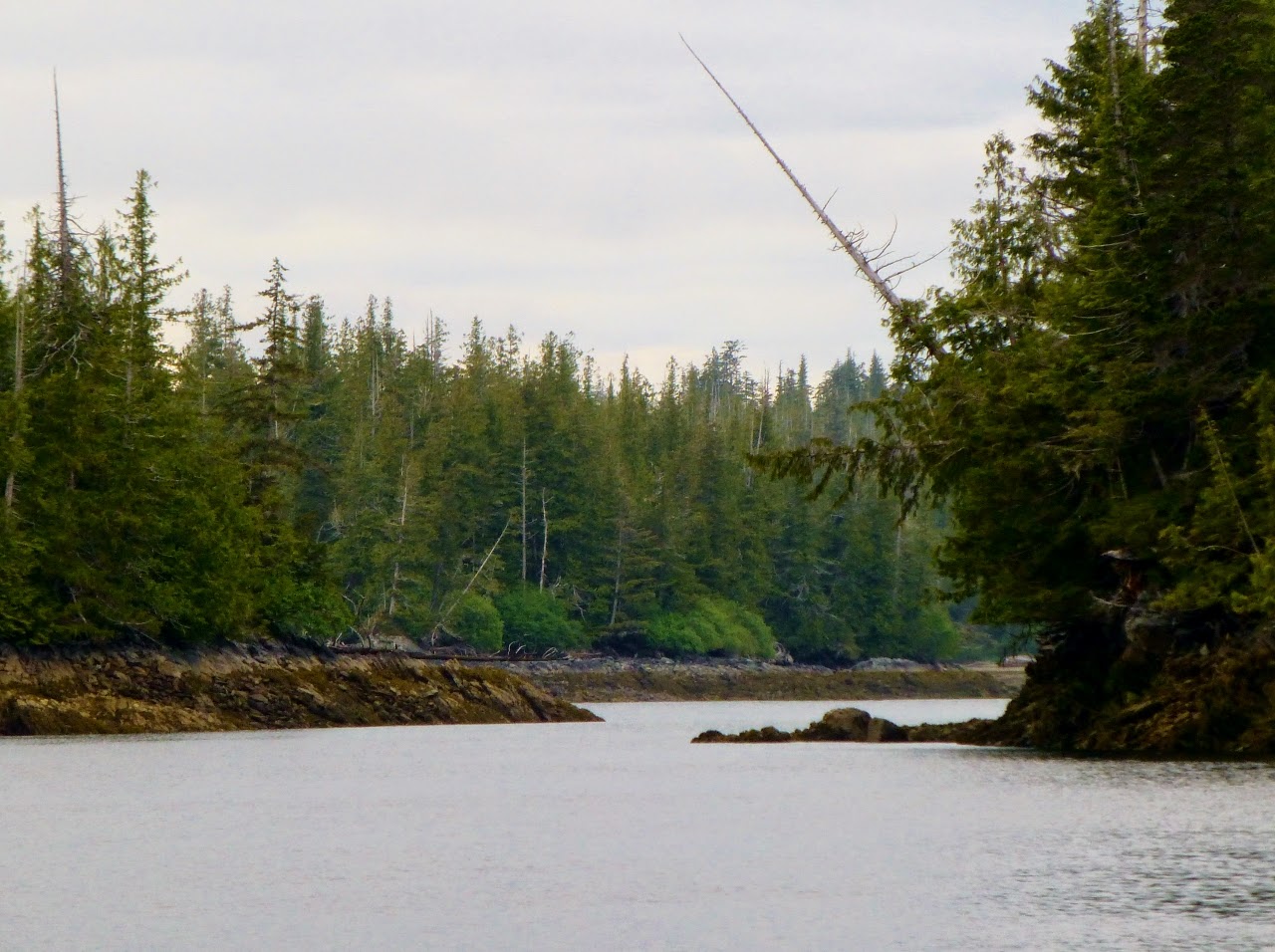 |
| The rock marked by the dead tree in inner Foggy Bay |
May 30, 2014
Setting the alarm for 0400, we had the anchor on deck and underway by 0430. The swell in Dixon Entrance was still present, but by the time we got 10 miles north to Mary Island it had dissipated. Spirit arrived without incident in Ketchikan and was cleared by US Customs by phone as we headed into Bar Harbor at 0920 to our assigned slip. The majority of the fishing fleet appears to be still here and moorage was scarce, tucked in between commercial vessels. Spirit has now covered 696 nautical miles on the transit to Ketchikan.
The generator was repaired by South East Diesel within one hour of our arrival. The problem turned out to be a bad AC voltage regulator. By early afternoon we had completed our re-provisioning, and plan on a Sunday departure to begin the transit to Sitka via Wrangell and Petersburg.
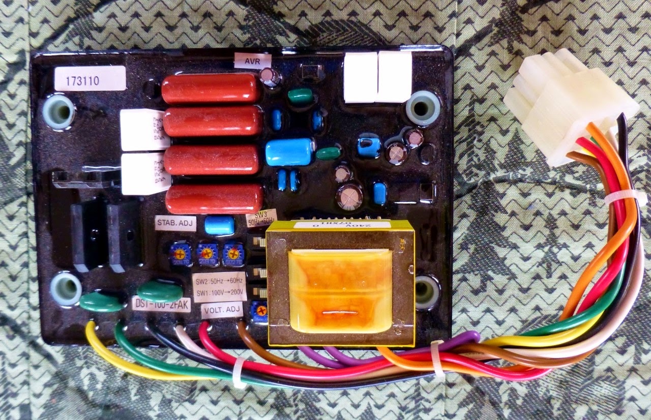 |
| The failed voltage regulator – expensive little part! |
FPB 64-3 Iron Lady ‘s “Welcome” To Washington
Pete Rossin and crew have completed another uneventful ocean crossing, 2300 NM in ten pleasant days between Hawaii and Puget Sound. Upon arrival they were forced to use the Washington State Pilots to dock in Port Angelese so they could check in with US Customs. The cost for this welcome – $1100 for two ten […]
NEW BLOG URL
I recently upgraded my blog to a dedicated URL which allows me to add a bunch of new features. I will no longer be updating myironlady.wordpress.com. Going forward, please go to mvironlady.com.
NEW BLOG URL
I recently upgraded my blog to a dedicated URL which allows me to add a bunch of new features. I will no longer be updating myironlady.wordpress.com. Going forward, please go to mvironlady.com.
Craig and Beyond
While in Craig, we rented a car for the day and visited some of the sites accessible from paved roads. I knew Prince of Wales (PoW) Island had many roads, but didn’t realize the quality of the main paved roads. In our one day car rental, we drove nearly 200 miles going from Craig to Hydaburg, then to Coffman Cove then back to Craig. Klawock is at a junction so we passed through it several times.
Both Klawock and Hydaburg have strong NW native indian heritages (Tlingit and Haida, respectively) and strive to preserve their cultures. Carving totems is part of it and each has a totem park with many recently carved totems.
PoW Island reminded me a little bit of the Olympic Peninsula on account of the evidence of past logging. There isn’t as much active logging as the Olympic Peninsula (we only saw one or two logging trucks) but there are many logging roads and many clear cuts of varying ages. Regardless, PoW is very scenic and offers many opportunities for hiking and exploring.
For Memorial Day weekend, we headed out for a couple of nights (we needed to be back on Monday to be prepared for our guided fishing trip on Tuesday). We tried to visit two new anchorages but ended up at a familiar one, Kaguk Cove, and one new one, Salt Lake Bay (both on Prince of Wales Island). Salt Lake Bay, despite a narrow entrance with submerged rocks guarding it, was very lovely and worth repeat visits.
The guided fishing trip was good. We hoped to pick up fishing tips we could use in general and local knowledge for our future trips to the Craig area. We also hoped to catch a king salmon (the only kind running currently). Unfortunately, no salmon chose to take our bait.
We did end up with two halibut, one ling cod and seven black bass. Many fisherman going out with a guide might pass on the last two kind of fish since they lack the name appeal of salmon or halibut. We kept them as we are not “catch and release” anglers but rather “catch and eat.”
On Wednesday, 5/28, after picking up our cleaned, fileted, frozen and vacuum sealed catch (Marcia especially liked that part of a guided fishing trip), we headed out again.
The plan was to position ourselves on Warren Island for a trip around Cape Decision and up Chatham Strait. As we were crossing the Gulf of Esquibel, the wind kept picking up and the chop became more unpleasant. We weren’t exposed to the ocean swell yet but we could imagine the unpleasant conditions that awaited us. While Alpenglow is certainly capable of handling those imagined conditions, we weren’t as sure of our feline passengers could (at least without getting seasick). A quick course change had us heading up the more protected waters of El Capitan Passage. The stop for the night was Sarheen Cove, a little south of the El Capitan Caves.
The next day, 5/29, we set the ambitious goal of taking the somewhat long but more protected route to Chatham via El Capitan Passage to Sumner Strait, then Rocky Pass between Kuiu Island and Kupreanof Island to Fredrick Sound and connecting back with Chatham Strait. It was engine on at 0400 (sunrise is 0415 so it is plenty light) and the anchor didn’t drop for the day until 1830. We did take an 1-1/2 hour break for lunch at the south end of Rocky Pass waiting to enter Devil’s Elbow at the right time. The anchorage that night was Honey Dew Cove on Kuiu Island, an anchorage we used when starting our southbound Rocky Pass transit in 2011.
After that long day, we traveled a shorter day on 5/30 to Ell Cove on Baranof Island, one of our favorite anchorages. From here we’ll head up to Hoonah Sound for some seafood foraging (hopefully crab and prawns). Sitka is a day’s journey from there even for a slow boat like ours.
