Our one and only schedule for this summer is a mini rendezvous with three other Krogen owners at Pack Creek, a spectacular bear preserve. We have visited Pack Creek several times and it is an amazing place. Pack Creek has been a popular bear viewing area since the 1930’s. It’s location is on Admiralty Island […]
Tag Archives | trawler
Forresfjorden
After a day of heavy winds and rain following our visit to Skjoldafjorden, we had wonderfully calm conditions to explore Forresfjorden. During our tender tour, we finally got close enough for a good picture after several eagle sightings in Norway from a distance. Below are highlights from August 5th and 6th. Click any image for…
More Wet Weather and Time to Leave
In our first trip to SE Alaska in 2010, we continued cruising through August and did not depart Alaska until September 4. The next year we planned to cruise through August but after three consecutive storms over about 8 days in the middle of the month, we skedaddled out of Alaska on August 26. Ever since that year, we’ve made it our practice to be south of Dixon Entrance sometime around the first week of August.
With our late arrival in SE Alaska this year, we thought we should make the most of the effort to get here and continuing cruising into August. After leaving Glacier Bay (and a storm), we traveled in pleasant conditions down Chatham Strait to Pavlof Harbor the first night (8/11) and then to Gut Bay the second night.
The next day (8/13) we fished east shores of Baranof Island where Marcia caught a couple silver (coho) salmon. From there we continued to an anchorage at the north end of Keku Strait to position ourselves for transiting through Rocky Pass. Our goal was to go to the area on the SW corner of Prince of Wales Island (PoW) near Craig for more fishing.
Rocky Pass is a shallow and intricate route going from the Frederick Sound area to Sumner Pass that is best done at high slack. By August the bull kelp has grown during the long summer days to be dense as you travel Devil’s Elbow and it is unnerving hearing it bump along the sides of your hull as you see you depth sounder read only 20 feet of water. Later that same day, after a bouncy crossing of Sumner Passage, we entered El Capitan Passage for another shallow route before anchoring the night in Devilfish Bay on Kosciusko Island.
It was a short day to Kaguk Cove the following day (8/15) where we thought we’d wait out a forecasted front before continuing south to the area we wanted to fish. Besides fishing, our plan was to continue SE around Cape Chacon at the bottom of PoW Island and cross back over the border to Prince Rupert without diverting back to Ketchikan.
After reading the morning’s (8/16) forecast:
8/16 – A broad surface low in the Gulf with associated troughs and smaller scale lows circulating around it will continue to bring dreary and wet conditions to SEAK during the forecast period.
We changed our plan to a more conservative one. Instead we would head back north around the top of PoW Island, follow Sumner Passage to Zimovia Strait where we’d head down to Ernest Sound, back to Clarence Strait and down to Ketchikan. Having been beaten up by Clarence Strait on a couple of occasions, we do our best to avoid it in anything greater than 15 knot winds.
Anchorages along the way back to Ketchikan were Labouchere Bay, Santa Anna Inlet and Meyers Chuck. We did some prawning near Santa Anna and would have done more but the weather forecast urged us to get to Ketchikan before another storm.
8/18 – Most solutions now converge over a gale force low developing south of the Panhandle Wednesday night and near the southeast gulf Thursday.
We arrived in Ketchikan on 8/19, and prepared ourselves for starting the journey south as soon as the weather permitted.
8/20 – The forecast for the weekend has come into somewhat better consensus, featuring more rain for the panhandle.
On 8/21, between incoming fronts, a window of calm winds arrived and we headed down to Fillmore Inlet for a few days before crossing the border into Canada.
8/22 – The forecast for the upcoming week is one dominated by rain.
On 8/23, we cross Dixon Entrance and head to Prince Rupert in order to clear customs. Afterwards, we continue to Kumealon Island Cove for the night. From here it is a very quick (by trawler speed standards) southbound trip with stops at Bottleneck Inlet, Fury Cove, Growler Cove and Yeatman Bay, before running the length of the Strait of Georgia at night and arriving at a crowded Prevost Harbor on Stuart Island on 8/28 at 12:30 PM.
8/29 – The jury is still out on whether or not Southeast Alaska locations will wind up August with the wettest summer (June, July, August) on record. Some, like Ketchikan, seem more likely than others.
From here we’ll head to Anacortes for some preventative maintenance and a fuel up before returning to our homeport in Eagle Harbor.
Skjoldafjorden
The Skjoldastraumen is a shallow waterway with swift currents, suitable only for small craft. To allow larger boats to reach the Skjoldafjorden beyond, a lock was built between 1904-1908. For many decades steam ships regularly passed through the locks, carrying people and goods between Skjoldafjorden and the larger centers of Stavanger and Haugesund. Today mostly…
Dee Dee, Too
Dylan and Dora have been taking a break from the dog park because Dora developed an infection in the folds on her neck. Think it could be due to all the time she spends lying in dirty puddles… Nah.
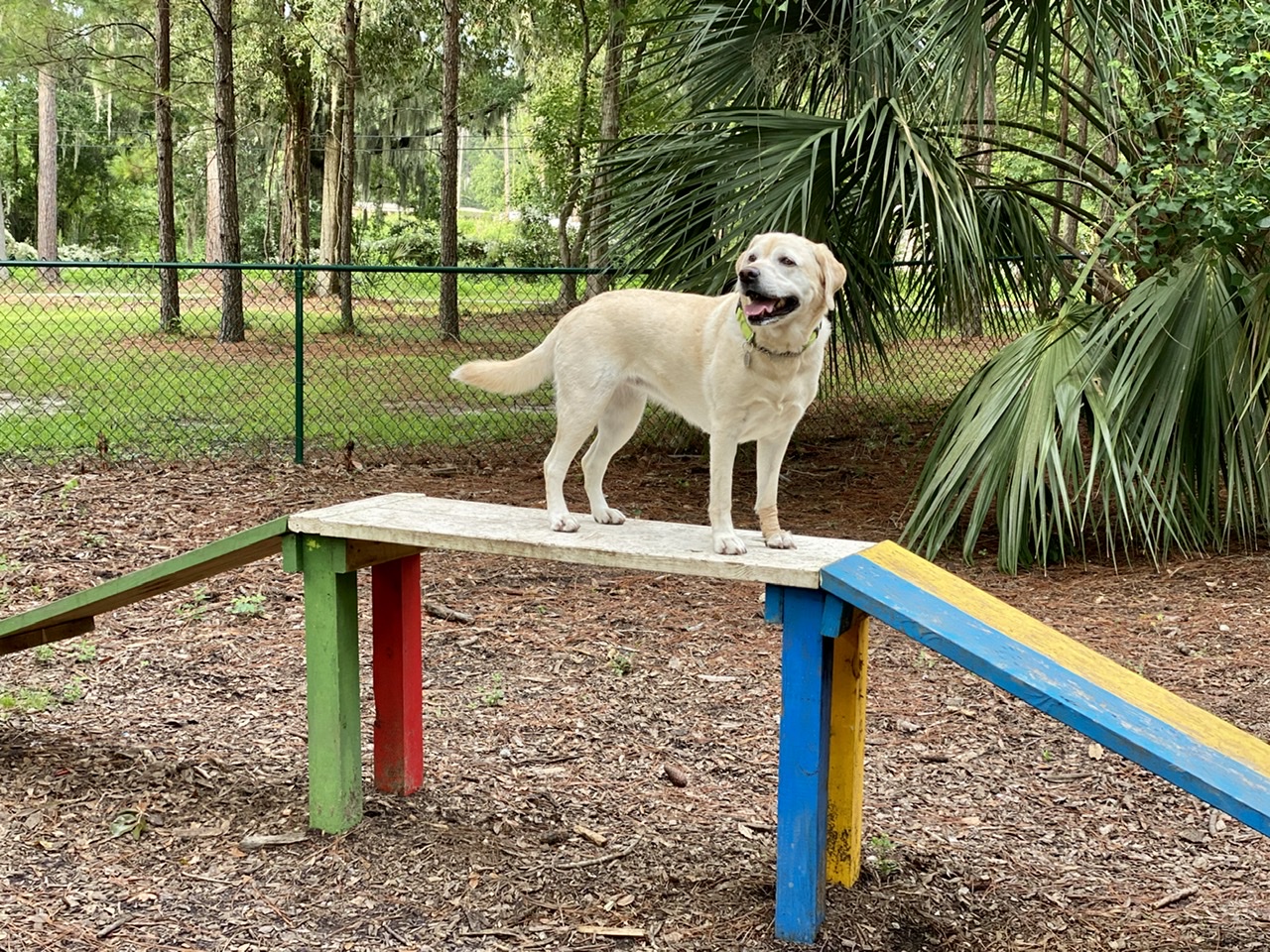
Dora’s doing much better, so today Mom and Dad decided to take the whole crew to a smaller park nearby. Dee Dee, too!
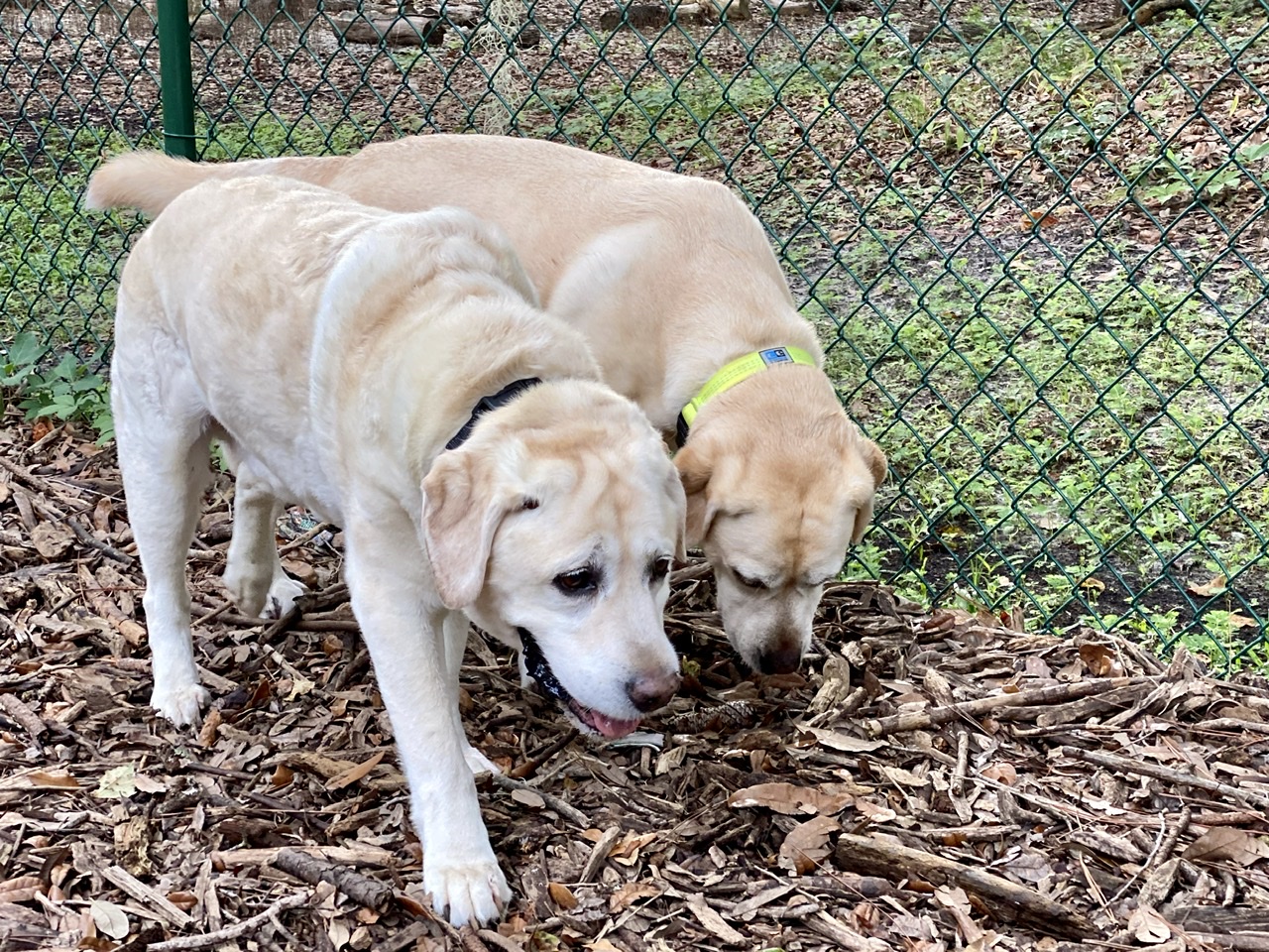
Dylan and Dee Dee protected the perimeter.
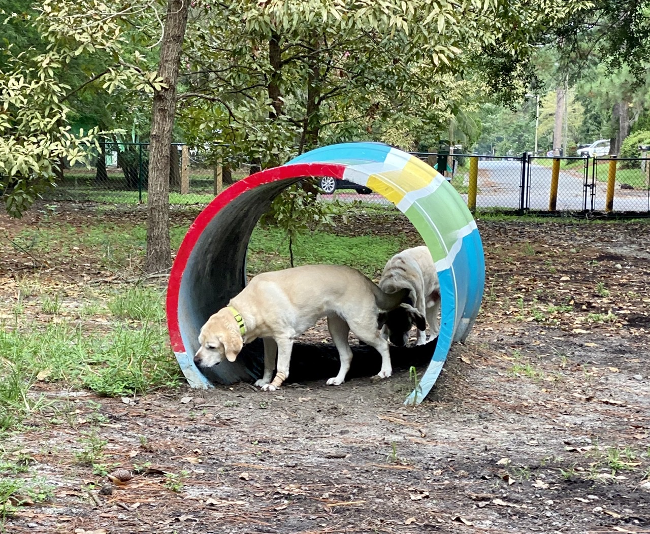
They practiced some agility work – sort of.
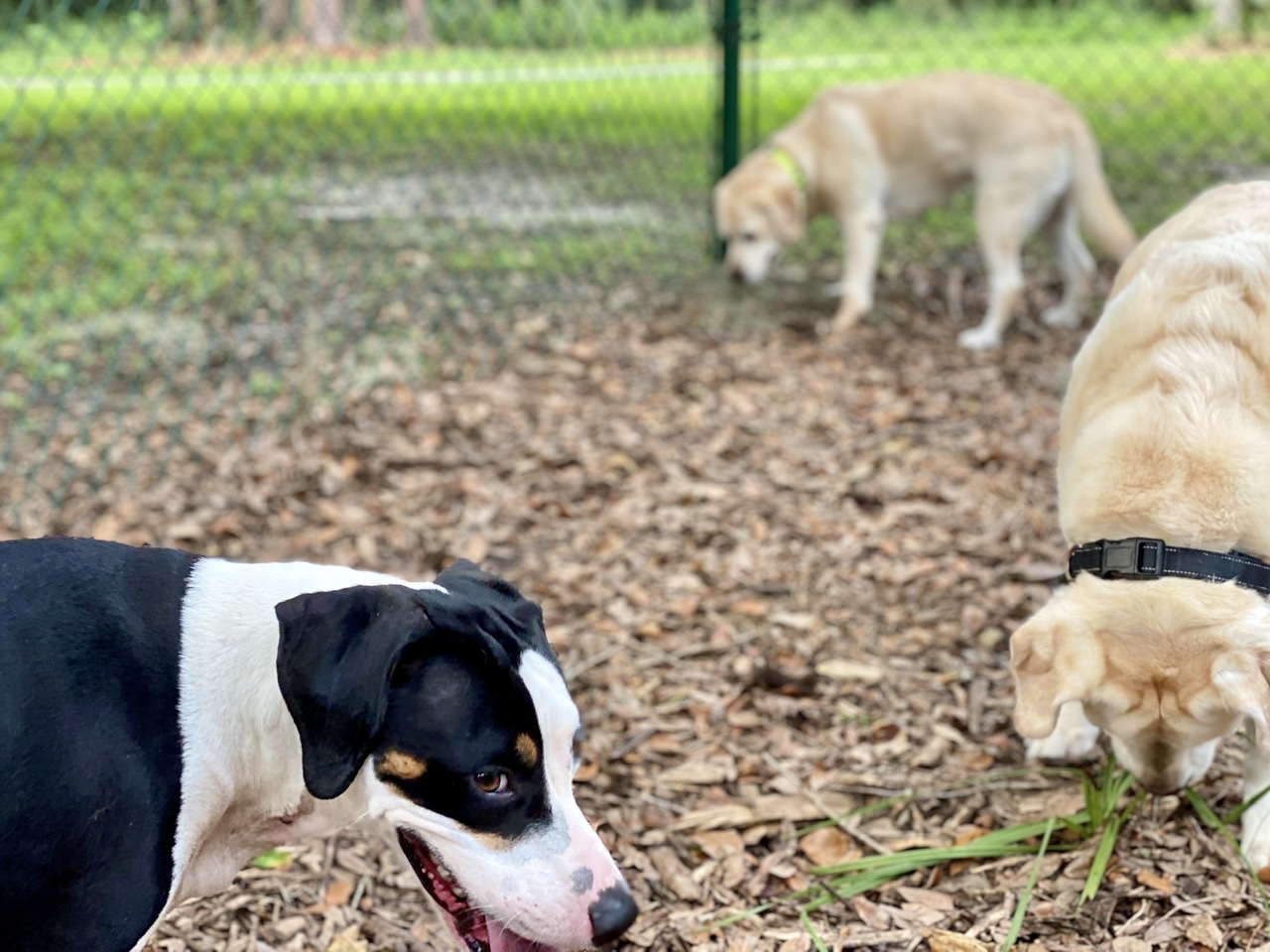
Then Dora decided to stir things up a bit.
Everyone had a great time. Maybe we’ll do it again tomorrow.
Sjernaroyrunden
Six of the islets in the Sjernaroyane group are interconnected with bridges, with a marked cycle path between them, Sjernaroyrunden, that makes for a wonderful day trip. From the anchorage at Kotavagen, we made a short nine-mile run to Sjernaroyane and anchored for a couple of nights near the community docks at Nodholmen. On our…
Randasen
The hike up 1,230ft (375m) Randasen was among the easiest we did on our return trip to Norway. The tender ride to shore was only a few hundred yards, the trailhead was an easy half-hour walk away and the roundtrip hike from there was only three hours. But the view was as good as any…
Josenfjorden
After two days of wind, heavy rain and overcast skies in Erfjord, we were rewarded on our third morning with clear and calm weather for a tender tour of spectacular Josenfjorden. What the 17-mile (27km) fjord lacks in length it makes up for in dramatic scenery, with 2,300 ft (700m) cliffs full of waterfalls. After…
Ship’s Log
We keep a detailed ship’s log that records where we have been, what we have done, system state, and things we fix. Unlike commercial ship’s logs, that normally are hand-maintained and can’t be modified, ours is a bit primitive in that it’s just a Word document. We focus on it being easy to maintain rather…