Tag Archives | trawlers

Elephant Island and Scotia Sea

 Thursday, February 9, 2023 – Elephant Island


Seabourn Quest steamed at 17-19 knots northeasterly from the tip of the Antarctic Peninsula 115 NM to Elephant Island.  The skies cleared after several hours, but the wind was still brisk and the seas were still 2.5 meters.  At 1630 Elephant Island showed up about 15 NM in the distance.  As we approached the eastern tip of the island numerous Fin whales were spotted, along with flocks of seabirds including Cape Petrels and groups of penguins porpoising in and out of the swells.  The area is rich in Krill.

Our Route through the Antarctic Peninsula to Elephant Island


Map of Elephant Island with Point Wild on north side

Cape Petrels off of Cape Valentine

Shackleton Memorial at Point Wild

Fin Whales off of Cape Valentine

Point Wild, Elephant Island

We passed about 4 NM abeam of Cape Valentine, avoiding reefs.  This point was the first landfall for Shackleton’s group, but it was an unsafe area with no real shelter and rockfalls down the steep slopes.  Shackleton moved to the middle of the north side and and found an area in which they could build shelters.  Their shelters were the two other lifeboats, overturned and with canvas sidewalls.  By this time it was April and winter was approaching.  The third lifeboat, “James Caird” took off for South Georgia with a crew of six and after an amazing journey three of them turned up at the Stromness whaling station on May 20, 1916.  The James Caird was recovered along with the other three crew a few days later.  After four attempts, the survivors on Elephant Island were all recovered by Shackleton five months later.


The Seabourn Quest also rounded Cape Valentine and retraced Shackleton’s route, approaching Point Wild where Shackleton set up camp.  We approached to within ½ mile and were able to see the memorial cairn set up at the site of the camp.  Landing on the island is not permitted and the site is now also a penguin colony, which was not present 110 years ago.


During the voyage to Elephant Island, retracing Shackleton’s route, we were treated to a lecture by Robert Egelstaff, the lead kayak guide, who had been on Seabourn Venture with us this past summer.  His talk, “In The Wake of Shackleton” was about how he and three others built a replica 29 years ago of the “James Caird”, the 22 foot lifeboat from the Endurance, and recreated that famous voyage from Elephant Island to South Georgia.  They named the replica “Sir Ernest Shackleton”.


Robert and his teammates took the same amount of time, 14 days, and were able to take the same number of noon sextant sights (4) as Frank Worley, the Captain of Endurance, to determine their location.  Due to weather they were unable to land in King Haakon Bay, where Shackleton and his 5 companions landed, instead finding shelter on the NE side of South Georgia.  Their replica boat is on permanent display in the UK at the Scott Polar Museum in Cambridge.


As a matter of interest, last year the wreck of Endurance was found in the Weddell Sea, only 4 miles from Frank Worley’s estimated position relying only on celestial navigation and a chronometer that had not been adjusted for 18 months.  The wreck lies more than 10,000 feet deep and is in surprisingly good shape.


Seabourn Quest departed from Point Wild on Elephant Island at 1845 and headed out across the Scotia Sea, following the general track of Shackleton more than 800 NM to South Georgia.


February 10-11, 2023 – Transiting the Scotia Sea


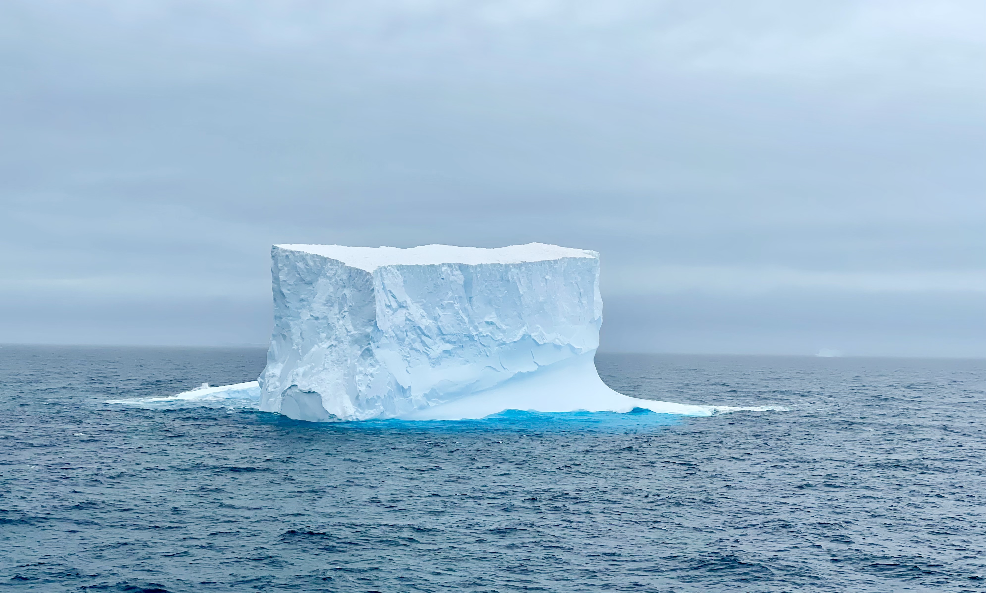
Midday on Feb 10 Seabourn Quest passed through a large field of tabular bergs, giving us some spectacular views, even though it was a little hazy/foggy.  The morning was spent on bio-security inspections of all outerwear going ashore on South Georgia and a mandatory bio-security briefing in preparation for the inspections by health officers from South Georgia when we arrive at Grytviken on Feb 12.  The government of South Georgia and the South Sandwich Islands are determined to preserve the area from an ecology standpoint.  Since were here last they have eradicated rats, removed the non-native reindeer and actively look for non-native plants and remove them.  They have also established a 200 NM Marine Protected Area around the islands, strictly controlling all activity, including illegal fishing.


Tabular Berg more than 1 mile wide

Internet connectivity remains very poor, with little communication from the crew on what the real problem is, since we are quite a bit further north and it should be better than on the Antarctic peninsula where coverage was surprisingly good.


We continued with lectures on Shackleton’s voyages, on the Global Ocean, and on several attempts to cross the white continent, Antarctica.


On Feb 11, we had lectures on “What happens to Whales when they die at sea”, descriptions of both the Amundsen and Scott races to the South Pole and their respective life histories, and on Elephant Seals, which we expect to see on South Georgia.


Feb. 11 – Aguadilla, PR

“To find a seashell is to discover a world of imagination.” –Michelle Held

Today was our last day at the beach. The weather was wonderful and the surf was down, so we were able to truly enjoy the beach in front of our house. It’s been a fun week…mostly relaxing and taking in the view of the ocean and watching the power of the water. When the tide, wind and waves allowed I did a lot of beach combing for amazing sea glass. I found an unbelievable amount of great glass and some beautiful shells.

This is the path from the street and our garage down to the beach and our house.
The local fishermen returning to the beach. They roll the boat down to the surf and roll it up when they return.

Some of our treasures. We found so many more shells that I didn’t get a picture of…this was a great beach.

The town of Aguadilla is clean and beautiful and the water here is so pretty. We enjoyed walking along the shoreline and wandering through town. Here are a few photos from our week in paradise. 

So many stars in the sky.

A pretty little park in town.

Looking towards Aguadilla.

We enjoyed our last evening in Aguadilla at this little place overlooking the beach. We had a great very of the sunset.

Feb. 11 – Aguadilla, PR

“To find a seashell is to discover a world of imagination.” –Michelle Held

Today was our last day at the beach. The weather was  wonderful and the surf was down, so we were able to truly enjoy the beach in front of our house. It’s been a fun week…mostly relaxing and taking in the view of the ocean and watching the power of the water. When the tide, wind and waves allowed I did a lot of beach combing for amazing sea glass. I found an unbelievable amount of great glass and some amazing shells.

CONTINUE READING HERE…»

Second Trip tp Marina Costa Baja Days 7 – 8

Sunday and Monday (February 5 and 6) were more chores days. The weather was sunny and warm, with it reaching 80 degrees Fahrenheit (27 celsius) both days. Eric: Christi and Keith finally got around to washing the boat. They were … Continue reading

Girlache Strait

The Girlache Strait extends from the northern end of the Wilhelm Archipelago and separates the Palmer Archipelago from the Antarctic Peninsula. It was discovered in 1898 by Lt. Adrien de Gerlache, leader of the 1897-1899 Belgian Antarctic expedition. The crew included famed Norwegian polar explorer Roald Amundsen, who in 1911 was the first to reach…

Feb. 9 – Charco El Pilon Waterfall

“To the tourist, travel is a means to an end; to the traveler, it’s an end in itself.” — Marty Rubin
Yesterday we took it easy. We hung out around the house and enjoyed our beach. I’m glad we did because the wind picked up today and the waves were so large they completely took over the beach. The water literally was up to the house. It has been fun to see how much our beach changes from day to day. 

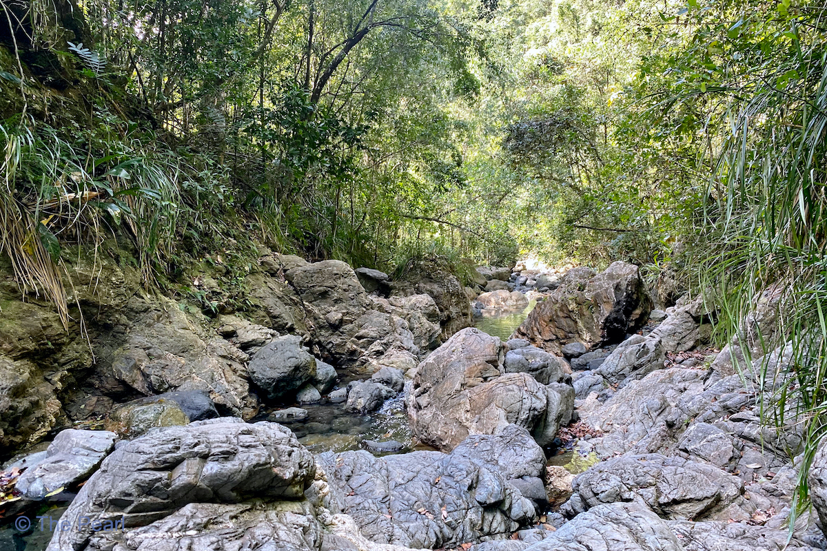
Since it wasn’t a good beach day, we decided to be a little more adventurous and do a hike around San Germán. I had read that the Charco El Pilon trail took you to a beautiful spot with crystal clear water and a beautiful waterfall. The hike goes upstream along the Rio Cain. We had to cross the river 15 times before we reached the falls. All along the trail there were amazing places we could have spent the day playing in the water, but we trekked on to the waterfalls and then up to a slot canyon, called Charco la Iglesia (Church Puddle) above the falls. Each place was more spectacular than the others.

Our morning entertainment.

We came down this road from the parking area. The true trail began here.

Here are a few pictures of the trail to the falls.

Here it is…Charco El Pilon Waterfall.
The best part of this hike…we had the place to ourselves.

The safest route to the top of the falls was up this old stream bed.

Once we were above the falls we had to repel back down to the river. It was a work out but well worth it.

Our first glimpse of the Charco la Iglesia.

Looking upstream above the waterfall and slot canyon. 

I walked through the water towards the top of the waterfall. The pictures don’t show how truly spectacular this place was.

One of the many pretty butterflies we saw on the hike. This one is a Siproeta. (Stan took this wonderful picture.)

Since we hiked over three miles today we decided to treat ourselves to a nice dinner at Peña Blanca this evening.

Stan took a short video of me swimming in the pool.

Feb. 9 – Hike to Charco El Pilon Waterfall

“To the tourist, travel is a means to an end; to the traveler, it’s an end in itself.” — Marty Rubin
Yesterday we took it easy. We hung out around the house and enjoyed our beach. I’m glad we did because the wind picked up today and the waves were so large they completely took over the beach. The water literally was up to the house. It has been fun to see how much our beach changes from day to day. 

CONTINUE READING HERE…»

More Photos from the General La Paz Area (Including the Islands)

Sunset in Marina Costa Baja, La Paz on January 9, 2023

Ensenada Gallo on Isla Espiritu Santo, January 13, 2023

Sunrise, Sunday, January 15 at Playa Bonanza on Isla Espiritu Santo

Sunday, January 15; Playa Bonanza on Isla Espiritu Santo

Drake Passage and Antarctic Experience

 Drake Passage and Antarctic Experience


February 4, 2023 – enroute the Antarctic Peninsula via the Drake Passage


The ship did depart Ushuaia and continued easterly down the Beagle Channel towards the southeastern tip of South America.  The seas were initially calm, but by 0800 we were in the Drake Passage proper.  The Drake Passage is notorious for strong westerly winds and large seas.  There are no landmasses further south except for Antarctica, so nothing to impede the wind and seas.  The water depth averages 11,000 feet.  The body of water is named after Sir Francis Drake, but he never actually crossed the passage.  We passed 30 miles abeam of Cape Horn about 0930.


Entering the open ocean, the seas increased, along with winds of more than 40 knots.  There was a large westerly swell averaging 5 meters, with at times an occasional 10 meter swell, with wind driven seas of 4+ meters.  Theses conditions persisted until late afternoon when the winds decreased, but the large swell persisted overnight.  The ship’s stabilizers really got a workout since the wind and seas were just aft of the starboard beam.


February 5, 2023 – Approaching the Antarctic Peninsula


The swells decreased somewhat overnight and at 0430 we crossed 60 degrees South and the Antarctic convergence zone.  At about 1230 we entered Nelson Strait and proceeded into Eduardo Frei Montalvo Station on King George Island to pick up polar jackets (Courtesy of Seabourn Venture) for those guests still without jackets.  Snow squalls greeted our arrival at the anchorage.  By 1900 we were complete with that stop and began the overnight voyage to Portal Point, our destination for the next day.  Traveling in the waters of the Antarctic Peninsula, in most areas there is a 10 knot speed limit to help protect numerous Humpback Whales, which are feeding on the rich krill here during the Antarctic summer.

Eduardo Frei Station


February 6, 2023 – Portal Point, Antarctic Peninsula


Portal Point received it’s name since it is named as the gateway to a overland route to the Antarctic Plateau.  In 1956, a hut was established here by the Falkland Islands Dependencies Survey.  Arriving at 0800, it took the expedition team a while to sort out zodiac problems and identify suitable locations for kayaking.  Portal Point is located on the Antarctic Peninsula itself, our only chance to actually step on the Antarctic continent.  Nonetheless, we finally started going ashore and Patrick started his first kayak excursion this trip.  The weather was a little windy and choppy, with very little wildlife, but we did see a glacier calving while in the kayaks.  There were no penguins, but there were both Weddell and Crab Eater seals, as well as Antarctic Terns, Kelp Gulls and Skuas.

Weddell Seal, Portal Point
Crabeater Seal, Portal Point


The weather deteriorated enough (and since the ship was 2-3 miles from the landing sites) that the final kayaking excursion was cancelled and it was a wet ride from shore back to the ship.  However, everyone who wanted to go ashore was given the opportunity, including some of the crew.


This is not the furthest south we will go, however we are now at 64 degrees 30 minutes south latitude.


February 7, 2023 – Melchior Bay 


We entered Melchior Bay, formed by a group of islands known as the Melchior Islands and the site of an inactive Argentina research station.  The bay was reasonably protected from the wind and swells we had experienced overnight.

Peaceful waters in Melchior Bay

Inactive Argentine Research Station, Melchior Bay

Fur Seal scratching with his flipper, Melchior Bay

Fur Seals


Patrick was once again on an early morning kayak excursion, where we saw one solitary Chinstrap Penguin, a number of fur seals, Blue Eyed Shags, Kelp Gulls and Antarctic Terns.  The afternoon zodiac excursion was underwhelming, cruising along the opposite shoreline from our kayaking route, with few wildlife sightings except for fur seals, and two  Weddell seals.


February 8, 2023 – Cuverville Island


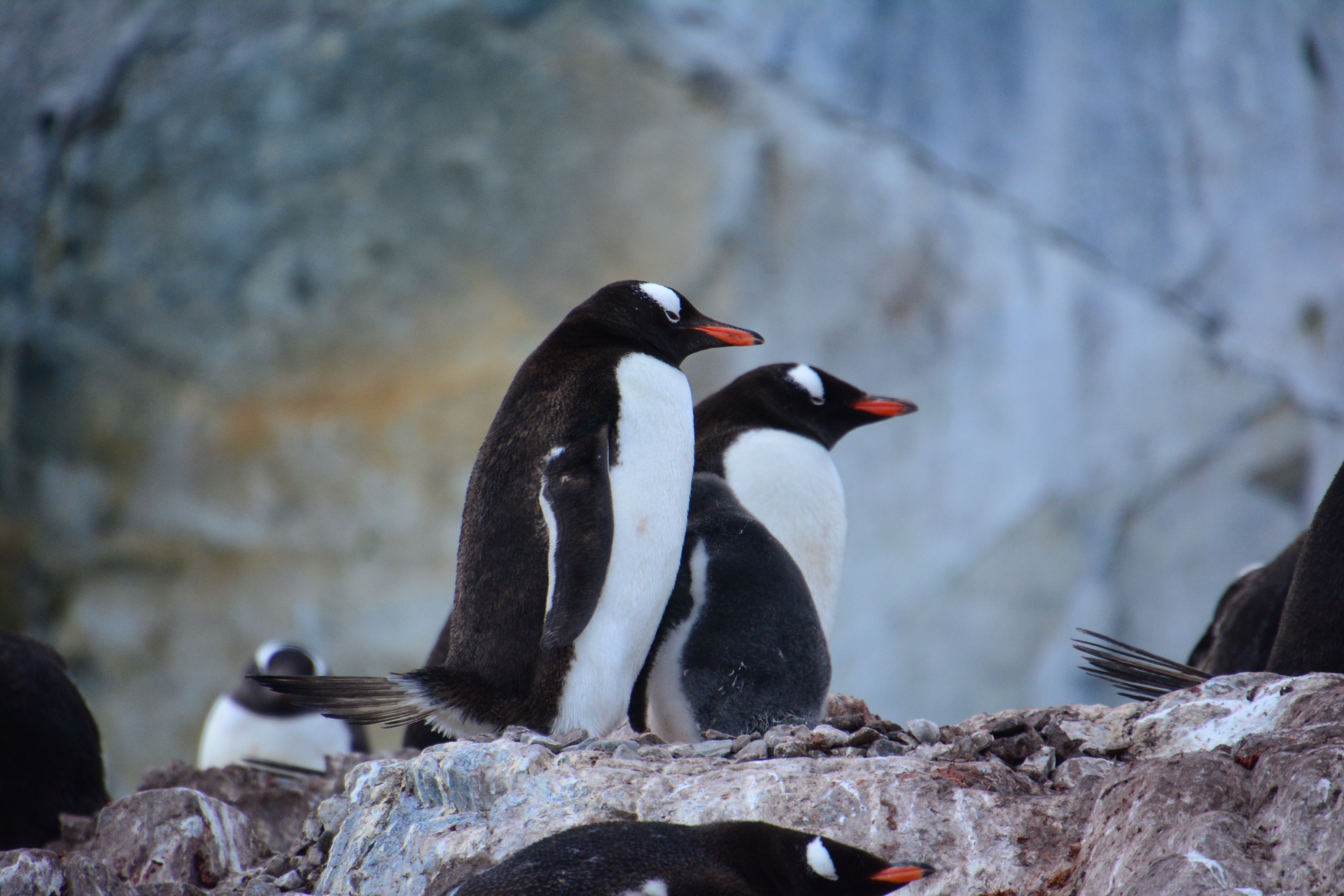
Cuverville Island is in Errera Channel and is home to the largest single colony of Gentoo Penguins in Antarctica, some 6500 breeding pairs.  The island was discovered by the Belgium Antarctic Expedition of 1897-1899 led by Adrien de Gerlache who named it after a French vice admiral, J.M.A. Cavelier de Cuverville.  The island has been designated an important Bird Area by Bird Life International.  Other birds such as Imperial Shags and Southern Giant Petrels also nest here.


Weather is predicted to be windy, so there was to be a early and shortened day when the wind arrived.  However, operations started at 0700, when the wind was light.  Patrick was in the first group for kayaking, which started from a beach below a small Gentoo Penguin colony on Ronge Island, at 64 degrees 40 minutes south latitude.  The excursion started by following the shore of Ronge Island and then heading east towards Cuverville Island through massive floating bergs and past a Danish sailboat anchored in the lee of Cuverville Island.  Our route then went around Shipwreck Island, with a derelict small boat and a number of seabirds such as Antarctic Terns, Kelp Gulls, and even a few Gentoo Penguins, as well a several fur seals.


Kayaking at Cuverville Island

There are massive chains still draped around the small island, left over from before WW1 and used by the Norwegian whale factory ships before the market for whale oil collapsed after the discovery of synthetic oil and chemicals after WW1.  The whale oil was a component used in making Nitroglycerin.


We then paddled around some small bergs and practiced paddling in brash ice, taking some time to sit quietly in our kayaks and meditate on the experience and the location before recovering into the Zodiac for a wet ride back to the ship.  


The wind had started to increase, but Patrick changed out of the dry suit into the antarctic parkas, boots and waterproof pants and headed back to Cuverville Island for a brief closeup look at the Gentoo Penguins with a number of large gray puffy chicks.  After about 20 minutes the wind really increased and at 1015 we were all recalled to the ship and all further shore operations were cancelled, since the wind was now gusting to 50 knots and the seas were building quickly.  After a really wet ride, we returned safely to the ship and watched as the expedition team gathered up the rest of the guests from both the beach and the kayak excursion.  It took another 120 minutes, with winds now gusting to 70 knots, to get all the guests back on board and all the zodiacs and kayaks recovered.

Gentoo Penguin and chick


We steamed slowly north out of Errera Channel into Gerlache Strait, destination unknown for the time being.


At the 1830 recap briefing the new destination of Hope Bay  on Antarctic Sound at the very tip of the Antarctic Peninsula was announced.  Hope Bay has a large Adelie Penguin colony which we saw briefly in 2016, before katabatic winds suddenly began gusting to 50+ knots in the space of just a few minutes, and all the zodiacs were recalled.


The wind and seas continued to be unfavorable all night as we steamed northeast in Bransfield Strait past King George Island.


Thursday, Feb 9, 2023 – At Sea


Our hopes for zodiac excursions and kayaking at Hope Bay were dashed since the weather had not improved as expected and waiting for improvements would have affected the timing of our planned stop at South Georgia Island.  Visibility was poor, it was raining, winds and seas were well beyond the operational limits for shore operations, so the Captain and Expedition Leader made the call about 0800 to turn around and  head for scenic cruising around Elephant Island, famous for it’s role in Shackleton’s voyage as the island on which the majority of his crew waited while Shackleton sailed to South Georgia to mount a rescue operation.


Heading to Elephant Island we passed a number of impressive tabular icebergs.


Second Trip to Marina Costa Baja, Day 6

Sunrise on Saturday, February 4 We decided to take a break from chores today. Instead, we went to breakfast at a small restaurant called La Chata, which was not far from Marina Cortez. It had a cheerful mural on one … Continue reading