
The plan: Get up to Nova Scotia, then over to Ottawa, then to visit friends Rick and Edyie in Ontario, the to Niagara On the Lake, then to Mackinac Island, MI, then home. We plan to see friends along the way—the Blinns at VA Beach, Marc Bowerman in SW Harbor, ME, and the Hawkins at […]
2015 RV trip to Canada. We’re blogging again.
The Long Way Home
Normally our drive back to Illinois takes 2 days. Not this time!. When we left Tourist the car took off in a Northeasterly direction. We skirted around the Western edge of Lake Okeechobee and before long found ourselves on I-95 headed North. Traffic wa…
Running the Coast Again: Retiring to the ICW
The trip from Hingham to Fort Lauderdale was actually great fun. Diana drove me 20 minutes from Hingham to Hull to catch the 8:40 AM ferry to Boston. 35 minutes later, after a brief stop at Long Wharf, the ferry dropped me off at Logan Airp…
Sunny Alaska
A big old blocking high has been sitting off the coast for a couple of weeks keeping the BC coast and SE Alaska generally warmer and drier than normal. It was nice to not have to worry about big storms but the prevailing NW 15-25 winds can build up wav…
SAMOA Show me the Tala!
SAMOA: Show me the Tala!
 |
| DOMINO in Apia, in front of the cathedral |
May 22,2015 – Apia, Samoa
You’d think that after 5 years traveling through34 countries and dealing with officials of multiple cultures, politics, economics and language, I’d be a bit thick-skinned. You’d think that Paraguayan Customs officers, La Marinha do Brazil, and Belize’s Park Rangers would have taught me the ultimate patience. Oh, but that was before having to deal with the operations in Apia, Samoa. Admittedly, some cruisers have had a wonderful experience here… Not us! Since I am still upset over shelling $500 in 5 days to see nothing under water, I’ll just be clinical about this post.
 |
| Apia, on our iSailor… forget the Navnet charting, it’s one mile off! |
Fishing – You’d better catch your fish before getting to Apia, cuz the sea is rather sterile around here. But the bank around American Samoa is excellent if we’re to judge but the tuna leaping alongside Domino and the 20-lb Mahi cooling in the fridge!
 |
| Fifty man long canoe |
Date Line – When you go from American Samoa to (Western) Samoa, you cross the International date line; in other words, you’ve just lost a day. We thought we arrived on Friday afternoon, but noooo… We were Saturday. And on a Saturday at 1pm, don’t expect to get any official attendance to your entry.
 |
| Apia, from above |
Port Captain – Arriving Apia, the only official port of entry in Samoa, you are to call the port captain on VHF 16, and he’ll clear you for traffic, then direct you to the anchorage or the marina. Our calls were ignored, and only when we were in a position to drop anchor did the port attendant OK’d to drop. When we left the harbor on Wednesday, port control did not respond to anybody ‘s call until way into the afternoon. So, don’t count on the port captain!
 |
| Another nice bay where you’re not to anchor |
Apia Marina – The marina has been rebuilt after the 2009 tsunami and the 2011 hurricane, and it looks quite nice. At the time of our arrival there were 3 spots at the docks, including a large one for Domino, and all the pylon spots were free. According to Samoa Port Authority (SPA) all yachts are to dock at the marina. We were directed to drop anchor in the bay, though. Another problem: draft. The marina has a 2.2 to 2.4 meter limit. Sailing yacht Ariel IV was denied entrance due to their 2.6 meter draft. Of course, the Nordhavn 87 Zembra was on the hook as well. What should you do? Usually, cruisers inside the marina will scramble to find you help!
 |
| New cathedral Try the 9 AM Sunday mass and enjoy Samoan singing at its best… check out the woodwork on the ceiling, continue with touring the half dozen churches on the main street |
Fees – The fee structure published on Noonsite is, for the moment, correct. Catamarans pay 150% of these published fees. Now, be aware that even though we were at anchor in the bay, we were assessed the same fees as inside the marina, or 87 talas/day. That’s US$ 40/day, my friends! These fees also apply to the days when officials are not around to process your clearance, an extra 2 days while you are denied access to shore, just flying your “Q” flag. But wait! There is more! SPA has just leased the marina to a private operator. We went to his office and asked for clarification on the marina fees. He had no idea, except that the marina partners were going to raise the fees, not willing to lose money the way SPA did…. Really?
Cruising Permit – Are you or are you not allowed to cruise around the islands? JP met with Claire, on the 2nd floor of the SPA building. Yes, for US $100 you could get a cruising permit that also included your anchorage fee in Apia. But if you went to Matautu Bay in Sava’i there was no cruising fee, but you needed to get permission from the Ministry of the Prime Minister at the government building. Uh?
 |
| R.L Stevenson’s house |
Clearing In – After spending Saturday and Sunday on board, patiently flying our Q flag, we were anxious to proceed with our clearance on Monday morning. By 9AM, Port Control had come in on VHF and promised to send the officials on board… Do NOT go to shore!
1. Health showed up at noon, cleared us, and we could now take our Q flag down.
2. Immigration called us for pickup at the dock an hour later and stamped our passports. He also filled out our exit papers, agreed to stamp our exit so that we could leave directly from Sava’i…. But didn’t, and that would bite us in the rear 3 days later.
3. Customs called for their pickup late in the afternoon, but cleared us in a few minutes.
4. No visit from port captain or marina officials.
5. Agriculture??? Ah, that would be the next morning, another dockside pickup and a 4 Talas fee for our on-board trash.
 |
| Every morning at 9AM, flag raising at the Government Building |
6. Ministry of the minister… By 10 am on Tuesday we had finally secured our clearance and cruising permit, and we’re ready to tour the island… At last!
 |
| One of the tree house hotels in one of the giant Aoas. |
Touring Upolu – For 250 Talas ($120) our taxi driver took us around the island of UPOLU. And what a splendid island it is, there is no denying it. But the weather wasn’t with us as low clouds and rain marred the sky and obstructed the views.
 |
| Tapa-lined walls |
Robert Louis Stevenson’s house is worth a peek for its classic architecture, manicured grounds, tapa-lined walls, and just the famous writer’s local lore.
 |
| Bahá’í House of Worship |
The Bahá’í House of Worship is also a relaxing stop, knowing that all religions are welcome to worship in one single place. Again, the grounds are a source of wonder.
 |
| Gardens at the Baha’i temple |
Papapapa-something Waterfall? Yep, it was supposed to be there, behind the curtain of clouds.
 |
| What’s your worship… any one will be OK |
Aoa tree house? Yes, we could kind of see it, perched in the enormous Aoa Tree.
 |
| Baha’i ceiling |
Sliding rocks and swimming hole? Not for us today, under a deluge.
 |
| Waterfalls… because it rains so much! |
Lunch? We had asked for typical and local food fare, and we should have stopped with the “Kéké Puha”, a taro flour steamed bun filled with spicy pork… Yummy… But our driver insisted on taking us to “good food.” We ended up at a resort, offering nothing better than pizza and fish and chips…. But the Indian Chef prepared a raw fish salad and a beef curry, just for our driver and us…. A very special $100 treat indeed!
We paid more village entry fees for hilltop vistas and swimming in a grotto… And we’re only too happy to return to the boat.
The best thing, really, was to drive through the lush vegetation and observe how the villages are organized, the houses without walls surrounding the meeting hut. Samoans still live a rather simple lifestyle. The streets are clean, the grounds manicured and there is no crime. This, according to our driver (the son of a local chief, soon to be chief himself) is thanks to the chief’s authority who has the power to punish and even ban the malfeasants!
 |
| Matautu Bay. Our anchorage… in red, how to take the dink to shore, and snorkeling area |
Savai – Matautu Bay – The wide bay opened to the North is a no-brainer. Come in and drop the hook… Quiet and peaceful and the surrounding reef holds the promise of splendid snorkeling. The local dive boat has been hopping from one site to the other and we’ve noted his moorings, even got his permission to tie up at his moorings. Otto’s a very cool guy.
 |
| The reef tries to come back |
Question is, how do you go to shore? The reef is forbidding and extensive. At high tide, though, you can cross the reef in the direction of the old jetty and, keeping the white sticks on your starboard, carefully head to the beach at the resort. The owner is quite accommodating. The store across the street will gladly sell you a Wifi Card and you can arrange to tour the island. Sava’I is, according to local lore, the island that Hawaii was named after, 1,000 years later, and it’s supposed to be the most beautiful of all of Samoa. We didn’t experience that, too antsy to check the underwater scene.
 |
| Sea anemone and clownfish are one of the rare occupants |
And what a disappointment! The reef at Matautu is dead. Dynamite fishing and the resulting shockwaves, as well as root-brew fishing have killed it all. If the locals were able to stun the fish and paralyze it so it would be easy to catch, they also have destroyed the entire reef life. Dejected, we abandoned our underwater quest and hoped for better experience on land. But the wind shifted to the north and we just hightailed it out of there, back to Apia to process our out clearance.
 |
| One of the more delicate seaweeds we found… no idea what it’s called |
Clearing out – We figured that an afternoon would be enough to process our clearance, right?
1. Immigration – Taxi downtown to the immigration office, queue in line, get passports stamped, done!
2. Port – Taxi over to SPA, go upstairs to Claire to process fees?… Oops, Claire took the day off, no replacement… So much for our all-inclusive $100 fee… The gentleman downstairs kindly offers to take care of us…. So, 87 Talas x 5 day =435 Tala, or $200…. We complain: but we were at anchor, not inside the marina! But we were at anchor only 2 working days, waiting for the officials and cruising to Sava’I the rest of the time! No matter, mate…. Pay up… But Claire promised it would just be $100 all-inclusive cruising permit… But Claire is not here, is she? Finally, after much coming and going, the guy shakes JP’s hand, “Gentleman’s agreement, US $100”. And gives us a receipt for 100 talas!
3. Customs – We rush there to beat the 4pm cashier ‘s deadline. Hand out our stamped passports and SPA receipt. Oh, but where is your clearance letter from immigration? Uh???? To make a long story short, immigration is supposed to give you a clearance letter IN ADDITION to stamping your passports. Oh, but you must return to the immigration office and get your clearance!!!! That’s when, in tears, I blow up and start at the customs official… “This is just not acceptable… The official should have known his job and didn’t do it… Call him ….” I choke, barely holding my anger… JP agrees, “please call him and tell him to bring the clearance, I’m not paying for another taxi!” Agreed… An hour later, the immigration official shows up with our clearance and rushes out of the building… Here, Mr. Customs official, here is our clearance… OH, but this won’t do, it is only a copy and I need the original ! ARE YOU KIDDING ME?????? We argue some more and customs finally accepts the document. PHEW…. We pay the 54 Talas ($22) clearance in exchange for a very nice document with an enormous bright blue “clearance” sticker reminiscent of kindergarten. DONE! It’s 5 pm and we made it.
We needed to celebrate… Walked to the KK grocery store and spent our last few Talas on a nice bottle of scotch.
EPILOGUE– As we walk past the marina entrance and wave at the security guard, he hails us over… What now? “Aren’t you guys forgetting something?” Hum…. Got our clearance, got Scotch, paid our fees, waved goodbye… Nope! He hold our passports in his hand… Customs Guy just dropped these for you! In the confusing mess, our passports had remained stuck somewhere on his desk! Thank you after all, Mr. Customs Guy!
Saturday, 7am, VHF 16 . “Apia Port Captain, this is Domino, do you copy? …. Request clearance out of the harbor, do you copy? Nothing heard!” And we steam out, only too glad to affront the 22-29kts on the nose to return to Pago Pago!
That was our Samoan experience. Yours may be totally different.
Until Next time…
Running the Coast Again – The Adventure Begins
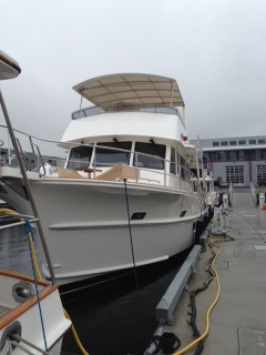
A little background. My friend Pam has just taken delivery of a new 2014 Grand Bank 54 Heritage, The boat is located in Dania Beach and as I write this is in the final stages of preparation for a cruise north to Newport, RI.
 |
| Grand Banks 54 Heritage EU |
Diana and I met Pam when we moved from H-dock at Chicago’s Belmont Harbor to I-Dock in the spring of 2007. This was a year after we purchased the 2006 Sea Ray Sundancer. At the time she owned a 40 foot Sea Ray Sedan Bridge. She later upgraded to a 2008 47 Sea Ray Sedan Bridge. Pam is unique in the boating world as she single hands her own boat.
Pam hosted our 2010 Great Loop going away party on October 2 on her boat. In attendance were Mark Fidanza, our next slip neighbor, Dick and Cathy Hoffman, Mark, Wendy, Mike and Brad. On October 3, Dick followed Guided Discovery out of Belmont and took photos of our departure. Most recently, Mark visited us with his children, Jon Marco and Helena, in Sarasota and again connected with us last week in Hingham. Dick, as you recall, crewed for me when we ran the boat north from Fort Pierce to Hingham (See the three part series “Onward to Hingham” published two weeks ago).
We made a lot of good friends on I-dock.
Now to the 2014 Grand Banks Heritage 54 EU.
- Overall Length: 54.4 feet
- Max Length: 61.6 feet (with bow pulpit and swim platform)
- Max Beam: 17.9 feet
- Max Draft 5.0 feet
- Air Draft: 25′ 11″
- Displacement: 83,335 pounds (1/2 load)
- Fuel Capacity: 1,500 gallons
- Water Tank: 270 gallons
- Holding Tank: 100 gallons
- Engines: MTU S-60 825 HP
- Top Speed: 21 knots
- Cruise: 17 knots
So how does this boat compare to the 63 Outer Reef? While the GB is shorter by 9 feet she is wider by 9 inches. Grand Banks says she has the space of a 65. Beam makes a big difference. Hence, she is almost as roomy, overall, as the 63. That extra 9 inches translates into some very desirable features such as dual helm seating on the flybridge, slightly more room in the salon and a settee with a large table across from the galley. What’s missing is the lazerette. a complete jitchen and the abundant storage found on the 63 (which makes sense given that we have 9 more feet of length).

Like the 63, she has an open layout on the main deck, which gives a feeling of increased space. We love the open layout on the 63 and it works well here. She also has a walk-in engine room with well organized storage space.
 |
| 54 open layout looking forward from the galley to the pilothouse |
 |
| Galley and dining area with settee and two chairs (comfortable seating for 5) |
 |
| Galley equipped with stove top, dishwasher, drawer type refrigerators and microwave The double draw freezer is located forward of the sink |
 |
| Another view of the dining area |
 |
| Salon looking aft |
This is a three stateroom boat, which is, again, very similar to our 63.
 |
| Master stateroom |
 |
| Master head and shower |
 |
| Guest head and shower |
 |
| Looking from the master stateroom at the washer, dryer, refrigerator, storage and accessed to the engine room |
The 54 has significantly more power. The 63 has two 503 HP Cats. The 54 has two 825 MTUs. 1006 HP versus 1650 HP. This produces some interesting differences. While both are displacement hulls, the 54 is considerably faster than the 63 with a top speed of 21 knots as compared to 13.5 knots. The 54 can cruise at 17 knots. However, that comes with a significant increase in fuel consumption, which should be in 60 GPH range. That provides 22.5 hours of cruise time and a range of 382 NM with a 10% reserve (based on 1350 gallons). The 63 really does not have a rational cruise speed beyond 8.5 knots.
 |
| Walk-in engine room with 6 feet of head room |
By comparison, the 63 running at full tilt burns 50 gallons per hour and with a 10% reserve can run for 23.4 hours at 13.5 knots. That yields a range of 316 NM. The 54 has 16% more range at cruise, which could come in handy to run toward shore in an emergency or to seek shelter from a storm. Put the 54’s “pedal to the metal” and her 21 knot top speed will produce 17 hours of running time and 354 NM of range with a 10% reserve (at 80 GPH with 1350 gallons usable). Again, much better emergency capability.
Running the 54 at trawler speeds makes the most sense. The 825 HP MTUs burn about 10.0 gallons per hour at a speed of 9.0 knots. That yields 150 hours of run time or 1215 NM range (with the 10% reserve). This is very similar to the 63’s capability of 1178 NM at 8.4 knots; her best range versus speed setting. Essentially Grand Banks, by installing bigger engines, gets the best of both worlds. She can run very efficiently at trawler speeds and move fast when she has to.
Displacement of the boats is very similar. Grand Banks represents displacement for the 54 at half load or 83,334 pounds. The 63’s empty weight is 73,000 pounds. Add 4550 lbs for 650 gallons of fuel and 1600 lbs for potable and black water (200 gallons) and the 63 comes in at 79,150 pounds. Both boats are semi-displacement fully stabilized trawlers. They should have very similar see keeping characteristics. We’ll see if this is true as we experience the different seas on our run.
Cruising Options:
The next question is whether Pam decides to take a leisurely run up the coast with stops every night or run the distance to Newport, which in this case is 1308 nautical miles. The theoretical difference is 6.5 additional days (i.e., 13 days with stops every night versus 6.5 days running 24 hours per day).
I say theoretical because in long distance cruising the wildcard is weather. As readers know, I like to take advantage of weather windows and prefer to run at 24 hours/day with good (well OK good enough) weather rather than sit at a dock overnight. The weather is going to change. It is rare to get 6 days in a row of favorable weather (which I’ve come to define as winds under 20 knots and seas under 5 feet).
The run up the east coast is further complicated by the ever present Cape Hatteras. The combination of its location at the convergence of the Gulf Stream and Labrador currents and its 17 mile Diamond Shoal, that must be circumnavigated, present an interesting obstacle. Running the Cape with at trawler speed (8.5 knots) requires traveling at night to cover the 200 NM distance between Morehead City and VA Beach as there are no usable inlets. The alternative is three days on the ICW. Unfortunately, when bad weather (i.e., high winds producing heavy seas) dictates the ICW route the likelihood that the run will be more than 3 days increases due to the Alligator River Swing Bridge and Currituck Sound, both of which are effected by high winds. Throw in a 3 mile long river with 5 feet of depth at MLW and you have lots of potential for delay.
In any case, I’m not up for a leisurely cruise up the coast. Been there, done that (actually two times – the Great Loop on the entire 1000 mile ICW and the 2014 spring run to Hingham – which took 35 days). However, Pam needs help. So I volunteered 6 days which she can use as she pleases. If we run only during the day we will comfortably make Charleston by Wednesday (June 3).
Pam, at my suggestion, installed a complete Garmin system (Chartplotter, AIS, Sonar, Weather and Radar). I hope to share with her my “Garmin” knowledge, which should have the benefit of greatly shortening her learning curve. That said, the Garmin system is incredibly user friendly. I’ve managed to master the system over the last 15 months but at times it was stressful due to sea conditions and the need to solve a problem. Rarely, have I used the owner’s manual, which was helpful when I needed it but not well indexed.
 |
| Pilot House equipped with Garmin 8215s, autopilot and GMI-10, |
Now back to weather. The forecast as of Friday morning for the coast between Fort Lauderdale and VA Beach shows a ridge of high pressure over the Appalachian Mountains that will continue though weekend. The high is forecasted to produce winds of 15 to 20 knots and sea of 3 to 5 feet with a wave period of 9 seconds over the Florida waters. At Cape Hatteras the forecast calls for a frontal boundary to move southeast through the waters by midweek. Winds are predicted to be 5 to 10 knots with seas of 3 feet through Wednesday when they build 3 to 5 on slightly higher winds.
Again, I consider the conditions along the Florida coast as reasonable and the weather north of Florida to VA Beach as very favorable. Assuming an early Friday AM departure on Guided Discovery I would be rounding Cape Hatteras Monday evening on calm seas (a first). The potential to go from VA Beach all the way to Newport is very favorable assuming one is willing to put up with 3 to 5s.
Oh well, we’ll (or shall we say, she’ll) see what the weather brings after Wednesday.
Written by Les.
5-26 & 27-2015 Heading Home from Spring Fling
Tuesday morning everyone got up around 5:00 AM to get ready to head out for home. We were all so ready to get out of here! The radar was showing a band of storms coming our way, so with great disappointment we went back to bed. Anothe…
Alaska 2015 – Glaciers and Whales – Petersburg to Hoonah
May 17, 2015 – Petersburg to Portage Bay
We know we have lost a day somewhere, but so what. This morning we finally departed Petersburg and fought a 5 knot flood tide against us for several miles as we headed out of Wrangell Narrows and up Frederick Sound. The seas were calm as we motored the short distance to Portage Bay where we anchored about one mile into the bay. Even one mile in, the peak current was over 2 knots, but he bottom was mud and held well, since Steel Tiger rafted alongside of us. Our Delta FastSet anchor had no problem at a 4:1 scope holding the combined weight of 135 tons as the current ebbed and flooded during the night. Crab pots were set, but with no success. We suspect we were not far enough into the bay.
May 18, 2015 – Portage Bay to Tracy Arm
Both boats departed Portage Bay at 0635 to take advantage of the ebb tide out Frederick Sound and then the flood tide up Stephens Passage to Holkam Bay. At Cape Fanshawe we encountered a large pod of Orca, then Dall Porpoise near Fife Finger Islands Lighthouse. Off Windham Bay we encountered humpback whales, which were mostly feeding on the surface. One came to the surface right in front of Spirit and we had to go into reverse to avoid hitting it. We just stayed in idle for a few minutes until we were clear of the whale.
 |
| Part of the large pod of Orca |
 |
| We almost ran into this one |
 |
| Lots of tails, no breaching |
 |
| Just another humpback tail |
 |
| Foot shaped rock on Entrance island, Holkam Bay |
 |
| Brown bear on the beach, No Name Cove |
Crossing the bar at Holkam Bay, we entered No Name Cove (also known as Tracy Arm Cove). There was a solitary brown bear on the beach when we arrived. Spirit rafted to Steel Tiger. We took Steel Tiger’s tender from the anchorage up Tracy Arm to assess the ice conditions for the next day. We turned around at mile 15 since the ice was easily navigable.
May 19, 2015 – Tracy Arm
We broke up the raft at 0750 and headed up Tracy Arm. Stopping at Ice Falls for photos we shortened the tow lines on the tenders and continued up the arm, easily dodging the sparse ice. Passing Sawyer Island we reached to within ¼ mile of the South Sawyer glacier face about noon. Shutting off the engine, we just drifted for several hours and watched the calving and listened to the noise the glacier made. We returned to the cove and anchored separately at 1715.
 |
| Looking up the “S-Curvess” |
 |
| The icebergs are constantly changing |
 |
| Finally – South Sawyer Glacier |
 |
| Calving every few minutes |
 |
| This one set up a large wave from the face |
May 20, 2015 – Tracy Arm to Taku Harbor
Spirit departed Holkam Bay behind the cruise ship “Star Princess” at 0850, and after an uneventful trip, docked at the public dock in Taku Harbor at 1255. The crab pots were set and by evening we had 2 large Dungeness crab. The harbor was windy, so we were glad to be at a dock. There is also another public float, not connected to shore further south in the harbor. Several humpback whales entered the harbor and provided entertainment during the evening.
 |
| Departing Holkam Bay behind the Star Princess |
 |
| Abandoned building – Taku Harbor |
 |
| Public dock – Taku Harbor |
 |
| The last of the squat lobsters became cocktails |
 |
| Harry Johnson’s famous crab spaghetti |
May 21, 2015 – Taku Harbor to Auke Bay
After pulling the crab pots, with 6 more legal crabs, we headed for Auke Bay. Leaving Taku we were treated to a breaching humpback whale. We were able to get on the inside of the breakwater and shut off the engines at 1220. After picking up the rental van from Juneau Car Rentals, we picked up Steel Tiger’s guests at the airport. All eight of us headed for Mendenhall Glacier, Costco and then Alaskan Brewing, before returning to the boat. We grilled steaks to celebrate the last night with Bob & Dianne Tucker before taking them to their hotel in downtown Juneau. They will continue to travel to Anchorage and Homer before returning to Anacortes. Juneau was very warm, with most people in short sleeved shirts and many in shorts.


 |
| Taku whale show |


May 22, 2015 – Juneau
After a leisurely group breakfast of blueberry waffles and homemade German sausage we all piled back in the van and headed to downtown Juneau where we dropped of the Tucker’s at their hotel and then spent several hours mingling with the thousands of cruise ship passengers browsing the jewelry stores, souvenir shops and Alaskan Native art shops. By now it was lunchtime, so we headed for the Red Dog Saloon where we managed to get a booth with no waiting time. The sawdust on the floors, the server’s costumes, the piano player and the décor all attempting to recreate a Gold Rush era saloon atmosphere. The beer was good (Alaskan Amber) and the food passable for pub fare, so we had a good time. Leaving downtown, we headed back to the airport where we picked up our friends, Jon & Suzanne Liljegren. After a stop to pick up fishing licenses we repeated the tours of Mendenhall Glacier, Costco, Alaskan Brewing and then Safeway for some last minute provisions before returning to Auke Bay. We had a “welcome aboard” BBQ and enjoyed the warm, sunny evening.
May 23, 2015 – Auke Bay to Swanson Harbor
After returning the rental van we said goodbye to Auke Bay for 2015 and left the dock at 1030 for the 30 nautical mile run to Swanson Harbor. Heading around the north end of Admiralty Island past Point Retreat we encountered windy, choppy seas in the southern Lynn Canal. As we headed south the seas and wind gradually slackened and it was mostly calm as we entered Swanson Harbor and found space at one of the two public floats, docking at 1445. By evening the floats were full of people coming out from Juneau to celebrate the Memorial Day weekend. Crab pots were set in the usual locations, but were empty at the evening check.
May 24, 2014 – Swanson Harbor to Glacier Bay
Patrick picked up the crab pots, there were only 2 legal crab in the pots, and Spirit tossed off the lines at 0702 and we headed to Bartlett Cove, Glacier Bay. Just outside Swanson Harbor we observed a number of Sea Otters, which may explain the lack of crab in the harbor, since they can decimate the crab population quickly. We crossed the boundary at 1100 and after getting permission, docked in Bartlett Cove at 1224. We all visited the lodge, watched the movie, and then the skipper’s orientation at 1400, where we signed the logbook. Both Spirit and Steel Tiger departed Bartlett Cove at 1455 and by 1830 we were rafted alongside Steel Tiger in North Sandy Cove. Along the way we stopped at South Marble Island and viewed the massive colonies of Stellar Sea Lions and looked for Puffins, to no avail.
 |
| Stellar Sea Lions, South Marble Island |
May 25, 2014 – Marjerie Glacier
After a leisurely departure from North Sandy Cove at 0810, we headed north and stopped just short of Tidal Inlet to photograph Mountain Goats. We proceeded up Tarr Inlet, passing to the east of Russell Island and directly to Marjerie and Grand Pacific Glaciers. We had to share the glacier views with the “Star Princess” for a while, but then it departed and we had the glacier face to ourselves. Marjerie Glacier is very active, with some calving every few minutes. Patrick collected some glacial ice and then we headed to Blue Mouse Cove. We spent nearly two hours enjoying the sounds and sights at the glacier face.
 |
| Mountain Goats, Glacier Bay near Tidal Inlet |
 |
| Cormorants Hitching a ride |
 |
| Majerie Glacier comes into view |
 |
| The Star Princess is dwarfed by the glacier face |
 |
| Calving – Oftne |
 |
| The rivers of ice stretching into the Fairweather Range |
 |
| The Fairweather Range makes cruise shiips look tiny |
 |
| A final calving as we leave Marjerie Glacier |
 |
| Our haul of glacial ice from Glacier Bay |
Departing the glacier at 1600 we headed back down Tarr Inlet, passing west of Russell Island, passing the entrance to John Hopkins Inlet, past Lamplugh Glacier, Reid Glacier and finally anchoring in Blue Mouse Cove where Steel Tiger rafted alongside Spirit. As the sun set we were treated to great views of the Fairweather Range and portions of the Brady Icefields.
 |
| Skinny Moose on the beach, South Finger Bay |
 |
| Brady icefields from Blue Mouse Cove |
May 26, 2015 – Blue Mouse Cove to South Finger Bay
At 1000 we broke up the raft and by 1220 both boats were anchored in South Finger Cove. Jon and Suzanne took the tender out to the other side of the bay near Tidal Inlet to photograph more Mountain Goats. We put prawn pots down in Berg Bay and had to dodge Humpback whales both in Berg Bay and in the entrance to South Finger Bay. There were hundreds of sea otters floating at the mouth of the bay, many with babies on their chests. Our halibut fishing expedition was unsuccessful, but the Steel Tiger crew landed one nice halibut. Returning to the bay, we watched two skinny moose wander down the beach right behind the boat.
May 27, 2015 – Glacier Bay to Hoonah
Spirit pulled the anchor at 0750. Patrick and Jon took the Grady White down to Berg Bay to retrieve the prawn pots and Miriam and Suzanne drove Spirit behind them. We got about 2 dozen, a disappointing haul, but enough for an appetizer. Heading out of Glacier Bay, we checked out of the park with Bartlett Cove and headed to Hoonah. The wind peaked to 22 knots and the seas to 4 foot as we headed back east in Icy Strait. Heading up Gedney Channel we were treated to more Humpback whales and a rock covered with Bald Eagles. We docked at the transient float in Hoonah at 1440 and after checking in, refueled the Grady White and refreshed our produce at the Hoonah Trading Company. We have decided to stay an extra day in Hoonah so we can fish for halibut in the morning.
 |
| Sunny evening in Hoonah Harbor |
 |
| Eagle Rock |
 |
| Chickens Wander the streets in Hoonah |
SUWARROW… no go!
 |
| On the hook north of Tom Neale’s Jetty |
SUWARROW… no go! May 1st 2015 … Suwarrow Atoll …. (My computer is on the fritz, some keys are dead, so I’m improvising …. 13°14.86S, 163°6.467W… > “Suwarrow, Suwarrow, Suwarrow caretaker, this is the motoryacht DOMINO, DOMINO, do you coly, over” no response. … Let’s keep on fishing, then!
 |
| Entrance into Suwarrow by calm weather |
For the last 3 hours, we’ve been trolling the NW end of Suwarrow with fantastic results… 2 nice size wahoos and 2 yellowfin tunas. Didn’t matter if the wind blew a stink and we were pelted by rain, we were NOT to abandon the sixty pound fish on the hook! Now, the freezer is full again, especially after catching a 35lb Mahi during our crossing, just north of Maupelia.

 |
| Nice Mahi… our first in a over 6 months! |
We’ve done all the paperwork required by the Cook Islands Customs… form 27 gave us permission to enter Suwarrow in the presence of the park Ranger, but we were not allowed to “LAND” on the atoll in the absence of the Caretaker. The caretaker had agreed to meet us there on the 3Oth of April… we were now May 1st and nobody answered on VHF 16. By mid afternoon, the wind and seas were picking up and the forecast for the following day was nasty. We decided to take a peek inside the lagoon, just to make sure that there, indeed, was nobody waiting for us. Deserted… nobody in sight.
 |
| Now, this twin hooku] made rejoiced us |
Now, we were in a quandary… We could have diverted our route north penrhyn, but the rates have gone up so much (NZ$3 a foot a day!!!! } that we did’t even consider it. Making an executive decision, our chief dropped the anchor north of the jetty in 1O meters of blue water, we floated our chain and waited. That was a good decision, as it turned out. The next day, we were still hoping to see the ranger’s transport show up on our AIS… what we saw was a 26 meter sailing yacht slushing through 35 to 4O knots of wind… “DOMINO, do you think we can anchor inside the lagoon# It’s too rough out here, even for us… but we have a 12 food draft and the seas are bad, visibility sucks…” We talked for a while and the yacht decided to continue on to Western Samoa. Needless to say that we didn’t leave the boat, didn’t drop the dinghy, didn’t go to shore… we just looked at the dozen shark that had decided to check us out. It was cold, rainy, and we had no desire to go for a swim.
 |
| What do you do with all that fish .. Tuna Tartare on a bed of avocado, tomato and hard boiled eggs |
We kept checking the AIS, hoping for the ranger to show up… nothing. And what a shame, really! Suwarrow was such a dream for us… just reaching this destination was an accomplishment… we wanted to experience one of the best diving in the pacific… It didn’t happen… in the morning we raised anchor and waved goodbye to Tom Neale’s retreat, the coconut crab we didn’t hunt, the reef we didn’t dive, the gin=clear water we didn’t experience. I’m sure that other yachts do stay even if the ranger is not around… if fact, I know several who did… but I’m not one to defy authority and I was such a paranoid mess to deal with for those 36 hours inside the lagoon that my skipper was only too happy to leave.
 |
| Into the West |
Off to American Samoa, then… Home port of pago pago!
 |
| Here goes nothing! |
Until then… dominomarie
Boating Safety Tips For Everyone
Always review basic safety rules with your passengers before departure.
BE WEATHER-WISE ❐ Check local weather conditions before departure• Play it safe and get off the water if you notice darkening clouds, rough, changing winds or sudden temperatur…
