
Another great day! We started off with some more beach time, strolling up and down enjoying the beautiful scenery before the weather starts to turn yucky. Orange Beach reminds me of Destin and Panama City with a lot of beach for beach walki…
Day 306…Dream Boat
Welcome to day 306 of 365 photos…I see many boats like this along the coast – no matter where we have traveled. I’ve seen them in Maine, North Carolina and Florida and places between. Every time that I see one, I wonder if it is someones dream boat. Was it put there until next season and […]
The post Day 306…Dream Boat appeared first on Moosetique Musing.
Hingham to Sarasota: Life in the Slow Lane
Back in may I wrote a series of articles entitled Life in the Fast Lane reporting on the run from Fort Lauderdale to Albany New York in a new 2014 64 foot Pershing express cruiser. The Pershing, which is equipped with twin 1,326 HP diesels, cover…
Calm before the storm.
Forgot to say how beautiful it was last weekend, will keep those thoughts in my memory bank until spring.
11/11/2014 – Tuesday – Orange Beach Marina Play Day #1
Yesterday’s shit list – today’s HIT list! We talked to the harbormaster first thing this morning and we were able to move to outside slips. (actually the ones that we wanted last night and they said we could not have!) We think o…
FPB 64-5 Tiger in Passagemaker Magazine: “The Minerva Option”
Recently FPB 64-5 Tiger, her intrepid owners John and Sandy Henrichs, and their adventurous cruising choices, were the subject of a detailed feature by John Beatty in Passagemaker Magazine. We thought SetSailors might enjoy the read, so we’ve embedded the whole article here below:
Hingham to Sarasota: Crossing Cape Hatteras in a Raging Storm
THURSDAY, PM
Southwest winds at 15 to 20 knots and head seas of 1-2 feet continued as we approached the Chesapeake Bay shipping lanes on a southwesterly course to Cape Henry and the Virginia Beach / Norfolk area. It was just after noon. In terms of our cruising strategy this is the stretch where we would need to make our third major route decision. Whether to continue on the open ocean around Cape Hatteras, delay at Virginia Beach waiting for favorable weather or continue to Norfolk and take the ICW from Norfolk to Beaufort.
There were two other critical decision points earlier in the trip. One as a crossed out of Buzzards Bay where we needed to decide whether to tuck in to Long Island Sound and one at Cape May where we would elect to cruise up the Delaware River and then down the Chesapeake Bay. Both of these decisions effectively increased our time enroute by increasing the distance and limiting our night travel. If we had elected both we would have added over a hundred of miles (12 hours) and at least three days. We opted to run outside as the conditions, while not perfect, we easily within the 63’s capability.
Weather, as always, is the key ingredient in these route decisions. The decision to go to Norfolk and take the ICW increases the trip by one full day as we can only run during the day. It also has the potential to add another day if the decision is related to high winds. The Alligator River Swing Bridge will not open when winds exceed 30 knots. This proved to be a problem on the trip north last spring when we were delayed by high winds in the Belhaven Haven (Dowry Creek Marina).
We have been watching the weather intently since departing Hingham so it was no surprise when we reviewed the weather from Cape Henry to Ocrakoke Inlet. The forecast was not good. Below is the synopsis
SYNOPSIS FOR EASTERN NORTH CAROLINA COASTAL WATERS… A COLD FRONT WILL MOVE OFF THE COAST THIS EVENING. HIGH PRESSURE WILL MOVE THROUGH FROM THE WEST SATURDAY. ANOTHER COLD FRONT WILL MOVE THROUGH ON SUNDAY WHILE AT THE SAME TIME AN AREA OF LOW PRESSURE WILL MOVE NORTHEAST OFF THE COAST. HIGH PRESSURE WILL MOVE THROUGH EARLY NEXT WEEK. A COLD FRONT WILL MOVE THROUGH THE MIDDLE OF NEXT WEEK.
Below are the NOAA forecast maps.
 |
| Thursday night show the cold front crossing over Cape Hatteras with a low pressure center moving up the northeast coast |
 |
| !2 H]hour later the low deepens and a low pressure trough forms west of the coast Isobars close together indicate high northwest winds over Cape Hatteras |
 |
| 24 hours out shows the low weakeing over the northeast withj a low pressure trough west of Cape Hatteras. |
The following is the near shore marine forecasts for the Cape Hatteras:
327 PM EST THU NOV 6 2014: S OF OREGON INLET TO CAPE HATTERAS NC OUT 20 NM- S OF CAPE HATTERAS TO OCRACOKE INLET NC OUT 20 NM
SMALL CRAFT ADVISORY IN EFFECT THROUGH LATE FRIDAY NIGHT
TONIGHT SW WINDS 25 TO 30 KT…BECOMING NW AFTER MIDNIGHT. SEAS 6 TO 9 FT. DOMINANT PERIOD 6 SECONDS. A CHANCE OF SHOWERS THIS EVENING.
FRI NW WINDS 20 TO 25 KT. SEAS 5 TO 7 FT. DOMINANT PERIOD 6 SECONDS.
FRI NIGHT N WINDS 15 TO 20 KT. SEAS 4 TO 6 FT. DOMINANT PERIOD 6 SECONDS.
SAT N WINDS 5 TO 10 KT. SEAS 3 TO 5 FT. DOMINANT PERIOD 9 SECONDS
Notice the 25 to 30 knot winds and 6 to 9 foot waves forecasted for Thursday night. This would have dictated stopping and that probably was the prudent thing to do. However, the wind shift to NW after midnight influenced my decision. Since we would be running close shore the shift to NW would put the wind on our starboard aft quarter in effect putting on a lee shore. The only question I could not precisely answer is when the frontal passage would occur.
Explanatory Note: Waves are a product of wind and there are three factors that effect their formation; the speed of the wind, the time of the wind and fetch, the size of the area over which the wind it blowing. The higher the wind speed, the longer it blow and the amount of open water dictate wave height. On Lake Michigan a 20 knot wind blowing out of the north east produces 10 foot waves on the Chicago lake front.
As we proceeded south just past Currituck Light at 4:45 PM we had south southwest winds at 18 to 20 knots with a 1 to 2 foot head sea. Sunset occurred at 5:07 PM and at 5:59 PM we lost nautical twilight. At 8:18 PM just south east of Bodie Island Light I noted head seas of 2 feet with SW winds running 25 to 30. The 63 in not noticeably affected by head seas under 4 feet. Hence at 10:18 PM we were riding smoothly even as the the head sea build to 3 feet in the continued 25 to 30 knot southwest wind, At that point we had covered 532 nautical miles since leaving Hingham.
Shortly thereafter satellite weather showed the area between Currituck Light and southwest of Cape Hatteras under a severe thunderstorm warning. Cells were visibile both on sat weather and also on my radar screen moving northeast and were northwest of our position. Satellite weather showed the cold front 157 NM west of our position.
As a general rule thunderstorms and rain showers occur ahead of the front. Further, frontal information unlike Doppler radar is not immediate. Hence the front’s exact location was unclear.
At 10:51 PM a cell visible on our radar crossed our position with heavy rain and gusts to 39 knots (45 MPH) and the wind shifted northwest. Nine minutes later we crossed our next waypoint and changed course to 186 degrees putting the wind on our starboard aft quarter. At 11:00 PM I recorded 30 knot winds out of the north northwest and a peak gust of 49 knots (56 MPH). Between 10:51 and 11:00 seas quickly built to an estimated 6 to 8 feet. Fortunately we were experiencing a following sea.
 |
| Approaching Cape Hatteras with a thunderstorm on radar. Next to radar is our night vision. |
We were in big seas with gale force winds just 2 hours northwest of Cape Hatteras. Clearly a raging storm. However, we experienced its intensity by looking at the waves through the window, which is not easy at nigh, and reading numbers on the instruments. We could not hear the wind due to the integrity of 63’s construction. It was surreal. The photo below is of my notes for the hours before the frontal passage and for two hours afterwards. Notice that the legibility of my writing does not change. This speaks to the amazing stability of the 63. Thank you Outer Reef.
Our next challenge was Diamond Shoal. From Cape Hatteras, Diamond Shoal juts out 17 miles to the southeast. Noticeably there are no depth numbers on the chart suggesting that bottom tends to shift around. Bottom line. You have to go around Diamond Shoal. In our case, we wanted to round Diamond Shoal and then immediately head northwest into the wind to get close to shore and take advantage of the lower seas created by the lee shore (i.e., reduced fetch). The question here was how would the 63 perform in the different points of sail as we rounded the shoal.
At 2:13 AM we turned to starboard (266 degrees) which put us on a beam sea. Waves were 6 to 7 feet with winds out of the northwest at 25 to 30 knots. The stabilizers were giving us a stable ride. An hour later (3:04AM) were turned northwest into a 6 to 7 foot head sea. Again I recorded “stable ride despite high winds and seas.” The rounding of Diamond Shoal (Cape Hatteras) demonstrated the 63’s sea worthiness.
At 4:03 AM we were off Hatteras Inlet in a head sea of the starboard quarter. Winds were northwest at 40 knots but owing to being close to shore the waves were only 3 to 4 feet. Lots of spray from the wind but a very stable ride.
At 6:19 AM we were off the Ocrakoke Inlet Open Water Buoy on a course of 237 degrees. Winds were NNW at 29 knots. We were enjoying 1 to 2 foot seas as we cruised within one mile of shore. We were finally getting the full advantage of the close to shore strategy.
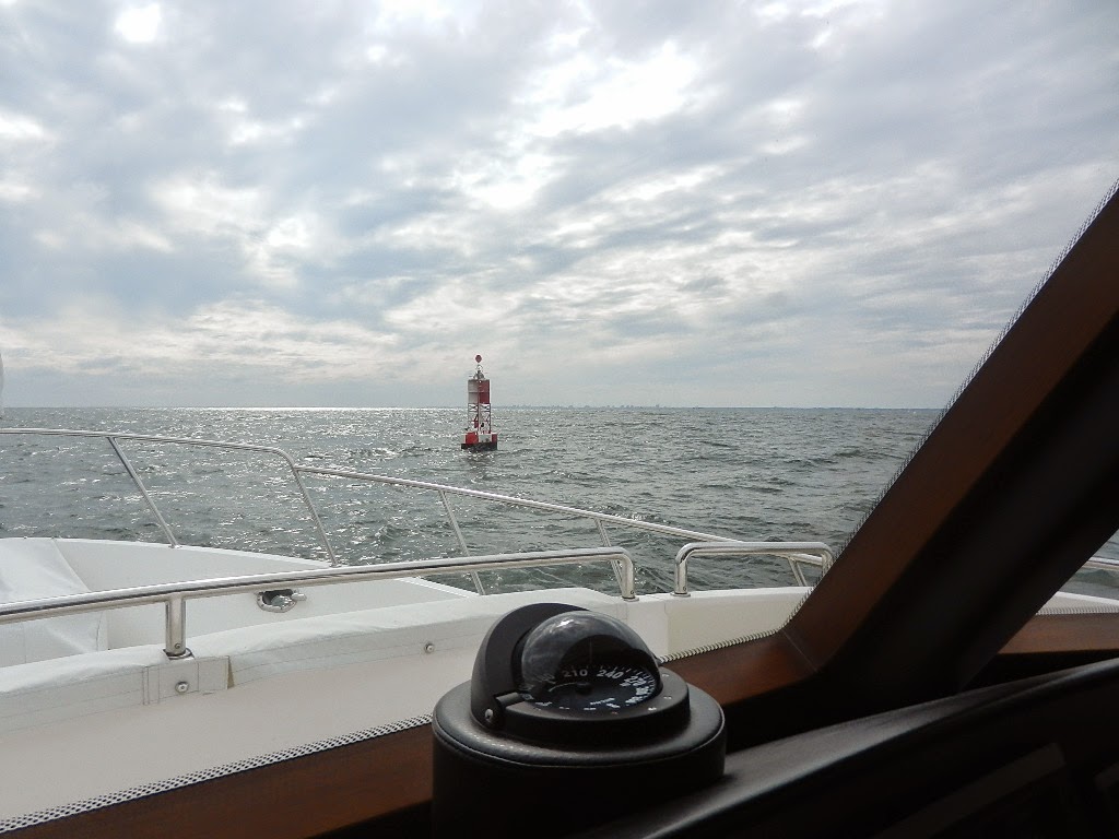
We continued on toward Morehead City rounding Cape Lookout at 11:57 AM. Winds were now 19 knots. At 2:20 PM we entered the Morehead City Inlet. We had covered 661 nautial miles since leaving Hingham three days ago.
 |
| Heading into the sunset as we start our second leg to Stuard |
We stopped at Morehead City Yacht Basin, refueled and by 4:00 PM we were headed outbound to continue on to Stuart. Stay tuned for my next article “Life in the Slow Lane – Morehead to Stuart.”
Below is the note that I wrote to Jeff Druek, President of Outer Reef.
Dear Jeff,
We transited Cape Hatteras Thursday night during a very strong cold frontal passage with wind gusts as high as 49 knots. Seas built very quickly to 7 to 9 feet with sustained winds of 30 to 35 knots. All this happened as we were circumventing Diamond Shoal, which puts us at least 17 miles offshore and required course changes encompassing 270 degrees. We went from a following sea to a quartering sea to beam sea to another quartering sea to a head sea at the height of the storm.
Notwithstanding the flaw in my judgment for being out there (I took a calculated risk), the 63 showed no flaws in terms of its sea keeping regardless of the point of sail. The experience is almost surreal. You cannot hear the roar of the wind due to the boat’s amazing quietness and since it was night, it was hard to see the wave heights. The boat just moved through the turbulence with sure footed stability.
Sir, you and your team build an amazing boat. I was confident that the 63 could handle heavy seas when I bought it but now I know from experience how stable she is. While I will continue to adhere to my conservative approach to heavy weather I will have the confidence that should the unexpected happen the boat can handle it.
Written by Les
What the heck are Grits?
Introduction to Grits It you asked me a year 5 years ago about Grits I would have replied “yuck” in referring to what looks like slop on a buffet in Florida. However after having spent 6 months in South Carolina, … Continue reading →
11/10/2014 – Monday – Palafox Marina to Orange Beach Marina
Al and Kay returned the rent car, Jerry and Susan headed out to go back to the Wharf Marina until our return trip back to Texas and we filled our water tanks and put our bikes away for the trip to Ft. McRee Cove anchorage. The weather is going to…
