Part 2 – Anchoring in the Gulf Intracoastal Waterway – Cape Sable, FL to Mobile, AL

Taken from The Great Book Of Anchorages, Cape Sable, Fl to Mobile, Al, including the Okeechobee Waterway..

The Big Bend–Crystal River to Carrabelle (Mile 46 to Mile 164)
Many boats, especially those with deeper drafts, use Anclote Key as their jump off or arrival point from the Carrabelle area. Even we used to be under the impression that the Big Bend region was only for shoal-draft boats, but it really isn’t. The main thing you have to contend with is the distances in from deeper water to the river entrances, usually about 10 miles. Then add another 10 miles or so to the anchorages.
About 46 miles north of Anclote Key is the Crystal River, your first stop on the Big Bend route heading north. Yes, there is a 5-foot bar near the river entrance, but on a rising tide, even vessels drawing 6 feet can enter and travel upriver. The river itself is deep and once in Kings Bay, you can find a spot with enough water to drop the hook. A grocery store, laundry and marine supplies are all close by. Next, a short distance north, is the Florida Barge Canal. There are no depth issues here, with 7 feet at MLW being about the lowest you will see out in the Gulf and a consistent 10-14 feet in the canal itself. It’s a protected spot next to a park where you can walk, bike or hike and just a little over a mile to provisions to the north.

Making a short trip out, then northeast into the Withlacoochee River, you will not see anything less than 7 feet. The Withlacoochee is absolutely beautiful. Plan on stopping here to wait out a weather system or simply to rest and relax. It is truly “Old Florida” at its finest. After coming out of the Withlacoochee, head west about 10 miles toward Seahorse Reef, then north into the Main Ship Channel to visit quaint Cedar Key. Anchor either by Seahorse Key or near town, depending on the wind direction. You’ll need to come out the same way you entered, however, as the Northwest Channel has shoaled to the point where it is not recommended by locals to use.

With at least 7-foot depths over the northern portion of Seahorse Reef, you can easily cross over and continue on your way to the Steinhatchee River, a reasonably comfortable day’s journey. You will find 6-foot areas in the entrance channel so a rising tide is recommended for deeper draft vessels, but those areas are few and far between, so don’t let that stop you from visiting this quiet little fishing village. The river offers a number of anchoring options. all within a short dinghy ride to shore. Then walk to grocery or hardware stores.

The next leg of the Big Bend takes one to the St. Marks River. With the exception of a brief period of 8-foot depths at a bend in the lower section of the river just north of the lighthouse, the rest of the river is quite deep. A number of anchoring options present themselves here as well. Restaurants, a small grocery and marine supplies are available.

A relatively short trip will carry you down Apalachee Bay, around South Shoal and then into Alligator Harbor to anchor at Peninsula Point. With 7-foot depths in the approach channel, this too is a viable option for most cruising vessels and a pretty stop for the night behind a lengthy sand bar. One more short hop west takes one to Carrabelle, the end of the Big Bend and the beginning of the East of Harvey Lock portion of the Gulf Intracoastal Waterway. The little town of Carrabelle is a great spot to provision, dine and just to visit in general. It’s a friendly place with anchorage in the protected harbor. But don’t forget to visit the beautiful anchorages behind Dog Island. These anchorages are open to the north, but are protected from the prevailing afternoon sea breezes. Do not miss this lovely island.

GIWW EHL FL–Carrabelle Beach to Perdido Key State Park, FL (Mile 378 to Mile 170)
If you don’t need to come into town or want an easy start in the morning, anchor off Carrabelle Beach, located down the river and around to the west. This is also your starting point for this stretch. Continuing southwest along St. Georges Island, one finds another group of beautiful anchorages, some more protected than others. Rattlesnake Cove is a cozy spot for shoal-draft vessels. Gap Pt. to the east has better depths. All of these anchorages, however, share one thing–they are open to north winds blowing across the sound from the mainland, but are great in prevailing winds.

At the southwestern end of the sound, a turn to the north finds one in Apalachicola. This super little town continues to try to find ways to lure the cruiser to visit. They have free docks just to the north of the fixed high-rise bridge as well as a long wharf along the waterfront to which one can tie during the day. If you prefer to anchor, it’s a short ride across to the floating dinghy dock at the wharf in the mouth of Scipio Creek. The next section of the GIWW takes you away from the beach and into beautiful, protected forest and swamp. The Pinhook or Saul and Searcy creeks are well-protected options within the next 15 miles. Then one arrives at White City, a public park belonging to the county, which has a floating dock along the canal for deeper-draft boats or fixed docks for boats that draft less than 6 feet in the basin.

A little more than a mile northwest in the GIWW, the Gulf County Canal heads southwest to Pt. St. Joe and St. Joseph Bay. The significance of this 5-mile-long canal that accesses the Gulf is that if you cannot clear the 50-foot Dupont Bridge, some 33 miles northwest near Panama City, you must go offshore here and come in via the inlet into St. Andrew Bay to visit Panama City. You’ll not be very happy to cover all of those miles to find you need to turn around and go back out at St. Joe Bay! The good news is there are some great anchorages in St. Joseph Bay, which we’ve included, and it’s only a day run to Panama City along the coast. Anchor near Port St. Joe and walk to provisions or the nice downtown area shops and restaurants, and then visit the great beach anchorages on St. Joe Peninsula. The bad news is you’ll miss some cool anchorages in the GIWW.
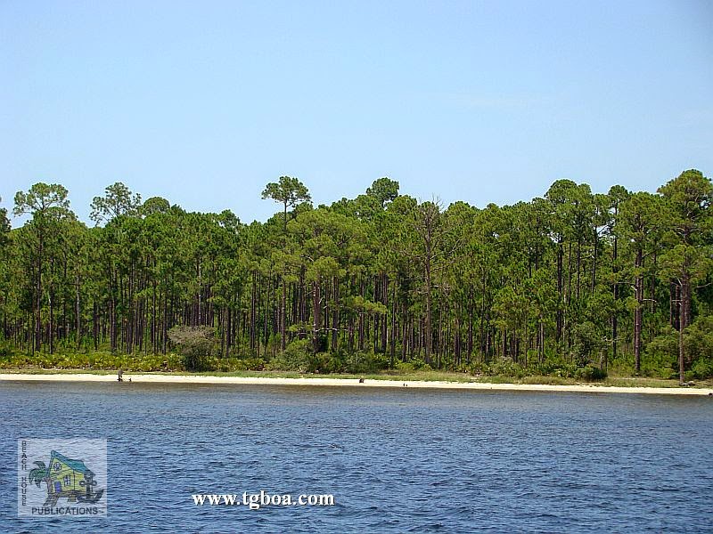
Back on the GIWW from Gulf County Canal to the Dupont Bridge, there is a 20-mile stretch of waterway with only one viable anchorage, Wetapoo Creek, and then the waterway opens into East Bay with its many bayous to choose from. Some are good for overnights where others are good for sitting out bad weather. Although they each have some sort of shore access for your pet, you’ll have to wait to reach Panama City for any provisioning. Once through the Dupont Bridge at SM 295.5, the very protected Pearl Bayou opens to the southwest. Even sailboats with tall masts will be able to visit here by coming through the deep inlet into St. Andrew Bay. The bayous on the north side between here and SM 290 will provide boaters an opportunity to access provisions while the bayous on the south side, like Smack Bayou, will be primarily for holing up for weather or getting away from it all. Watson Bayou to the north is one of our favorites.

St. Andrew Bay gives folks another opportunity to get their beach fix with some great anchorages behind Shell Island and in Grand Lagoon, both part of St. Andrews State Park. The downside of these anchorages is that there is a lot of local boat traffic throwing wakes. They are also very busy during the summer and on weekends. Also, be aware that dogs are not allowed on state park beaches in Florida. The St. Andrew Bay/Panama City area is another spot where tall-masted vessels will be able to visit, but can only travel so far without turning around and going back out the inlet. We’ve already covered the restriction of the Dupont Bridge to the east. To the west, your next height restriction doesn’t come for a long time, but again, it will ruin your day(s) to find you have to turn around and travel many miles to get back out into the Gulf. Though over 60 miles away, you may be restricted by the 50-foot Brooks Bridge just west of SM 225 in Ft. Walton Beach and the 49-foot bridge at Destin, leading from Choctawhatchee Bay to the Gulf of Mexico. If your mast can’t clear these bridges, you’ll have to run from St. Andrew Bay to Pensacola offshore, a distance of about 90 miles that we’ve done in an overnight run.

If you can run the inside route from Panama City, you’ll have a couple of nice, peaceful options to anchor for the night before making the 20 mile or so trek through the land cut sometimes known as the “Grand Canyon” for it’s unusual sand and rock formations. In North Bay there’s Upper Goose Bayou for east winds, and in West Bay, Harrison Bayou for west winds and Burnt Mill Creek for north winds. At the west end of the canal, you’ll be in Choctawatchee Bay. Pick an anchorage there based on wind direction if you are ready to stop for the day–just outside of the canal for east winds or either end of the 65-foot bridge for north or south winds. If you feel like continuing on, your next option is going to be another 8 miles beyond the bridge on the south side of the bay in Hogtown Bayou; another beautiful, quiet spot with little traffic. Beyond here it’s another 10 miles to any reasonably protected anchorage short of just pulling off to the side of the bay in the mouth of a shallow bayou or cove. Because they offer little to no protection, we have not included them here, but there are options. After passing under the 64-foot bridge that runs from White Pt. to Moreno Pt., head north into Rocky or Boggy bayous for some great anchorages or south into Joes Bayou at SM 230 and back into the very protected basin in the southeast corner. You’ll have a lot more traffic in the latter than the former.
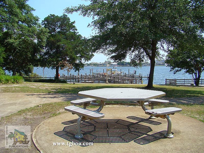
A few miles farther on brings you to Destin. If you can clear the 49-foot bridge, you can enter Destin Harbor or access the GIWW from the Gulf. It is incredibly busy in this area on weekends and during the summer, but if you’d like, take care with the constant shoaling and current turning in here, then anchor wherever depth and space allows outside the marked channel in the harbor. Boats also anchor before the bridge in Cinco Bayou to the northwest of Destin. Cinco and Garnier bayou’s inner recesses are only accessible by vessels that can clear the 19-foot bridges that cross their entrances, leaving them out for most cruising boats. At the west end of Choctawhatchee Bay is the 50-foot Brooks Bridge and the entrance to The Narrows. The Ft. Walton Beach Free Dock is just west of the bridge to the north. This is a great provisioning stop as a major grocery store is just blocks away to the northeast, but be careful crossing this busy road. There is no power on the dock, but pump-out and water are available on the dock, and trash cans, recycle bins and restrooms are located in the park. You will be bothered by wakes here so fender well.

The next 10 miles of Santa Rosa Island is in a restricted area occupied by the military so if you anchor along this stretch, land on the mainland side if needed. Navarre Causeway is another easy access point to shopping with a grocery store right across the street from the anchorage by the bridge. For the next 10-15 miles between the bridges, you can pull off toward Santa Rosa Island just about anywhere you’d like with plenty of depth, but for a specific anchorage, we recommend Big Sabine Pt. for the best protection. It is only open to the northeast, and even then, the shoals break up any chop. If you need more protection, Little Sabine Bay about 6 miles west offers 360° protection. After passing English Navy Cove to the north, another great anchorage for frontal passages, you will enter Pensacola Bay. Here, you can either continue west in the GIWW where it enters the land cut just north of Fort McRee, or head north to Pensacola, a city rich in military history. The free day dock downtown gives you access to the city’s restaurants and museums, then anchor for the evening across the bay in Old Navy Cove, or around and into Bayou Chico if more protection is needed.

Back in the GIWW, those of you who had to run offshore due to bridge heights will be able to re-enter here and pick up the waterway at Big Lagoon. If you want to anchor at Ft. McRee, make sure you only attempt entry from the west side as the east side near the inlet is shoal. There is plenty of water between the visible shoals on the west side to enter and anchor. Redfish Pt., a mile or so away, is a favorite amongst cruisers, but one of our favorite spots is farther down Perdido Key near Big Lagoon State Park. We anchor on either side depending on weather. It’s great to anchor, dinghy ashore, then walk across the dune to the Gulf beach. Again, the beaches are the highlight of Gulf cruising for us.
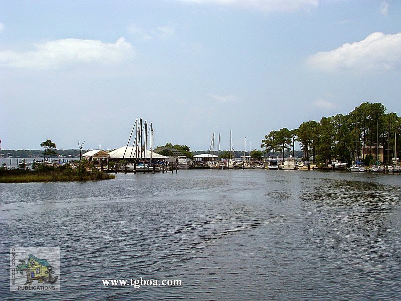
GIWW EHL AL–Orange Beach to Dog River, AL (Mile 167 to Mile 133.5)
The line between Florida and Alabama is a bit murky. Perdido Key is in Florida, but Ono Key is in Alabama. The 1st anchorage is on the way to Orange Beach, the spot between Ono and Perdido keys near the bridge–a good stop for the night. You’ll have Florida on one side and Alabama on the other. Our 2nd anchorage in Alabama is in Terry Cove, Orange Beach. It’s a 5-mile trek off of the GIWW to get there and it’s also a very busy place. Just north of the GIWW, Spring Branch and Palmetto Creek in Perdido Bay provide beautiful, sheltered anchorages for those who draw 5 feet or less. Continuing west is the gorgeous, protected Roberts Bayou, with good eats and drink at the restaurant or the Arnica Bay anchorage next to a marina and restaurant, but exposed to wakes. Ingrams Bayou, another lovely, protected spot, is just around the corner to the north.

Anchor off the north side of Orange Beach for easy access to convenience stores and other services, or head up into Wolf Bay for quiet, pretty anchorages. These will be your last opportunities to anchor until you reach Bon Secour Bay, some 10 miles west. Upon exiting the land cut, the Bon Secour River entrance will be immediately to your north. These will be the last protected anchorages you will have until the Dog River northwest in Mobile Bay. Bon Secour provides a couple of adequate anchorages. Edith Hammock on the peninsula is a good spot for south winds, or head north some 20 miles to the Dog River in Mobile. Once beyond the marinas and restaurants, head west to anchor around the bend. This ends the coverage of anchorages from Cable Sable to Mobile.
I Voted today…

Early voting began here in North Carolina last week. I decided to take advantage and voted today. You know what they say – if you don’t vote, you shouldn’t complain. No lines, no fuss. I LOVE being able to vote early.

The post I Voted today… appeared first on Moosetique Musing.

Oct. 26 – Houma, LA

Houma City Dock

Miles to Rockport, TX – 468

“It’s not what you look at that matters, it’s what you see.” ―Henry David Thoreau

We had a long day filled with locks, barges and industrial lined shores. Our first lock this morning was the Industrial Lock that raised us up to the Mississippi River. Once out of the lock we cruised past New Orleans…the best view of the day. We existed the Mississippi about six miles up stream at the Harvey Lock. This lock isn’t used by commercial traffic, so there isn’t usually a wait. We found out a few days ago that it will be closed for maintenance for three weeks starting tomorrow. We lucked out…the alternate route wouldn’t have been fun. After crossing the river we had about a 58 mile cruise to Hoama.

CONTINUE READING HERE…»

Day 289…go fly a kite

Welcome to day 289 of  365 photos…”go fly a kite” took on a new meaning at Atlantic Beach, NC this weekend. It was the 27th annual Carolina Kite Fest. The sky was filled with colorful kites of all shapes and sizes. They were flown by folks of all ages. Who knew that  kite could be […]

The post Day 289…go fly a kite appeared first on Moosetique Musing.

Monday, October 26, 2014 – She is for sale

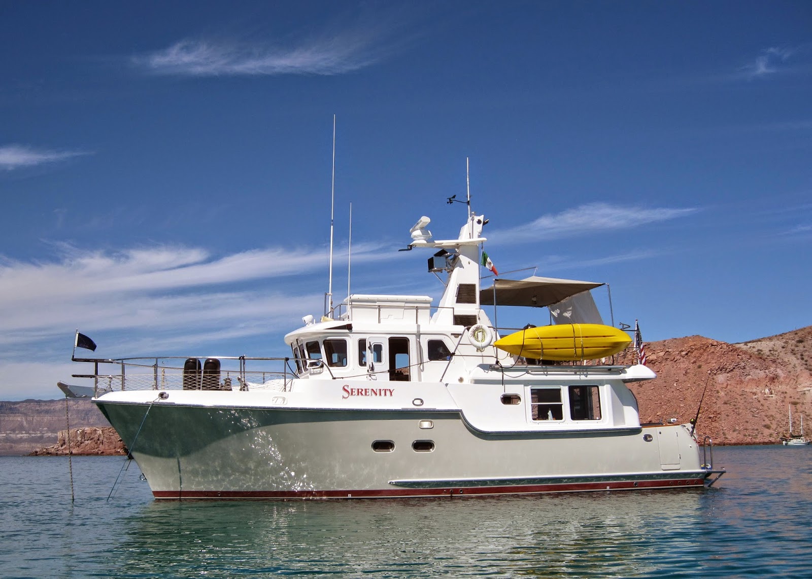
We finally got all our stuff out of cupboards and hiding places and off the boat.  What a job!  Anyway, Serenity is now ready for some lucky person.  We have so loved her!  We are going to try to market her ourselves since we are not really in a hurry.  We are posting the full specs on NordhavnFSBO.com and lots of photos here.  If anyone knows someone who might be interested, have them call Earl (360-333-1546).

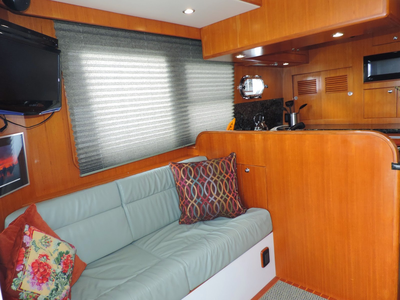
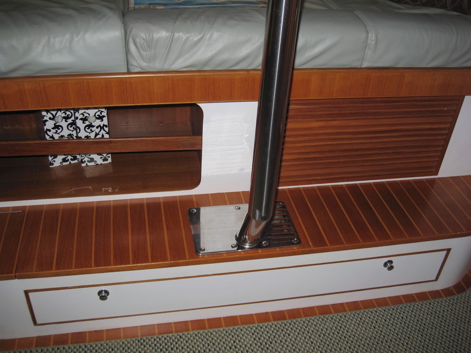
SALON

Storage under settee


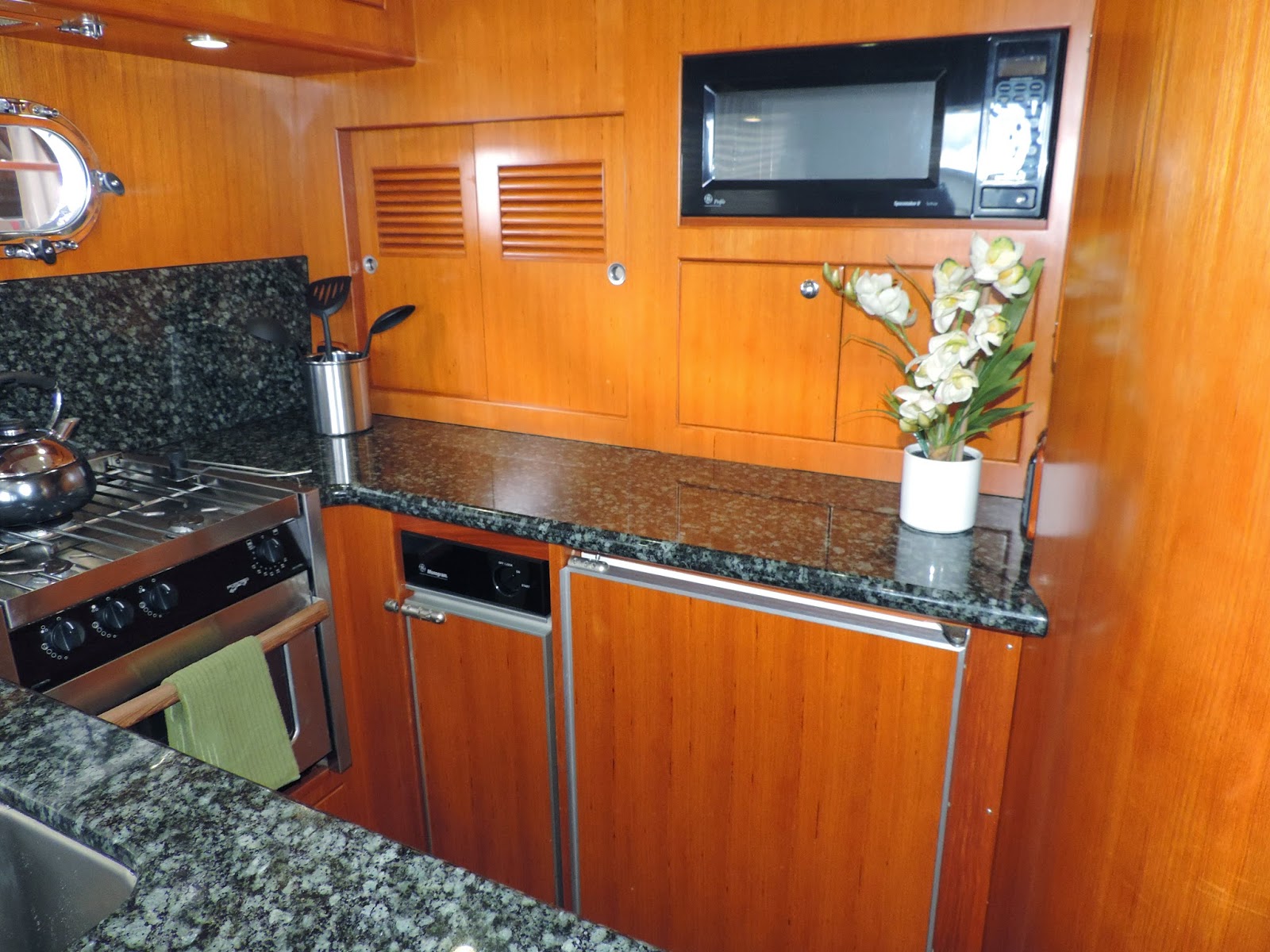
GALLEY


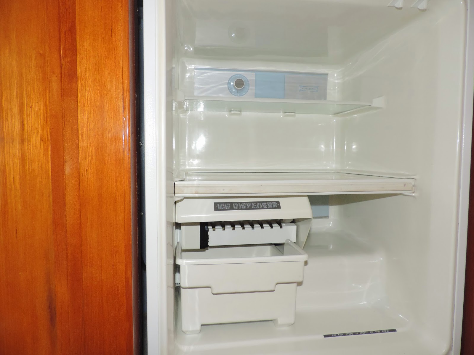
Combo Frig/Freezer with ice maker

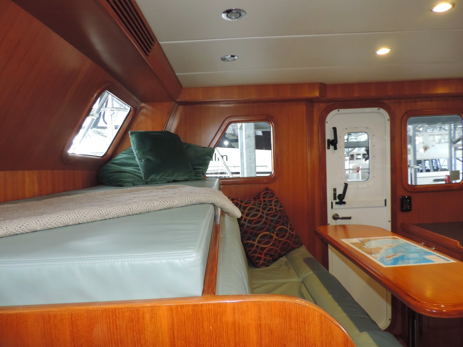
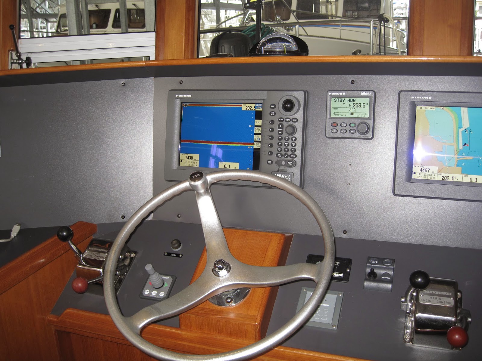
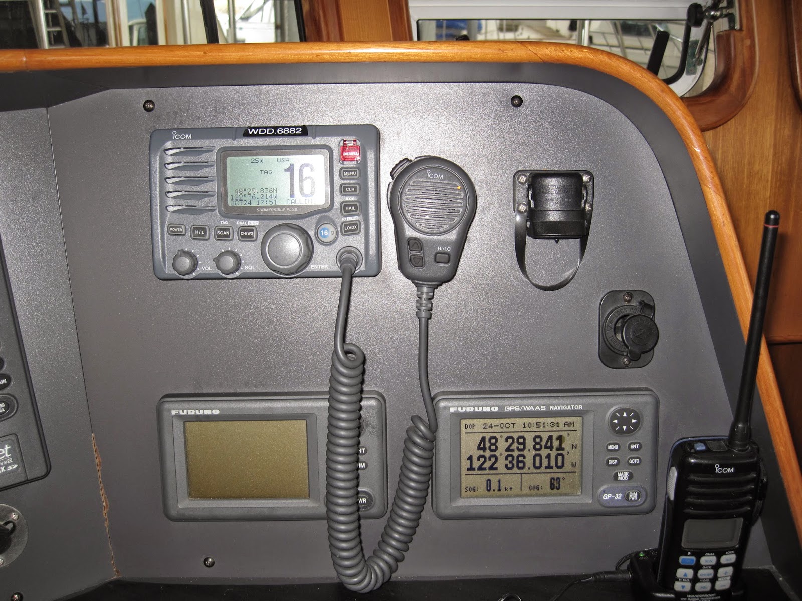
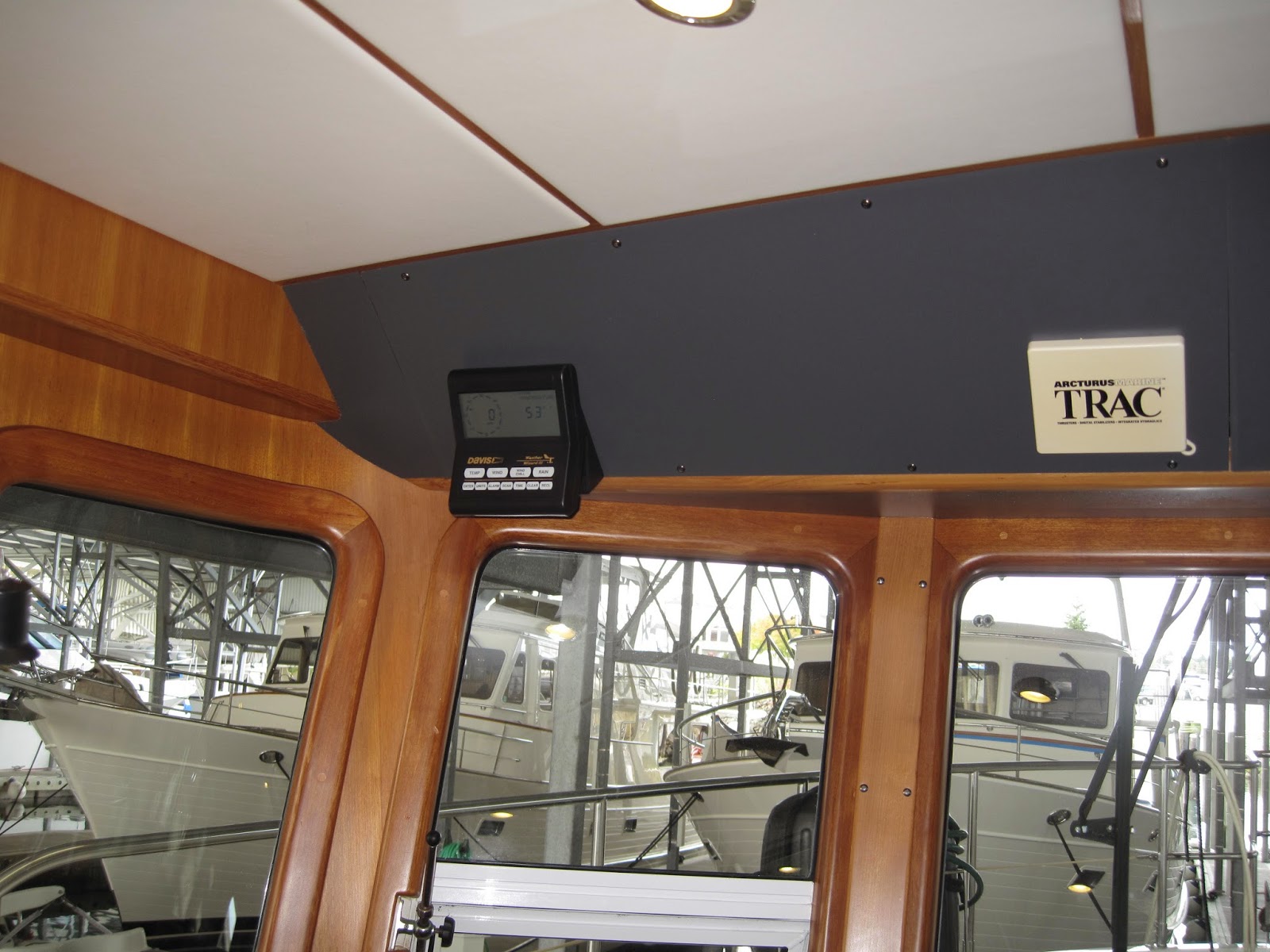
PILOT HOUSE

Pilot Berth

Chart Drawer

GUEST STATEROOM & HEAD

Pipe berth stowed above bed
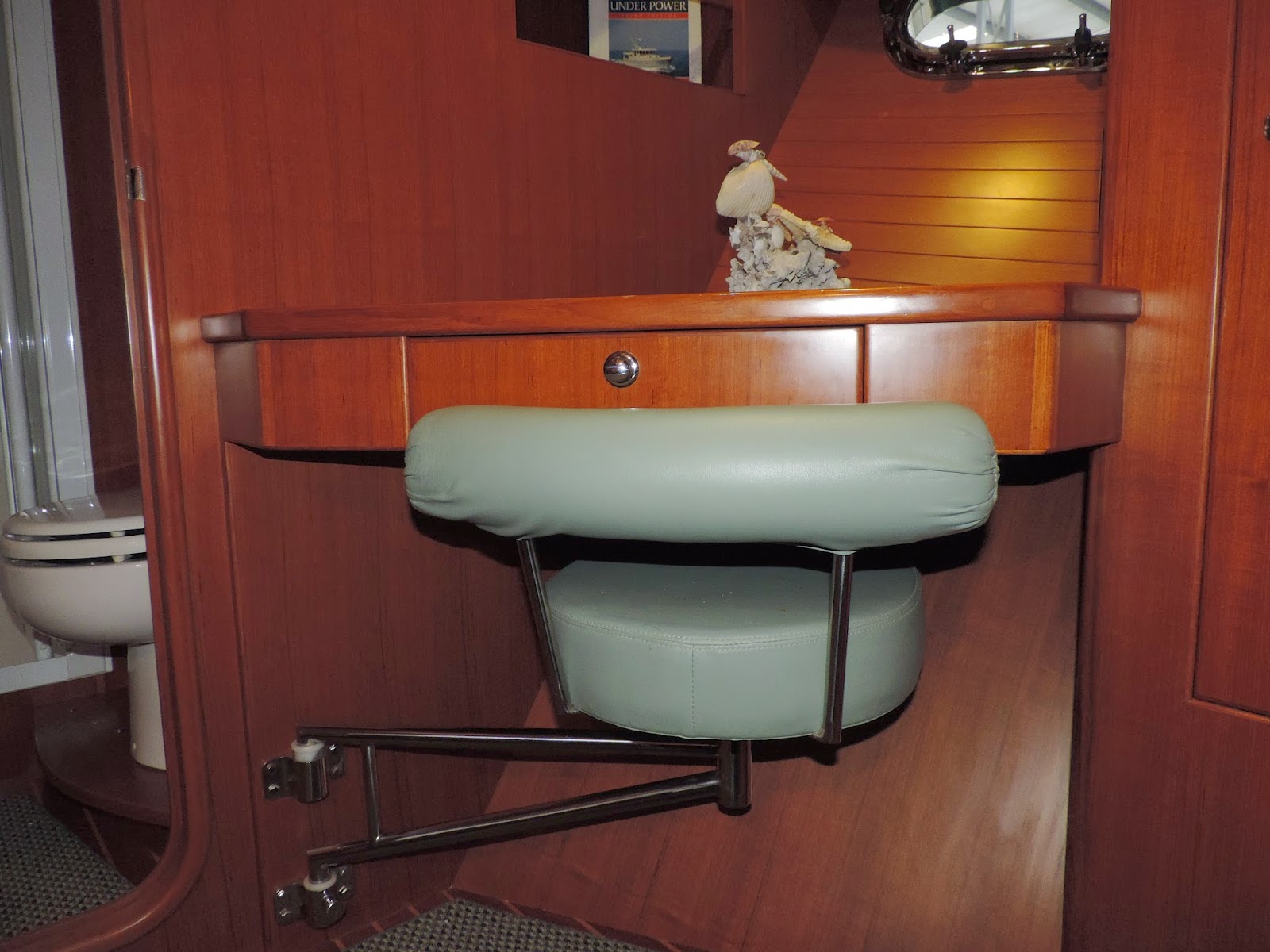
Swing out seat

 MASTER STATEROOM AND HEAD

ENGINE ROOM
OOPS!  I FORGOT!  I’ll GET PHOTOS NEXT TIME I AM AT THE BOAT

LAZARETTE
DITTO

SWIMSTEP

Great for landing fish
Watching fish in the blue lights

Sea of Cortez fish

BOAT DECK

Earl’s “Pavilion”

Plenty of room to entertain
SUMMARY DESCRIPTION
Serenity was commissioned in the Spring of 2007 and has taken her original owners north to Alaska and south to Mexico. She is berthed in Anchortes, Washington and is available for inspection by appointment.  In keeping with her primary mission as a passage maker, she has no flybridge, keeping her wind profile low, a feature valued by her owners who have many years experience commercial fishing in Alaska.  She has been beautiful maintained and is completely ready to take her new owners wherever they may wish to go. 
She is outfitted with many features that make her perfect for cruising couple.  She is one of the few 43s with an extended swim step complete with staples for ease of loading or unloading a tender or kayak.  In addition to Trac stabilizers – which allow you to leave items on the counter without fear – she has a flopper stopper for anchoring.  She has a water maker, extra batteries, and LED lights. The boat deck is equipped with a unique sun shade and dingy rack that swings out of the way, making the boat deck an additional entertainment area.  The deployment of the dingy is done using a Steelhead crane and does not require removal of the sun shade.  
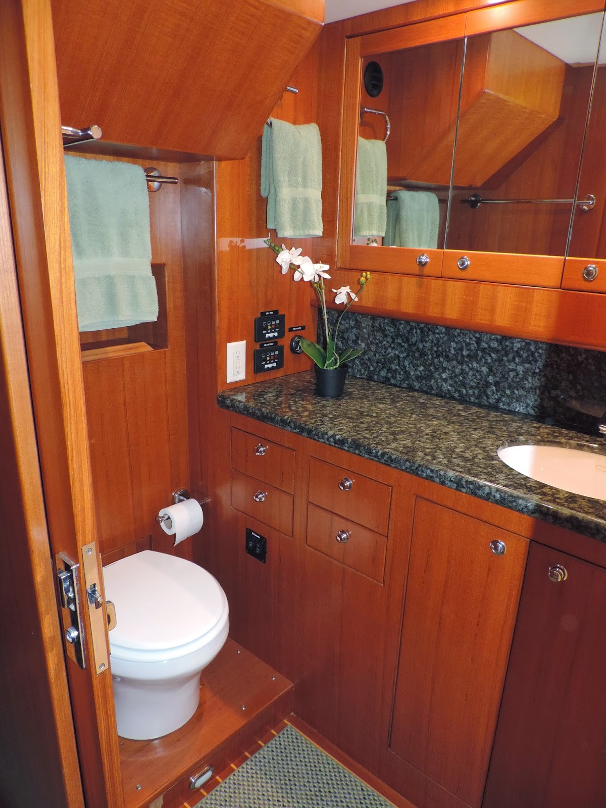
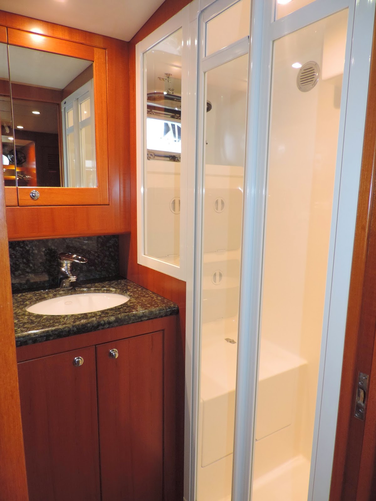
The boat has been continually upgraded and preventive maintenance performed.  For example, just over the past year, the owners have replaced the stabilizer pistons, the water maker membranes, the carpets, upgraded the alternator to 165 amps, replaced the master head with upgraded dometic model, painted the bottom and replaced zincs. 
DETAIL SPECS
INTERIOR TOUR OF THE BOAT
The interior is teak through out with teak and spruce sole.  The custom non-skid area rugs through out were replaced in May 2014.  The upholstery in the salon and pilothouse was upgraded to ‘ultraleather ‘ (color eucalyptus) and all counters in the galley and heads are granite.  All windows and doors have screening.  Most of the interior lights have been replaced with LEDs.  Extra railings have been installed on the stairways and overhead in the salon and pilothouse for safety.  Both staterooms have custom mattresses and Dometic fresh water flush electric heads. 
Salon and Galley
The Salon and Galley share the same space making it easy to prepare and serve food and refreshments.  There is a settee on the port side and an L shaped settee on the starboard side.  Under and behind the settees, there is generous storage.  The teak table in front of the settee is equipped with a slide that facilitates use of the storage and seating. High end accordion style shades provide light control and privacy.
The “U” shaped Galley is forward on the port side.  It has lots of storage, a Force Ten 3 burner propane stove/oven, a trash compactor, microwave, double stainless sink, under counter sub zero refrigerator, a combination sub zero refrigerator/freezer with ice maker and a 5 cubic foot top loading freezer.
A Splendide washer dryer combo is located on the port side of the Pilot House
Pilothouse and Navigation Electronics Equipment
Aft is a pilot berth with raised bench seat and teak table forward. There is a full-sized chart storage locker located under the footrest step. There are waterproof dutch doors on port and starboard sides leading to side decks.  In lieu of a captain’s chair, this experienced owner opted to drive from the bench seat using the remote control autopilot.  This creates space for easy flow through the Pilot House. All AC and DC panels are in the console. There is a replacement panel for the instrument cluster.  Full engine and navigation controls include:
Furuno NAVNET package including:
·      ·       Autopilot (NAVpilot-511)
·      ·       Autopilot Remote Contol (NAVpilot -520)
·      ·       Dual Displays (NavnetVX2) cmaps
·      ·       CMap cartridge for West Coast including Mexico, Canada and Alaska
·      ·       Radar
·      ·       Color Video Plotter
·      ·       Video Sounder
·      ·       AIS receiver
·      ·       GPS Receiver (GP-320B)
Other items include:
·      ·       GPS WA-AS Navigtaor (GP-32)
·      ·       Furuno RD-30 Depth Sounder, Temperature etc
·      ·       Sirius Weather Module
·      ·       Iridium Sat phone
·      ·       Village Marine Water Maker
·      ·       Icom sideband receiver
·      ·       Icom 504 VHF
·      ·       Icom Waterproof handheld
·      ·       Ritchie Compass
Master Stateroom and Ensuite Head and Shower
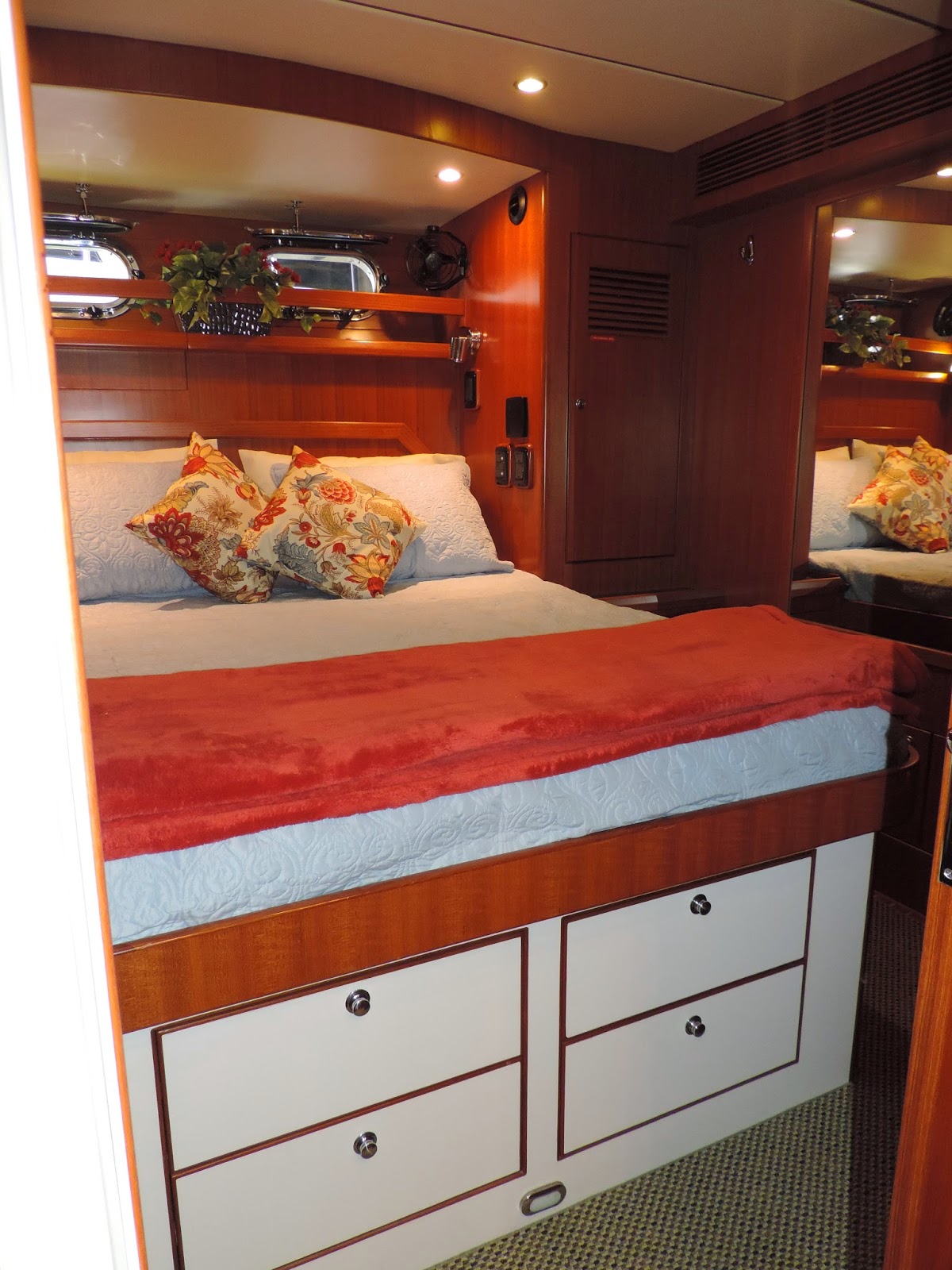
On the starboard side of the Pilothouse is a circular staircase leading to the Staterooms and Engine Room. On the starboard side of this staircase is a small hanging closet and a drop-in storage area.  Down and aft is the large Master Stateroom with walk-around athwartship berth to port, night stands with drawers on both sides and storage underneath. There are three hanging lockers and a shelf behind the headboard with two opening portholes.
To starboard is the large master Head and separate shower stall. There are two Tank Watches in the Head-one for grey water and one for holding tank- and a water tank level meter.
Aft of the MSR is a watertight, sound dampening bulkhead door to engine room.
Guest Stateroom and Head
Forward of the staircase and in the bow is the Guest Stateroom with double berth to port and a desk with swing out seat to starboard.  Storage incudes a hanging locker, night stand with two drawers, two file drawers in cabinetry under berth, shelf at side of berth, shelves at desk, and overhead opening cabinetry at berth and over desk.  There is one porthole above the desk and one overhead opening hatch with screen.
Folded into a storage space on the port wall, is a pipe berth that can be hung over the berth. 
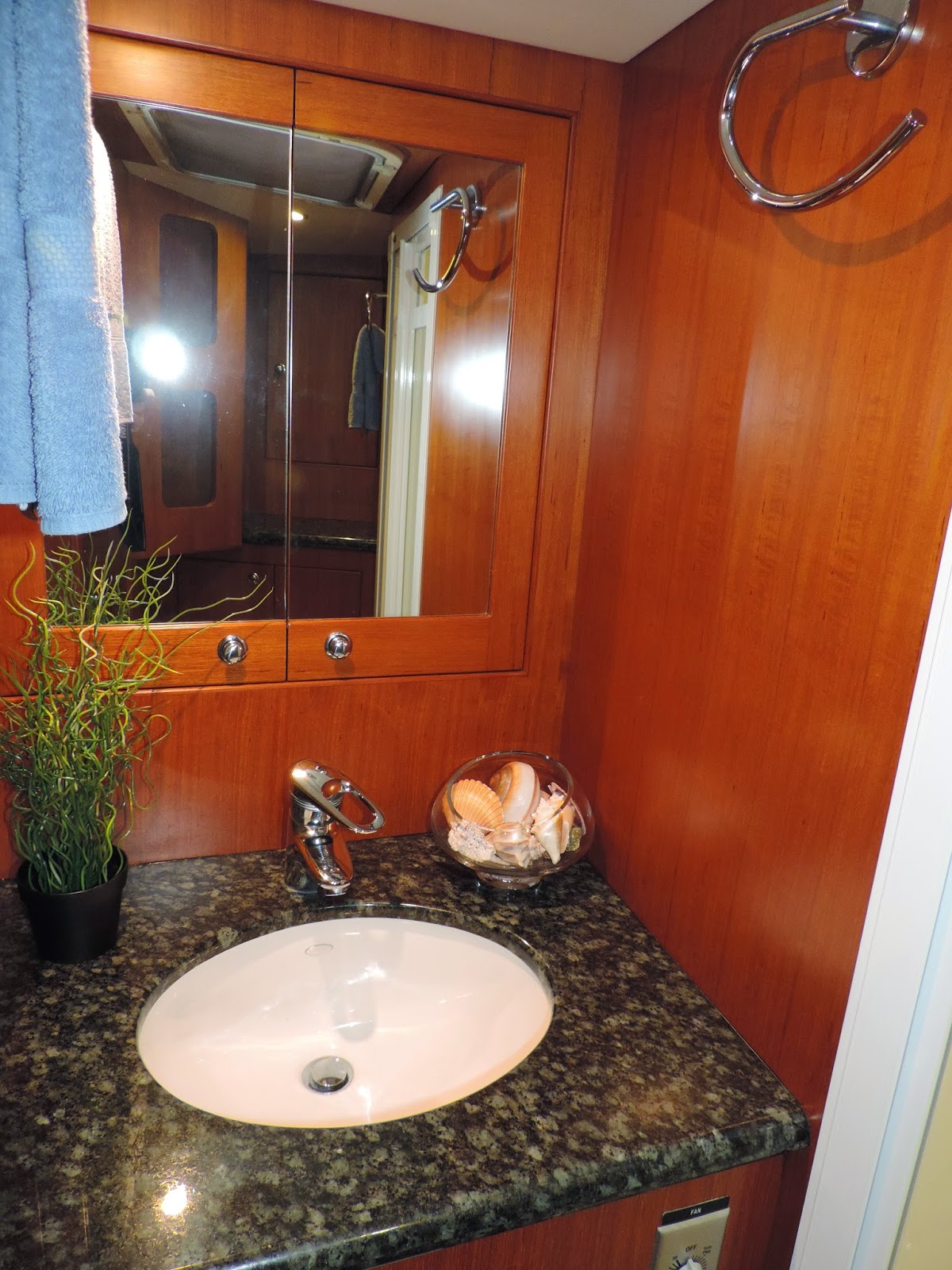
Forward is the Head with separate shower. .  There is one opening hatch with screen.  There are two waterproof storage cabinets in the shower as well four teak cabinets for more storage in the Head.
EXTERIOR TOUR OF THE BOAT
Swimstep, Cockpit and Lazarette
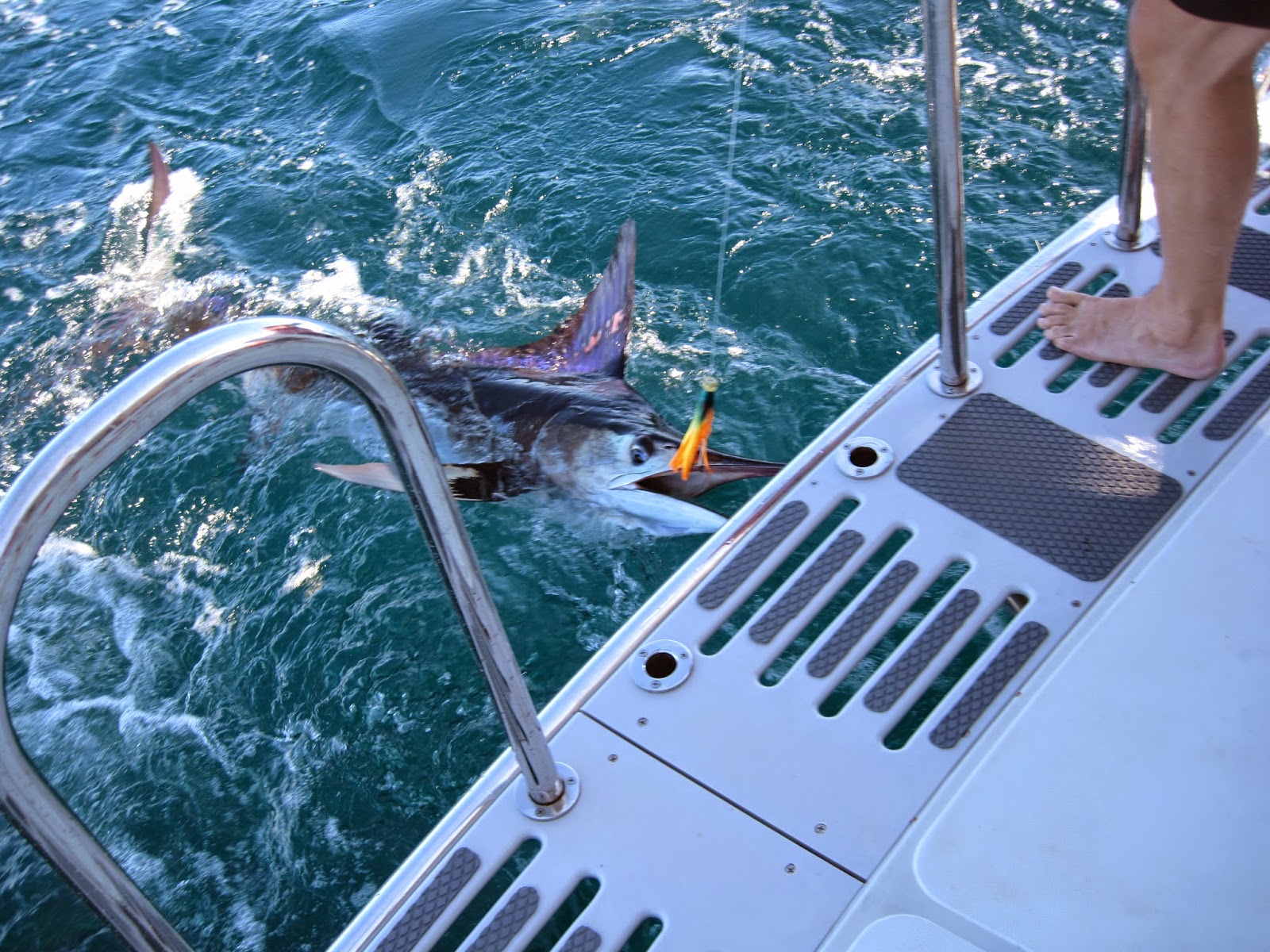
Serenity has been upgraded with a generous extended swimstep complete with moveable staples that has totally changed the functionality of this area for getting on and off tenders, kayaks, and paddle boards as well as for fishing and swimming.  At night blue underwater lights provide a splendid show, especially in clear water.
The Cockpit has high freeboard and overhead protection.  A mesh sunscreen can be hung from the boat deck to provide additional shade if needed.  A custom stainless steel coat rack provide a handy place for raingear or swimsuits.  Doors lead to the dock off each side and to the swimstep in the stern. There is hot and cold water for showers, a fresh water washdown and storage.  Large LED lights provide excellent security. Access to the large lazarette is from the cockpit. 
The lazarette houses the inverter, water maker, hot water tank, pressure water pump and batteries but still has generous room for other storage.  The inverter was upgraded to 3000 watt Magnum model.  The house battery bank was increased to 1200 AMP hour AGM batteries and all were replaced in 2012.  The water maker is a 400 gpd Village Marine. The membranes were replaced in 2014.
There’s plenty of room in the cockpit for a couple of chairs and table to enjoy the early morning sunrise coffee or the evening sunset cocktails!
Boat Deck
The boat deck is accessed on the starboard side and features a dry stack, a Steelhead 1000 lb crane,.  Flexlboat SR- 10 foot dingy with a 15 hp Honda motor, wheels. anchor line and sunbrella cover, and unique sunshade support and dingy cradle.  The sunshade support accommodates a large cover, and the dingy cradle swings out of the way so as to clear the entire boat deck for group activities.  The dingy can be deployed without removing the sunshade. There are two stainless steel dock fender holders on the port side and on each side there are kayak/paddle board supports.  A Forespar boom on the port side can be deployed to support a flopper stopper when the anchorage is rolly.  There is a ladder giving access to the top of the pilot house which is completed with a 15 inch high rail on three side and a 6 person life raft. 
Foredeck and Portugese Bridge
Access to the foredeck is on the starboard side through the Portugese bridge.  There is ample room to set up a chair and enjoy the ride from outside.  The autopilot remote reaches far enough that the skipper can enjoy this spot
·      •    SS Railing
·      •    (2) open hatches to guest head and stateroom
·      •    (2 )custom stainless steel fender holders
·      •    (2) Built-in Storage Boxes
·      •    105 pound CQR anchor
·      •    Fresh water wash down
·      •    Double bow roller on pulpit
·      •    Maxwell 12v 3500 lb windlass
Engine Room – Mechanical
·      •    Single Lugger 668 diesel – 3900 engine hours equipped with a 3.9 ZF reduction gear
·      •    Dry exhaust with keel cooler
·      •    American Bow Thruster (TRAC) 220 stabilizing system – keel cooled
·      •    12 KW / 50 Hz Northern Lights Generator with sound enclosure and gen separator muffler
·      •    Cruisair AC system (15k + 15k + 15k) SMX controls
·      •    8 HP Bow Thruster 12v
·      •    Engine room fire suppression with auto engine, generator and blower shutdowns. Manual pull cable.
·      •    Lazarette fire suppression system with manual pull cable
·      •    Reverso oil change pump – main/genset/and gethome
·      •    Yanmar Wing Engine 3YM30V with 10-gallon day tank and fuel transfer system
·      •    2-blade Martec folding prop for wing engine
·      •    Handrail around main engine  
Deck and Hull Equipment
·      •    Flopper stabilizer
·      •    Maxwell 12v 3500 windlass with bow, and pilot house controls
·      •    CQR 106 pound anchor
·      •    400’ 3/8” Hi Test chain
·      •    Delta 55 pound with chain and rode
·      •    Crewsaver 6 person life raft
·      •    Spurs line cutter on main shaft
·      •    Chain stopper
·      •    Sumbrella covers – windows, hatches, and dingy,
·      •    Guest “Beamer” spotlight with controls in pilothouse
·      •    1,000 watt halogen flood light
·      •    20,000 lumen LED flood and spot light
·      •    Port side exterior SS hand rail
·      •    Complete set of dock lines and fenders
·      •    Scandvik hot and cold shower in cockpit
·      •    Fresh water wash down fore and aft
·      •    Bottom was painted April 2014 (2 coats)
·      •    Zincs replaced April 2014
·      •    Stainless rod holders
·      •    Fish rod ceiling storage rack
·      •    Retractable screen door for salon
·      •    Spare propeller for main
·      •    400 feet ¾ inch extra line in lazarette
·      •    Handheld spot
·      •    All navigation lights are LEDs
·      •    Epirb
Dimensions
LOA: 44 ft 6 in
Beam: 14 ft 10 in
Maximum Draft: 4 ft 11 in
Displacement: 54540 lbs
Engine 1:
Engine Brand: Lugger
Engine Model: 668
Engine/Fuel Type: Diesel
Engine Power: 105 HP
Engine 2: (get-home)
Engine Brand: Yanmar
Engine Power: 30 HP
Tanks
Fresh Water Tanks: (300 Gallons)
Fuel Tanks: Fiberglass (1200 Gallons)
Holding Tanks: (50 Gallons)
Accommodations
Number of cabins: 2
Number of heads: 2

Monday, October 26, 2014 – She is for sale

We finally got all our stuff out of cupboards and hiding places and off the boat.  What a job!  Anyway, Serenity is now ready for some lucky person.  We have so loved her!  We are going to try to market her ourselves since we are no…

Ports #32 through #40: The Tenn-Tom and the Dirty Dozen…

Great Loop II Date: 10/23/2014

The days are becoming noticeably shorter. Early morning starts are a habit. The routine is…routine.

What does change was the scenery, meeting new folks at marinas and renewing friendships from ports visited previously. Each port becomes busier with docktails, trips to restock OB and catching up chores around the boat. Time underway is spent watching for markers and helping in navigation.

This part of the Loop resembles our first Loop Adventure in 2010. Blogging becomes difficult to keep up with. In an effort to catch up, lumping together a group of ports is a necessity, especially as we prepare for the Big Bend crossing.

Day # 69 (10/08/2014-Wednesday): 66 miles (1856 total miles)
Locks: 1 (13 total locks)
Port #32: Counce, TN
Marina: Grand Harbor

Counce, TN was where we would part from the Tennessee River and begin moving south through the Tennessee-Tombigbee Waterway, the Tombigbee River and the Black Warrior River. In 2010, this part of the trip took us 12 days moving every single day.

We picked up anchor in Double Island on another beautiful, calm fall morning. Our trip to the Pickwick Lock took about 6 hours. We slowed our pace to 5 mph when the lockmaster told us it would be about 3 ½ hours before we could lock through. Even at that slow speed we were there in about 2 hours. The lockmaster was able to get us into the auxiliary lock fairly shortly and had us on our way in less than 45 minutes.

OB was greeted at Grand Harbor Marina by many Loopers. This was their stop before going to Joe Wheeler State Park and the AGLCA Fall Rendezvous. It was our last stop before our run down the Tenn-Tom Waterway to Mobile Bay in Alabama.

Day # 72 (10/12/2014-Sunday): 56 miles (1912 total miles)
Locks: 3 (16 total locks)
Port #33: Fulton, MS
Marina: Midway Marina

During our Loop in 2010, we stopped at Bay Springs, MS before the Tenn-Tom Dirty Dozen began. Those are the 12 Locks we would transit before arriving at Mobile Bay. The locks themselves aren’t bad. It’s the wait time for barges coming through the locks that can destroy a day when daylight is a premium.

We arrived at Bay Springs early in the day and barge traffic seemed very light. I called the first lock and it was empty and waiting for us. We decided to try to make the next marina at Fulton, MS. We knew there was a line of severe weather working its way across the USA and wanted to get as far as we could before another weather delay would slow our progress.

Our trip was fairly easy with few barges along the way. Each of the next two locks were waiting for us with their doors open. We arrived at Midway Marina mid-afternoon and set in for an extra day to wait out the weather.

Day # 74 (10/14/2014-Tuesday): 60 miles (1972 total miles)
Locks: 4 (20 total locks)
Port #34: Columbus, MS
Marina: Columbus Marina

Another day of making good time led the crew on OB to add just one more lock to the day. The three previous locks had been fairly quick with no waiting.

The fourth lock proved to be the anchor in our day. The lockmaster told us he had a barge approaching northbound and he had emptied the lock to accommodate it. Todd looked at the AIS that tells us where the barges are and found this barge was 3 ½ miles from the lock. It would take the barge 1 ½ hours to get to the lock. The lockmaster had time to fill the lock, take us as well as another waiting boat down in the chamber and still be ready for the incoming barge long before it got there. However, this particular lockmaster decided to slow our progress for reasons unknown to us. We tooled around in circles for the 1½ hours.

The Columbus Marina was new to us. We had not stayed here in 2010. The dockmaster brought us into the fuel dock and tied us up there. Since we were only staying overnight, it wasn’t a problem for us or the marina.

Day # 75 (10/15/2014-Wednesday): 65 miles (2037 total miles)
Locks: 2 (22 total locks)
Port #35: Gainsville, AL
Anchorage: Sumpter Landing

The Columbus Lock was situated directly in front of the channel leading to Columbus Marina. We called the lock at daybreak. The lockmaster said he’d have the lock ready in 15 minutes. We dropped our lines and made way to the lock.

As our luck would have it, on the approach into the lock we heard a loud thump. I looked behind us and up popped a deadhead. We alerted the lockmaster about the deadhead however he didn’t sound very interested.

Our trip was full of barge traffic. We must have passed 4 or 5 barges. Passing them doesn’t slow us down but it can slow our progress with the locks.

We anchored in a nice little cove off of the Tombigbee River near a state park campground and boat ramp. This was familiar to OB. We had anchored here in 2010 with 7 other boats. This night we were by ourselves except for one campsite with some fishermen and a lone johnboat that was tied off on shore.

Day # 76 (10/16/2014-Thursday): 54 miles (2091 total miles)
Locks: 1 (23 total locks)
Port #36: Demopolis, AL
Marina: Kingfisher Marina

The nights got colder and the river water was still warm. That led to mornings with an increased chance of fog. We had been very lucky not to have the fog that delayed us in 2010. However once we entered the river this morning, a dense mist was rising from the water. At this point in the trip, since most of our travel is southbound the sun is directly in our eyes through the morning. The sun and the mist made navigation a little tricky. Again, all our electronics made even this situation safer with our radar, chart plotters, and AIS.

We were looking forward to our next port. We knew two Looper couples from our first Loop were staying in Demopolis. We hadn’t seen Jim and Sharon (Blue Angel) or Bobbie and Keith (Kim Jo IV) since 2011. We all keep in touch through Facebook but it is always a treat to visit with friends in person.

Jim met us at the dock. We had a wonderful visit with both couples once we had OB settled in. Both couples are preparing their boats to come into the Gulf for the winter and we look forward to catching up with them both in the Cape Coral area as well as the Bahamas.

Day # 78 (10/18/2014-Saturday): 97 miles (2188 total miles)
Locks: 1 (24 total locks)
Port #37: Silas, AL
Marina: Bobby’s Fish Camp

The Demopolis Yacht Basin is another marina just above the lock. At daybreak I called the lock and the lockmaster was locking a barge through. He said it was going to be a very busy day and we’d need to come as soon as he called us on the VHF radio. That call came 15 minutes later. As soon as we started our engines and began to move from the dock, not only our neighboring boat came with us as planned, two other boats we didn’t expect came out as well. It wasn’t a problem until we realized one of the boats did not have a radio or AIS.

As we traveled throughout the day, the boat without the radio proved to be a nuisance as well as a danger to navigation. He was ahead of us by about three quarters of a mile so the barges would spot him on their radar. They would see us on their AIS and equate to two as one. Worse yet, this part of the river system is very narrow and very winding. The barges would call for us and alert us to pass on the one whistle (portside) or the two whistle (starboard). Todd or I would have to call back and alert them that they were seeing a boat with no radio and that we, in fact, were still quite a distance from the problem boat. More often than not the radioless boat would pass on the wrong side of the barge! It proved to be a very stressful day as we tried to stay back and out of harms way.

Once we arrived at Bobby’s Fish Camp, we met two of the three men from the problem boat. They said their radio didn’t work so they just left it off. We asked if they were receiving transmissions on the radio. They said they thought they were. We mentioned they might want to leave the radio on since the tow captains were talking to them and telling them which side they wanted them to pass on. Then the mentioned their captain was crippled and in a wheelchair. We were dumbfounded.

After this conversation, Todd and I and the crew from another boat met at Bobby’s for their famous catfish. Bobby’s has changed since we were there in 2010. The catfish is better and they use real plates now. The restaurant seems cleaner, too. The maitre’d is very welcoming, their staff is happy and interacts with the patrons.

Day # 79 (10/19/2014-Saturday): 83 miles (2271 total miles)
Locks: 1 (25 total locks)
Port #38: Mt. Vernon, AL
Anchorage: Tensas (Tensaw) River

OB was rafted off the boat that we had visited with at dinner. Neither of us wanted to be near the radioless boat and hoped they’d stay put until we were well down river. We arose at our normal early hour, I called the lock and the lockmaster had the lock ready for us. We casted off, as did our buddy boat and headed for the lock. All seemed quiet on the problem boat.

Once in the lock, we waited for what seemed an eternity before the lockmaster closed the doors and started our lock down. We all breathed a sigh of relief. We’d never leave a boat in trouble. However, the crew of the radioless boat had merely laughed off our concern about their situation and the problem they had presented to the barges as well as us. Their intention was to continue on their way without a radio.

The lock doors opened, we waved goodbye to the other boat we knew would go much faster than us and said goodbye to our last lock until we are well up the East Coast in late May.

Todd wound OB through the twists and turns of the Tombigbee, the Black Warrior and the Mobile River until we turned into our anchorage in the Tensas River. Some charts and maps list it as the Tensaw River. At any rate, it was a peaceful anchorage for our last night in the rivers heading south.

Day # 80 (10/20/2014-Sunday): 55 miles (2326 total miles)
Locks: 0 (25 total locks)
Port #39: Mobile, AL
Marina: Dog River Marina

Todd and I were excited to get today under our belt. It wasn’t a bad day, it was just exciting to know we were about to be back in saltwater and closer to our home in Cape Coral. All our planning now would be our movement along the Panhandle region of Alabama and Florida to our Big Bend crossing from Carabelle to Tarpon Springs.

As the day progressed, the area began to have more saltwater scrub trees and palm trees. Coming down the Mobile River into Mobile Bay is not very pretty with all the freighters and barges being loaded and downloaded. There is a major ship builder that assembles Littoral Combat Ships for the Navy. Two of those ships were in the water outside of the dry dock. The city of Mobile sits in the background of all the clutter in the shipping channel.

After we were in Mobile Bay, dolphins were dancing at OB’s bow and alongside. It was exciting to see dolphins again. Before long we were taking our course in a channel that would take us into Dog River and our marina for the next few days.

Dog River Marina has a good maintenance facility. Once again we were in need of work on OB. Her alternators were not charging the batteries during our last two days. The maintenance folks tested the alternators and found no output. They sent them to be rebuilt. The turnaround was 48 hours. We were amazed and happy.

Day # 83 (10/23/2014-Thursday): 52 miles (2378 total miles)
Locks: 0 (25 total locks)
Port #40: Orange Beach, AL
Marina: Orange Beach Marina

Our next leg would take us right to the Florida State Line where we would wait until we could find out from the insurance company if we could have a few days grace period on our insurance guidelines. We aren’t supposed to take OB into Florida waters until November 1st, the official end of hurricane season (although hurricanes can occur well into November). We decided to go to Orange Beach, AL since we’d not been there in 2010 nor had we been there by car.

Mobile Bay was a little choppy when we crossed it however as we came into the lee of the east shore, the chop smoothed into a comfortable ride. Once we entered the Gulf Intercoastal Waterway, the beautiful white sands appeared along with palm trees and a lot of new homes since we were last here.

We stopped at Lulu’s in Gulfshores, AL for lunch. Lucy B. Goode is Jimmy Buffet’s sister. She started a small diner in the 70’s. Eventually the state of Alabama refused to renew her lease on the land where her little restaurant stood. She found land on the GIWW and she with some friends loaded the restaurant lock, stock and barrel onto a barge and moved it to its present location. Her reputation grew and so did the restaurant.

As we approached Lulu’s, Gina from Island Time came running out waving her arms. It’s so much fun running into our Looper friends. Gina and Steve are from Cape Coral. We met them last year when she and another Looper friend (Kitty) put together a docktails in the Cape for Loopers and Looper-Wanabees. It took forever for us to finally catch up with them.  Our first meeting was at Grafton, IL. Since then we’ve been chasing them and it probably will continue that way until we get to the Cape!

We had lunch with them and fine conversation. We’re all anxious to get back to our Florida home stomping grounds.

After lunch, Todd and I made way with OB to Orange Beach Marina where we will sit until we get an okay from the insurance company or November 1st. At this point, we are seven ports away from putting OB in her dock behind our house in Cape Coral. She will enjoy basking in the sun there, with a few side trips, until March when we will close up our house and head for the Bahamas. At least that’s the plan.

As we make our run through the Panhandle of Florida and down the GIWW on the West Coast of Florida, I will try to keep the blog somewhat caught up. You may see more of grouping ports together. Stay tuned…there’s more adventure ahead!

Oct. 25 – New Orleans, LA

Pontchartrain Landing

Miles to Rockport, TX – 529

We usually plan our day the night before. How far we travel depends on the weather, the way we feel and in this area what anchorages or marinas are available. The choices are limited right now. Our plan was to go to an anchorage (Rabbit Island) about 25 miles from the locks we have to do to get across the Mississippi River in New Orleans. There isn’t anything else available except two small marines south of Lake Pontchartrain.

CONTINUE READING HERE…»

Port #31: Not Seeing Double…

 Great Loop II Date: 10/07/2014
Day # 68 (Tuesday): 53 miles (1790 total miles)
Locks: 0 (12 total locks)
Port #31: Clifton, TN
Anchorage: Double Island

Although the crew on OB was very tempted to stay at Pebble Isle a day or two, we’d fallen behind our schedule with the prop repair as well as the weather delays. We couldn’t really come up with an excuse to extend our stay.

The day started off overcast and finally broke into partly cloudy skies. There was less wind than the day before. The landscape continued to change as the Tennessee River narrowed. Throughout this part of the trip, there was evidence the river was a lower than normal winter pool.

Some fall colors were beginning to peep through.
Nice little farm nestled in the trees.
New housing had popped up since our last trip.  It took away the rural nature of the area.
We saw more limestone outcroppings and higher hills.
We continued to navigate around the barge traffic.
Cypress trees were more prevalent.
We could see the water levels were well into winter pool.
The top line on the rocks is were the water level is at summer pool.  The water levels are controlled by the dams.  Here it was controlled by Barkley Dam (that we left behind at Green Turtle Bay) and Pickwick Dam (our next lock and dam before Grand Harbor).

Some of the scenes were reminiscent of our 2010 adventure. All in all, these next miles that took us eventually to Yellow Creek and the beginning of the Tennessee-Tombigbee Waterway held some of my favorite scenery.

We saw this old grounded tow in 2010.  I mentioned something about a ‘hard grounding’.  It was by itself at that time.
This time there was obvious work going on nearby with dredgings from shoaled areas being deposited there.

The anchorage we chose was one Blue Angel and Miss Ruby stayed in during 2010. A severe thunderstorm chased OB, Sea Estate and N II Wishin into Mermaid Marina that evening. Blue Angel and Miss Ruby had great protection during that storm so we felt this was an excellent place to put down our anchor.

Charlie found his comfortable spot.
A beautiful setting with the full moon rising.

Double Island was wide with a good bottom and our anchor took a sturdy hold. We enjoyed a quiet evening watching the full moon rise to our east. We hoped we’d see some of the Blood Moon early in the morning.

I awoke at 2:30AM to the rattle of our AGLCA burgee above our heads. That’s a small penant flag we fly on the bow to denote that we are Loopers. I got up to check the weather and saw lightening to our north. I closed the boat up and checked the weather radar online.

A strong line of thunderstorms was heading in our direction. I decided to stay up and ride out the storm. Once again OB hung well on her anchor. However, the cloud cover kept me from seeing the Blood Moon.

More Interior Pictures

Whew, I finally got Tucker to bed! We had the best day – son-in-law Tom dropped him off at the barn.  I had a great ride on Wiggles today – no antics or spooks, that’s ALWAYS a good thing.  I was offering my picky horse his lunch al fresco in…