Mississippi Flooding….Let’s go Boating!

For the past couple of weeks the Mississippi has been swelling as a result of the heavy rains in our area and upstream as far as the Twin Cities. Flash flooding along the streams feeding into the river brought trees, tires, barrels, and plenty of topsoil into the main channel of the river to start it’s journey to the Gulf of Mexico. For boaters venturing onto the river it can be like playing dodge ball. There’s room to move but you better keep a keen eye or you’ll end up with a bruise. Or worse.

Earlier in the summer we had made plans with Kim & Lu and Mike & Nancy to travel north by boat during this time. Kim and Mike had taken time off work never dreaming that our plans could be thwarted by an autumn flood.
As the time approached we weighed our options and decided to give it a try. The current in the river really wasn’t any worse than we’ve experienced before on our travels. The challenge would be the amount of junk that we’d be facing. Let’s go!

Our first stop wasn’t far from home. We anchored below Lock & Dam 11 behind some islands that are normally inaccessible with our boats. The current was minimal and the water relatively free from debris thanks to the filtering effect the islands around us created.

Following are some photos from our flood time.

  Anchored where we normally can’t go with Mike & Nancy and Kim & Lu.

Mike & Nancy looking for treasures.

Our view looking south.

Kim & Lu disturbing the seagulls at Dubuque Marina.

Just a tree making it’s way down river.

After couple of days at our first anchorage Kim & I decided to give it a try and head upriver. If it was too bad we’d turn around. Mike and Nancy stuck to their original plans to return to their marina. So off we went.
Locking thru 11 was just a formality. Pull in. Grab the lock lines. Lower gate closes and within a couple of minutes the upper gates open and out we go. And that’s how it was except for the lock attendant who moved at the speed of a snail when he made the 600′ walk from one end of the chamber to the other.

Debris in the water a few miles above Lock 11.


That’s a narrow channel between the red and the green!
 
 
We made our way upstream at trawler speed picking our way through the pockets of debris. As luck would have it we came up on a 15 barge northbound tow at one of the narrower parts of the channel. We asked which side he wanted us to pass him on and he said on his port side. Of course once we had a clear shot looking up his port side it appeared as though we were going to be pushing trees out of our way with no where to go. Barge on our right. River bank on our left. Junk coming at us!
Fortunately the debris stayed closer to shore giving us a path to get by the tow.
 
 
Not wanting to bite off too much in one day we decided to call the Municipal Marina in Guttenberg. Pam & I had stayed there last year with Mike & Nancy and knew that it offered protection from the current & debris of the main channel. We just had to get there by 5. We made it by 4:30!
 
Guttenberg Municipal.
 
Vagabond surrounded by duckweed.
 
Tourist livin the good life in the clear!
 
The parking lot for the boat ramp.
 
Usually boats in the marina can not see over this cement walkway.
 
The view looking over Landing 615 fuel dock towards L & D 10.
 
Lu & Pam smiling after a Packers victory! (Or maybe it’s from spending 3 hours in a bar!)
 
We spent a couple of nights in Guttenberg watching the water rise and debris float past.
 
Making it’s way south.
 
I think that’s an island passing by!
 
Trees taking out a red buoy.
 
After weighing our options we decided to abort our quest to keep going north and head back to our original anchorage below Lock 11.
 
Cassville, Wis. power plant a victim of the anti coal movement.
 
The Pride of Cassville ferry idled by the flood.
 
The mostly submerged ferry landing on the Iowa side of the river.
 
Canoeists on their way to New Orleans. And we thought we were nuts!
 
Pirates Pit Stop gas dock near Waupeton surrounded by water.
 
Where the hell is Waupeton?
 
Vagabond above Lock 11.
 
We arrived at the lock just as a northbound tow was exiting which allowed us to cruise right into the chamber. This time it was a different attendant who seemed to enjoy his job and made short work of getting us through.
It was just a mile downstream where we turned in behind the islands once more and dropped the hook.
The water had risen since we were last in here a few days earlier. Now completely over the islands it stirred our inner Huck Finn to get the inflatables and go exploring.
 
There must be a way through here.
 
Kim & Lu waiting to see if we get through.
 
We got through and popped out of the woods near this elevated camp.
 

Just above the camp is Lock & Dam 11 with the roller gates wide open letting the water flow unimpeded to the Gulf.
 
We took a less obstructed route back to the boats and found this red buoy resting in the trees.
 
Tourist resting comfortably.
 
Evening skies.
 
The next day both crews decided to stop in at our respective marinas and take care of some boat needs before moving on to our next anchorage.
 
While passing through Dubuque it was evident that the river was at or above flood stage because the excursion boats were moored outside of the Ice Harbor which closes it’s flood gates when the water reaches a 16.5 stage.
 
 
 Once at the marina I went to take trash to the dumpster and found that our ramp to shore was under water.
 
One of the ramps underwater.
 
Our ramp with the temporary planks spanning the water.
 
With our shore side mission accomplished we headed back out to anchor in another spot that only high water will allow access to for our boats.
 
Hidden deep in the island.
 
Even though the wind was gusting to 25 mph we had barely a ripple on the water where we anchored which made for a great nights sleep.
The next day we were back pretending to be Huck Finn again.
 
Dead end!
 
Maybe not this way?
 
Hmmm. Which way do we go?
 
Backwater statues.
 
How did they get here?
 
Don’t stand in a moving boat!
 
More backwater scenery.
 
Over the transom view.
 
Catfish Bob out wandering around.
 
Catfish Billy making sure Bob doesn’t get lost!
 
Isolated boats at Massey Station.
 
Massey Marina.
 
Massey Marina.
 
Massey boat ramp.
 
Once again we were joined by Mike & Nancy who thought we may be pulling a prank on them when they couldn’t see us anywhere.
 
Dixie had no mercy on Mike and made him run her to shore before nightfall.
 
Here are a couple of random shots taken over the last few weeks.
 
Two eagles on the beach behind our boat discussing just who gets that tasty dead fish for dinner.
 
Northbound American Queen below Dubuque. With the water rising at the time of this photo the Queen changed her itinerary and made a bee line to Red Wing, Mn.. As of this writing it still hasn’t come back downstream as far as Dubuque. 



Mississippi Flooding….Let’s go Boating!

For the past couple of weeks the Mississippi has been swelling as a result of the heavy rains in our area and upstream as far as the Twin Cities. Flash flooding along the streams feeding into the river brought trees, tires, barrels, and plenty of topsoil into the main channel of the river to start it’s journey to the Gulf of Mexico. For boaters venturing onto the river it can be like playing dodge ball. There’s room to move but you better keep a keen eye or you’ll end up with a bruise. Or worse.

Earlier in the summer we had made plans with Kim & Lu and Mike & Nancy to travel north by boat during this time. Kim and Mike had taken time off work never dreaming that our plans could be thwarted by an autumn flood.
As the time approached we weighed our options and decided to give it a try. The current in the river really wasn’t any worse than we’ve experienced before on our travels. The challenge would be the amount of junk that we’d be facing. Let’s go!

Our first stop wasn’t far from home. We anchored below Lock & Dam 11 behind some islands that are normally inaccessible with our boats. The current was minimal and the water relatively free from debris thanks to the filtering effect the islands around us created.

Following are some photos from our flood time.

  Anchored where we normally can’t go with Mike & Nancy and Kim & Lu.

Mike & Nancy looking for treasures.

Our view looking south.

Kim & Lu disturbing the seagulls at Dubuque Marina.

Just a tree making it’s way down river.

After couple of days at our first anchorage Kim & I decided to give it a try and head upriver. If it was too bad we’d turn around. Mike and Nancy stuck to their original plans to return to their marina. So off we went.
Locking thru 11 was just a formality. Pull in. Grab the lock lines. Lower gate closes and within a couple of minutes the upper gates open and out we go. And that’s how it was except for the lock attendant who moved at the speed of a snail when he made the 600′ walk from one end of the chamber to the other.

Debris in the water a few miles above Lock 11.


That’s a narrow channel between the red and the green!
 
 
We made our way upstream at trawler speed picking our way through the pockets of debris. As luck would have it we came up on a 15 barge northbound tow at one of the narrower parts of the channel. We asked which side he wanted us to pass him on and he said on his port side. Of course once we had a clear shot looking up his port side it appeared as though we were going to be pushing trees out of our way with no where to go. Barge on our right. River bank on our left. Junk coming at us!
Fortunately the debris stayed closer to shore giving us a path to get by the tow.
 
 
Not wanting to bite off too much in one day we decided to call the Municipal Marina in Guttenberg. Pam & I had stayed there last year with Mike & Nancy and knew that it offered protection from the current & debris of the main channel. We just had to get there by 5. We made it by 4:30!
 
Guttenberg Municipal.
 
Vagabond surrounded by duckweed.
 
Tourist livin the good life in the clear!
 
The parking lot for the boat ramp.
 
Usually boats in the marina can not see over this cement walkway.
 
The view looking over Landing 615 fuel dock towards L & D 10.
 
Lu & Pam smiling after a Packers victory! (Or maybe it’s from spending 3 hours in a bar!)
 
We spent a couple of nights in Guttenberg watching the water rise and debris float past.
 
Making it’s way south.
 
I think that’s an island passing by!
 
Trees taking out a red buoy.
 
After weighing our options we decided to abort our quest to keep going north and head back to our original anchorage below Lock 11.
 
Cassville, Wis. power plant a victim of the anti coal movement.
 
The Pride of Cassville ferry idled by the flood.
 
The mostly submerged ferry landing on the Iowa side of the river.
 
Canoeists on their way to New Orleans. And we thought we were nuts!
 
Pirates Pit Stop gas dock near Waupeton surrounded by water.
 
Where the hell is Waupeton?
 
Vagabond above Lock 11.
 
We arrived at the lock just as a northbound tow was exiting which allowed us to cruise right into the chamber. This time it was a different attendant who seemed to enjoy his job and made short work of getting us through.
It was just a mile downstream where we turned in behind the islands once more and dropped the hook.
The water had risen since we were last in here a few days earlier. Now completely over the islands it stirred our inner Huck Finn to get the inflatables and go exploring.
 
There must be a way through here.
 
Kim & Lu waiting to see if we get through.
 
We got through and popped out of the woods near this elevated camp.
 

Just above the camp is Lock & Dam 11 with the roller gates wide open letting the water flow unimpeded to the Gulf.
 
We took a less obstructed route back to the boats and found this red buoy resting in the trees.
 
Tourist resting comfortably.
 
Evening skies.
 
The next day both crews decided to stop in at our respective marinas and take care of some boat needs before moving on to our next anchorage.
 
While passing through Dubuque it was evident that the river was at or above flood stage because the excursion boats were moored outside of the Ice Harbor which closes it’s flood gates when the water reaches a 16.5 stage.
 
 
 Once at the marina I went to take trash to the dumpster and found that our ramp to shore was under water.
 
One of the ramps underwater.
 
Our ramp with the temporary planks spanning the water.
 
With our shore side mission accomplished we headed back out to anchor in another spot that only high water will allow access to for our boats.
 
Hidden deep in the island.
 
Even though the wind was gusting to 25 mph we had barely a ripple on the water where we anchored which made for a great nights sleep.
The next day we were back pretending to be Huck Finn again.
 
Dead end!
 
Maybe not this way?
 
Hmmm. Which way do we go?
 
Backwater statues.
 
How did they get here?
 
Don’t stand in a moving boat!
 
More backwater scenery.
 
Over the transom view.
 
Catfish Bob out wandering around.
 
Catfish Billy making sure Bob doesn’t get lost!
 
Isolated boats at Massey Station.
 
Massey Marina.
 
Massey Marina.
 
Massey boat ramp.
 
Once again we were joined by Mike & Nancy who thought we may be pulling a prank on them when they couldn’t see us anywhere.
 
Dixie had no mercy on Mike and made him run her to shore before nightfall.
 
Here are a couple of random shots taken over the last few weeks.
 
Two eagles on the beach behind our boat discussing just who gets that tasty dead fish for dinner.
 
Northbound American Queen below Dubuque. With the water rising at the time of this photo the Queen changed her itinerary and made a bee line to Red Wing, Mn.. As of this writing it still hasn’t come back downstream as far as Dubuque. 


Matthew Update

I think we’re okay… at the house anyway. Canary Cam shot of the front yard. A little ragged, but we’ve obviously got powerOptimism and cynicism seems to have won out.We’re hoping the folks up north will be as lucky as we’ve been.Now to check on …

2016-28 In La Push Washington

Thursday, October 6, 2016 – 11PM:We’re still tied up at the La Push Marina.  And that’s a good thing as we are now seeing 45 knot gusts here at the dock and a 1001 mb low pressure. The power went out at 9:30 tonight so the town and dock are dark. …

Malagawatch Harbour

In the late 1800s, locals built a canal between Malagawatch Harbour to Denys Basin. Via a portage from Little Harbour into Malagawatch Harbour and then through the canal into Denys Basin this safer route took 20 miles off the trip between Marble Mountain and Orangedale. The canal was 1,000 ft long, 17 ft wide and…

FPB 78-1 Cochise: Our Dream Machine

You are looking at one of the highs of the cruising lifestyle. Being anchored in crystal clear water with a …Read More

North Palm Beach Marina — Live Stream

While it lasts, onSpot wifi provides a live video stream from NPBM.  Even in good weather, the Comcast broadband connection has always been spotty there — so expect outages.
Click this link > look down to the second window > Press play.
https://onspotwifi.com/services/marina-cams/

Nordhavn Exumas Abacos Bahamas trawler Caribbean Pickwick Boat dogs
Memphis Downtown

Through Barra Strait

From the Washabuck River we travelled south through the Barra Strait to spend a couple of days in and around Denys Basin. The current can reach several knots in the Barra Strait narrows, so we left the anchorage at Washabuck River to time our arrival for slack water mid-tide. The Grand Narrows Railway bridge in…

Sometimes Your Luck Runs Out

So to hedge our bet, this crew is going to spend a few days on the West Coast of Florida on a business trip.

Sarasota has always been one of our favorite places.

Luckily, (we hope)  Istaboa is high and dry, on the hard, at Hinckley Yachts in Port Salerno. She’s inside a building, being painted as well as a sundry of other items being done to her.
We feel fortunate as we see the many boats at Old Port Cove scurrying around in order to find shelter. North Palm Beach Marina is full as I’m sure every other official Hurricane Hole in the area is.

This is a serious storm. We’ve never been forced to deal with such. So we’re buttoning up our little house on Spearfish and crossing our fingers in hopes all will still be here when we return.

We’re still clinging to both optimism and cynicism —  Maybe Matthew will head east — Maybe it’s media hyperbole — But, maybe not.

Guess we’ll know in a few days.

Wish us all luck, please.

In the left hand corner of this blog is our Old Port Cove Weather Station. This will be functional as long as there’s power and internet. Real Time Weather for OPC.

Nordhavn Exumas Abacos Bahamas trawler Caribbean Pickwick Boat dogs
Memphis Downtown

CRUISING TO HISTORIC SOUDHA BAY

CRUISING TO HISTORIC SOUDHA BAY
Envoy is currently anchored at Mourtos on the Greek mainland opposite Corfu with my brother Charles aboard.

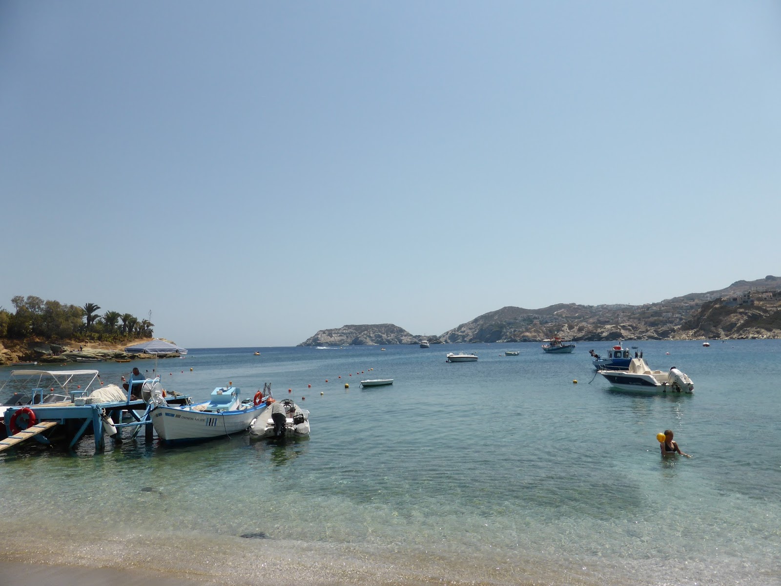
It’s great to visit destinations we missed during 2010 and we find one in Agia Pelagia – a spectacular beach in a great setting though ridiculously crowded ashore. We’re the only boat anchored here but like some other beaches an irritation is high-powered sports boats towing skiers, banana boats etc. To be fair they only seem to operate from about midday to 1700 (a good time to be ashore!) and the rest of the time is peaceful at anchor.

Agia Pelagia’s crowded narrow beach

At this location, like many, it’s difficult to find a place to put the RHIB when going ashore, but a fisherman kindly offers us a place and helps us moor alongside his boat.

Our RHIB is moored alongside a fishing boat in Agia Pelagia

The taverna owners tell us the tourists are mainly Greek on package tours and not spending much money. Many don’t have much to spend with the austerity measures, a 25 year-old qualified nurse saying she’d changed to waitressing as her nurse’s wages had reduced to 400 Euros (about NZ$670) per month – extremely low even per week. Her husband, a plumber, was told by his employer that he’d get paid when he could afford to pay him.

Next day we move further west to the small town of Ormos Bali, where often too much swell prevents anchoring but we find it calm this time and with no sports boat activity – bliss!

Ormos Bali’s beachfront

Ormos Bali viewed from Envoy at anchor

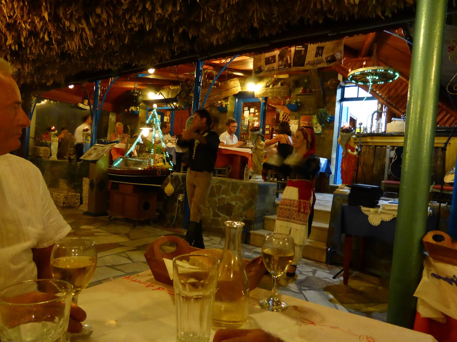
Later we have dinner ashore to the sound of live Greek music and traditional dancing, though the two performers seem mostly intent on getting the diners up to dance with them.

Dancers in traditional Cretan costumes

Like most overnight stops so far free fresh water is available from the small craft jetty and we replenish Envoy’s tanks using our portable containers and Chris’s pump.

One of our favourite destinations of all time is Ormos Milati on the northern side of the mouth of famous Soudha Bay, protected from all except rare easterlies and it’s here we anchor next.
Although it’s one of the best anchorages on the coast we’re the only boat anchored here. Ashore are excellent sandy beaches with clear water, although in typical Greek style large portions of the beach are covered with deck chairs and umbrellas. Here we have the first rain shower in many weeks.
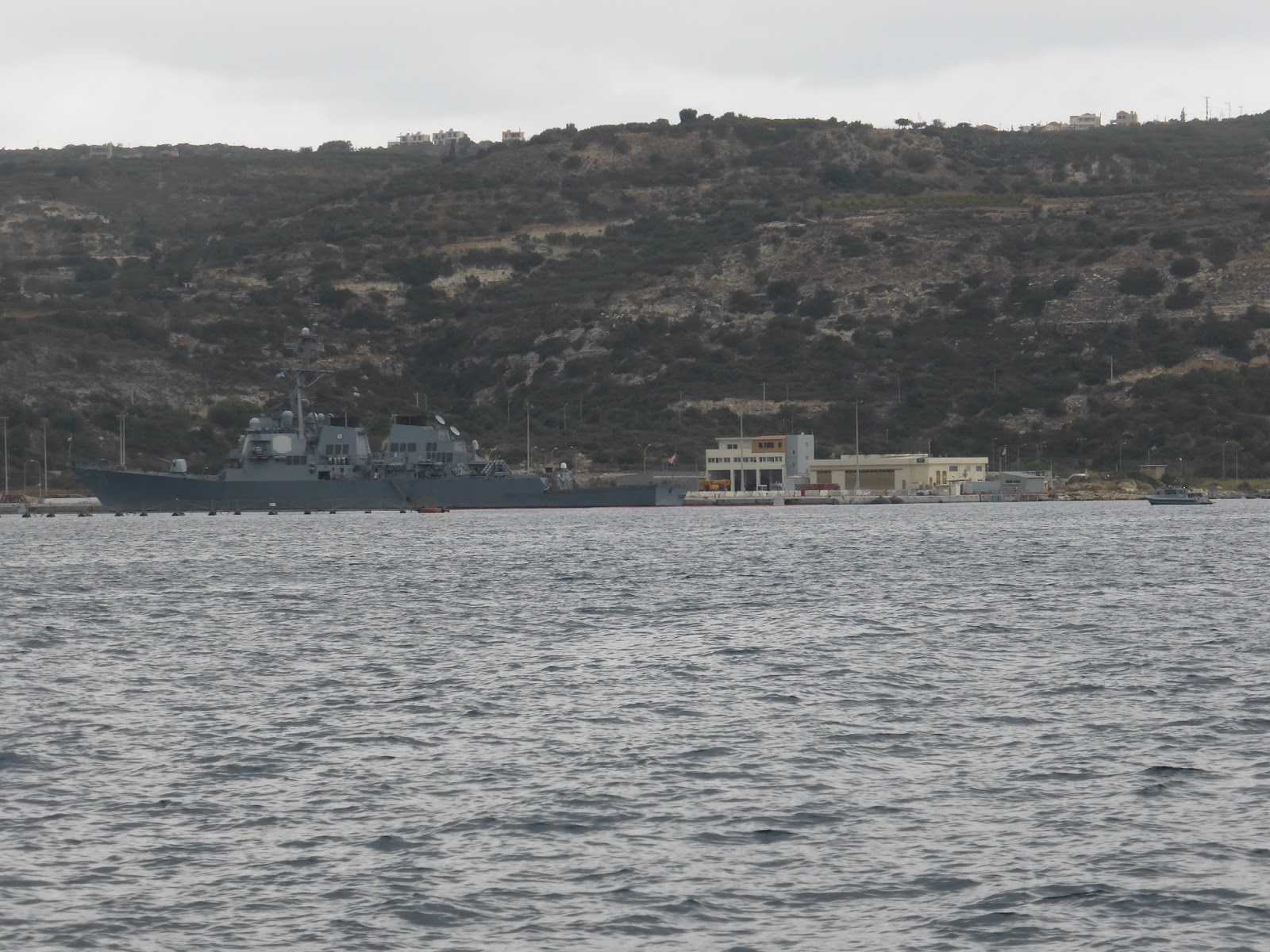
Soudha Bay itself is a four-mile long sheltered inlet running east-west containing a NATO naval base and the town of Soudha and a NATO naval base where we see several warships including a submarine. Tight security reigns here and armed patrol boats guard the warships. At one stage we approach too closely and a patrol boat roars over with blue lights flashing and siren sounding and instructs us to move further away.

Warship anchored in Soudha Bay

Artillery on the headland above the bay’s entrance still provides protection.
There is also a military airfield nearby, and jet fighters regularly roar over our heads.

During WW2 the Allies suffered heavy losses of ships in Soudha Bay at the hands of German bombers.
At the head of the bay is an Allied war cemetery, beautifully maintained in a wonderful setting, with the graves of 446 New Zealanders, mostly aged in their 20s, along with a lesser number of Australians who died during the German invasion of Crete.

Soudha Bay’s Allied war cemetery with Envoy anchored in background

The war graves are perfectly maintained and cared for

Although the battle was lost a big contribution to the war effort was made because the German paratroops were so decimated that Hitler never used them again. Also the invasion of Russia was delayed due to heavy German casualties in Crete, resulting in the freezing Russian winter taking a heavy toll and contributing to the eventual annihilation and capture of the German forces at Stalingrad – a critical turning point in WW2.

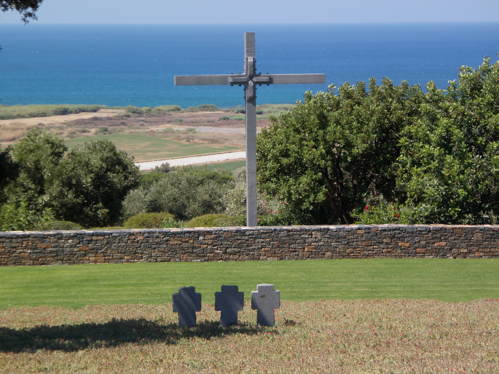
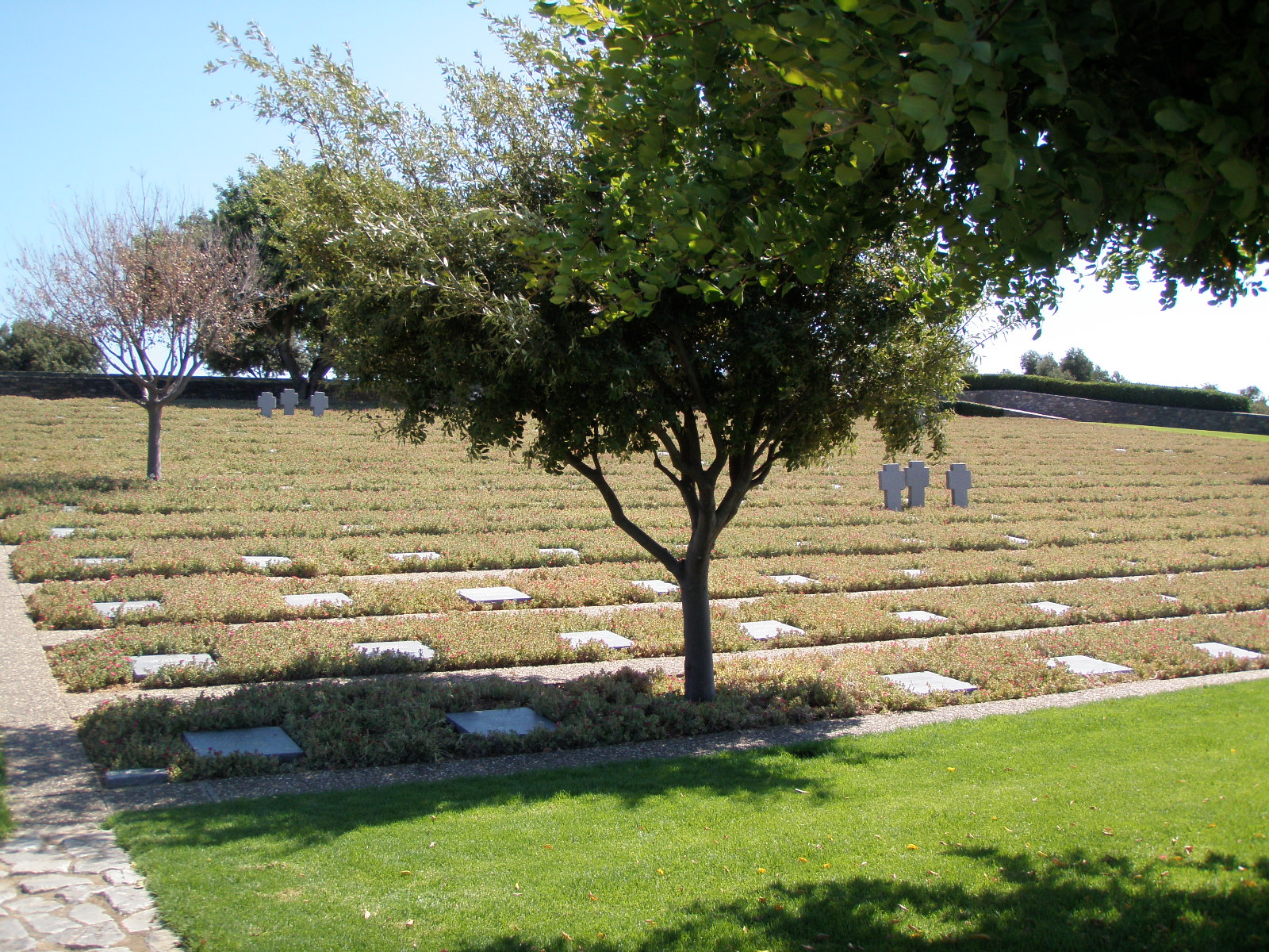
We also visit the German War Cemetery at Maleme, the scene of some of the fiercest fighting of the Battle of Crete. This is located on Hill 107 overlooking the airfield, and held by New Zealanders. They were decimating the German paratroopers on the airfield below until German aircraft arrived and wiped out most of the Kiwis. The cemetery is well designed and maintained, containing the remains of 4,460 young German men, disinterred from about 60 graveyards around Crete to be finally laid to rest in one location. It is typical of the generosity of the Cretans, that despite the appalling atrocities of the German soldiers to civilians during their occupation, they donated the land for the cemetery.

The German cemetery with Maleme airfield in background

The German graves are also in a peaceful and cared for setting

The Cretans fought very fiercely and bravely against the German occupiers eventually forcing them to retreat to the town of Chania, where they remained under virtual siege until surrendering to the British forces (not wanting to risk their chances with Cretan partisans) before the final collapse of Germany.