
High St. Ferry Dock
“I haven’t been everywhere, but it’s on my list” –Susan Sontag
It’s only 12 miles from Great Bridge to Norfolk but it can take half a day to navigate. Most of the low bridges have been replaced with taller one, but the railroaded bridges seem to always be under construction. One in particular was closed from 9-1 today, so we left Great Bridge with the 11:00 opening. Which gave us plenty of time to stop of diesel at another marina called Top Rack. We filled our fuel tanks and water tanks and got a pump out…we’re good for quite a while.
CONTINUE READING HERE…»
May 9 – Portsmouth, VA
2016-12 Prince Rupert to Ketchikan
Monday, May 9, 2016The 4AM weather report for Dixon Entrance East was special. No real wind until late in the day and seas less than 1 meter. Let’s cross… so we did.It was as forecast, a pleasant crossing in light winds with flat seas and…
Hingham Bound: On Golden (Blue) Pond
I’ve rounded Cape Hatteras three times and two of those were, shall we say, “exciting” (which is probably better than the word scary). In November of 2014, we saw 7 to 9 foot seas resulting from high winds (54 MPH) associated with thunderstorms in a passing cold front. Then in May of 2015, Tropical Storm Anna, hundreds of miles to the south, gave us 10 to 12 footers as we rounded Diamond Shoal heading north. Finally, last November (2015) we had smooth ride in a 3 to 4 foot following sea. Now, as we refueled in Morehead City I was again confronted with what to do about the Cape.
When it comes to Cape Hatteras It’s all about weather. How one interprets that weather will determine which of three courses of action one takes; take the ICW from Morehead City to Norfolk (3 days), stay put until the weather changes or “go for it” (and run 24 hours non-stop from Morehead City to Virginia Beach).”
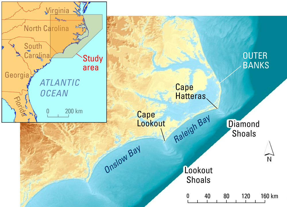
Explanatory Note (for new readers): Cape Hatteras is the most dangerous stretch of water on the eastern seaboard. Several factors account for this but the most significant is Diamond Shoal where, because of geography, you are effectively forced out to sea to get around the UNCROSS ABLE shoal. The geography is interesting. Hatteras Island sits 27 miles on the east side of Pamlico Sound (open water). Diamond Shoal juts out 7 more miles south east from the island. You must go around. Wave height is directly related to wind speed, time and distance over water. We went from 3 to 5 foot waves to 10 to 12’s in a matter of two hours on Thursday at Cape Fear.
Bottom line. You are 34 miles out to sea. Now add the fact that weather systems tend to favor this area to the convergence of the Gulf Stream and the Labradore Current and you have a formula for fast changing conditions and big seas. Oh, did I mention the fact that there are no inlets for 200 miles once you leave Morehead City for a boat of our draft (5 feet)?
Cape Lookout Shoal, just a few miles south of Diamond Shoal is no picnic either. Again, you are forced out to sea 16 miles and into bigger waves. Crossing this is risky as waves break over shallow water. Better to go around. We chose to cross at a deep spot in May of 2015 and saw confused seas, were hit with breaking surf and saw a depth of 9 feet under the bottom. Never again.
Friday’s coastal forecast for Cape Hatteras predicted west winds from 5 to 10 knots increasing to 10 to 15 knots with 3 to 5 foot seas with a wave period of 8 seconds and rain showers running from scattered to isolated as the day progresses. Looking ahead to Friday night and Saturday conditions remain about the same with a slight chance of thunderstorms. Given that west winds will most likely produce a following sea, we decided to go for it.
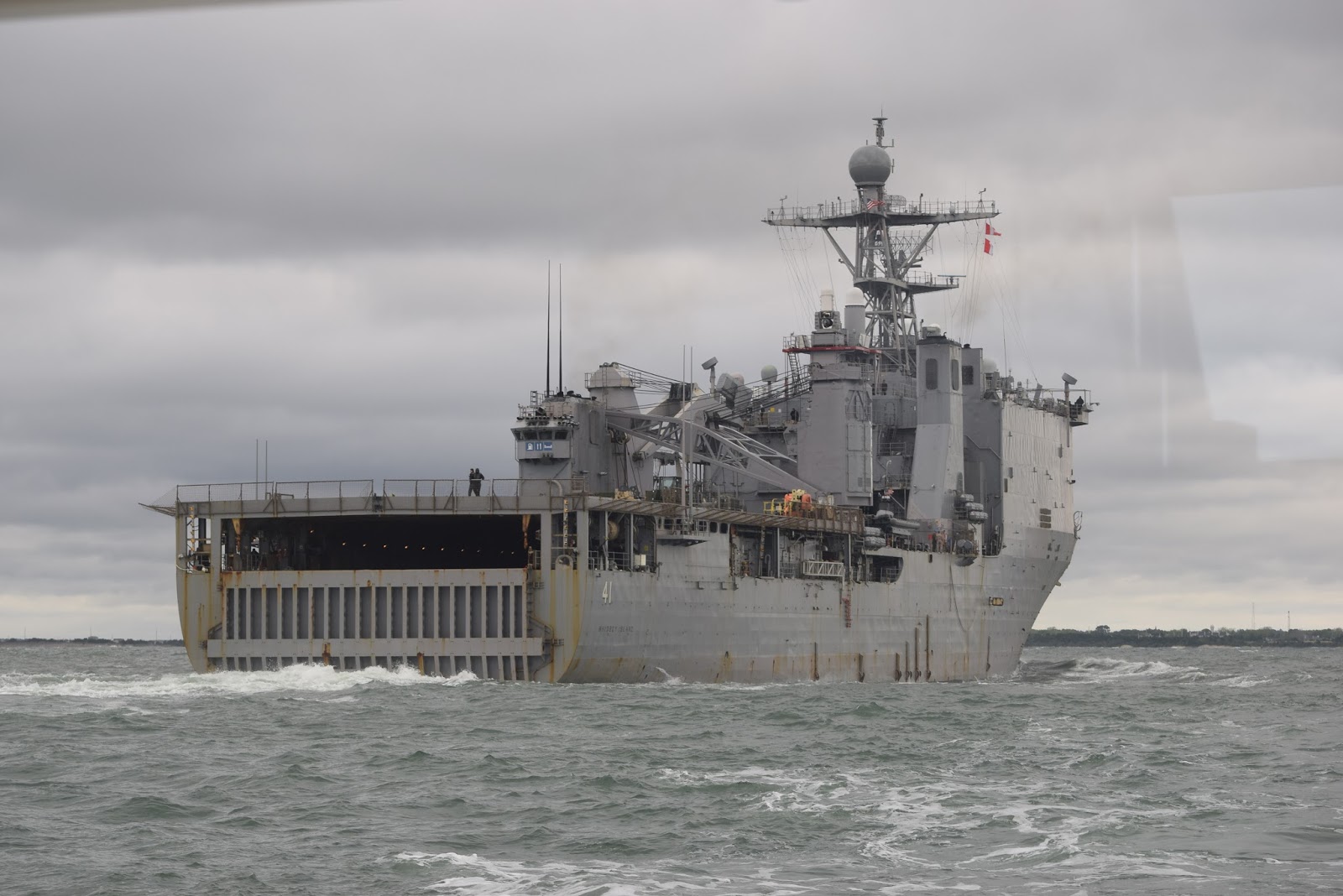
We departed Morehead City Yacht Basin at 10:04 and caught a 2 knot current down the Beaufort Channel thanks to an ebbing tide. Yes, for those who pick up on detail, we caught a favorable current both in and out. Then a little excitement. A naval warship was entering the Beaufort Inlet and warning vessels to stay clear. Clearly a Kodak moment.
Obstacle #1: Cape Lookout Shoal. As we headed on a southeast course along the southern side of the shoal in 4 to 6 foot seas we could see considerable breaking surf to our port side. We cleared the shoal at 12.41 PM. Turning north put the seas on our tail and gave us a smooth ride as headed direct to Cape Hatteras, some 4 hours to the north.
Obstacle #2: Cape Hatteras: At 8:54 PM we crossed the east end of Diamond Shoal in a 3 to 5 foot following sea. Wylie’s comment “Cape Hatteras is a pond.”
And it gets better. We had a following seas all the way to Virginia Beach, which we reached 24 hours after leaving Morehead City (10:35 AM on Saturday)
Now the question as we crossed the Chesapeake Bay was could we make it to Hingham without having to deal with bad weather. I came on watch at 1:00 AM on Sunday morning. Since leaving Virginia Beach we had experienced a smooth ride as seas subsided to 2 to 3 feet. Now we were off Cape Henelop (Rehoboth Delaware) some 318 NM into our trip. It doesn’t get much better.
Now to the upcoming weather. At 2:00 AM on Sunday, I got out my four dimensional chess board and started playing the weather game. The only precipitation was due west over the Shenandoah valley moving east. Good. The forecast conditions required a bit more thought. As of that moment, two weak low pressure areas with associated fronts were north and west of our position. A stronger low to the east and out to sea had a stationary front running east and west and a trailing cold front running south. Projecting the forecast out to 36 hours (in 12 hour increments) showed little change. What are the coastal forecasts for our route?
- Sandy Hook NJ: ETA 14:00 Sunday. South winds 10 to 15 knots with gust of 20 to 30 as the day progresses. Seas 3 to 5 feet with a wave period of 8 seconds. Analysis: Following sea. Favorable.
- Block Island RI (open water): ETA 2:00 AM on Monday. West winds 10 to 15 knots with gusts to 25. Seas 4 to 6 feet. Same winds during the day but seas build to 4 to 7. Analysis: OK enough. Still a following sea and, if necessary. we can duck into RI Sound where forecasted seas and winds are lower.
- Buzzards Bay MA: ETA 8:00 AM Monday. Southwest winds increasing during the day to 15 to 20 knots with gusts to 25. Seas 2 to 4 feet. Analysis: Favorable.
- Cape Cod Bay MA: Increasing west winds to 15 knots with gusts to 20 and 2 to 4 foot seas. Analysis: Favorable.
The Sirius Satellite Weather sea conditions forecast maps clinchedthe deal. Notice in the three photos below that a beautiful blue path seems to miraculously open up for us. We are still Hingham Bound with no stops or deviations.
Note: We have settled on three 3 hour watches starting at 10:00 PM and running to 7:00 AM. I’ve never tried this one before and it works better than what we’ve done in the past (i.e., six two hour or three 4 hour watches from 6:00 PM to 6:00 AM). This approach has allowed each of us to get a good night’s sleep.
Meanwhile, on my watch we crossed the Delaware Bay shipping channel and headed up the Jersey coast north of Cape May (3:15 AM). It was a busy evening with lots of traffic and great fun (since it was clear). I got to play with all the toys (AIS, radar, night vision and the VHF) and was able to see each target on all the toys and confirm each visually. This is a big confidence builder for times when the visibility disappears in fog.
Now it approaching 5:00 AM and we’re off Ocean City New Jersey. Tom is officially on watch and I’ve stayed with him solve a puzzle regarding a bright white light ahead. I’m also contemplating whether to take the Atlantic City to Block Island short cut, a straight line from Atlantic City to Block Island, which knocks off about two hours by eliminating the dog leg created by running along the coast.
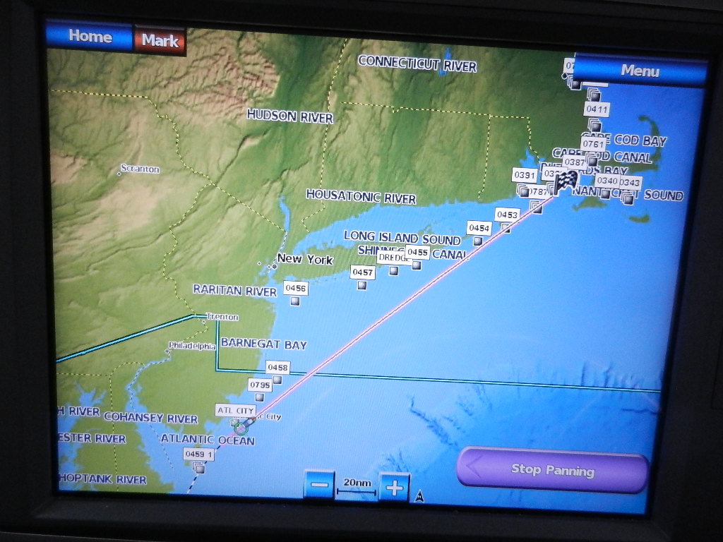 |
| Short Cut: Ocean City to the mouth of Buzzards Bay |
Explanatory Note: The decision to take the short cut is largely weather dependent. The short cut puts you offshore into open water where waves are bigger (i.e., Wind velocity over distance over time. The greater each, the higher the seas). Also to be considered is the distance from ports, which in this case is 45 NM or 5 hours to reach a port at the furthest point.
Time to play “The Weather Game.” Here’s the data:
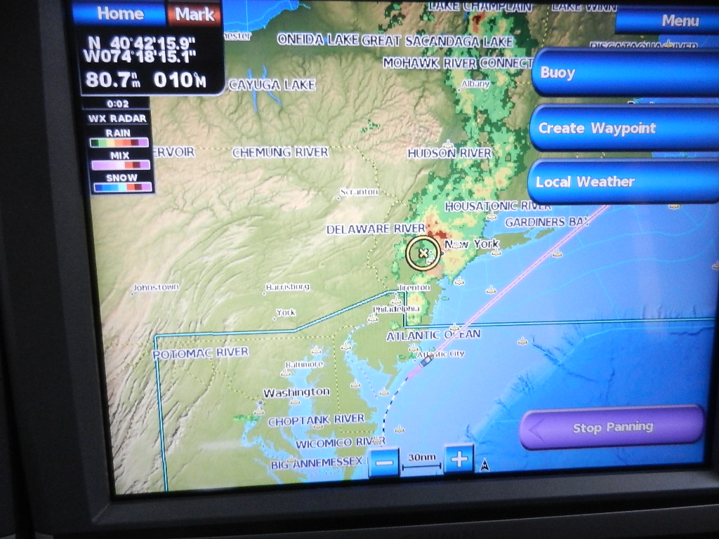 |
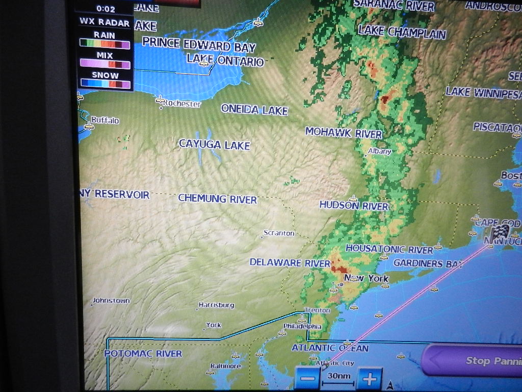
| Radar Map: We are south of Atlantic City. An area of rain and thunderstorms is north of us moving east |
 |
| Sea Conditions as of NOW. Dark Blue = flat, Light Blue = 3-5, Orange = 4-6, Green 7-10, Yellow 10-12, Red 13-20, etc. to 36 |
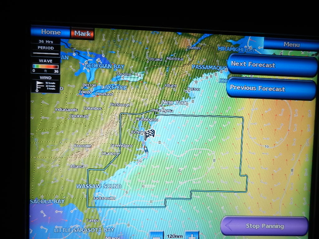 |
| Sea Conditions at 36 Hours Notice the “blue” path to Boston Notice the heavy seas to the east |
Time to make a decision. The forecasted seas going forward (12, 24 and 36 hours) show a widening path to Buzzards Bay that is good for 36 hours. We only need 24. The forecast maps (not shown) show a low pressure system east of our area, the cause of the big seas to our east. It is forecasted to continue north and east out to sea. To our west and south are a series of fronts associated with weak low pressure. A weak cold front west of the Hudson is most likely the cause of the rain system running north along the Hudson Valley. It’s moving east and north slowly.
Yes, I know it is likely to cross our path. But it’s moving faster than our 8.4 knots. It will move through the area in a few hours. We need 24 hours to reach Buzzards Bay. We are unlikely to be hit by the storm. Decision: Reasonable risk. Let’s go! It’s 5:25 AM.
Below is the big picture as seen on the pilot house screens three hours later at 7:51 AM. A light area of showers is visible to the north on our radar (center) screen, The storms have moved slowly east past the Hudson Valley (starboard screen). So far so good.
 |
| Notice the tape on the T353 night vision and engine control The tape is used to cut light that interferse with human night vision. |
We continued on the new course in relatively calm seas ranging from 1 to 3 feet. At 3:15 PM we recorded winds as WNW at 15 knots and rolling pleasant 2 to 3 foot seas off the starboard beam. We commented “Gorgeous, lots of fishing trawlers and no precipitation on our route.” At that point we were 24 NM south southwest of Fire Island NY.
15 minutes later the wind direction suddenly shifted northwest and climbed steadily to 25 and then 30. Seas started white capping and increased to 3 to 4 off the port aft quarter. The southeasterly swell was still dominant. The waves to port were wind driven. We were in sunny skies with no precipitation within 10 miles. I noted that we had experienced a dry cold frontal passage. We took heavy weather precautions just in case.
The winds did not last long. Four hours later (7:26 PM) we noted winds out of the northwest at 16 knots with 3 to 5 foot following seas. The comment says “no precipitation within 300 miles. Sunny. Comfortable but yawing.”
At 1:48 AM we were abreast of Montauk Light. The winds were WNW at 15 to 17 knots. I estimated seas as 2 to 4 feet. We were enjoying a very comfortable ride (although Tom and Wylie were sleeping).
Essentially, our offshore “short cut” passage was at end at Montauk Light and we were now running along our normal route. Since leaving Sarasota we had covered 1,300 nautical miles (1,495 statute) and 519 nautical miles (596 statute) since leaving Morehead City. The Cape Cod Canal was about 8 hours away and the weather data showed no problems all the way to Boston. Today, we had won the weather game.
Also noteworthy. We have had a following sea since we joined the Atlantic Ocean at Stuart. Than you Neptune, Zeus and Poseidon.
But the game is not over. Boy do I have a story to tell. See the next article.
Written by Les.
Going to Sea? Download For Free..
For decades, Linda and Steve Dashew’s books have been considered essential references for any serious cruiser. Having been blessed with …Read More
PHOTO OF THE WEEK – Perfect Storm
The story behind PERFECT STORM… A new addition to my online gallery, this is Perfect Storm photographed at Cape Reinga in New Zealand Cape Reinga is the northernmost tip of New Zealand, reaching into the sea and marking the meeting Read More …
May 8 – Great Bridge, VA
Great Bridge Historical Park Free Dock
“Happiness is not something ready made. It comes from your own actions.” —Dalai Lama
Great Bridge is one of my favorite places to sit and relax. I love to watch the show of boat on the river…the bridge opens on the hour so you know exactly when each performance is going to take place. The bridge blows a horn to warn all that it is about to open then it lowers the barrier arms to stop traffic and the show begins. Everything from small fishing boats to huge yachts, tugs and barges parade by. Through the years we’ve spent a lot of time here and the show never gets old.
CONTINUE READING HERE…»
PHOTO OF THE WEEK – Sea Fan Garden AE
The story behind SEA FAN GARDEN AE… A brand new addition to my online gallery, this is Sea Fan Garden AE photographed near Culebrita Island in Puerto Rico just last week. As we embarked on our month long Caribbean cruise in April, I Read More …
Solving the Jigsaw Puzzle
Most of the significant navigational challenges along the Inside Passage (i.e., Strait of Georgia, Cape Caution, Dixon Entrance) are solved the same way. You wait for the weather to settle down, either the wind or wave height (often both since wind is the main driver of wave height), and go for it.
Halfway up Vancouver Island, however, is a challenge that requires putting together multiple factors. Coming down from the northend of Vancouver Island is Johnstone Straight. Coming up from the southend is the Strait of Georgia. Where they meet are a multitude of islands between the Vancouver Island and the mainland joined by several fiord like inlets that penetrate the mainland. There is a lot of water sloshing through here creating a dozen or so named rapids with tidal currents that will change from as high as 13 knots (about 15 miles per hour) in one direction to 13 knots in the opposite direction over a period of six hours.
The winds play a factor as Vancouver Island is a major impediment to weather systems. The channels between the islands and inlets jutting into the mainland become the routes of choice for the winds associated with the high or low pressure areas moving between the Pacific Ocean and the North American continent.
When the direction of the often strong winds oppose that of the often strong currents, the waves created by the wind will become short in period and steep. Travel in those conditions will become difficult, unpleasant or, at times, unsafe. If the winds and current move in the same direction, however, you can speed along relatively comfortably several knots higher than your normal cruising pace.
Figuring out a route, there are three main routes with several variations, becomes a puzzle of monitoring the weather forecast and timing the currents through the various rapids. We’ve traveled through here thirteen times (either north or south) and the exact route we take is seldom known until a day or two before we actually do it.
This year’s trip involved taking the middle route through the Octopus Islands then using Mayne Passage to switch to the eastern route closest to the mainland. The final leg, a fourteen mile section in Johnstone Strait before cutting up into the more protected waters of the Broughton Archipelago was a bit of a bash in 20-25 knot winds opposing current.
We hope to round Cape Caution in the next day or so and complete the second half of the route to Ketchikan and little more expeditiously than the first half.
Find my iPad!
(Continued…)
VULAGA – FULANGA
VULAGA (AKA FULAGA)
May 9, 2016
OPUA, NZ –
This will be my last post for a while as we are leaving NZ this afternoon… HELLO Minerva Reef and Fiji. So, I’m catching up on the last of the Laus we visited, the lovely Vulaga.
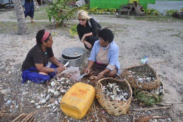 |
| In the village of Navadamu, as in the other 2 villages, women gather clams and prepare them for shipping to Suva |
Hush… what was once the best kept secret in the Lau Group is now a source of delight for many cruisers. There was a time when only a handful of yachts would head into the Easterlies and beat up to Vulaga, the southernmost of the islands of the Lau Group. However, times have changed. Last year, some 50 yachts visited this paradise.
 |
| Before fishing inside the lagoon, make sure that you are not dropping your line into a “tapu” area Ask the Chief and your family during the SevuSevu ceremony |
I won’t post pictures, because if you haven’t been there yet, you want to be surprised and delighted. So, the only things I will talk about are the pass and the village anchorage.
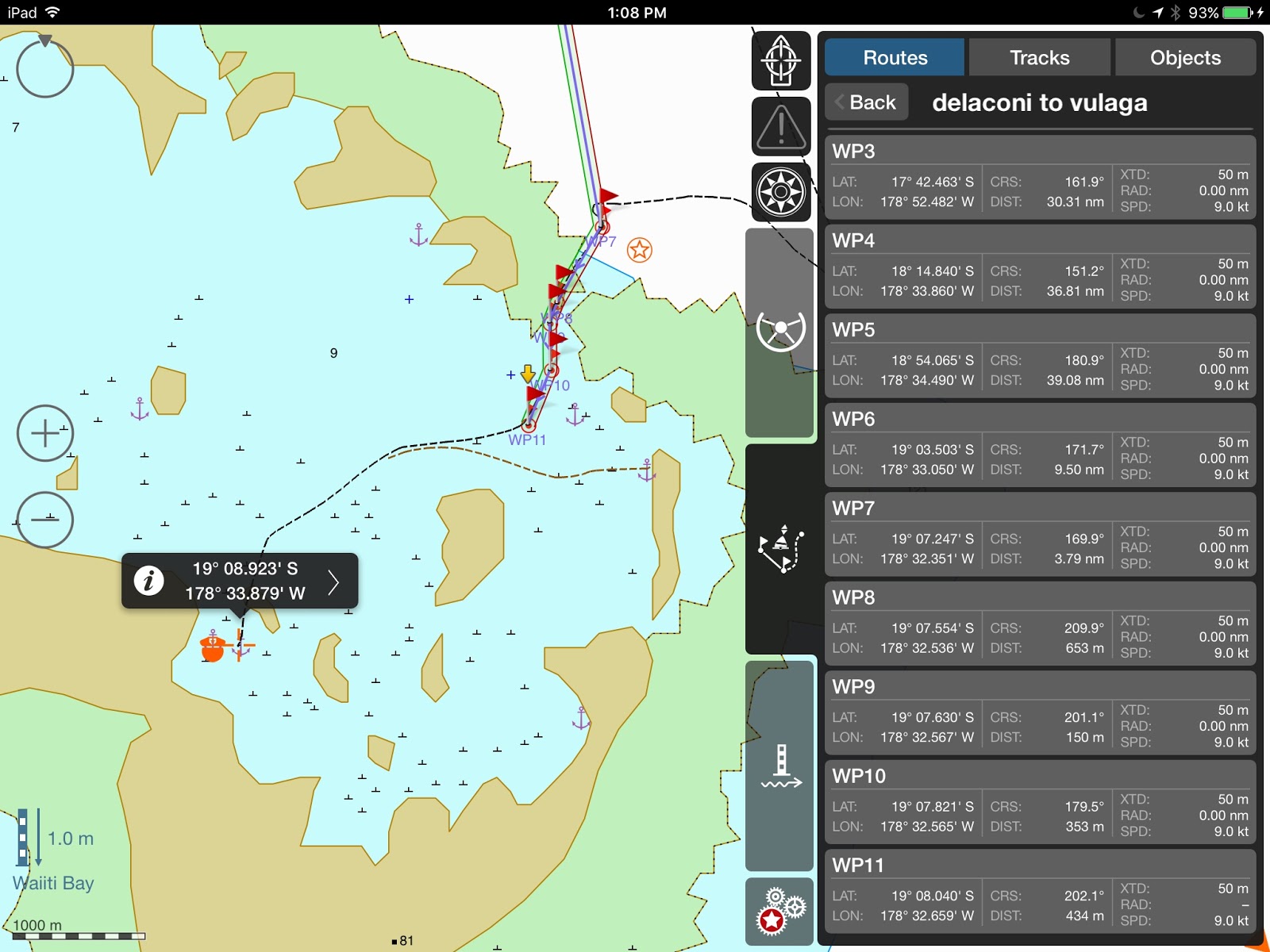 |
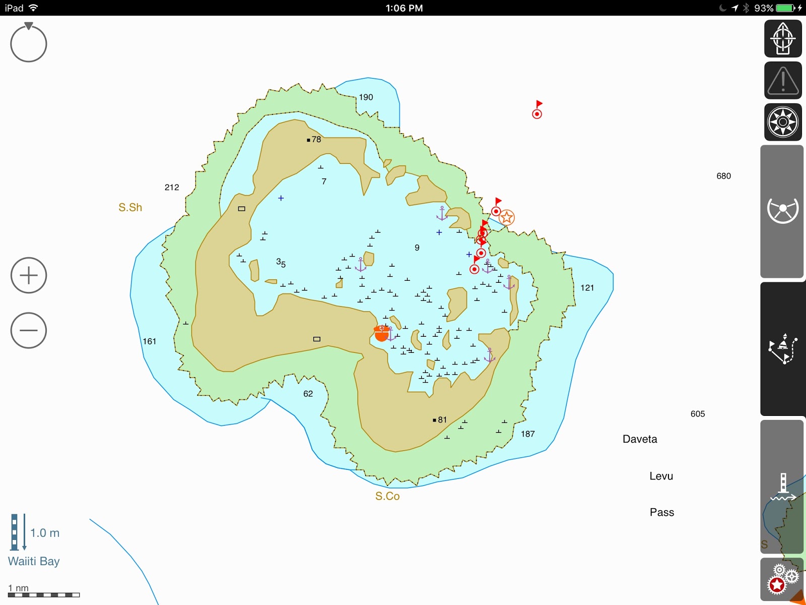
| Use Waypoints 7-11 to come in. Tested by DOMINO (1.2 m draft) and several other yachts in our group, with deeper draft |
Before coming into the lagoon, it’s not a bad idea to call VULAGA RADIO on Ch.16. Either Sarah (the nurse) or Sikelli (her husband) or Joe (Sikelli’s brother) will respond and confirm the tide time.
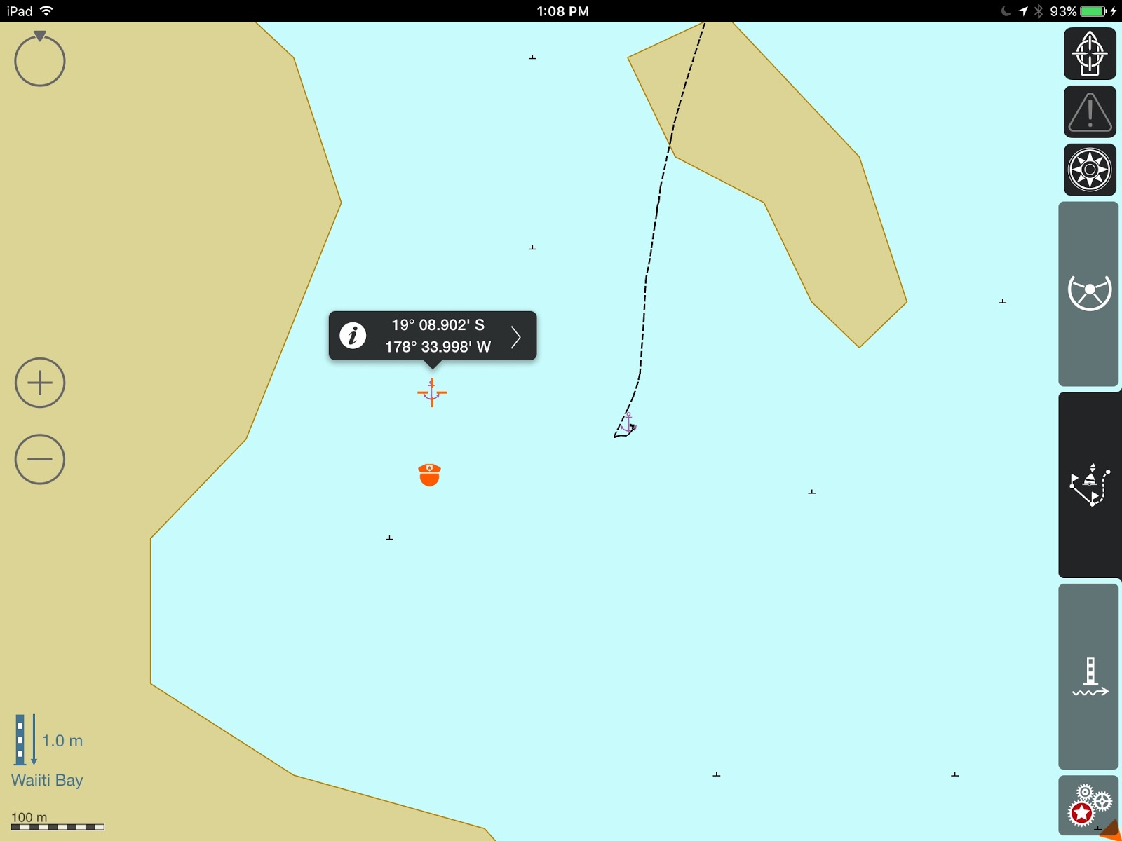 |
| Plenty of room to anchor at the village. Go to shore immediately, walk 20 minutes up the trail, and bring your yangona!!!! |
The pass is pretty tricky, a dogleg, and a bit narrow. Coming in, stay close to the black rock on port, as the reef is pretty shallow on starboard. Best time to go through (check tide table at MOALA): About the same time as high tide and almost 2 hours after low tide. We got at the pass early (in both directions) and waited for slack, but this is about right.

Once inside the lagoon, it’s pretty smooth sailing, as long as you keep a good lookout. The village anchorage is in 5-7 meters, good sand, very good holding. To dinghy ashore, be prepared to shuttle your little craft back and forth or, better, consider kayaking.
Either way, the villagers are absolutely delightful. Go do your SevuSevu ceremony and the Chief will assign you a family. Make sure you go to church with your family on Sunday and enjoy the singing! ‘nuff said!, you need to discover the rest for yourself.
Till next time….
dominomarie
