Port #12: What Can We Say About Leland?

Great Loop II Date: 8/18/2014

Day #19 (Monday): 55 miles (693 total miles)

Locks: 0 (2 total locks)

Port #12:  Leland, MI

Who would have thought it?!?!?  The weather predictions turned sour once again.  Everything we read about Washington Island, WI recommended going there only in fair weather.  Washington Island would not be a choice anytime this week.  Staying at Beaver Island was not a good option either.  We had to make a decision; risk it or play it safe.  We always take ‘safe’ so staying on the Michigan side of Lake Michigan was our only choice until weather improved.

Todd and I deliberated about which of three ports we should chose.  Our options were Charlevoix, Grand Traverse Bay or Leland.  Going to Leland would get us farther down the coastline and give us the opportunity to move on to Manistee, MI when the weather cleared.  From Manistee we could cross Lake Michigan to Sheboygan.

I’m pretty sure EVERYONE has heard about our experience in Leland September of 2010.  We darn near became residents because of back to back gales.  I was a bit depressed even thinking about seeing that village again, but decisions had to be made.

We had hoped for following seas to Leland and 1 foot or less waves.  Neither materialized.  As soon as we took our heading to Leland after passing the tip of Beaver Island we were taking mostly 2 foot waves on the port forward quarter beam with a few confused waves smacking us squarely on the port beam.  The crew gutted out the bumpy, rocky ride.  Once we were within a few miles of land, the wind shelter settled the waves and allowed the crew to regain some equilibrium.

The only sun we saw until well after we got to Leland.  See that little light patch close to the middle of the picture?  That’s the sun shining on Beaver Island.

Large sand dunes run along most of the Western Michigan coastline.  These are just north of Leland.
The dunes are very tall and very pretty.
This is the rock wall protecting Leland Harbor.  The office is the building with the red roof.  It takes both of us with binoculars to identify the entry into unfamiliar harbors.  We’re familiar with Leland from our last Loop.  However, looking at the picture, without a chart it would be hard to identify the opening to the harbor.
The clue to the opening is in the markers at the end of each rock wall.  The red marker (in the left circle) will need to be on the right side of our boat.  The green marker (in the right circle) will be on the left side of our boat.  The arrow marks the opening which is shown on our chart.
I didn’t have a picture of the chart so this is an overhead photo from Google with the channel markers and route direction.
This is what it looked like as we rounded the corner of the wall.
Coming into Leland Harbor, we had two Looper boats ahead of us:  El Nido and Blue Moon.  We docked next to another Looper, Takes Two.  After everyone was settled, the tradition of exchanging boat cards took place along with talk about where we’d been and where we were going.  There was mention of docktails however that didn’t materialize.  Leland has a lot to offer with Fishtown and other shops as well as a grocery near the harbor.

There’s OB on the left (with the red ball on the bow) and Takes Two on the right (Cheri and Gerald).  Takes two was a huge 49 foot DeFever.  The bow rose a good 10 feet above the waterline.  Walking by it was amazing…great ship to take out in the ocean.
El Nido on the left (Bob with his dog Duncan…taking the loop by himself) and Blue Moon on the right (Sharon and King).
The same harbormaster that was in Leland during our 2010 stay was in the office to check us in.  She mentioned they would not keep us as long this time.  We hoped for good luck!

We did much the same things as we did before; visited Fishtown, went through the shops and bought cheese curds.  Leland has added a wine store, so we checked it out, took in the wine tasting and bought 2 more bottles of wine.  We ate dinner at The Cove in Fishtown and never made it to the Blue Bird.  The dinner was over priced and not as good as we anticipated.

The Leland weather station.
See the water on the rock?  That’s the kind of day we came into in Leland.
Fishtown….the big draw in Leland.

The weather prediction looked good for an early morning departure on Wednesday, giving us only a one day layover in Leland.  The other Looper boats planned departures for the same morning only all were going to different ports or anchorages: Takes Two was off to Ludington, El Nido was going to Frankfort and Blue Moon to an anchorage in Portage Lake near Onekama.

Family Events and Family Visits

We made it back from our road trip in time for Pam and her sister Barb to put the finishing touches on their parents 60th anniversary party to be held a few days after our return. It was decided some time before the date to hold the party at Manny’s Pi…

Discover Historic Old Town Toronto

In 1815 Toronto was named York and Old Town neighbourhood was the first neighbourhood to be named. The city was expanding quick so the residents called the old neighbourhood “Old Town”, and not surprising the new neighbourhood was called “New Town”. Today Old Town in defined … Continue reading

Heading South – Petersburg to Cape Caution

From Fredrick Sound we head into Petersburg for a few days to provision.  Arriving on Thursday, July 24, our stay was originally to be two days but we stretched it into three when heard the windy forecast in Sumner and Clarence Straits through which we had to travel. A very stable low was sitting in the Gulf of Alaska and it would send periodic waves of rainy and windy weather through SE Alaska, especially the southern portions.

We transited through Wrangell Narrows the afternoon of 7/27 and headed to St John Harbor, directly across Sumner Strait from Wrangell Narrows. 

The next morning, after reading the weather report we downloaded via the satphone, we chose to avoid the northern section of Clarence Strait and head down Zimovia Strait and use Ernest Sound to join Clarence Strait only 30 miles north of Ketchikan.  Santa Anna Inlet was our anchorage for 7/28.

On the morning of Tuesday, 7/29, we headed for Meyers Chuck, a small Alaskan community at the NW corner of the Cleveland Peninsula, right where Ernest Sound meets Clarence Strait.  The forecast we downloaded, updated as of 0648, said Clarence was SE20 knots going to SE15 in the afternoon with 4 foot seas.  We were only traveling 2 or 3 miles in Clarence before entering the protected cove of Meyers Chuck.

As we were approaching the area where Ernest Sound met Clarence Strait, the forecasted E10-15 winds of Ernest Sound gave way to first SE20-25 and then SE30+, the seas began to build and our forward speed dropped from 6+ knots (our typical plodding pace) to 3+ knots on account of the head seas were pounding through. 

After 45 minutes of nerve wracking pounding followed by and even more nerve wracking 120 degree turn in order to line up with the entrance to Meyers Chuck, we rode the following seas through the narrow entrance.  The salon was a bit of a mess as books came crashing out of the book case during rolling we did while executing the turn.  We listened to the weather radio and found out that the weather service had issued a 0940 update which changed the Clarence Strait forecast to SE30 knots with 50 knot gusts and 6 foot seas, going to SE20 in the afternoon.  We were beaten up in 2011 by Clarence Strait and it did it again.

The next day, the forecast and reality agreed on a pretty nice day, and we arrived in Ketchikan mid-morning on July 30.  After our weather experiences of the previous week, we decided get into British Columbia ASAP and we did lots of chores in order to leave the next morning.

July 31 was a beautiful day, we thought the Alaskan weather gods were trying to persuade us to stay a bit longer but we weren’t buying its story.  We dropped anchor in Foggy Bay, one of the last good anchorages before crossing Dixon Entrance into Canada.

August 1 we headed into Prince Rupert in order to clear customs and immigration.  We stayed at the Prince Rupert Rowing & Yacht Club, probably the most accommodating moorage in the town to transient pleasure craft.  It is also convenient to shopping for those forbidden items (most fruits and many vegetables) or customs limited items (beer & wine).

After a lovely night at anchor in Lowe Inlet on August 2, the morning of August 3 we continued down Grenville Channel to do some fishing around Gil Island. After an 1-1/2 hours of trolling, Marcia had one silver and one king salmon and we headed to Cameron Cove for the night.

The next day, August 4, we tried trolling around the south end of Gil Island, a few nibbles but no takers.  There was lots of humpback whale activity in the area so that provided some amusement.  We also had one near collision with a whale who decided to take a nap (or at least a facsimile of one) on the route to our anchorage.  I was pretty close when I noticed this grey mound in the water was neither a wave nor an uncharted rock.  I maneuvered around him but he was not alarmed and remained there drifting along.  Our Hawk Bay anchorage on Fin Island was only a short distance away.

On August 5, we had the first rain showers since our Clarence Strait experience, a week earlier.  That didn’t dissuade Marcia from putting her hooks in the water around Gil Island one more time.  After 2 hours we were ready to throw in the towel when a beautiful 27″ silver salmon took the bait.  The rainy weather was a blessing because we travelled nearly 60 miles to Bottleneck Inlet with the fish in a cooler filled with cold water before Marcia got her chance to clean the fish when we anchored.

We headed down Finlayson Channel in a thick fog the morning of August 6 but it burned off as we rounded Ivory Island into Seaforth Channel.  The wind was picking up so we didn’t fish Idol Point.  We tried a new (to us) anchorage in Troup Narrows.

The winds were calm the morning of August 7 as we headed back out to Idol Point.  Lots of trolling but no fish was caught.  We did see and greet a vessel of another member of our yacht club who was also fishing the area.  We hoped to spend the night at the dock in Shearwater but they were fully booked so we dropped the anchor in a satisfactory but not exciting anchorage, Bob Bay.

2014-08 Silver 1The weather and winds were pretty mellow on August 8 as we cruised Fitz Hugh Sound southbound to fish along Hakai Passage.  Our dock neighbors in Eagle Harbor on Bainbridge Island spoke highly of the area.  We first tried the north side where 10 or so boats from nearby fishing lodges were fishing.  After one pass and no action, we crossed over the the south side.  After a half hour or so and right outside the entrance to our anchorage, Marcia hooked and landed a 29″ silver salmon.

2014-08 Silver 2The next morning, August 9, we started early for the morning bite.  It took a little over an hour of trolling but in nearly the same spot as the night before, Marcia landed a 28″ silver salmon.  Since the freezer is getting full, we headed to our anchorage in Pruth Bay.  That afternoon we paddled our kayaks to the beach at the head of the bay and walked the trail over to the lovely sandy beach that looks out onto the ocean. For dinner that night Marcia grilled on a cedar plank some of the salmon she had recently caught.

The sunny weather continued the next day, August 10, as we crossed Fitz Hugh to explore Fish Egg Inlet.  We worked our way towards its end and anchored the night in Oyster Bay.  It is totally landlocked with trees down to the high tide line, a very different feel from Pruth Bay which, while protected from ocean surf still has an outer coast feel. 

With a favorable forecast for the next day, on August 11 we drop the anchor in Fury Cove, a lovely anchorage and conveniently located for rounding Cape Caution.  There are already four boats here but before the day ends, another six follow bringing the total to eleven boats (including ourselves).

2014-08 Fury Cove

BACK IN SICILY’S EGADI ISLANDS

John, Alice and Lily enjoyed their remaining time with us at the Egadi Islands – strolling in Favignana village with stops for cappuccino and delicious cannole, going ashore to sunbathe and swim, John and Alice doing a day-long bike tour of the island.
The wind was mostly 15-20 knots and every couple of days changed from NW to SE requiring us to move from one side of Favignana Island to the other, sometimes anchoring, other times picking up a mooring buoy for 25 Euros (about NZ$39). There was some slight swell wherever we anchored so we used our flopper stoppers most of the time and sometimes an additional anchor to keep our stern to the swell.

John and Laurie deploy stern anchor

At one beach we met some retired mainland Italians, Francesco and Lilian, who have a holiday house at Favignana. Lilian never had children of her own and would have cuddled Lily forever.

We meet Francesco and Lilian ashore

One of our favourite swimming beaches with RHIB anchored

A great anchorage on the southern side of Favignana Island

Favignana is the only island with reasonably sheltered anchorages, the two other islands being subject to swell. Because these islands are a Marine Protected Area cruising in some parts is not allowed, while anchoring in other areas is also not allowed.

Envoy on mooring in Cala Freddo, Lovanzo Island

Two fabulous weeks passed all too quickly, and we headed back to Trapani to take John, Alice and Lily to Palermo airport – a wonderful time, many more to come.

We drove back from the airport via Monreale, visiting the awesome Cathedral, commissioned by the Norman, William 11, and completed in 1184. This is considered the greatest example of Norman architecture in Sicily and one of the best in Italy. Countless paintings inside depict Biblical history in gold leaf, making you wonder how it has all survived Sicily’s tempestuous history.

Monreale Cathedral

Monreale Cathedral Cathedral’s naive has paintings in gold leaf

In Trapani we refueled for the first time this year taking on 804 litres of diesel plus 40 litres of petrol for the RHIB.
With nearly two weeks before the arrival of our daughter, Amy, it was back to Favignana again. A few days later we met some Australians – Gary and Vanessa and their children Marina (7) and Elliot (14) aboard their 13m yacht Neptune 11. They sailed from Brisbane six years ago and only Vanessa has been back one time since, so interestingly Marina has spent nearly her whole life aboard the yacht with no memory of Australia. Gary and Vanessa provide education but they do plan to sail home during the next two years, crossing the Atlantic and the Pacific, partly so their children can receive a more formal education.
Gary is a talented sax player, formerly playing in bands and we had one great evening playing guitar and sax aboard Neptune 11.

Gary and Laurie jamming

Although many people live the cruising life it’s very rare to meet people firstly with children aboard and secondly who don’t return home every year or so.
One day we were enjoying a quiet swim in a sandy cove when a 9 metre RHIB with about eight noisy Italians motored up right beside us. They introduced themselves and produced a bag of sea eggs (known in New Zealand as kina). One of them proceeded to break open some kina and spread their roes on slices of fresh bread for us, as they asked us al sorts of questions to satisfy their curiosity. We are surprised to meet some Italians who don’t know where New Zealand is – one said “close to Scotland isn’t it”.
One night we took a mooring in a Favignana Island bay called Cala Rossa (Cove of Blood). Here in 241BC a Roman fleet of 200 ships defeated a Carthaginian fleet of 400, taking 15,000 prisoners and making the sea red with the blood of those killed. All around this part of the island are Carthaginian ruins, laid waste by the Romans.
Then it was back to Trapani again, just two hours away, to meet Amy.

TECHNICAL – nothing to report

ENVOY LOG As at 1/8/14, we’d spent 115 days aboard and cruised 983 miles for 180 engine hours.

Day 221…Footbridge to the sunset…

Welcome to day 221 of  365 photos…I came upon this footbridge over the White Oak River just as the sun was going down. I loved the look of the Spanish moss in the trees, the bubbling water, and the footbridge seemingly making a path to the sunset. The lighting was really different here. Even though… Continue Reading

The post Day 221…Footbridge to the sunset… appeared first on Moosetique Musing.

Where the River Flows

The next morning started overcast but quite warm. A 50% chance of rain meant we also had a 50% chance it wouldn’t rain. Yeah, right. Our anchorage for the night was not yet decided, but a few options were available. The plan was to transit about 50 m…

Where the River Flows

The next morning started overcast but quite warm. A 50% chance of rain meant we also had a 50% chance it wouldn’t rain. Yeah, right. Our anchorage for the night was not yet decided, but a few options were available. The plan was to transit about 50 mil…

Alaska 2014 – Wrangell to Port McNeill

August 1, 2014

Since we did not have to be in Ketchikan until August 4 we spent the day in Wrangell, finished off with a potluck dinner hosted by Dance’s on Peregrine, with Lennons from Tranquility and Millers from Hathor.  Doug and Karen Dance had prepared black cod for the main course, which was delicious.  We ate al fresco on the fly bridge in warm and sunny weather.

August 2, 2014

Spirit left Heritage Basin in Wrangell for the last time in 2014 at 0935 under sunny skies.  Heading south through Zimovia Straits we anchored at 1435 in Santa Anna Inlet where Patrick placed a single prawn pot near the entrance.  By evening we had several dozen large spot prawns.

August 3, 2014

Under sunny skies we raised the anchor at 0800 and headed for Ketchikan, stopping to fish at several locations, but with no luck.  Cruising by Meyers Chuck, we could see it was full, so we continued down Clarence Strait, stopping several times to drag lines in the water, again no luck. We finally docked in Bar Harbor, Ketchikan at 1740 and were greeted by our normal rain showers.

Patrick walked to Thomas Basin, about 2 1/2 miles away and visited with “Coccinelle”, the dismasted French sailboat, who were planning to cross Dixon entrance the next day.
August 4, 2014

We spent the day on maintenance and cleaning in preparation for the arrival of Dianne and Bob Tucker the next day, while watching the “Duck Tours” splash down the launching ramp in front of our slip, each one playing the theme song from Gilligan’s Island as the Ducks departed for the harbor tour.

August 5, 2014

The day started out sunny, but we still had some rain during the day.  Tuckers arrived on schedule in the late afternoon, and after a sightseeing walk downtown we returned to Spirit for a grilled King Salmon dinner.  The evening finished with a quick trip to Safeway for some last minute items, just enough to get us across the border to Prince Rupert and still be legal on vegetables, fruit and alcohol.

August 6, 2014

We departed Bar Harbor at 0645 for the last time in 2014 and headed for Anderes Oil to top off the fuel for the trip south.  The harbor and docks were full of seiners and tenders, but we squeezed in astern of a large tender and put on 350 gallons of diesel fuel before heading down Tongass Narrows.  Reaching Mountain Point we slowed down and put the fishing lines in the water and soon had several Coho salmon in the boat, as well as several Pink salmon.  The fishing cooled off and we continued down Revillagigedo Channel to Foggy Bay where we anchored with one other vessel.  Bob and Patrick took the Grady White out fishing and returned with a Coho and a small 15# Halibut to add to the freezer.

August 7, 2014

Leaving Foggy Bay at 0500, just as it was getting light, we started trolling as soon as we cleared the outer bay and could not keep the Pink Salmon off the hooks, so after four of them in just 20 minutes we pulled in the gear and headed across Dixon Entrance, through Venn Passage and into the Prince Rupert Rowing and Yacht Club, where we cleared customs and headed for Safeway to buy the items we could not take across the border.  While there we received an email from “Coccinelle” indicating they were looking at trucking their boat to Anacortes rather than motoring another 600 miles.

August 8, 2014

Today we motored out of Prince Rupert at 0805, stopping several times to fish, with no luck, heading down Grenville Channel and finally anchoring in Lowe Inlet, where a bear was feeding on Coho Salmon jumping up Verney Falls.  We tried to entice the Coho to take our bait, but with no success.  We dined on halibut under the setting sun in the cockpit.
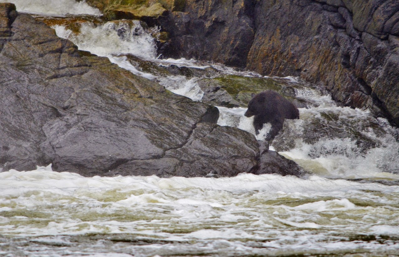
Bear feeding in Verney Falls, Lowe Inlet
The Tuckers in front of Verney Falls
August 9, 2014

Raising the anchor at 1000 in light rain and fog, we headed back out into Grenville Channel, stopping to fish at Gribble Island.  By noon the skies had cleared and we headed down Princess Royal Channel to Khutze Inlet where we anchored in 110 feet of water at the base of the waterfall.  Patrick set two crab pots for an overnight soak.  The fog started rolling in and there was patchy fog overnight, but no wind.

Summer scenery in Khutze Inlet

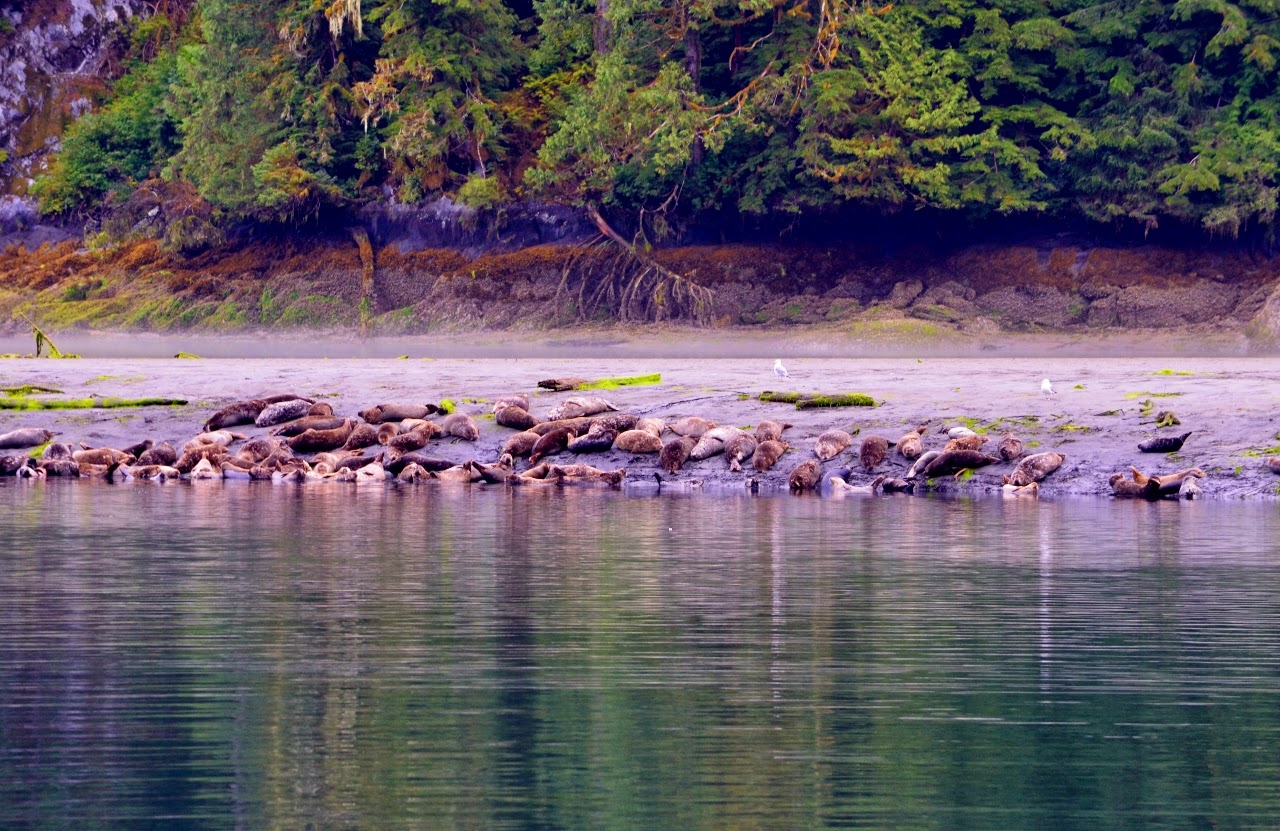
Seal colony in Khutze Inlet
August 10, 2014

Patrick pulled the pots in the morning and found 18 legal crabs, well within our combined limit for four licenses.  At 0805, after cooking the crab we headed back out Khutze Inlet and continued down Princess Royal Channel, Tolmie Channel and Klemtu Passage before crossing Milbanke Sound. Bob and Miriam spent quite a bit of time picking the crab meat from the shells.  The swells increased to 6-10 feet, but smoothed out as we turned in at Ivory Island into Seaforth Channel.  We anchored Spirit in sunny weather at 1835 in front of Shearwater along with many other pleasure craft.  We enjoyed fresh crab in the sun for dinner.
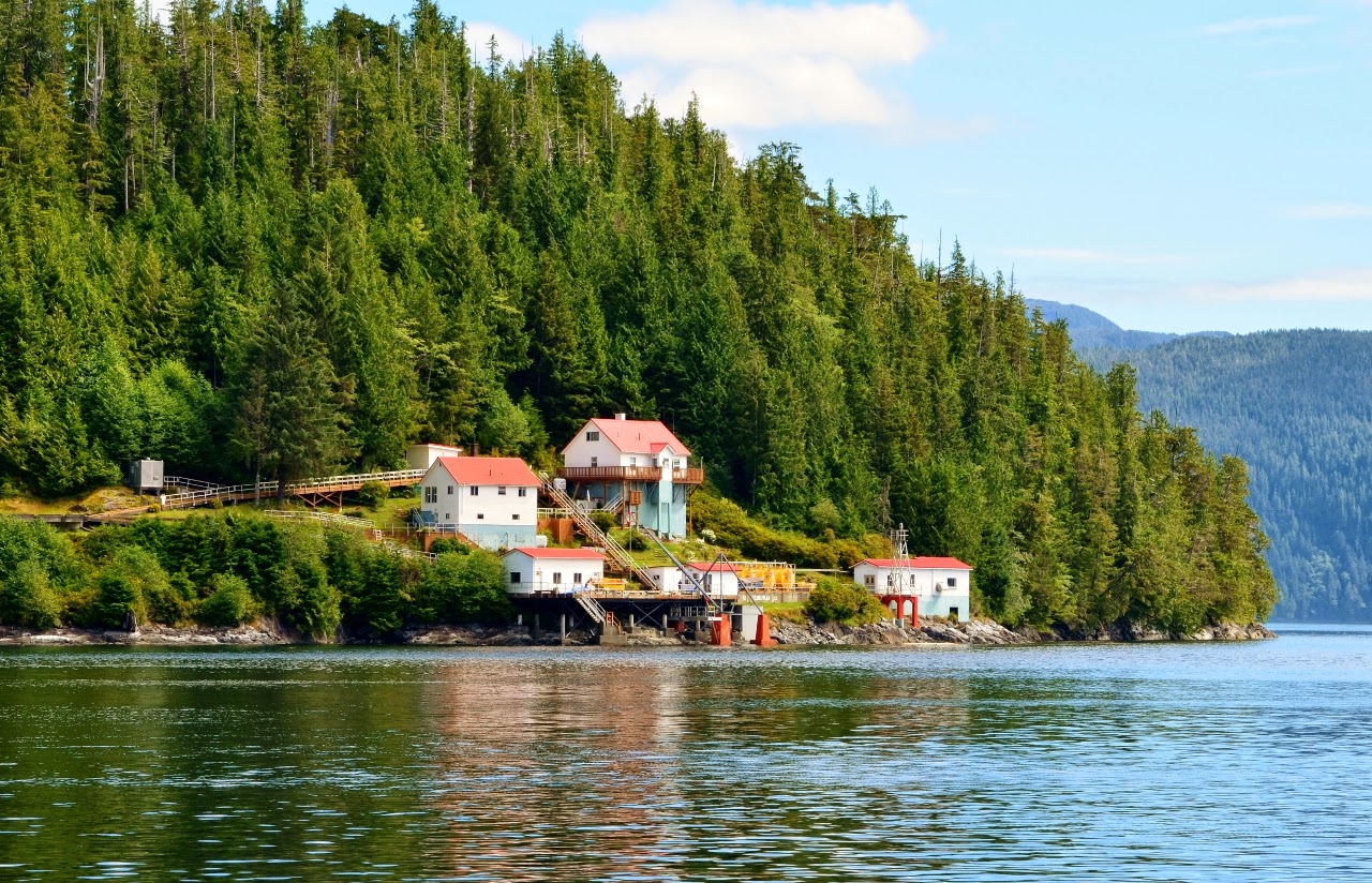
Boat Bluff Lighthouse

Longhouse at Klemtu
Super Full Moon at Shearwater
August 11, 2014

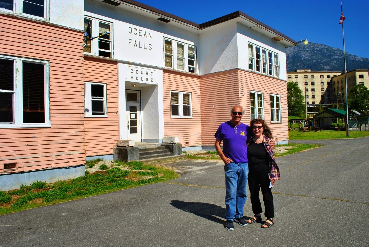
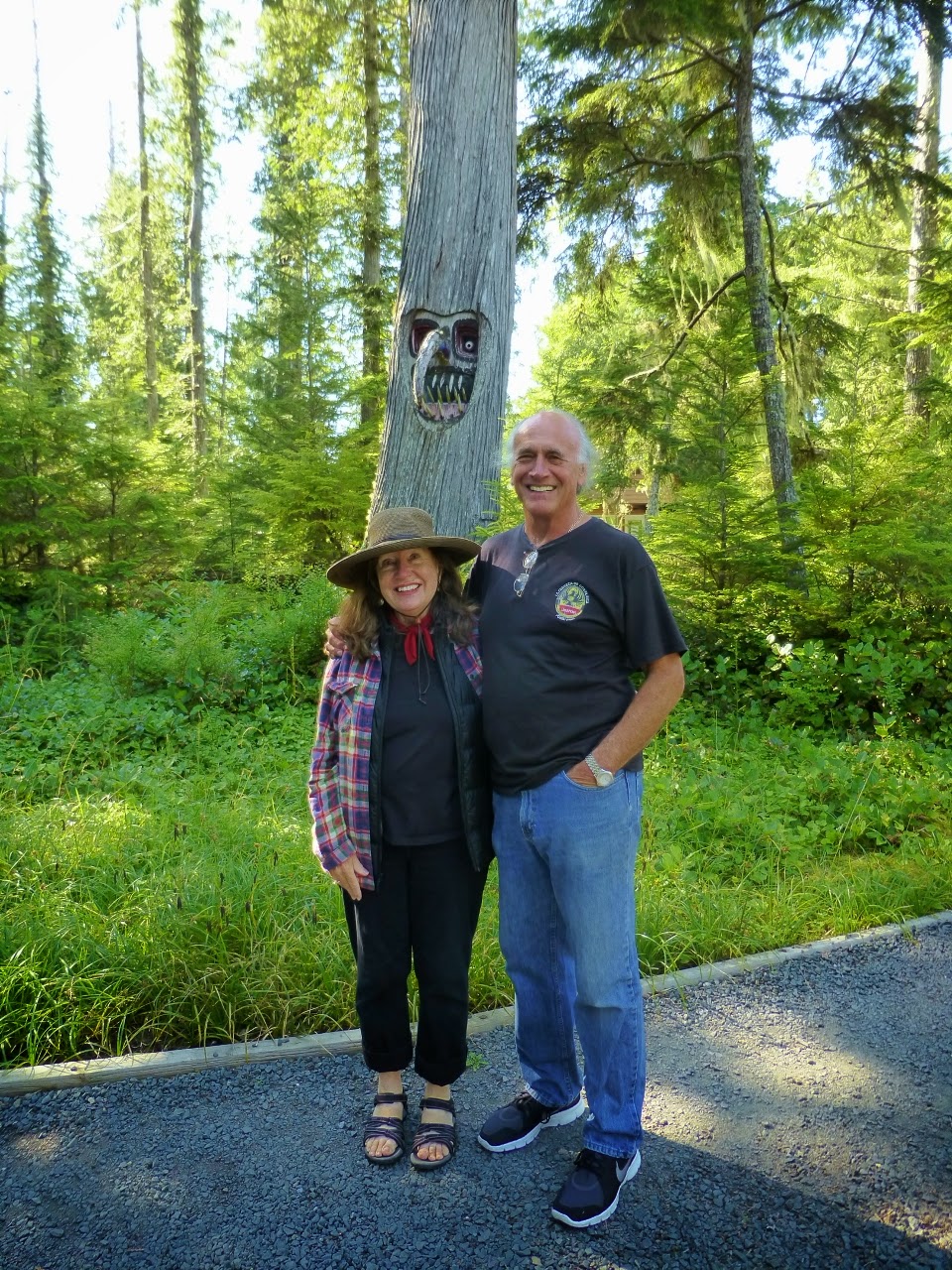
After the fog cleared we pulled up the anchor at 1155 and headed into Gunboat Passage to Ocean Falls.  By 1515 we had moored at the Ocean Falls dock in brisk winds, but sunny and very warm weather.  Bob, Patrick and Dianne toured through the deserted town up to the dam and Link Lake before returning to Spirit where we enjoyed more of the crab from Khutze Inlet, now made into a crab and corn chowder.

Ocean Falls Mermaid
The Tuckers in Ocean Falls

Some of the remaining deserted houses slowly falling apart
August 12, 2014

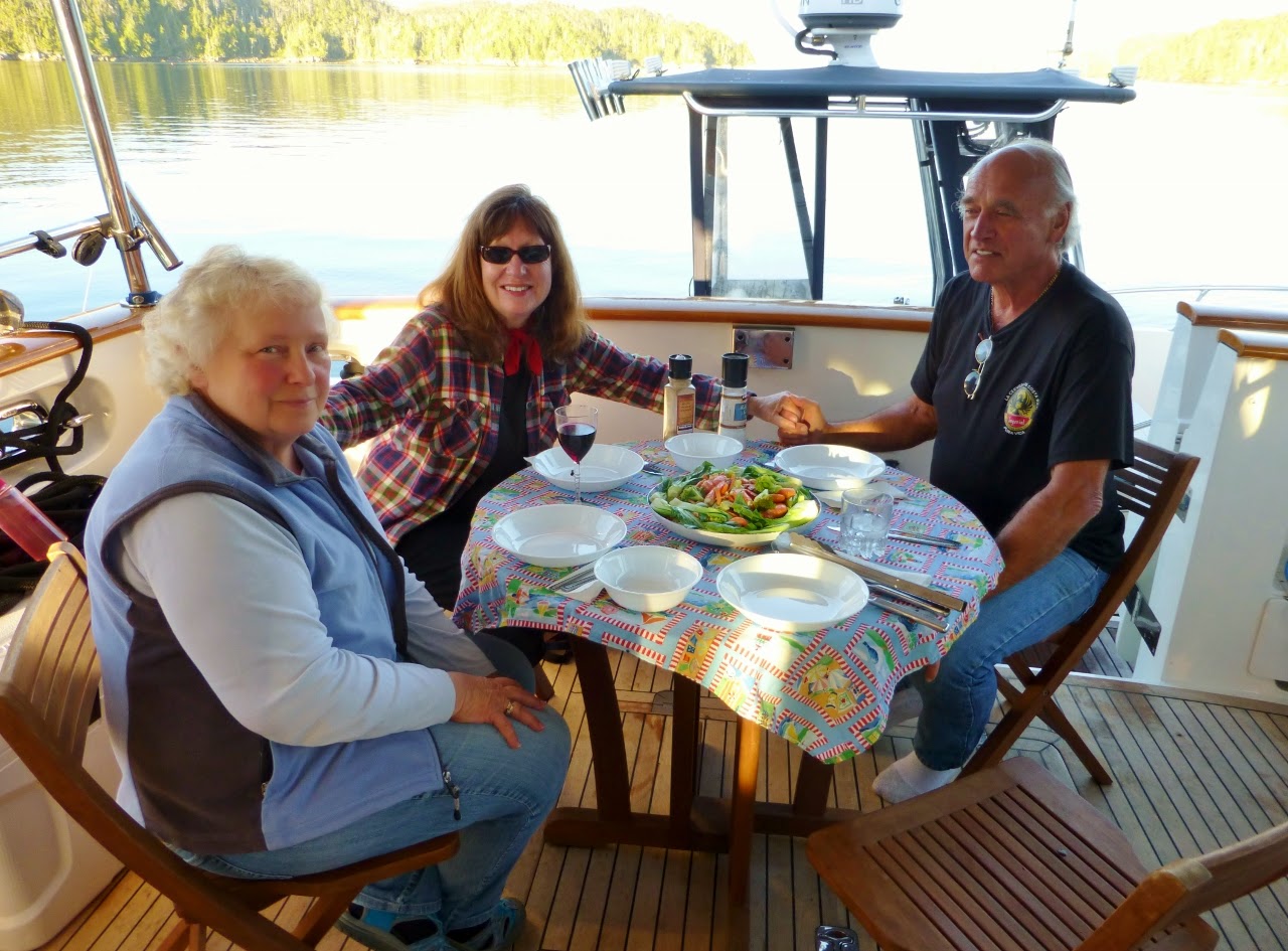
We wanted to fish today, so we left Ocean Falls at 0845 and drug a variety of lures at different depths, getting only two strikes, both of which we lost.  Returning to Shearwater via Gunboat Passage we briefly anchored and went grocery shopping at the Shearwater store, which had a good selection of fresh vegetables.  After pulling the anchor we headed down Lama Passage, across Fisher Channel and into Codville Lagoon, which was full of boats.  Our favorite spot was still available, so we anchored and set out both crab and prawn pots and then had dinner in the sunshine in the cockpit.  We were surprised to still have cell phone reception in Codville Lagoon.

August 13, 2014

Bob and Patrick headed out in the fog to find the prawn and crab pots.  They came back with only one crab, but 10 dozen prawns.  Seeing the fog beginning to lift, the decision was made to head for Pruth Bay.  We pulled the pots again, getting several dozen more prawns and headed into Fisher Channel, where we were greeted by dense fog.  By the time we got several miles north of Hakai Passage the fog cleared so we headed down scenic Ward Channel and across Hakai Passage though Meay Channel and into Pruth Bay.  Already at anchor were cruising friends Lisa and Mike Haistings on “Legasea”.  We made a trip into the beach to visit West Beach, which was littered with blue sailing jelly fish known as Valella Valella”, as well as a large “88” jellyfish in the clear water at Pruth Bay.  The prawns we had caught became a pasta and prawn dinner in the cockpit under sunny skies.  
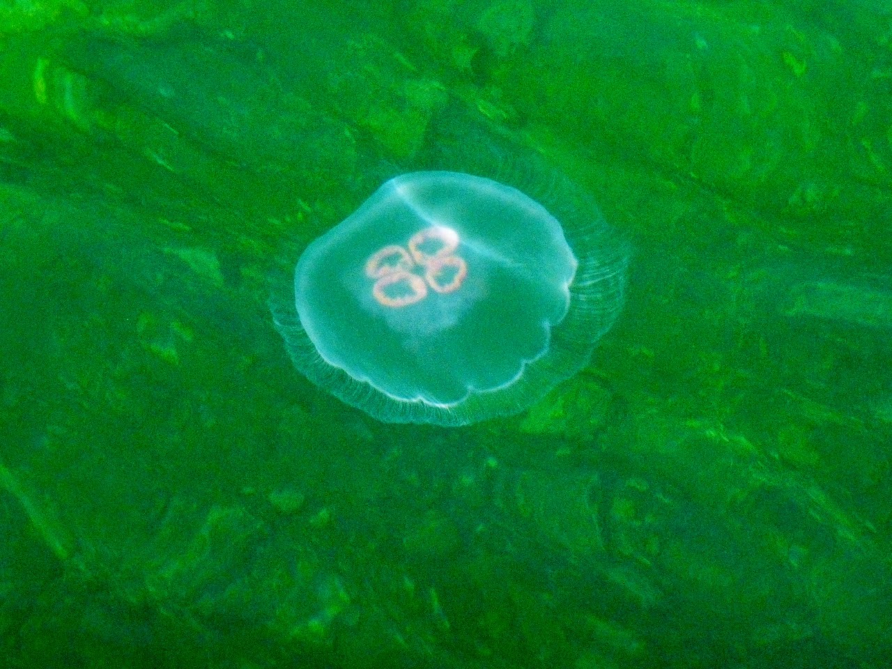
Jellyfish in Pruth Bay

Dianne and Bob Tucker at Mosquito Tree, Pruth Bay

Valella Valella on West Beach, Pruth Bay

While preparing dinner we heard a “Pan Pan Pan” on the radio and responded to a distress call from a 30 foot sailboat that had run aground on an ebb tide entering the south arm of Pruth Bay, within sight of us.  Bob and Patrick took the Grady White over to see what they could do.  Patrick attached a tow line to the main halyard and pulled the boat over to a higher angle of heel, freeing the keel from the reef, then pulling them off the reef and guiding them into safe water.  They claimed the chartplotter they were using did not show the reef, but all three of our programs showed it clearly.  After freeing the 30 foot sailboat from the reef, we resumed our prawn dinner in the delightful sunshine.
Pulling a sailboat off the reef in Pruth Bay
Prawns from Codville make great pasta
August 14, 2014

Surprisingly the fog was not in Pruth Bay when we awoke.  The couple from the sailboat we had freed dropped of Vietnamese Summer Rolls which we put in the refrigerator.  After breakfast, Patrick, Bob and Dianne headed into the beach and spent the day on West Beach and hiking to North Beach.  Returning to Spirit, we had the summer rolls in the cockpit.  That afternoon we met on “Legasea” for happy hour.  By the time we were finished, both Miriam and Dianne were under the weather, and by the next morning, everyone but Patrick was feeling ill.
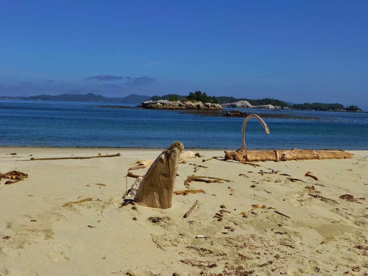
North Beach, Pruth Bay
August 15, 2014

Miriam, Patrick and Bob were awake early for a 0500 departure from Pruth Bay, in the dark, for the long crossing to Port McNeill.  As we headed down Fitz Hugh Sound we ran into dense fog near Cape Calvert, which persisted until we approached Malcom Island.  There was a moderate westerly swell, but little wind, and the swell died out by the time we passed the Walker Group while in Gordon Channel.  After 84 nautical miles we arrived in Port McNeill at 1610 under now sunny skies.  The trio who were feeling ill seemed to recover, but we cancelled dinner with Alex Benson on Wild Blue to make sure everyone was really well.

Spirit has now covered an additional 456 nautical miles since leaving Ketchikan on August 6.

August 16, 2014

Bob and Dianne spent the day in Alert Bay, visiting the cultural center, while Miriam and Patrick worked on minor maintenance items on the boat and watching the parade of pleasure craft heading south for home.  After the Tucker’s returned we had dinner at Gus’s Bar and Grill.

August 17, 2014

It was a long night since the trio had not really recovered fully from what we think may have been some sort of food poisoning which Patrick was immune to.  Bob and Dianne felt well enough to depart on the bus to Victoria mid-day.

August 18, 2014

Today was another maintenance day, working on the bow thruster issue and other items before having an evening get-together with the crew of “Adventure”, a vessel that used to moor next to us at Anacortes Marina.  Both Port McNeill marinas have more and more vacant slips at night as people keep heading south for the season.

Short Timers

The crew has been very busy helping clean out the house and have hardly noticed that the summer has flown past. None of us can believe that we are down to days before we move back onboard. There’s one more run to the dump, a carload of books to take to…