Tag Archives | Nordhavn

View From Mile Zero

Yep, Conch Harbor Marina’s onSpot wifi hotspot is fast enough to stream live video.

So grab a Margarita, sit back, and watch the sunset in Key West — From the comfort of your own home.  ~Searchin’ for my lost shaker of salt~

World Class Sunset

Enjoy

Nordhavn Exumas Abacos Bahamas trawler Caribbean Pickwick Boat dogs
Memphis Downtown

it’s been a long time —

— since our last stay in Key West.

Today was the first day of Lobster Season. Pots everywhere, looks like Maine, I imagine. We dodged pots from Marathon to Key West.

 Conch Harbor Marina is home for now.
We’ve got work to do right now, but I bet we find time for fun in a day or so. 
Waitin’ for a Sunset. I’ll post pics.
Cheers,
Istaboa

Nordhavn Exumas Abacos Bahamas trawler Caribbean Pickwick Boat dogs
Memphis Downtown

JOHN, ALICE AND LILY ARRIVE IN SICILY

With the imminent arrival of our son John, daughter in law Alice and grand daughter Lily into Palermo, we moved to Trapani harbour, about 50 km from Palermo airport.
We were about one mile out from our Favignana anchorage on our way to Trapani when we noticed our RHIB was no longer behind us – I had improperly secured it, so couldn’t blame Di! We turned around and went back to the anchorage, where the RHIB was now close to rocks ashore, so I brought Envoy in as close as I could and Di leaped into the water, and swam about 40 metres to the RHIB. The plan was for Di to climb aboard, start the engine and bring the RHIB back to Envoy, but Di had forgotten where the outboard’s power tilt button was so couldn’t start it. I could see that Di was having problems and had got back in the water to hold the RHIB away from the rocks, so I anchored Envoy close-by, swam to assist her and all was OK. But there’s a lesson here – it’s nearly always me, the skipper who drives the RHIB, but it should be your crew so they are familiar with it. I’ve also thought about whether I should have asked Di to wear a lifejacket. I think the answer is no, because the swimming distance was short, conditions were reasonable, it was close to shore, and a lifejacket would have made swimming much more difficult.

Trapani is an interesting town based around an ancient large well-sheltered harbour where Peter of Aragon landed in 1282 to begin the Spanish occupation of Sicily. Trapani has an interesting well-preserved “old town” full of cobbled alleyways, churches, former palazzos (palaces), restaurants, tavernas and quirky shops.

Statue of Neptune in Trapani

View down Vittorio Emanuele, one of the old town’s main streets

A Trapani wine shop where you can taste first and buy cheaply in bulk

Delicious selection of Sicilian pastries including our favourite cannole (bottom left) – fried pastry filled with sweetened ricotta cheese

Berthing alongside a jetty in a Trapani shipyard cost 40 Euros (NZ$63) per night including power and water. Our location was anything but picturesque, surrounded by large vessels in various states of disrepair, but it was sheltered, safe, cheap and suited our needs.

Envoy moored in lifting berth in Trapani harbour

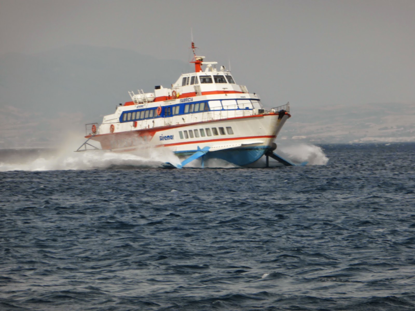
Impressive view of hydrofoil below water. She was out for repairs

On Monte San Giuliano (St Julian) 756 metres above Trapani is the fabulous medieval walled village of Erice, accessed by cable cars that provide fabulous vista for miles of surrounding area. Baby Lily was agape as she waved at the cable cars whizzing over our heads at the lower terminus.

Alice and John take in the view during cable car ride

Diane and the great view from the mountain-top village of Erice

The Norman castle, about 1,000 years old is still in good shape

Erice street musician with gaily painted donkey-drawn cart

Close-up of historical scene paintings on cart

Erice is famous for the mysterious ancient Cult of Venus – in the Temple of Venus acolytes (assistants to the priestesses) participated in sacred prostitution. Lonely Planet says it’s easy to guess why the site remained inviolate through countless invasions, until the Normans built the Castello di Venere on the site of the temple.

Ceramics shop on cobbled lane in Erice

Prior to leaving Trapani we needed to get our Constituto stamped by Coastguard so John and I went down to see them. Normally we find Coastguard staff to be civil and bordering on friendly, but these were a strange lot – it seems that a snarl on your face is a job pre-requisite, but after a long wait and none-too-friendly service we finally got the stamp we needed.

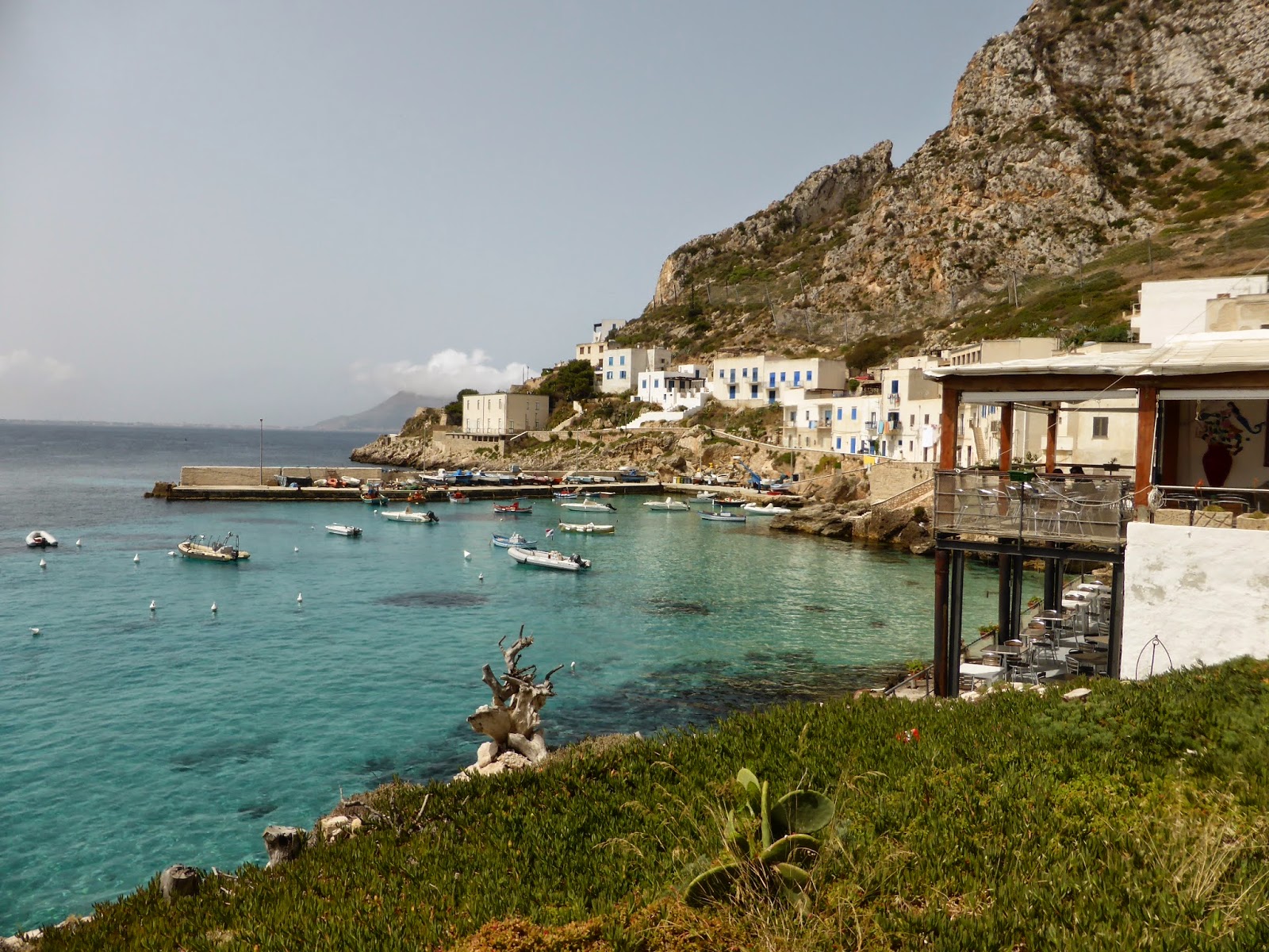
Back at the Egadi Islands we all had some family catching-up and relaxation time – swimming, walking, having coffees and beers ashore and generally chilling out. 11 month-old grand daughter Lily took to the water like a duck, and Diane and I loved looking after her, giving John and Alice some time out.

John, Lily and Alice enjoy a refreshing swim

Lily enjoying swim Favignana’s tepid waters in her new lifejacket with John

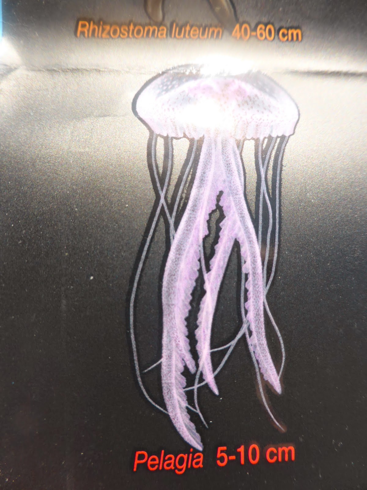
For a time one issue at the Egadis was a small jellyfish, called Pelagia, that give a nasty sting, feeling like a minor electric shock. Di had a brush with one that left nasty welts and still hadn’t healed over two weeks later.

Pelagia jellyfish

The jellyfish scars on Di’s upper arm was still there three weeks later

I got stung twice, and John once, and although the marks took some time to go they weren’t anywhere near as sore as Di’s. From then on wherever we swam we kept a sharp lookout for them, particularly with Lily in the water. At least there are no wasps – a curse last year in Croatia, and very few flies or mosquitoes.

Our plan was to head towards Palermo and then out to the Aeolian Islands, north of Sicily, so we cruised back towards Sicily in a rising WNW wind exceeding forecast, reaching 20 knots. The long fetch here caused waves up to three metres high on our port quarter with some cresting and breaking, making for an uncomfortable trip and poor Lily was seasick, although fine after that. Anchored outside Capo San Vito marina that night was quite rolly from the unsettled seas, even with our flopper stoppers down, but by next morning when we set off for Castellamare del Golfo the wind and seas had dropped considerably. 

TECHNICAL The guest head holding tank contents full light isn’t working – another job for electrician Doug.

ENVOY LOG As at 10/7/14, we’d spent 93 days aboard and cruised 757 miles for 128 engine hours.

[KensBlog 2014-Entry-7] Welcome to Party Island

Welcome to Ken’s Blog!

Greetings all!

I mentioned in my last blog entry that I was going to try to do more frequent and shorter blog entries.

As I am typing this, Sans Souci has just departed the island of Ponza, about 100 miles off the mainland of Italy. We are now on a LONG 160nm run to the island of Sardinia. To check our current position, use this link:

http://www.kensblog.com/current_location

Journey Map

This map shows Sans Souci’s route over the last few days, plus the long passage we are making today. Don’t forget that you can click on the pictures to see them larger!

Vietri Sul Mare


These are some pictures I meant to put into my last blog of a small town (Vietri-Sul-Mare) that seems to have dedicated itself to selling ceramics. Most of the buildings in the town had painted tile decorating the outside. Overall, it felt a little too touristy to us and we didn’t buy anything. But, it was fun to see some of the creativity.

Running past Positano and Capri

We had planned to stop at Positano, a waterfront town where Roberta and I stayed in a hotel over twenty years ago. However, the anchorage in front of town is completely exposed, and there was a strong swell running. We had to settle for nothing more than a picture, taken from over a mile offshore. In the picture you can see lots of megayachts anchored in front of Positano. If a boat is large enough you can anchor in places that smaller boats can’t get away with.

I notice that the large boats are able to keep their nose pointed into the swell, which mitigates the side-to-side rolling. I’m not sure how they do that. Do they leave their engines running? Do they use a stern anchor? I have no idea….

The town of Positano. We wanted to stop there but there was too much swell. We’d have been miserable at anchor.

We also bypassed the island of Capri. Once again, we wanted to stop, but Capri really has no good place to anchor the boat, and the high-season moorage costs in the marina are outrageous. Can you believe 1,810 euros (around $2,500 USD) per night for a boat our size (7 meter beam.)

The island of Capri. The seas were too rough to anchor and the moorage prices too high to enter a marina. Roberta and I were there 20 years ago, so it wasn’t a big priority to go there.

Ischia

Our goal was to arrive at Sardinia and we had mapped out a series of islands that would permit us to “island hop” our way to Sardinia. We had hoped to stop at Capri but the weather had other ideas, so we continued on, another 45nm (about a seven-hour run) to the island of Ischia.

Approaching the island of Ischia, about 50 miles off the coast of Naples, Italy.

We anchored on the south end of Ischia. Because the swell was coming from the west, we anchored on the east side of a small pennisula (Sant’Angelo). The town looked cute, but neither us nor Steven and Carol put the tenders down. We were as protected from the swell as we could be, but we were still rolling. The problem with these small islands is that there aren’t many bays and you are completely open to hundreds of miles of surrounding water. We have near-perfect conditions, no wind, settled conditions, and we’re still rocking.

Sans Souci is equipped with something called “flopper stoppers.” They are large butterfly-shaped plates that hang from giant “fishing” poles that extend from the sides of the boat. The idea is that by dangling these giant plates (called “fish”) in the water, the side to side rolling motion of the boat can be reduced. Putting them out isn’t difficult, but does take enough effort that during the last couple of years, in Turkey, Greece, Croatia and Montenegro, we never used them.

Roberta pointed out that we are accustomed to thinking about wind, and have never really had to focus on swell. This is a bit of a wake-up call for us. Out in open ocean you have giant swell, and even twenty or thirty foot waves are a non-issue, as long as they are far enough apart and not breaking. You just gently ride up one side and down the other. But here, we are seeing short-period (close together) three to six foot chop. It makes it uncomfortable to run, and impossible to sleep.

The reasons neither boat put the tenders down was that we weren’t sure we would be staying. On Sans Souci we hoped that the flopper stoppers would reduce the swell enough that we could sleep. And, as bad as it was, thanks to Sans Souci’s size and weight, and the flopper stoppers, we had it better than anyone else in the anchorage.

The doggies keep looking at us like, “Can’t you make the constant motion go away?”

Swell on Ischia

Roberta made the comment that we enjoyed life much more last summer when we were in Croatia, in a large bay pinned down by three days of sustained 25-45 knot winds. It’s a reminder that boating isn’t just about the wind: it’s about the fetch. High winds in an anchorage don’t hurt (generally) if there is no fetch (the distance wind travels over water.)

I shot this video which shows conditions the morning after we anchored at Ischia. They were by far the calmest we saw, and well within the acceptable range.

That said, we had anchored off a popular beach. By noon we would have speed boats zigzagging around us in every direction throwing out wakes. The prior evening we had been circled constantly by people kite surfing.

You should see a video above. That said, if you received this blog entry via email you may need to click this link to see the video:

http://player.vimeo.com/video/102115657

We anchored for the night. Sleeping conditions on Sans Souci were uncomfortable, but not that bad. However, when I spoke with Seabird the next morning, they had a much worse evening, and had been unable to sleep. We didn’t know if it would be any more comfortable on our next island, Ponza, but we knew we couldn’t stay where we were.


Various scenes from our anchorage on Ischia. It looked like a great town, but we never visited it. We stopped for the night, decided we were rolling too much and went on to Ponza, another 50 miles on the way towards Sardinia.

Ponza – The party island

After our “failed” night on Ischia, we decided to run another 50 miles to the island of Ponza.

Ponza is a bizarre little island. It is perhaps 500 feet wide by four miles long, and runs roughly north to south. There are lots of bays where you can anchor, but none offer much protection from any weather coming from the south or north.

Based on its location (100 miles offshore) and shape I’d expect it to be an empty rock no one goes to — but, that would be the completely wrong idea.

Another Nordhavn owner who visited Ponza a year ago, Jennifer Ullman (Starlet, N46) warned me that this was a party island. She said that when she and Mark anchored they felt they might need fenders to hold off other boats. Jennifer was right! When we were a couple miles offshore I radioed to Seabird, “Steven. Get your binoculars! Look at the island. You won’t believe it!” I had never seen anything like it! A solid wall of anchored boats, several rows thick stretching for miles, the entire length of the island.

To drop our anchors we had to cut through a highway of tenders going back and forth from the anchored boats to town. And…it was a young crowd. Lots of bikinis, swimming and festive atmosphere!

We dropped anchor in 30 feet of crystal clear water, dropped the flopper stoppers, dropped the tender — and jumped in the water!

This radar image shows about two miles of the coast line and tells the story.

This picture shows only about two of the four miles of coast on the east side of Ponza. How did all of these boats get here? It was a completely bizarre sight!


These pictures were shot early in the morning, or late in the evening, after all the boats had cleared out.


On our first night Roberta and I decided to tender into town with the puppies. Unfortunately, our timing was bad. We wanted to get into town early, around 6pm, try to grab an early dinner, and be back onto the boat before dark.

We were riding on extremely lumpy water, surrounded by dozens of boats all going the same place at the same time. This was the “end of day” rush back to port. I had assumed all the boats would be staying the night, but instead 99% of them pulled anchor and headed to port. We got caught in the parade, which was stirring up the water badly. At the port they were doing something I’ve seen only once before. Instead of people returning to assigned slips, the marina was assigning slips in real-time, from the end of the dock. It was exactly like the big parking lot at Disneyland, with a long line of boats, and with attendants directing boats to the next available parking place.

After a bumpy tender ride, followed by the difficulty finding a place to tie up the tender, and then having to rush through dinner, we decided that visiting the town just wasn’t worth it. On our second night on Ponza we dined on Sans Souci.

Here’s a short video showing the fun we had yesterday just cruising around exploring. Nothing can be less interesting than watching someone else’s home movies, but because I tend to always focus on the annoying bits of cruising I thought people might like to see that we also have fun from time to time.

The video starts with Toundra and Keeley getting swim lessons from the back of the boat, and then is followed by a fast tender ride at dusk. The best bit of the tender ride is Roberta shouting, “No! No! No!” when the camera starts to come her direction. When she is feeling grubby she doesn’t like getting her picture took. I’m always grubby, so it never matters. And, lastly there is a brief bit of fun going through a rock arch, and you can hear me calling out the depths. The water is so clear that 30 feet of depth, and 3 feet all look the same.

Fun on Ponza

Video showing us teaching the puppies to swim, and more!

http://player.vimeo.com/video/102115657

We couldn’t resist trying to pass through this arch. We found several other arches like this, some larger, some smaller. This is the only one we went through.

One of the cuter things about Ponza is that there are homes actually built into the cliffs. Here you see some of the many windows you see carved into the cliffs.

And in closing…

And, that’s it for this issue of KensBlog… My next report will be from the island of SARDINIA!

Thank you for following along on our big voyage!

If you missed my prior blog entries from this season, you may view them here:

If you aren’t receiving my blog entries via email, click this link to register:

http://www.kensblog.com/register

I should also mention that this is one of two blogs that I do. My other blog is on Facebook, although you do not need to register with Facebook to view the blog. Just click on this link:

http://www.facebook.com/kensblogdotcom

My other blog is very different than this blog. I post to it almost every day, and post whatever I happen to be thinking about, without editing or filtering. I also tend to respond instantly to any questions. Check it out!

Thank you!

Ken and Roberta Williams
ken(at)kensblog.com
MV Sans Souci
Nordhavn 68
PS – In case you haven’t figured it out, clicking on any of the pictures above will give you a higher-resolution (bigger) version of the picture.

Start your own blog now! Free!

[KensBlog 2014-Entry 6] We’re having a SWELL time

Welcome to Ken’s Blog! (top)

Greetings all!

First off, I would like to apologize for the length of this blog entry. We’ve been busy traveling and I haven’t found time to work on my blog. Going forward, I’ll try to produce shorter blog entries, and send them more frequently. That said, it never seems to work out that way. One tip for this issue of the blog: make sure you read the section on Scario. It describes a scary event!

As I am typing this, Sans Souci is on the west coast of mainland Italy, in Salerno (about 150 miles south of Rome)

Here’s an index to this issue of Ken’s Blog:


Journey Map (top)

This map shows Sans Souci’s route over the two-week span covered in this blog entry. As you can see, we’ve been moving!


Taormina (top)

At the end of my last blog entry Sans Souci and Seabird were working our way north along the east coast of Sicily. We had expected nice calm seas but were instead pushed around by lumpy seas. Our problem wasn’t as much the rough seas, as it was that we had no idea what would be waiting for us at arrival. The east coast of Sicily has only a few anchorages, and other than Siracusa none offer protection from rough seas or swell.

The major topic of discussion was, “What happens when we get there?” The cruising guides are quite explicit in saying that there is no anchorage at Taormina except in “settled conditions.” We could see on the chart that the anchorage was exposed to the sea and that there were no other anchorages. Nor were there any others anywhere close. We identified one that “might” work, right at the Messina Strait (the narrow channel between Sicily and Italy) but that would mean getting beat up for an additional two hours, only to arrive at a dubious anchorage.

Another Nordhavn owner had recommended we try the mooring buoys at Taormina, which were placed in the most protected possible location. We were aware of these, but had written them off as impractical. Generally, it is impossible to know what is under the water on these mooring buoys, or the condition of the line that attaches the buoy to the bottom. However, with a bit of googling I found a website that had this to say:

“… Taormina Moorings are situated at the south side of Capo Taormina and are sheltered from North, North East, South West, West and North West winds and swell. The 11,000 square metre area is private and offers 20 dead weight moorings. Each concrete block weighs 5000 kg to which large orange fender buoys are attached via a 26mm rope and a 30mm chain at the base. These moorings offer a perfectly safe day and overnight anchorage for yachts up to 43 meters (140′) in length. …”

(http://www.yachthotel.it/index.php?option=com_content&view=article&id=47%3Ataormina-moorings&catid=72%3Ayacht-hotel )

Interesting! I didn’t like the idea of being in what was effectively a “boat parking lot” but we were in no position to be picky. If the mooring buoys could hold us, we wanted them! The price looked outrageous – 120 euros (about $180 USD) to tie to a little orange ball for the night, but…what was our other option?

The seas stayed rough up to within a mile of the moorage, then suddenly flattened out. Just short of the mooring buoys we saw water flat enough to drop our anchors, and probably could have, but we were in the mood for a “sure thing” and the mooring buoys had captured the best possible (most protected) location.

About the time we finished tying up the wind dropped. Suddenly it was flat in every direction. Our moods brightened and we were instantaneously transported to paradise! A flood of other boats came in and we looked around and realized we were in a great place under a very cool, cliff-hugging town .

The best of all: Taormina is near the base of Mt Etna, an extremely active volcano. We were close enough to easily see the lava flow – at night. How many people can say they had dinner on the back of their boat while being entertained by an active volcano at the base of cliffs, holding a hillside city?

Taormina Moorings. An incredible place to be! George, who runs the place takes good care of you, and is always available to run you to the town for exploring, help you with taxis or restaurant reservations, make deliveries and take away your garbage.

Imagine this: dinner on the back deck watching the lava flow on an active volcano. How great is that?

Looking down at our boats from the hilltop town of Taormina.


Taormina — fun to explore, and we even discovered a really good sushi restaurant.


The Messina Strait (top)

After a few spectacular days at Taormina the time had come to head north. To do this we would be passing through the Messina Strait.

The Messina Strait is a narrow channel separating mainland Italy from Sicily. If you think of Italy as a leg with a boot at the bottom, then Sicily would be like the soccer ball that is about to be kicked by the “toe.” We’d be passing in the narrow gap between the toe and the ball.

I was nervous about the strait, and kept googling it on the internet, trying to figure out whether there would be heavy currents. The Messina Strait turned out to be anti-climactic. I had expected a narrow channel, like the Corinth Canal (Note: If you haven’t seen our video of going through the Corinth Canal, check it out by clicking this link: http://www.youtube.com/watch?v=l6KjXNYiXfo), but whereas the Corinth Canal was only 75′ wide, the the Messina Strait is 1.5nm wide at the narrowest. There were currents, but with so much maneuvering room they were a non-factor.

There are a few interesting things worth noting:

  • In the narrowest part of the channel, fishermen were everywhere in little (Approx. 4 meter) fishing boats. They were hard to see at times and I have to believe one gets hit from time to time. At one point I was dodging two ferries zig-zagging around them, while being passed by a cruise ship!
  • The currents were strange. I had downloaded a program for my iphone which was a current table for the Messina Strait. It claimed the current would be 1 knot with us, but for most of the run it was three knots AGAINST us.
  • Apparently the area is known as a place where swordfish boats hang out. Sadly, we weren’t able to see one.

    Here’s a fun article talking about why these boats are SO interesting:

    http://tinyurl.com/osk4jbx

    Swordfishing boat at the Messina Strait. Look at the length of the bowsprit!


The Aeolian Islands – Vulcano (top)

Anyway, the real excitement didn’t begin until we reached the Aeolian Islands (north of Sicily). They are a series of volcanic islands, and we wanted a spot to drop anchor for the night. Unfortunately, there aren’t many places, and on a nice Sunday afternoon in high season, room to anchor is rare.

The islands drop vertically into the sea. By the time you are 100 yards offshore the depth is easily 300 feet or more. At Porto Levante, on Vulcano Island, which was our first anchoring effort, the closest I could come to anchoring was a narrow shelf in 124 feet of water. We searched for an hour for a place to drop the anchors, and finally found a very nice place in 50 feet of water on the west side of Lipari Island.

Sans Souci and Seabird at anchor on the west side of Lipari Island. The anchorage was crowded during the day, but by the evening we were almost alone. You can see the volcano on the right side, on nearby Vulcano Island.

While sitting at anchor I was shocked to see the strangest looking airplane I had ever seen land in the water right next to Sans Souci. Or, at least that’s what I thought! It appeared out of nowhere, and was HUGE. I immediately ran to the radio to tell Steven (on Seabird). “Steven! You aren’t going to believe this. A plane just landed next to me!”

Steven took a look and immediately recognized the strange beast. It was a solar-powered boat! Steven had seen it in Thailand as it was circumnavigating the planet. Take a look at it, and you’ll see why I was confused:

http://www.planetsolar.org/

After one calm night at anchor, we had no choice but to move around to the east side of Lipari and go into a marina at Lipari Town. There would be a strong west wind coming for the next 48 hours, and we needed to be somewhere safe.

Sans Souci approaching the Aeolian Islands

You should see a video above. That said, if you received this blog entry via email you may need to click this link to see the video:

http://player.vimeo.com/video/102115657


Lipari (top)

As we were on route to the town of Lipari Roberta once again grabbed the video camera, and shot this video of us following Seabird around the island:

Sans Souci circumnavigating Lipari Island

You should see a video above. That said, if you received this blog entry via email you may need to click this link to see the video:

http://player.vimeo.com/video/102115657

A marina had been recommended to us in Lipari Town (the main town on the island of Lipari.) We knew that Lipari was a small island, and weren’t expecting much for a marina, but the marina was even smaller than expected. It was just a large pontoon, with no breakwater, open to the sea. We knew bad weather was coming, but weren’t too worried. The wind would be coming from the west, and we were on the east side of the island inside a bay. We would be protected from the wind and swell by the island.


I had heard that the restaurants in Lipari weren’t very good, but Roberta and I had great luck and went to two different restaurants we thought were very good: La Conghilia, and La Anfora.

There’s one “cultural detail” that should be mentioned about restaurants here in Italy. People eat late! Roberta and I usually eat early, like 6:30 or 7:00 pm. In Italy, restaurants don’t even start opening until 8 pm. Above are before and after pictures showing the restaurant La Anfora: Roberta and I at 8:30 pm, dining alone. The “after” picture shows the restaurant full at 10 pm when we were leaving.

Our “marina” at Lipari was actually a long pontoon. We were tied up at the end of it. I worried we were too heavy for it. Overall though, it was a very nice place, and the owner, Pierro, took very good care of us.

Seabird and Sans Souci were tied, side by side, at the end of a pontoon. With the high winds we were constantly moving side to side. Sans Souci uses inflatable fenders, and at times there was so much pressure between the two boats that I expected a fender to pop at any time. We had twelve large fenders separating our boats. Even this wasn’t enough and Steven purchased a large “ball fender” at a local marine store for extra protection.

We spent one afternoon exploring the streets of Lipari with the dogs.

As Roberta and I were walking up our dock I noticed that many of the boats were charter sailboats (flying a banner that said “Yacht Week”). I mentioned to Roberta that I felt sorry for the people who rented the boats after flying many miles to enjoy a week in the sunshine, only to find themselves pinned down by weather for several days and being bounced around in the wind. Sans Souci is an extremely heavy boat. We were moving somewhat, but nothing like the little sailboats tied to the dock. They were moving so much that I could envision almost anyone getting seasick just sitting at the dock!

As the evening went on, the weather didn’t improve, but a “spring break” atmosphere took over the dock. No one looked like they were suffering too bad, making the best of it, although I bet there were some people who had headaches the next morning.

During the worst of the wave action I noticed a couple of young ladies swimming in the tight space between their sailboat and the dock. I was afraid that one of them was going to get badly hurt should the sailboat (or the dock) crash into them. I was probably overly sensitive because of an incident Steven and Carol witnessed in May while in Sibenik, Croatia, waiting for us to arrive. During a wild party at a nearby dock someone went overboard, only to be fished out of the water next to Seabird the next morning. A very sad, mortal event. Although I didn’t say anything to the girls I couldn’t stop myself from approaching the captain the next day to warn him to keep a closer eye on his passengers. He didn’t stop them swimming, but did move his boat farther off the dock creating a larger area behind the dock, so that his passengers could swim safely.

A VERY short, but very interesting, video showing our pontoon moving in strong wind

You should see a video above. That said, if you received this blog entry via email you may need to click this link to see the video:

http://player.vimeo.com/video/102115657


Panarea (top)

After three days hiding from weather at the dock on Lipari the weather improved and we were able to move the short distance to another island in the Aeolian group: Panarea.

Panarea is a tiny island with a huge anchorage in front of Panarea Town. The enormous size of the anchorage has made it popular with the megayacht and jetset crowd. There’s kind of a St Tropez ambiance on the island, with the nightlife to match.

Sans Souci at anchor at Panarea. We anchored farther than I liked from town, but it was BEAUTIFUL!

As much as I was looking forward to visiting Panarea, there was another reason to be there. We had been trying to cross paths with Nordhavn 76 owners, Laust and Monika Sondergaard, who had been cruising further north and were working their way south. We had never met, but had corresponded from time to time.

Nordhavn 76 – L’Adagio

Owners, Laust and Monika, were kind enough to give us a tour of their beautiful boat. We invited them over to Sans Souci for a tour, but after seeing how perfectly clean their boat was we asked them to give us a couple of hours to tidy things up first. We’ve been living on the boat full-time for more than two months without crew, and, though we are tidy people, it sometimes comes down to: do we take much of our time cleaning the boat inside and out – or go sightseeing and have fun? Fun often wins! We have decided that one important thing that crew does (“crew” meaning one or more persons) is to keep the boat constantly clean while the owners get to go out and have fun! Roberta envied the fact that L’Adagio had one crew member.

In this picture Laust is trolling for sharks with his son and son’s friend, beer bottles in hand. The young men joined us for dinner later in the evening, so the sharks must not have been biting.

Party on Sans Souci!

Sans Souci’s upper aft deck is a wonderful place for an afternoon gathering. Here you see the guys huddled at one end of the table looking at their phones (Laust from L’Adagio, and Steven from Seabird) while the ladies are at the other end of the table gossiping about us (Carol from Seabird, Roberta from Sans Souci and Monika from L’Adagio).

Ken and Roberta Williams with the Sondergaards. One of the sad things about boating is that you meet amazing people for a day, then you sail on and may never meet again.

Panarea is famous for its nightlife. Roberta and I bailed early wanting to get back to the dogs waiting for us on the boat. The tender ride to town, which, in the light of the early evening, took only 15 minutes, lasted over 30 minutes for the return trip. By then, it was pitch black, with many boats to zig-zag around, plus a large area with blinking mooring balls, some lit and some not. We were very happy we weren’t trying it after a longer evening spent enjoying the nightlife.


Nordhavn 76 – Nordhavn 68 – Nordhavn 62

This picture took some work to make happen. L’Adagio (Monika and Laust’s N76) was anchored a mile away. In order to take this picture Laust re-anchored his boat in a cramped location near our two boats. We then had to be creative in maneuvering the tenders in order to get the three boats lined up.


Stromboli – Dinner beneath an active volcano (top)

Seabird and Sans Souci share a common desire for short-distance cruising on flat, calm seas. We’re in a part of the world where the seas and winds can quickly turn nasty. The Aeolian Islands are beautiful, but they are very exposed to high wind and swell. It was time to move on.

Our next stop after Panarea would be the another of the Aeolian islands: Stromboli. Stromboli is an active volcano, and can apparently put out quite a fireworks show at night, viewed mostly from the NW of the island. The problem is that there is virtually no protection from the winds and waves at the one anchorage at the NE of the island. There also isn’t much space to anchor, and what little there is forces the boats to anchor much closer to each other than they normally would. As we were approaching the anchorage I noticed that I was still reading 350 feet of depth within 100 feet of a sailboat to which I’d be anchoring next to. But the bottom came up quickly and I was able to drop the anchor in 38 feet of water.

We never did get to see the fireworks; the crater points to the NW while we were anchored at the NE. Though we were anchored at the volcano, in order to see the show you need to wait until the early morning while it’s still dark, pull your anchor and drive around to the northwest side of the island. We felt lazy and decided to pass on that, figuring that we saw Mt. Etna in all of her glory from the wonderful viewpoint of our upper aft deck at Taormina! That doesn’t mean we didn’t have a magical time, though. From where we were sitting we could see constant smoke at the top of the volcano, and an endless stream of people hiking the switchback trail to the top of the volcano. Apparently tourists hike for hours to reach a viewing point at the edge of the crater, watch the fireworks, and then, after dark, hike back down, flashlights in hand. We were watching them through the binoculars, and, while sitting in the hot tub, we could see what looked like a lit-up snake crawling down the mountain. And to add to the surrealness, though we never personally viewed the eruptions, about every 30/40 minutes or so, we’d hear it: a loud sound like a huge jet engine!

Aeolian Islands – Stromboli

Here we are approaching Stromboli. The anchorage is on the northeast corner, where the town is located.


Seabird and Sans Souci at anchor on Stromboli

Roberta cooked an amazing dinner anchored in front of Stromboli. We spent the evening watching, through the binoculars, the hikers working their way to the top, only to hike back down a few hours later.

Stromboli – Viewed from north side


Scario – Sometimes you get lucky, and sometimes you don’t (top)

Apologies, but I have no pictures for this section of the blog, and I have a REALLY good excuse. In fact, Steven (Seabird) and I were debating whether this was our worst cruising day ever, or second worst. We couldn’t decide, but are confident it ranks high on the “day from hell” scale.

Our journey from Stromboli to Scario (a village on the west coast of southern, mainland Italy) began at 5am, as we prepared the boats for departure. We had a perfect weather forecast for a 75nm (nine hour) trip to an anchorage we had heard good things about.

The trip was every bit as calm as predicted. Zero wind and dead-calm seas.

On arrival I noticed ten or so boats anchored below some cliffs just outside of town. We had planned to drop our anchors just outside of the town but were curious why all the boats had chosen a place a couple miles out of town to anchor. (It was a great place to swim!) As we approached we could see that it was a fairly tight location without much room to anchor, but incredibly beautiful. We could drop our hooks and feel like we were in the middle of nowhere, but be an easy tender ride into town. At around 5:00 pm all of the other boats pulled their anchors, leaving our two boats alone at the anchorage.

The anchorage turned out to be perfect. We floated in the calm water and had dinner on the upper back deck. The evening was predicted to be no more than five knots of wind, and we would be moving to a city (Salerno) 70nm farther north the next day, so Roberta and I put away our flopper stoppers (the giant poles that hang out the sides to help keep the boat from rolling side to side while at anchor).

Roberta and I turned in for the night at 10:30 pm. At 11:00 pm we felt the boat roll with a swell, and assumed some big boat had passed by and we were feeling its wake. But then, the boat rolled again, and then again, and again and…

The boat kept rolling side to side making sleep impossible. By 12:30 we were rolling so that I had to lay down chairs (so they wouldn’t fall) and move computers off table tops. At 1:00 am the swell was absolutely unacceptable. It was virtually impossible to move inside the boat without falling. The strangest thing was that there was no wind. The forecasters had been right about that. But there was a HUGE swell entering the bay; perhaps seven to eight feet of swell.

I used the radio to call over to Seabird. No answer. I tried the phone and woke Steven and Carol up. “Should we move?” I asked. Steven answered, “It’s bad, but we’re able to sleep. I think this is going to calm down.” Roberta and I tried to sleep.

The swell continued to worsen and was becoming frightening. At 1:30 am Steven called, “Let’s get out of here!” He then asked, “Are you sure we can get our anchors up in this?” Our bows were bobbing dramatically by this time.

It was a very good question. The bows were pitching through a five to ten foot arc every few seconds. As soon as the anchor cleared the water it could fly up like a missile.

My answer, “We really don’t have a choice, do we?” We were close to shore and I could hear waves crashing. Things were getting worse quickly. We knew we were in trouble where we were, and thought we might be in trouble out at sea. We had to pick between two bad solutions to our problem: stay, or go. We knew we couldn’t stay, so, in reality, it was an easy decision.

Pulling the anchor was not fun. It was pitch black and we didn’t want to mess up our night vision by turning on the deck lights. Roberta managed the helm as I went to the bow to try to retrieve the anchor.

The bow was pitching more than I had expected. Although I had no light, our anchor light was illuminating the waves around us, and I could finally see how much we were rising and falling. Raising the anchor went reasonably well until the end. We were apparently well stuck with the anchor buried. We had dropped the anchor in 70 feet of water. When I was on the last 70 feet of chain, the anchor stuck and wouldn’t pull up. I started pulling in chain as the bow descended, and then let the weight of Sans Souci’s upward momentum help unstick the anchor as the bow lurched up. I was worried the anchor would be trapped under some rock and that by lifting chain as the bow plummeted I’d be ripping off the bowsprit when the wave pushed the boat higher.

Suddenly, the anchor freed and went neatly into its position on the bow. I looked over at Seabird, and their anchor had come up backwards. He and Carol were on the bow using a boat hook to rotate the anchor into a proper position for lifting the last few feet onto the bowsprit. Steven mentioned later that he had been nervous hearing the waves crashing nearby. His worry was that the boat would be blown onto shore while he was away from the helm helping to spin the anchor. Once again, there were no other options. In situations like this you do what you have to do.

Finally…the boats were free! We assumed that as soon as we were moving, and got out into deeper water, the rolling would stop. Our first thought was that we had anchored in a bad location, but we quickly discovered that it wouldn’t have made a difference. I did a quick check of the weather and the report had been updated to reflect the swell being two meters (nearly seven feet) rather than the previously forecast calm.

But, now what? We were in heavy seas, with strangely no wind, and a seventy mile passage ahead of us — and, we hadn’t slept in almost 24 hours!

There was nowhere we could have anchored. It was just a surprise swell due to some unexpected weather event far away. It was what it was, and our boats are solid, so we just kept going. While underway, Roberta logged onto the internet to search for a marina further north, where we could go and safely dock.

It was a rough ride, but we’ve had rougher. The wind was only in the 5 to 15 knot range, it was the unexpected swell that was causing the problems. What made this run particularly bad was that it was pitch black out, and we had seen fish pots when we came in. Also, our exhaustion was complicating the situation. We decided that both Roberta and I would drive until the sun came out (three hours later) and then we’d take turns while one rested.

We decided to shift our route farther offshore. Originally we had routed ourselves fairly close to land, but now wanted to stay in the deep water (over 1,000 ft depth), to avoid any fish pots. We were also concerned there might be some poorly lit fishermen. We wanted as far from other traffic as we could get. The extra distance caused by rerouting turned our nine hour run into a twelve hour run.

The story does have a happy ending. The ride was miserable the whole way, and even entering the marina ( Marina D’Arechi, in Salerno) was tricky, but we were finally tied up, and ready for well-earned sleep.

And…that’s why there are no pictures! (Both Roberta and I were too busy and exhausted!)

Keeley and Toundra

The puppies have their own doghouses. When the seas are rough we need to convince them all is well and give them special attention.


Salerno – And a visit to an ancient city (top)

Our journey to Salerno was a challenge, but overall a good experience. Roberta made the comment at dinner that “It’s amazing what you can do when you have to.”

Roberta had her own personal battle bringing the boat into the marina. She had shoulder surgery a year ago and now doesn’t like to work the lines, fearing to hurt her shoulder again. These days, I’m the one who fenders the boat, handles the lines or lowers the anchor. As we approach marinas or anchorages, she drives while I work outside. Entering would normally be easy, but that big swell was relentlessly pushing us through the marina entrance with a tight turn just inside. There were a couple of boats exiting the marina at the same time and she had to dodge them just as the surge was pushing Sans Souci toward them. She isn’t accustomed to driving the boat in those conditions — but, she rose to the occasion and stayed calm. We entered the marina perfectly. When I took over, the Med-mooring went smooth. It’s always a bit of a struggle to convince the marina staff that I need someone on the boat to help work lines as this is a big, heavy boat and there is no way I can get it Med-moored without someone helping Roberta. Normally Roberta drives while I fender, but then I take over driving for the actual docking. Roberta is proving she can maneuver the boat more than she thinks she can, so…my next goal is to get her to drive while Med-mooring, so that I can assist the marina staff with lines while tying up.

Marina D’Arechi

Sans Souci and Seabird, at Marina D’Arechi, a huge new marina near Salerno, Italy. I can’t say we really loved the town of Salerno, but it was a convenient place for land touring.

Salerno

This is my favorite picture of the trip! It was taken at the small town of Vietri Sul Mare, near Salerno, while Roberta and I were exploring. It looks like a painting.

Our primary reason for visiting Salerno was to see Herculaneum, a town which was destroyed by Mt. Vesuvius at the same time as its more famous counterpart, Pompeii (79 AD.)

Herculaneum had been a port town where the wealthy lived. Roberta and I toured Pompeii years ago, and had heard that Herculaneum, though much smaller than Pompeii, was much better preserved.

I’ve seen more than my fair share of historic sites (pyramids, many ancient walled cities, ancient temples, etc.). I’d say that I am tough to impress these days. That said, Herculaneum blew me away. The place is well enough preserved that you feel like you are really in a town, walking the streets. You can go into houses and actually feel like you’re in someone’s home, and know where the gardens were, where the fountains were, where the bathroom was, etc. You could also sense how the city was laid out; the streets are all there and very well made. For example, there was a “restaurant row,” and streets with shops and a couple of bakeries where the oven is still there…and probably still usable.

Click this link to see a 3d picture of just one room of one building:

http://photosynth.net/view/bff5e224-dfb4-4832-834e-caff9e9583ed


Herculaneum

A wealthy waterfront town, destroyed by the eruption of Mt Vesuvius in 79 AD.

After a couple of hours of exploring Herculaneum we came across a particularly sad sight: At the front of the town are the boat storage areas (this was a waterfront town, now set back from the water by about a thousand feet due to all the tremendous ash fall.) Where boats or marine equipment would have been stored are a series of arched vaults. There, many of the town’s inhabitants went and huddled while waiting to be evacuated by boat or to hope that the large vaults would provide some protection from the eruption. They didn’t make it. Three hundred exceptionally preserved skeletons were found in those boat storages– mostly women and children. Quite a few men were found outside on the beach, not far from those boat storage vaults. It is theorized that the men had the women and children go into those large, protected storage areas, then went to the beach to….die????


Herculaneum

Over 300 skeletons were discovered huddled together in vaults at the waterfront. One poignant scene: a mother, clutching her little boy, who, in turn, was holding his dog in his arms.


And, something for the techies… (top)

This has been a fairly calm time for mechanical problems with the boat.

Watermakers – New Membranes

In Lipari (Aeolian Islands) our mechanic from Siracusa drove for hours and took a ferry, to bring new watermaker membranes. They seem to have been part of the problem, but were not the total solution I had hoped for. Four new membranes were installed, and my salinity numbers got better, but were running in the 700s (too high!) rather than the 300s I had hoped for.

His and my best guess as to what is happening: There are O-rings which seal the membranes. Paolo (the tech) believes that the O-rings have failed and are letting seawater pass, contaminating the filtered water. My next step will be to replace the O-rings at the end of the season and hope that the situation improves.

Marina Shorepower

At Marina D’Arechi in Salerno, electricity was a challenge. Steven (Seabird) needed an electrician to come to his boat to figure out the power. And, I had a problem that sent me back to the office a few times.

The marina issued me a “key” (a computer chip basically) that I could use to activate the electricity. I then purchased 50 euros (about $65 USD) of credit that was put onto my chip. Back at my boat I selected a nearby meter (pictured) and turned on the electricity by transferring the 50 euros of credit from the key to the meter. Finding a meter (power pedestal) was not easy. The marina seems to have different connectors at each pedestal. I found four different connectors at the nearby pedestals, none of which matched my cable, and none of which matched any of the various adapters I carry. I almost gave up but then found a pedestal I could stretch my cord to that had the 63 amp connector I wanted.

This was just after our hellish arrival into Salerno, and I was not in the mood for problems. All I could think about was going to sleep.

About 90 minutes after going to bed I woke sweating. The air conditioning had gone off. Shore power had quit.

I went out to look at the meter and it was showing no electricity. I pressed my key to the meter and it said “no credit.” It had been a long day and I was not in the mood for more problems. I started the generator on the boat and hiked back to the marina office.

They explained that I needed to buy more credit. I explained that my 50 euros had been used in 90 minutes. The office staff wanted to help me, but cross language the message wasn’t getting through. One person asked if I was running air conditioning, and when I said yes, everyone nodded like, “Well, there’s the problem.”

Sans Souci is a power pig. We do use a lot of electricity. But, that said, I run the boat with a 20kw generator, which is under-loaded most of the time. And, that includes watermakers, laundry, air conditioning, electric stove, etc. Most of the time the boat uses only 5kw, with spikes to 18kw when everything is running at once. On average we run somewhere around 8kw per hour.

I asked the office staff what the price per hour, per kw, is. Back came the answer: “.27 euros” (around 40 cents). So, if Sans Souci averages 8kw, at 40 cents per hour per kw, then we should be spending $3.20 USD per hour on electricity. That’s a bunch of money, but it would be 50 euros a day, not 50 euros an hour. I was being charged ten-fold what I should be.

I just explained all of that to you in written English, and it took a couple of sentences. Try explaining it to a rookie office staff who speaks Italian, in pigeon verbal English, hastily sketched diagrams, and hand gestures. Not easy. And, perhaps impossible.

They did suggest a solution: “Buy 100 more euros and try again.” I did that and hiked back to the boat. In 10 minutes, 5 euros were gone. Over the next two hours, 25 euros more had bitten the dust. I was spending about $30 USD per hour for electricity. Being a long day, I turned off shorepower, turned on the generator and went to sleep.

After a day running the generator, I decided to try a different power pedestal. I wanted to give the local electricity another chance. I bought 250 euros MORE electricity, bringing my total to 400 euros! The marina said they’d send an electrician.

An hour later, back on the boat, Roberta shouted, “The electrician is here!”

This began a long session (spanning over an hour) with the electrician, with him trying to convince me that I was being correctly charged. We did a variety of experiments, turning on and off the electricity, wholly and partially. Roberta was cooking dinner at the time, and was not happy that we kept turning off the power. We were also turning on and off the air conditioning while she was working at a hot stove and oven, which was further dropping my popularity.

Finally, the marina electrician decided I was being billed correctly, and that I was consuming 49kw! I knew this was hogwash, but didn’t know how to communicate it. We average only 8kw, with air conditioning. At 49kw my shorepower cable would melt, and 99% of the time I run the boat on my 20kw generator, which is under-loaded 99% of the time. I liked that the marina electrician had at least now settled upon a ludicrous position.

The electrician backed down fairly quickly when I got out my calculator and started multiplying amps times voltage and computing kilowatts. One of the marina staff was watching as we worked and finally conceded that I was being billed incorrectly.

I don’t think the marina was being sneaky. It’s just a new marina and they had their billing algorithms wrong in the power pedestals. To make it fair, the marina gave me free electricity for the balance of my stay, two more days.


And in closing… (top)

And, that’s it for this issue of KensBlog… Thank you for following along on our big voyage!

If you missed my prior blog entries from this season, you may view them here:

If you aren’t receiving my blog entries via email, click this link to register:

http://www.kensblog.com/register

I should also mention that this is one of two blogs that I do. My other blog is on Facebook, although you do not need to register with Facebook to view the blog. Just click on this link:

http://www.facebook.com/kensblogdotcom

My other blog is very different than this blog. I post to it almost every day, and post whatever I happen to be thinking about, without editing or filtering. I also tend to respond instantly to any questions. Check it out!

Thank you!

Ken and Roberta Williams
ken(at)kensblog.com
MV Sans Souci
Nordhavn 68
PS – In case you haven’t figured it out, clicking on any of the pictures above will give you a higher-resolution (bigger) version of the picture.

Start your own blog now! Free!

The ARGONAUT June 29 to August 6, 2014 Bora Bora

CAPTAIN’S LOG                                                              The Society Islands 

                                                         Tahiti, Moorea, Huahine, Raiatea, Tahaa, Bora Bora

                                                                                June 29 to August 6, 2014 

Preface

The September issue of PassageMaker magazine has been published and includes a feature article and pictures of our passage through the Panama Canal.  We are very complimented that PassageMaker syndicates our newsletter letter The Argonaut and publishes it on their website.  http://www.passagemaker.com/category/destinations/cruiser-blogs/the-argonaut/

  Rebecca and I have been accepted as members of the Ocean Cruising Club, which isn’t an honor of any sort except that you have to log of miles on the high seas.  It’s just fun to be part of a group of people who have made long open ocean passages.  Members often display their burgees in port so we can identify them and learn of their adventures.

So far we have traveled 10,500 miles on this Pacific trip.

The Society Islands

Tahiti:  We enjoyed a lovely 22 hour cruise down to Papeete from Tikehau.  The sea was calm, we cruised before a light 5 knot breeze, and the sky was blue and clear.  It couldn’t have been more beautiful; perfect for deploying our fishing gear and Father Neptune gave us two Mahi-Mahis and one huge Skip Jack for our effort.  The skip jacks are a type of tuna, and in these waters they grow to twenty-five or thirty pounds.  It was a picturesque passage in every way.

Geography:  Tahiti is located in the middle of the Pacific Ocean about 3,300 miles due south of Hawaii and 2,000 miles northeast of New Zealand.  It is an island formed about two million years ago by ancient volcanos.  Tahiti is made up of two mountains joined by an isthmus to form Tahiti Nui and Tahiti Iti.   Mt. Orohena is the highest peak at about 7,000 ft. above sea level, but it began its ascent over 11,000 ft. below the sea’s surface on the ocean floor.  Its peaks are often surrounded by clouds, and its rugged mountain tops encircle what used to be the volcano’s crater.  Mt. Orohena is composed of basaltic rock, which is soft and has eroded over the centuries into spires and carved edges that delight the eye and the imagination.  Its mountain tops yield to valleys that are covered by jungle vegetation of every description. Papeete sprawls around the northwest edge of the island and flows down the lava slopes.  As we approached the island, we could see lovely homes perched precariously on the hillsides, and the town itself nestled inside the lagoon at the harbor.  The island is surrounded by a coral reef.  Large rollers meet the coral with thunderous roars and white surf.  The coral ring is easily seen as a pale blue circle­­ of water around the island punctuated by rocks that pierce the surfa­­ce and then submerge on the inside of the lagoon to form a dark blue navigable waterway between the island and the reef.  Every so often there is an opening that permits passage over the reef and into the lagoon.

Shortly after we arrived, Rebecca arranged a tour of the island by car; other than in Papeete there is essentially one road around the island.  The island is very steep, so most of the homes and gardens are located near the lagoon that surrounds the island.  It is very lush and verdant providing a high standard of living for Tahitians.  At the southeast end of Tahiti Nui is an isthmus that joins the bigger portion of the island to the smaller Tahiti Iti.   We drove up the side of the mountain on Tahiti Iti to see the view of the isthmus and its surrounding lagoon.  This was one of the most beautiful geographic sights I have ever seen.  Tahiti is also a world renowned surfing location. 

Arriving at Papeete:  Papeete was a welcomed sight to us because we hadn’t been to a town bigger than a few thousand people for several months.  We were looking forward to provisioning and other benefits of civilization.  We entered the lagoon at Passe de Taapuna, about seven miles south of Papeete.  The pass was a little tricky as it is shallow, subject to the effects of the surf and requires several turns in the shallow area, but we negotiated it with only a slightly elevated pulse.  We proceeded north up the lagoon’s channel to Marina Tiana, the largest marina in French Polynesia and home to several hundred boats.  We stern tied to the so-called super yacht wharf and within a few hours we had rented a car, dined at the restaurant on the pier, and began shopping.

Shopping in Papeete was relatively easy.  French is the national language, but English is taught in school and most people are happy to converse in English.  A half mile walk from the marina was a shopping center that was stocked with virtually everything on our provisioning list.  Argo was in need of some oil filters and a couple of extra impellers, and this proved a bit of an adventure to find a heavy equipment parts supplier on the wharf at Papeete.  Driving in alleys and around ships being broken apart for scrap was interesting, and the supplier we found was staffed by knowledgeable and friendly people who were very excited and interested to learn of our adventure. 

The downtown area of Papeete is not particularly memorable from an architectural point of view.   Most of its buildings are of a 60’s vintage that surround a busy, working harbor, but to us it was a welcome respite of civilization after several months in places with few people.  Papeete is the capitol of French Polynesia, which is a protectorate of France.  The French support the country by paying for most of the cost of government (teachers’ salaries, the Gendarmeries, customs and immigration services, and many other government functions – $18 billion), yet there is an active, if ill-advised political movement to separate from France.  Without French subsidies, however, the Confederation of French Polynesia would not enjoy its relatively high standard of living, so I cannot imagine that the majority of Polynesians would be willing to give up French support.  Economic activity here peaked in the 1990’s, with cheap airfares appealing to tourists and black pearls fetching a very high premium.  Today however, the Chinese are selling black pearls cheaper than they can be produced here, and the tourist industry has not recovered from the Great Recession; tourist revenue is below 1997 values.   Papeete is home to the CFP government and offices of the French government.  Students over the age of fifteen from all the seven archipelagoes that make up the CFP come here for high school.  There are universities and a sophisticated medical center here.   Papeete is the main distribution center for all the islands.


The money here is the CFP franc.  Its conversion value varies from day to day; on some days we received as little as $1 equals 0.83 francs less a commission of 1% plus a fixed charge of $17.50.  Only some bank offices convert dollars, and their hours of operation are hard to predict what with holidays, the equivalent of a siesta in the afternoon, and local factors.  Banks will only convert $500 at a time, netting us considerably less when all is said and done.  Prices are generally higher than we pay in the U.S., particularly for food and restaurants.  These factors have us relying on our credit cards.  The CFP government waives its tax on fuel and parts purchased by transient yachts, making things more affordable for yachters.  We purchased fuel here for $4.53 a gallon (which I didn’t think was too bad); a hamburger with fries, on the other hand, costs about $20 (which I thought was pretty expensive).

Local Customs:  In talking with our guide, she told us that people in Polynesia do not find it necessary to get married in order to live together or raise a family.  Instead they move in with each other and maintain separate financial dealings and ownership of property.  Women maintain their own name and are free to leave the man or vice versa without legal squabbling.  Sometimes they marry in the church, but often this is done later in life.  I assumed wrongly that people were free to be promiscuous, but she told me that if her partner went wondering, that would be the end of their relationship.  If there is a breakup, the children go with whom they wish, and there are often children from many liaisons living under one roof.  So what’s new?

One thing that is apparent here is that life is slower paced.  The climate is so agreeable and the temperature is never cold, so the cost of housing and clothing is much lower than in the northern hemisphere.  A lot of fruits and vegetables are grown in family gardens, and fish is cheap and plentiful.  People don’t seem to be in much of a hurry, cars are available and expensive, but with only ten miles of road are not the status symbol that they are elsewhere.  Many people live on an island their entire life and are buried with their ancestors on the family homestead.  There is a rich connection to the ancient past.  Land ownership here can be tricky since much of the land is subject to tribal-family claims (requiring perhaps tens if not hundreds of people to approve the sale of their rights), while at the same time the same piece of land may be subject to ownership under subsequent colonial and church claims. The legal system, particular where property ownership is concerned, favors those who look Polynesian. 

Europeans here are primarily from France, and from what I can gather, are people who have opted out of the rat race.  Many own small businesses, shops, or restaurants here.


HeivaFrench Polynesians celebrate the “Festival of Life” or Heiva each year in July.  All the islands that we visited had something going on such as out-rigger canoe races, coconut husking competitions, cookouts, and above all dance and singing competitions.  Canoe clubs are popular and easy for us to identify as an athletic event, but the dance groups are something entirely different.  The biggest Heiva is held at Papeete, where dance and choral groups from all over the hundreds of Polynesian islands come to perform and compete. 

Dance groups are formed as a social club in many villages or islands such as the Huahine Island group that we saw perform one evening.  Dance groups have a membership of perhaps 150 people with about 20 of them being orchestra members and the rest being dancers.  They practice for six or eight months before the Heiva begins each summer, readying themselves for the competition.   The orchestra is predominately a percussion orchestra comprised of several different size drums, a ukulele chorus, and other unusual instruments.  The performance begins when the orchestra creates a primitive, pulsating, loud, rhythmic sound that will soon send the dancers into an erotic frenzy.  At other times during the performance they sound like a Kabuki orchestra, making it all the more exotic.  A narrative in the Tahitian language is given by what appears to be a chief or shaman who relates a mythical story of how the islands were formed by Maui or Pele or some other god or goddess, or perhaps the story of a great battle between tribes in ancient times; the dancers then interpret the story in dance.  When the narrative is over the dancers swing into action.  The dance is viewed by the audience in an arena setting, so that they can appreciate the choreography and precision movements of this tribe of people.  The dancers are dressed in costumes made of grass, leaves and flowers.   They are quite beautiful and very colorful.  The females move their hips with amazing rapidity that is clearly intended to be erotic, while the men move their thighs in a way that reminds me somehow of spawning or reproduction in the animal world.  In any case, it is a spectacle to behold.   The dance lasts about an hour and closes when the males and females pair off, all the while shaking and quivering as they and the audience reach a point of ecstasy as the drum beat intensifies.  It seems to evoke ancient tribal customs, sometimes savage, sometimes erotic.  If you allow yourself to get caught up in it, you can almost smell a missionary roasting on the spit!

The Credit Card Debacle:  We have had a devil of a time with our VISA cards.  We carried two of them from different banks as insurance against having one cancelled, but as fate would have it they were both canceled in the course of our travels because of fraud issues with participating stores.  After literally hours and hours of phone time, repeatedly answering the same security questions over and over and talking with all levels of incompetence, having the phone blank out after talking to the third tier in their hierarchy and having to start all over at the bottom rung again, we sweated out having new cards sent to Marina Tiana.  In the course of trying to track them and find out if they made it here, we discovered that the lame brain in the Bank of America’s VISA office sent it to “Tamiti”.  Of course there is no such place.  To make matters worse, the UPS form doesn’t have enough lines on the computerized address label to accommodate addresses here, so this increased our anxiety.   As the days ticked off, we finally got a tracking number and learned that the cards actually got to Papeete.  UPS uses a private vender here.  The phone system here is adding two digits to all phone numbers, so once we found the right number, we contacted them and arranged to drive over to their offices and pick up our cards since they had no idea of the final address to which they should have been delivered.  All’s well that ends well, I suppose, but our AT&T bill was over $1,400 largely due to calls to the credit card companies!

New Friends:  One of the greatest pleasures of traveling on a yacht is meeting new and interesting people.  In the Tiana Marina we met several couples that we really enjoyed.  One was Don and Laurie aboard True Blue: he was a prominent plastic surgeon and she an interior designer.  Don told me that last year they sold everything: the house in Sausalito, the helicopter, the motorcycle, the cars …everything, and bought their Oyster 66 and began their odyssey.  They’re having a wonderful time and dealing with a few bumps here and there, like their captain and his girlfriend (the cook) getting into a terrible row leading to their departure and the emergency hiring of a replacement captain, and don’t forget the failed generator that took three weeks to get parts for.

Johnny and Veronica and their three kids moored next to us on Walkabout, a Nordhavn 62; they have been spending the three summer months when the kids are out of school sailing as far as possible.  They leave their yacht in the last port they reach for nine months until next season.  They have traveled up the west coast to Alaska, then across the Aleutian Islands and down to Japan, then to Korea, Shanghai, Vietnam, and other places including Borneo, where they sailed up a river and saw orangutans, pigmy elephants and other exotic creatures. 

Julie and Mike: My sister and her husband, Mike, flew into Papeete for a two week visit with us.  They are sharing all the experiences that I am describing, particularly the Heivai Dance festivals and snorkeling. 

Moorea: After almost two weeks in Papeete we shoved off for Moorea, a gorgeous island just twelve miles away. Our passage was a little rough, as wind speeds reached around 25 knots and seas were in the six foot range.  Julie gets sea sick easily and this little jaunt was no exception.  She is a good sport and after getting sick she just came back up on deck for more.

The passage across the reef into Cook’s Bay was easy.  We anchored in 60 ft. of water near boats that we had seen in other anchorages.  Cook’s Bay is one of the most beautiful places I have ever been.   Like other Polynesian ports of call, the bay is the remnant of an ancient volcano with the eroded sides of the crater forming the peaks of the mountains.   Like Tahiti, Moorea is surrounded by a coral reef that is teeming with all types of colorful tropical fish.  It wasn’t long before we arranged for a scuba dive on the reef, the big attraction of which was the sighting of a huge 9 ft. lemon shark.  Unfortunately it was a rainy day, and underwater that didn’t make any difference except that it was rather low light and a little chilly after two dives

The next day we toured the island with our charming Polynesian guide, Paulina, and saw the vista from Belvidere, went to the local distillery, saw the ruins of her ancestors, and had lunch at Snack Mahana.  The place occupied a beautiful waterfront location and served up gourmet fare known far and wide, including its featured dish, Poisson Cru lait coco Tahiti, a raw tuna salad in coconut milk that was simply delicious.  It is made with slices of raw blue or yellow fin tuna marinated in coconut milk and lime and served with cucumber slices and onion.

Of course no tour would be complete without a little shopping, and Moorea had some very nice artisan shops that Julie and Mike took advantage of including the black pearl jeweler. 

That afternoon Julie, Mike and I took the tender on a snorkeling expedition.  This proved interesting in that we saw quit a few sting rays and managed to get stuck in shallow water in the labyrinth of the coral reef, but otherwise all was fine and it was a lot of fun. 


Huahine:  We decided to do a night cruise to Huahine so that Julie and Mike could see the ocean and sky at night.  It was almost 100 miles from Moorea to Huahine and it was a lovely evening for a cruise.  We left Moorea at 1700 and by the time we transited the pass into the open ocean the sun had nearly set.   The cruise was everything I had hoped it would be for them: the sky was pitch black and the stars twinkled in the firmament with a brilliance of clarity and in numbers that bewitch the mind.  The Milky Way appears as a cloud of star dust extending from one horizon to the other.  The waves peeling back from ARGO’s bow revealed stars in the water – star light like bursts from the plankton rising from thousands of feet below.

We made Huahine the following morning and put in at the little village of Fare, and fair it was.  We anchored in 90 feet of water and laid out 450 feet of chain; it’s a good thing I ordered 650 feet of chain on this boat!  Tyler secured Argo and gave her a bath after our cruise.  Everyone else but me went ashore for shopping and reconnoitering while I laid low with very bad cold.  That evening I managed to join the family for a really great happy hour and dinner at the beach front restaurant, which we later found out is known to boaters far and wide.   After dinner we went to the local Heiva, which was very provincial compared to the more professional performances in Papeete.  We stayed overnight and the next day we cruised down the lagoon to another anchorage that was not only a visual knockout, but had some of the most beautiful coral formations we had seen.  The troupe went snorkeling while I nursed my cold.  After they returned and dined on one of Rebecca’s fabulous meals, we took the dingy through a passage to another bay that connected to the other side of the islands.  There we found a little tavern.  We enjoyed a libation in a very rural and authentic setting, and it gave Mike a chance to pick up the bill as I forgot my wallet. 

Raiatea and Tahaa:  The next morning we hoisted the anchor and departed for Raiatea, a couple of hours away.  It was a beautiful day, but the fish weren’t at all interested in what we had to offer.  We moored at the town dock at Uturoa and dined at the little French restaurant on the dock.  We were all anxious to get to Bora Bora because of all we had heard about it.  That evening Harry Smith, an Australian that we meet in Jamaica and who had made the crossing during the same time period that we had, came by for a visit.  He offered us some advice on Tahaa, the next island, and reported a phenomenal coral garden there.  He also helped me plan our 2016 trip down the coast of Australia to Tasmania.  The next morning we left Raiatea and moved over to Tahaa, which was only a few miles away.  After we anchored in a secluded bay, we launched the tender and spent two days floating in the fabulous wonder of its coral garden.  It was located in a channel between two motus with the sea water from the outer reef flowing through rather briskly to keep things fresh for all sorts of fish, corals and other creatures.  We anchored our tender at one end of the channel and walked up the motu to the head water about ¼ mile away, and then floated down the channel to our boat, all the while watching the fabulous aquatic scenery as we floated by.  Among the hundreds of brightly colored tropical fish swimming about their business oblivious to us, were two particularly interesting creatures that I hadn’t seen before.   One was a sea anemone that was a beautiful red color with sticky tan tentacles and beautiful little fish weaving in and out.  The other were maxima clams or small giant clams with the curved edges that have beautifully blue, red or brown colored lips.  It was so fabulous it can’t be described.

Bora Bora:  We reluctantly left Tahaa but looked forward to coming into Bora Bora, which is a seminal experience for a captain; it’s like coming into New York or San Francisco harbors.  The pass channel is wide and easily navigated, but the bay is full of coral heads and reefs.  As we entered we saw the beautiful rollers breaking on the reef on both sides, the reef awash with turquoise water, and the deep blue lagoon inside the reef.  Dominating the whole scene is a huge megalith of a receding mountain named Mt. Otemanu that was once a mighty volcano.  The caldera beneath the volcano has cooled and the mountain has eroded and collapsed over the centuries; it sinks about a centimeter a year into the sea.   Eventually it will be like the Tuamotus. i.e., a ring of motus surrounding a lagoon.

 We expected a bustling island with lots to do and see, but in reality it is a small and quiet place with only a few restaurants.  Most of the activity here is at the famous hotels and resorts scattered about the motus that surround the island.  The room prices are an unbelievable $2- 3,000 per night.  A friend of ours went to a cheap $1,200 place where they got the third night free.  We have been told that the resorts are all full, yet you don’t see many tourists about as they are locked away behind the gates of their resort. 

Julie and Mike had a few more days with us so we planned an island tour that proved to be fantastic.  We were picked up by a four wheel drive open back Range Rover pickup truck with bench seats in the bed.  I must say I wasn’t very enthusiastic at first, but in a few minutes I was having a lot of fun.   This thing climbed 500 slopes: it was fantastic.  We climbed all over the mountain including a place where the Americans had placed gun mounts during the Second World War.  We examined the guns, which had a legend marked with the name of the manufacturer and the date of manufacture: 1907.  I asked our guide about this and he told me that they were taken from ships that were sunk at Pearl Harbor on December 7th.  Later they were removed from the sunken ships and brought here as defensive weapons.  They were probably part of the weaponry on the Battleship Texas or some other old ship that wasn’t salvaged after the attack.  The guns looked like they were cut from the ship’s deck plate, moved here, and then cemented into position on the top of the hill, deck plate and all. 

One of the interesting things we found on the tour aside from the fabulous views from the mountain peaks, was the fact that people here bury their dead next to their homes.  As we drove up the mountain side we could see that almost all the homes had small, roofed tombs in the yard near the home with colorful plastic flowers to memorialize their ancestors who were buried there. 

Life on the Dock:  During the last few days Tyler, handsome and youthful as he is, has been the object of attention from at least two young women who have found themselves stranded on the dock here in Bora Bora.  It seems they were crewing on sailboats that are crossing the Pacific.  Usually these women offer to cook, clean, and perhaps stand watch in exchange for free passage across the ocean.  As you can imagine, people often get annoyed with one another while being in close quarters over such a long time period, so it isn’t unusual to see people leave a boat and look for other arrangements.   Sometimes they fall in love, dare I say?  In the two cases this week, the captains put it to them bluntly.  The ladies took great offense and in their righteous indignation immediately left their boats, penniless and without an apparent means of support.  We fed one hungry young women (a 30 year old Chilean on her way to New Zealand for a job)) a healthy meal, and both found temporary accommodations on other sailboats until some stability in their lives could be arranged.  After a brief period of time during which strangers rallied to extend a helping hand,  both have now moved on to new arrangements and the dock has return to the its normal tranquil and bucolic state.    

One of the sailors hold up in Bora Bora waiting on the weather reported that one of the men associated with the hassle with the ladies mentioned above, left port without the permission of the gendarmes and without a clearance to the next port.   At his next port of call he could face a stiff fine, perhaps as much as $10,000 and/or be required to retrace his steps back to the last port and obtain a clearance there.   He is now 800 miles out at sea, in seas of 14 ft. and winds over 30 knots, having lost his mainsail and his engine.  

Getting Underway:  After Julie and Mike left we planned to get underway for American Samoa.  We found out from our fuel agent that American Samoa requires a customs agent for motor yachts (but not sailboats) to enter American Samoa.   The agent’s fee is $500, plus a bunch of other government fees, so we decided to skip the islands and their hospitality.  Instead we decided to move along to independent Samoa about 100 miles further west, which as far as I know is more reasonable.  The passage is 1,200 miles that will take about six days.  The weather will be less than ideal, but we are looking forward to the trip.  In the course of preparing ARGO we discovered a few problems.

 Mechanical Problems:  In preparing for any long voyage we check the yacht thoroughly.  This time Tyler found the unwelcomed presence of hydraulic fluid in our bilge, which is not a good sign.  As you know the hydraulic system has been a repeated source of difficulties.  We began to hunt around for the source of the leak and found that the actuator on our port stabilizer had begun to seep oil, but it was a small and slow leak, not enough to cause us to lose two gallons of oil.   Up forward however, we found two more leaks at the manifolds of the windless and thruster.  Apparently two seals had failed and oil under 3,400 lbs. of pressure was spraying everywhere.   It was a mess and a very big concern. 

Lucky for us we bought Argo from Nordhavn, which subcontracts the hydraulic system from American Bow Thruster, Inc.   Once we notified them, parts were in the FEDX system within 24 hours and a technician in New Zealand was organized to come here.  Despite the disappointment and concern over the failures, we are grateful for the fast and wonderful service we are getting from Nordhavn and ABT.  However it will delay us by almost ten days.


Meeting Garrick Yrongi:  We are staying at the Mai Kai Marina in Bora Bora.  Here we are Med-moored or stern tied to a dock that is attached to the outside terrace of the restaurant.   The main business of the marina is the restaurant and a small hotel that’s part of the little complex.  The restaurant is quite good and is run by Teiva and his wife Jessica (she is a Californian).  Teiva is not only the chef, but also runs the marina and everything else.  He is a very energetic, happy Polynesian who has been extremely helpful to us 

In the restaurant are hung several interesting paintings that I was immediately attracted to.  Rebecca says, they “speak to us”.  They are humorous, bright, and colorful pieces of modern art.  I asked Teiva to introduce us to the artist, Garrick Yrongi.  He is the fourth generation of his family to be artists and sculptures, and he is widely known.   Garrick came by the marina and invited us to his Tuscan style villa, a sprawling compound built on the hillside overlooking the sapphire blue bay and Mt. Otemanu.   On the living room terrace is a life size sculpture in bronze of a gorgeous, nude young woman sculpted by Garrick’s father.  As we were looking at this beautiful woman, Garrick told us it was his mother.  After he told us, I was a little embarrassed to continue looking at her, but she was so beautiful!

We had lunch at his home and he showed us his studio and collection of pottery, sculpture, and paintings.  Our lunch was Poisson Cru accompanied by a fine bottle of Kistler Chardonnay that we brought along for the occasion.  At lunch we discovered that we were both born on the same day, which made for a lovely coincidence and a lot of fun.  The most interesting subject of our conversation evolved around his vision of the world and how he has developed his style of painting and sculpture to express it.  He sees the Polynesians as people with a wonderful spontaneity unfiltered by the psychological defenses necessary in a more complex society.  He sees them as people possessing an innocence of an earlier time.  He loves the light here in Bora Bora, a light that is warm, but changing and pure.  His paintings reflect the dominance of the sea and its creatures, but also the beauty of the flora as it meets the sea, all expressed with his intrinsic good humor and optimism.

Next Stop:  We will be in Bora Bora until at least August 6.  In the meantime, the nasty weather to our west will abate and we will hopefully be on our way soon.  Next stop, Apia, Samoa about 1,200 miles of open ocean to the west.

I will try to [post new pictures on the website before we get underway.

Start your own blog now! Free!

The ARGONAUT June 29 to August 6, 2014 Bora Bora

CAPTAIN’S LOG                                                              The Society Islands 

                                                         Tahiti, Moorea, Huahine, Raiatea, Tahaa, Bora Bora

                                                                                June 29 to August 6, 2014 

Preface

The September issue of PassageMaker magazine has been published and includes a feature article and pictures of our passage through the Panama Canal.  We are very complimented that PassageMaker syndicates our newsletter letter The Argonaut and publishes it on their website.  http://www.passagemaker.com/category/destinations/cruiser-blogs/the-argonaut/

  Rebecca and I have been accepted as members of the Ocean Cruising Club, which isn’t an honor of any sort except that you have to log of miles on the high seas.  It’s just fun to be part of a group of people who have made long open ocean passages.  Members often display their burgees in port so we can identify them and learn of their adventures.

So far we have traveled 10,500 miles on this Pacific trip.

The Society Islands

Tahiti:  We enjoyed a lovely 22 hour cruise down to Papeete from Tikehau.  The sea was calm, we cruised before a light 5 knot breeze, and the sky was blue and clear.  It couldn’t have been more beautiful; perfect for deploying our fishing gear and Father Neptune gave us two Mahi-Mahis and one huge Skip Jack for our effort.  The skip jacks are a type of tuna, and in these waters they grow to twenty-five or thirty pounds.  It was a picturesque passage in every way.

Geography:  Tahiti is located in the middle of the Pacific Ocean about 3,300 miles due south of Hawaii and 2,000 miles northeast of New Zealand.  It is an island formed about two million years ago by ancient volcanos.  Tahiti is made up of two mountains joined by an isthmus to form Tahiti Nui and Tahiti Iti.   Mt. Orohena is the highest peak at about 7,000 ft. above sea level, but it began its ascent over 11,000 ft. below the sea’s surface on the ocean floor.  Its peaks are often surrounded by clouds, and its rugged mountain tops encircle what used to be the volcano’s crater.  Mt. Orohena is composed of basaltic rock, which is soft and has eroded over the centuries into spires and carved edges that delight the eye and the imagination.  Its mountain tops yield to valleys that are covered by jungle vegetation of every description. Papeete sprawls around the northwest edge of the island and flows down the lava slopes.  As we approached the island, we could see lovely homes perched precariously on the hillsides, and the town itself nestled inside the lagoon at the harbor.  The island is surrounded by a coral reef.  Large rollers meet the coral with thunderous roars and white surf.  The coral ring is easily seen as a pale blue circle­­ of water around the island punctuated by rocks that pierce the surfa­­ce and then submerge on the inside of the lagoon to form a dark blue navigable waterway between the island and the reef.  Every so often there is an opening that permits passage over the reef and into the lagoon.

Shortly after we arrived, Rebecca arranged a tour of the island by car; other than in Papeete there is essentially one road around the island.  The island is very steep, so most of the homes and gardens are located near the lagoon that surrounds the island.  It is very lush and verdant providing a high standard of living for Tahitians.  At the southeast end of Tahiti Nui is an isthmus that joins the bigger portion of the island to the smaller Tahiti Iti.   We drove up the side of the mountain on Tahiti Iti to see the view of the isthmus and its surrounding lagoon.  This was one of the most beautiful geographic sights I have ever seen.  Tahiti is also a world renowned surfing location. 

Arriving at Papeete:  Papeete was a welcomed sight to us because we hadn’t been to a town bigger than a few thousand people for several months.  We were looking forward to provisioning and other benefits of civilization.  We entered the lagoon at Passe de Taapuna, about seven miles south of Papeete.  The pass was a little tricky as it is shallow, subject to the effects of the surf and requires several turns in the shallow area, but we negotiated it with only a slightly elevated pulse.  We proceeded north up the lagoon’s channel to Marina Tiana, the largest marina in French Polynesia and home to several hundred boats.  We stern tied to the so-called super yacht wharf and within a few hours we had rented a car, dined at the restaurant on the pier, and began shopping.

Shopping in Papeete was relatively easy.  French is the national language, but English is taught in school and most people are happy to converse in English.  A half mile walk from the marina was a shopping center that was stocked with virtually everything on our provisioning list.  Argo was in need of some oil filters and a couple of extra impellers, and this proved a bit of an adventure to find a heavy equipment parts supplier on the wharf at Papeete.  Driving in alleys and around ships being broken apart for scrap was interesting, and the supplier we found was staffed by knowledgeable and friendly people who were very excited and interested to learn of our adventure. 

The downtown area of Papeete is not particularly memorable from an architectural point of view.   Most of its buildings are of a 60’s vintage that surround a busy, working harbor, but to us it was a welcome respite of civilization after several months in places with few people.  Papeete is the capitol of French Polynesia, which is a protectorate of France.  The French support the country by paying for most of the cost of government (teachers’ salaries, the Gendarmeries, customs and immigration services, and many other government functions – $18 billion), yet there is an active, if ill-advised political movement to separate from France.  Without French subsidies, however, the Confederation of French Polynesia would not enjoy its relatively high standard of living, so I cannot imagine that the majority of Polynesians would be willing to give up French support.  Economic activity here peaked in the 1990’s, with cheap airfares appealing to tourists and black pearls fetching a very high premium.  Today however, the Chinese are selling black pearls cheaper than they can be produced here, and the tourist industry has not recovered from the Great Recession; tourist revenue is below 1997 values.   Papeete is home to the CFP government and offices of the French government.  Students over the age of fifteen from all the seven archipelagoes that make up the CFP come here for high school.  There are universities and a sophisticated medical center here.   Papeete is the main distribution center for all the islands.


The money here is the CFP franc.  Its conversion value varies from day to day; on some days we received as little as $1 equals 0.83 francs less a commission of 1% plus a fixed charge of $17.50.  Only some bank offices convert dollars, and their hours of operation are hard to predict what with holidays, the equivalent of a siesta in the afternoon, and local factors.  Banks will only convert $500 at a time, netting us considerably less when all is said and done.  Prices are generally higher than we pay in the U.S., particularly for food and restaurants.  These factors have us relying on our credit cards.  The CFP government waives its tax on fuel and parts purchased by transient yachts, making things more affordable for yachters.  We purchased fuel here for $4.53 a gallon (which I didn’t think was too bad); a hamburger with fries, on the other hand, costs about $20 (which I thought was pretty expensive).

Local Customs:  In talking with our guide, she told us that people in Polynesia do not find it necessary to get married in order to live together or raise a family.  Instead they move in with each other and maintain separate financial dealings and ownership of property.  Women maintain their own name and are free to leave the man or vice versa without legal squabbling.  Sometimes they marry in the church, but often this is done later in life.  I assumed wrongly that people were free to be promiscuous, but she told me that if her partner went wondering, that would be the end of their relationship.  If there is a breakup, the children go with whom they wish, and there are often children from many liaisons living under one roof.  So what’s new?

One thing that is apparent here is that life is slower paced.  The climate is so agreeable and the temperature is never cold, so the cost of housing and clothing is much lower than in the northern hemisphere.  A lot of fruits and vegetables are grown in family gardens, and fish is cheap and plentiful.  People don’t seem to be in much of a hurry, cars are available and expensive, but with only ten miles of road are not the status symbol that they are elsewhere.  Many people live on an island their entire life and are buried with their ancestors on the family homestead.  There is a rich connection to the ancient past.  Land ownership here can be tricky since much of the land is subject to tribal-family claims (requiring perhaps tens if not hundreds of people to approve the sale of their rights), while at the same time the same piece of land may be subject to ownership under subsequent colonial and church claims. The legal system, particular where property ownership is concerned, favors those who look Polynesian. 

Europeans here are primarily from France, and from what I can gather, are people who have opted out of the rat race.  Many own small businesses, shops, or restaurants here.


Heiva:  French Polynesians celebrate the “Festival of Life” or Heiva each year in July.  All the islands that we visited had something going on such as out-rigger canoe races, coconut husking competitions, cookouts, and above all dance and singing competitions.  Canoe clubs are popular and easy for us to identify as an athletic event, but the dance groups are something entirely different.  The biggest Heiva is held at Papeete, where dance and choral groups from all over the hundreds of Polynesian islands come to perform and compete. 

Dance groups are formed as a social club in many villages or islands such as the Huahine Island group that we saw perform one evening.  Dance groups have a membership of perhaps 150 people with about 20 of them being orchestra members and the rest being dancers.  They practice for six or eight months before the Heiva begins each summer, readying themselves for the competition.   The orchestra is predominately a percussion orchestra comprised of several different size drums, a ukulele chorus, and other unusual instruments.  The performance begins when the orchestra creates a primitive, pulsating, loud, rhythmic sound that will soon send the dancers into an erotic frenzy.  At other times during the performance they sound like a Kabuki orchestra, making it all the more exotic.  A narrative in the Tahitian language is given by what appears to be a chief or shaman who relates a mythical story of how the islands were formed by Maui or Pele or some other god or goddess, or perhaps the story of a great battle between tribes in ancient times; the dancers then interpret the story in dance.  When the narrative is over the dancers swing into action.  The dance is viewed by the audience in an arena setting, so that they can appreciate the choreography and precision movements of this tribe of people.  The dancers are dressed in costumes made of grass, leaves and flowers.   They are quite beautiful and very colorful.  The females move their hips with amazing rapidity that is clearly intended to be erotic, while the men move their thighs in a way that reminds me somehow of spawning or reproduction in the animal world.  In any case, it is a spectacle to behold.   The dance lasts about an hour and closes when the males and females pair off, all the while shaking and quivering as they and the audience reach a point of ecstasy as the drum beat intensifies.  It seems to evoke ancient tribal customs, sometimes savage, sometimes erotic.  If you allow yourself to get caught up in it, you can almost smell a missionary roasting on the spit!

The Credit Card Debacle:  We have had a devil of a time with our VISA cards.  We carried two of them from different banks as insurance against having one cancelled, but as fate would have it they were both canceled in the course of our travels because of fraud issues with participating stores.  After literally hours and hours of phone time, repeatedly answering the same security questions over and over and talking with all levels of incompetence, having the phone blank out after talking to the third tier in their hierarchy and having to start all over at the bottom rung again, we sweated out having new cards sent to Marina Tiana.  In the course of trying to track them and find out if they made it here, we discovered that the lame brain in the Bank of America’s VISA office sent it to “Tamiti”.  Of course there is no such place.  To make matters worse, the UPS form doesn’t have enough lines on the computerized address label to accommodate addresses here, so this increased our anxiety.   As the days ticked off, we finally got a tracking number and learned that the cards actually got to Papeete.  UPS uses a private vender here.  The phone system here is adding two digits to all phone numbers, so once we found the right number, we contacted them and arranged to drive over to their offices and pick up our cards since they had no idea of the final address to which they should have been delivered.  All’s well that ends well, I suppose, but our AT&T bill was over $1,400 largely due to calls to the credit card companies!

New Friends:  One of the greatest pleasures of traveling on a yacht is meeting new and interesting people.  In the Tiana Marina we met several couples that we really enjoyed.  One was Don and Laurie aboard True Blue: he was a prominent plastic surgeon and she an interior designer.  Don told me that last year they sold everything: the house in Sausalito, the helicopter, the motorcycle, the cars …everything, and bought their Oyster 66 and began their odyssey.  They’re having a wonderful time and dealing with a few bumps here and there, like their captain and his girlfriend (the cook) getting into a terrible row leading to their departure and the emergency hiring of a replacement captain, and don’t forget the failed generator that took three weeks to get parts for.

Johnny and Veronica and their three kids moored next to us on Walkabout, a Nordhavn 62; they have been spending the three summer months when the kids are out of school sailing as far as possible.  They leave their yacht in the last port they reach for nine months until next season.  They have traveled up the west coast to Alaska, then across the Aleutian Islands and down to Japan, then to Korea, Shanghai, Vietnam, and other places including Borneo, where they sailed up a river and saw orangutans, pigmy elephants and other exotic creatures. 

Julie and Mike: My sister and her husband, Mike, flew into Papeete for a two week visit with us.  They are sharing all the experiences that I am describing, particularly the Heivai Dance festivals and snorkeling. 

Moorea: After almost two weeks in Papeete we shoved off for Moorea, a gorgeous island just twelve miles away. Our passage was a little rough, as wind speeds reached around 25 knots and seas were in the six foot range.  Julie gets sea sick easily and this little jaunt was no exception.  She is a good sport and after getting sick she just came back up on deck for more.

The passage across the reef into Cook’s Bay was easy.  We anchored in 60 ft. of water near boats that we had seen in other anchorages.  Cook’s Bay is one of the most beautiful places I have ever been.   Like other Polynesian ports of call, the bay is the remnant of an ancient volcano with the eroded sides of the crater forming the peaks of the mountains.   Like Tahiti, Moorea is surrounded by a coral reef that is teeming with all types of colorful tropical fish.  It wasn’t long before we arranged for a scuba dive on the reef, the big attraction of which was the sighting of a huge 9 ft. lemon shark.  Unfortunately it was a rainy day, and underwater that didn’t make any difference except that it was rather low light and a little chilly after two dives

The next day we toured the island with our charming Polynesian guide, Paulina, and saw the vista from Belvidere, went to the local distillery, saw the ruins of her ancestors, and had lunch at Snack Mahana.  The place occupied a beautiful waterfront location and served up gourmet fare known far and wide, including its featured dish, Poisson Cru lait coco Tahiti, a raw tuna salad in coconut milk that was simply delicious.  It is made with slices of raw blue or yellow fin tuna marinated in coconut milk and lime and served with cucumber slices and onion.

Of course no tour would be complete without a little shopping, and Moorea had some very nice artisan shops that Julie and Mike took advantage of including the black pearl jeweler. 

That afternoon Julie, Mike and I took the tender on a snorkeling expedition.  This proved interesting in that we saw quit a few sting rays and managed to get stuck in shallow water in the labyrinth of the coral reef, but otherwise all was fine and it was a lot of fun. 


Huahine:  We decided to do a night cruise to Huahine so that Julie and Mike could see the ocean and sky at night.  It was almost 100 miles from Moorea to Huahine and it was a lovely evening for a cruise.  We left Moorea at 1700 and by the time we transited the pass into the open ocean the sun had nearly set.   The cruise was everything I had hoped it would be for them: the sky was pitch black and the stars twinkled in the firmament with a brilliance of clarity and in numbers that bewitch the mind.  The Milky Way appears as a cloud of star dust extending from one horizon to the other.  The waves peeling back from ARGO’s bow revealed stars in the water – star light like bursts from the plankton rising from thousands of feet below.

We made Huahine the following morning and put in at the little village of Fare, and fair it was.  We anchored in 90 feet of water and laid out 450 feet of chain; it’s a good thing I ordered 650 feet of chain on this boat!  Tyler secured Argo and gave her a bath after our cruise.  Everyone else but me went ashore for shopping and reconnoitering while I laid low with very bad cold.  That evening I managed to join the family for a really great happy hour and dinner at the beach front restaurant, which we later found out is known to boaters far and wide.   After dinner we went to the local Heiva, which was very provincial compared to the more professional performances in Papeete.  We stayed overnight and the next day we cruised down the lagoon to another anchorage that was not only a visual knockout, but had some of the most beautiful coral formations we had seen.  The troupe went snorkeling while I nursed my cold.  After they returned and dined on one of Rebecca’s fabulous meals, we took the dingy through a passage to another bay that connected to the other side of the islands.  There we found a little tavern.  We enjoyed a libation in a very rural and authentic setting, and it gave Mike a chance to pick up the bill as I forgot my wallet. 

Raiatea and Tahaa:  The next morning we hoisted the anchor and departed for Raiatea, a couple of hours away.  It was a beautiful day, but the fish weren’t at all interested in what we had to offer.  We moored at the town dock at Uturoa and dined at the little French restaurant on the dock.  We were all anxious to get to Bora Bora because of all we had heard about it.  That evening Harry Smith, an Australian that we meet in Jamaica and who had made the crossing during the same time period that we had, came by for a visit.  He offered us some advice on Tahaa, the next island, and reported a phenomenal coral garden there.  He also helped me plan our 2016 trip down the coast of Australia to Tasmania.  The next morning we left Raiatea and moved over to Tahaa, which was only a few miles away.  After we anchored in a secluded bay, we launched the tender and spent two days floating in the fabulous wonder of its coral garden.  It was located in a channel between two motus with the sea water from the outer reef flowing through rather briskly to keep things fresh for all sorts of fish, corals and other creatures.  We anchored our tender at one end of the channel and walked up the motu to the head water about ¼ mile away, and then floated down the channel to our boat, all the while watching the fabulous aquatic scenery as we floated by.  Among the hundreds of brightly colored tropical fish swimming about their business oblivious to us, were two particularly interesting creatures that I hadn’t seen before.   One was a sea anemone that was a beautiful red color with sticky tan tentacles and beautiful little fish weaving in and out.  The other were maxima clams or small giant clams with the curved edges that have beautifully blue, red or brown colored lips.  It was so fabulous it can’t be described.

Bora Bora:  We reluctantly left Tahaa but looked forward to coming into Bora Bora, which is a seminal experience for a captain; it’s like coming into New York or San Francisco harbors.  The pass channel is wide and easily navigated, but the bay is full of coral heads and reefs.  As we entered we saw the beautiful rollers breaking on the reef on both sides, the reef awash with turquoise water, and the deep blue lagoon inside the reef.  Dominating the whole scene is a huge megalith of a receding mountain named Mt. Otemanu that was once a mighty volcano.  The caldera beneath the volcano has cooled and the mountain has eroded and collapsed over the centuries; it sinks about a centimeter a year into the sea.   Eventually it will be like the Tuamotus. i.e., a ring of motus surrounding a lagoon.

 We expected a bustling island with lots to do and see, but in reality it is a small and quiet place with only a few restaurants.  Most of the activity here is at the famous hotels and resorts scattered about the motus that surround the island.  The room prices are an unbelievable $2- 3,000 per night.  A friend of ours went to a cheap $1,200 place where they got the third night free.  We have been told that the resorts are all full, yet you don’t see many tourists about as they are locked away behind the gates of their resort. 

Julie and Mike had a few more days with us so we planned an island tour that proved to be fantastic.  We were picked up by a four wheel drive open back Range Rover pickup truck with bench seats in the bed.  I must say I wasn’t very enthusiastic at first, but in a few minutes I was having a lot of fun.   This thing climbed 500 slopes: it was fantastic.  We climbed all over the mountain including a place where the Americans had placed gun mounts during the Second World War.  We examined the guns, which had a legend marked with the name of the manufacturer and the date of manufacture: 1907.  I asked our guide about this and he told me that they were taken from ships that were sunk at Pearl Harbor on December 7th.  Later they were removed from the sunken ships and brought here as defensive weapons.  They were probably part of the weaponry on the Battleship Texas or some other old ship that wasn’t salvaged after the attack.  The guns looked like they were cut from the ship’s deck plate, moved here, and then cemented into position on the top of the hill, deck plate and all. 

One of the interesting things we found on the tour aside from the fabulous views from the mountain peaks, was the fact that people here bury their dead next to their homes.  As we drove up the mountain side we could see that almost all the homes had small, roofed tombs in the yard near the home with colorful plastic flowers to memorialize their ancestors who were buried there. 

Life on the Dock:  During the last few days Tyler, handsome and youthful as he is, has been the object of attention from at least two young women who have found themselves stranded on the dock here in Bora Bora.  It seems they were crewing on sailboats that are crossing the Pacific.  Usually these women offer to cook, clean, and perhaps stand watch in exchange for free passage across the ocean.  As you can imagine, people often get annoyed with one another while being in close quarters over such a long time period, so it isn’t unusual to see people leave a boat and look for other arrangements.   Sometimes they fall in love, dare I say?  In the two cases this week, the captains put it to them bluntly.  The ladies took great offense and in their righteous indignation immediately left their boats, penniless and without an apparent means of support.  We fed one hungry young women (a 30 year old Chilean on her way to New Zealand for a job)) a healthy meal, and both found temporary accommodations on other sailboats until some stability in their lives could be arranged.  After a brief period of time during which strangers rallied to extend a helping hand,  both have now moved on to new arrangements and the dock has return to the its normal tranquil and bucolic state.    

One of the sailors hold up in Bora Bora waiting on the weather reported that one of the men associated with the hassle with the ladies mentioned above, left port without the permission of the gendarmes and without a clearance to the next port.   At his next port of call he could face a stiff fine, perhaps as much as $10,000 and/or be required to retrace his steps back to the last port and obtain a clearance there.   He is now 800 miles out at sea, in seas of 14 ft. and winds over 30 knots, having lost his mainsail and his engine.  

Getting Underway:  After Julie and Mike left we planned to get underway for American Samoa.  We found out from our fuel agent that American Samoa requires a customs agent for motor yachts (but not sailboats) to enter American Samoa.   The agent’s fee is $500, plus a bunch of other government fees, so we decided to skip the islands and their hospitality.  Instead we decided to move along to independent Samoa about 100 miles further west, which as far as I know is more reasonable.  The passage is 1,200 miles that will take about six days.  The weather will be less than ideal, but we are looking forward to the trip.  In the course of preparing ARGO we discovered a few problems.

 Mechanical Problems:  In preparing for any long voyage we check the yacht thoroughly.  This time Tyler found the unwelcomed presence of hydraulic fluid in our bilge, which is not a good sign.  As you know the hydraulic system has been a repeated source of difficulties.  We began to hunt around for the source of the leak and found that the actuator on our port stabilizer had begun to seep oil, but it was a small and slow leak, not enough to cause us to lose two gallons of oil.   Up forward however, we found two more leaks at the manifolds of the windless and thruster.  Apparently two seals had failed and oil under 3,400 lbs. of pressure was spraying everywhere.   It was a mess and a very big concern. 

Lucky for us we bought Argo from Nordhavn, which subcontracts the hydraulic system from American Bow Thruster, Inc.   Once we notified them, parts were in the FEDX system within 24 hours and a technician in New Zealand was organized to come here.  Despite the disappointment and concern over the failures, we are grateful for the fast and wonderful service we are getting from Nordhavn and ABT.  However it will delay us by almost ten days.


Meeting Garrick Yrongi:  We are staying at the Mai Kai Marina in Bora Bora.  Here we are Med-moored or stern tied to a dock that is attached to the outside terrace of the restaurant.   The main business of the marina is the restaurant and a small hotel that’s part of the little complex.  The restaurant is quite good and is run by Teiva and his wife Jessica (she is a Californian).  Teiva is not only the chef, but also runs the marina and everything else.  He is a very energetic, happy Polynesian who has been extremely helpful to us 

In the restaurant are hung several interesting paintings that I was immediately attracted to.  Rebecca says, they “speak to us”.  They are humorous, bright, and colorful pieces of modern art.  I asked Teiva to introduce us to the artist, Garrick Yrongi.  He is the fourth generation of his family to be artists and sculptures, and he is widely known.   Garrick came by the marina and invited us to his Tuscan style villa, a sprawling compound built on the hillside overlooking the sapphire blue bay and Mt. Otemanu.   On the living room terrace is a life size sculpture in bronze of a gorgeous, nude young woman sculpted by Garrick’s father.  As we were looking at this beautiful woman, Garrick told us it was his mother.  After he told us, I was a little embarrassed to continue looking at her, but she was so beautiful!

We had lunch at his home and he showed us his studio and collection of pottery, sculpture, and paintings.  Our lunch was Poisson Cru accompanied by a fine bottle of Kistler Chardonnay that we brought along for the occasion.  At lunch we discovered that we were both born on the same day, which made for a lovely coincidence and a lot of fun.  The most interesting subject of our conversation evolved around his vision of the world and how he has developed his style of painting and sculpture to express it.  He sees the Polynesians as people with a wonderful spontaneity unfiltered by the psychological defenses necessary in a more complex society.  He sees them as people possessing an innocence of an earlier time.  He loves the light here in Bora Bora, a light that is warm, but changing and pure.  His paintings reflect the dominance of the sea and its creatures, but also the beauty of the flora as it meets the sea, all expressed with his intrinsic good humor and optimism.

Next Stop:  We will be in Bora Bora until at least August 6.  In the meantime, the nasty weather to our west will abate and we will hopefully be on our way soon.  Next stop, Apia, Samoa about 1,200 miles of open ocean to the west.

I will try to [post new pictures on the website before we get underway.

MORE ABOUT SICILY’S STUNNING EGADI ISLANDS

Envoy is back at Favignana Island in the Egadi Group.
The Egadis are a marine park with all boats banned from some areas and motor boats from others.
Buoys are laid in many sheltered bays and these are in excellent condition costing a reasonable Euro 25 (NZ$39) per night or less for longer periods, during which you can use any of the moorings around the Egadis. Unlike Croatia anchoring is allowed near moorings at no cost. Friendly park staff patrol the islands regularly to collect fees as do Carabinieri to ensure rules are being followed.
The Egadis have no fresh water so this is regularly delivered by tanker.
One morning we awoke to find this tanker had moored just in front of us, and we never heard a thing when it arrived

A Scirocco (strong southerly wind) lasting three days, gave us plenty of time to explore the area around our sheltered anchorage. Like outer Gulf islands home in Auckland the Egadis have winds around 15 to 25 knots much of the time, and here we get a few days of NW-N, then a few of SE to S, so move our position accordingly. Rarely has the wind dropped below 10 knots.

We visited one of the other islands, Isola Lovanzo, and picked up a park mooring in a bay called Cala Freddo. This island’s only village is in the next bay around, Carla Dogna.

Carla Dogna’s quaint harbour

Envoy on mooring in Cala Freddo

We reported earlier that Sicilian wine is great and well-priced – this extra large 1.5 litre bottle of excellent Nero D’Avola red cost only 5 Euros (NZ$7.80)

Back on the main island – Favignana there’s a great anchorage on the southern side where we spent several nights.

There are a few yachts around, mostly Italian and we’ve not seen many cruisers at all except for a couple of French and Germans. During daytime many locals cruise the area in their small powerboats but they’re mostly gone by about 1700 and then all is quiet.

TECHNICAL “Touch wood” for good luck we’ve not had any major issues, only routine things like changing the oil and filters on the Lugger and generator.
Our Lugger engine’s conventional dry exhaust never emits any smoke, and although the exhaust blows directly onto our white-painted mast I only need to clean soot stains off this area about once monthly. We even hang washing out to dry by the exhaust while under way with no risk of stains. One recent morning I started the engine, went on the foredeck to lift the anchor and saw clouds of white smoke coming from the exhaust. My heart missed a beat – what has happened? I checked our diesel handbook and it cites stuck thermostats, dirty air cleaners, or blocked crankcase vent tubes as possible causes. We were clearing a lee shore in a strong wind so proceeded on and the smoke gradually cleared. Later it occurred to me that we’d had a heavy shower of rain during the night and the exhaust cover wasn’t closed, so some rain must have gone down the exhaust and was now showing up as steam. Since then all fine – huge sigh of relief!

Every day I check the engine room bilges and under each engine for fluid leaks, and our bilges are dry so any drop of oil or water shows up. One day I found the paper towel under the Lugger stained with brown dried liquid. It wasn’t oily or smelly and I had no idea what it was – but out of the ordinary occurrences on a boat do prey on my mind. A couple of days later we decided to clean the freezer. Lo and behold we found a large plastic bottle of coke had exploded, and coke had gone through the freezer’s drain hole into the engine bilge – mystery solved. Up to then we would regularly freeze plastic coke bottles with no problems – but no more!

Although our large RHIB’s 25 hp 4-stroke Yamaha was serviced in Lefkas we only test ran it at idle – big mistake eh Frank? Since then we’ve found it runs OK up to 2,300 rpm and above 2,700 rpm but erratically in between. The Trapani shipyard was also the Yamaha dealer so after much persuasion we got them to take a look and test run. They said the carburetor needed a clean so pulled the RHIB out of the water to do that in their workshop. It was such a quick job they said there was no charge, but when we tested it there was no real change, and we ran out of time for them to look again. So far our experience dealing with Italian technicians has not been good (neither was it on our previous visit). They always say “we’re coming in half an hour”, and you wait all day but they just don’t show up!

Our washing machine has developed a slight water leak. I’m able to see the rear of the machine through an inspection hatch and it’s not leaking from loose supply hoses, but possibly from a discharge hose which can only be accessed by pulling the machine out, which is quite a major job, so we’ll leave this until Corfu where we know there are good technical resources. Meanwhile we place a towel around the leak to soak up the water.

The engine room has two 12 volt blowers to extract hot air. One of these is not working and has a wiring problem that I can’t resolve, but we have an electrician friend, Doug Gooch, arriving next month so hopefully he can help me on this.

ENVOY LOG As at 2/7/14, we’d spent 85 days aboard and cruised 757 miles for 136 engine hours.

[KensBlog 2014-05] Malta, Winds and High Seas

Welcome to Ken’s Blog! (top)

Greetings all!

Sans Souci is in Malta!

Here’s an index to this issue of Ken’s Blog:


Journey Map (top)

As you can see in this map, Malta is south of Italy, and centrally located in the Eastern Med. It’s location has been a mixed blessing. On one hand it’s a place with great natural beauty and warm weather, but limited natural resources. Malta’s problem has been that its central location makes it an attractive location for a naval base. Over the years Malta has been fought over, and captured, many times by a variety of countries.

It was even a battleground during World War II. During a two year period over 3,000 bombing raids were flown against Malta, earning this tiny country the dubious distinction of being one of the most heavily bombed locations during WWII. The Grand Harbor, where we moored Sans Souci received more bombs that all of London!

Map showing Malta’s location


St Julian’s Bay, on the island of Malta (top)

In my last blog entry we were concentrating on Gozo and Comino, the northern-most of the three islands that form Malta. We enjoyed the remoteness and “small town” feel, but wanted to journey south to the capital: Valletta, on the island of Malta itself.

As we were working our way south, along the east coast of Malta, we saw a small bay, just north of Valletta called “St Julian’s Bay” that looked good. In Valletta, the main city and capital, we would be going into a marina (the Grand Harbor Marina) and wanted another night or two of relaxation before hitting the big city.


St Julian’s Bay on the island of Malta. We didn’t realize it at the time but St Julian’s is the “party center” with rowdy bars, nightlife, and a multitude of restaurants. (NOTE: You can click on any of the pictures in my blog for a closer view)

Anchoring at St Julian’s didn’t match up with Roberta’s and my “style” at all. It was like being anchored in front of a major city. We were surrounded by condos and restaurants, in a fairly small, and somewhat rolly, bay. Later, we decided that St Julian’s was probably a fun town, with lots of great restaurants, but at that moment it wasn’t what we were seeking, so we prepared dinner and stayed on the boat. Steven and Carol on Seabird, the Nordhavn 62 that we are traveling with, dropped their tender and went into town, where they had a terrific dinner.

This picture of Sans Souci was taken at dusk from Seabird. It’s one of my favorite pictures of our boat, but I’m also somewhat amused by it. The picture shows how misleading photos can be at times. Had the camera been pointed the opposite direction you’d see all the condos, restaurants and bars – plus the disco lights which were just kicking in for the evening.

We had planned two nights at St Julian’s Bay, but after one night Roberta and I decided we would go on to Valletta, which was really just around the corner. Med-mooring (parking the boat stern-to the dock with nothing but other boats beside us) for the first time in a strange marina is always stressful for us. Roberta had shoulder surgery last year and is still fearful of putting too much load on her shoulder, so is not much help with handling lines and fenders (and we have some heavy lines and big fenders!). Although Roberta is good with driving and maneuvering Sans Souci – though not when coming into a Med-mooring situation in some tight areas – I am effectively single-handing the boat and need help with our lines and fenders. (We’re totally fine with side-tying anywhere, though.) Therefore, whenever we have something to do with which we’re uncomfortable the foremost thought on our minds is, “Well. Let’s just do it and get it behind us.” Thus, we made the decision to cut short our time at St Julian’s and head to the Grand Harbor Marina in Valletta the next day. Seabird, on the other hand, wanted one more relaxing day and night at anchor and headed back to Comino Island to a wonderful anchorage that they had discovered near the Blue Lagoon.


Valletta (top)

Here we are entering “The Grand Harbor” in front of Valletta for the first time. We knew it was a busy harbor with freighters, and every other type of boat, going in and out. We still have vivid memories of our wild approach to Hong Kong where we spent hours dodging other boats; however, it turned out to be a perfectly calm day with plenty of room to maneuver.

Upon entering the marina I radioed for assistance and asked if it would be possible to put a couple of guys on the boat to assist with working lines. The marina said, “No problem” and within five minutes we had two of the marina staff onboard, brought out to the boat by a tender. This made mooring the boat trivial, and in minutes we were tied up at the dock. We were happy campers!

Sans Souci tied up at the Grand Harbor Marina in Valletta, Malta.

As I stepped off the back of the boat the harbormaster was there to greet us. He mentioned that over the years many Nordhavns had been in the marina, but that ours was the first he had seen with a walkway on both sides of the boat. Nordhavn offers boats with an external walkway on one side, or both sides (called “symmetric” or “asymmetric.”) By eliminating one walkway running the length of the boat, the main salon and galley can be larger. However, as with everything on a boat, there are always trade-offs. It is convenient to have the walkway on both sides, especially with performing docking maneuvers, but it is also great to have more space in the salon and galley that would otherwise be taken up by the second walkway outside. In Europe the process of Med-mooring is often simpler by having the ability to quickly and easily move from the bow of the boat to the stern along either side. The dual walkway can also be an advantage when side-tied to a dock because you can thus exit the boat from either side, or dock on either side, whereas asymmetrical boats (single walkway boats) prefer being oriented to the one side with the external walkway. It’s one of those things where there is no one right answer; it’s a personal preference. The N68 has plenty of room in the salon, so we had no trouble giving up some internal space for the ‘option ability’ of docking and maneuvering.


The Grand Harbor viewed from high on the hill of Valletta, as well as the sunrise and sunset views from aboard Sans Souci. To reach Valletta we would take a water taxi, then ascend a cliff in a very tall elevator with windows looking out over the harbor as we rose.

Seabird in the process of Med-mooring. At the completion of the process there will be four lines attached to the boat: two at the bow, and two at the stern. The bow lines extend to the center of the marina basin, and the stern lines to the dock. To reach shore you need a gang plank of some sort (called a passarelle) that allows you to walk from the stern of the boat to the dock.

Valletta is the capital city of Malta and is across the channel from the marina. There is regular shuttle boat service there, but we preferred using these gondola-like water taxis. They were a little expensive (10 euros each way) but very convenient. They would pick us up directly from the boat and drop us a few minutes later very close to the base of the giant elevator which rose very high to the old city of Valletta. Our taxi driver mentioned that his water taxi business had been in his family for 155 years – and was still a family business.

Several times we took a water taxi into the city. Perhaps we just had a particularly colorful taxi driver, but we were always amused by our discussions with him. Over the days we were in Valetta we would meet his brother – also a water taxi driver — hear stories about his wife, trips to the doctor and even opinions on world politics. His English was far from perfect, and at times we would wonder if we had heard correctly, and at other times hope we hadn’t.


Streets of Valletta. There was much to see, and we saw about 10% of it. Being in the crowded city was hot, sweaty and miserable. We did a day of sightseeing, and attended a movie showing the history of Malta, but otherwise avoided downtown Valletta as we wanted to explore other areas as well.


St. John’s Cathedral is a gem of Baroque art and architecture. It was built in the 1500s as the church for the Knights of St John. The floor is paved with 400 inlaid marble tombstones (picture in lower left,) under which several generations of the great nobility of Europe, members of the Order of St. John, are buried.


From Wikipedia:

On 15 April 1942, King George VI awarded Malta the George Cross, the highest civilian award for gallantry in the Commonwealth, normally awarded to individuals: “to honour her brave people, I award the George Cross to the Island Fortress of Malta to bear witness to a heroism and devotion that will long be famous in history.” President Franklin Roosevelt, describing that wartime period, called Malta “one tiny bright flame in the darkness.”

On the tiny island of Malta, in the first six months of 1942, there was only one 24-hour period without air raids. Luftwaffe records indicate that between 20 March and 28 April 1942, Malta was subjected to 11,819 sorties and 6,557 tons of bombs. 1,493 civilians were killed and 3,674 wounded out of a population of 270,000.

The siege caused significant hardships for everyone on Malta. Bombs killed many and left even more homeless. Businesses and civil infrastructure were destroyed. The disruption of shipping caused food, fuel, and other commodities to be in very short supply. During the greatest times of starvation, it is said that foods were rationed to “three boiled sweets, half a sardine and a spoonful of jam a day”. Poor nutrition and sanitation led to the spread of disease. But they survived and have prospered. After observing the Maltese, Roberta and I agree that they are indeed a resilient, strong and very moral people – and industrious, to boot.

Steven (on Seabird) and I have a semi-ritual of heading to McDonalds for breakfast at least once when we are in a large city. This was the first McDonalds we had seen since Croatia so we had to check it out. To our surprise it really was…”McDonalds.” Just like at home! We’ve found more variation in the food at McDonalds than expected, as they adapt the food to match local tastes, and many McDonalds don’t serve breakfast at all (perhaps because the local country doesn’t eat the breakfast food as we habitually do in the United States – be that good or be it bad).

Once was enough, but one of the reasons I like to visit is just to look at the prices. In Malta an Egg McMuffin costs 3.25 euros ($4.40 US dollars) vs $2.79 in Seattle, or 58% more. Labor prices? Exchange rate? Higher food costs? I don’t know, and don’t know that it matters, but…I’m always curious about these things. I also tend to look in the window at real estate places, curious to see what home prices are like. Thus far, Europe may be overpaying for Egg McMuffins, but they make up for it on home prices (vs Seattle, where prices are, let’s say…high.)


Our marina, the Grand Harbor, is actually located in a town called Vittoriosa, and while exploring it the first evening we saw an advertisement for “Rolling Geeks,” a tourist business based at the marina. They rent you A beefed-up golf cart with a GPS-synched and automated tour guide. The GPS is programmed with a 17-mile route around three surrounding cities, including Vittoriosa. It seemed like something fun to do; a chance to explore outside the main tourist zone of Valletta, and without having to walk in the heat of the day to see things.

What I didn’t realize is that the business was just opening and we were only their second customer!

I also didn’t realize that we’d actually be on real roads driving in real car traffic – where they drive on the left instead of the right as we’re used to in the U.S. The GPS-talking-tour guide was supposed to intelligently guide us around, but the synchronization was off in some places, then halfway through our tour, we went over a small bump (not speeding, don’t worry!) and our GPS-talking tour guide went blank! Without it, we didn’t know where we were and what we were supposed to be seeing. We made our way back to the marina via my cellphone and Google Map! It’s a cool idea and we liked that we could move at our own pace (theoretically the tour guide would trigger its speech-tour based on our location.) But it obviously didn’t work out quite as it should. The lady who ran the business (who was REALLY nice and helpful) was monitoring us from back at her office, and was observing remotely as we went miles off course, and even went into a loop at one point, being guided around a two mile circle. When we finally returned the cart, she looked at us like we didn’t know how to read a map, or maybe didn’t understand GPS or computers! I tried to convince her that we had somehow cruised a boat from Seattle to Malta, and that maps and computers are our strengths. But she looked doubtful. All of that said, I like the idea, and people running a business, and wish them all the luck in the world – once they work out the bugs! Even though we deviated from time to time and missed one city out of the three, it was a really fun day! We even went back two days later to rent the cart again, this time to drive several miles to a well-stocked supermarket for provisions.

These pictures show one of the stops on our tour: Smart City. Malta is a tiny set of three islands out in the middle of the Mediterranean, with limited natural resources. As we travel the world, part of the fascination for me is to look at how different countries play the cards they are dealt, and how their economies respond. Smart City is a joint venture between Dubai and Malta to create a high-tech “city,” in an attempt to bring high-tech businesses to Malta. The project is early in development but big money is being spent to create an environment with residential, educational and commercial real estate, paired with massive bandwidth, restaurants, and amenities like beach walks and man-made lagoons. It’s a very long-term effort to try to bring high paying jobs to Malta. To some extent we’ve seen this in Seattle where Paul Allen (of Microsoft fame) has basically transformed the south Lake Union area of Seattle over the years by targeting high-tech companies like Amazon, and creating the kind of living/working environment that appeals to young well-educational professionals.

Another example of this same goal of proactively bringing jobs to Malta was a film studio that we drove past. Malta is trying to lure mainstream film production to Malta (emphasis on “trying”) with a combination of financial incentives and Malta’s excellent weather.

And, Malta also receives a boost to the economy from the many British who retire there or who buy second homes. They also encourage friendly tax policies and tourism.

There are probably many more examples. But, based on the little that I’ve seen, and the people with whom I’ve spoken, the Maltese seem to be entrepreneurial, religious, hardworking, family-oriented and exceptionally friendly!

After four days in the Grand Harbor Marina we decided it was time to move on.

Sans Souci carries 3,000 gallons of fuel, although I probably only started the trip with about 2,800. The Montenegro fuel dock had made it clear that personal disembowelment was a distinct possibility if I let one drop of fuel touch their pristine water! Thus I left some room at the top of each tank and we departed Montenegro with approximately 2,800 gallons. In Malta, I was now at 1,700 gallons remaining. With well over half of my fuel remaining I could almost certainly squeak by for the balance of the trip. However, my philosophy is to take fuel whenever I need more than 500 gallons and see an easily accessible fuel dock.

The Grand Harbor Marina doesn’t really have a fuel dock. To take fuel, you look for empty space amongst their super-yacht moorings, side-tie to the wall and make an appointment with a fuel truck.


Sans Souci, snuggled between two super-yachts taking fuel from a truck. There was plenty of room to go between the boats, but there was also 20 knots of wind, and I knew that if I scratched one of the big boats it would be an expensive mistake. The fuel was reasonably priced for being Europe: $7 per gallon.


Back to St Julians Bay (top)

I am not someone who believes in backtracking, but sometimes you have no choice. From Malta, our next destination would be back to Siracusa (Syracuse). From there, we would leave Sicily, traveling north through the Messina Strait, and start working our way through the Aeolian Islands, the west coast of Italy, Sardinia and Corsica.

We had an uncomfortable ride when coming south to Malta, and wanted a smooth ride for the trip back north. We all wanted at least one more night at anchor before heading north and thought a return to St. Julian’s Bay might be a good idea. We were expecting some wind, but St. Julian’s bay is open only to the northeast and the wind would be coming from the northwest. Roberta and I felt that we hadn’t given St. Julian’s Bay a fair shake and wanted to spend a night there and eat at one of the great restaurants for dinner. Specifically, we had heard the nearby Hilton Hotel had a high-end Thai restaurant, the Blue Elephant, that we wanted to visit.

Just after dropping the hook we realized that we should have stayed another night at the Grand Harbor Marina. Whereas on our first trip to St. Julian’s we’d had a relatively smooth night, this time, we could see a swell coming into the bay. We had predicted the wind direction correctly, so…there shouldn’t have been “much” of a swell, but…there was, and it was a strong one. Not only would we NOT be going out for Thai food, sleep was looking unlikely as well.

When anchoring conditions are less than perfect I usually head for the pilot house. Roberta never understands why, if all is safe – as it really was. I really have no good explanation. I just feel more comfortable when I’m where I can keep track of our swing circle and see what the wind is. If I’m not going to be sleeping anyway – I reason — why not be where I can at least monitor the situation?

In the middle of the night, as we were being rolled from side to side in a beam swell, I started thinking about my blog and what adjectives I’d use to describe it. Would I say it was a “moderate swell,” a “heavy swell,” or … an “extreme swell.” Ultimately, none of these words mean much of anything. They are too ambiguous. I decided to search the internet for an app that would quantify the amount of roll, and found one: “myGyrosope” for the iPad. I am not endorsing that particular app, it was just the one I found in the middle of the night. I wanted to be able to say something like, “We were rolling 5 degrees in each direction.” These are the things we retired software guys think about at 4 a.m. Was there ever any doubt?

Anyway…I ran the software and produced the graph below. The answer: We were rolling +/- 7 degrees. I’ll be darned. It felt a lot more than that!

We spent that miserable night anchored at St. Julian’s bay, rolling all night. This picture shows an attempt I made to “quantify” the amount of roll.


Return to Gozo (top)

With the weather not cooperating, all ideas of anchoring anywhere were off the table. We decided to make the short run back to Gozo, to position for the passage north, and just return to the Mgarr marina. It’s funny that a marina we had never planned to go into suddenly dominated our time in Malta, and that we went there on three separate occasions. Oh well…that’s boating for you. Ultimately, all cruising plans are “best written on sand — at low tide.”


Roberta and I wanted to give the dogs a walk and also wanted to get a picture of the Gozo Mgarr Marina from high up. During our walk, we discovered an old walled fort, dating back to the 1700s, which, after hundreds of years of decaying was being redeveloped as high-end condos.

Click this link to see a panoramic image of the view over the islands from the fort:

http://photosynth.net/view.aspx?cid=ff95350d-80af-45db-abfc-489b1ead0054


Although we were forced into port by the weather, we weren’t suffering. This is the four of us having dinner by the sea in Xlendi, a small seaside town on Gozo. Xlendi is a beautiful little place with a waterfront lined with restaurants. It was only about three miles from the marina, but a 20 minute drive by land. I considered using the tender to get to dinner, but as this picture shows, it would have been a bad idea, as the entrance to the bay looks rough because of the wind. Allegedly boats our size can enter the bay to anchor, but I don’t think I’d try it.

Both Seabird and Sans Souci were moored just across from where a large ferry arrives and departs every 45 minutes. Normally, the wake from the ferry is only a mild annoyance, but every once in a while the ferry does a spinning maneuver to move from one dock to the next, employing its giant thrusters. When it does this it passes so close to Seabird that Steven sitting on the back deck felt he could almost touch the ferry. The thrusters put out so much force you feel you are in a fast-moving river.

Roberta and I and the pups took the ferry one day, to visit the main island of Malta, rent a car and drive around. Here’s our view from the ferry as we departed.

http://photosynth.net/view.aspx?cid=a122e813-615f-4cf4-9971-ee7c59c11bc1

Driving around Malta was more of an adventure than expected. The Maltese drive on the left side of the road, like the British. That was a little difficult, but the worst was having the stick shift on the “wrong” side – for us Americans, that is.

While were driving around Malta I took this panoramic image of St. Paul’s Cathedral in the medieval walled city of Mdina. It is built on the site where governor Publius was reported to have met Saint Paul following his shipwreck off the Maltese coast.

http://photosynth.net/view.aspx?cid=54e67c27-dc28-4c9f-825c-9811657b9da2

And .. a story well worth reading about St. Paul’s shipwreck… http://www.cbn.com/cbnnews/world/2010/february/searching-for-pauls-shipwreck-on-malta/


Siracusa (top)

Our strategy of waiting in Malta until we had a nice clean weather window worked flawlessly. We were up at 4:30 a.m. for a departure at daybreak. The ride north was smooth, with us arriving back at Siracusa, Sicily by the afternoon.

Whereas on our first trip to Siracusa we wanted to explore the city and discover the sites and restaurants, this time we were just looking for a place to rest on our travels north. I was also hoping to get a mechanic on board to work on my watermakers, and I was also going to be effectively replacing my satellite internet system (more on these topics in my “boat geek” report).


Sans Souci and Seabird at anchor in Siracusa, Sicily. We sat at anchor for two days. On BOTH days we had mechanics on board, one for our watermakers and two for our V-Sat internet system. Those were busy days!


Never trust a weather report – the journey to Taormina  (top)

I’ll finish off this edition of the blog (except for those who want to read the boat-techy report below) with a video showing what happened on our passage north from Siracusa to the cliff-hugging town of Toarmina, which would be our last stop in Sicily. It was supposed to have been a totally calm day. We would have 60 nautical miles of the best cruising we could want, with a nice calm anchorage waiting at the other end.

But, it didn’t work out that way….

Instead, we had a solid six hours of nothing but lumpy, choppy seas with 20 knots of wind in our face. The waves weren’t that high (at the worst eight to ten feet), and it was never dangerous, but because the waves were so close together it was just a miserable ride.

Here’s a video which is perhaps too long, but will give you a small sense of what we encountered. Unfortunately, though, video never really captures how it really feels. The waves in this video appear much smaller than they looked at the time. Our two boats did perfectly fine, but it was definitely a day when I was happy that I own a Nordhavn. Really, the worst of it was wondering, “If it is this rough here, what will our anchorage look like on arrival?” And, “If the weather forecasters blew it this bad on forecasting the weather today, what happens when we are headed out on much longer passages?”

And, actually, it wasn’t the wave height that was an issue. We’ve been out in much bigger seas. It was the distance between wave crests that made it uncomfortable, and of course, the fact that it was so unexpected.

Here’s the video. I hope you enjoy it. And, I hope you’ll look forward to my next blog entry when I’ll explain the surprise that awaited us in Taormina!

IMPORTANT NOTE: If for some reason you don’t see a video above (some email programs filter the video out), try clicking on this link:

http://vimeo.com/101063390

Video showing Sans Souci caught in rougher than expected seas. It’s a good one! (albeit perhaps longer than it should be – but, we got to see it for six solid hours. This is just a two minute taste of the action.)


Boat Geek Report (top)

While in Siracusa I was able to find a technician to come on board and look at our watermaker. He had a great idea….

My watermaker has an LED showing the salinity of the water being produced. This LED is effectively an indication of the effectiveness of the membranes. If they are producing water in the 100-300 range, the membranes are virtually new. In the 400-600 range, either something is happening with the temperature or clarity of the water, or more likely the membranes are starting to die.

Once the watermakers start producing water over 700, unless there is something else going on, it’s time for new membranes.

One of my two watermakers (known as WM#2) had died completely. The technician felt the problem was the high pressure pump, but my theory was that the membranes were so clogged they were jamming up the whole system. The second watermaker (aka WM#1) was working, but producing water in the 700 to 800 range, and was randomly spiking to the 1200 range.
Paolo, the technician, felt that we should put the membranes from WM#2 onto WM#1. This would tell us once and for all of the problem was the membranes or the high pressure pump. And, actually, we went a step past that. We did some re-plumbing such that the watermaker (WM#1) could be run on a single membrane. We then ran WM#1 on one membrane at a time, trying each of the four membranes (my watermakers each had two.)

What we discovered was that three of my four membranes were completely dead, with one struggling, producing water in the high 300s and low 400s.

Paolo has ordered four new membranes, which will arrive on Monday. Our current battle is with logistics. It isn’t clear where we and Paolo will be able to hook up, so that he can install the new membranes. And, our other HUGE unknown is, “Why do I need four new membranes?” These were new just two years ago. I’m not sure I’ll ever solve that particular mystery.


For years I’ve been fighting with my KVH internet satellite.

I have a nasty tendency to want to be amongst the first with any cool new technology. That means I often have release 1.0 equipment, and that is certainly true with my VSAT unit. My VSAT unit (from KVH) was one of the first ones made. Over the past seven years my satellite internet has had non-stop problems. It has been awesome when it worked, but it has been prone to random failure. I’ve been on a first name basis with KVH’s Vsat support team and they have gotten to know me much better than any of us would like.

During a call last week I told them that if they could find a way to swap my unit in one day, while in Siracusa, it would make both our lives a lot better. They said they’d give it a try, and worked their system to get me the lowest possible price. I was in Malta when I made that call, but planning to be in Siracusa, Sicily a few days later. We were only scheduled to be in Siracusa for a day or two, but KVH said they could make it happen, and they did.

On our second day in Siracusa, two technicians started out from Messina, a two-hour drive away, and showed up at the boat by 8 a.m. I picked them up from shore in the tender, Steven (from Seabird) carried the new V7 dome on his tender, and the techs worked without stopping, except for lunch, until 10:30 p.m.

They did a great job! Sans Souci’s VSAT is now the latest technology and is locking onto the satellite in minutes. A very special thanks to KVH who worked hard to make this happen, and especially to the two guys who were on my boat (Giovanni and his son.) The project did come at a cost, but I wish I had done it years before.

P.S. If anyone needs electronics work done in Sicily, contact: Giovanni, at Elettromar (Elettromar di Lo Forte Rosalia, Tel./Fax. 0941 874000 (Portorosa) , Mobile +39 3385852034 , Mobile +39 3351045636 , e-mail elettromar.me@gmail.com , http://www.facebook.com/pages/Elettromar-Messina/323823081154) VERY highly recommended.

IMPORTANT NOTE: If you don’t see a video above, click this link:

http://vimeo.com/101162479

This is a short video showing Roberta and I up at 4:30 a.m. to ready the boat for departure. The bad thing about leaving so early is that no one is around to help with lines. Because of the earlier high winds I had nine lines onto the boat. They were tied to rings down at the water line, and had been tied by dock attendants who had created knots that were difficult to untie. I spent 20 minutes laying on my belly cursing at knots.

In the video, you hear Roberta mentioning that we want to “loop the lines” .. this is just us creating a simple loop at the front and the back of the boat to hold the boat in place, while all the other lines are removed, so that I can step back onto the boat at the end of the process and release the boat from shore by simply letting go of the ends of those two lines. It’s a way of leaving the dock with no one on shore to help.

The second part of the video shows Seabird running ahead of us. The last four hours of our ten-hour run were in following seas, with 20 knot winds, and the swell coming from exactly behind us. It doesn’t seem to happen very often that the waves are coming from the stern, but when it does, the auto-pilots don’t like it. The boats tend to zig-zag rather than going in a straight line. Both Seabird and Sans Souci were swinging +/- 5 degrees from our intended course. It bugged us inside the boats, but in actuality we didn’t lose more than a few minutes on our journey, and as you can see in this video, it isn’t obvious when watching from outside. I shot 10 minutes of Seabird zigzagging and trimmed it to this 10 second shot simply because there is nothing to see. Actually, I was convinced we weren’t zig-zagging at all, until I really studied it, and realized that we were – but, not much. No big deal.


And, in closing… (top)

And, that’s it for this issue of KensBlog… Thank you for following along on our big voyage!

If you missed my prior blog entries from this season, you may view them here:

If you aren’t receiving my blog entries via email, click this link to register:

http://www.kensblog.com/register

I should also mention that this is one of two blogs that I do. My other blog is on Facebook, although you do not need to register with Facebook to view the blog. Just click on this link:

http://www.facebook.com/kensblogdotcom

My other blog is very different than this blog. I post to it almost every day, and post whatever I happen to be thinking about, without editing or filtering. I also tend to respond instantly to any questions. Check it out!

Thank you!

Ken and Roberta Williams
ken(at)kensblog.com
MV Sans Souci
Nordhavn 68
PS – In case you haven’t figured it out, clicking on any of the pictures above will give you a higher-resolution (bigger) version of the picture.

Start your own blog now! Free!

ENVOY VISITS SICILY’S EGADI ISLANDS

Envoy is now in Trapani Harbour, north-west Sicily.
Leaving Sciacca we headed further west along the mainland coast in near-perfect conditions until several miles later we spotted a nice sandy bay, partially protected by the breakwater of a nearby marina. It looked idyllic with people swimming in the calm water, the sun shining down on golden sand and a good anchoring depth of four metres. Then the sulfurous smell of sewage hit us – how can people swim in this?
Unfortunately Sicily has a huge litter problem ashore – on roadsides and beaches as well as a sewage problem at many harbours, marinas and beaches.
We moved on to anchor under the protection of the breakwater outside Mazara del Vallo harbour, where it was flat calm, the water was clear, everything smelled good and it was the first time we’d anchored in 11 days – unusual for us as we normally mostly anchor. I wasted no time in getting in the water to inspect under Envoy’s hull, clean the RHIB and clear our speedometer impeller which had gotten fouled with something. It was great to be “on the pick” again and we had a calmer night than we’d mostly had in marinas.
The Egadi Islands beckoned and we’d had enough of towns and marinas so bypassed Marsala, the home of Marsala dessert wine, to visit another time. Marsala’s name comes from when the Arabs conquered it in 830 AD and named it “Marsa Allah” – Port of God.
We were cruising in glorious conditions with smooth seas for the first time in many days. The weather seems unsettled and summer is later this year – in mid-June the daytime temperatures are only reaching low to mid 20s.
There are three main islands in the Egadi group, about five miles off Sicily’s north-west coast. We headed to the largest called Favignana, about five miles long and two miles wide, roughly the shape of a butterfly, and found a great spot on the southern side called Lido Burrone to anchor off. Here are several small sandy coves set in between a rocky coastline, with crystal-clear water. Although Envoy was the only cruising boat there, the beaches were busy with land-based locals and tourists.
Being used to New Zealand’s stunning beaches it’s difficult to get hugely excited by those in the Med, but these were much better than average with the plus of the imposing fortress of Santa Caterina looking down on us from 300 metres above.

Envoy at anchor with castle (barely visible) on hill behind

The fortress was originally built by Normans in the 11th century, re-built by the Aragonese (Spanish) at the end of the 14th century, and over the centuries mostly used as a prison.
From late afternoon until late next morning we had the area pretty much to ourselves until the tourists arrived. They don’t call Sicily “the windy island” for nothing, and the forecast showed southerly winds up to 32 knots, so we moved to anchor off the island’s main village – Favignana. The biggest problem in strong winds is other boats dragging their anchors so we anchored outside the harbour, well clear of a throng of a dozen yachts anchored closely together in shallow waters inside, deploying our flopper stoppers to combat wakes caused by numerous hydrofoils and ferries.

Hydrofoil zooming in to Favignana harbour passes close to Envoy

Favignana is an attractive village, albeit centered on tourism.
The deep waters and strong currents of the Egadi Islands have always been a breeding ground for tuna and for centuries different conquering countries have fished here. This culminated in the late 19th century when mainland entrepreneur Ignazio Florio bought the islands from the Spanish, developed a fleet of 90 fishing boats and built two canning factories. Then they grossly over-fished anchoring large nets between the islands catching 5,000-10,000 tonnes of tuna annually. In those days many weighed 200-300 kg, and some up to 500 kg. But sadly man’s greed depleted the fish and the industry closed down in the early 1980s, although there has recently been a revival in tuna fishing on a smaller scale. The canning factory is now a museum. 

Over fishing of tuna caused the demise of the industry like elsewhere in the world

Favignana’s now-abandoned tuna canning factory

Open 18 metre wooden tuna fishing boat in museum 

These derelict trawlers laid-up ashore will never taste salt water again

Initially we couldn’t find a place to leave our RHIB as the fishermen and locals jealously guard their spots, but found a supervised jetty where we could leave it for 10 Euros (NZ$16 ) per day with no security concerns, and obtain water in our plastic jerry cans. Mostly this was free but one day they asked for 15 Euros (NZ$23) for 220 litres. Another day it was only 5 Euros (NZ$8) for 150 litres.

Loading supplies at jetty costing 10 Euros to leave our RHIB

Huge pile of discarded anchors formerly used for tuna nets

In one of Favignana’s piazzas is a statue of Ignazio Florio, who controlled tuna fishing in the 19th century

He must have done alright as he lived in this mansion, now a tourist office

This great atmospheric shop offered a combination of delicatessen delights and local crafts

Favignana’s harbour has a great sandy beach

Envoy anchored with flopper stoppers to reduce the roll caused by ferry wakes

TECHNICAL Nothing to report (that’s great!)

ENVOY LOG As at 24/6/14, we’d spent 77 days aboard and cruised 681 miles for 126 engine hours.