Utah’s Zion National Park is exceedingly popular, and for good reason. The rugged red-rock canyon scenery is spectacular, with many hiking trials, climbing and canyoneering opportunities for unique perspectives and experiences. And after enjoying a day at the park, nearby Springdale has excellent accommodations and restaurants. From Flagstaff, AZ we drove 328 miles to Springdale,…
Tag Archives | trawler
Ketchikan to Port Townsend
Like so many boaters we followed the monthly announcements out of Ottawa as to whether the Canadians would reopen their borders to foreign visitors entering for non-essential reasons. or at least those who are fully vaccinated. The July 19 announcement, while allowing fully vaccinated US citizens with a current negative COVID test to enter for any reason, was a bit of a disappointment because it didn’t go into effect until August 9, the scheduled date for our haul out in Port Townsend. Sadly it would be another quick transit through British Columbia.
After 3-nights in Ketchikan (we now regularly spend an extra day in port so that Drake can get “just one more shore experience” before being stuck on the boat) we departed on July 27. So that we clear into Canada at Prince Rupert as early in the day as possible, we anchored one more night in Alaska just north of the border.
The next morning started our transit through Canada in earnest and we arrived at the Customs Dock at Cow Bay Marina at 1028 PDT (losing an hour from AKDT). The transit clearing process went smoothly and we departed the dock at 1118. The table below shows the transit travel days with anchorages between our last anchorage in Alaska and our first anchorage is Washington.
| Date | Anchorage | NM Traveled | Engine Hours |
| July 29 | Lowe Inlet, Grenville Channel | 93.7 | 14.4 |
| July 30 | Bottleneck Inlet, Roderick Island | 74.6 | 11.5 |
| July 31 | Fury Cove, Penrose Island | 91.9 | 14.0 |
| August 1 | Mist Islet, Port Harvey, Cracroft Island |
95.7 | 14.1 |
| August 2 | Tribune Bay, Hornby Island | 103.0 | 14.3 |
| August 3 | Lyall Harbor, Saturna Island | 76.0 | 11.1 |
| August 4 | Prevost Harbor, Stuart Island | 11.4 | 2.4 |
On our last night, rather than arriving in the late evening at a crowded San Juan Island anchorage, we chose to stop a little early at a quiet and uncrowded anchorage in BC. The next morning we started leisurely, traveled a short distance, cleared back into the US along the way, and arrived at Prevost Harbor after many of the previous night’s boaters had left left .
The total distance travelled during the transit (last US anchorage to first US anchorage) was 546.3 nautical miles in 81.8 engine hours (that includes the time to drop and retrieve the anchor). The clock time from our departure from the Alaska anchorage to our arrival at the Washington anchorage was 149.1 hours.
We relaxed a couple of nights in Prevost Harbor before positioning ourselves on the southeast corner of Lopez Island. On the morning of Saturday, August 7 we crossed the Strait of Juan de Fuca and moored in Boat Haven at Port Townsend. Arriving early gave us time to prepare the boat for the yard work that begins Monday, August 9.
Ketchikan to Port Townsend
Like so many boaters we followed the monthly announcements out of Ottawa as to whether the Canadians would reopen their borders to foreign visitors entering for non-essential reasons. or at least those who are fully vaccinated. The July 19 announcement, while allowing fully vaccinated US citizens with a current negative COVID test to enter for any reason, was a bit of a disappointment because it didn’t go into effect until August 9, the scheduled date for our haul out in Port Townsend. Sadly it would be another quick transit through British Columbia.
After 3-nights in Ketchikan (we now regularly spend an extra day in port so that Drake can get “just one more shore experience” before being stuck on the boat) we departed on July 27. So that we clear into Canada at Prince Rupert as early in the day as possible, we anchored one more night in Alaska just north of the border.
The next morning started our transit through Canada in earnest and we arrived at the Customs Dock at Cow Bay Marina at 1028 PDT (losing an hour from AKDT). The transit clearing process went smoothly and we departed the dock at 1118. The table below shows the transit travel days with anchorages between our last anchorage in Alaska and our first anchorage is Washington.
| Date | Anchorage | NM Traveled | Engine Hours |
| July 29 | Lowe Inlet, Grenville Channel | 93.7 | 14.4 |
| July 30 | Bottleneck Inlet, Roderick Island | 74.6 | 11.5 |
| July 31 | Fury Cove, Penrose Island | 91.9 | 14.0 |
| August 1 | Mist Islet, Port Harvey, Cracroft Island | 95.7 | 14.1 |
| August 2 | Tribune Bay, Hornby Island | 103.0 | 14.3 |
| August 3 | Lyall Harbor, Saturna Island | 76.0 | 11.1 |
| August 4 | Prevost Harbor, Stuart Island | 11.4 | 2.4 |
On our last night, rather than arriving in the late evening at a crowded San Juan Island anchorage, we chose to stop a little early at a quiet and uncrowded anchorage in BC. The next morning we started leisurely, traveled a short distance, cleared back into the US along the way, and arrived at Prevost Harbor after many of the previous night’s boaters had left left .
The total distance travelled during the transit (last US anchorage to first US anchorage) was 546.3 nautical miles in 81.8 engine hours (that includes the time to drop and retrieve the anchor). The clock time from our departure from the Alaska anchorage to our arrival at the Washington anchorage was 149.1 hours.
We relaxed a couple of nights in Prevost Harbor before positioning ourselves on the southeast corner of Lopez Island. On the morning of Saturday, August 7 we crossed the Strait of Juan de Fuca and moored in Boat Haven at Port Townsend. Arriving early gave us time to prepare the boat for the yard work that begins Monday, August 9.
STORM DURING NIGHT OF 2 AUGUST
,During the night of 2 August there was a massive blow in Auckland causing quite a bit of havoc ashoreincluding fallen trees and downedpower lines. I recall lying in bed listening to the gusts thankful not to be out on our boat.
Hobsonville marina emailed us the next day advising of gusts up to 67 knots in the marina with some vessels suffering damage to canopies and hatches. Di and I went thereto check on Rapport, fortunatelyfinding everything was fine.
Sir Peter Blake’s former 36 metre alloy expedition yacht Seamaster, now called Archangel, which has been anchored for a long time off St Heliers Beach dragged her anchor, but fortunately beached withapparently no damage. Her current owner says Archangel had a heavy anchor and 100 metres of chain out, but there are two issues of interest here:
1. Her owner was not aboard, but able to tell remotely that Archangelhad dragged and therefore able to go and investigate. I don’t know what technology the owner was using, but see our lastposting re Anchor Watch HD as it shows how valuable this free app canbe.
2. Her owner says Archangel dragged her anchor due to a 180 degree wind shift. This is a point I have mentioned many times, that is with adequate ground tackle set (as Archangel had) you are most unlikely to drag in a consistent wind. However when you encounter a 180 degree wind shift – which often happens during storms and/or as fronts pass through, all bets are off. This is because your boat’s movement following the wind shift can pull your anchor out from its set position and just drag it across the seabed. In other cases as your chain moves in the opposite direction it mayfoul the anchor and drag it across the seabed preventingit from resetting.
But wait there’s more. You have almost certainly anchored on a weather shore, that is with your bow pointing to the shore and no matter how hard the wind blows you are unlikely to see wavelets more than about 25cm high. After the wind shift you will be on a lee shore, that is with your stern pointing to shore and in shallower water. Now the wind has much greater distance to create waves and these can quickly rise to a metre or more. Waves cause a jerking motion placing further strain on your anchor and compromising your security.
Lesson: a 180 degree wind shift is always a case for concern and for close monitoring of your situation.
STORM DURING NIGHT OF 2 AUGUST
,During
the night of 2 August there was a massive blow in Auckland causing
quite a bit of havoc ashore
including fallen trees and downed
power lines. I
recall lying in bed listening to the gusts thankful not to be out on
our boat.
Hobsonville
marina emailed us the next day advising of gusts up to 67 knots in
the marina with some vessels suffering damage to canopies and
hatches. Di and I went there
to check on Rapport, fortunately
finding everything was fine.
Sir
Peter Blake’s former 36
metre alloy
expedition
yacht Seamaster, now called Archangel, which has been anchored for a
long time off St Heliers Beach dragged her anchor, but fortunately
beached with
apparently no
damage. Her
current owner says Archangel had a heavy anchor and 100 metres of
chain out, but
there
are two issues of interest here:
1.
Her owner was not aboard, but able to tell remotely that Archangel
had dragged and therefore able to go and investigate. I don’t know
what technology the
owner
was using,
but see our
last
posting re Anchor Watch HD as it shows how valuable this free app can
be.
2.
Her owner says Archangel dragged her
anchor due
to a 180 degree wind shift. This is a point I have mentioned many
times, that is with adequate ground tackle set (as Archangel had) you
are most unlikely to drag in a consistent wind. However when you
encounter a 180 degree wind shift – which often happens during
storms and/or as fronts pass through, all bets are off. This is
because your boat’s movement following the wind shift can pull your
anchor out from its set position and just drag it across the seabed.
In other cases as
your chain
moves in
the opposite direction it may
foul the anchor and
drag it
across the seabed preventing
it from
resetting.
But
wait there’s more. You have almost certainly anchored on a weather
shore, that is with your bow pointing to the shore and no matter how
hard the wind blows you are unlikely to see wavelets more than about
25cm high.
After the wind shift you will be on a lee shore, that is with your
stern pointing to shore and in shallower water. Now the wind has much
greater distance to create waves and these can quickly rise to a
metre or more. Waves cause a jerking motion placing further strain on
your anchor and compromising your security.
Lesson:
a 180 degree wind shift is always a case for concern and for close
monitoring of your situation.
East Baranof Island Part 2
East Baranof Part 2
July 15, 2021
After spending 2 days in Petersburg doing maintenance, we headed back out Wrangell Narrows at 0905 and headed down Frederick Sound to Henrys Arm for the evening, anchoring at 1605. Spirit was the only vessel anchored in the calm waters. We began a Mexican Train tournament that evening which will continue.
July 16, 2021
We pulled the anchor from the good holding mud in Henrys Arm at 0700 and headed out Frederick Sound and across Chatham Strait to the east shore of Baranof Island just north of Gut Bay. The weather was overcast, with rain at times. We started fishing at 1230 and by 1630 we had a total of 6 Coho salmon in the box, along with a nice rockfish. Heading into Gut Bay we anchored and processed the fish before having a nice dinner under now sunny skies.
July 17, 2021
We pulled the anchor from 100 feet of water at 0810 and headed back out into Chatham Strait. After several hours we had 5 Coho and 2 rockfish in the icebox, so we headed across Chatham Strait to Halleck Harbor in Saginaw Bay on Kuiu Island for the evening. The anchor was set at 1645 after 34 NM of travel. We were treated to many Humpback Whales feeding including several bubble feeds.
July 18, 2021
With no particular schedule in mind, we raised the anchor from the good holding in Halleck Harbor and headed back up Frederick Sound to Portage Bay, where we set the anchor at 1845. We were the only vessel for some time until a commercial crab boat came in and anchored further up the bay.
July 19, 2021
Dense fog greeted us in the morning as we raised the anchor at 0622 and headed out of Portage Bay, never glimpsing the entrance lights. The dense fog, with visibility of often less than 100 yards, continued all the way to the entrance buoy to Wrangell Narrows. Then the weather cleared and we docked in stall N27 with no incidents at 0956. The remainder of the day was spent cleaning as many fish scales and as much dried blood from the cockpit as possible, but now dressed in shorts and t-shirts in the sunny warm weather.
We enjoyed grilled bratwurst and potato salad for dinner, along with appetizers of smoked oysters and cream cheese in the cockpit under sunny skies. A Mexican Train marathon then ensued until nearly midnight.
July 20, 2021
The skies were mostly sunny as we continued cleaning Spirit. Miriam went to “Salty Dawg” for lunch with Jerry Frostad and the visited with Marj Oines before we cooked filet mignon on the BBQ for dinner. The rain began about 2000 as we play mor Mexican Train.
Southbound to Anacortes and home
July 21, 2021
Timing our departure from Petersburg to take advantage of the currents in Wrangell Narrows, we slipped the lines from the dock at 1003 in rain. We left a little early, so did not get quite the boost we expected. Surprisingly, approaching Wrangell we found that Heritage Harbor was full and were redirected to Reliance Harbor, where we were able to get the only transient slip with both 50 Amp power and deep enough for the morning minus 3.5 foot tide.
We had made reservations at the Stikine Inn for dinner, and it was a good thing because there was a line of people without reservations waiting to get in. As usual, the meal was excellent, good flavors and generous portions. The Stikine Inn still has a courtesy van, so it was pretty easy to get Miriam to the restaurant.
July 22, 2021
The water depth under the keel was only 3 feet at low tide in the morning. The rain was heavy overnight. After a few last minute shopping trips we headed out of Reliance Harbor at 1000 and down Zimovia Strait. By 1505 we had Spirit anchored in Santa Anna Inlet and by 1600 had the prawn pots set, again in the rain.
The evening check of the pots provided us with another nice haul of prawns.
July 23, 2021
After a disappointing haul of prawns in the morning, we pulled the anchor at 0820 and headed towards Ketchikan, some 54 nautical miles away. Ernest Sound was flat, but turning into Clarence Strait the seas were short and choppy, with winds to 30 knots. We had to slow down and tack to keep from damaging Johnson’s boat.
The sloppy conditions persisted until Ship Island and then calmed somewhat until we finally entered Tongass Narrows. Calling the Ketchikan Harbormaster we found out there was no transient moorage due to the fishing fleet being in. Many boats were anchored out and we thought we might have to do the same, but there was a slip at Ketchikan Moorage where stayed on the way up. Montgomery’s on Rendezvous were also there so we had another chance to socialize before we went our separate ways back to Anacortes.
July 24, 2021
Ketchikan all day, rain heavy at times. The first large cruise ship of the season arrived about noon and 600 passengers descended on the town from the “Serenade of the Seas”.
July 25, 2021
We were underway at 0650 to be at the fuel dock when they opened at 0700. We had to dodge the second cruise ship docking at City Float, the Celebrity Millennium. After putting 580 gallons in the tanks we left Ketchikan for the last time in 2021 at 0735, again in the rain. The seas were calm and winds light, so we bypassed Foggy Bay and instead headed past Cape Fox to Harry Bay where we found a small nook to anchor in for the evening.
This anchorage allowed us to shave 12 NM off the transit to Prince Rupert.
July 26, 2021
Desiring to get as far south as possible today, and not knowing how long the CBSA clearance process was going to take, we were underway at 0405 and by 0530 AKDT had crossed the border into Canada, in the middle of Dixon Entrance. After changing our clocks forward one hour for PDT, we docked at the lightering float at 1035. After a one hour wait, CBSA called and redirected us to the Cow Bay Marina, where they were waiting on the dock. It turns out the lightering float is being decomissioned and is no longer a port of entry for CBSA since March of this year, that occurs at Cow Bay Marina. The clearance process was quick and after about fifteen minutes we were on our way again at 1215 local time.
With the southerly winds and high outflow from the Skeena River, we bucked a 2+ knot adverse current from Prince Rupert south to Grenville Channel. There was a lot of debris in the water requiring much manual dodging of some really massive logs. Our original plan was to stop at Kumealon Inlet, but since the day was still young we continued down Grenville Channel and ended up in Klewnuggit Inlet and a small inlet at the south end called Exposed Inlet, since it is open to the northwest. With light winds predicted, we entered through the narrow fairway and anchored in 55 feet of water in a really pretty inlet. By the end of the day we had covered 87 NM since Harry Bay and were well on our way home. We have now covered almost 2300 NM since leaving Anacortes on May 6.
July 27, 2021
We planned our departure for 0600 from Exposed Inlet to take advantage of the southbound ebb current in Grenville channel. Heading out under cloudy and rainy skies we immediately ran into dense fog. The fog persisted until we passed Lowe Inlet, then the skies cleared and warm sunny conditions prompted some of us to don shorts and t-shirts. South of Lowe Inlet, Grenville Channel was littered by massive amounts of floating debris, forcing us to manually steer much of the time. Heading across Douglas Channel we entered Princess Royal Channel, again dodging debris, especially heavy past Butedale. The tide finally changed and rather than fight the 2 knot flood current we hugged the west wall in back eddies for several hours, until we reached Green Inlet.
The pleasant conditions persisted all the way through Hiekish Narrows to Bottleneck Inlet, where we anchored in calm water at 1708, having covered nearly 88 NM today. There were no other boats in the inlet and a sign at the entrance said the inlet was closed to crabbing.
As sun set, the rain returned and after only a couple of rounds of Mexican Train, we all retired for another 0600 departure.
July 28, 2021
The rain continued all night, but with no wind. We actually beat our planned departure time, getting the anchor up at 0550 and heading out into Finlayson Channel, where we encountered more massive debris fields until we passed Klemtu. With the benign conditions we continued out into Milbanke Sound and around Ivory Point Light in Seaforth Channel to pass by New Bella Bella and an hour of cell phone coverage. The rain stopped before continuing down Lama Passage into Fitz Hugh Sound and setting a course for Penrose Island and our anchorage for the night.
We finally decided on a new (to us) anchorage in Big Frypan Bay on Penrose Island. Negotiating the narrow entrance from the north we put the anchor down in 70 feet of water with good holding at 1815 after a run of 95 NM. There were no other boats in the bay. The sun stayed out and the evening was pleasant after a light dinner and a few rounds of Mexican Train.
July 29, 2021
Big Frypan Bay had clear skies, but we could see the ground fog slipping in the entrance to the bay. At 0550 we retrieved the anchor and headed out the narrow entrance into dense fog. Fortunately, Patrick had built a route the night before that helped pick the right path out of the Penrose Island group of islets and into Rivers Inlet and from there the path around Cape Caution. We passed within 0.25 NM of Egg Island at 0805, but never saw it visually. Cape Caution was abeam at 0845, still in dense fog. The fog persisted until nearly noon, and then we had calm seas and sunny, but cool skies. Looking at the times for currents in Johnstone Strait the next day we altered our plans for Mound Island (6-7 miles further away and 6 miles further in the morning) and instead anchored at 1610 on Hanson Island in the bay behind Spout Island on the Blackney Passage side of the island. It must be a popular place, since the bay continued to fill with Canadian boats as the afternoon progressed.
We discovered that local knowledge is everything, since as the afternoon progressed, we started rolling even in little wind since our chosen spot was open to the chop coming in from Blackfish Sound and a location just 100 yards further in would have been ideal.
July 30, 2021
Departing in dense fog from our anchorage at 0520, we headed out Blackney Passage into Johnstone Strait, passing close by an Orca that surfaced just ahead of our starboard bow. Visibility was about 100 yards at the time.
The fog continued dense until we reached Fanny Island and then began to dissipate as we passed Kelsey Bay. Realizing we were early for slack water at Seymour Narrows we slowed down and poked the bow into Otter Cove just south of Chatham Point. By this time the skies were clear and the temperatures were soaring outside so we were able to enjoy the seat on the bow, protected from the following wind.
Hugging the eastern shore of Seymour Narrows we used the back eddy to minimize the adverse current of 5 knots, since we were still very early for slack. Successfully clearing the narrows we headed to Gowlland Harbour where we anchored at 1630 for the evening. There were only a few other yachts anchored in the harbor. We were able to enjoy an al fresco dinner in the cockpit in the warm, sunny weather.
July 31, 2021
Under sunny skies and a moderate northerly wind we departed Gowlland Harbour at 0610 and continued south past Cape Mudge, dodging dozens of small boats all trolling off the cape. As predicted, the northerly winds were 10-20 knots with about a 1 foot following sea. The clear skies at departure were replaced by a high thin overcast. Heading out into the Straits of Georgia, we were surprised at the warm sea water temperature of 67 degrees.
Passing by Cape Lazo we decided to bypass Tribune Bay on Hornby Island and began looking for alternate anchorages closer to Anacortes to make the last days a little easier. Nanoose Harbor was a choice, but it is now a controlled access area requiring advance permission to anchor. Since it was Saturday, the office granting permission was closed, so Patrick looked at potential anchorages on the south end of Lasqueti Island and we finally settled on Boat Cove.
We anchored in calm conditions with good holding at 1345 and were later joined by two other large Canadian sailboats. There is room for perhaps several more boats, but our charts did not give enough detail towards the head of the cove to make that determination. With our quarantine status, we could not leave the boat in the tender to investigate. Boat Cove is fine in northerly winds or settled conditions.
August 1, 2021
The wind remained calm all night. At 0800 we pulled the anchor and set out on a course for Point Roberts, our destination for the night. Anacortes was a possibility, but 90 miles would have gotten us into the marina after 2000.
Area Whiskey Golf was open for transit, so we were able to set a direct course for the east side of the Straits of Georgia in the vicinity of Sand Heads. Although there was minimal wind, the residual swell on our starboard quarter made for a somewhat uncomfortable ride, even with stabilizers active.
About 1445 we crossed back into the USA and received a clearance number via email using the CBPRoam App on our phones. We could then go directly to our assigned slip in the nearly deserted Points Roberts Marina. Everything in town was closed on a Sunday evening, so after dinner we had a final round of Mexican Train.
August 2, 2021
We were underway at 0800, near low tide. We had only 3 feet below the keel at the dock at a +4 foot tide, so we would have been aground on an extreme tide. The exit channel was a little deeper, but entry at other than low tide would be better.
After a calm crossing behind Guemes Island we docked at our homeport at Anacortes Marina in sunny, warm conditions at 1305. Then we started the task of off-loading Spirit with all the unused supplies, clothing and fish.
We have logged 2778 NM this trip, with 386 hours on the main engine.
Planning is underway for Alaska 2022.
Aug. 2 – Cascadilla Gorge Trail
“Water is the most perfect traveller because when it travels it becomes the path itself!” ―Mehmet Murat ildan
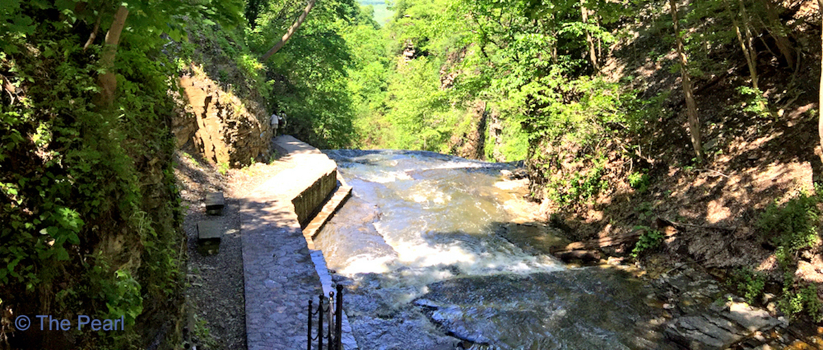
We hiked the Casadilla Gorge today, or I should say we hiked half of the trail…it was a combination workout. A five mile bike ride to the falls and back and then a .59 mile hike. The prettiest portion of the trail was closed for repairs. We’ve hiked it several times, so I will include a few pictures from other hikes.
Road Trip to Seattle: Grand Canyon
Grand Canyon has long been high on our list of places to visit, and we finally got there on our cross-country road trip from Charleston to Seattle. Even after seeing countless pictures and reading many descriptions, Grand Canyon still appears unbelievably immense when first seen in person. We spent most of our visit on an…
Four great products to enhance your winter cruising
Here’s an edited version of an article to appear in Pacific PowerBoat’s next issue.
FOUR GREAT PRODUCTS TOENHANCE WINTER CRUISING – AND ONE’S FREE!
We really enjoy our winter cruising, but when it’sdark from before 1800hrs until first light arrives about 0700 the dynamics are quite different to summer cruisingwhen we’re still on the beach or BBQing until much later. These four products have helped keep us safe, warm and entertained during those 13 hours of darkness aboard Rapport.
See the light– Techlight hand-held spot
In days gone by our hand-held lights were usuallya 12 volt spotlight with a halogen bulb connected through a cigarette lighter socket anda trusty battery powered Dolphin . Whenusing these duringnight searches as Coastguard volunteers we often found the boat’s wiring to the power socket was too light for sustained use of the spotlight, due to the heat generated, while the Dolphinhad limited range and runtime plusexpensive batteries to replace. Also if the Dolphin hadn’t been used for a while we needed to remove and replace the (same) battery, presumably to provide a better connection.
But a technical revolution has been occurring during the last 15 years or so not only with LED bulbs, that provide brighter light, give a higher quality beam and consume less power, but with rechargeable lithium batteries that continue to improve as well as becoming lower cost. I can distinctly recall when I first became seriously aware of this. Technical guru Chris aka MacGyver, our most frequent visitor to Envoy made his first visit in late 2010. We were sitting in the cockpit after sunset in a bay near Bodrum when Chris showed me a black aluminium flashlight about 130mm long, with an LED bulb and powered by a rechargeable lithium battery. This compact light easily illuminated trees on the foreshore, which I guess was about 250 metres away. By comparison the light from my largest flashlight – a clunky unit with 4 x D cell batteries and conventional bulb couldn’t even reach the shore. Flashlights using conventional dry cell batteries lose their brightness early on as the batteries start to lose their charge, however lithium battery powered lights can lose much more charge before their brightness reduces. We now carry one of the new generation MK 7 Dolphins with an LED bulb aboard as one of our low cost general purpose flashlights together with a rugged, no-nonsense looking TeklightST-3329 we bought from Jaycar Electronics for $159. The Techlight has an incredible 480 metre rangeand its 4,500 lumens of light (the Dolphin has 200 lumens) provides amazing brightness. It’s waterproof and floats, has a convenient wrist security strap and its lithium battery pack is rechargeable using either a mains charger orUSB cable, both supplied. Its full power option provides 75 minutes use while its still very bright low power option increases this to 150 minutes. If the proverbial hits the fan the unit can also emit a continuous SOS signal. In essence the Techlight provides the power of a hard wired spotlight with portability and we love it.
User tips: it takes about 40 minutes for human eyes to completely adjust to darkness so using low level red lighting at the helm and reducing brightness on navigation screens helps maintain night vision. Don’t try to use any spotlight through windows and avoid directing the beam on reflective surfaces.
Have we moved – Anchor Watch HD app for devices
When the wind is howling at 40 knots with the boat moving around during squalls as we encountered during early July’s “weather bomb” it can be difficult to tell if your anchor’s dragging during the night, especially as distance is far more difficult to estimate during night time. Most plotters incorporate anchor alarms, but as with our boat these may be on the flybridge and difficult to hear below. Enter Anchor Watch HD – a free app allowing you to maintain anchor watch from below or even while away from your boat.
When you open the app while connected to the internet it shows a Google Earth view of your current location and while Google Earth is not essential to use the system, being able to see your position on a map provides additional reassurance. This view is historical, so boats shown on the map will not be there now. You can change the scale using normal two finger zoom.
After your anchor is set press the anchor button and an anchor icon with an orange circle around it appears at your position. Now while the anchor icon remains in the original anchored position a blue/white/blue circle shows your current position. There are two on screen buttons to the right of the anchor button that increase and decrease the alarm range, which would typically be about 15 metres to allow for some sideways movement. The actual range displays on top centre of screen together with the distance and bearing from your current position to the original anchored position. If your vessel moves outside the set alarm range a volume adjustable (seriously loud at full volume) siren sounds and a dialogue box appears allowing you to ignore the alarm for 30 seconds while you adjust the scale or “raise the anchor”. The app can also send an alarm message by sms or email allowing you to monitor your anchored position while going ashore.
User tips: the app consumes a lot of power so keep your device charging when it’s using this app. Make a note of your GPS position after anchoring so that if you suspect dragging you can compare that with your current GPS position.
Stay warm as toast – Gasmate heater
Even on cold nights,once we start cooking the boat warms up quickly and when using ourgenerator we can also run our 2.4Kw electric fan heater. At other times we use our Gasmate portable heater with its ceramic burner providingan atmospheric warm glow. We bought ours from Bunnings costing $140 and usingdisposable 220gm butane gas canisters costing about $1.40 and lasting about 90 minutes. It’s very safe as a simple lever disconnects the butane cartridge when not in use and gas supply automatically stops if the unit should be accidentally knocked over, the oxygen level becomes too low or the flame goes out. It’s piezo ignition works well and it’s compact and smart with the butane cartridge housed within the casing.
User tip: when using the Gasmate allow some fresh air into your boat and never use it while sleeping.
Gasmate butane cartridge heater and Techlight spotlight

Entertainment during those long nights – RSE Mini-Lite Plus
We promised ourselves our next boat would have Sky TV capability to watch favoritessuch as Super Rugby. When we bought Rapport she already had an Avtex flat screen and a TracVision TV5 satellite dish enabling us to watch free to air TV. Our friend Chris suggested buying anRSE Mini-Lite high definition digital satellite receiver enabling us to plug in our Sky card from home.Theunit is easy to install, attaching to the rear of the flat screen and wired to our AC power supply. It’s performed welland accessesSky channelswherever we are, except for some unknown reason Oneroa.The RSE unit costs $199 and can be bought through RSE in Takanini orproviders of caravan accessories.
User tip: the power to the Mini-Lite and screen must be off beforeyou insert and remove the Sky card. If you don’t do this the Sky card will no longer work until after it’s used again in your box at home.
Enjoy your winter cruising!