Wordless Wednesday

Manteo to Ocracoke

Casting away from the docks just as the sun is starting to rise, we retrace our steps out the skinny water of Shallowbag Bay and pick up the Roanoke Sound Channel. We follow this narrow but well buoyed channel for about ten miles as we work our way south between Roanoke Island and the Outer […]

Sarasota Bound: Pit Stop then Express Clewiston

We arrived at the Morehead City Yacht Basin on Friday at 1:40 PM with a goal of fueling and getting back on the road in less than two hours.  Complicating this year’s “pit stop” was the failure of both the starboard and port running lights, which …

Tuesday News From Cochise: Squalls, Data And Details

Lots of excitement aboard FPB 78-1 Cochise in the last 24 hours, and a series of milestones. Cochise has seen …Read More

BROTHER CHARLES VISITS ENVOY

Envoy is in Lefkas Marina for the northern hemisphere winter and we’re in London with our daughter Amy en route to New Zealand and home.

Back to early October and my brother Charles joins us at Corfu for his first visit to Envoy. It was Charles who first introduced us to Med cruising when we spent some time aboard his 34ft sailing yacht in Turkey. He’d sailed it from Australia with his now-wife Marie and after several years in the Med continued on to the far north-east of Scotland where they now lives and he works as Harbour Master in Lossiemouth, near Elgin. It was during our time with Charles and Marie that we decided to buy our own Med-based boat. Look what they started!

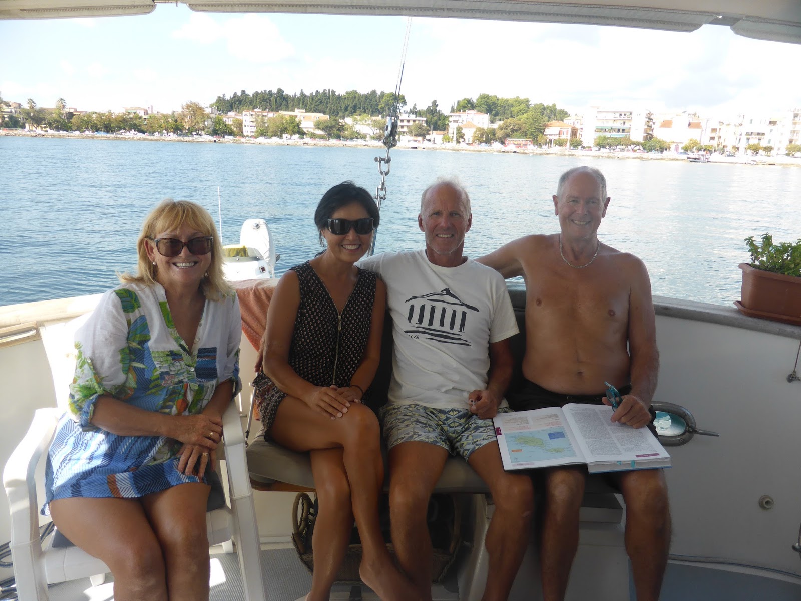
Still anchored off Corfu town we meet New Zealanders Alan and Tina from the yacht, Whisper. They’re the first NZers we’ve met this season and it turns out they know our NZ friends Bruce and Leslie from the catamaran, Midi.

Di, Tina, Allan and Laurie in Envoy’s cockpit, Corfu
Visiting Malta has been on our minds for a while and Alan and Tina provide us with some more information about this interesting destination, making it a definite possibility for next year.

Checking my emails one morning I see an official-looking one mentioning the US Navy and my first thought is that I’m getting a telling off for including a photo in our Blog of a USN ship moored in Crete’s Soudha Bay.

Here’s that photo again

On reading the email though I’m delighted to find that it’s from a very senior officer of the USN’s 6th Fleet, Destroyer Squadron 60 saying that he’s very happy to see “one of my ships, USS Ross, appear in the Blog”. The officer and I have since had several exchanges of emails and it turns out that he has an interest in Nordhavns and follows our Blog. We’re even talking about possibly meeting up next year in Italy where he’s based – Diane and I haven’t exactly decided which of two cruising plans we’re going to adopt next year but both include Italy.

We spend a couple of nights of perfect tranquility anchored at Mourtos until the weather forecast predicts southerly winds over 30 knots with heavy rain, quickly turning to northerly winds over 30 knots. This is the kind of forecast it’s hard to find shelter from, but nearby Igoumenitsa Creek is perfect so we head there to anchor in a depth of about 14 metres (a bit deeper than we prefer) laying out 60 metres of chain. The bottom is mud and Envoy has a heavy (40kg) Delta anchor plus 3/8 inch chain and we rarely drag with this much chain out.
There’s plenty of thunder and spectacular lightning plus a choppy sea whipped up by over 40 knot gusts, but we’re perfectly safe.

Balmy evening in our anchorage before the storm

Wind-driven chop in Igoumenitsa Creek

Laurie and Charles at Koulara

Koulara Harbour

Charles leaves us at Corfu’s Gouvia Marina where we visit to get a few maintenance jobs done (details in next posting). Meanwhile summer seems to have come to a sudden end and we have several days below 20d with heavy showers and thunderstorms.

In Gouvia we meet some other New Zealanders – Trevor Giles from catamaran Kiwi and Chris and Michelle from yacht Endless Summer.
An Australian yacht Pablo Neruda berths next to us, formerly owned by Melbourne-based Rob and Kerry, who we met through recent visitors Simon and Bronwyn and who gave us a lot of cruising advice before we started in the Med.

FPB 78-1 Cochise: Weekend Update

It is Saturday afternoon, Cochise and crew are chilling, and recovering from a dose of CED (current events depression). No, …Read More

Becoming an Author of Sasquatch

I know I don’t post hardly anything anymore on this blog.  After all, Pamela and I aren’t cruising on Drift Away anymore.  The boat was sold to the Roziers and is now named “Happy Ours”, and they too have dumped a load of money into it. &nbsp…

Stagecoach Watering Hole – Somewhere in Maine

Stagecoach Watering Hole was one of those places that we passed up on the way to somewhere else. Steve was driving and I asked him to go back so he turned around and back we traveled. We actually do a lot of that and luckily he humors me when I find something that I would […]

The post Stagecoach Watering Hole – Somewhere in Maine appeared first on Moosetique.

Solitude in Paradise

At Compass Cay.The onSpot guys are just back from making the necessary repairs in the Exumas and sent me this shot of Compass Cay. Hurricane Matthew blew right over the little island, but thankfully there was little damage. Tucker reported; Lily’s door…

Sarasota Bound:The Fat Lady Screams

NOTE TO READERS: I’ve had this article ready for several days but could not publish due to lack of internet connectivity. The first part of the story anticipates what we think is going to happen and the second parts is what happened.

THE PLAN:

Thursday, November 3:

Weather, weather weather. 

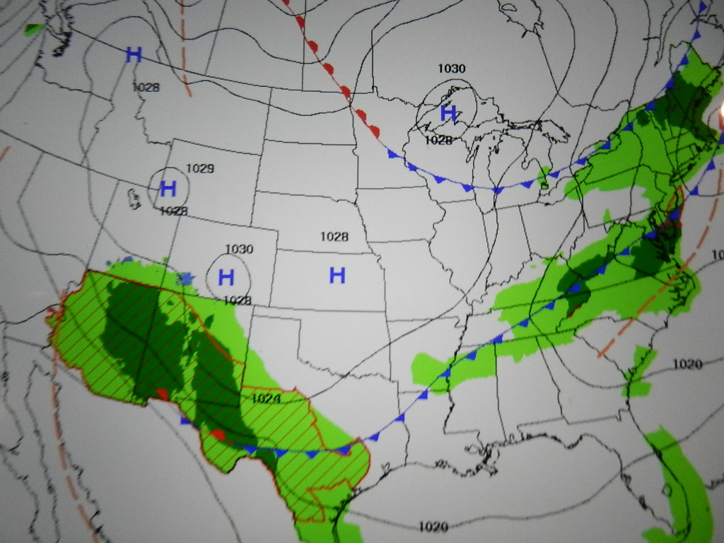
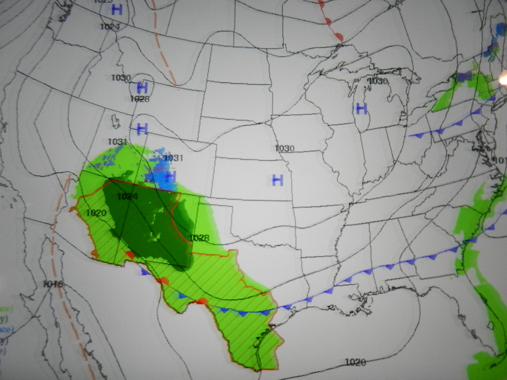
You will recall that the forecasts were very favorable for the entire run down the coast. Well, things change. We are now looking at a cold frontal passage in the vicinity of Cape Hatteras and the question we have been dealing with since last night is simply one of the timing of its arrival.
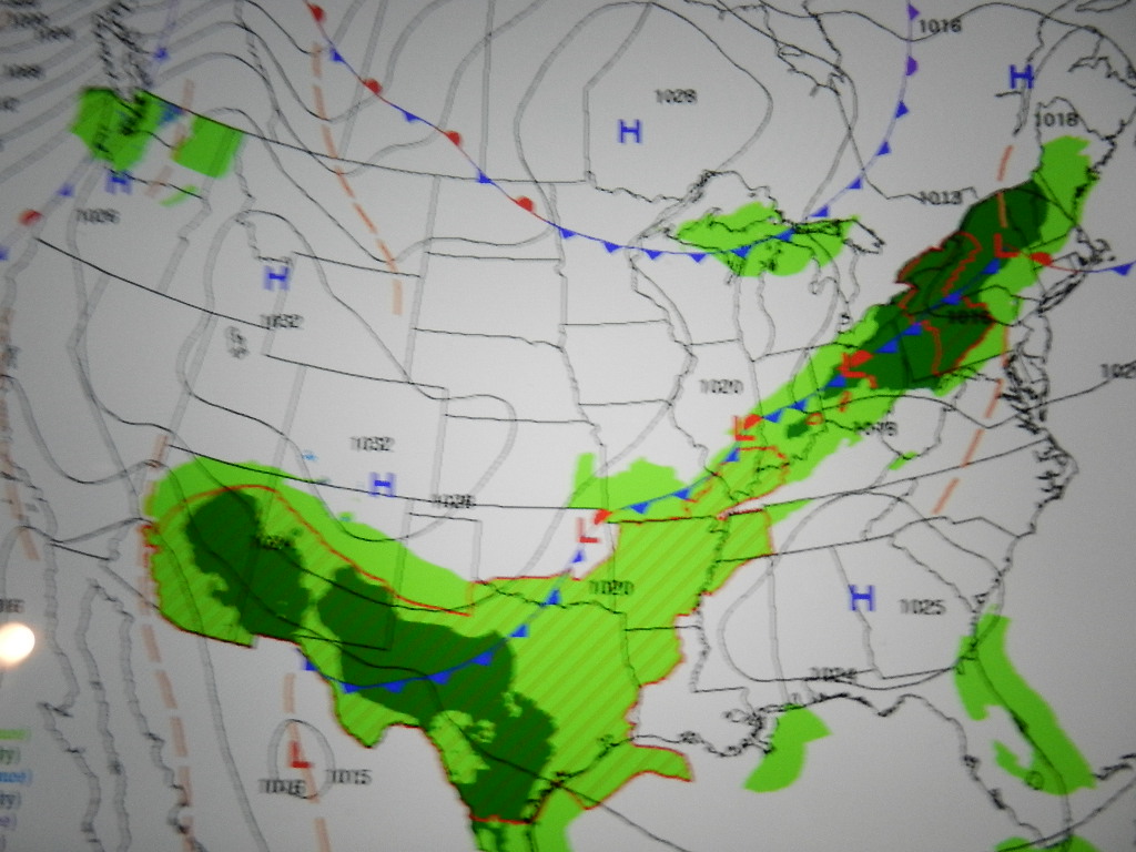
Wednesday at midnight – A cold front stretches from New York to Texas

Thursday at midnight – The cold front approaches North Carolina with light rain 

Friday at midnight – The cold front has passed Cape Hatteras
As we cross the Chesapeake Bay and approach Cape Henry (Virginia Beach area) with the threat of heavy weather we face a critical decision. Stop at Virginia Beach and wait for the front to pass (possible 3 day delay), head down the ICW from Norfolk to Morehead City (3 days for sure. More if the Alligator River Bridge is shut down due to 30 knot winds) or proceed to Hatteras on the outside (24 hour passage to Morehead City).

We know we will arrive at the east end of Diamond Shoal at 1:00 AM on Friday, well before the front arrives. Below is the forecast for Cape Hatteras as of 6:00 PM. The forecast for tonight calls for seas 2 to 4 building to 3 to 5 with a dominant period of 10 seconds. This is very favorable. By morning the winds will have built to 30 knots with seas reaching 6 to 9 feet. This was the case in November 2014 when I went south with Dick Singer and Phil Fuoco. Stated another way. I’ve seen this movie before and it is not pretty.

Looking forward to Friday night you can see the 6 to 9s subsiding to 5 to 7. So stopping at Virginia Beach at noon on Thursday would have produced a three day delay while we wait for Cape Hatteras to calm down. 

WEATHER FORECAST – CAPE HATTERAS

Synopsis: A COLD FRONT WILL MOVE THROUGH THE REGION TONIGHT AND EARLY FRIDAY MORNING. HIGH PRESSURE WILL BUILD IN FROM THE WEST FRIDAY AFTERNOON INTO EARLY NEXT WEEK. 

Thursday Night

SW winds around 15 kt…becoming W 15 to 20 kt late. Seas 2 to 4 ft…building to 3 to 5 ft. Dominant period 10 seconds…decreasing to 5 seconds late. A slight chance of showers late this evening. A chance of showers with a slight chance of tstms after midnight.

Fri

N winds 20 to 25 kt…increasing to 25 to 30 kt in the afternoon. Seas 4 to 6 ft…building to 6 to 9 ft in the afternoon. Dominant period 5 seconds. Showers likely with a slight chance of tstms in the morning.

Fri Night

N winds 25 to 30 kt…diminishing to 20 to 25 kt after midnight. Seas 6 to 9 ft…subsiding to 5 to 7 ft after midnight. Dominant period 6 seconds. 

The run from Cape Henry to Morehead City is actually more than just going out to sea 13 NM to go round Diamond Shoal at Cape Hatteras (which is actually 33 NM from the west shore of Pamlico Sound – a sizeable amount of fetch). Once clear of Diamond Shoal the next obstacle before arriving at Morehead City is Cape Lookout, where a second shoal so named extends out to sea 9 NM south and east. There are no marked crossings. Short cut this one at your peril (as the bottom does move around).

Cape Lookout Shoal is over 40 miles south of Diamond Shoal. Add another 10 NM if you run northwest toward shore after rounding Diamond, then run along the coastline and then, finally, head out along the north edge of Cape Lookout Shoal.

There are also no usable inlets along the 212 nautical miles between Virginia Beach and Morehead City. Therefore, once you start this leg you are more or less committed.  Yes you can turn around and head back but that comes with its own set of challenges especially when a front is moving north to south.

So, the weather at Cape lookout Shoal must also be considered before proceeding on this leg. Remember, Cape Hatteras is affectionately know as the graveyard of the Atlantic.

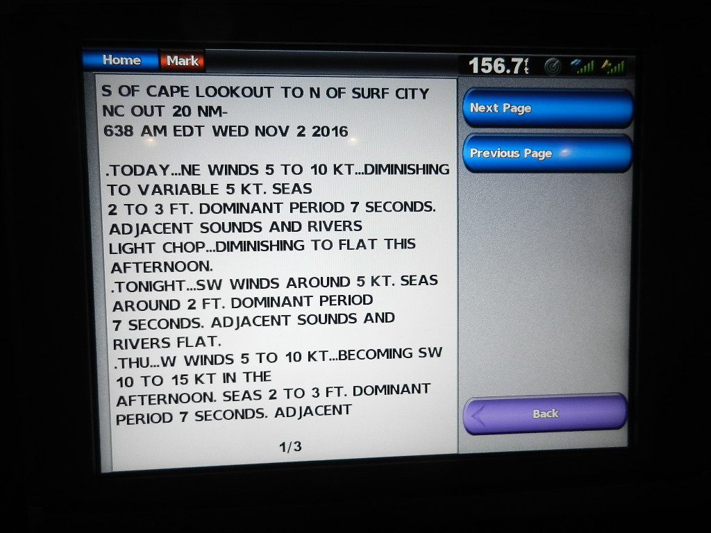
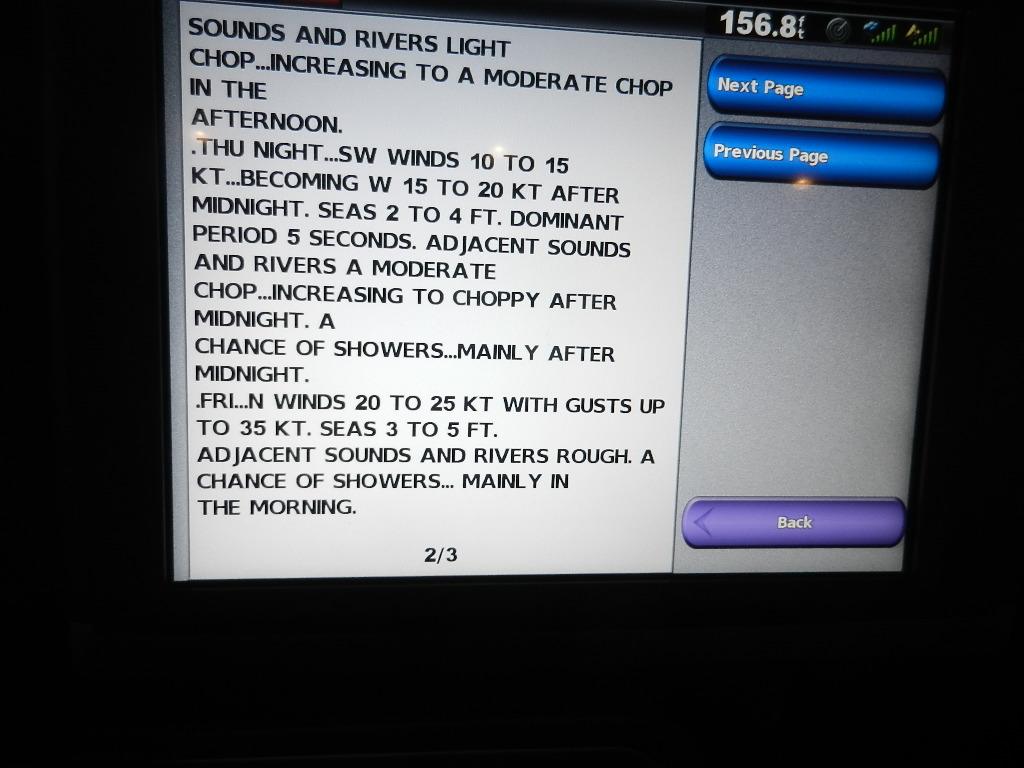
WEATHER FORECAST – CAPE LOOKOUT SHOAL

We will arrive at the Morehead/Beaufort Inlet at approximately 11:00 AM on Friday. The forecast calls for winds of 20 to 25 knots with gusts up to 35 knots in the afternoon with seas 3 to 5 feet. On the surface this looks threatening. However, a wind out of the north produces a following sea. A following sea with 3 to 5s is easily doable.

Another factor to consider. The forecast for the coastal waters south of Morehead City after our “pit stop” called for 25 to 30 knot north winds with 6 to 9 foot waves offshore and 3 to 5s close to shore. This is depicted in the sea conditions photo below.

So weighing all the factors we democratically decided to “go for it.”


WHAT HAPPENED:
At 12:30 PM we plugged in the Virginia Beach to Beaufort route and began the passage with winds out of the southwest at 7 knots and seas at less than one foot. Conditions were so good that we operated from the flybridge for 3 hours in 72 degree sunny weather. Back in the pilothouse at 6:00 PM we noted west southwest winds at 14 knots with seas less than 1 foot. A gourmet dinner followed.

By 11:00 PM winds had built to 21 knots (still of out the southwest). We estimated seas at 2 to 4 feet. Rounding Diamond Shoal at 2:00 AM Friday, we noted a 3 to 5 foot head sea off the port bow. Wind speed and direction had not changed. The words “very stable ride” appear in that log entry.

Given the stability of our ride we elected to go directly to the tip of Cape Lookout Shoal saving 9.3 NM by not heading in to shore. We noted at 6:17 AM that the wind had shifted to the north at 23 knots and waves had built slightly to 4 to 6 feet.

A communication between the Coast Guard and a 44 foot sail boat south of our position got our attention. The captain reported the boat hard aground and taking on water. He also reported injuries. The Coast Guard was sending a cruiser, a chopper and a (Sea Tow) tow boat. We never learned any more.

The fat lady screamed (well ok, the front passed): Log Entries:


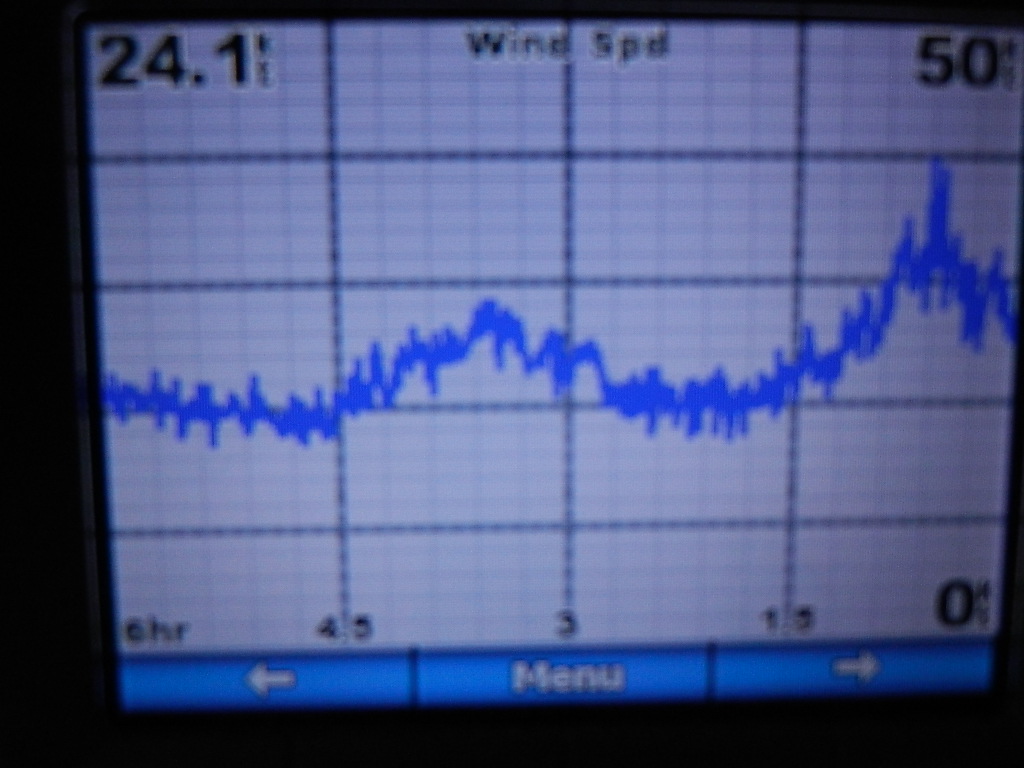
Wind graph showing the trend line leading up to the frontal passage
·        08:38: Heading direct to the tip of Cape Lookout Shoal. CRS 242. Wind NE 28 to 35 knots with gusts to 40. Seas 7 to 9 with an occasional 10 to 12. We are 14 NM southeast of the shoal.

·        
0    9:06: Barometer rising from 29.96 to 30.06. The front has passed.


Frontal passage


·     10:20: Direct WP (waypoint) 477 around the end of the shoal. CRS 222. Winds 33 knots gusting to 40. Following sea 8 to 10 occasionally 12.
High seas – photo does not due it justice
No fun for better than two hours. By 11:57 AM we were on the south side of Cape Lookout Shoal with the Morehead/Beaufort Inlet about 9 NM ahead. Winds were still howling at 33 knots from the north but seas had subsided. We were now in 3 to 4s owing to the shelter proved by the shoal against the north wind. We entered the inlet at 12:45 PM.

Forecasted 3.6 seas at the point we are experiencing 8 to 10s
So what happened? NOAA got the wind and sea part of the forecast right. They totally blew the timing. Essentially the front passed quicker than expected. Mind you, I’m not blaming NOAA. We made a decision and took a calculated risk. Factored into that decision was a cost benefit analysis. If it all worked out we would be south of the Cape(s) with a favorable north wind and a following sea on our tail and clear sailing to Florida. A second consideration was my experience with the 63. The 63 has seen 10 to 12s before and on different points of sail and handled it well.

Forecasted sea conditions showing a narrow path along the coast
We arrived at Morehead City Yacht Basin at 1:30 PM with the goal of refueling quickly and getting back on the road within 2 hours. 

Stay tuned for the next adventure. Pit Stop then Express Stuart

Data Hingham to Morehead City:

  • Distance Traveled: 643.1 NM
  • Average Speed: 8.1 NMPH
  • Time Enroute: 80 hours
  • Fuel Purchased: 872.2 gallons
  • Price per Gallon: $2.18 plus tax
  • Fuel Cost: $2029.74
Written by Les.