A NEW ADVENTURE FOR THE CREW OF M/V ABREOJOS

Trawlers are great fun.  Aboard Abreojos, we go lots of places.  There are limitations, however.  The Roughwater 41 is an excellent coastal cruiser.  In my opinion, it’s one of the best.  She has adequate range and is very seaworthy.  Yet, she was never meant to cross oceans.

This August, Brenda and I will be doing just that – crossing an ocean.  Unfortunately, our Abreojos will be awaiting our return at the dock.

Our friends, Phil and Sara, have a Swann 44 over in Hawaii that they want brought home. Her name is Second Chance, for many good reasons.

In 2011, Second Chance raced from Long Beach, California to Hawaii in the Transpac.  Here she is at the start of the race:

Second Chance

She completed the race.  However, not long before crossing the finish line, she earned herself a bit of acclaim by rescuing a rather forlorn paddler who managed to get himself into something of a pinch quite a distance from the beach.  Here is a link to an article that explains essentially what happened:

http://www.sailmagazine.com/racing/regattas/luck-on-the-transpac/

For the last 4 years since the race, Second Chance has called the island of Oahu home.  Most recently, she has been berthed at the beautiful Ko’ Olina Marina which lies on the south-west side of the island of Oahu near the town of Kapolei.

http://www.koolinamarina.com/

This year, Second Chance is coming home to Channel Islands Harbor in sunny Oxnard, California, and Brenda, my friends Robert and Lou, and I will be bringing her home.

We will be leaving for Hawaii on July 29 and plan to leave the marina on August 1.  Although this is really not a “cruise” so to speak, the same adage as we apply to cruising applies; cruising plans are often written in the sand on a rising tide.  As I write this, the National Whatever Service is keeping an eye on a tropical depression they are calling “Tropical Depression 18e”.  Here is what they say:

The National Hurricane Center in Miami Florida is issuing advisories on tropical depression Eight-E, located 1715 miles east-southeast of Hilo Hawaii, under AWIPS header tcpep3 and WMO header wtpz33 KNHC. Eight-e is expected to cross 140°W into the Central Pacific Hurricane Center area of responsibility Thursday morning.

Central Pacific Graphical Tropical Weather Outlook and Infrared Satellite image for 02 UTC

This will probably turn out to be a fizzle and cause no more than a period of excessive heat and humidity.  Moreover, we are heading north and it appears, based on the projected cone of influence, that the unstable weather will pass well to the south of the Hawaiian Islands.  Nevertheless, it adds one more thing to the matrix of matters that form the myriad of considerations taken in planning this trip.

The trip is approximately 2600 nautical miles.  It will take us somewhat north (probably to around the latitude of Oregon) before we start heading easterly and then south-easterly towards Channel Islands Harbor.  This is primarily because of the belt in which the trades blow and the location of the center of the North Pacific High.  The way things look now, we will almost always be sailing well off the wind on a variety of headings that make great points of sail for Second Chance.  In that regard, we hope the trip will not take us more than 14-18 days.  I have asked my crew to bring their passports with them, however.  Granted, one would think navigating from Hawaii to California is easy – just head east.  Well, it’s not THAT simple.  I mean, what if we get in close and tune the fm radio and hear Spanish music?  Well, then we turn left.  If we approach shore and are met by folks paddling skin covered canoes and offering us seal blubber to eat, well, then we turn right.  Seriously, August is the best time of year to do this trip because the weather conditions are most apt to remind us of just why the Pacific is so called.

So, we head out tomorrow morning to catch an early flight to Honolulu.  From there, we’ll catch a shuttle to a friend’s house where we will pick up his truck which he generously offered us for our use prior to shoving off.  Then, we’ll head down to Second Chance and begin the process of packing and unpacking and provisioning.  It promises to be a big job.  Although there will only be 4 of us aboard, and thus plenty of space, there will also be provisions for 4, all of which must be stowed appropriately.    I’m glad we have a couple days to get it right before we head to the fuel dock.  Yes, I said it, “fuel dock.”  While Second Chance is a first rate sailing vessel, she does have an auxiliary engine and a generator that need to be fed.  We’ll carry as much fuel as we can possibly stuff aboard so, if we have to, we will easily make it across the North Pacific High, although the goal will be to sail as much and as fast as possible recognizing, of course that we are only 4 and we are not in a race.  Second Chance had a much larger crew when she sailed TO Hawaii.

So, for now, I’m going to close this out and hope that you will follow our progress.  How is that possible, you ask?  Easy!  We will have a DeLorme In Reach device on the boat.  This is a two way satellite communication device that relies on the Iridium system.  It does many amazing things.  Perhaps the most amazing is it will function as a tracker linked to a website so our friends and family can not only follow our progress, but send us text-like messages.  The following link is the link to our page.  Check it out.  We will turn the tracker on and start “pinging” the website when we leave the harbor on August 1…..we hope.  I’ll also ping the link to my own timeline on Facebook.

https://share.delorme.com/LawrenceGolkin

I’ll try to write more before we leave and let you know how the provisioning goes.  So, for now, this is the crew of M/V Abreojos, on temporary assignment aboard S/V Second Chance, signing off.

Out!
2015-14 Up Chichagof Island’s West Coast to Pelican

Saturday, July 25th:  Northward from Sitka up Chicagof’s West Coast

We have a busy plan this morning then an 8-hour motor.  Let me back up:

After spending the last ten days back in California, we left San Luis Obispo via car up Highway 101 meeting our local crew along the way.  Veterans Vince and Marianne Fonte, and Chuck and Carolyn French, joined with us at a new San Jose hotel close to a favorite restaurant: Vito’s Trattoria on Skypark Drive.  Early Friday we flew to Sitka, arriving late afternoon.  After unpacking, we made our provisions list for stocking on Saturday.

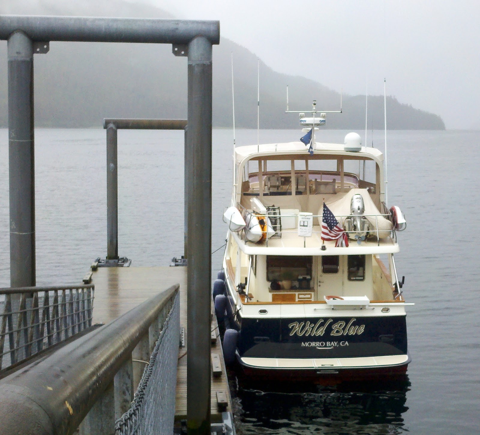
Today, we have to unload our on-shore cold storage locker into the boat’s freezer, provision at the market and fuel the boat.  Once completed, we will get motoring northward, hoping for a secure anchorage this evening.  The girls get marketing while the boys head to the fuel dock.  A line of boats at the fuel dock adds almost an hour and it takes another hour to fuel.  The girls have the groceries delivered to the fuel dock where we load, and go. The Wild Blue has been in and out of Sitka since May 5th.  By 1PM we are saying good bye to this pretty Alaskan town after almost three months!

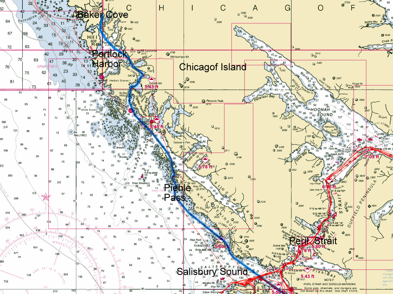
Our route today is a bit different. We will follow the standard inside route northward towards Peril Strait but at Salisbury Sound, instead turning right into the flat waters of the Strait, we head out to sea.  At Piehle Pass we turn for the inside route again, up Smooth Channel, then Ogden and Surveyor Passages, through Portlock Harbor, Golding Harbor and into Baker Cove.  About 9PM we pulled into Baker and set the hook.

Our route northward from Salisbury Sound, outside Chicagof Island,
through Piehle, Smooth, Ogden, Surveyor, Portluck and Golding
into Baker Cove.
Sunday, July 26th: Lisianski Strait, Bohemia Cove to Pelican
This morning we cruised out of Baker and Portlock Harbor dodging a seiner set.  A seiner season had opened early this morning and we watched from our anchorage as the fishing boat set his net across the mouth of Baker Cove.  We left between two sets and it looked like a good catch of coho salmon.
We exited Portlock via Imperial Passage and were in the ocean for about an hour.  6-foot well-spaced swells rocked the boat on our way to the southwest entrance of Lisianski Strait.  At the entrance a couple humpbacks feeding almost too close!
Short of the top of the Strait we pulled off at Bohemia Creek and tied to the National Parks provided float.  It was a nice respite from the rain and we enjoined a great lunch.
A robust dock built by the National Park Service for recreational use.  No charge!
Crew Vince and Marianne are playing in the rain.  These two are less than
 3 months away from celebrating their 50th wedding anniversary.  
After 2 hours of hiking, lunching and napping, we slipped our lines and headed for Pelican.  We arrived about 3pm to very quiet community.  Only about 120 folks live here year round and maybe as many as 250 in the summer months.  Pelican Seafoods closed for business in July 2008 and the population has dwindled. Rosie’s Bar amd Grill was very quiet, the brightest light being her “OPEN” sign.  With no harbormaster, we just picked an open slip and hoped for the best.  It had no power so we occasionally ran the generator.  After walking the town and chatting up a few folks, we decided to leave an envelope with our dock fees at the harbor office.
Because of a storm forecast we spent two nights here.  We walked the Pelican boardwalk, saw the near new schoolhouse, visited the power station, and spied on as two large halibut were filleted on the boardwalk.  It was a quiet time for Scrabble, Mexican Train, rain watching and book reading.  It was just too rainy to get any decent photos of Pelican.

Slowly Southbound – Sitka to Petersburg

July 12, 2015

Spirit departed Sitka for the last time in 2015 at 0940.  We departed from our usual route north, instead going up Hayward Strait and Krestof Sound, rejoining Neva Strait at the southern end.  Along the way we caught a large black sea bass, enough for two meals for the two of us.  Retracing our route up Sergius Narrows and Peril Strait we stopped for the night at Saook Bay.  The rain was now heavy.  Anchoring in 125 feet of water over a sticky mud bottom we settled in for the night and cleaned the sea bass.  Later that evening we were joined in the bay by “Mist Cove”, a small cruise ship which we see often.

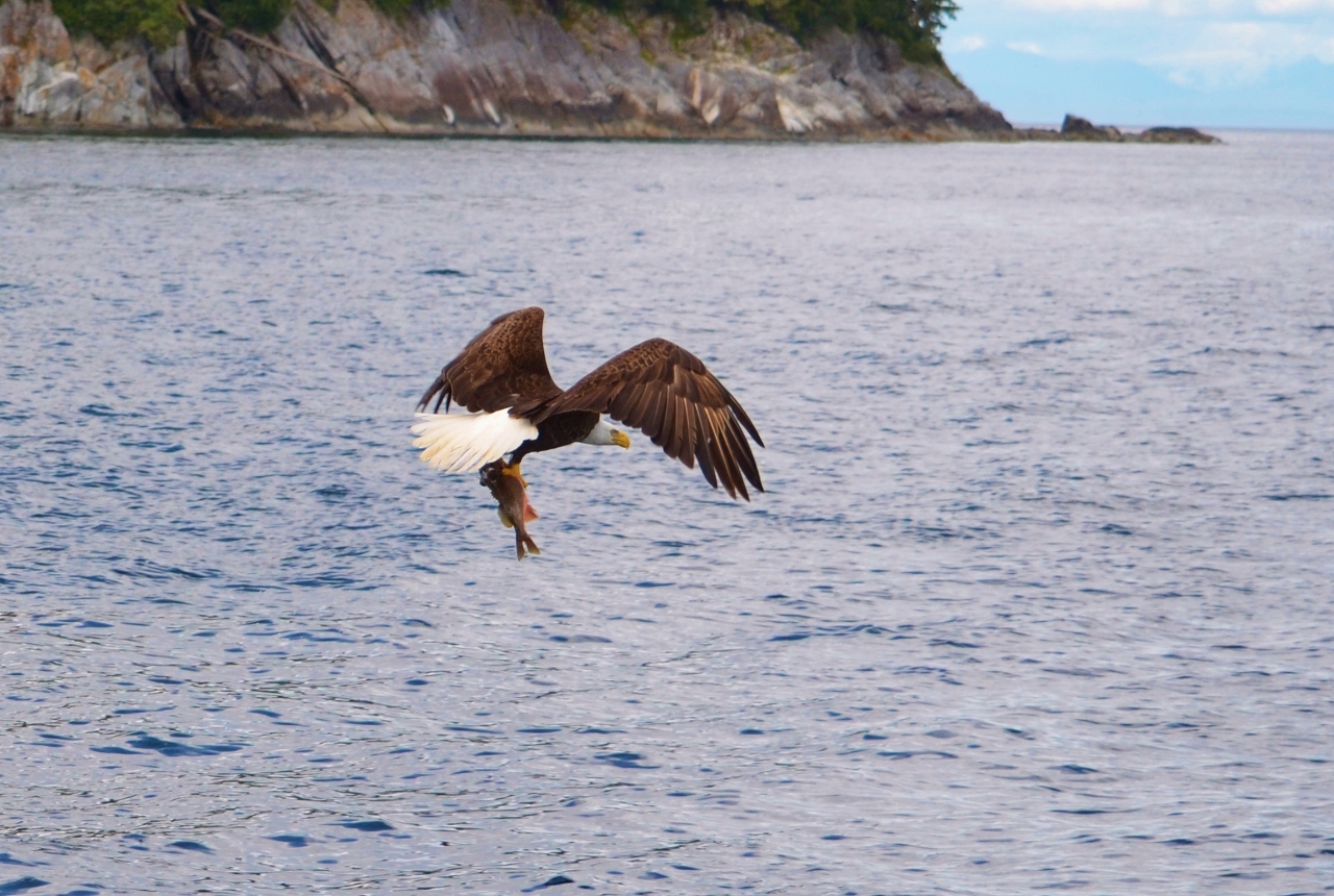
Eagle snatching a seabass we released
July 13, 2015

The halibut rod and bait had no takers overnight, but we left it out and set one crab pot among the string of commercial pots across the end of the bay.  Although cloudy, the rain held off most of the day.  Our crab pot was empty and the commercial crabbers were also having little luck, pulling some pots up and taking them to other places.

July 14, 2015

Pulling the anchor in heavy rain shortly before 0900 we departed Saook Bay and headed east in Peril Strait.  Taking a small detour we investigated the anchorage in Hanus Bay at Point Moses Cove.  The small cruise ship “Safari Explorer” was anchored there and it looks good if the wind is not too heavy from the SE.  We had timed our departure to hit slack water at Point Lull on Catherine Island to go halibut fishing.  We anchored in our selected spot in rainy, windy, choppy conditions and after 2 hours had landed three halibut (27, 31 and 36 inches) and three rockfish.  The visibility in the rain and low clouds was down to less than one mile as we pulled the anchor and headed to Takatz Bay.
The bay was empty, but soon we were joined by two small cruise ships, the Safari Explorer and “Discovery”, a classic 82 foot wood vessel from Juneau.  The fish we caught were fileted and vacuum sealed, adding another load to our nearly full freezers.
July 15, 2015

After a leisurely morning, watching the passengers on the Safari Explorer kayak around the bay, we headed out shortly before 0900 and soon picked up 2 pink salmon, releasing 2 more and a small king before heading to our fishing spot near Warm Springs Bay.  We soon had 2 pacific cod and 2 more halibut in the boat, one 32 inches and one 37 inches.  The public dock was full at Warm Springs Bay, so we anchored over a hard bottom in the westernmost south arm behind the Selene 47 “Jean Marie” at 1515, in 85 feet of water.  After processing the fish Patrick took a soak in the hot springs.  We were later joined in the south arm by the Selene 53 “Three Wishes”.  Although we had occasional light rain showers, the glimpses of the sun were a welcome sight after so many days with heavy rain.

July 16, 2015

Light rain greeted us as we departed Warm Springs Bay at 0910.  Our intended destination was Red Bluff Bay, but as we headed south, bucking a 2 knot flood tide current, we realized we could be at Gut Bay near slack water.  Heading down another 10 miles we put out the downriggers and immediately started getting strikes.  After 3 hours of fishing we had 8 nice Coho salmon, 2 pinks and 2 large black sea bass.  We had one double header, which made for interesting maneuvers to get the net ready for the second Coho.  Spirit was at anchor in Gut Bay by 1740 in 154 feet of water.  Cleaning and processing the fish took nearly three hours, standing in the heavy rain at the cleaning table on the swim step.  Our freezers are now essentially full, so we may not fish again until we offload our fish in Petersburg for shipment home.

July 17, 2015

The rain was still falling when we left Gut Bay, though now with fog limiting our visibility.  Exiting the bay, the seas got progressively rough as we headed north.  There were a number of vessels heading into Red Bluff Bay, so we continued north and anchored in Takatz Bay.  We tried fishing in the entrance, but no luck, even though the salmon were almost jumping into the boat and schooling up underneath us.  The seas were still too rough for the Grady White to go to the halibut hole.

July 18, 2015

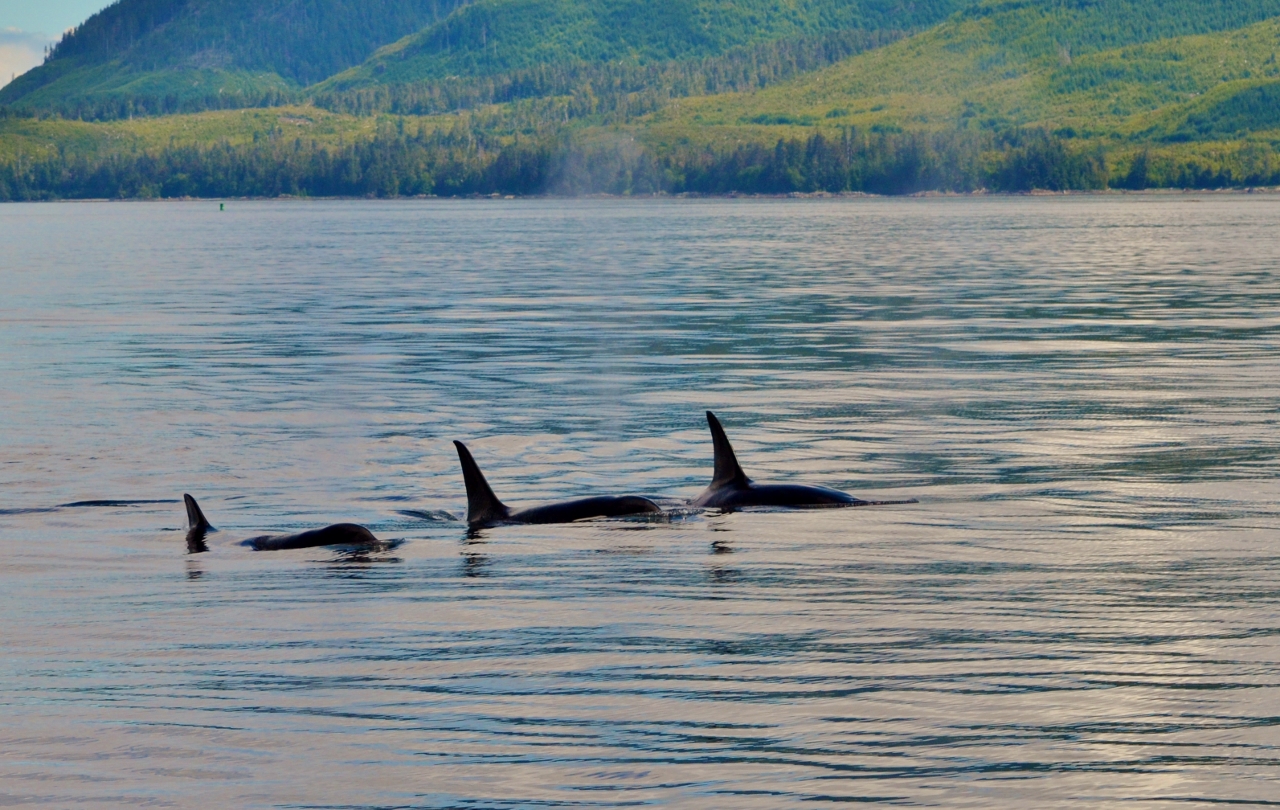
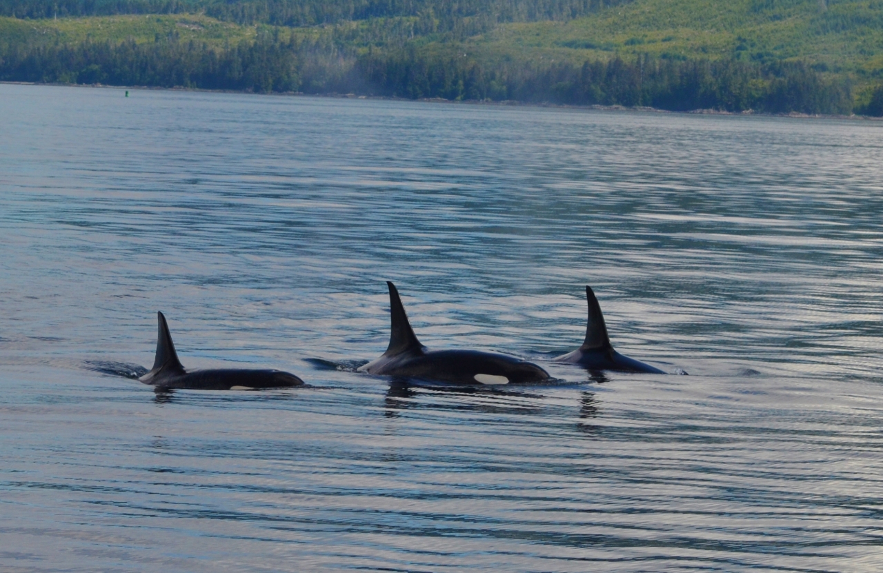
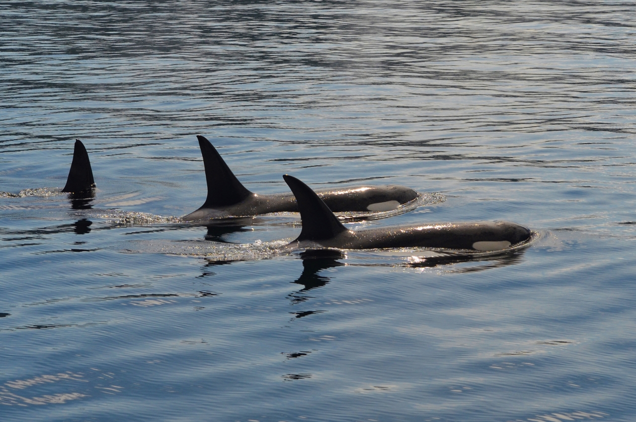
The sun was shining when we left Takatz at 0840.  We had mostly calm seas, mostly sunny skies and little wind as we headed to Portage Bay.  We stopped several times to photograph both Orca and Humpback Whales.  One pod of Orca suddenly surfaced dead ahead and we stopped Spirit as the Orca passed down one side and disappeared astern.  Spirit anchored in Portage Bay at 1705 under mostly sunny skies with light winds from the north.  The west side of the bay is still filled with commercial crab pots.

Orca Pod near Turnabout Island

Orca Pod

Orca Pod
You can see why we stopped dead in the water!
July 19, 2015

0540 came early as we pulled the anchor and departed Portage Bay before maximum ebb current and headed slowly to Petersburg to hit slack water.  A slip was available, but the current was still over three knots as we headed into Wrangell Narrows.  Even with the current, docking was uneventful at the north harbor docks.  By 1000 we were docked and shortly thereafter Patrick contacted the fish processors and shippers. After purchasing shipping boxes, we delivered five 50# boxes to the cold storage plant and made room in our freezers for more fish.  Patrick then changed lube oil on the generator, which we have been running more than normal to keep all three freezers running.

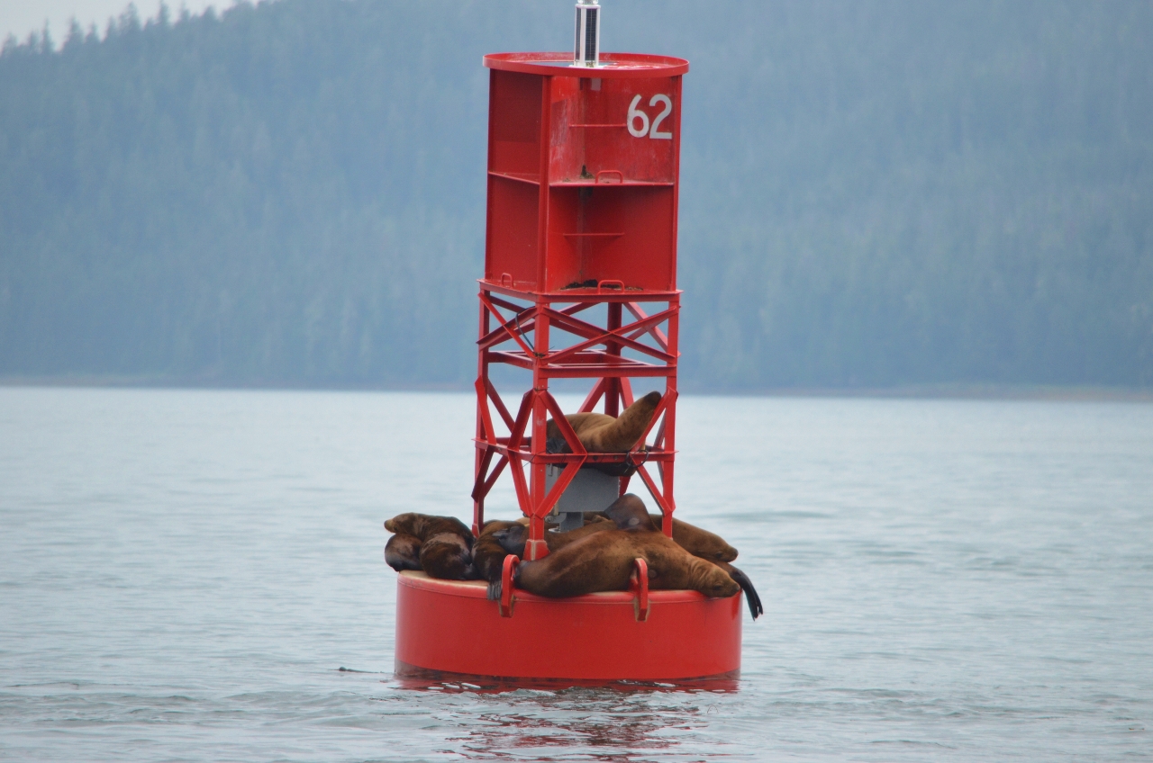
Sea Lions using the buoy for a hotel
July 20-21 – Maintenance stop in Petersburg.  We replaced the exhaust gasket for the third time this trip, although we now have the OEM Cummins metal gasket which was waiting at the Petersburg Post Office.  On Tuesday Patrick took the Grady White to Wrangell to pick up mail, rather than spend two days doing that with Spirit.  It is 40 nautical miles each way, and even with fog the round trip took less than five hours.

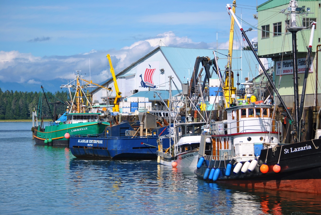
The fishing boats are crowding into the processors and the smell is indescribable, but is the smell of money.
Vying for space at the processors in Petersburg
July 22, 2015

At the early hour of 0600 we cast off the lines and joined the parade of vessels exiting Wrangell Narrows northbound at slack water.  After a 75 nautical mile transit we stopped at our halibut hole near Warm Springs Bay and took a 30 inch halibut and a pacific cod aboard, despite windy and choppy conditions.  By 1730 we were anchored in Takatz Bay after a total trip of 81 nautical miles.  Later that evening the rain started, heavy at times.

July 23, 2015

The rain continued all night, but about 1000 Patrick loaded the halibut gear on the Grady White and headed the short distance to the halibut hole.  Anchoring in more than 200 feet of water Patrick soon had his daily limit of two halibut, plus one more Pacific Cod.  The two halibut were 37 and 42 inches long, so we had more than 50 pounds of halibut to process, with a net weight of about 25 pounds.  The rain let up briefly in the afternoon, but returned in the evening.

July 24, 2015

Today was scheduled for Coho fishing, so at 0805 we pulled the anchor from Takatz Bay for the last time this season.  We stopped first south of Gut Bay and after two passes had six Coho salmon in the ice chest, along with two pink salmon.  Deciding to save some of our daily limit for another location, we continued south along Baranof Island and made two passes near Mist Cove.  These Coho did not like to stay on the hook as well, but were somewhat larger than the first location.  Even so, after two passes we had five more Coho salmon on board.  Since it was now after 1600, and we had a lot of processing to do, we headed into Patterson Bay where we finally anchored at 1745.  
Aptly named Mist Cove

Our catch for the day

View up Patterson Inlet
Shortly after starting the cleaning process, the generator ingested a jellyfish into the water intake and we had to shut it down, since the sea strainer was totally clogged with a slimy mess.  Deferring cleaning the strainer until the fish were done, we finally finished the fish about 2030 and the sea strainer after 2100.  It was a late dinner of baked chicken, since neither one of us could face any fish after the lengthy process of fileting, vacuum sealing and freezing we had done for the last two days.  We both felt our mission to get halibut and Coho had been accomplished, so we start the return to Petersburg tomorrow.

July 25, 2015

We had a long run to get back to Petersburg, so the anchor was pulled from the jellyfish infested head of Patterson Bay at 0620.  The run back north across Chatham Strait was under calm seas, little wind and finally sunny skies.  There were numerous whale sightings, both orca and humpback, but none close enough for decent pictures.  Salmon were jumping the entire trip as we passed Kingmill Point and headed into Frederick Sound and our destination for the evening in Cannery Cove, Pybus Bay on Admiralty Island.  We anchored at 1445, having come 58 nautical miles from Patterson Bay.  By now the sunny skies had been replaced with high overcast, but no rain.

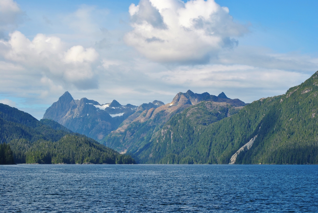
Some of the permanent snowfields on the east side of  Baranof
July 26, 2015

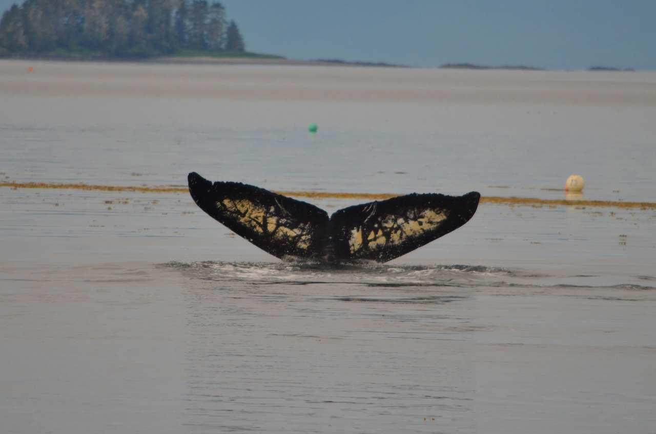
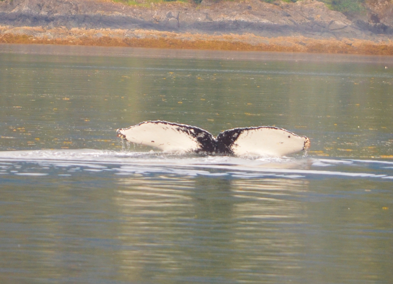
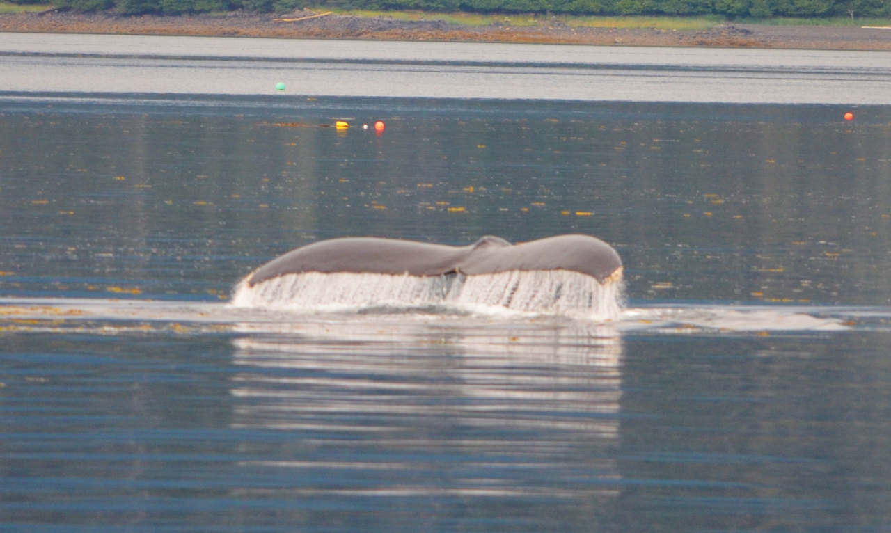
Spirit departed Cannery Cove at 0655 under overcast skies.  Heading out into Pybus Bay we had to slow down and thread our way through the numerous humpback whales feeding in the bay and in Stephens Passage.  Most of the time we just looked at the tails, but did get some photos.  It appears that the white tail markings on the humpbacks are all different, just like fingerprints.  This may explain how the biologists can track individual whales from year to year. 

Humpback Whale tail flukes

Unique Patterns

Different Again

No two the same
The top of the flukes all look the same

The differences are on the bottom of the flukes
As predicted, the wind changed to the SE and we could see rain clouds over Petersburg as we headed east Frederick Sound.  Approaching Wrangell Narrows, we had to wait for two tug/barge combinations to exit, then we headed to North Harbor and tied up in stall 32 at 1515, where we had been before.  To our chagrin, we had planned on having pizza at “Papa Bear’s”, but it was closed on Sunday.  We travelled 52 nautical miles today and have put in just under 500 nautical miles since leaving Sitka on July 12.  The rain returned in earnest later in the evening and is predicted to continue the rest of the week.

Alive and Well – "Chillin on Bald Eagle Lake"

“How did it get so late so soon?Its night before its afternoon.December is here before its June.My goodness how the time has flewn.How did it get so late so soon?”Dr. SeussSorry for the lapse in postings – updates to follow.

Another beautiful day

Heading over to Devil’s Isle. Saw three freighters already in just five minutes on the river. One passed right in front of us as we turned into the main river. We’re turning off onto a freighter free slough now. We’re also trying out our new flybr…

Another beautiful day

Heading over to Devil’s Isle. Saw three freighters already in just five minutes on the river. One passed right in front of us as we turned into the main river. We’re turning off onto a freighter free slough now. We’re also trying out our new flybr…

2015-13 Last Whale Bay Fishing Trip

Friday-Monday, July 10-13, 2015It took us two days to complete the windlass repair so by Friday afternoon we were headed back for one last fishing soiree to Whale Bay.  We fished the northern side of the Bay until 8PM then moved to Rakovi Bay for …

A Rainy Visit

While in Juneau we picked up Marcia’s cousins Chris, Diane and Diane’s husband, Ron, for a 2-week cruise from Juneau to Sitka with a visit to Glacier Bay National Park.  Chris and Diane have lived in Arizona for over 40 years so we warned them that Alaska weather would be radically different.  It turned out the weather was a bit more “Alaskan” than even we expected.

Below is a table showing the Juneau Airport weather summary for the first 3 weeks of July.  Our guests flew in the evening of July 7 and departed today, July 22. The highlighted dates coincide with their full days visiting.

Date Max Temp Min Temp Avg Temp Precip
July 1 64 46 55 0.42
July 2 57 52 55 0.20
July 3 58 48 53 0.09
July 4 74 44 59 0.00
July 5 76 48 62 0.00
July 6 84 53 69 0.00
July 7 76 55 66 T
July 8 63 55 59 0.64
July 9 66 55 61 0.01
July 10 61 54 58 0.34
July 11 62 54 58 0.40
July 12 63 56 60 0.92
July 13 58 54 56 1.26
July 14 60 52 56 0.66
July 15 59 52 56 0.38
July 16 59 52 56 0.04
July 17 59 53 56 0.26
July 18 67 54 61 0.08
July 19 59 51 55 0.63
July 20 66 50 58 0.04
July 21 76 46 61 0.00

While our local weather as we cruised certainly varied from that of Juneau, this isn’t a bad representation of what we saw along the way. Fortunately, they heeded Marcia’s warnings and brought their rain gear.

We ended up cutting short our visit in Glacier Bay by two days (using 5 days of our 7 day permit) because Marcia & I felt we had hit the highlights given the weather we were experiencing.

The left photo is Chris, Diane & Marcia at the Bartlett Cove NPS dock.  The right photo is Chris, Diane and Ron at the end of Tarr Inlet with the Margerie Glacier in background.

2015-07-014x  2015-07-019x


Fortunately, wildlife viewing isn’t adversely impacted by rainy weather. The birds around South Marble Island were abundant and we had a wonderful “whale dance” outside of North Sandy Cove.

2015-07-066x2015-07-053x


2015-07-076xFrom Bartlett Cove we headed to Sitka via Chatham Strait and Peril Strait.  Along the way we stopped at some of our favorite anchorages.  We shared anchorages with other boats, adding to our impression that this has been a busy cruise season in Alaska.  In Douglass Bay in Hoonah Sound, the other boat there was David Cohn’s Diesel Duck Shearwater which he brought across the Pacific on its own bottom from China in 2013.

2015-07-094xThe weather began to clear a bit as we headed into Sitka from our last anchorage.  Low clouds hovering above the hills outside Sitka provided a dramatic back drop as we headed into to conclude Chris, Diane and Ron’s cruise with us.

From here, we’re starting our trip south to Puget Sound.  For a number of reasons, we’ve decided to wrap things up early and hope to be back around the third week of August.

Milazzo to Cefalu, Sicily

I am kind of waiting for the shoe to drop. We have had nothing but flat calm water and perfect temperatures since leaving Marina di Ragusa. We have not even used the air conditioning once yet. On top of that, the boat is running just perfectly. I hope I am not jinxing myself.

 This was our course to Cefalu, still on the island of Sicily

We had yet another perfect trip of 64 miles to Cefalu. The water out here is so clear and calm.  Schools of Dolphin who seem to spot our boat from a great distance do an about face from wherever they are going and do a beeline for our bow. For the next ten minutes or so, between 2 and 10 of them will swim just under the surface a few feet on either side of our bow. Every so often, one or more will turn sideways and look up at you with that smirk that Dolphins seem to have. Watching them do that and then leaping out of the water convinces you that they are intelligent and very aware, almost trying to show off. 


 Dolphins – for some reason they seem to be attracted to our bulbous bow on Seabird

We were getting close to the our final waypoint on the trip and Carol quipped “uh, where is this marina?”  We were very close and it was not what we were expecting, at all. The course pointed us to a cement pier with a few raggedy, bobbing, floating docks off of it. The whole place was exposed directly to the open water and if a wind were to come out of the Northeast, Seabird would turn those puny would be docks into floating mush. Carol actually thought we should leave, but it was later in the day and we really did commit to staying there. I thought that as long as the weather experts stayed expert, we would not have a problem. 


 The dock you see in the photo is the hefty one.  Where Seabird is, it drops down to 
a flimsy floating dock.

The docking situation was a classic Med Moor, where you back into the allotted space, tie two lines to the dock and then pick up the “slime line”.  For those of you who are unfamiliar with the term, a slime line is really a mooring line that you attach to the bow of the boat to keep the stern away from the dock. That line is tethered to a cement block some distance from the bow of the boat, and you need to pull it piano wire tight. The “slime” part comes from the way the line is attached to the dock from the cement mooring. It usually has been lying in the mud and God knows what else before you pick it up in the slip. It is handed to you by the dock hand and you then work your way up to the bow with it to secure it to the cleat. By the time you are done, you are usually spotted with mud and water. This is why we prefer the side tie with conventional dock lines.

So….we finish tying up to the saddest excuse for a dock we have ever been to and go to the marina office to check in. Marinas around here are usually categorized by “Charge Bands”.  We usually see Charge Band 4, 5 and 6, the 6 being the most expensive and usually reserved for exclusive marinas or special destinations. This place was neither.  It was advertised in the guide we used as a Charge Band 5, but, that was a very optimistic rating. I would have given it a 2, but the town was so charming, I raised it to a 4.  At a 5, the nightly rate should have been $125, but I was shocked to find that he wanted $200!  Since we were already tied up, I begrudgingly accepted it but said we would leave in the morning. 

Shortly after that, our friends Bill and Janet called. They were about an hour behind us. I asked him what they were charging for his 42 foot sailboat and he said “$50”.  What??!! I stomped up to the office and asked why I was being charged 4x as much as a boat that was only 25% smaller than Seabird. He responded “seabird is BIG boat”. I said “yeah, but not 4x as big”. He then went to the owner and voiced my complaints and the owner agreed that if I stayed 3 nights, he would lower two of the nights to $100 per night. Ok….I was still getting fleeced, but it was now a low level fleecing and I left the office with some of my pride intact, sort of. 

The town of Cefalu, as I mentioned, is charming. It was about a 10 minute walk from the marina and I guess you could call it a “typical” Sicilian seaside village, if there is such a thing. It was built on a hill with narrow streets barely wide enough for one car to skim by you, brushing your clothing as casually as could be. Walkers generally have the right of way, but even those tiny little cars they drive weigh 2000 lbs, so we generally yield! In addition, per usual, it seems that every other business on the street is a restaurant or a cafe.

Trying to pick a restaurant in a place like this is difficult. The menus all look so good and the aromas coming out of each place make you want to choose them all. It is especially difficult for me because Italian food is kind of my thing. So, we usually end up choosing, as we did this time, a place with exceptional atmosphere, overlooking the beach and a good rating on Trip Advisor. 


Of course, the food was spectacular and, as in the case of everywhere in Sicily, a relative bargain!  I suspect one of the reasons for the low pricing might be their food transportation costs. The last photo in the blog is an example of their innovative thinking…..

We spent a good part of each day walking through the narrow streets of Cefalu. You always find something new that you have not seen before. All of these towns in Sicily seem to have a large town square, a grand cathedral being the centerpiece surrounded by cafe’s and outdoor restaurants. The cathedral, in this case, was just this week named a Unesco Heritage Site. Pretty spectacular. 


 The Cathedral in Cefalu

Our last day at the marina proved the weather gurus wrong. There was not a huge amount of wind, but a good size swell started to develop from the Northeast. With no protection from any sort of breakwater, our boat started to pitch a bit in the berth, stretching the slime line and our swim platform started creeping perilously close to the dock. In addition to that, our passarelle,  basically a fancy name for a boarding plank, started dancing on the dock, threatening to pulverize the electrical post next to it or detach itself from the boat and then deep sixing  itself. We decided it best that we disconnect the electrical cord from the dock and pull up the passarelle. Having done that, my only fear left was that the slime line would give out, sending the 70 ton Seabird into the flimsy floating dock. So, since we had no intention of getting off of the boat again, we loosened the two stern lines, giving us an additional 4 feet of slack, then tightened up the greasy slime line as taught as we could make it. We were now a minimum of 8 feet away from the dock with no more worries. 

We had 225 miles to our next destination, Villasimius, Sardinia, so we scheduled our departure from Cefalu at 7am the following morning. At 8.5 knots, we can usually cover up to 110 miles on a day trip.  This was going to be a 17 hour trip and an overnighter. We actually enjoy an overnighter with a full moon and calm seas. You don’t always get what you want…..

Next Blog:  Cefalu to the island of Sardinia

a few more pics from Cefalu…….

 
Italy seems to have lots of wild cats.  Every once in a while we find these 
kittens that have not learned to be skittish yet.


this is a very common sight from this season.  Calm seas and beautiful 
sunsets


Our morning walk usually resulted in spectacular views


Seaside view of Cefalu.  Just around the corner is a beautiful beach


this was taken during our departure from Cefalu in the morning

And last but not least…….

You now know the secret to low fish prices in the restaurants in Sicily.  Normally, from the dock to the restaurants
means wholesalers, agents, refrigerated delivery trucks etc.  Not is Cefalu. We watched this guy make several
trips from the fishing boat at the pier that caught these to the individual restaurants. Notice there is no 
“Wide Load” sign on the bike……