
Breem Head is in our wake, and Cochise is running free, squared away towards the north. We’ve got high pressure …Read More
Aug. 28 – North Haven, ME
Pulpit Harbor – Anchorage
“Changing your perspective changes your experience.” –Author Unknown

We spent extra time this morning enjoying our breakfast on the flybridge. What an amazing way to start the day…the sky was clear, the temperature a little crisp, but not too chilly, the view out standing and the water looked like glass. We love these beautiful slow mornings watching the world come alive.
Like all good things the perfect morning couldn’t last all day and it was time to move on. The weather predictions were for a strong south wind to come in during the night and we wanted an anchorage that offered better protection. So by late morning it was time to move west to a new spot. Our travel day was short, we only moved about 20 miles…we love these short day. There are so many places to explore along the Maine coast.
Our morning


We’re in Pulpit Harbor with a great view of Pulpit Rock at the entrance to the harbor and the Camden hills across Penobscot Bay. After getting settled we went ashore to find a little general store for a few essentials. The store was less than a mile away, but the walk took us awhile. Along the way we found apples, raspberries and blackberries…we ate as many as we could. What a treat. On the way back we picked a pint of blackberries to take back to the boat. They’re the sweetest blackberries I’ve ever eaten. We spent the evening like we started the day…on the flybridge enjoy our meal with a view. It was interesting watching the fog developing over the Camden Hills.
Pulpit Rock

The back of Pulpit Harbor

Some of our finds


The cute general store

Our evening view

Dinner…coconut curry lobster

Northern Arm
Northern Arm extends as two long inlets roughly eleven miles into the Newfoundland Coast from the western edge of Bay d’Espoir. The scenery there, particularly along seven-mile North Bay, is spectacular. We spent four nights in Northern Arm where we saw seals, whales and eagles, made five climbs, and completely ran out of superlatives to…
She Has a Name…
When we purchased Red Head as the kids new home, we decided to keep her name. It’s such a fitting name, after all.Before we picked her up she spent some time in an industrial yard being blasted with something they called “black Betty” or “black beauty”…
Perspective
Nordhavn Exumas Abacos Bahamas trawler Caribbean Pickwick Boat dogs
Memphis Downtown
Sea Turtles of Emerald Isle, NC
The sea turtles of Emerald Isle have fascinated me since we moved to North Carolina. This year there was a record of 51 nests found on EI. Turtle programs are found from Florida to North Carolina. I will begin this post by saying that I don’t have first-hand knowledge of this program. The only Loggerhead […]
The post Sea Turtles of Emerald Isle, NC appeared first on Moosetique Musing.
Prince Rupert to Port McNeill – “The long way home” – Part 2
 The morning of August 16 we left Shearwater Marina for Codville Lagoon, dropping prawn pots before we anchored. Since it was still early, we dropped the kayaks into the water and paddled to shore. We then hiked 2 km trail to Sagar Lake and its lovely sandy shores.
After picking up our prawn pots (enough for a meal or two) on the way out, we headed down to fish outside Gold Stream Harbor. We’ve anchored there in the past but the forecasted strong westerly winds persuaded us to continue further south after fishing (unproductive) to Fish Egg Inlet. We dropped prawn pots part way in then worked our way to the very back and anchored in the shallow waters of Oyster Bay.
 The next morning, August 18, we headed out to fish Addenbroke Island where we had seen lots of guide sport fishing boats the day before. They were there when we arrived and we joined the melee, a blundering 50’ goliath amongst more agile 20’ davids. While Marcia got some good hits on her gear there was no firm bite. We stopped to pull our prawn pots as went back into Fish Egg Inlet to anchor. The first pot had a nice haul of prawns, the second pot felt equally heavy as we pulled it in but its heft came from an octopus in it surrounded by prawn carcasses. We opened the pot and let the octopus ooze its way back into the water.
We were concerned with the third pot as the line was initially snagged on the bottom but we ultimately retrieved it and its load of prawns to the surface. We reset the pots but in a location a distance away from where we returned the octopus. For the night we anchor in a cove south of a passage called “The Narrows”.
 After the excitement of the day before, when we pull pots we aren’t sure what to expect. The first two pots had a good number of prawns but the third one we pulled up had another octopus. This octopus was a bit smaller than the previous days catch and we quickly returned him to the water. We decided to give this area a rest and did not reset the prawn pots. We first fished Addenbroke where we had two good hooks but Kurt botched the netting at the swim step on the first fish and the line at the hook broke on the second one. We headed off next to Gold Stream to fish the afternoon bite. After a couple of hours trolling (and not seeing any other boats fishing), we conclude
 the fish aren’t here. We head to Pruth Bay for the night. As we make our way there, we watch our engine hour gauge roll over another thousand hours of operation to 4,000.
 Figuring that Addenbroke Island is “the” place for fishing, we head back there on Saturday, August 20. After several days of no fish caught, Marcia hooks and brings up a nice size coho salmon. We call it a day and head to Green Island to anchor. After the fish is cleaned and fileted, we drop the kayaks and paddle around this delightful anchorage.
 We had been monitoring weather for crossing around Cape Caution, one of the few sections of the Inside Passage with prolonged exposure to ocean swells and conditions. We decided that Monday, August 22, looked like good conditions. On August 21, we first fished Addenbroke Island where Marcia caught one more coho salmon then we headed into Fury Cove to join the other boats waiting to cross.
The next morning, August 22, started off nicely but the NW wind did pick up as the day progressed. We put our stabilizing fish in the water to reduce the boat’s rolling motion caused by ocean swell which it did nicely. Our original intent was to stop at Blunden Harbor but when we started to go in, the wind was brisk enough that there were white caps in the anchorage so we continued on. We ended up in Napier Bay on N Broughton Island which was very calm but not particularly scenic on account of past logging activity.
The next day we headed into Drury Inlet and make our way to Jennis Bay Marina. Considerable logging has taken place in the area which offer logging roads on which to walk so we did a 5 mile round trip hike to a vista overlooking Drury Inlet and Jennis Bay. At happy hour we were able to meet the other boaters on the dock, a treat you can’t easily do if your anchored out (especially you are by yourself).
The Broughtons are a compact area so it was a short day to the next anchorage in Burly Bay in MacKenzie Sound. A dramatic cliff stands above the anchorage.
On Thursday, August 25, we worked our way along the inside channels to the cozy and quiet anchorage in Lady Boot Cove (aka “East of Eden Cove”) on Eden Island. It is ony a 1 or 2 boat anchorage and you have no visibility as to whether anyone is in it until you are almost in. We had it to ourselves for the night.
We completed this leg of our journey the next morning when we traveled through the thick fog blanketing Queen Charlotte Strait to Port McNeill arriving late morning on August 26, 23 days after leaving Prince Rupert
Prince Rupert to Port McNeill – “The long way home” – Part 1
After celebrating Marcia’s birthday at the Cow Bay Café, we continued the next leg of our journey south by heading over to Edye Pass on the north side of Porcher Island and fishing the afternoon slack. Marcia got her first Canadian coho salmon of the season before we headed into Hunt Inlet for the night.
The next day, August 4, we made the trek down Ogden and Petrel Channels towards Principe Channel. We were continually surprised at the remarkable changes in our speed over ground due to eddies and back eddies as we went around the many points and bends in Petrel Channel. As we entered Principe Channel, we encountered the forecast NW winds of 20-25 knots. We ferried 2 miles across Principe Channel and anchored for the night in Colby Bay.
 On August 5, we did a short day and went to the north cove of Patterson Inlet, also know as Princess Diana Cove. It was an extraordinarily lovely anchorage, land locked with steep mountains on two sides and lower hills on the other two. We dropped the kayaks down and paddled around the anchorage.
The next day was devoted to fishing, stopping first in Otter Channel for the early slack, then heading up to the NW corner of Gill Island for the afternoon. The salmon successfully eluded Marcia at both although there were some good hits at the lure. We anchored in Hawk Bay on Fin Island for the night.
August 7 was another fishing day with the early bite being at Money Point at the south tip of Hawkesbury Island and the afternoon bite again at the NW corner of Gill Island. Marcia released 2 pink salmons but no coho salmon were caught. The very convenient Hawk Bay was again the anchorage.
 We headed out the next morning for Laredo Channel, stopping first at Ulric Point for a little fishing. Marcia managed to coax a salmon into remaining hooked (the Canadian fishing regulations require barbless hooks for salmon fishing) so we didn’t come away empty handed. Our destination for the night was Alston Cove in Laredo Inlet, a very lovely anchorage.
We continued our explorations in Laredo Inlet the next day, first looking for some halibut fishing areas which proved to be illusory, then dropping some prawn pots outside the Bay of Plenty (a promising name!) where we anchored for the night.
The next morning, August 10, we pulled the first pot with some hopeful expectations which were dashed when we found the pot was totally bare of sea life even though the bait (salmon belly and herring) were stripped clean. Our expectations now set appropriately, the next two pots did not disappoint when they too were barren. We continued to the head of Laredo Inlet, which was lovely but had no suitable anchorage so we turned around retraced our path out. We timed our exit to fish the entry just north of Hastings Island. Marcia reeled in a lovely coho salmon for the effort. Our anchorage for the night was Meyers Narrow Cove just off of Meyers Passage.
 An early start the next day saw us through Meyers Narrow at slack and then through Milbanke Sound and into Seaforth Channel before the forecasted afternoon winds started. We fished Idol Point along the way and Marcia was blessed with two coho salmon for her efforts. We had a lovely afternoon and night anchored in Wigham Cove.
 On Friday, August 12, we first headed over to Shearwater Marina hoping to be able to get moorage for the night. Being high season for the area, the docks were full so we made reservations for the following Monday. With time on our hands, we cruised up Roscoe Inlet, a spectacularly beautiful channel carved out by a glacier. It would be even nicer in early season when snow melt from higher elevations cascaded down the steep rocky slopes. We anchored at the very end sharing it with a sailboat.
Our explorations continued the next day when we exited Roscoe Inlet and headed up Spiller Inlet. The views were not as nice as t he surrounding slopes were less steep and obvious signs of recent and ongoing logging marred them. We anchored the night in the east cove of Ellerslie Bay.
The next morning, we headed to Idol Point where Marcia again caught two coho. Idol Point was the obvious hot spot as close to a dozen boats were fishing the area. For our anchorage, we headed to Discovery Cove on Cunningham Island.
On Monday, August 15, we traveled the short distance to Shearwater, where after a brief wait, we got onto the dock and proceeded to do chores (laundry and an oil change) and some light provisioning.
(To be continued)
It Is Time
It has been a wet and windy winter for FPB 78-1 Cochise and her Kiwi boat builders at Circa. Perfect …Read More
CRUISING TO MILOS ISLAND IN THE CENTRAL AEGEAN SEA
Envoy is now anchored in Soudha Bay, western Crete.



At Monemvasia we’re having strong northerlies of 20 knots gusting 30 and the seas outside our reasonably protected area are over two metres and breaking – not what we want for a 60 mile easterly crossing to Milos. But we see an improvement with the wind forecast to be 12-14 knots gusting 20 and seas of about one metre, so having removed our stern lines the night before to aid a speedy departure we leave Monemvasia at 0700 hrs. Thirteen hours later we pull into the welcome shelter of Ormos Provatas on the southern side of Milos Island – our first time here. This is a relatively long trip for us and it was on one course all the way – east with a 1–1.5m breaking sea on our port beam. The Naiad hydraulic stabilisers did their job perfectly and provided a comfortable trip with our roll being mostly about 5 degrees and sometimes 10. On the way we see only one yacht, one fishing boat but several large cargo ships and have to change course to avoid one approaching from starboard. Here’s a typical sequence of events when we see a vessel approaching:
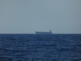
-I notice a speck on the starboard horizon and use the binoculars to identify it as a tanker on a converging course
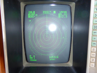
-Activating the radar I see it is 12.3 miles away heading towards us
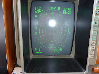
-I adjust the radar’s Electronic Bearing Line (EBL) so that it lies over the tanker and do the same with the Variable Range Marker (VRM)
-The EBL shows the bearing of the tanker from Envoy and if this remains constant we are on a collision course. If the tanker moves ahead of or behind the EBL by a safe distance no course change is needed
-The VRM shows the exact distance from the tanker to us
The approaching tanker in the distance

The tanker shows as a blip on the right side of our radar under the EBL (the white is reflection of camera’s flash). Another blip bottom left of radar is a vessel well behind us and not a threat.
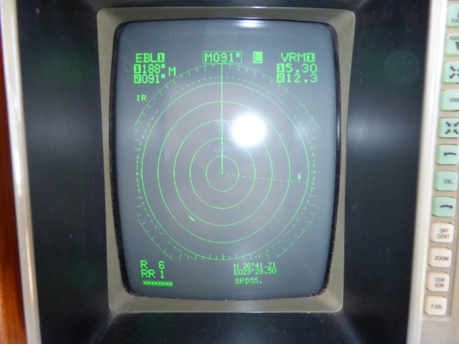
The blip has moved ahead of the EBL showing that the tanker will pass safely ahead of Envoy
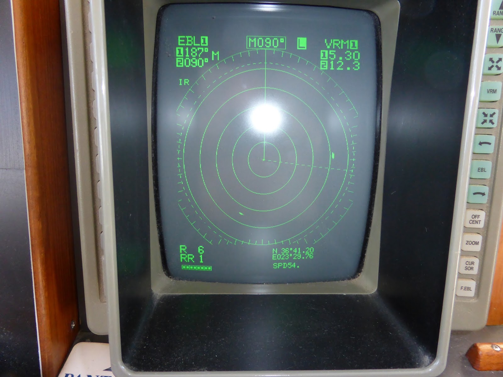
The tanker as it crosses Envoy’s bow at a safe distance of 1.8 miles
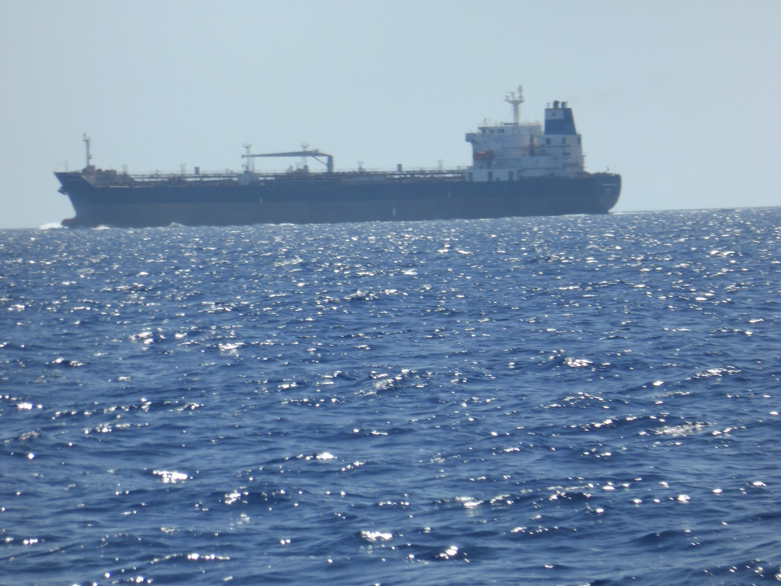
This gets to be great fun is at night time with more than one vessel approaching!
Apart from monitoring other shipping we do an hourly check recording engine temperature, oil pressure, battery charging voltage and AC and DC amps being drawn as well as a quick visual inspection of the engine room to detect any unusual smells, leaking hoses, fluids under the engine, suspect vee belts or water in the bilges.
We also took the opportunity of a lengthy cruise to check our fuel consumption and it worked out at just over eight litres per hour running between 1530 and 1640 rpm, but including three hours of generator running as well.
Ormos Provata is a great bay providing near perfect shelter for the next three days from mostly about 20 knots but up to 30 northerly winds. The seas are sufficiently rough that smaller local ferries and day tripper boats are canceled but the bay is well protected from the north and people are enjoying the sandy beach and nearby tavernas. Envoy is anchored about 300m offshore where there’s a 200mm wind chop so we take the RHIB ashore for our swims.
When the wind reduces and the seas abate we cruise to the northern side of the island noting that the rugged coastline indented with many sea caves has also been ravaged by both historical and current mining of sulpur, kaolin, alum and barium. In fact the first settlers came here in Neolithic times (7000 BC) in search of glass-like obsidian to make axes, knives and adzes. During the Bronze Age (about 2,800 to 1,100 BC) Milos became a prosperous centre of Cycladic culture. The Byzantines arrived later until the Turks took over in 1566.
But Milos is best known for the 4th century BC armless statue of Aphrodite – the Venus di Milo found by a farmer in an olive grove in 1820 and now in Paris.
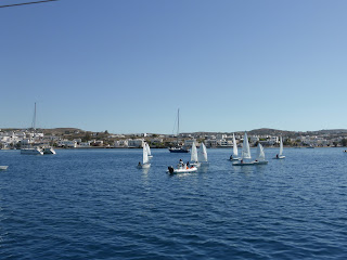
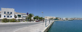
Milos is a volcanic island and in a huge bay formed by an eruption in 90,000 BC we anchor outside the marina off the island’s main town of Adhamas, a stunning village with typical whitewashed buildings on the bustling taverna-lined seafront, some interesting shops and excellent facilities to re-supply.
Kids sailing around Envoy at anchor off Adhamas

The Adhamas waterfront
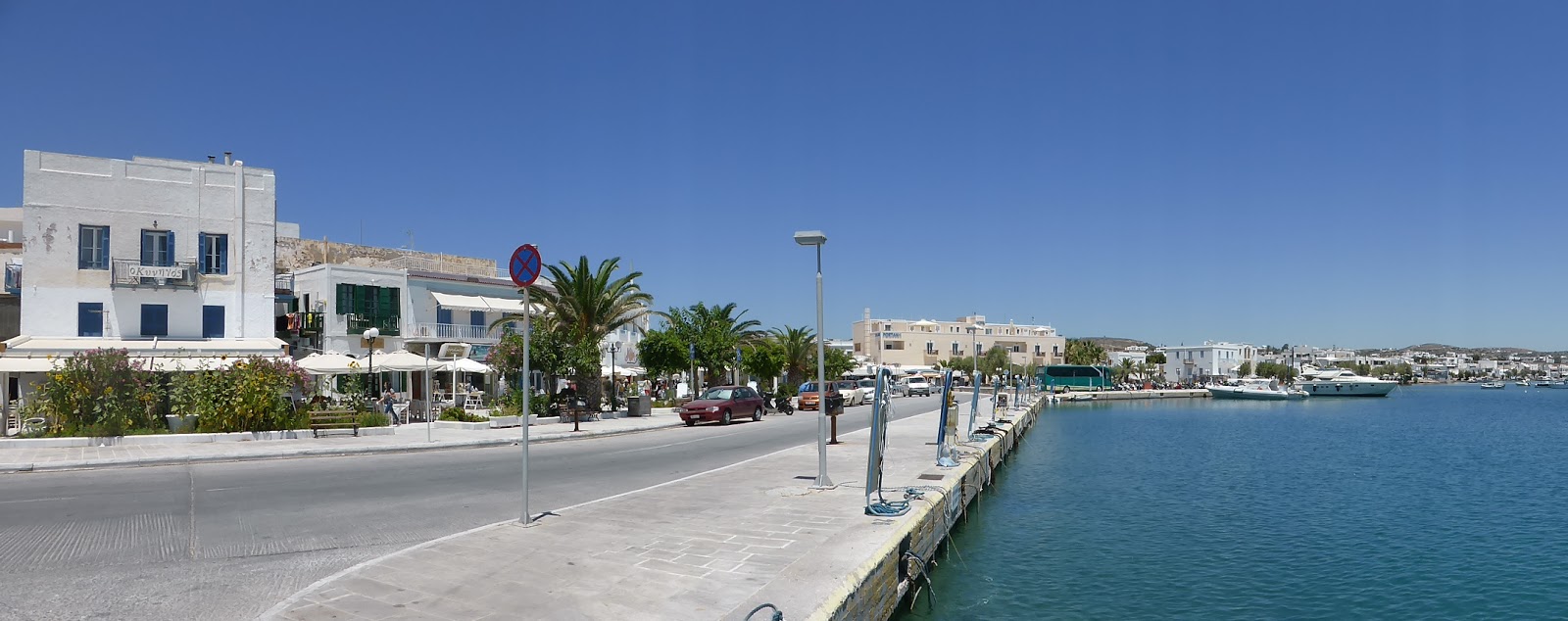
Atop some steep hills behind Adhamas sits the Chora offering superb views over the island, although little else of interest compared with other Choras we’ve visited.
The hilltop Chora above a seaside village

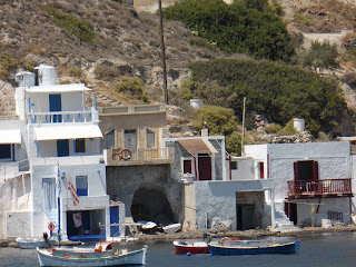
Close up of very quaint village by the sea
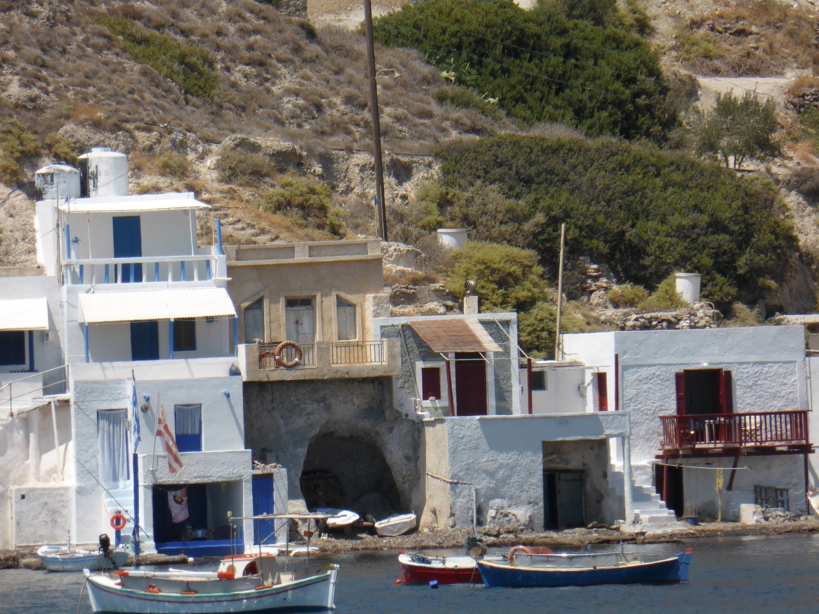
Someone lives in this dwelling built into a sea cave – at least for the holidays

FOR FOODIES
Di and I have become very partial to ice cold coffee Frappes accompnaied by a slice of the delicious cakes which are available from bakeries here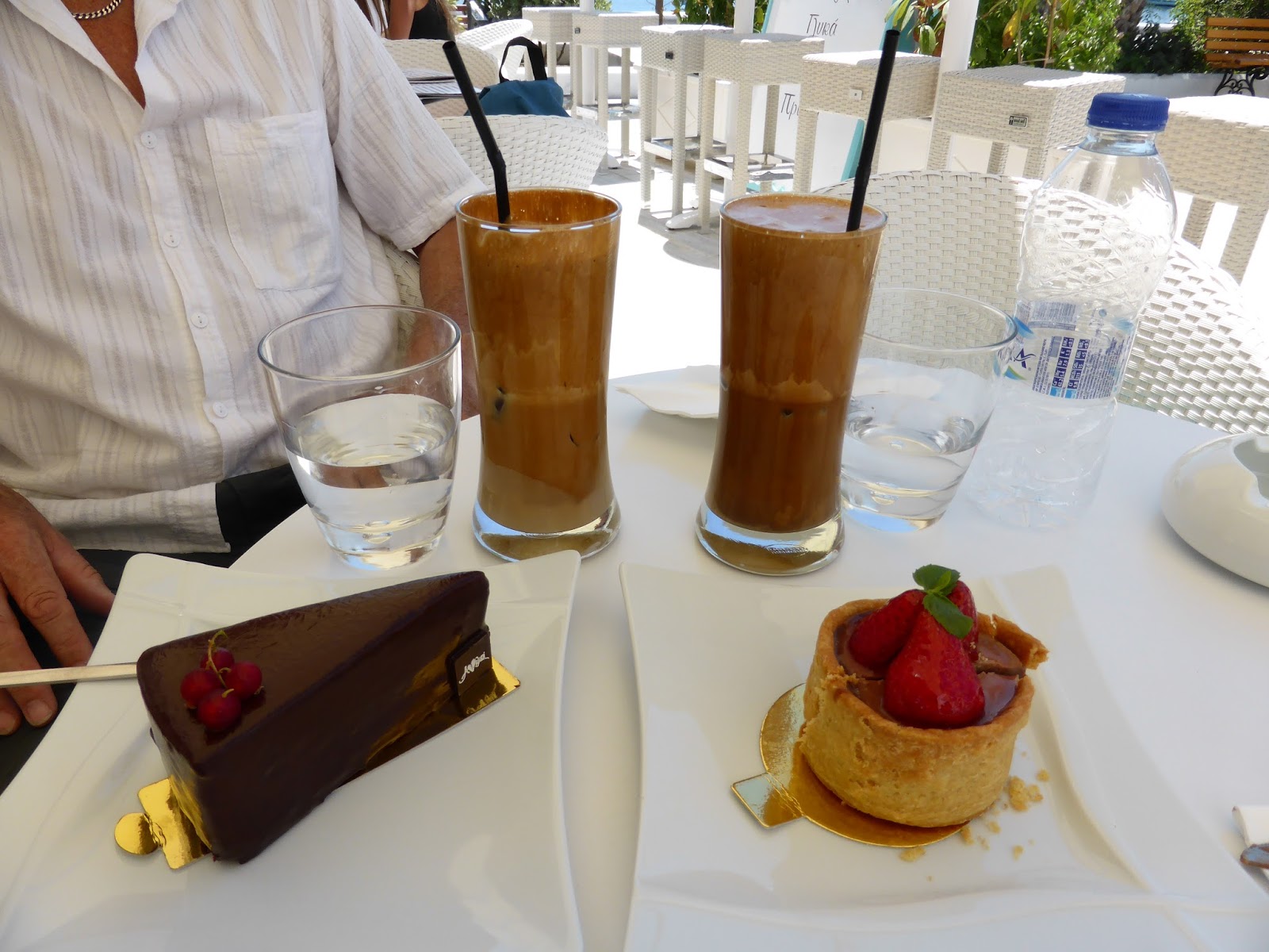
TECHNICAL
Most things are working well. I contact our Greek agent, A1 Yachting, as the RHIB’s auxiliary power supply to the depth sounder and VHF radio have failed. Their electrician fixes this in about 15 minutes charging 25 Euros (about NZ$42).
One of our two aircon units has failed, tripping the circuit breaker on powering up. I will need to find some specialised help on this later. We only use the two aircons to provide an electrical load for the generator as the refrigerator and battery charger don’t load it up sufficiently.
