
(Continued…)
2016-09 Lambard Inlet to Work Bay
Friday, May 6, 2016This is our 8th year cruising the Inside Passage to Alaska. Each year we try new anchorages. In 2016, for the first time we’ve anchored in Fish Egg, Lambard and tonight’s Work Bay. It’s a 5-hour motor from the Inlet up to…
May 4 – 5, 2016 Orange Beach to Pensacola
April 4 – The weather people were wrong again! We could have moved on before now. The bad weather that was predicted to blow through on Tuesday did not happen. It was just a cloudy day. Wednesday was a little windier than we wan…
May 5 – Hobuckin, NC
Campbell Creek – Anchorage
“God promises a safe landing not a calm passage.” —Author Unknown
We woke up to a fairly nice day…it was a little cool and the sun was out. The day deteriorated from there…the clouds got thicker and the wind pick up, making it feel more like a Texas day in March than the first week in May. We had a bumpy ride up the Pamlico Sound and by the time we anchored in Campbell Creek it was beginning to rain.
CONTINUE READING HERE…»
Hingham Bound: Direct Stuart to Morehead City
I struggled a bit with the title for this article. I considered “Windows on the Weather” or “Weather Window Around Cape Hatteras.” The first represents the utility of having three multifunction screens in the pilot house, which, when used for weather, allows us to see current conditions, forecasts and sea conditions without having to toggle back and forth between screens. The second, which represents very good news, are coastal forecasts as of Tuesday morning for relatively moderate seas (2 to 4 foot waves) on our 563 NM three day route to Morehead City and, best news of all, the forecast remains favorable for going around Cape Hatteras (3 to 5 footers).
That said, the weather is not perfect – see coastal forecast above. While sea conditions appear favorable, the forecast calls for a chance of showers and thunderstorms. This is the result of a weak low pressure center situated over North Carolina with a slow moving trailing cold front. According to NOAA, that system moves very slowly northeast creating several days of mostly sunny weather with occasional showers along our route.
The “official” title, “Direct Stuart to Morehead City,” encompasses the gestalt of a very good situation. We are 5 hours ahead of our original plan (see article Bank Error in My Favor) with a favorable weather forecast. So approximately 72 hours after clearing the Saint Lucie Lock and barring no surprises, we will be refueling in Morehead City on Friday morning and then headed for Cape Hatteras for an early evening passage.
Now to the trip.
Not wanting to sacrifice any of the 5 hours saved on Tuesday, we decided to depart River Forest Yacht Center early (6:27 AM) so that we would arrive at the St Lucie Lock, one mile east, well before its 7:00 AM opening and, hopefully, be first in line. The first challenge was backing out of the marina. The photo below shows the marina configuration, which is a narrow channel with boats tied to the concrete wall on either side. While it may have been possible to turn around, we choose to back out. No big deal especially with a remote control and no wind.
The plan worked. We arrived at the lock at 6:55 AM and were first in line. However, the lock process was slow. Paint dries faster. We waited 13 minutes to enter the lock and from there it took 30 minutes to lower us 14 feet to the Saint Lucie River.
Photo of the tour boat.
Now we were free. We continued east on the Saint Lucie to the junction of the Okeechobee Waterway and the Atlantic ICW where I had to make a decision on whether to turn north on the ICW and head for the Fort Pierce Inlet where we would access the Atlantic Ocean or access it through the Saint Lucie Inlet. According to Active Captain, the Saint Lucie Inlet requires “local knowledge” as it is not a commercial inlet. A quick call to Tow Boat US said it was well marked and that the dredges were not a factor. The Tow Boat US captain also reported shoaling just short of the junction, which was a problem no matter which inlet decision we made. We saw as little as 1.5 feet of water under the keel as the entered the junction.
Picking up the Atlantic at Stuart rather than Fort Pierce had real advantages. First, the southeast wind would be on our tail producing a following sea and increased speed. Second, we could engage the pre-planned route to Morehead City and run on autopilot. Third, we would eliminate the narrow ICW channel and last, we would not be slowed by currents. The Saint Lucie Inlet was “as advertised” and at 9:40 AM we engaged the autopilot and headed for Morehead City NC 555 nautical miles and 72 hours away.
“Hours of boredom punctuated with moments of stark terror.” I learned this phrase years ago when I flew airplanes as an instrument rated private pilot and it very well describes what can happen. I have many tales. Now change the word “moments” to “hours” and the phrase now works for boating. As readers who follow this blog know, I have some pretty wild tales.
Sorry no wild tales at this time and hopeful not on this voyage. On my 4 to 7 AM watch Wednesday night I did a complete review of the weather for the remainder of our route and as of 8:00 AM the weather window remains open and OK enough. So much for boredom even on a three hour watch.
We have been busy ever since exiting the Saint Lucie Inlet. Once on open water we had time to review, in detail, the “Crew Orientation and SOP” and Medical Emergency Checklist” documents that I provided to Wylie and Tom weeks before departure. To their credit both had read the documents and our review led to a productive discussion of each item. We still have to review the Abandon Ship Procedures, which given the fact that we are 10 miles or more from shore “might” just be appropriate.
Other activities include checking weather, performing engine room checks, keeping our detailed log, making dinners, reading, playing Scrabble, discussing politics and, yes, even watching a little TV. We noted as of Wednesday that Donald Trump was now the presumptive Republican Nominee. (Another note. None of us our Trump fans.)
We did have a bit of excitement on both Tuesday and Wednesday, both related to electronics. We’ll start with Tuesday. As the day came to a close we got out the SOP and worked through the preparation for night operation. This includes dimming the instruments and blocking other light sources. Finally we turned on the Raymarine T353 infrared camera. Oops, the unit did not boot up. Not good. The T353 consists of a camera mounted on the hardtop and a JCU (joystic controller unit) on the panel. The JCU had power and was responding as it should. The camera was dead. Fortunately we were on Eastern time. I called Raymarine and spoke with Steve Cruz. Steve and I have, shall we say, a relationship. Not all bad, but not all good. More in a separate fascinating article to come.
Steve walked me through a series of troubleshooting steps, one of which was seeing if the camera moved left, right up and down in response to the JCU. The camera was not moving even though the JCU was responding correctly. I’ll spare you the details but we concluded that the unit was originally installed improperly (without a dedicated circuit breaker) and therefore was “on” 24/7/365. Because elements of my system are used without the T353, it became out of sync. Steve proposed a reboot on the entire system and, bingo, the problem was solved. More on this in a separate article.
Wednesday, as we were cruising along, Wylie asked me why the target tracking feature (MARPA), which is activated on the radar screen failed to show up on the chartplotter as it had the day before. Since it was mid-afternoon I called Garmin and spoke with Michelle, a technician. We worked together for over an hour during which time other glitches emerged. Interestingly, a restart of the entire system solved 80% of problems. Michelle did a fine job. I lost cell service before we finished so some issues remain open. Thank you Michelle. Michelle, like other Garmin techs, provide incredibly competent tech support.
Back to the Abandon Ship Plan.
Did I mention that this article was written on Thursday afternoon? (No. consider this new information.)
Did I mention that we were 10 miles of shore when it dawned on me that it might be wise to review it? (Yes, and the plan is mention several paragraphs earlier?)
Did I also mention that there was a “chance of isolated thunder storms” in the forecast for our route segment today?
Did I mention that I took my own advice and we all sat down in the pilothouse to review the plan?
Did I mention that while reviewing the plan with the crew all HELL broke loose? (No, I did not but you might want to read the next article – “Spoke Too Soon.”
Written by Les.
VANUA BALAVU (Part 2)
VANUA BALAVU (PART 2)
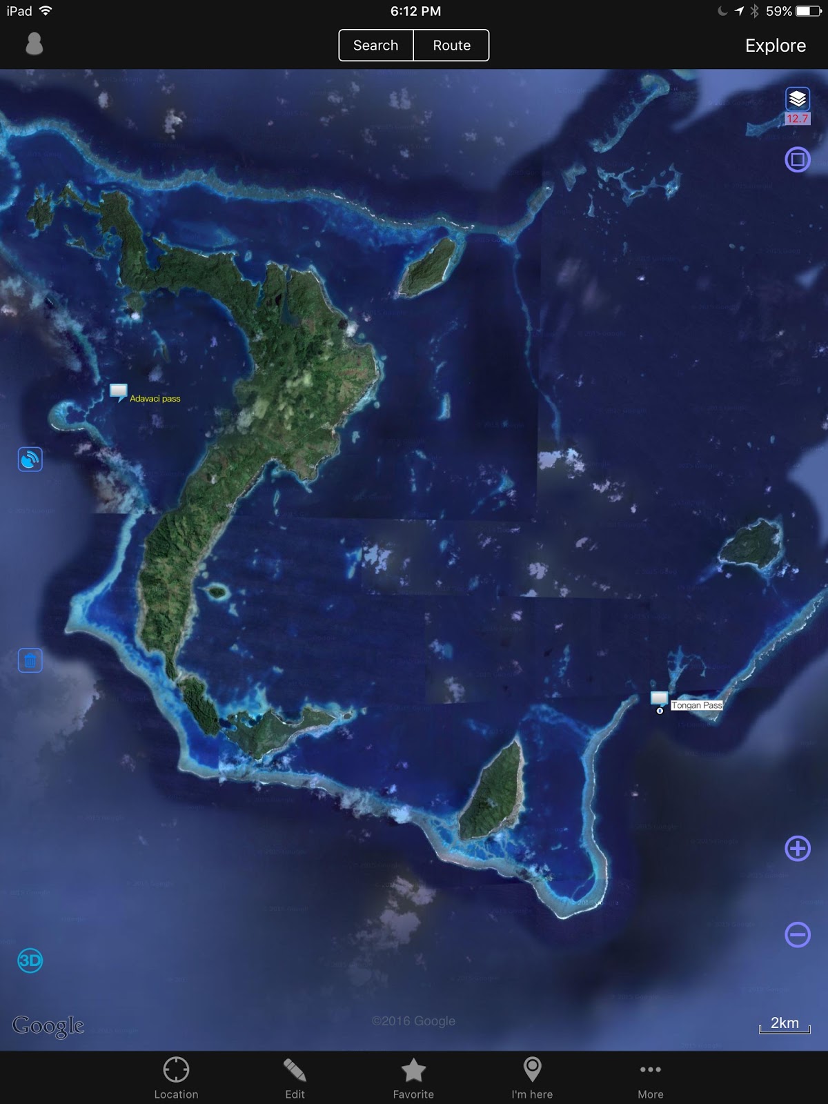
EAST AND SOUTHEAST
Opua (NZ) – May 6, 2016 – This is the second installment of my compendium of navigation notes on the Lau Groups, Fiji.
*** Disclaimer – This is a collection of waypoints, anchorages and routes that I have gathered from other cruisers, websites, guides and seminars I attended. DOMINO has not navigated in the Eastern lagoon of Vanua Balavu and we have not tested these waypoints. Furthermore, in the aftermath of Cyclone Winston, the seafloor may have been littered with debris and the anchorages may have been altered. We recommend caution and a sharp lookout, daytime navigation in good conditions only! ***
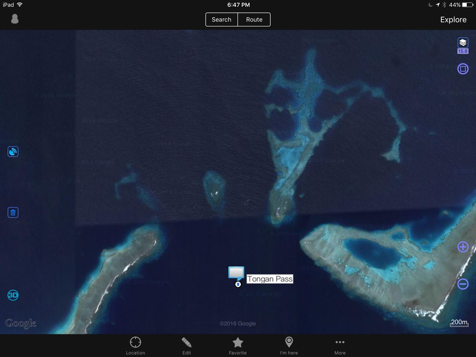
1 – The Tongan Pass – This is the SE pass into Vanua Balavu and the most direct route to Lomaloma. A reef bisects the entrance of the pass, so cruisers have to go east or west of that reef. Although I have waypoints for both sides, I have more reports for the west channel.
 |
| Tongan Pass – The route entered is for the western channel… The eastern channel is possible as well |
2 – Munia Island Anchorage – A good anchorage before or after transiting through the Tongan Pass.
 |
| Munia Island Anchorage point |
3 – Susui Island – There are 2 anchorages possible –
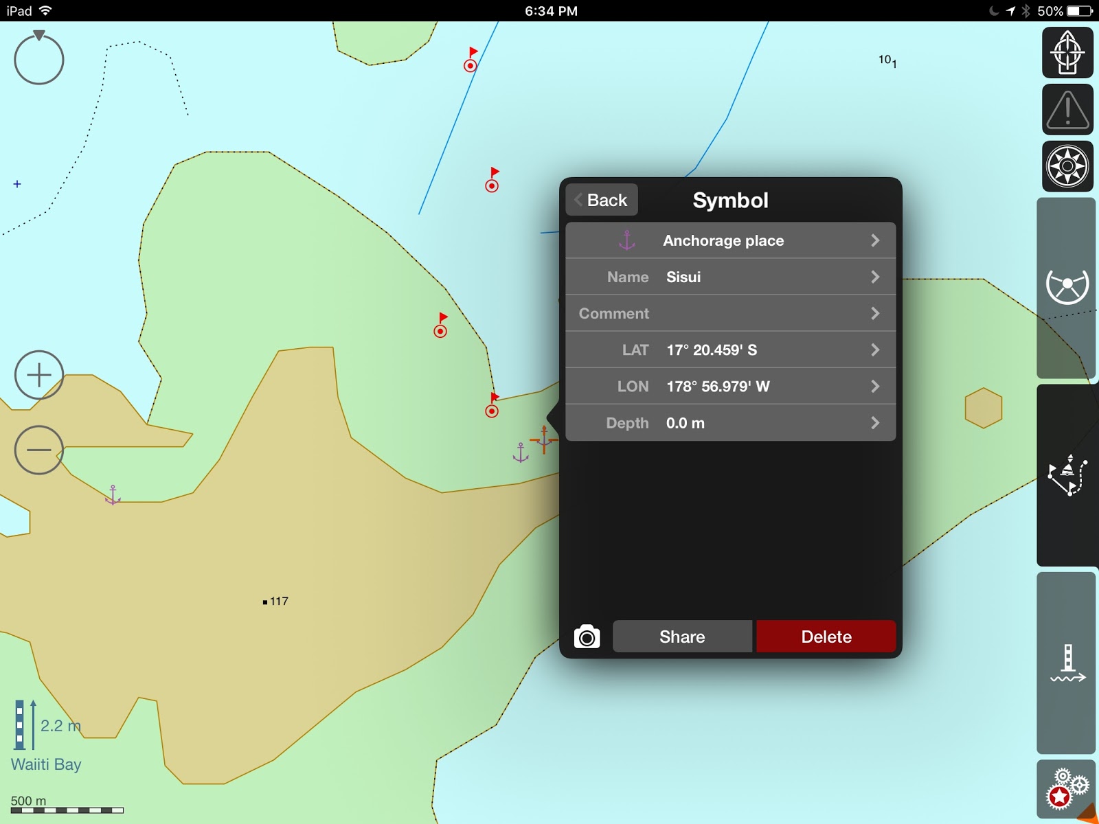 |
| Sisui |
4 – The Hidden lagoon – Possibly, the locals at Susui can give cruisers directions to the Hidden lagoon.
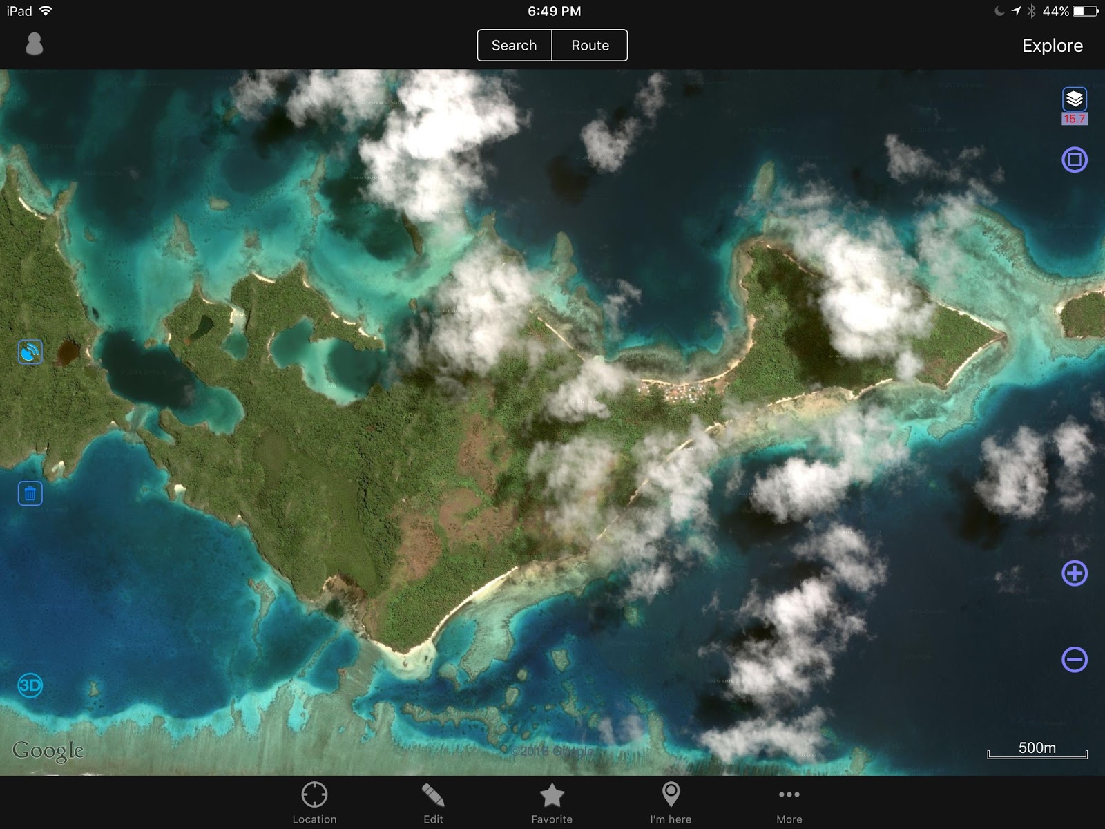 |
| Susui Island: Anchorage and Hidden lagoon |
 |
| Sisui – Hidden Lagoon Anchorage Point – unsure if the lagoon is accessible |
5 – Lomaloma to Susui
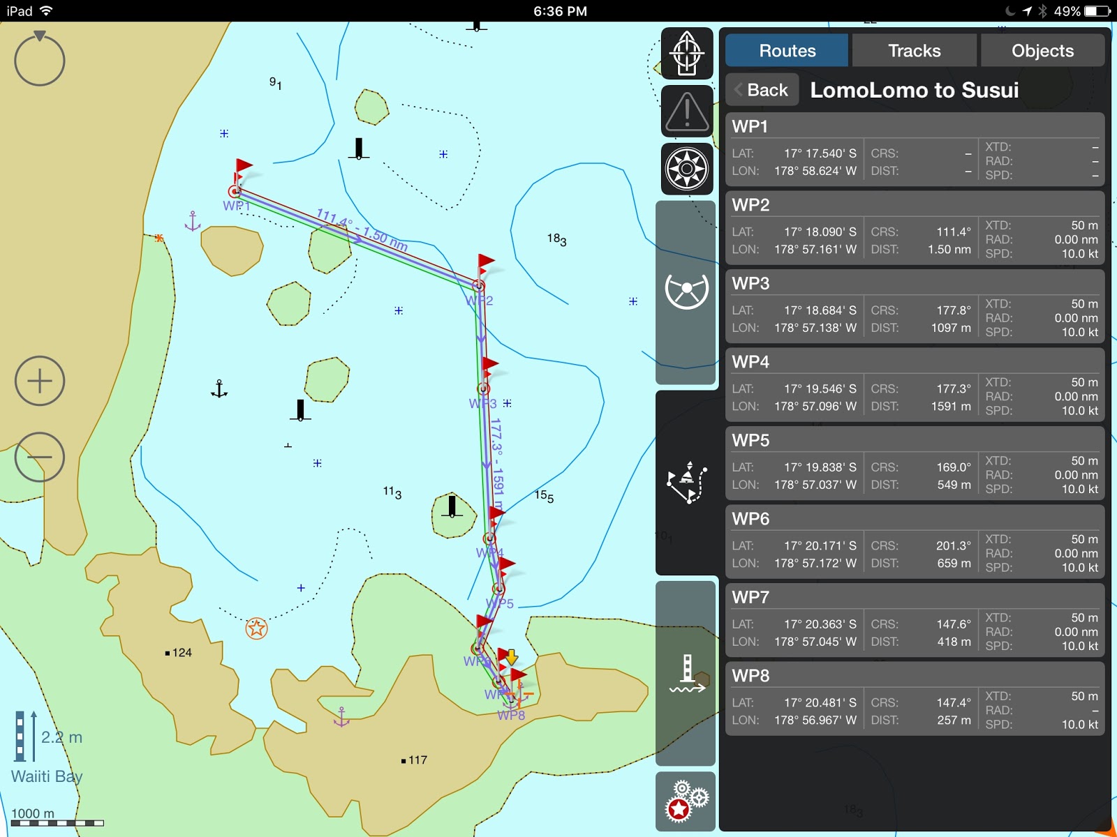 |
| Lomaloma to Sisui |
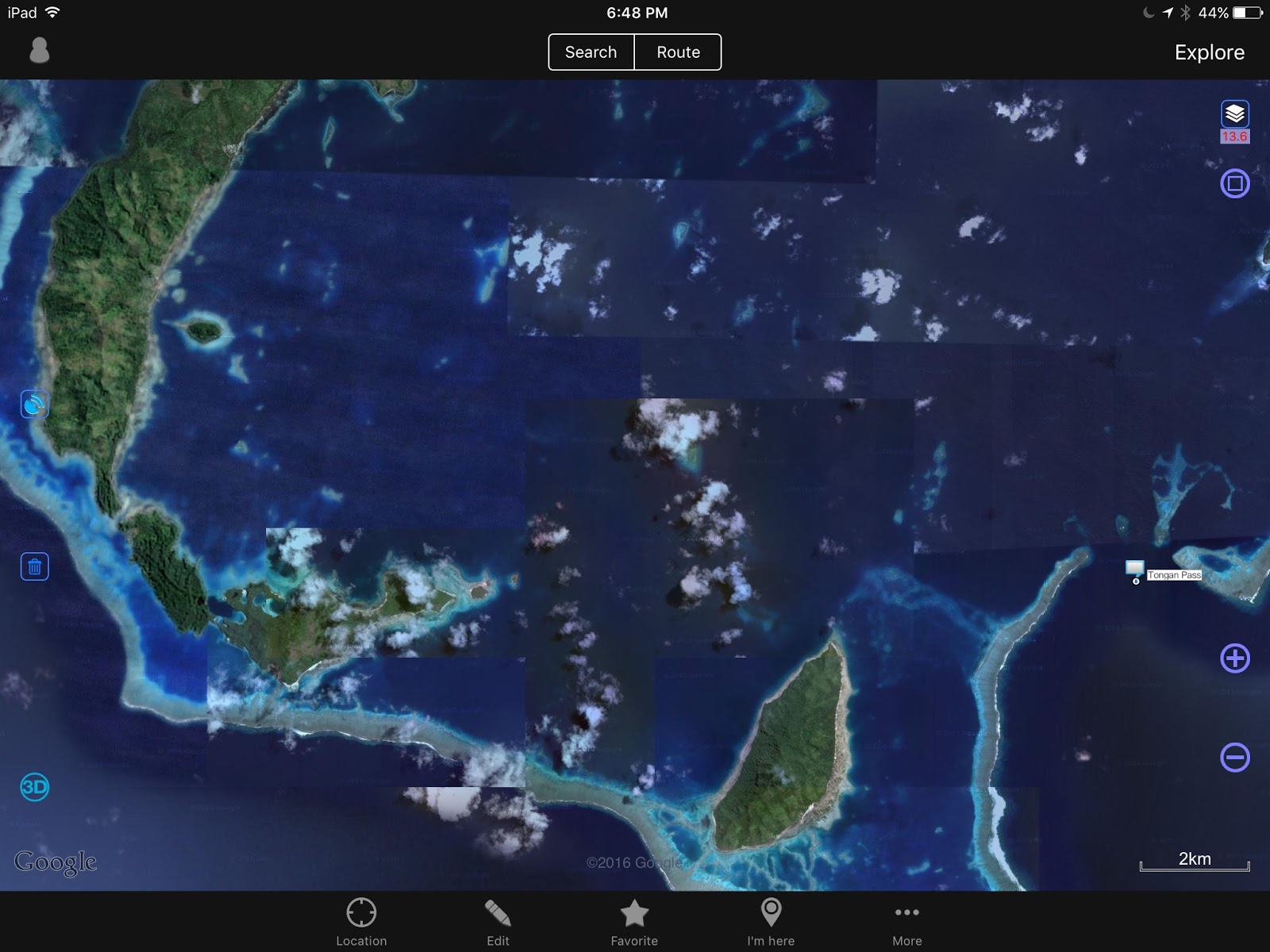 |
| Lomaloma to Sisui, and Munia Island |
6 – Tongan Pass to Lomaloma
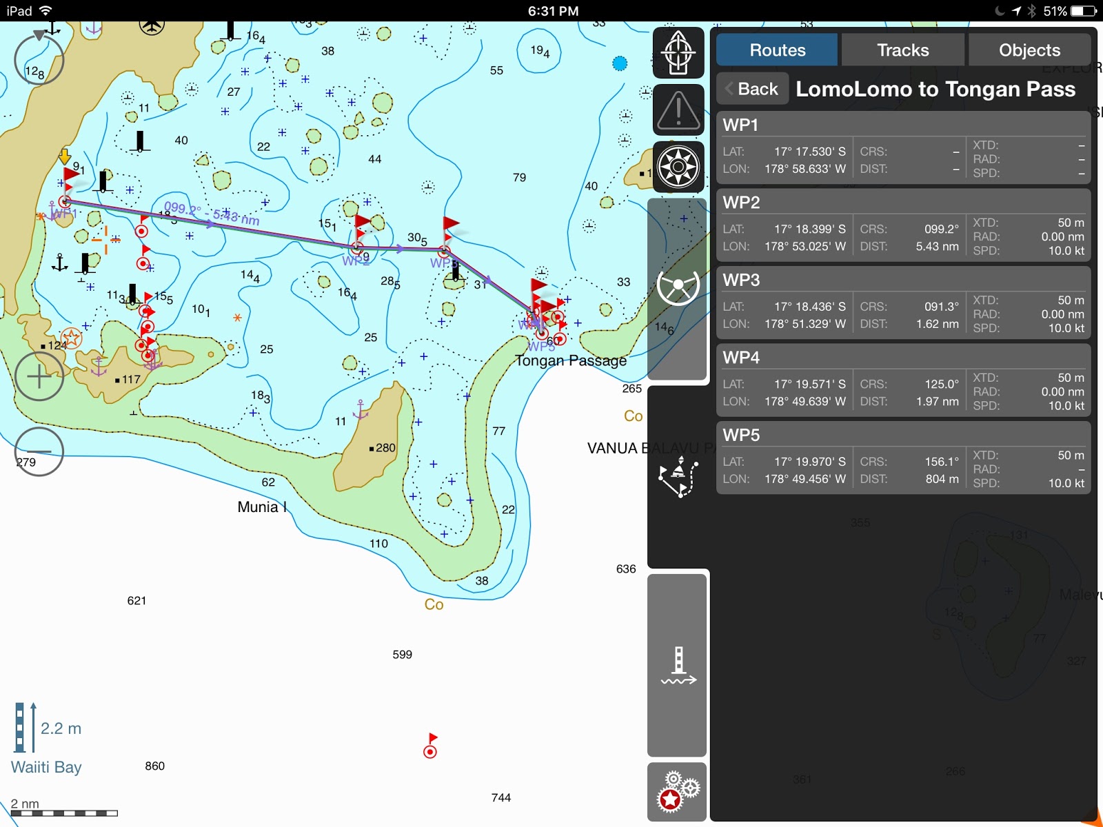 |
| Tongan Passage to Lomaloma |
7 – Lomaloma anchorage –
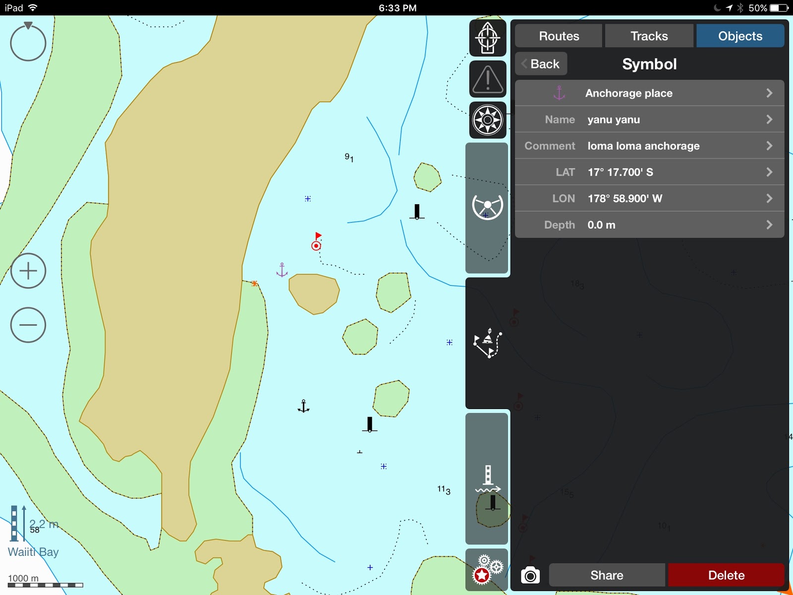 |
| YanuYanu = Lomaloma |
8 – Mavana –
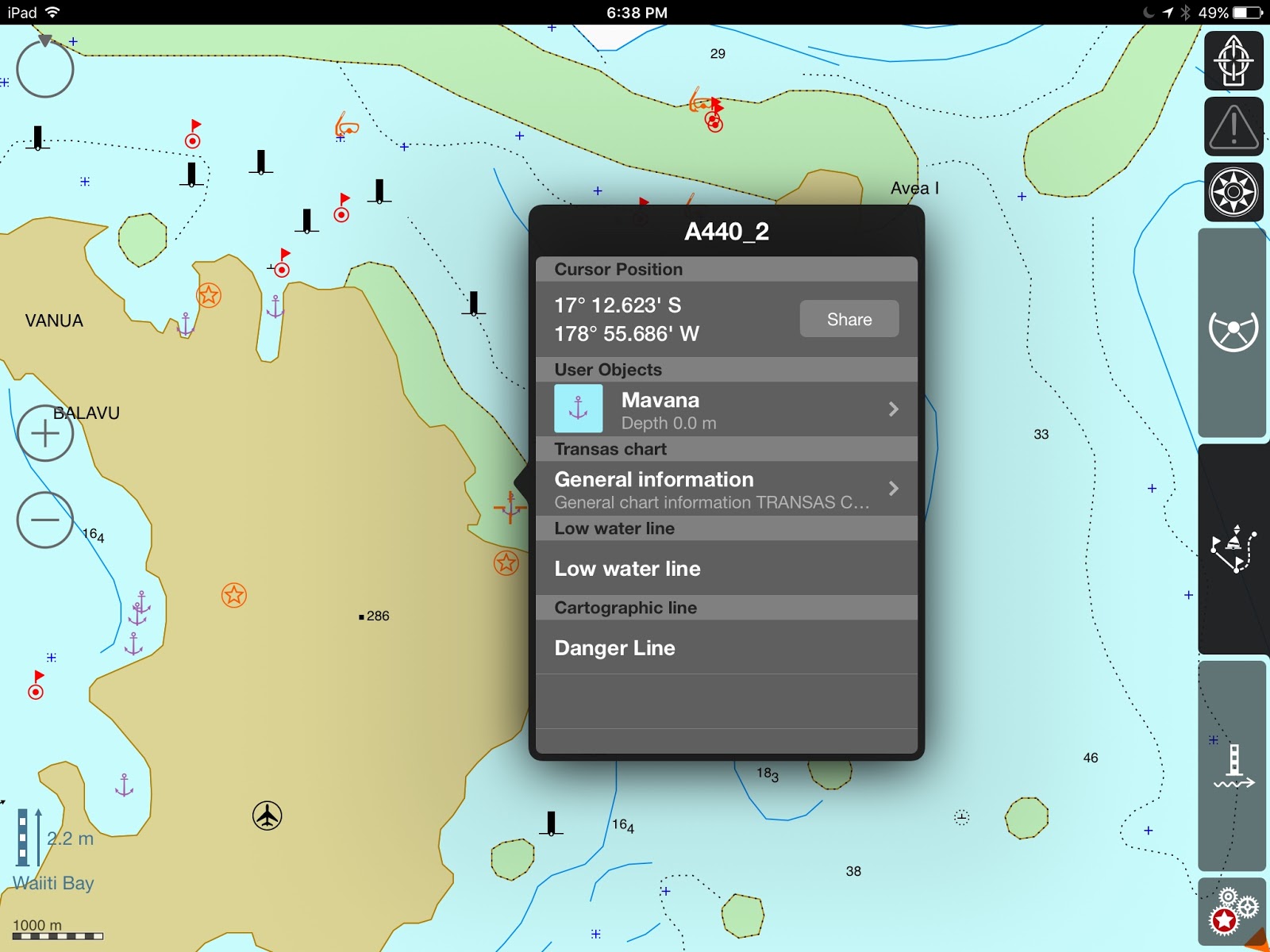 |
| Mavana Anchorage |
9 – Lomaloma to Mavana –
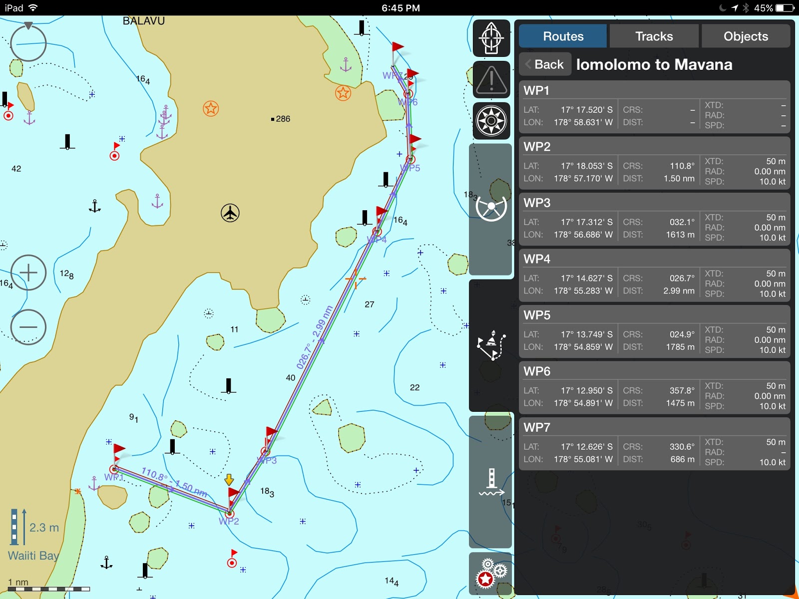 |
| Lomaloma to mavana |
Again, we have not experienced these anchorages and we expect they have most suffered from a 30’ surge and 165 mph winds. I wish I had recent Google satellite pictures to share, but all of these are pre-Winston.
In any case, be careful!
Until next time
dominomarie
Vライン限定の脱毛の場合は…。
フェイスとVIOライン脱毛のどちらもが含まれた上で、何よりも低料金の全身ミュゼなどの脱毛コースを頼むことが必要…
My brother Dave
Dave and Mary Margaret have sailed around the world in their catamaran Leu Cat. A link to their blog is on the side. You should visit. They are awesome sailors. But, Dave is an amazing blogger, blogging nearly every day of their 8 year journey. He…
VANUA BALAVU (Part I)
VANUA BALAVU – West and North
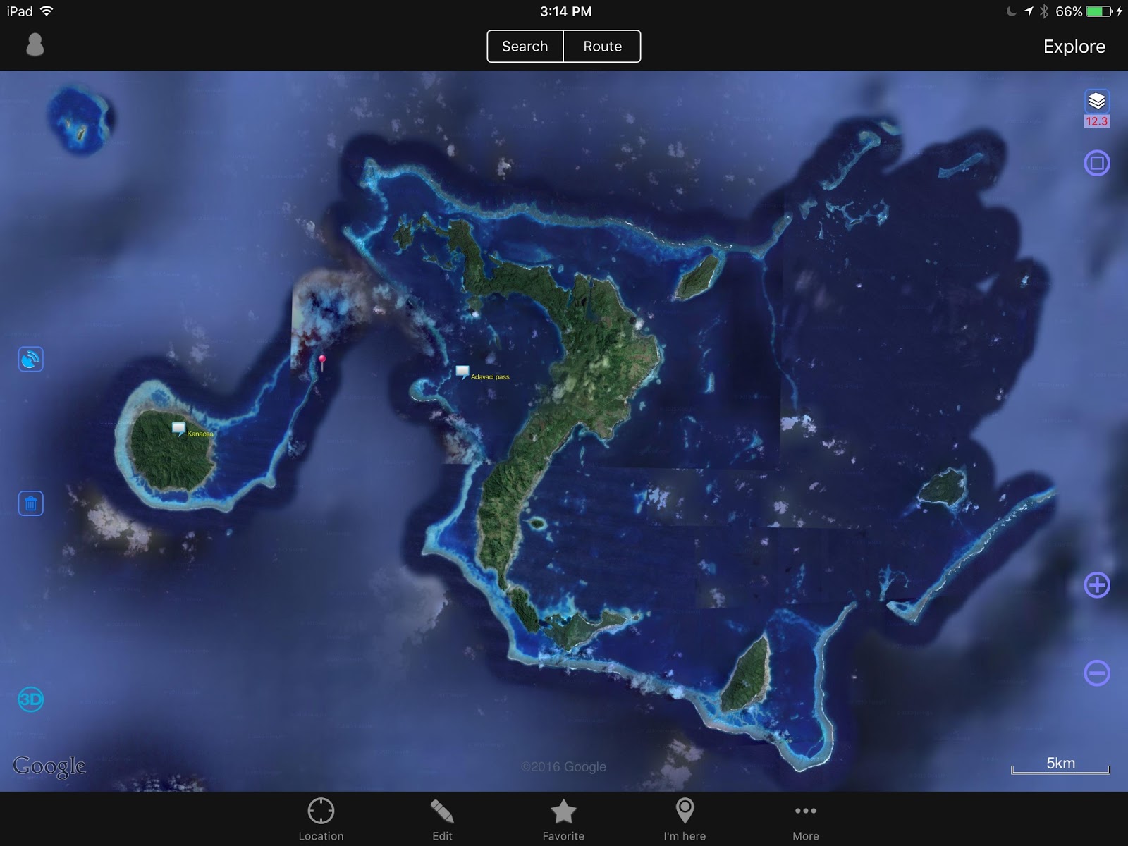 |
| Vanua Balavu, Northern Lau Group, Fiji 3 passes: Qiliqili to the NW, Adavaci to the W, and Tongan Pass to the SE |
*** Disclaimer — These navigation notes have been gathered from many sources as well as from our own experience. After Cyclone Winston, we can expect that many navigation beacons and marks have disappeared. We can also expect that, in some places, the coral beds have been damaged and perhaps re-arranged. The litter and rubble in the anchorages is unknown. Use the provided information using your own discretion, and keep a sharp lookout. Do not navigate inside the lagoons and passes in poor visibility. ***
Note that DOMINO draws 1.2 meter (4′) –
QILIQILI PASS (NW PASS)
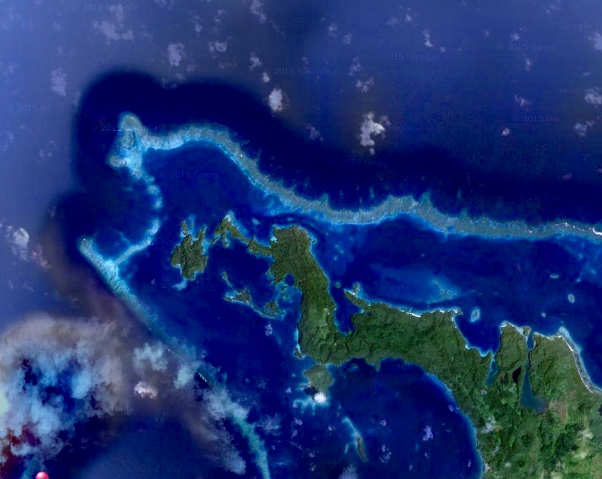 |
| Qiliqili Pass (NW end) |
- Photo 1 – Vanua Balavu – General Location of Northwest pass entrance (Qiliqili)
(NOTE – iSailor files may still be available for download on my Google Drive )
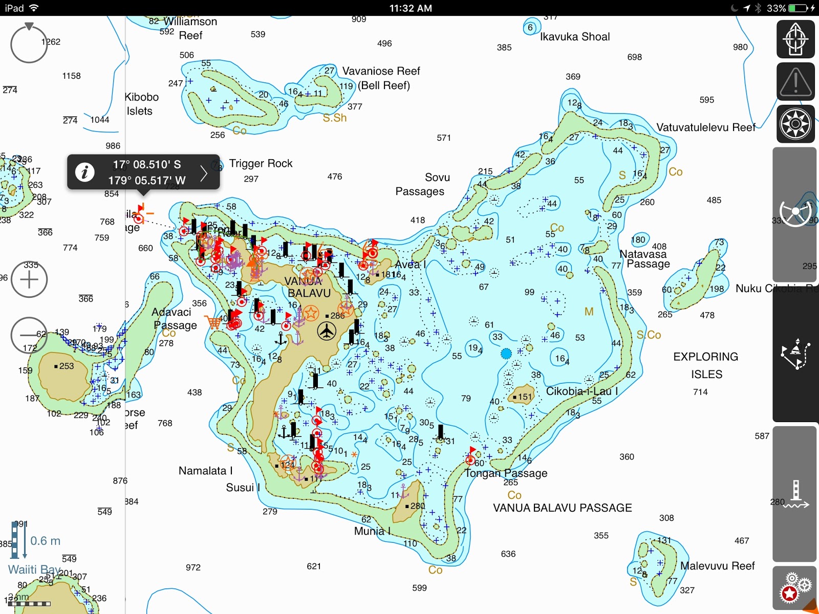
- Photo 2 – Vanua Balavu NW Pass (Qiliqili) to Delaconi village – Waypoints 3-11
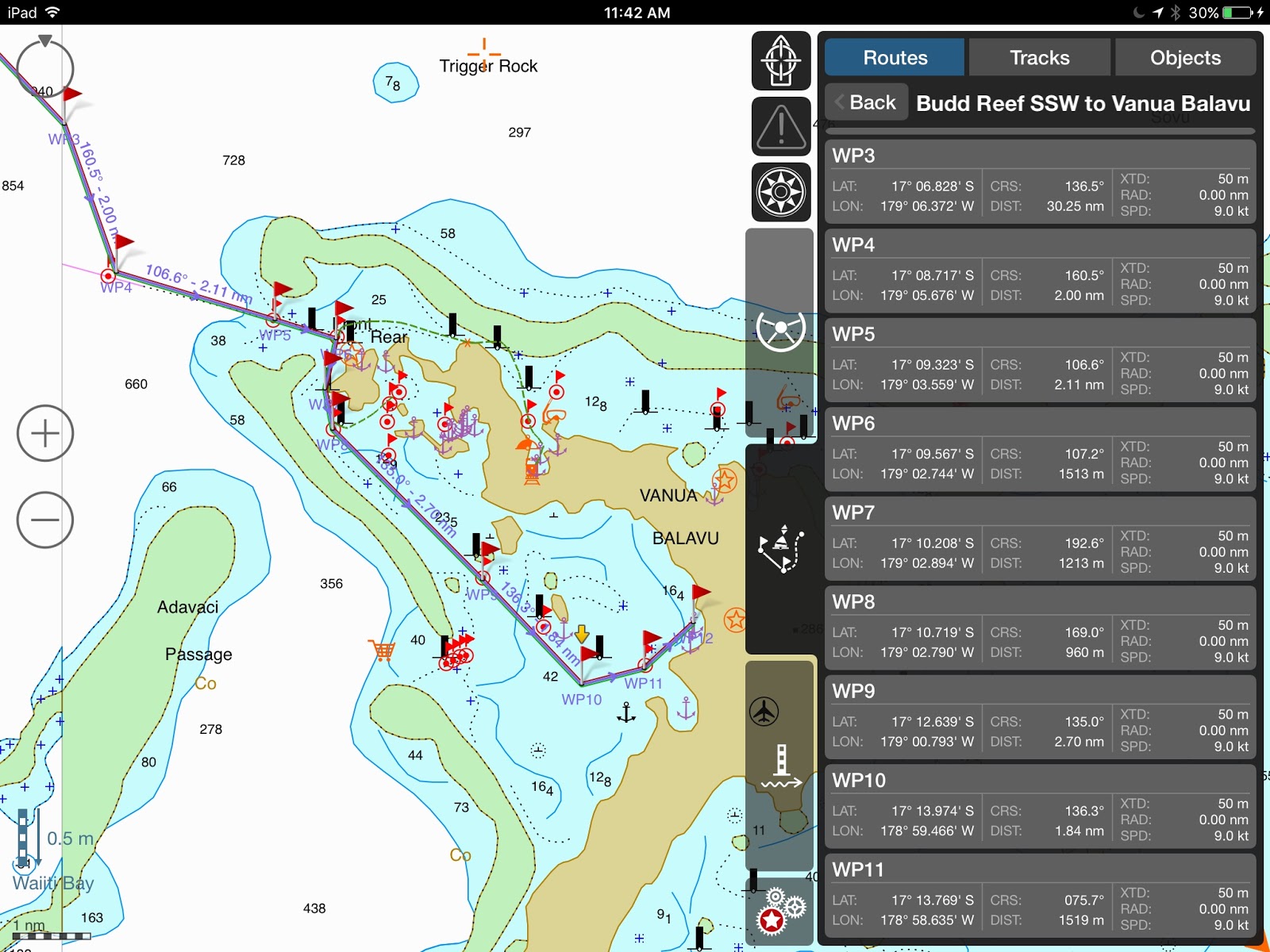
- Photo 3a – Vanua Balavu – Domino’s track from Qiliqili Pass to Delaconi anchorage

** CAUTION ** Be mindful of the small reefs when approaching the village – The holding at Delaconi village is marginal, lots of rocks and rubble. It is rolly in any SW to NW condition. Then, a better anchorage can be found just west of the airstrip.
- Photo 3b – Delaconi – Airstrip anchorage
 |
| A bit of a dingy ride to the village, but the “airstrip” anchorage is popular in westerly conditions |
Getting to shore by dinghy, look for the small opening in the reef, not wide but present at low tide… not no much worry at high tide.
ADAVACI PASS (SW PASS)
- Photo 4 – Vanua Balavu – Adavaci Pass (SW) – Waypoints 1-7 – This is a straight shot west of Delaconi Village. One of the reasons while the anchorage is rolly in westerly conditions, but a quick way to get out. At any rate, only advisable in calm and clear conditions as there are bits of reef to be avoided.
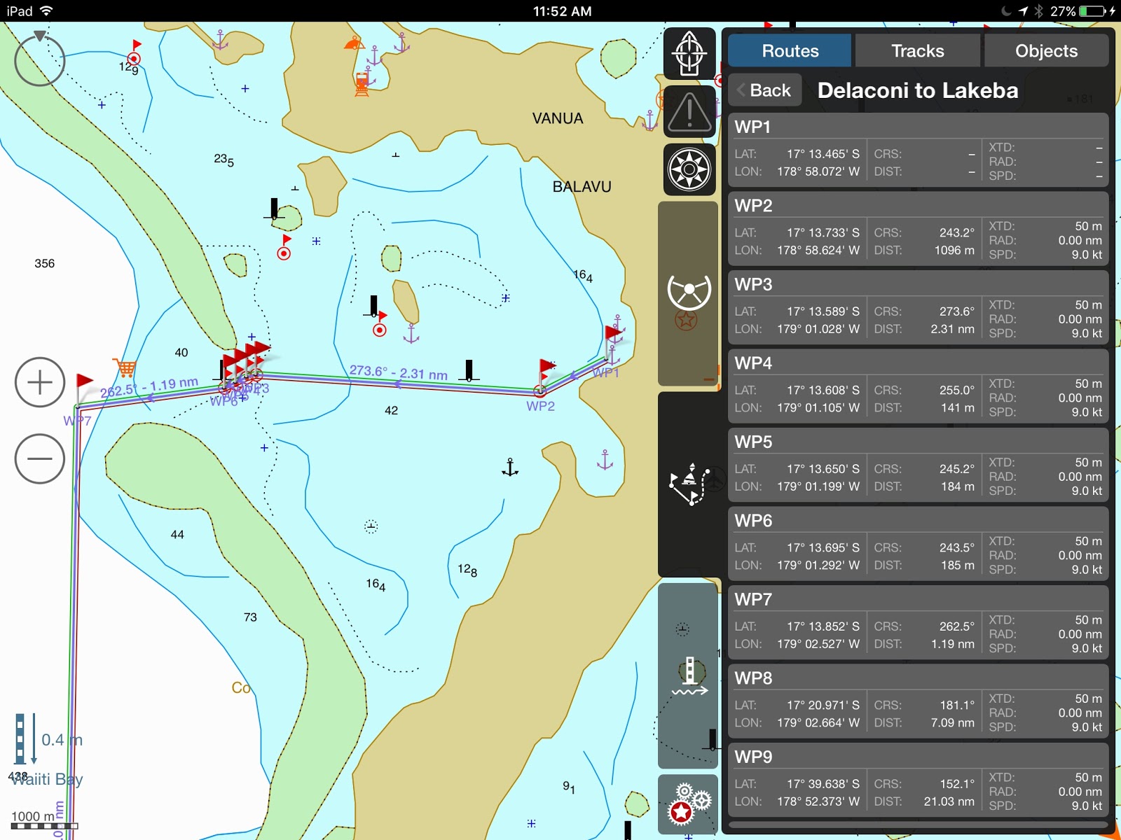
Photo 5 – Vanua Balavu Adavaci Pass (SW) – Detail – WP 3-6
(The orange food cart denotes good fishing!!!)

BAY OF ISLANDS
When the anchorage in Delaconi gets too rolly and windy, the Bay of Islands (BoI) offers good protection from most directions. Some yachts may find it hard to anchor in the 17-20-meter depth, but the holding is good. With a bit of poking around, you can find shallower spots.
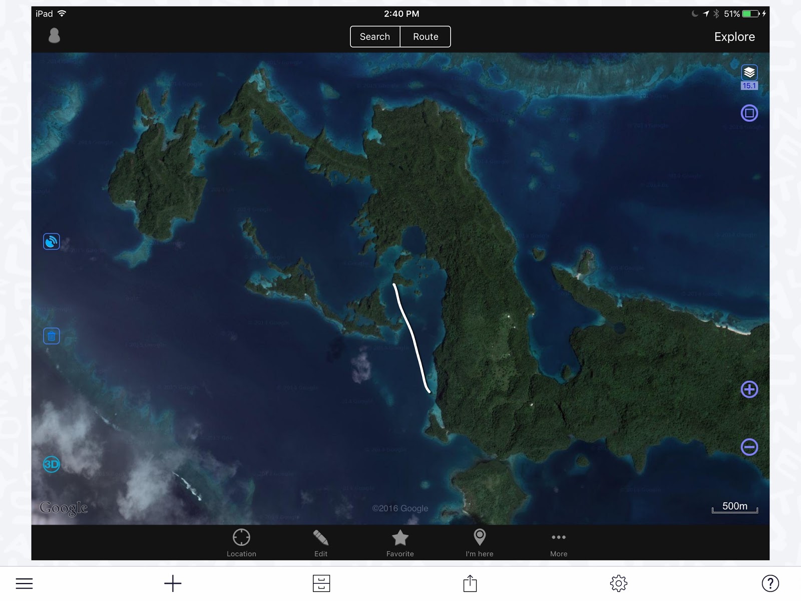
To get to the BoI anchorages from Delaconi, we found it safer to track back towards Qiliqili Pass and enter the “dogleg” track. Always trolling a couple of lines, always catching a Sierra (Spanish Mackerel) or two!
We’ve seen some yachts take the shorter “inside passage”, but only with excellent visibility and 2 lookouts on deck, and it’s a gutsy passage I would’t try. S/Y Rewa did it and we watched them hesitate and backtrack between rocks and reefs!
 |
| The “Inside Passage” to the BoI – Not recommended! |
Photo 6 – Bay of Islands “Dogleg” and Domino’s track
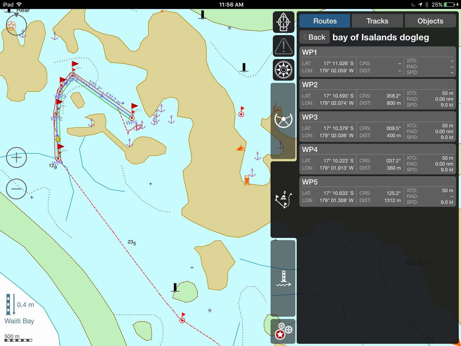
Photo 7 – Bay of Islands Anchorages – There are many of them in The “Swimming Pool”, but there is no need to be on top of each other. It’s a wonderful area to explore, find the caves, look for the fruit bats, and kayak around. The nook at the northern end is a good overnight spot while waiting for good conditions to exit. Note that the “Front” and “Rear” beacons are most likely gone.
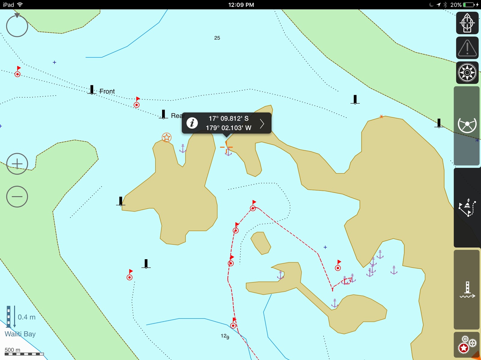
BAY OF ISLANDS TO MBAVATU (PLANTATION)
Photo 8 – DOMINO’s track – to enter Mbavatu, use Wpts. 2 and 1
** Note that at the northern end of the island, the reef extends farther out than on the chart. Keep a sharp lookout… most of the marks may have disappeared ***
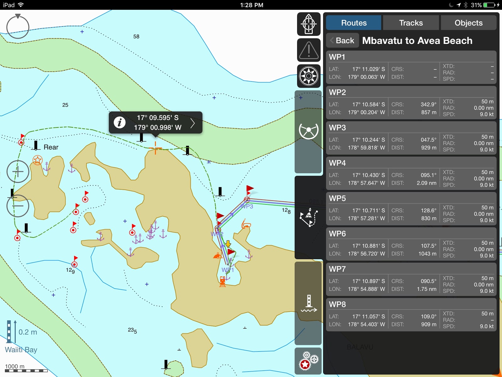
Photo 9 – Rounding over the top… notice the reefs in the north channel… careful… only do on a clear day!
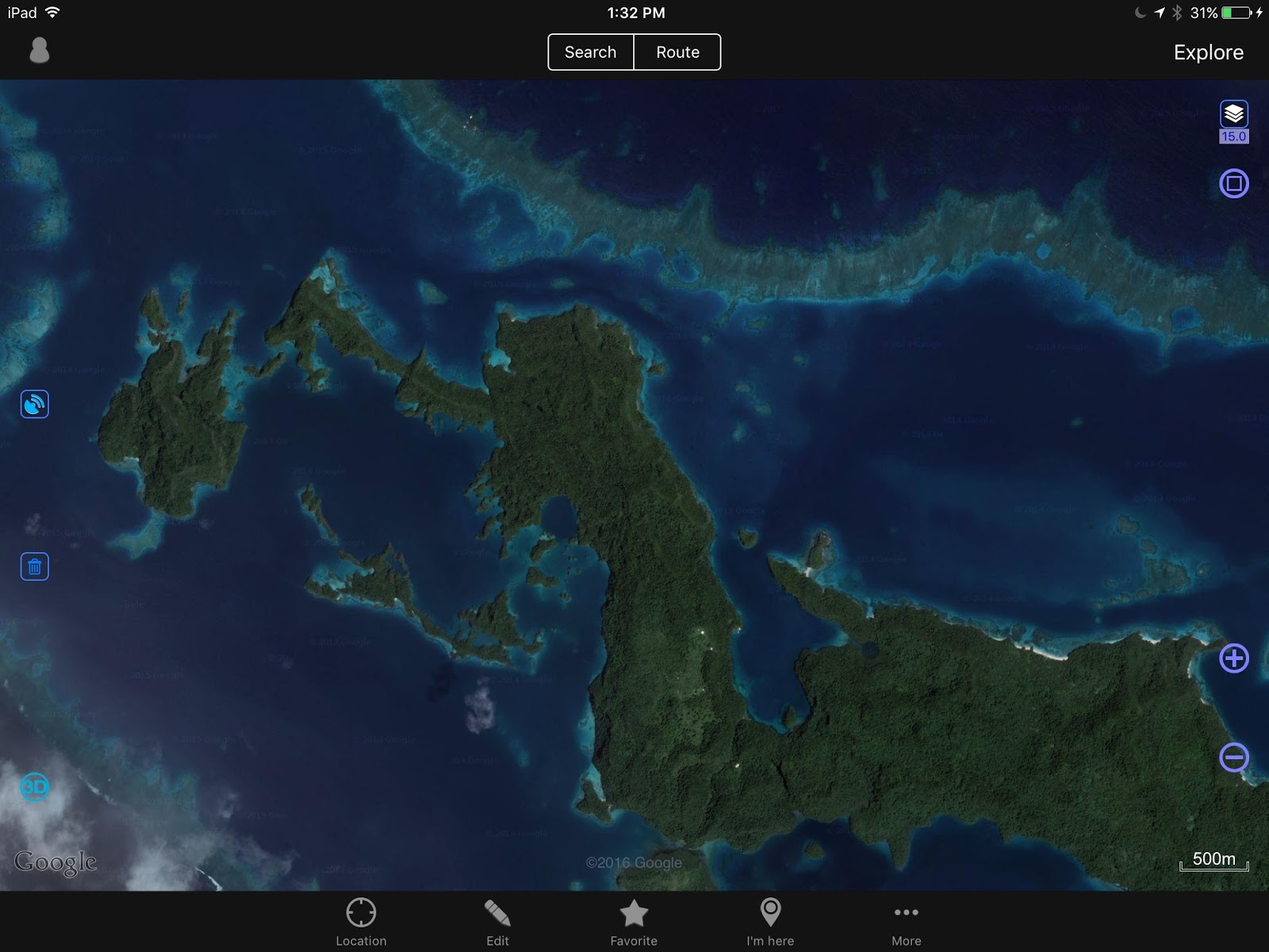 |
| OVITALMAP satellite photo |
Photo 10 – Mbavatu Harbor – There are several anchorages, but the closer you get to shore, the more likely you are to encounter rocks. Also, the anchorage in the NE hook has been proven to get rolly as the rocky shores reverberate and amplify any kind of wave action. We just prefer to anchor smack dab in the middle! The “Yacht Club” moorings on the Western end may be gone, the Yacht Club building too… The Landing is at the bottom Western side of the bay. Just walk up the hill and you should get to the coconut oil plant, or what’s left of it. Higher yet is the coconut plantation and workers’ village… if still standing.
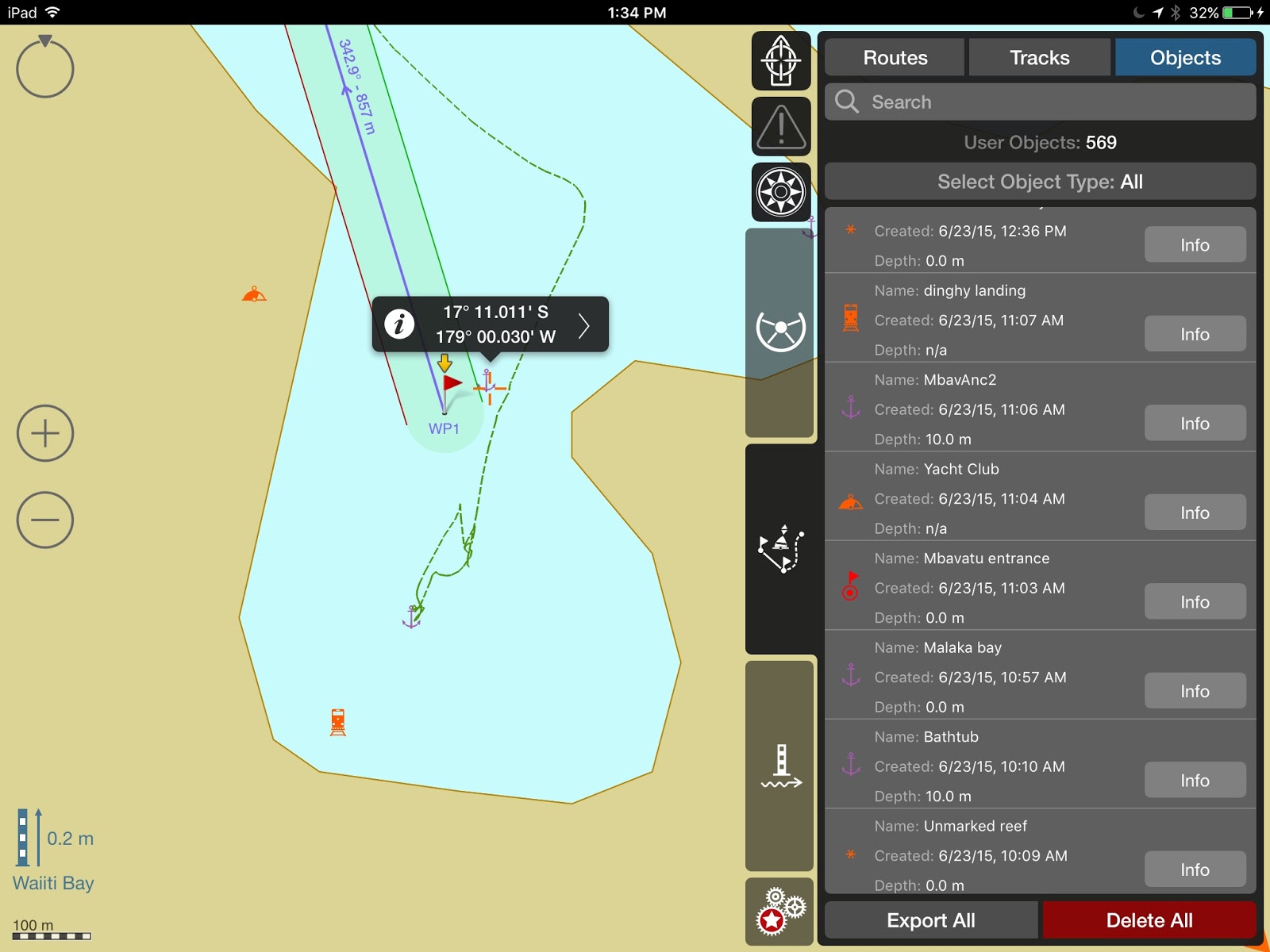
Photo 11 – Mbavatu Harbor
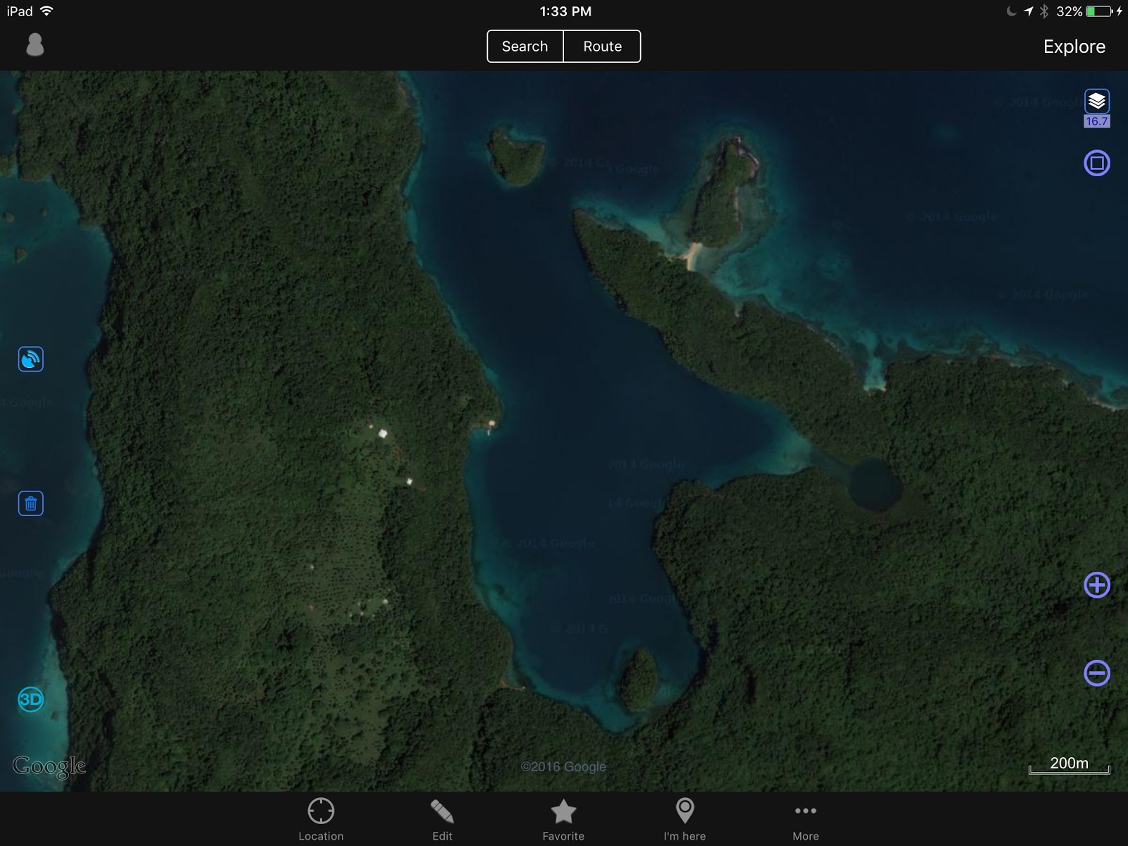 |
| OVITALMAP |
Photo 12 – Horse Bay and Little Bay
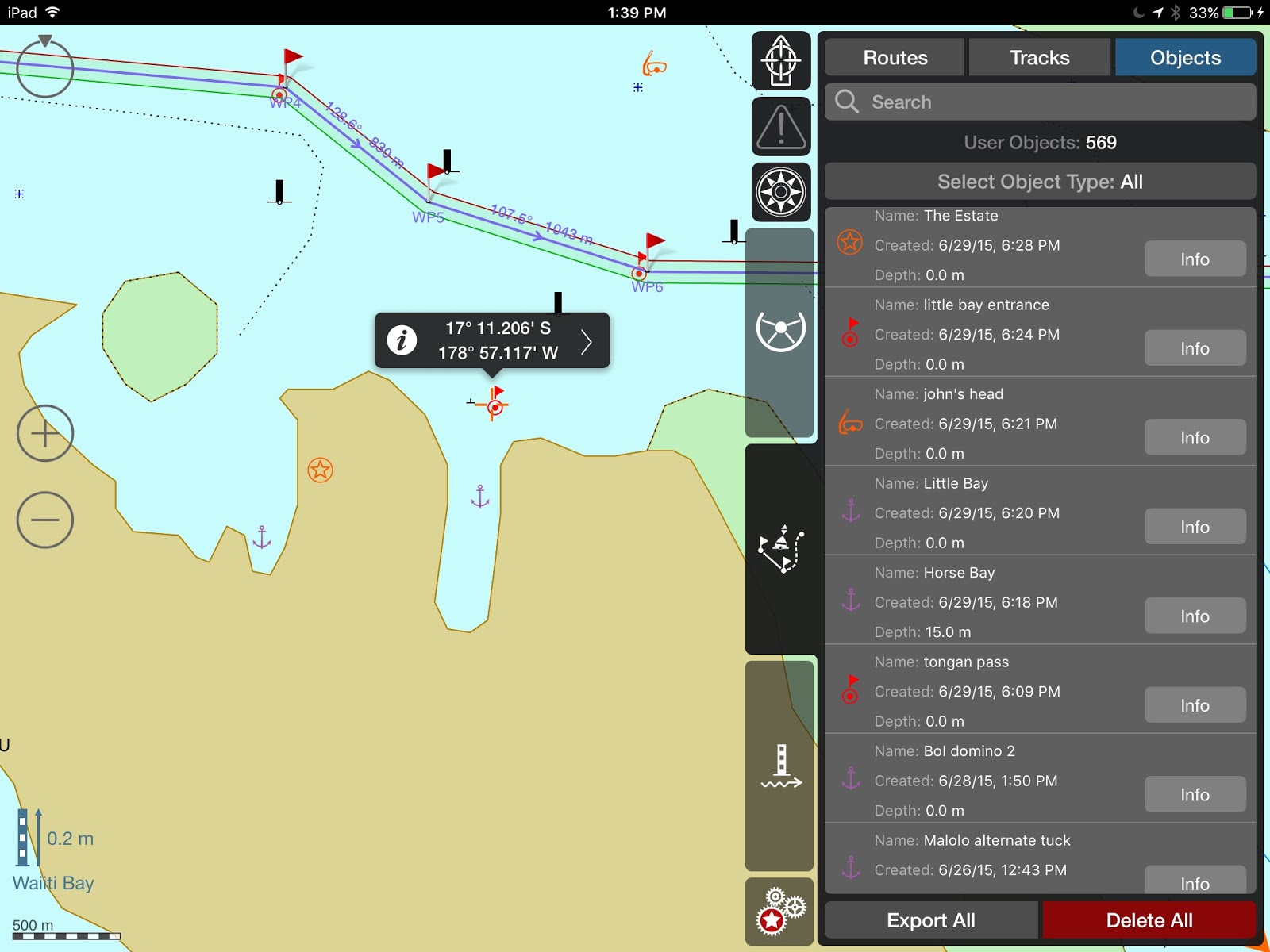 |
| Horse Bay, Little Bay, The Estate and other waypoints |
Photo 13 – Horse Bay “The Estate” was a pig farm. What is left, we do not know. It is possible to anchor – 17*11.527S – 178*57.710 W
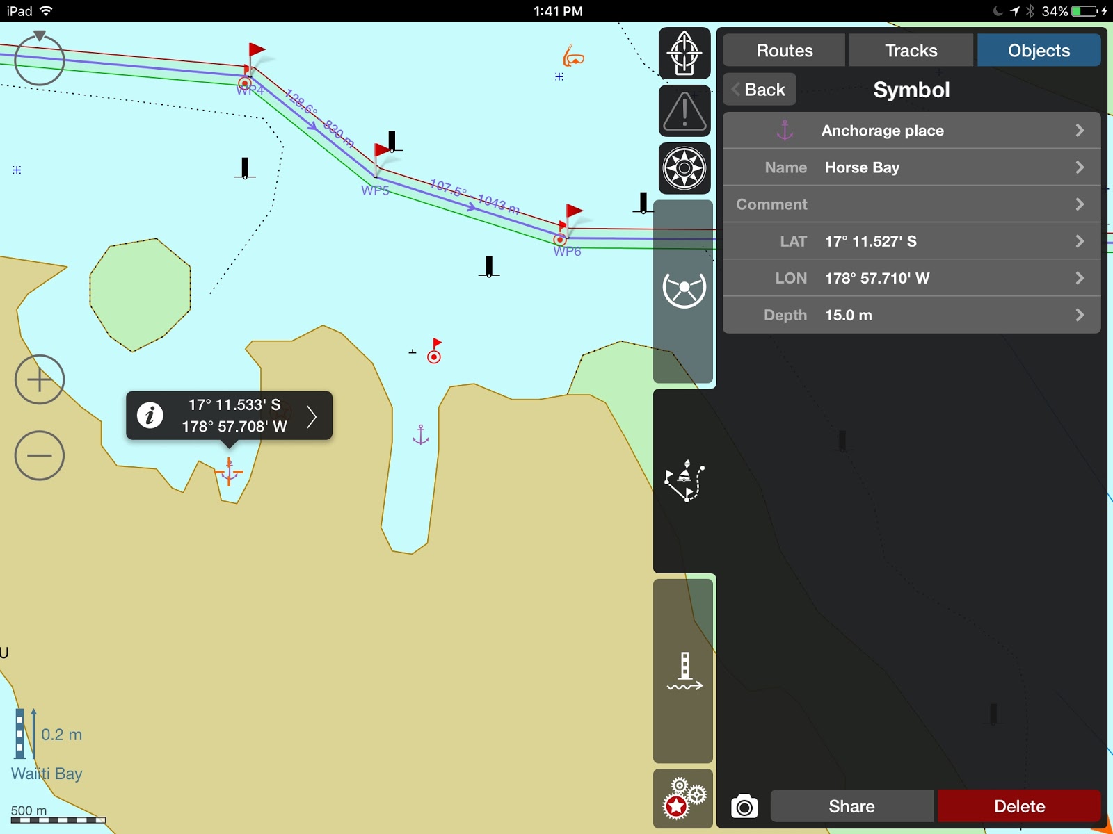
Photo 14 – Little Bay – It is possible to enter Little Bay – It used to have good Internet, in straight line from the phone tower, but who knows what happened with the comm. tower? Very secure anchorage, not much room for more than 1 boat.
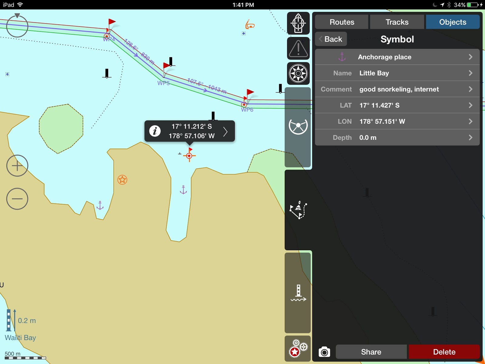
Photo 15 – Mbavatu to Avea – Again, careful of the reef, especially around WP7 –
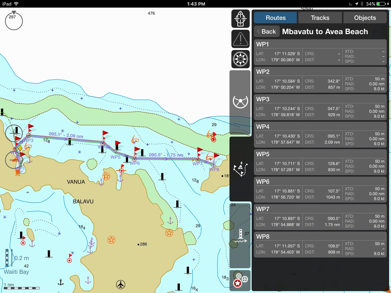
Photo 16 – Avea Anchorage – Just north of the village, the anchorage can be rolly, and we only stayed one night. The village was so low-lying it’s probably gone.

There is good snorkeling just north of the anchorage and Soggy Paws reported good diving just through the pass
( WPs: dinghy pass Inner 17*10.349S 178*54.429W
dinghy pass Outer 17*10.315S 178*54.447W
Dive spot 17*10.239S 178*54.504W ) What is left?
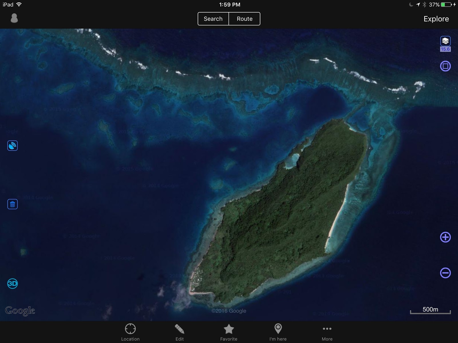
Photo 17 – Avea – The village is located at the SW tip of the island.
till next time
dominomarie
2016-08 Fish Egg, Shearwater to Uncharted Lambard Inlet
Thursday, May 5, 2016This morning we harvested more seafood. With 12 crab it was time to cook and pick. After 50 prawns had their heads twisted off, a prawns and pasta dinner was likely. Maybe crab cakes for appetizers? We motored up …
